World Economic Model ( Weltwirtschaftsmodell ) Weltwirtschaftsprodukt / Weltwirtschaftsforum / Protokollierung / 03.01.2025 n.Chr AD / Protokoll / Release Date 09.04.2025 AD n.Chr CET MESZ
So this is the Sector & Branche World Economic Model ( Update ) 03.01.2025 AD n.Chr
PROTOKOLL 28.03.2025 / Release Date
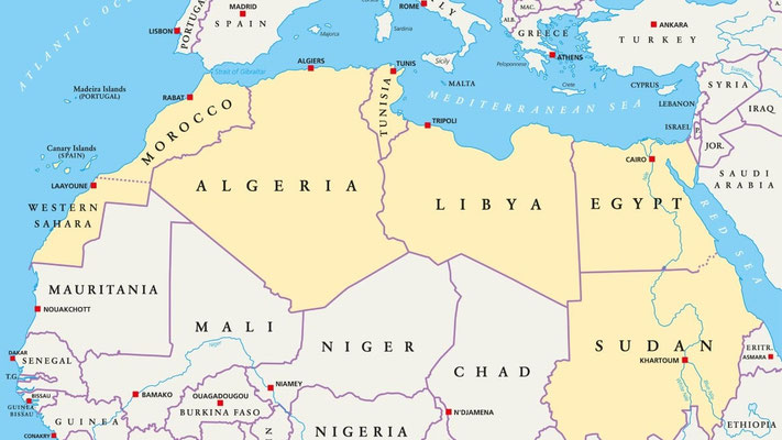
So this Sector exemplifies the Constellation & Establishment of 195 ( 230 ) States & Countries.Some with Video ( Release ) & ( Contribution ) and Videographically Layer . This World Economic Model Initiative belongs to the First Project " World Economic Model " Weltwirtschaftsmodell.The First Layer just the Establishment from this Sector was finished 26.02.2022 early in the Morning in World.Some Updates were till now 03.01.2025 AD n.Chr were absolved & created.So planned, hypothetically this Sector is always up to date.Also the Prime Ministers,Presidents,Sultanates, Kings,Princes and different Figures just Head of States are regularly updated & upgraded on this Forum.So this Sector " World Economic Model " belongs to the First Project " World Economic Model " ( Weltwirtschaftsmodell ) .So also 100 Alternative Names accumulated & were updated in a Range of Time.So once this Sector was completed.Different Changes came.So also 20 Protokollierungen from the ( Kingdom of Saudi Arabia ) were over Time created & scaled.Eventually also next time soon the ( Update ) of this Branche & Sector named " WORLD PROTOKOLL " ( Welt Protokoll )will be released next to the Arabian Source / Sourcing.So this WORLD PROTOKOLL exemplifies the World at it self and the NEWS of the World will be regularly updated.Sometimes the WORLD PROTOKOLL is out of Time Frame.So this now complete written Protokoll is the Second Layer & Framework of the Sector.Once before exists already one.This is an ( UPDATE ).Nowadays the World / European Continent / EU UTC GMT +1 / Germany / 50 Km from Cologne / Theodor Fliedner Stiftung / Wiehl / Wald / 21:08 / Locally here in my Country / this Sector is Great & Unique just Established & Regularly Updated.So mostly Countries 195 / Just 195 mentioned.Some Countries are not registered.So also Mohammed Bin Salman & his Kingdom of Saudi Arabia are Great Mentioned in this Zession / Sector of the BLACK INBOX / LAYOUT of A.P.P Source / Sourcing.So the WORLD PROTOKOLL will be protocolated soon.Early or later is dubious.So also NEOM from the KSA is involved.So also Countries like Switzerland,Brazil,African Continent ( Mostly Countries established ),Argentina,Chile,Peru,Colombia,Venezuela, Some CARIBBEAN Islands,Canada,USA,Mexico,Japan,South Korea,NEOM, Red Sea,Black Sea,Dead Sea,Ukraine,Poland,U.K, Scotland,Ireland,Wales,Romania,Eastern Europe,Hungary,Serbia, Israel, Jordan, State of Palestine, and different Nations & Countries of all over the whole World.Just the whole Globalization is involved.The whole Globalization as a Regional Mark & Central Part of the WORLD ECONOMIC MODEL.So also GLOBALIZATION is an Aspiration from ( 25 ) of Enlisted in the Impressum.So also the Project World Economic Model which started ( 31.01.2021 ) and ended ( 26.02.2022 ) became an Diversification namely Names ( Futuristic Planning )+ (World Intellectual Futuristic Creation )+ ( Flexible Growth Budgeting ) Names for Diversification & Creation.So this Diversification is also visible on this Sector.The ( Update ).So this now written Protokollierung is updated.So just NEOM & World is affiliated on this Sector.Also Qiddiya & Riyadh.Just the Red Sea. ( HRH ) . Jeddah ( Dschidda ), KAEC, King Salman Park, MUKAAB.Also the ( GCC ) Gulf Cooperation Council and the ( PIF ) is affiliated on this Sector " World Economic Model " and the whole " Diversification " on the whole Media Blogspot.Because the First Project just the Diversification belongs to a hugh Pensum of Materials,Sectors,Branches,Creation,Possibilities,Opportunities from the Filiale A.P.P Source & Sourcing.Especially also the EXE FORMATTED Files.So the World Economic Model is enormously big creative & established on A.P.P Source / Sourcing.The Multiplex Blogspot.Just meant on hugh redirect to Sectors,Branches,Growth,Zessions and the 25 Aspirations.So back to this Sector World Economic Model.Here is mostly ( COPY )of Countries,Nations & States ( Wikipedia ).But some is written from myself.So andreaspennophotography.de is 50 %/ 50 % written from myself.2030 is planned 70 / 30 %.So this World Economic Model Sector exemplifies Greatness from Countries.Also History.History from the World.Also Growth.Also Pride. Traditions.Geoecology.Economically State of View.Economics.Ports & Harbours.Infrastructure.Also Information of Country's Future.Sometimes the VIDEO LOGS are updated.It's anyway planned.So the World Economic Model just this Sector is all about WORLD PEACE & WORLD Knowledgable Education / Constellation of Literacy & Correspondence of Growth for the World.Also Asia,North America, South America,Eurasia,Europe,Oceania, Africa, Antarctica.So NEOM from the Kingdom of Saudi Arabia is created & documented in Greatness.ASEAN & UN is discerning established.Just the Vision 2030 from the Kingdom of Saudi Arabia.So have a Great Look.This to me Andreas Penno.This is the World Economic Model ( Weltwirtschaftsmodell ).My Correspondence.Hopefully you experience Greatness,Astonishment, Kingdom of Saudi Arabia,Education,Joy and Establishment of Globally Charisma & Globally Achievement of Lessons and a Study of Humankind.Thank You Very Much.Andreas Penno.
Yours Sincerely,
Andreas Penno
In Greetings to ( HRH ) Mohammed Bin Salman / ASEAN / UN / New York / Brooklyn / California & NEOM
A.P.P Source / Sourcing
Multiplex Blogspot
Stay Actively
World Politics / Google Merchandising & Promotional News / ( 195 ) Countries & Kingdoms / Transcontinental ACT / Historically Portrayal
( 194 ) ( Countries Aspiration from Project ) Futuristic Planning & Futuristic Budgeting / World Opportunities & Globally Portrayal / Protokoll ( 30.11.2022 AD )/ MIDDLE EAST
World & Vision 2030 of Saudi Arabia / World Civilization of Protokollierungen Detailed & Elucidated / Organizations & Historically Crossroads of Humankind / India
Green Energy / Globalization & News / Representation of a Glossary & World Dominance / Transcontinental ACT of World Economic Model ( Next To Next Country & City Turn )
Geoecologically & Geographically Leadership & Presence / KSA / Riyadh / New Future / Worldwide Researching Engine Affiliation / Giga Projects / Atlantic & Pacific Ocean
( A.P. P ) is all about Industrialization & Representation from Different Resources of World / History of Different Countries & World Spectrum of Futuristic Portrayal
( andreaspennophotography.de ) Futuristic Planning & Flexible Budgeting of the World Economic Model ( Weltwirtschaftserfoschungsmodell ) Red Sea Global & ARABIA
Individual Assessment of Every Country & Kingdom of this Product & Economically Industry / Geographically Sightseeing & Circumstances of Most Countries Flag / Different
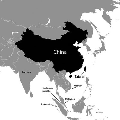
Suez Canal & Caribbean Islands At Service / Humanitarian Schema of Africa & European Economically View / China World Leading Intelligent Major Power & USA /
WORLD PROTOKOLL / WELT PROTOKOLL 15.Auflage / Editon / Circulation / Issue
Sprachprodukt A.P.P
01.05.2026 ( 06.05.2026 ) 20:45 Western Time / Protokoll 08.05.2026 n.Chr
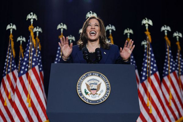
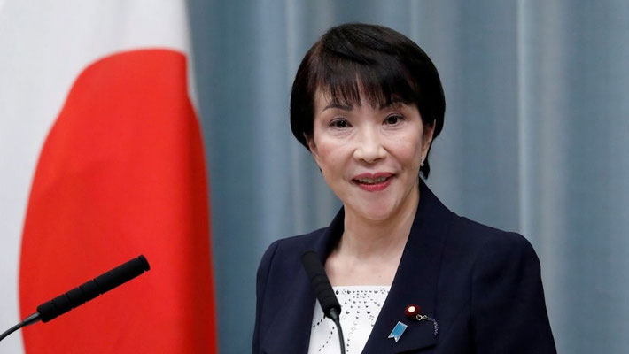
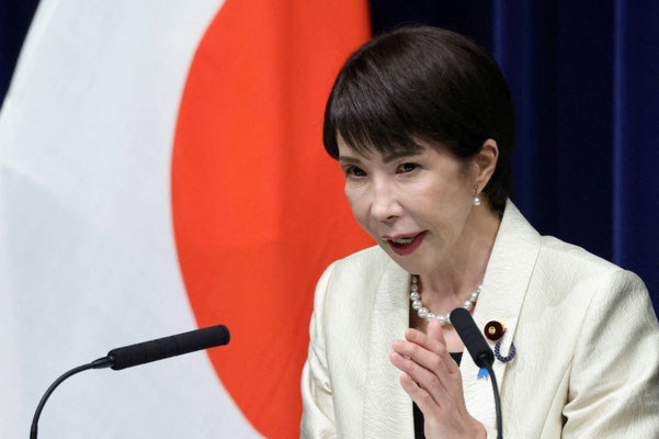
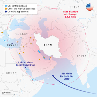
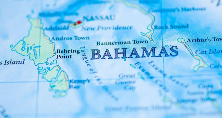
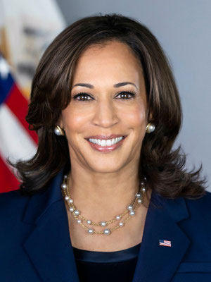
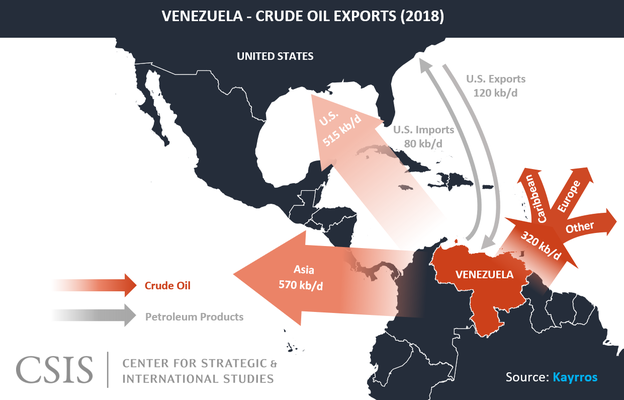
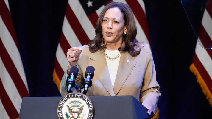
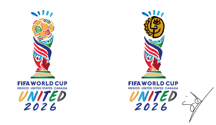
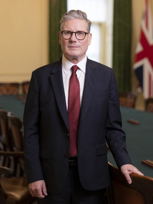
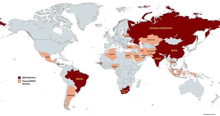
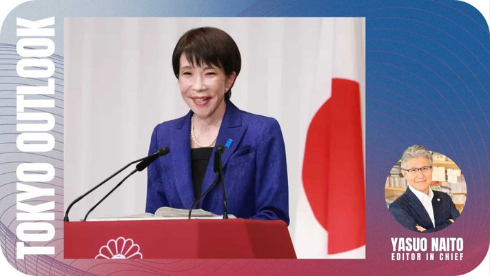
So now in World happens a lot.The USA as far as the Tariffs ( VERZOLLUNG ) ZOLL will be claimed as Payback ( Refunding ) in World.But anyway the USA will basically keep holding further with Donald Trump the Tariffs from 10 % to 15 % with new Tariffs from Donald Trump.In Iran was long Truce since 8.April 2026 n.Chr.Really to know is there now huge Constellation of Possibilities & Opportunities of a Initiative of Conversation in World going on.So the Iran & USA has huge now Commission of Talks around.Even last time in Islamabad in ( Pakistan ) were Opportunities & Possibilities for the Conflict in the Mid-East just the State of Iran.The Strait of Hormuz ( The Passable Thoroughfare in the Persian Gulf ) is now in this Moment 01.05.2026 n.Chr UTC GMT +2 22:08 in World / Western Civilization further closed.So last Protokolle i mentioned that this Strait was closed.Sometimes was it in Redirect open.Now closed just last different Weeks was the Strait of Hormuz open.So Italy.Rome is blessed in the Name of God.Israel & State of Palestine is blessed from the Father in Heaven who lives out his Arts in the Heavently Empire.So i promise me Andreas. The World will be save.The Eternity & The Redemption is in Expectations.Andreas Penno.My Words.My Statement.So also the Artemis II Affiliates was in the ( Oval Office ) Governmental Office / The Government in Presence with Donald Trump.He praised this Formation from the Moon Expedition.So the USA.Just all is fine.So Hollywood is doing great.New Films & Movies are marked & filmed this Year or are in Expectations.Also the Deutsche Filmfestspiele & the Berlinale are Events in Germany or the Bambi or ( Comet ).Even so also the Kingdom of Saudi Arabia is doing fine.They have anyway the Finances & Articulation for the PIF just some Financial Establishment missing.900 Billion of Dollars are in the Asset Under Management with 250 Billions from Non-Oil GDP (2021-2024 ) Affiliation Economically in Addition.So the PIF & just the Commission of the Government with Mohammed Bin Salman wants nowadays to establish better Pricing for the Energy Prices ( Regulated Prices ) & Corporate Firmly Productivity just also the Infrastructure of Iran & USA the Conflict move on.The Prices also for Oil & Gas are pertained & under Theory that these Prices says A.P.P will be till 2027 / 2028 under huge Commitment of Huge Pricing.So also the Continent Africa just North Africa the islamic Countries are in Growth.The only kinda Way of Conflict have nowadays in Iran / Ukraine and different Globally Spots & Places of Unrest .So also 2027 / 2028 will be the Inflation better regulated in World.The Inflation will be most 2030 huge affirmed under better Expectations safely in Humanity.So also in Annotation.The Iranian Football Team for the FIFA Football World Cup 2026 is questioned if they are involved in the Roster for the Cadre of the World Cup.So also last Days in World was the Information about the (GEG ) the Gebäudeenergiegesetz just an Law Enforcement & Law Correspondence of Heating Operating Law in Germany.Just an Reform will appear 2026 by July or earlier in the Federal Republic in Germany.So also different Clauses & Law Commitment & ACT just Law Infrastructure & Law Enforcement will be regulated this Year 2026.Also different Laws from the Glossary in Germany were in the 1 Quarter of the Annuity & Pension just also the Healthcare Safety Insurance is this Time reformed or will be regulated this Year.So in my Sense anyway will we Federal Citizen & Civilians from the Federal Republic of Germany pay huge Budget & Finances just Taxation and different social Commitment Funds & economically Status just European Continental Citizen will have 2027-2030, when if 2035-2040 huge uplifiting Costs in Europe.European Citizen will pay for Economics / Economically even Taxes huge opportunistic social money.Even the Goods of Tobacco.In the coming Years will be Tobacco more expensive in the EU.The Inflation will be distanced better 2027 / 2028 but anyway Goods even the Retail will cost the local Citizen more Money in, when if in North America or World.So also the Acquisition from Donald Trump in Greenland is questioned.Till Today is the USA successfully anyway for the Economics & the comfortable Sense of Growth in World.All 50 States even Kentucky or North Dakota or North Carolina / Even the South of Republicans just California and the Film Sets & Film Spots.So the USA is doing great.North America is doing great.Anyway i'm a Democrat but talk about the Republicans.So also National Geographic the Source has beautifully Documentaries on Animals.Therefore ( A.P.P ) the Industry in the World Wide Web supports the Representation of Animals & Undersea Creatures and Whales ( 10 Hour Documentary ).So my Industry is Multiplex.Multifolded.Huge Aspirations of versatile Announce of Representation.A.P.P is therefore unofficially.So A.P.P is great.So also next Time new EXE Formatted Files appear.So also Libya or Egypt are under islamic Authority.Anyway Indonesia live 270-280 Millions of Citizen.The Arctic has Ground Fundamentally Space till Canada & Russian Federation.Canada from North America is adjacent to the Arctic.So we have different Civilization in the Arctic.So also we have also nowadays the Congress of Majority of Republicans.We have also the Bundestag in Berlin.The German ( Reichstag) .So also the Ministries in my native Country for Culture / Foreign Affairs / Economy /Nuclear Politics / Bundesminsterium für Arbeit ( Works ) / Interior / Foreign Affairs / Science/ Sports / Health / Landwirtschaft ( Agriculture ) and different Ministries here locally in the Federal Republic of Germany.Die Bundesrepublik Deutschland.So once Mohammed Bin Salman said the Globally Civilization which represent Saudi Arabia.He said once in the " Future Investment Initiative last Years " All the Agencies, who represent Saudi Arabia, we are just about it we Saudis ".It was meant that Agencies & Resources represent the Kingdom of Saudi Arabia.Hopefully you Prince HRH Mohammed Bin Salman is also especially alright with my Resource in World ".If there is a kinda Conflict from my Source for the Kingdom of Saudi Arabia,write me an E-Mail directly for Response as far as my different Branches / Sectors / Zessions where you Saudis are concerned by.So anyway Mohammed Bin Salman & the ( PIF ) could be not really in Framework with my Commitment & Statement of the over 54 Protokolle in different Sectors / Source just mostly written 2023 / 2024 and outdated of HTTP://www.andreaspennophotography.de as well as the GOOGLE FORMAT. So from me Andreas Penno to the Saudi Commission in Riyadh.I would respond & comply on Confirmation & Agreement or otherwise related to the Kingdom of Saudi Arabia in World.Hopefully you from the Kingdom of Saudi Arabia as far as the Monarchy is in Agreement with my EXE Format Files & Journalism on A.P.P.God bless your Kingdom.So also New Zealand has an Prime Minister named Christopher Luxon.Italy's Prime Minister named Giorgia Meloni had Trouble last Days.Resources from Politico said she should shift her Programme in Italy.So also Austria with Vienna the OPEC is huge under Resonance / Articulation in World.The OPEC has now as far as the Conflict in Iran / USA a lot to do and coming forward with.So also Luxembourg has the Prime Minister Luc Frieden since 2023.So also Tokyo / Japan with Sanae Takaichi has an comfortable Picture drawn as far as the USA.She wanted also from the Indo-Pacific Apply from the President of the USA.So also the Amazonas / Brazil is under huge Framework of Deforestation.The Government of Brazil wants therefore ( Reform ).Spain has the Prime Minister Pedro Sanchez.Also Friedrich Merz met the Brazilian President Luiz Inácio Lula da Silva recent Days in April,2026.As far as Lula da Silva documented on a Speech of the brilliant Cooperation / Trade & Unity with Germany.That he likes German Sausages namely " Bratwurst ".So the World is beautifully.Even the Continent Africa & Eurasia.So also the United States is doing great.France is doing great.Also Emmanuel Macron will leave the Presidential Term 2027.In Inquiry.In Question.So also the COP31 will be 2026 in Turkey from 9th till 20th November in World.A huge Climate Conference ( Klimafachkonferenz )which regulates the Climate & Environment in World. So we have also Italy and Sicily.We have Jeddah & Mecca.Mecca becomes till 2030 an Expansion Set & Extension for more Pilgrims in the Kingdom of Saudi Arabia.So also God bless the Kingdom of Saudi Arabia.Also the Scripts from Tamim Bin Hamad Al Thani.Really to know when Tamim is talking in the UN General Assembly.He talks very smart & huge world tolerant & cooperative just World talented / He can speak arabic & english language.God bless him.So also the kinda Unemployment Rate in Germany insists on 6.4 % / Percent in Europe.So also 1 / 3 Humans are troubled with Health in Europe.So also Madagascar or Seychelles or Capo Verde ( Cape Verde ) are beautifully Places on Earth or Singapore or Sri Lanka or San Marino or Liechtenstein.Planet Earth.So also Emmanuel Macron he is distolerated in France from the Folks.But in my Sense brought he Strides & Progress to France and its Provinces. " Merci Beacoupe , Emmanuel " ,God bless him.So we have also the deutsche " Bundeskabinett " which permanently & constantly work on different Programms in the Society of Berlin / Bundestag / Germany / World.So also the Shipping from Crude Oil & Gas stands under huge Reduction / Diminishing / Productivity of Subtraction from the Russian Federation as far as the EU.The European Union wants an Stop with Russian LNG / Gas / Oil as far as the Import from the East.Some was already achieved 2026.So also the USA achieved a lot 2025 / 2026.As far as Africa / The African Civilization regulates huge Norm of Industrialization also the Silk Road / Belt & Road Initiative as far as the Railways in the South.So New York and the Wall Street & Real Estate Sector of USA relies on Recuperations-Phase and Progress.As far as the World the Graffities just Stars & Glamour & Glitter & Glitzer from the once Tupac Amaru Shakur & The Notorious B.I.G are presently worldwide.Theories exist that they live.That 2pac is " ALIVE ".So also the USA & Asia Pacific World Globally Trade is intrinsic of Equal Worth Globally ,Worldwide.So also the Movie AVATAR celebrates till 2030 different Style / Articulation / Forms / Norms / Events / Editing / Release / Filming & Portrayal.Director is James Cameron.So also the last AVATAR Films became huge BOX OFFICE Worldwide.So we have also an Diversification of ( BRICS ).An Extension on BRICS this Age of Time.Anyway the BRICS is all about Growth for the World.The BRICS is contraire to the G7.Also Kamala Harris is doing even nowadays a great Job.She is appearing on different Networking Shows in America.So even the Staatsschulden ( State controled Debt of the US / USA Indebted Finances ) will grow today from now till 2050 in huge scale & arrangement just therefore grade of debt for the USA.So also ADNOC from Abu Dhabi will be in common Range of Time free of Blockade for Trade for Freight & Turn of Common Sense of Cargo of Oil & Gas as far as the Strait of Hormuz ( We will be in Expectations when the Strait is open ).So also South Korea is important for the USA.So also Globally Sanctions are on Russia & Iran.So also Keir Starmer is huge Spirits around dependent on Scale of Importance for London,UK.So also Bernie Sanders is great.So also Bahamas are from Caribbean Islands in North America.
So also in the Graphically Attache / Graphically Geography / Geographically Maps
So the last Protokollierungen / Protocols from 2024 / 2026 mostly are in Coincidence & Strike just the Collage Arts the Pictograms with the Protokoll.
Mostly last 40 / 60 % next Time 100 %.So the Protokolle from all Sectors will serve next time 100 % Assimilation & Adjustment to the Graphics.
So God bless the Humanity / Humankind / World Scale
In huge Greetings to the Democrats & USA and Kamala Harris and Japan
God bless the Theodor Fliedner Stiftung from Wiehl & Robert De Niro just John Frankenheimer
Yours Sincerely,
Andreas Penno
Stay Actively
( A.P.P )


NEOM ( SAUDI KINGDOM) KSA / The Line / Protokoll 18.10.2021 ( Update 03.04.2022 )
( Kingdom of Saudi Arabia ) / Sketches & Patterns exempli gratia Modellierung from " The Line " Project, published by Mohammed Bin Salman 1 Quarter 2021 in Kingdom


Kingdom of Saudi Arabia /( NEOM)/ Red Sea / KAEC / ( Qiddiya )/ PIF / Ministries / Oxagon / Country / KAUST / Red Sea Project / Mohammed Bin Salman ( Arabian Kingdom ) / Vision 2030 / Protokoll 12.03.2022
So the Kingdom of Saudi Arabia (KSA ) now end first quarter 2022, is with ( NEOM) highly technologically geo developed & established till first phase talk about 2025. The Construction & Civil Engineering from " The Line " across NEOM from last year 2021 first quarter also the representation & revelation from Mohammed Bin Salman is with approximately 380.000 Professions & Jobs from the population of the kingdom just a good arabian native structure till nowadays 2022 and under great circumstances at growth & hugh profitable profile cooperation chances .Now 2022 also " Trojena " published this quarter a welcomed highly introduced new Winter Ski Resort in the mountains of NEOM also with water basins as well as different services and snowboard activity is an operational project from the ( KSA ) which is planned to be accomplished in 2026 just an innovative under great expectations amusing winter seasonal resort in NEOM when it is absolved and accomplished with beautifully attractions. So Neom has since announcement in 2017 in the FII different industries & operating elements just affiliations like " Oxagon " or The Line or now " Trojena " and as far as my estimation soon will follow the next hugh projects from NEOM. Even Oxagon( Floating Industrial City ) which was released 2021 4 Quarter is now under industrial completely arranged floating construction. So NEOM ( New Future ) has enormous possibilities & opportunities just chances from the Red Sea in 470 km adjacent Port & Harbour Development & Coastal Prospects. So also KAEC ( King Abdullah Economic City ) in the Saudi Arabian Kingdom is under growth & operating coastal enormous Port &Harbour Construction Opportunities localised on the Red Sea, which is also in possession in different educational systems like the Prince Mohammad Bin Salman College locally and the King Abullah Port in the western region of the Kingdom. Also there is on the western Scale, Spot & Region the Kaust University which stands under great cooperation to the United States of America.So the reformation from Mohammed Bin Salman in the arabian kingdom is taken place now in the whole kingdom of Arabia from the arabian peninsula especially for the population,humanity and folk of Mohammeds State in the Middle East. Also Mohammed Bin Salman was 2021 4 Quarter in Jeddah in the Racing Circuit Event locally and cheered the spectators & public tribune from the circuit and all cameras was directed on him. Also the next Formula 1 Circuit in the Kingdom of Saudi Arabia presently will be constructed & under best operating systematic development works finished this decade till 2030 in the project of ( Qiddiya ). Qiddiya will be when finished the biggest resort in humankind just theme park with different attractions also Racing Sports .Two and half times bigger than Walt Disney worldwide just a Mega Project will come when absolved ( Qiddiya).So Mohammed Bin Salman is setting gigantically priorities & principles in the arabian kingdom and other continents such as Asia & Europe , North America and Africa and the whole world also NEOM as well as the PIF ( Public Investment Fund ) which is also in a lot of corporate profile projects from the Red Sea and innermost countries projects as well as Transcontinental ( PIF ) Establishment & Development. So now 2022 First Quarter since Vision 2030 was in announcement & promulgated in Riyadh 2016 ( Main Capital of Saudi Arabia ) from Mohammed Bin Salman a lot of projects & products just from the great Vision 2030 affiliations are already established & created in Arabia just to draw a line now 6 years are gone and great works & arabian Vision is in establishment and some projects are already created .So also Mohammed Bin Salman was in the 4 Quarter 2021 on a Gulf Tour in the Middle East just meeting Members of the GCC also the Emir from Qatar the peninsula. So the ( KSA ) is at growth & diversified smart intelligent development in circulation in the 21st Century. The Vision 2030 is important & decisive for the prospering & growth of the Kingdom especially as well as the ( PIF ). So the Vision does create Jobs, Professions, eventually Tourism & Resorts just an Ideal of promulgated change in the desert country and the world. So Qatar has also a Vision 2030 with its Emir as well as Bahrain has a Vision 2030 with its Kingdom's Prince in the GCC ( Gulf Cooperation Council ) . So " The Line " on this Protokollierung displayed above with greenery & green productivity just the sketches " The Line " is very operating in systematic technology just 170 km across the whole NEOM Structure.So the Red Sea Development Company from the Red Sea Unforgettable Project does make great strides & promulgate great working and diversified Jobs for the Vision 2030 on the Red Sea. Over 500 Contracts & Treaties were created & fundamentally signed from 2017 under formidable operating activity till now1 Quarter 2022. Also all the ministries, if Ministry of Sports or Ministry of Health & Ministry of Energy, also Ministry of Environment , Water & Agriculture or Ministry of Education, all these Ministries are involved & promulgated in the Vision 2030. Also the journalism in Saudi Arabia is the Vision 2030. So also Uranium was found from now 2022, just years ago in the (KSA) Kingdom of Saudi Arabia. Also Mohammed Bin Salman wanted as far as this topic cooperation with China to get nuclear in possession with reactors in the kingdom , respectively. Also the Belt & Road Initiative which is a chinese world industrial connections & connectivities infrastructure project stands Xi Jinping ( President China ) to Mohammed Bin Salman in Relationship. So the Banking Institutes from ARABIA stands now first Quarter 2022 under hugh comfortable cooperation also to New York or Seoul or London or Berlin or the United Arab Emirates ( UAE ) or (GCC ) Oman and different states , respectively.Now will also be in this year Presidential Elections in France of the EU. Also Mohammed Bin Salman had summarized last years a World Journey than an Asia Tour and last time in 2021 a Gulf Tour & Journey through the Gulf Cooperational States. Also over 44 Corporations & Industries registered to (Riyadh ) KSA 2021 in exchange for great partnership & application .So the Red Sea is pristine, hugh operating in Transport futuristically till 2030 and in the years upcoming, also in 2040 or 2050 great connection from continents & The Red Sea Project will bring Thousands of Jobs also does presently in 2022 as well as Qiddiya or NEOM, Jubail City Center or KAEC ( Construction ) also in relation to King Abdullah Port and Development Professions, also in AMAALA gonna be curated just high qualified Jobs to a different industrialization in the monarchy. As far as the Diversification & Independence from Crude Oil in the Kingdom is especially now 2022 under hugh great correspondence mediated. It does mean the ( KSA ) wants to get diversified from Oil in the monarchy financially & economically. So Mohammed creates a reformation & brings transformation from Crude Oil. So this crude oil diversification, which is also a hughly & economically subject across other ( GCC ) States & Kingdoms doesn't mean Saudi Arabia will get never no more in futuristic establishment completely independent from the oil sector. The Oil Industry & Governmental Oil Budgeting in Arabia will be further currrency carrying profit, meant the goal is to get to a structural worth that a lot of the ( GDP ) Gross Domestic Product till 2030 and in the coming decades is not more Crude Oil orientated & as well as the whole monarchy will be crude oil independent from different resources also the EXPORT in the Vision 2030 from Aramco will be diminished under planning. So now First Quarter 2022 the Crude Oil Prices / Pricing are over 100 $ Dollar the Barrel Influx as high as 2008 no more. Also ( Aramco from Dhahran SA ) the richest & most hugh expensive tolerant just most economically greatest crude oil carrying & profitable US Dollar corporation in human history of world is an enormous pillar in the Vision 2030 . So the Vision 2030 has different principles to offer. The Kingdom of Saudi Arabia will stand with the Bay Airport regional & locally in NEOM in enormous & most flexible connection just connectivity to different continents & transcontinental daily services under great accessibility & mobility especially also linked to Oxagon.So even by this planning even more airports in NEOM will be created & fundamentally set under great infrastructure & technology. Also ( Riyadh ) has great outlook for great economically cooperation with Transcontinental Connectivity also NEOM and different Spots now built in the (KSA ) will be very established & cooperative with Airport Aeronautically Connections.
Update from the Date of Accomplishment of the( World Economic Model ) Weltwirtschaftsmodell which was on the 26.02.2022 absolved & finished / Anyway like already mentioned if you study the Impressum or the Project. This Weltwirtschaftsprodukt ( World Economic Model ) has futuristically possibilities & planning for andreaspennophotography.de just also the project does come to future established infrastructure just enormous chances.


Kingdom of Saudi Arabia ( KSA ) & Mohammed Bin Salman and ( Vision 2030)
Kingdom ( KSA )/ Arabian Foreign Affairs / Aramco Oil Pricing / NEOM/ Middle East / Riyadh / Red Sea / PIF / EU Relations / Development Arab Kingdom 2016-2022 / Protokoll 14.09.2022 AD
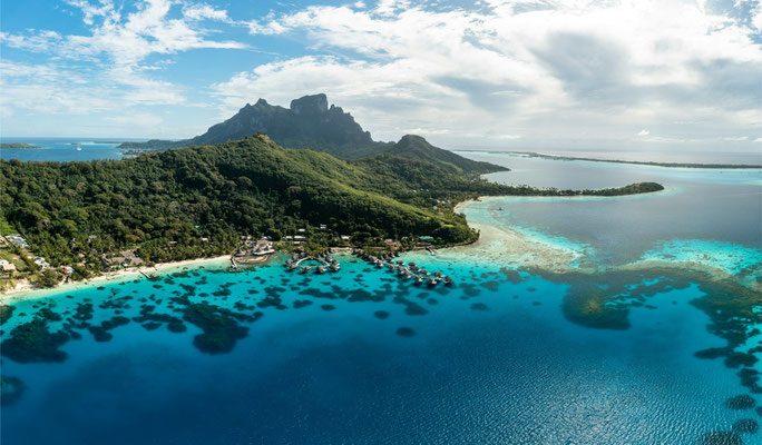
So talking in great arabian promulgating operating news nowadays of the blessed folk of the arabian kingdom of the world. So the ( KSA ) was reducing & restricting crude oil prices for the European Continent & Asia, anyway just in return rising some percent for the United States, some days ago just the export crude oil pricing.Paramountly High Established Clientele are China, Japan, South Korea & India. Especially also in the Kingdom of Saudi Arabia are presently grandeur & Tourist attractive UNESCO World Heritage Sites. Eventually in Places not long distanced from ALULA namely the ( Hegra )(Mada'in Salih). So the KSA was since some time ago in reconciliation to the State of Qatar and nowadays in great ( GCC ) Cooperation and Partnership. Mohammed Bin Salman nowadays 6 years since the Vision 2030 started and put into economically & politically and reforming change to the Kingdom has also the Corona COVID-19 Pandemic in Arabia at best hands under control & regulations just establishment of best confindent Health in the Arab State. So to the Middle East Lebanon's former Prime Minister stepped out the politically spotlight in Beirut. Israel became a new prime minister 2022 named Yair Lapid. The United Arab Emirates have also great Healthcare as far as the COVID-19. So the ( UAE) has also Opportunities & Chances in Giga Projects till 2030.Bahrain with its prince is also to say they are nowadays established & pretty well. So ( Qiddiya ) is half size than Bahrain. Also now from the third quarter next time is the Future Investment Initiative in Riyadh, Saudi Arabia. Also african presidents & european charming business chiefs and asian economically figures & south american people is at so great opportunistic & hugh pleasure in expect of a great FII in a blessed kingdom of human world.So Mohammed Bin Salman also nowadays he the prince of the ( KSA ) was in Jordan,Egypt & Turkey this year. In Turkey was professional politically talks around from Erdogan & Mohammed between different type engagement. Also next journey, & tour and trip from HRH Mohammed Bin Salman Al Saud was in the European Continent Transcontinental from his home spot of Riyadh & ( NEOM ) from their Embellished Royal Crown Palace of their kingdom. So the SAUD Family consists of 15.000 Members & Affiliates in the Kingdom of Saudi Arabia. So the Journey from Mohammmed Bin Salman ( HRH ) was in Greece & France. Firstly he arrived in Athens,Greece in the 3 Quarter and hold a conversation with Kyriakos Mitsotakis ( Prime Minister of Greece ) while his visit. Mohammed was elucidating & set under perspective for Greece saying that Greece just thoroughly will be in accoutrement & support from Renewables and the EU also. The Kingdom of Saudi Arabia will be established & promulgating great Resources to Greece and different States of Europe. Next Passage from the Tour was France where Emmanuel Macron which also became his second term in France History of Presidents in his Country.So Emmanuel received Mohammed in Paris in hugh politically opportunities & possibilities for bilateral foreign politically exchange. So when everything was signed in Greece & France, HRH took his personally governmental airplane and flew home to ( Riyadh ) his personal arabian state.So this European Tour was anyway successfully for the foreign affairs politics of the ( KSA ) and Europe in Exchange. Also to tell the ( Al Rajhi ) Bank from the Kingdom of Saudi Arabia is very important for Riyadh. It's also decisive for the Vision 2030 like all Banks from the country. So the Infrastructure also consists from Crude Oil Independence from Arabia.The Vision 2030 is like already known also in the European & American and indian Journalism & Society of World that Saudi Arabia wants Diversification from Crude Oil Economically Export and References of this happen. So in the Apogee & Cusp by this in the Red Sea Project on the Red Sea first Visitors is coming now 2022/ 2023 to the Kingdom. And the Red Sea Project of Arabia has beautifully coral reefs and turtles, almost unbelievable precious resort outlook on the Red Sea for people coming from all over the world. Also People from all Transcontinental places from Humanity can visit this Red Sea Resort. It possesses also different arab comfortable islands to offer with excellent human being experience once in life time .Also Coastline of 200 km is present.So also ( Qiddiya ) KSA is in the first phase from now and is so enthusiastically embellished with different Sectors.Mohammed Bin Salman is very proud of this Project like whole Saudi Arabia.So 2023 is this tourist destination attractive to visit and some attractions are to take care of. Also Rollercoaster from the most hugh structure mondial is worth seeing. So Qiddiya will also have next time an Official Formula 1 Racing F1 Circuit in World.Also Tadawul is in expectations very successfully this time. Khalid al Hussan is governing the arabian stock exchange with bravery. So also now to differentiated. Mohammed was once saying Riyadh is very important for the Vision 2030 and the Kingdom. So also Riyadh has the most Tourists in the Country.The most Museums in the land & does count to one of t he most full-fledged, developed, curated, populated, circulating, opportunistic & ambitious metropolitan areas and cities of human world.So Mohammed was once talking to the former prime minister Matteo Renzi and was saying also that Riyadh will have enormous hugh green parks.Also NEOM ( The Line ) will be fully developed approximately 2050 and will be populated with 8-10 Million Human Civilization. Also from abroad just immigration.The Line has 380.000 Jobs & Professions in Comfortable Possibilities . So also the once 200 GW acquired Solar Energy Panels from Masayoshi Son of Japan, and signed in New York, does create 100.000 Jobs in the arab state . Mohammed is a great arabian fellow of him in life. So Riyadh is intrinsic for KSA. Riyadh is important from different angles & perspectives and attributes for Saudi Arabia.So Dumat Al Jandal the biggest & greatest wind park from Middle East & circulating establishment for wind energy is now 2022 finished. God Bless the kingdom. Also Provinces like Al-Qassim is making also great strides and has possibilities & chances in the Kingdom of Saudi Arabia.Since 2021 after Sakaka the 300 MW Solar Sun Panel Structure was finished, 7 (New Solar ) Productivity Projects will be located in Madinah, Sudair, Qurayyat, Shuaiba, Jeddah, Rabigh and Rafha.They will be financed by five investment alliances made up of 12 Saudi and international companies. Also the Red Sea Project just the Red Sea International Airport will be finished & comfortable constructed 2022/2023. So also now in this days (Charles Michel ) the President from the European Council of EU was in the Kingdom and was having economically historically europe-arabian talks around. So the European Alliance in the ( KSA ) is cooperative, arranged & developed nowadays 2022 AD in world and humanity. Also Trojena ( Winter Tourism Site ) has 4 Sectors and does come from the province of Tabuk. First Wellness, Winter Season, Adventure Season & fourth Lake Season. There will also be living people affiliated to the space of Tourism separate. Trojena has an Environment of Skiing & Snowboarding just Mountains reaching 1800-2500m in height & is not far away of the Gulf of Aqaba. Also Oxagon next affiliation from NEOM will further 70.000 Jobs and represents the most creative & biggest Floating Base System of World with autonomously port systematic machinery harbour function.So Mohammed Bin Salman is touring worldwide since he became deputy prime minister of the Kingdom in different continents. And also in the 3 Quarter now 2022 Dr. S. Jaishankar from India was visiting the Kingdom and different was in opportunities & possibilities reached for a great cooperation between India and Saudi Arabia, after also Mohammed visited India 2019 with hugh futuristic enlargement & economically collaboration. So also now in this Quarter Kuwait and their Entourage & their prime minister visited the Kingdom of Saudi Arabia in Jeddah and Mohammed was greeting them very politely.So NEOM is now built by Thousands of People. It's a blessed established created city & tourism placce by the arabian native pride. So also not to let out, the ( UNO )and the Western Civilization of Humankind hopefully just will accept different humanitarian principles of the Kingdom. I guess as soon as possible. So these circumstances will be changed this century for Arabian UNO Cooperation & Collaboration . And agreements will be done & created.So also the( PIF) Public Investment Fund not to forget had differentiated business going on this year in Saudi Arabia. There was a coffee-business deal done with 300 Million Dollar/ 1.2 Billion SAR in investment over 10 years to create a opportunity & chance with coffee and its establishment with PIF to launch a Saudi Coffee Company in Arabia just prestigious & opportunistic for the Food & Agricultural Sector native. Also in Quantity & Production Capacity from 300 to 2.500 Tonnes Annually. So the Red Sea Development Company in Arabia is making great advancement & strides in World, especially also other PIF ( Public Investment Fund ) Projects in the Kingdom also on the Red Sea and circulating Mainland of Arabia . So Mohammed Bin Salman is touring since years through the world. Also next two years a new president is elected in the United States of America. New Opportunities can eventually come for the Kingdom. Also Southeast Asia and different circulating regions of world the ( KSA ) is in futuristic hugh connections of just great arabian values in world. Also in the Matteo Renzi Interview from the (FII ) Mohammed was saying that Riyadh has opportunities & possibilities worldwide with different attributes. Also just most percentage of job creation, mostly in Kingdom. Also (UNESCO ) World Heritage Sites and Outlook to 15-20 Millions of Population in Country, Riyadh till 2030 also belonging planning from the Vision 2030. Also Riyadh is decisive with enormously importance for the ( KSA ). Especially also it does count to the most 20 Privileged & Opportunistic Cities of World. In this Interview was also the PIF Inquiry from World declared & explained from Mohammed Bin Salman Bin Abdulaziz Al Saud just the Trillion Riyals Results in future accomplished in the kingdom. God Bless the arabian kingdom .
So stay actively on A.P. P.....
Best wishes short of Christmas and Christmas Eve, also New Year
Sincerely Yours,
Andreas Penno
So Mohammed Bin Salman,
Great & Best Greetings from Europe, to your Arabian Kingdom


( KSA )/ Kingdom of Saudi Arabia / Middle East / Red Sea Global /( NEOM ) / Red Sea / Gulf / Vision 2030 / Provinces / Kingdom Transcontinental in World / Protokoll 27.02.2023 AD
So, the Kingdom of Saudi Arabia from the Middle East is nowadays 2023 AD 1 Quarter since beginning of 21st Century in enormously growth & nationwide, kingdom's circulating news and countries crude oil independence recruited in best position for futuristic circumstances with clear expectations. So Mohammed Bin Salman was creating a bid to host the World Fair about the EXPO 2030 in ( Riyadh ) KSA. So in ( Al Jawf ) was 2022 the Dumat al Jandal Wind Park absolved with a bandwidth of 400 MW Energy Resource. The biggest in Middle East History.So His Royal Highness from the blessed Kingdom named Mohammed Bin Salman is taking care about the Kingdom of Saudi Arabia in hugh expectations.Also Mohammed Bin Salman is minister of defence in Arabia. So he is also in obligation & commitment to countries abroad. So also NEOM " The Line " is now in extraordinary hugh operating occupied work from the excavators & earthmovers about the 170km Line across Tabuk the Province of the Arabian Monarchy.So NEOM is now built in operating great hard working forces & individuals working in ( Tabuk ) on Trojena,Sindalah, OXAGON & " The Line ".So the greatest & most hugh centralized, modernly, green ecomomically world historically and biggest city ever built named ( NEOM ) is 26.500 km² enormously size & position in the Kingdom circulating in a great scale for hugh Tourism, Heritage , Technology, Health, Foods, Trade ( Suez Canal ) Red Sea opportunities & possibilities worldwide. So the Suez Canal could bring efficient trade possibilities from the Port & Harbour of OXAGON and different harbour & coastal system of NEOM ( Gulf of Aqaba ) & Straits of Tiran. So the Metropolitan Scale Area & City NEOM has close to Half A Million of Jobs in Hands of the Kingdom. Also Provinces like Asir will grow under enormously conditions. Especially when 2030 the Vision is reached & mastered, most,hugh & immense new opportunities & possibilities will be in the Kingdom of Saudi Arabia granted,just enormously new structures could be created. Also for NEOM the Megacity & World.So the Eastern Province & Makkah will grow great under the Vision 2030. Also the project ( Red Sea Global ) partitioned in AMAALA & The Red Sea will be completed & finished 2030. Amaala earlier namely in date of 2028 & The Red Sea in 2030.Also like NEOM is this fusioned Project on the Red Sea Terrain & Establishment in Humankind. So Amaala has also operations like Tagging of Turtles from the Red Sea Structure. Amaala has also 3 different partitioned regions on the Red Sea.One is Triple Bay. The next is " The Island " and the third is " The Coastal Development ". It's a hugh project standing in cooperation with The Red Sea, so it's Red Sea Global.Also Coral Reefs from this Project are standing under hugh preservation & environmental protection of the conservation. The Red Sea has a circulating scale of " 250 Millions " of World Human Civilization can take a journey to the Red Sea Global within circulating 3 Hours Time of Flight Worldwide. So NEOM is under tourism opportunities to achieve a landing on different destination NEOM Airports from 6 Hours of world civilization to reach this world city in 6 hours from 40 % of Humankind World. So NEOM " The Line " has more air conditioned aligned temperatures than the ( GCC ) Gulf Coopeation Council just cooler from the grade celcius. Nature is also important in NEOM, especially 100 % Green Energy for the New Future alias NEOM. So the Vision 2030 from Mohammed Bin Salman & his Empire and his Kingdom is since 2016 till now 27.02.2023 AD in so great progressive stride visible & circumstances from all the ( PIF ) Public Investment Fund Projects are till nowadays very successufully mastered & accomplished in the building, construction time & phase. So the Kingdom will be green modernized in the Middle East & World, also NEOM & King Abdullah Economic City also Jeddah (Dschidda ). Also KAEC is 13-15 % accomplished from 100 % now in 2023 AD.So NEOM has also approximately 40 Islands in Affiliation & Archipelago to the Region, the 8th Continent of world " NEOM " from the Kingdom of Saudi Arabia ( World ) . So the modernization & opportunities in the Kingdom,also Red Sea, are enormously. The essence by the Crude Oil Independence & Diversification from Oil ( Profit Financially From Oil ) to get rid of & independent from Oil also the complete Gulf Cooperation Council is since long time in planning in the Arabian Peninsula.So also Saudi Arabia the Monarchy will build ( Qiddiya ) the over 340 km² the Theme Park and great established Formula 1 Circuit Racing Parcours in the Kingdom and also ( Qiddiya ) will have swimming bath wellness regions in Estate & Complex with Chiseled Animals as statues in the Qiddiya Complex. Six Flags is now busy with Qiddiya. Six Flags is the North American Contractor ( Society of being engaged with Building the Project ) of Qiddiya.Also Once Mohammed Bin Salman founded the MISK. A Youth Campaign from the Kingdom . So also King Abdullah Economic City has enormously trade possibilities & chances to carry freight on the harbour & coast like NEOM. So the Red Sea on the Arabian Coastline with NEOM, Jeddah or KAEC have hugh potential for coastal receiving import freight & transportation systematic initiative. Transcontinental ( NEOM ) is very famous even now in construction progress.Also like before mentioned just the Suez Canal wit h 13 % of Trade Passing Through. NEOM could strong cooperate with the Mediterranean & Europe the Continent. Also NEOM combines & coordinates 3 Continents through the establishment of the city with establishment with Jordan & Egypt. So also Golf the sport is becoming now internally popular in the Megacity ( Giga Project ) this 1 Quarter 2023. So the Public Investment Fund ( PIF ) now in this time HRH Mohammed Bin Salman was opportunistic initiating a plan for a project in Riyadh named New Murabba Development Company to develop the world's largest modern Downtown in Riyadh. This Project adds 180 Billion Saudi Arabian Riyal to NON-OIL GDP of arabian state and creates 334 Thousands direct & indirect jobs & occupations. " Mukaab " is from civil engineering an iconic landmark from latest innovative rising world technology which will be financed from the ( PIF ) and built. So the PIF has extraordinary & enormously influence in the Kingdom of Saudi Arabia,NEOM & World. Riyadh is truly important & decisive for the country & the Vision 2030. So 2030 in the whole scenario & complete picture the Kingdom wants to achieve 100 Million Tourism Success Goal in fully spectrum. Also the green city NEOM on the Red Sea. Book Values will be written 2030 will strong Tourism Profit & capitalized Saudi Arabian Riyal Structured Profit for Mohammed & his Kingdom. So also Masayoshi Son stands in great,good & business related partnership to Mohammed Bin Salman HRH. As far as the momentarily count on population value from the Kingdom now 27.02.2023 AD 02:04 UTC + 1 European Continent At Nights, are 36,307,511 Million Arabian Citizen in the Kingdom populated. This a a great value & also for Riyadh, just the Vision 2030. This numerology from the population will also grow rapid & quick till 2030. So NEOM is World Historically.
Yours Sincerely,
Andreas Penno
Stay Actively on Corporation & Industry
Greetings from Germany
( A.P. P )


KSA /( NEOM ) and Nature & Red Sea / Makkah / PIF / SPA Agency ( Sourcing ) / Shushah / OXAGON / Ports / Trade / Mohammed Bin Salman / Green Energy & Provinces / Riyadh / Vision 2030 /Protokoll ( 16.06.2023 )/ Release Date - 20.06.2023
So the Kingdom of Saudi Arabia is in evolvement & profitable green coastal development in hugh circumstances & principles of arabian leadership of the Prime Minister & Minister of Defence and De Facto Arabian Leader Named Mohammed Bin Salman Bin Abdulaziz Al Saud .( NEOM ) is in Progress & Growth under the ( CEO) named Nadhmi Al-Nasr, which controls & operates truthfully enormous professional & constructive also in the now building process of " The Line ",Sindalah,OXAGON,Trojena & Shushah .The ( KSA ) just the Kingdom and all 10-13 Provinces are in Progress & Evolvement especially the ( Province) from Riyadh , assigned & established under Hugh Green Energy & Renewables.The ( Riyadh )Province, in this Region is now under building & creational process named ( Qiddiya ). Qiddiya celebrates now the Phase 2 since the Phase 1 from ( Qiddiya ) ended in 2022 in World.Qiddiya are rumours that the Opening of this Greatest & Biggest Leisure & Theme Park Complex is this year ( 2023 ) AD.Also is rumoured that Qiddiya opens in 2024. Qiddiya was also mentioned in the other Protocols from my Blogspot & Corporation ( A.P.P ). Qiddiya's Theme Park from Six Flags will be grandeur and so beautifully & excited for the Families & Children coming to the Kingdom of Saudi Arabia & Qiddiya.This Park represents also a Water Park & Water Attractions and a new & world's new appointed & established Formula 1 Circuit in Qiddiya. The Second in the Kingdom of Saudi Arabia next to Jeddah. The Province Asir does grow or ( Makkah ) has strong growth.Arabian Regions & Provinces like Najran or Al-Jawf standing in great developmental growth in the Kingdom. Especially Eastern Province is developing.Al-Bahah is in developmental progress.Al-Qassim is also in creational state & growth.Also OXAGON from NEOM will open its first Harbour's & Port Terminal in 2025. ( OXAGON ) will be connected to the ( Suez Canal ) which leads 13 % World Trade. OXAGON is 50 % Land & 50 % Water Addicted.OXAGON will be when accomplished the most in regard biggest floating complex in the World.OXAGON Essence leads an Area of 48² Square Kilometers.( OXAGON ) will have behind the Port Autonomous Connecitvity & Harbour Possibilities and Opportunities a spot on the Complex of Human Civilization on the Spot just Housing.Just People will live in OXAGON. This Borough from NEOM is now in this moment even in World established from 70.000 Human Forces in the Kingdom till 2030.OXAGON comes from OCTAGON. The Definition. OXAGON will be progressive with Sustainable Food Production & Modern Construction & Circulating Water Opportunities & Innovation.So also( Makkah ) the Province is the most populated Region & Province in the Kingdom of Saudi Arabia.In Makkah comes now an diversification & enlargement of ( Space ) of the Grand Al Haram Mosque in Makkah in Worth of 100 Billion of Dollar in the Vision 2030 of the Kingdom.Also the Realization Programme is greatfully to look at. Different Programmes are in Spectrum now in development.Eventually Health Sector Transformation Program or Pilgrims Experience Program, namely National Industrial Development and Logistics Program. Also involved in this Vision Realization Programs, is Human Capability Development Program. So this Vision Realization Programme is great collected & put in arabian research and defining promulgating establishment for the Kingdom. Mohammed Bin Salman is also very proud & positively and elaborated from this Values & this Programme.So the Red Sea, this Region of World is blessed from God. ( NEOM ) is adjacent to this Water Region. NEOM will be strongly 2030-2035 Cash Riyal Profitable from the ( Red Sea ) and its affiliated Export / Import Opportunities & Possibilities.The Red Sea has also Terminals in the World Arabian Metropolitian Area, Jeddah for Freight & Transportation Systematic Trade. Futuristic also ( KAEC ) King Abdullah Economic City will be on the Red Sea immense & Hugh Cash Riyal Profitable for the Budgeting & Price Scale for Mohammed Bin Salman & his Kingdom.So the ( PIF ) which was once founded & established in 1971 in Riyadh has since 2015 over 100 Investments in Kingdom. So the PIF invested also in Riyadh Air or Coffee Business Corporate Initiative in 2022. Also the PIF created an Investment in ( Newcastle United ) from Public Investment Fund from Muhammad Bin Salman of Saudi Arabia. Newcastle United is a Professional Football Club from the United Kingdom of Europe.So also in NEOM is the Region from Tabuk just the Upcoming World Metropolitian Area with Different City Boroughs and a Region of Nature ( 95 % ) of Complete Area under Natural Protection.Also Different Species of Animals live in the Wilderness of NEOM, eventually Foxes, Deer,Ibex,Oryx or Sand Gazelles. So NEOM is animals-friendly & animals protections state of World No.1.NEOM is beautifully. So NEOM ( THE LINE ) has also 2 Servicing-Layers. The Transit Speed-System just Underground will be developed soon.Also Shushah will be 2025 completely constructed & developed with its Coral Garden Underwater.Shushah will be in establishment of a Marina & Coral Reef, Visitor Center,Underwater Museum, Diving Center, Coral Garden,Beach Clubs,Upscale Boutique Hotel.So Shushah the Affiliation of ( NEOM ) will be soon established.Enrichment & Enhancement are the Title for Shushah ( NEOM ).So the SPA ( Saudi Press Agency ) was protocolating News last time and making Protokollierungen ( Protokolle ) of the Gulf Cooperation Council ( GCC ) - US Summit in Riyadh.Also approximately 660.000 Pilgrims Hajj Arrived in Madinah 2 Hours Ago.This news coming from the ( SPA ).Also from Origin & Sourcing from the Saudi Press Agency. This great Source from the World was releasing news like that Mohammed Bin Salman ( HRH) His Royal Highness was congratulating & appreciating the politically prime minister from Bulgaria on an Occasion of establishing a new government & regime in Bulgaria.Also the SPA was protocolating & establishing news that the Kingdom of Saudi Arabia was receiving a Rank of the 13th Air Connectivity Index of World. So Mohammed Bin Salman now, World.European.Continent.( EU ).Germany.16.06.2023.UTC.GMT+02:48 Time Zone, me Andreas Penno gonna say that the Kingdom of Saudi Arabia will be the greatest,established.unique,innovative,enriched & most grandeur blessed country with NEOM & Riyadh of World Human History.So this Nation & Country, this blessed Kingdom will be reformed from Mohammed Bin Salman in greatest clearly first position & greatest reformed word scale & trade opportunities.So NEOM will be built in strong speed & pace and tempo this time.Mohammed Bin Salman is an intelligent arabian blessed human being in World. His Reformation since 2016 is taking effect every & every day in the Kingdom. Just lookt at all the price-awardings from World for the Kingdom.Mohammed is truly about this. His Kingdom & his Reformation is very appreciative & successfully till this day.So the Kingdom of Saudi Arabia has now this time 36.478.989 Civil Citizen in Population Directly from Measurement & Count Officially from Kingdom. So in the Arabian Kingdom ( KSA ) will be in prognosis & realistic analytics 2030 just open economically & native gates like no country in no Continent by 2030. All the Book Values from NEOM and Red Sea Global and Trojena, or King Salman Park or Qiddiya, eventually " The RIG " on the Gulf will enrich & establish the Kingdom of Saudi Arabia to Billions of Riyal.Trillions will be plausible in 2040 / 2050 in hugh Amount of Riyal from the ( PIF ) Projects coordinated & Arabian Economically Growth in Kingdom.Multiple ( Trillions ) of Saudi Arabian Riyals will be 2040 strongly achievable & tolerated in the Kingdom of Saudi Arabia in Hugh Chiffre of Trillion Riyal.Also the NEOM ( OXAGON ) World Trade Possibilities & Opportunities on the Red Sea, different Cities from ( SAUD ) on the Red sea will fill the Accounts & Chiffre from the Kingdom.Also the Air Routes worldwide are even now connected in the complete world to NEOM. So NEOM will have more than the Bay Airport available in the Aerial & Aeronautically Space in World, as far as Airports. Also Asia-Pacific or the European Continent from Athens, Rome, Luxembourg, Berlin, London, Lisbon, Zurich, Bern, Basel,Dublin,Warsaw. All Cities from this Continent are in Air clearly connectivity to NEOM & Riyadh next time . That's grandeur & beautifully for the Tourism in the Kingdom of Saudi Arabia. Also North America & South America & Australia have hugh directly Flights from the Airports with Airplanes to ( NEOM ) in Tabuk the Giga City / Giga Metropolitan City. So the Air Routes are in world directly linked to NEOM as far as the opportunities & possibilties also the ( Red Sea International Airport ) from Hanak, Tabuk,Saudi Arabia.Kingdom.World.So the Air Routes are great connnected & linked worldwide to NEOM and the Kingdom.So the Kingdom on the Red Sea will celebrate great success as soon as possible with Tourism & Trade.Especially Riyadh will reach eventually 15-20 Million Population in this City in 2030. Also the Mukaab will be built this time in SAUD. So His Royal Highness ( HRH ) Mohammed Bin Salman's Reformation of the Kingdom just the Independence from Crude Oil just the Diversification from Oil is taken place this time and soon this decade and afterwards from 2030 till 2050 the Oil Independence will be hugh in process.Mohammed is prime minister since 2022 established & elected from King Salman Bin Abdulaziz for this post, he is doing his job great.Also as a Chairman from the PIF ( Public Investment Fund ). So Saudi Arabia has an Outlook as far as Exterior Investment from circulating outside just classically & predominant glorified for the next 20 or 30 Years . So " The Line " from NEOM ( Completely Green Energy ) & Hydrogen creational is now under progression. 2022 / 2023 was the beginning of the construction developmental progress & works.In the 1 Quarter of 2023 1/5 was officially in the Kingdom with " The Line achieved in measurement.So Mohammed Bin Salman reforms the Kingdom with best gesture, gratitude and blessing.God Bless the Kingdom. NEOM & World.NEOM is World History. NEOM will build a new Generation in World. NEOM will write World History in Humankind.Sure.
In Glorified & Peace Message and Cooperation from ( A.P.P ) to the Kingdom of Saudi Arabia. (NEOM ) & World.
God Bless The Kingdom of Saudi Arabia & Mohammed Bin Salman ( His Royal Highness )
21st Arabian Protokollierung from whole Corporation & 5th on this Sector & Zession.
Yours Sincerely,
Andreas Penno
( A.P.P )
So Stay Actively on Blogspot & Corporation and Industry


Muhammad Bin Salman / ( NEOM ) Progress 2024 / ( PIF )صندوق الاستثمارات العامة / QIDDIYA / Riyadh / Gulf of Aqaba 7 Regions / THE RIG ( Gulf ) / Red Sea / Aramco / Protokollierung / 27.01.2024 in World / Release 20.09.2024
So this is a Great Arabian Protokollierung from the ( World Economic Model ) Sector .As far as the Arabian Protokollierungen on the Upper Side of the Branche & Sector and Zession.A.P.P has momentarily 30 Sectors include Impressum.So the Kingdom of Saudi Arabia is in Growth & Development in Hugh Circumstances. The Headquarters from the ( PIF ) is gaining on Standard with 700 Billion of US American Dollars in World.In 2025 is Planned 1 Trillion of US Dollarization ( US Dollar ) ( 4 Trillion Riyal ) in World from the Kingdom of Saudi Arabia in Riyadh. 2030 is planned 7.5 Trillion Riyal in Arabia.So Riyadh is in Growth & Challenging Hugh Count on Population Figure & Riyadh ( Riad ) is in Strides of Population's Growth Constantly & Economically just Peculiar Growing.Also the Mukaab from the New Murabba Development Company will be till 2030 development & finished in Riyadh.The( RIG ) on the Gulf will achieve 1 Million Visitors by 2032 annual in the Kingdom of Saudi Arabia for Great Tourism Purpose & Conditions.THE RIG is no Resort like the Arabians does say, it's a Extreme Sports Event & Resort with Adrenaline Experiencing Activity on the Gulf of the Kingdom just the ( KSA ). Exactly Dates of Opening of The RIG is unclear.So The Red Sea is beautifully & Tourism friendly.The Red Sea has biblically historically Acts in World. So Mohammed Bin Salman is reforming the Arabian State till 2030 and even after this Date the Reformation will hold on.( QIDDIYA ) which is 334 km² big is strong shape of Growth in the Province of Riyadh.It's gonna be fascinating when the first visitors come in 2024 / 2025.Great.Qiddiya is gonna be Great.All 300 Attractions.Also the Water Park and Six Flags.And the Formula 1 Circuit.Also counting worldwide to a official Racing Formula 1 Circuit.QIDDIYA will be profitable in Billions of Dollars for the Kingdom of Saudi Arabia in 2030 annually like Red Sea Global will be receive 1 Million of Tourists by 2030 annually. Some Guests & Visitors came 2023 already to the " Red Sea " Resort in the Kingdom.And 2026 will be Trojena ( NEOM ) نيوم Open for Tourism .2030 will be the Mukaab established. So the whole Pensum from the Arabian Infrastructure of Vision 2030 will be 2030 reached it's end & will be finished.ARAMCO is doing a Great Job even the Start in 2024.Also ARAMCO is managing Arabian migrating Birds.Aramco is fostering a great State of Energy Opportunities & Oil ( Export ) Worldwide.Saudi Aramco will release in the 2 Quarter of 2024 the Quarterly Report from the 1 Quarter.Aramco is fostering the Ocean Spectrum & Relationship to Sanctuary Wildlife Parks in the Kingdom of Saudi Arabia.So Mohammed Bin Salman is proud of every Employee of Aramco.( Aramco ) will now reduce the Production & Export also in the Indian Ocean & Different Regions in World as far as different Oil & Gas Extracts & Commodity in World.The ( OPEC ) was in the Distance of 2023 / 2024 in Decision to Curb & Dwindle and Reduce Oil Export Worldwide & constrain Production Of ( Oil ) Worldwide from ( OPEC ) Members in Scale. Just ready to see what next Results & Resolutions and Conclusions from OPEC will be 2024 / 2025.So ( NEOM ) 470km on the Red Sea the Giga City has also in the Framework & Timeline of 2023 / 2024 Strongly 7 New Regions & how ( A.P.P ) does just say Boroughs from ( NEOM ) just NEOM the World Metropolitan Scala City in Human History of World.So these Boroughs & City Municipal Regions are named in arrangement Leyja,Siranna,Epicon,Norlana, Utamo.Aquellum & Zardun. So these 7 Regions & under Spectrum just Metropolian Municipal Regions from the Greatest City which will be ever built in History of Humankind are all locally on the Gulf of Aqaba.Also ( Leyja ) stands under construction under also in the World Wide Web Marked under a Significance and Opportunistic Schema with a CAD Model like different GIGA Projects from the Kingdom of Saudi Arabia.So Most all NEOM Districts from Tabuk are marked in Pre-Constellation with a CAD (Computer Aided Design ) Model for Media Representation also the Mukaab from Riyadh. Now back to ( Leyja ).Leyja has a Hotel like a Oasis.So Leyja is a Masterpiece of NEOM also the Media Representation with a Young Woman just a Lady playing on a Instrument on the Mountains of NEOM.Leyja is in Environment of 400m high Mountains.So Leyja is a Region which is a Block on a Mountain Specifically Localised.Mohammed Bin Salman is blessed from God & NEOM is blessed from God.So Leyja is a Installation on a Isolated Spot in the Mountains on NEOM with 3 Buildings ( Real Estates ) Wellness, Oasis & Adventure.In the Hotel itself of this Region is also in some appartments a sparking burning rustle fire which is exciting and welcomed.So Next Region from the Gulf of Aqaba is ( SIRANNA ). Siranna is as same as Leyja carved into ( NEOM ). It's a Metropolitan Region of Beauty & Enormously Design & Great Ambience of NEOM .Siranna has also Gym, Spas and Pools. Also World Class Beach Clubs and Nature Trails.Siranna is Beautifully & Magnificient and Grandeur.Be in Expectations for the Date of the World Class City NEOM to be Open.Siranna is allowing Visitors of this Masterpiece of a ( Real Estate) Complex to World Top Class Exciting Unique Moments in Life of World Era in the 21st Century of World.Siranna offers also Swimming-Pools in the Interior of this Complex like in Riyadh,Qiddiya.The Shore & Forefront of ( NEOM ) Siranna is placed with a Shallow Water Structure.So Siranna is really amazing for visitors from all Continents of World coming to NEOM.Epicon is the next Region of the Gulf of Aqaba Metropolitan Scale Tourism Opportunities in NEOM.Epicon is located on the Ocean of the ( Gulf of Aqaba). ( EPICON ) is a Complex which was firstly painted & constructed on a Blanco Paper Model.This Complex of Epicon represents a Model of two Complexes of Hugh Intelligent Curated Architecture Creativity from Designers for Mohammed Bin Salman محمد بن سلمان آل سعود & NEOM.So also Norlana represents a Ship's Harbour & Port in NEOM.Just Yacht Clubs & Equestrian & Polo Estates. Norlana is exquisite & promising one of the Greatest Tourism Destinations of Humanity.So NEOM is granting a Hugh Pensum on Tourism from different Metropolitan Regions & Boroughs of this Classified Great City ever built.( Utamo ) especially a Region on the Gulf of Aqaba sets an Example for Entertainment,Fashion,Music and different Aspirations in NEOM.Utamo represents a Region in NEOM of Hugh Prestige Opportunities in Exhibitions & Portrayal of Tourism of Great Conceptual Receiving Status of Versatile Entertainment.Utamo is located on Aqaba.And Utamo was also depicted on a CAD Model also in the Video Representations and Showmanship.So Utamo has also VIP Lounges & Musically Harmonically Systematic Gala & Ceremonies.Utamo is beautifully.Next Region from the 7 Aqaba Destinations is ( Aquellum ) which is situated like most Aqaba Regions from ( NEOM ) from Mountains.Aquellum is subterranean & complex developed.( Aquellum ) is the 10th Region from NEOM and has in Opportunities a Sunken Marina & a Cloud Garden.Aquellum represents also a Pedestrian Walk through the Region of ( NEOM ) which is appropriated, futuristic and modern.Aquellum is unique in World. Very Modern & Greenery is embellished for Tourism overall.NEOM is Great.So last Region namely the 11th just ( Zardun ). Zardun is a Spot in World of Nature.Zardun is established from Natural Parks.Zardun is a Movement of Existence,Sighseeting of ( NEOM ). This Area is filled with Birds,Mammals and a Monolith.Zardun has glorified Opportunities & Possibilities for People come from all over the World & different Continents and visit the Natural Park fom NEOM.It's localised on the Gulf of Aqaba in NEOM. So this to NEOM. Also ( OXAGON ) the Harbour & Port has Strides in NEOM.Especially the ( PIF ) صندوق الاستثمارات العامة had in January,this time new investments in the Kingdom of Saudi Arabia.The new PIF Investments were Offering Bonds in Worth of 5 Billion of Dollars.Especially also last Investments were from 22th January 2024 an Investment from the ( KSA ) for Growth in Racing Motor Sports and the Investment for Formula E ( Auto Racing ). And since the Vision 2030,2016 in Riyadh was in Announce 100's of ( PIF ) Investments were entrenched & established. So the ( PIF ) is in the 21st Century in hugh Growth.God Bless the ( PIF ).And Mohammed Bin Salman محمد بن سلمان آل سعود has the Vision 2030 from 2016 since announcement in great cooperate,arabian native & a Resolution of Accomplishment and Success lying in front of his Desk in the Headquarters of Riyadh.God Bless Riyadh & Mohammed Bin Salman and NEOM. So the Vision 2030 is successfully.So محمد بن سلمان آل سعود Mohammed Bin Salman 2024 started.Like all other Protokollierungen from my Corporation, Industry more Blogspot, i wish you and the ( PIF ) & NEOM a successfully year, a constructive year & a significant year for the arabian folks & your blessed Kingdom of Saudi Arabia.
Yours Sincerely ,
Andreas Penno, from Federal Republic of Germany,European Continent ,World
From my Continent Europe Greetings to Riyadh & Greetings also to NEOM on the Red Sea
( A.P.P ) The Sourcing


Kingdom of Saudi Arabia / Red Sea / Epicon /( Leyja )/ NEOM / Red Sea / Aquellum / THE RIG / His Royal Highness.SA. / Zardun / ( Protokoll ) / 12.02.2024 / Release Date 20.09.2024
So well now, the KSA is in Strides & Advancement and Progress in NEOM & Riyadh.Also( Jeddah ) & the King Abdulllah Economic City.So Mohammed Bin Salman His Royal Highness is welcomed in World & is in Opportunities.Just the Kingdom is doing Great. So Mohammed Bin Salman محمد بن سلمان آل سعود is in Reformation in the Kingdom in terms of Migration ( Immigration ),Trade Commission,PIF ( Public Investment Fund ) صندوق الاستثمارات العامة,namely in regard of ROSHN, Real Estate Housing Opportunities, NEOM ( 12 Regions ),King Salman Park,Qiddiya,NEOM Movie Production, Sports,Entertainment,Red Sea,ARAMCO,Makkah Diversification.محمد بن سلمان آل سعود Mohammed Bin Salman Al Saud is reforming Women's Rights,Greenery from 10 Billion Seed Planted,SABIC,Arabian Civilization,the Folklore & His Folks in Strong Arabian Growth in Riyadh and his Kingdom.So the Arabian Desert is filled with Wind Turbines & Solar Energy Panels just Wind & Sun Energy in the Kingdom.NEOM is in long distanced Opportunities just EPICON the Architectural Exemplar on the Gulf of Aqaba with Spas & Hotels and Lounges for tailored Human Civilization.NEOM & Epicon is Splendid & Pristine.Epicon was created from a Painter & Colorist just Architect as an Black Coal Coloring Pattern & Circuit on a White Blanco Paper in a Designer Embellished Room.Epicon the Contriving Model lies on the Gulf of Aqaba (خَلِيج الْعَقَبَة) .So Opportunities & Possibilities are in NEOM also Leyja the Region is beautifully designed from Developers.Leyja is an Region just a Borough from NEOM the Zone, the World Metropolitan Scale City in the Mid-East Asian Continent.Leyja is an ( Oasis Hotel ) with an Tourism Grade of Hugh of Count of Human Civilization is in Expectations coming to NEOM & Leyja.This Model has beautifully Glass Transparency Windows above the Gulf of Aqaba Plateau( خَلِيج الْعَقَبَة) in NEOM.Leyja is designed as an Region economically in the Mountains of NEOM carved & filled just built in the Mountains.Aquellum is also very promising & opportunistic just futuristic, like the name " New Future " from NEOM.A hugh Tolerance in NEOM of Tourism is coming next time also this year 2024 Opens Sindalah the Luxurious Island ( 1000 m² ) in the biggest City which was ever built in World History on this Planet from now the 2000 Years AD in World. So Aquellum a Region of NEOM represents also like ( UTAMO ) beautifully & charismatically Design & Contriving Beauty.Aquellum is an Resort just Model of NEOM نيوم which is placed on the Water just Gulf of Aqaba.Ships just Marinas is taken you to an Region of a Yacht Harbour.In Common Sense further are the Expectations of a Transit Opportunistic Place just a Spot of subterranean Scale for Tourists.So NEOM نيوم is beautifully & grandeur.So Aquellum in my sense the most greatest ACT of is the Passenger Way Subterranean for Made People.Just a Promenade of NEOM which is formidable.So there are 12 Regions in NEOM also the 11th Region is Zardun & the 12th Xaynor.So Xaynor is so beautifully just the Basins of an Source for Water in the Foyer & Entrance of the Region.Xaynor represents the 8th Region from the Gulf of Aqaba خَلِيج الْعَقَبَة) .Xaynor is for Dreamers.Just Nadhmi Al Nasr ( CEO ) of NEOM.Also Riyadh the Population is in Growth as far as Mohammed's Stragedy.Also for The Mukaab and The New Murabba Development Company.So THE RIG the Tourism Island for ( Extreme Sports ) belongs also to the Vision 2030 is in Proximity absolved. Also Red Sea Global ( Red Sea )البحر الاحمر ( The Projects The Red Sea,Amaala & Thuwal ) are under Progression very in Success.The Red Sea Global has since the 4 Quarter 2023 First Guests & Visitors in the Tourism Grade & Opportunities in the Kingdom of Saudi Arabia.Also has the ( PIF ) Public Investment Fund Strides & Progression since the Vision 2030 started.His Royal Highness حمد بن سلمان آل سعود is hopefully established & glad to watch the Kingdom of Saudi Arabia with NEOM & the Arab World in Growth.So hopefully is Transcontinental from my Continent to the Middle East also Mohammed Bin Salman in great Constitution.Also Denmark,Switzerland, Hong Kong,U.K,Poland & Norway just Germany cooperates with the KSA.So Dubai, Abu Dhabi the United Arab Emirates stand with the Arabian Kingdom in Great Connection just the Monarchies.So the ( GCC ) Gulf Cooperation Council is doing great.And Qatar has also a Vision 2030. They are with Tamim Bin Hamad Al Thani in Pretty Conditions and Growth & Prospering State and a Pristine Peninsula.Mohammed Bin Salman said once the Mid-East is the Second Europe.Especially also maybe meant by the Size & Growth in the 21st Century.So maybe Mohammed has new Destinys & Journey Planning for 2024 / 2025. He was last years 2018 on a World Journey (Egypt,U.K,United States, France,Spain ), 2019 Pakistan,China,India Tour,2020-2023 was he in Tokyo,Japan or South Korea, Turkey, Egypt,Jordan,France,Greece ( Athens ) and different Countries in World.So the Kingdom of Saudi Arabia has now with ( NEOM ) Different Construction Works also with ( The Line ) finished & accomplished.Riyadh and the MUKAAB will be completed till Vision 2030.حمد بن سلمان آل سعود Mohammed Bin Salman is Prime Minister from the Kingdom of Saudi Arabia and Chairman of ( PIF ). The Sovereign Wealth Fund from Riyadh had striking Opportunities now 2024 in the beginning of the year.700 Billion of Dollars are already created & done.This Chiffre should be in Planning 2025 1 Trillion Dolllar & 2030 2 Trillion Dollar. To Top the most expensive just from Norway nowadays in World.So the PIF is in Growth.ALULA is in Growth & The Red Sea. King Abdullah Economic City should be bigger than Washington D.C. So Donald Trump is now in the Primaries & has already over 3 States established in Speech & Anthem of his Politically US American Affairs.So God Bless the United States of America & all 50 States of North America the Continent. God Bless Riyadh & NEOM.The Mid-East Continent had strong Growth in the 21st Century.Like all Associations,Confederations,International Alliances, BRICS,PIF,ASEAN States, ICE ( Intercontinental Exchange )US, UNICEF,UNESCO,United Nations,ROSHN,RED SEA,Growth in NEOM, ISS, NASA and different Organizations in World History of all Time.So God Bless NEOM & World and the Red Sea.
Yours Sincerely,
Andreas Penno
Greetings to Berlin,Riyadh & NEOM
( A.P.P ) The Sourcing
andreaspennophotography.de / The Source for Opportunities & World Industry


Kingdom of Saudi Arabia / Gulf / Interconnectivity China & Asian Continent / Riyadh / NEOM / Civilization Middle East / PIF ( Protokoll ) 01.03.2024 / Release Date 20.09.2024
So the Kingdom of Saudi Arabia is now in Progress at the 1 Quarter in 2024 AD.Mohammed Bin Salman the Holy Prince from Makkah developes & reforms the World Politics in Riyadh & NEOM.Mohammed Bin Salman and his Red Sea is in Growth.NEOM grows.The World Metropolitan Scale City Riyadh is brilliant & constructive in Progress also the ( Mukaab ) & The New Murabba Development Company & the Circulating Environmental Are of Riyadh with 100.000's of Jobs for Riyadh.The Greenery in Riyadh is in hugh Strides & Development just Progress for a beautifully City in World.Also now 01.03.2024 World European Continent UTC GMT +1 21:43 World, NEOM in ( Updated ) Growth As same As Qiddiya.Especially Red Sea Global Since 2023 October are coming Tourists from all over the World to " The Red Sea " & " Amaala " from the PIF ( Public Investment Fund ).So also the Interconnectivity to China is in Crossroads of World Historically & Decisive for the World.Xi Jinping fosters a hugh Cooperation to the KSA from Beijing / Asian Continent.So Interconnectivity to the Asian Continent like Japan or Korea,China,Hong Kong,Russian Federation ( Moscow ) Vladimir Putin,Macau,Taiwan,Indonesia,Malaysia,Thailand,Vietnam the Kingdom of Saudi Arabia fosters a great Relationship & Cooperation,especially also ARAMCO through Crude Oil Export to Asia also Eurasia just Turkey or Cyprus.So the Government of Saudi Arabia fosters strong Cooperation to Asia & Eurasia also Europe .Muhammad Bin Salman was also especially hosting an Opportunistic Conference Meeting with Wolodymyr Selenskyj last days in Riyadh in the Commission.So International Saudi Arabia has also strong Connectivity to North America just USA,Canada & Mexico.Also the KSA fosters strong Alliance this Time to Developed Birds & Flowers in the Civilization of the Kingdom.So Mohammed Bin Salman and his Red Sea is uplfiting,confident,established,optimistic to build NEOM in World History.So Jeddah ( Dschidda ) is also in strong Growth as far as the Population like in Riyadh ( الرياض )in the Land of the Holy Land of the Mecca. So just ( NEOM ) نيوم and the Aqaba Regional Building Projects counting now close to 8 Regions.Namely, in Accordance,in Regard, Leyja,Siranna,Epicon,Norlana,UTAMO,Aquellum,Zardun,Elanan,Xaynor.So ( NEOM )نيوم and the 9 Aqaba Regions are immersed in Architectural Pristine Beauty & Exquisite Opportunistic Possibilities in World for Tourism Worldwide.So Riyadh is also in Growth also the Skyline & the Specific Buildings with Amenities in Riyadh الرياض are coming forward with.So the Geoecology in the Kingdom of Saudi Arabia is pristine also on the Gulf.Hugh Trading Cooperation with Qatar & Bahrain and Dubai & Abu Dhabi coming across the KSA & The Gulf States.Also ( THE RIG )the Tourism Epic Center for Extreme Sojourn of Sports on the Gulf will be next upcoming Timeframe accomplished.The RIG is Great.Hugh Percentage of Tourists are in Expectations for Mohammed Bin Salman محمد بن سلمان آل سعود & the Kingdom of Saudi Arabia.So the Gulf has also Opportunities for Future of different Occasions for the KSA also maybe Plannning from 2026.So the PIF has now 700 Billion of Dollars in Asset Under Management in Riyadh.So also KAEC is in Development & Structure.Just close to 15-25 % of KAEC is developed already on the Red Sea.So ( NEOM ) Zardun is like a Safari Park & Environmental Area of a Sanctuary Wildlife Park in NEOM just the Geoecology. Zardun has a Center just a Tower & Building,exactly a Monolith in NEOM.So NEOM is Versatile behind already under Construction OXAGON,Sindalah,The Line & Trojena.So Mohammed Bin Salman wants to build NEOM.Nowadays over 70.000 Employees & Workers are on the Construction Region of " The Line " in NEOM.So NEOM has strong immense Progress. The Earthmovers are excavating the Ground, also for the Transit System Underground.So the PIF has maybe next time behind the arabian " Diriyah " Project, just the 5th Hugh PIF Project of Scale, next 6th Giga Project in the Roster of the Public Investment Fund.Also Riyadh the Population is in Growth.Muhammad and the Arabian Contracts & Scriptures he is underwriting & administrating & establishing all day in Riyadh.Also the Palace from NEOM he is Native of or in Riyadh the Palace he is living in is his Domicile & Home in the World just the Arabian Native Royal Kingdom's Palace in World History.So also ALULA is proceeding into Growth of Tourism.Al Jawf & Medina or Asir and Riyadh ( Province )or Makkah is actively in Growth of World or Najran.So Mohammed Bin Salman محمد بن سلمان آل سعود is Chairman of the ( Public Investment Fund ) in Riyadh.Now also in the Red Sea are Attacks on Western Ships from Houthi Rebels.Also the United States of America is presently.So also Egypt & Jordan adjacent on NEOM are beautifully countries.Also Israel is important to NEOM.Just on the Gulf of Aqaba & The Red Sea.So the African Continent is as far as the Red Sea in Trading Opportunities & Possibilities just Trade a Grandeur Great Strike for NEOM.So in Different Provinces & the Zone of NEOM are filled now under Construction & Progress with Wind Turbines & Solar Energy Panels in Enormous Quantity of the 200 GW Energy Sources.So God Bless Mohammed Bin Salman & The Red Sea.God Bless Riyadh & NEOM.
Yours Sincerely,
Andreas Penno
Greetings to NEOM & His Royal Highness Mohammed Bin Salman and Riyadh, PIF & Qatar and New York City
A.P.P The Source


( Kingdom of Saudi Arabia ) / Arabian Foreign Ministry / NEOM / PIF / Makkah / Asir / KSA 2040 / Riyadh EXPO 2030 / Qiddiya / Protokollierung 22.04.2024 / 20.09.2024 Protokoll Released
So now 22.04.2024 the ( PIF ) since Beginning of the Vision 2030 100 Corporations & Industries and Societies were built from the PIF. The PIF ( صندوق الاستثمارات العامة ) created 650.000 Jobs also referred to NEOM & Red Sea Global.So the ( PIF ) has now a Budget Classified Chiffre of 930 Billions of US American Dollars.So since now the PIF Signed an Agreement & Comprehensive Profitable Contract with the Saudi Telecommunications Company. Whereby the PIF establishes 50 % from ( TAWAL ) which is a Regional Economically Status from STC.So the PIF has enormously ( Public Investment Fund ) Investments Annually.Especially Since 2016. When the Vision 2030 started in the Kingdom of Saudi Arabia.So Mohammed Bin Salman (محمد بن سلمان آل سعود ) is now building NEOM in World History.Also over 60.000 World Human Civilization building now " The Line ". 500.000 Jobs till 2030 in NEOM.11 AQABA Regions are now in Constellation & Construction on the Gulf of Aqaba from NEOM.NEOM exemplifies a Science just a World Historically Event in Hugh References & Establishment.Also Aquellum & Elanan or ( Leyja ) or Zardun and Xaynor.So AQABA NEOM is now under Construction & Development from Thousands of Civilized Individuals in NEOM.So the Foreign Minister from the Kingdom of Saudi Arabia Prince Faisal bin Farhan bin Abdullah visited today 22.04.2024 AD the Foreign Minister of ( Austria ) Alexander Schallenberg in the World.In Europe ,Luxembourg in a special Event of a Forum for Security and Regional Cooperation between the Gulf Cooperation Council (GCC) and the European Union (EU), held in the Duchy of Luxembourg.In this Globally Event Faisal met also the Foreign Minister of Poland & Netherlands.Also the Prince Faisal met the Italian Deputy Prime Minister in Arabian History.All 4 Conversations & Conference Concessioned Round of Talks in Europe were about Fostering Relationship in Strong ( EU ) & Arabian Cooperation. So the European Continent will be in the Future cooperative with the Kingdom of Saudi Arabia.In this Correspondence also Sweden, Norway, Denmark & Finland stands in Great Cooperation to the Arabian Kingdom. So the ( PIF )( صندوق الاستثمارات العامة ) & NEOM نيوم stands in hugh Growth since 2022 when the Construction & Building from The Line began.So NEOM will be 2030 established.2030 will be the King Salman International Airport be built.The MUKAAB from Riyadh will be 2030 contrived & established.Just the Murabba Development Company from Riyadh.So the King Salman Park is already open since Beginning 2024.So NEOM is grandeur.Also 2024 now Sindalah opens.Also since recent SPA ( Saudi Press Agency ) News the Grand Mosque from Makkah has Hygienically / Healthcare / Medically Regulations in Establishment. So also since News the Arabian Kingdom creates Worth on different Birds / Ornithology just the Conservation behind it.Also Species of Magpies in the Kingdom.So the KSA / 2040 will be also on GDP( Gross Domestic Product ) in Hugh Growth. Also Millions of Jobs 2030 / 2040 from the ( PIF ) ( صندوق الاستثمارات العامة ) just Occupations & Professions in the Kingdom of Saudi Arabia. Also 2040 in NEOM will be Splendor & Beauty just Accomplishment to find.So Mohammed Bin Salman gonna admire ( NEOM ) نيوم 2030 and will be fascinated just ground fundamentally glad & freshly joyfully & pleased from the Result of the Vision 2030 in World History.So Amaala will be finished 2027 / 2028 in World.The Riyadh EXPO 2030 stands already in Planning.The EXPO 2030 will host Millions of World Humanity will visit & come to Riyadh.So the Gulf has also THE RIG in nearly Accomplishment for Tourists in Visitation.THE RIG is truly impressive & in a Status for Hugh Amusement for the Guests & Visitors coming from all over the World.Also in Al Jawf is Growth in the Kingdom.Qiddiya القِدِّية the World Leisure & Amusements Park will open this Year 2024 / 2025.300 claimed established Attractions in Qiddiya.Qiddiya is 45 km from the World Metropolitan Area Scale City Riyadh.So also Restaurants & Cafés are presently in Riyadh / Qiddiya in World. Also Qiddiya represents an Formula 1 Parcours & Circuit.Next to Jeddah's on the Red Sea.So Qiddiya will come to Tourist Reference / Compendium of 50 Millions of World Civilization coming to Qiddiya annually.Hugh Book Values & Financially Profitable Riyals coming to the Kingdom.Also NEOM ( Tourism ) & Different Occasions from the Vision 2030 will lead to Financially Profit.Just the Component for the Crude Oil Independence.So Makkah the holy Grand Al Haram Mosque gets an Diversification of Space in different Regions.So Riyadh is really important for the Vision 2030.The Population in this Moment is exactly 7.820.551. Millions from Riyadh & from the Kingdom of Saudi Arabia is the Chiffre 37.374,738 comprehensive now 22.04.2024 23:05 UTC GMT +2 just the Population in World.So Riyadh is decisive for the Vision also the Population.So Mohammed Bin Salman is Prime Minister of the Arabian Kingdom.This Year 2024 will appear the G20 Summit in Brasil in South America / Rio De Janeiro Transcontinental from Europe or Middle East / NEOM. Also the Future Investment Initiative will open in October for 3 Days in the Kingdom.Just the 8th Edition will be released & published and established in World.So also next time the G7 Summit will be open in Apulien, Italy,Europe,World.The Richest & Greatest Countries will come together and discuss & create a Round of Talks in Italy.So the Kingdom of Saudi Arabia is no Part of the G7 Summit.But in the G20 Summit & Crest of World.So the ( PIF ) & the ( GCC ) & NEOM have Strides & Growth till 2030.Also Indonesia is a cooperative Partner just South Korea & Japan and China just for Petrochemicals.So SAUD wants to be 2040 the Top Leader in Chemicals in World.Also the FIFA stands with Gianni Infantino in Cooperation to the Kingdom of Saudi Arabia.Just also North America / Texas has Petrochemical Refineries in Cooperation with the KSA.And KAEC & the Prince Mohammad Bin Salman College has also great Educational & Aspirations for Literacy in Programme of the Arabian Empire.So also the ASEAN Southeast Asian States are in Partnership with hugh Goodwill & Worth with Saudi Arabia Transcontinental.So this Year 2024 are the Presidential Elections in the United States of America.Joe Biden Against Donald Trump.Republicans Against Democrats in the United States. So Principles from Donald Trump are the Resolution of " The Wall " just the Separation of Latin America & the USA.The Establishment of a Wall which is already 3 / 4 finished.Also Principles from Trump is the Industry & Farming Landscape of the USA. He wants Strong Foreign Establishment from Asia & Europe.His main Ideas are Native Dollar Profit.I guess Trump will win the Election & Vote of the Presidential Elections in History 2024 in the 4 Quarter.So the Monarchy of the Arabian Kingdom is now under Reformation & Diversification from Oil from محمد بن سلمان آل سعود Mohammed Bin Salman from NEOM / Riyadh.So Mohammed me Andreas Greets you Transcontinental from Europe to your Palace in Riyadh of the Kingdom of Saudi Arabia.So Toy Toy Toy for NEOM and the Development.Bye Bye Bye from me Andreas Penno to the Arab World / NEOM.
Yours Sincerely,
Andreas Penno
Greetings from the Federal Republic of Germany to ( NEOM ) & Riyadh and the Monarchy of Saudi Arabia
A.P.P The Source / Sourcing


Kingdom of Saudi Arabia / NEOM / 2024 / Red Sea / Foreign Ministry / Riyadh / Egypt / Qiddiya / ARAMCO / AQABA & Straits of Tiran / Public Investment Fund / Protokollierung 03.06.2024 / Released 20.09.2024
So the Arabian Kingdom is Great like the whole 21st Century the way up.So Mohammed Bin Salman Reforms the Kingdom of Saudi Arabia.Especially also in 2024 nowadays exist an ARAMCO Stock of 12 Billion of Dollars.So this Stock is nowadays truly successfully.The Kingdom will hugh & enormously gladly on this STOCK & Share in World.So NEOM and the 16 Regions include 12 AQABA Regions stands in hugh Growth & Development.So NEOM has nowadays over 120.000 Thousand of Employees in NEOM.Also Racing Teams take Place in NEOM.Just McLaren Model.Also NEOM Beach Games Annually.NEOM just crossing 3 Continents of World.Asia,Europe & Africa.NEOM has also great Connectivity to the Red Sea.Just Shushah the Island.Shushah is a Great Beautifully Island of NEOM.Also just the Coral Reef Example from NEOM ( Shushah ) is planned for 2030.So also NEOM has Affiliation & Participation of 100 Countries through different Opportunities & Possibilities in World.So NEOM started since 2017 in the Announcement & the Hugh Construction began 2022 / 2023 in NEOM / World.So also NEOM Epicon or Aquellum & Elanan or ( Jaumur ),Utamo,Leyja, Gidori and different AQABA Regions are exemplified in Hugh Sourcing / Source from NEOM just AQABA ( NEOM ).So the Kingdom of Saudi Arabia earns hugh Prizes since the Vision 2030 started.So Mohammed Bin Salman Al Saud from the Kingdom of Saudi Arabia stands in hugh Ministry of Defence to Iran.Just in Tehran differentiated Nuclear Politics exists just in Contraire to the Western Civilization & Riyadh ( KSA ).So Mohammed Bin Salman said 2023 / 2024 if Iran from Tehran acquires Nuclear Weapons & Atomic Mid-East Opportunities, so he Mohammed & the Kingdom of Saudi Arabia will do as well as in World.So also the Foreign Ministry of Saudi Arabia met with Jordan,Egypt,United Arab Emirates & Qatar to arbitrate & reduce & dwindle just diminish the Plague & War-Torn Situation just Catasthrophically Situation in Israel / GAZA. In this Course these Countries met to have a Round of Talks of Israel in Humanity & World.So also ( Qiddiya )45 Km from Riyadh the World Metropolitan Area stands under Progress & Development just Growth.So Qiddiya is especially also an Diversification from Oil in the Kingdom of Saudi Arabia.So Mohammed Bin Salman wants this 21st Century Crude Oil Independence & Diversification from Oil in the Kingdom of Saudi Arabia.This Empire & glorified Kingdom relied close to a Century on Oil.Nowadays they want the Diversification how i articulated different Protokollierungen before.Just Protokolle from A.P.P Source also on the Industrial Terms / Business Establishment / Corporation's Language Sector or here on World Economic Model, the Sector & Project.So Mohammed Bin Salman the Vision is at Rise & Growth.The Vision 2030 is in Progress.Just when it was released 2016 April in Riyadh / World.So also ARAMCO nowadays in Opportunities with their STOCK.So also Tadawul the Stock Exchange is in Great Constitution & Facade.Just Tadawul and the Markets is Great in the Arabian Kingdom of World.So also the Straits of Tiran are in Cooperation to NEOM just the Egyptian / NEOM Bridge.I guess it will be in Construction or Not.This stands open.So Mohammed Bin Salman محمد بن سلمان آل سعود wants to build ( NEOM ) / AQABA Regions in World History.Historically NEOM is the Greatest & Most Biggest World Metropolitan City of World Historically Books,especially from the Kingdom of Saudi Arabia.So also the Red Sea / KAEC with its Trade Opportunities & Possibilities reaching by Vision 2030 just starkly & progressive just also Jeddah has Port / Harbour Opportunities are in Concern & Crucial for the Arabian Kingdom,especially by 2030 ( Vision 2030 ) from the KSA.So Qiddiya ( 360 km ² ) by Size & Area will be nowadays by 2030 accomplished. In this Year 2024 will be the Ceremonial Qiddiya Pristine Welcome for the World Civilization.So also the ( PIF ) Public Investment Fund achieved last days the Most Valuable Sovereign Wealth Fund Brand in World.In Accordance, in Regard, in Portrayal & Correspondence the صندوق الاستثمارات العامة Public Investment Fund started the NEO Space Group in the Kingdom of Saudi Arabia.Just the ( PIF )is engaged in a Space Program,just also till 2040 the ( PIF ) صندوق الاستثمارات العامة will be in Futuristic Opportunities in Space.Also NEOM is PIF Affiliated like Diriyah or Qididya or ROSHN.So also ROSHN the Housing Infrastructure for different Regions will create & establish Millions of Homes & Real Estate for Arabian Citizen in the Blessed Kingdom of Saudi Arabia.ROSHN is Great. Also the King Salman International Airport was ( 2022 ) 4th Quarter released.Just also the Mukaab the Cube from the Regional New Murabba Development Company is in Growth.Release Date from Mukaab was 2023/ 2024.So the New Murabba Development Company offers 340.000 Jobs include the Mukaab.So the Mukaab stands in Downtown Riyadh.So NEOM is a GIGA-Project from the PIF.Also Egypt stands in Great Cooperation to Mohammed Bin Salman.As same as Jordan or UAE namely Bahrain.So Egypt and Cairo القاهرة & Mohammed have hugh Cooperation just Mohammed mentioned also in a Al Arabiya Interview " Pyramids ".So the Western Civilization is a little bit scary of the Arab World.Just North Africa & Middle East. The Western Civilization thinks different of the Arab World.So also Israel & The State of Palestine just the Hamas should sign an Peace Treaty & Resolution just a ( GAZA ) Peace Accord & Peacefully Agreement and Peacefully Unification's Act in World.So also from the Arabian Infrastructure is " Thuwal " which became introduced 2023 in " The Red Sea Global " in the Kingdom. Just the Land of the Thuwal.So just Red Sea Global already visited since 2023 October first Visitors & Guests this Newly Created & Established Tropically & Charismatically Arabian Resort.Just one of the most beautifully of World.It's the Future of Tourism offered by Mohammed Bin Salman just different Resort & Holiday Regions from the Kingdom of Saudi Arabia are the Future of Tourism,just created till 2030 ( Vision 2030 ).So that from A.P.P The Source / Sourcing. Now محمد بن سلمان آل سعود Mohammed Bin Salman Greetings from me Andreas to you & the Kingdom.Hugh Great Correspondence &" Good Luck " with the Vision & NEOM.Thanks
Yours Sincerely,
Andreas Penno
In Great Greetings to NEOM نيوم & Riyadh just Berlin / Cologne & Mohammed Bin Salman and Qatar/ Doha
( A.P.P ) The Source / Sourcing


Kingdom of Saudi Arabia / 2024 / Red Sea / MAGNA ( AQABA ) / PIF / Riyadh / NEOM / OXAGON / Spain / Makkah / Mohammed Bin Salman / Protokoll 21.06.2024 / Release Date 20.09.2024
So now in the 21st Century,World,Civilization,European Continent,UTC GMT +2,Germany, 21.06.2024,19:53 At Evenings from my Continent Europe ( EU ),Transcontinental to Mohammed Bin Salman & The Kingdom of Saudi Arabia to Riyadh & the Mid-East Continent in Asia in World History.The Kingdom of Saudi Arabia is blessed from God and NEOM is in Growth & Pristine Establishment & Development to be 2030 a Full-Fledged Constructive Developed World Metropolitan Scale City Area in World. Just the Construction of NEOM " Shushah " on the Red Sea will be next Years accomplished. NEOM " The Line " became a Reduction & Long Stretched Shortenage in NEOM " The Line " in Tabuk the Province.Just nowadays NEOM " The Line " the Borough & Metropolitan Region from NEOM & is only 2.4 Km long in Tabuk,instead of 170km. If it only was speculated & Theories of the Reduction seems not plausible & justified.So the Ministers of of Saudi Arabia rescinded this Theory,which was coming from Bloomberg. Riyadh is in Growth.The EXPO 2030 will be actively in Riyadh 2030.Millions of Civilized Populated World Guests will attend this Event.The Red Sea is extraordinary in Growth in the Kingdom of Saudi Arabia just the Circumstances of this Ocean.The Red Sea is all about in 2030 in Port / Dock Harbour Receiving Transportation & Export / Import Opportunities & Possibilities.Even nowadays the ( Red Sea ) is all about Export / Import Opportunities through Cities like KAEC ( King Abdullah Economic City ) & Jeddah.So Mohammed Bin Salman & the PIF is blessed in the Kingdom of Saudi Arabia.ARAMCO will nowadays shorten its Export Capacity through the OPEC from Vienna / Austria.The OPEC wanted in the Beginning of the Annually Year 2024 a Reduction & Diminishing of Production Capacity of Oil & Gas of all OPEC Members.So also Mohammed & King Salman and the whole Kingdom of Saudi Arabia cheered King Felipe VI for his Throne Ascenion for further Royal Fostering Title in Spain the Monarchy.Also Makkah and its Pilgrims were having this Time a Great Pilgrimage in Makkah.Just the whole Arab World in World History.Just also the World Civilization from Pakistan and different Asian Countries which were Regional / Transcontinental Pilgrims for Makkah.So Also ( MAGNA ) AQABA Regions just 12 AQABA Regions from the Gulf of Aqaba are Blessed from God in World & stand nowadays under hugh opportunistic Development & Construction in World in NEOM.Also ( Epicon ) just the Architectural Principled so Regional AQABA fascinating Exemplar for different Conditions in Tourism.Just Aquellum or Norlana.Utamo the Establishment & Works for Entertainment.Just AQABA Regions like Leyja.Or Jaumur.AQABA shines in NEOM.Just my Complimentary & Supplementary Opinion,even " NEOM " The Line is shortened, it doesn't mean NEOM is now disadvantaged.It's now only refurbished & re-planned & restablished.So NEOM will shine in its Beauty & Grandeur like Jeddah & KAEC or ALULA in Arabian History in 2030,especially also Riyadh or Al-Qassim.Or AL-Jawf & Al-Riyadh,Asir and the Eastern Province.So the Saudi Arabia will shine like the Stars & Moon of Ankara in World 2030.So the Grandeur Kingdom's Metamorphosis in the Kingdom of Saudi Arabia comes in the Vision 2030.So 2030 will be a Totally Annually Date & World Historically Year Written for the Kingdom of Saudi Arabia.2030 AD.A Metamorphosis in World History.Also " THE RIG " which was once 2021 under announcement ,changed 2024 from 150.000 m² to 300.000m² in Scale.THE RIG is close to the Persian Gulf.It's formed like a RIG just an Oil RIG but its transformed to a Tourism Rig from the Opportunistic Schema just hugh Percentage of Tourists are Planned 2030. So also OXAGON will achieve 2025 first ( Shipping ) Terminal Courses in NEOM.OXAGON is formed like an OCTAGON.So NEOM is very in climate of 6 ° Degress ( Celsius ) less than the Gulf Cooperation Council ( GCC ).The Aeronautically Opportunities via Airplane are 40 % of World Globalization are 6 Hours away from NEOM. So Even the MAGNA ( AQABA ) Regions are comfortable to reach via Air Routes.The PIF is close to 1 Trillion Dollar nowadays in the 2 Quarter in 2024.Mohammed Bin Salman is blessed from God in World History and he will reform the Kingdom of Saudi Arabia under Greatness & Social Privileged Chances for the Arabian Folk.Just as much what already occured since 2016 April in the Kingdom of Saudi Arabia.So the Public Investment Fund's Plan is 2030 2 Trillion Dollar just 7.5 Trillion Arabian Riyal.So when 2030 is achieved NEOM & the PIF will be in Growth even more in Development from Riyadh.So Mohammed Bin Salman will hopefully achieve 2030 the 2 Trillion Dollar.NEOM will be 2030 shine like no World Metropolitan Scale City every in History. 2030 AD NEOM will outperform & overturn just reach with its 16 Municipal District Borough Regions a World Historically Moment and will overpass Berlin,London,Tokyo,Rotterdam,Hamburg,Brisbane,Adelaide,Ottawa,Winnipeg,New York,Chicago,Los Angeles,Mexico City,Rio De Janeiro,Johannesburg,Cape Town and the whole World.NEOM is World Science & a World Revolution and a World Capital just the World Center of Humanity. The World Grandeur Center ( Zentrum ) of the World.NEOM the Geographically Center of World on the Red Sea located . So even nowadays the World Civilization from the Islamic Heritage visits Annually the Al Haram Mosque for the Pilgrimage.So also the King Salman Park is eventually in this Moment open or in further Construction in Riyadh. Beautifully Greenery from a Great Park.Also Sports,Literacy,Education,Sights,Rehabilitations Centers, Waterfalls,Riyadh is blessed with a Park of Beauty & Greatness in Riyadh,named King Salman Park.So also the Sun & Wind Energy,especially the 200 GW Solar from Masayoshi Son.No really Correspondence in the World Wide Web were released from 2018 till now 2024.No really Info for the Development of the 200 GW in the Arabian Kingdom.So Mohammed Bin Salman Toy Toy Toy for the Vision 2030 in Riyadh & The Kingdom of Saudi Arabia & NEOM.God Bless the Kingdom & the GCC States & the PIF.God Bless the Arab World & NEOM.Bye Bye.Andreas Penno
Yours Sincerely,
Andreas Penno
In Greetings to Kamala Harris & Joe Biden & Mohammed Bin Salman & Olaf Scholz from Berlin / Bundestag
A.P.P Source / Sourcing / World


KSA / AQABA Gulf / Morocco / MAGNA / ( GDP ) 2024 KSA / NEOM / Riyadh / Red Sea Global / محمد بن سلمان آل سعود / Makkah / Mukaab / Population / Arab World / PIF / Protokollierung 04.07.2024 AD / Released 20.09.2024
So the Kingdom of Saudi Arabia is in Growth & Development and such Rise in History of World.So the صندوق الإستثمارات العامة ( Public Investment Fund ) scored till now 2024 925 Billion of Dollars.Also ranked Secondly Globally for Governance, Sustainability & Resilience.So the PIF is in unprecendented Growth in World.So the PIF had last time Renewables Programmes developed.The PIF scores Prizes & Arabian Riyal just like in the 20th Century the Wall Street New York Stock Exchange in American Dollarization just a Commercial Trade of the ( PIF ) of an Establishment & Essence of Percentage Riyal Growth serving as an Generator for Jobs and a Remedy for a Generation of the Kingdom of Saudi Arabia for Kingdom's Development. So محمد بن سلمان آل سعود Mohammed Bin Salman reforms the Kingdom of Saudi Arabia with the Governmental ( PIF ) Branch & also Green Energy,Red Sea Global,Qiddiya,Tourism,Greenery,The Line,Mukaab, ROSHN,Real Estate Commercial Trade for the Kingdom,Makkah,The Red Sea,KAEC,Jeddah,Religion,Arabian Riyal,Tadawul,Markets,Wildlife Sanctuary Parks,ARAMCO,Crude Oil Independence & Diversification,AQABA ( Magna ).Mohammed Bin Salman serves as a Prime Minister & Chairman of the PIF and Executive Employee of NEOM and reforms the Kingdom. He created also the MISK in the Kingdom.Also next Months is the Future Investment Initiative in Riyadh.The 8th Edition.The 8th Circulation.Just African CEO'S,African Presidents,Geoecologists,Painters,Politicians,Arabian Natives,Tidjane Thiam,American Businessmen,US Officials,USA Experts, Canadian Professionals,Australian Affiliates,Desert Individuals,Arabian Enthusiasts,Stock Exchange Broker,Bankers and different World Civilization will visit this 3 Day Event in Riyadh.So Mohammed Bin Salman محمد بن سلمان آل سعود the arabian Crown Prince from the Kingdom of Saudi Arabia has a beautifully Kingdom.So the Arab World has a ( GDP ) of 2.7 Trillion Dollar.In the Arab World live 500 Million of World Civilization.37 Million therefore in the Saudi Arabia.The Red Sea has in Vision 2030 strong Export / Import Opportunities / Possibilities in World.Also OXAGON.The Red Sea البحر الاحمر is blessed from God.Also KAEC which is nowadays 20 % built on the Red Sea or OXAGON / NEOM.So also Lebanon stands in hugh Cooperation to the KSA.Also Uranium Reserves belong to the Kingdom of Saudi Arabia.The Nuclear Intelligent Powers will be elaborated till 2040 in the Arabian Kingdom.The Crown Prince said when Iran is developing Nuclear Bombs the Kingdom will follow as well as.So Mohammed is decisive & intrinsic for Saudi Arabia.The Kingdom of Saudi Arabia was recently have a Birth of an specific Animal coming to the World in a Wildlife Park.Mohammed phoned also a Call to Morocco in World.Also NEOM is taking in this Scale of Time Fruits.The Settlements & Villages grow in NEOM.The Sports Programme in NEOM is actively.Red Sea Global is Tourism actively since 2023.The New Murabba Development Company & The Mukaab is under Construction.300.000 Jobs in Advance are planned.So the Population of the Kingdom of Saudi Arabia is 37.480.506 in this Moment World / European Continent / Germany / Wiehl / UTC GMT +2 04.07.2024 20:27 at Evenings in my Continent of World.So Qiddiya القِدِّية opens 2024 / 2025 the biggest & greatest Theme Park & Adventure Park for the whole Family in World History.Just Qiddiya القِدِّية is in Growth like the complete Pensum of the Vision 2030.Also Qiddiya could also be some Regions of the whole Qiddiya City be opened.God Bless Mohammed Bin Salman & القِدِّية.So the Gross Domestic Product ( GDP ) of Saudi Arabia is now in this Moment 1.106 Trillion of Dollar.So NEOM AQABA has also Epicon,Aquellum,Elanan,Jaumur,Utamo, Leyja,Xaynor,Zardun,Gidori and different AQABA / MAGNA Regions Boroughs from NEOM the World Greatest and Biggest most Hugh Metropolitan Scale City ever built in World History.Neom is History.NEOM is Science.NEOM is a Zone.As same big as Belgium.So also Red Sea Global offers Scholarships & Sailing with Boats.Also ( Cruise ) Shipping offers Red Sea Global as well as NEOM نيوم.So NEOM is in Growth with till 2030 Half A Million of Jobs.NEOM is spectacular.NEOM is precise.NEOM is Glorification.NEOM lies on the Red Sea & AQABA.NEOM is super & crunchy.Makkah also the regularly Hajj in the holy land of the Mecca.So Mohammed Bin Salman & Makkah is a Host for Millions of Muslims in World.The whole Arab World is pilgrim to Mecca regularly.So also Al-Jawf,Asir,Al Riyadh,Al-Qassim,Tabuk,Eastern Province,Bahah,Najran and different Provinces stands in incorporating Growth in World in the Arab World.The Kingdom of Saudi Arabia stands also in Contact to the ( EU ) European Union & ( UN ) & ASEAN.So Muhammad Bin Salman محمد بن سلمان آل سعود serves his Post since Era and the Kingdom of Saudi Arabia is in Growth & Rise.The Gulf is also bordering on the Kingdom of Saudi Arabia.Also ( THE RIG ) the Tourism Rig 300.000 m²in Scale will open soon. The King Salman Park opens now 2024 / 2025.So King Salman bin Abdulaziz is a Great King from Saudi Arabia.Also the Emir Tamim Bin Hamad Al Thani from QATAR.So also Bahrain has till 2030 its Giga Projects like Oman.Also Dubai has Cobra Giga Projects.So محمد بن سلمان آل سعود Mohammed Bin Salman rules the whole Arab World and is Prince.NEOM is in Growth.So NEOM will have when completed in The Line hugh clean pure breathable Air.The Infrastructure of The Line has hugh Greenery & Green Flowers innermost the Building. Also the Mirror Reflecting Exterior reflect Heat & Light.NEOM The Line will have a Transit of over 300 Mph in Speed through NEOM.So God Bless NEOM & the Arab World and Mohammed Bin Salman.God Bless Riyadh & The Mukaab.God Bless U.
Yours Sincerely,
Andreas Penno
In Greatest Greetings to the Kingdom of Saudi Arabia & the Bundestag ( Berlin ) & New York Brooklyn
A.P.P Source
Stay Actively


Riyadh / EXPO 2030 / Giga Projects / ARAMCO 2030 / EU-Pole to Kingdom / Mohammed Bin Salman / Red Sea Global / Eurasia / Petrochemicals Globally / Seeds Planted in Kingdom / NEOM 16 Regions / AQABA / Protokoll 06.07.2024 /Release 20.09.2024
So the Arabian Kingdom by Natural Native Perspective.The Arab Folk is Great in World.Mohammed Bin Salman raises his Nation & Country with Splendor & Economically Views which are Promising till Vision 2030.So محمد بن سلمان آل سعود Mohammed Bin Salman reforms the Kingdom of Saudi Arabia لمملكة العربية السعودية.The Petrochemicals are an hugh Components of the Vision like also Chemical Leadership Globally 2040.So Petrochemicals the Kingdom has Refineries in Malaysia,India,China & North America ( Texas ).Saudi Arabia.So the Kingdom of Saudi Arabia has now 37 Millions of Population in World.10 Billion Seeds are planted in the complete Vision 2030.Also in NEOM are Millions of Seed Sown & Planted just seeded.In Riyadh the beautifully World Metropolitan Area were Seeds Planted.Especially also in Jeddah & KAEC ( King Abdullah Economic City ) will be the Landscape & Environment Green in 2030.The PIF صندوق الاستثمارات العامة is in Great Growth and possesses nowadays close to 930 Billion of USA Dollars.Mohammed Bin Salman is proud of the Kingdom,his Folk,also of AQABA and the Red Sea.Petrochemicals are decisive for the Kingdom of Saudi Arabia.Also are Petrochemicals a Pure Natural Product created from Crude Oil.So this Product & Segment is also Regional in the Kingdom of Saudi Arabia a hugh Opportunity.The Arabian Kingdom will be more green with Greenery just the Environment of the Seeds Planted in all 13 Provinces.Respectively,accordingly also in NEOM.The EXPO 2030 will be also a Partition from the Vision 2030 in the Kingdom.God Bless Muhammad Bin Salman and the لمملكة العربية السعودية Kingdom of Saudi Arabia.Just the GCC.The Gulf Cooperation Council مجلس التعاون لدول الخلیج العربية is blessed from God in World History.So NEOM and its 16 Regions include ( The Line ) & OXAGON and Sindalah & Trojena also MAGNA / AQABA العقبة Epicon,Aquellum,Xaynor,Zardun,Elanan,Jaumur,Leyja, Gidori,Norlana,Siranna,Utamo & Treyam.So NEOM ( AQABA ) is in Procedure of Growth.NEOM / AQABA stays under Construction & Development.Also Epicon with its so beautifully & charismatically stagnant constructive High Complex on AQABA.This Complex has also Hotels & and Tourism Opportunistic Representation just the Model on AQABA.Also Gidori is beautifully.Also Zardun the ( Safari Park ) & Natural Park just the Region from NEOM.So Leyja with its 3 Adjacent Regional Buildings on the Mountains of NEOM The Giga City.NEOM نيوم in Tabuk grows under authoritary Circumstances in World.The EU Poles reaching to the Kingdom of Saudi Arabia are liquid,pristine, constructive,established & opportunistic just economically futuristic & solid just transparent.The European Union cooperates with the Kingdom of Saudi Arabia under hugh Privileges & Circumstances.The Giga Projects from the KSA are 5 from ARAMCO now 2024.So the Kingdom of Saudi Arabia carries today 18 Giga Projects .Just 5 also from the PIF ( Public Investment Fund ).ROSHN,NEOM,Red Sea Global,Qiddiya & Diriyah.So the Population is nowadays 37 Million of Arabian Civilization in the Kingdom.So the KSA works on Red Sea Global.In October 2023 First Visitors & Guests came to this regenerative luxury Tourism Resort.So also Mohammed plans 2026 new PIF Projects.Red Sea Global Geoecologically has a Distance of 250 Millions of World Population can come via Airplane to Red Sea Global within 3 Hours.The Red Sea Global Project مشروع البحر الأحمر discerning & established as an Project of Hugh Opportunities & Possibilities for the Kingdom of Saudi Arabia.Just the Book Values by The Vision 2030.So the مشروع البحر الأحمر is pristine and carries Volcanoes Actively & a Coastline of 200 km Length.So 22 from 90 Islands gonna be developed.The Others will be fostered in Natural Preservation & Conservation in World.So Mohammed Bin Salman محمد بن سلمان آل سعود has a beautifully & grandeur Kingdom,also in Referral to The Red Sea & the Gulf.ARAMCO has also Opportunities in Drone Technology which is facilitating its Works.Also Aston Martin cooperates with Aramco.Aramco stays an Chemical & Energy Leadership in World.Aramco is also actively in Globally Clean Energy.أرامكو السعودية Saudi Aramco is also Transcontinental Actively also Aramco.Indonesia.Aramco.Korea.Aramco.Philippines.Aramco.USA.Aramco أرامكو السعودية .The Aramco Yanbu Refinery is 40 Years old in the Kingdom of Saudi Arabia and achieved Global Lighthouse Status.So the Kingdom of Saudi Arabia wants an Oil Diversification & Independence. The Oil Opportunistic Model should be transformed to Tourism,Education,Religion,Media,Health and different Components in the Kingdom of Saudi Arabia.Mohammed Bin Salman محمد بن سلمان آل سعود reforms the Kingdom of Saudi Arabia,with NEOM,Red Sea Global,Qiddiya,Diriyah,King Salman Park,Trojena,OXAGON and different Components.So the Arabian Structure is promising & aspirational and sustainable for the Future of the Country & Kingdom.The EXPO 2030 will be hugh immense expected from Millions of Visitors in World.Mohammed Bin Salman took the FIFA Bet for the 2034 World Football Championship to the Kingdom of Saudi Arabia.In 2034 is the Organizational World Cup coming to the Kingdom of Saudi Arabia.Especially all the Stadiums just in Riyadh or NEOM or Jeddah,KAEC will be ready for 2034 & the FIFA World Cup Teams from all over the World.So Mohammed Bin Salman محمد بن سلمان آل سعود is a Prince from the Arabian Kingdom. A Crown Prince from Makkah.God Bless Him.God Bless the Kingdom of Saudi Arabia & NEOM.Just the Vision 2030.That to me Andreas Penno.
Yours Sincerely,
Andreas Penno
Greetings to Riyadh / Berlin / Kamala Harris & the United States of America & Tokyo
A.P.P ( The World Industry )
Stay Actively


Kingdom of Saudi Arabia / Ministry of Defence / Global Sports Tower / Vision 2030 / Environment / Bahamas / Desert Storms in Arabia / Qiddiya / NEOM / Protocolation + Protocol / Officially from A.P.P Source 11.07.2024 AD / Release 20.09.2024 AD
So the Kingdom of Saudi Arabia achieved new Goals this Time of World Era & World Civilization in the Mid-East Block of World.So to mark at first to correct my Statement on the last Protokolle just about the Name of the Minister of Defence of the Kingdom of Saudi Arabia .In the Year of 2022 27.September became Khalid bin Salman Al Saud Minister of Defence in the Arabian Kingdom.He replaced Mohammed Bin Salman.Especially also last Days the Ministry of Defence signed Contracts for 4 Airbus A330 Models for the Kingdom of Saudi Arabia the Monarchy.So also News from the ( KSA ) accordingly,in Regard is the new Global Sports Tower.The tallest Sports Tower in the World.This Project circulates comprehensive 135 km on the Mohammed Bin Salman Bin Abdulaziz Road.Pedestriants ,Cyclists,Athletes & Horse Riders are established in this Project from the Vision 2030.It includes 50 Multidisciplinary Sports Facilities.The World's first Sports Tower,especially from ( Riyadh ) of the Capital and Headquarters from the Kingdom of Saudi Arabia,Globally, Internally.It will serve a Great Look into the Space of Riyadh.The Global Sports Tower is a Landmark & Affiliation of the Sports Boulevard Project which was introduced 2019 in the 19th March in the Kingdom of Saudi Arabia,World.So also Green Riyadh or King Salman Park were introduced this Time of Era in World.So also the Global Sports Tower serves for 30 Sports Facillities in Riyadh.So also NEOM is in Progress & Developmental Growth & Phase in Tabuk.Today live 1 Million Population in Tabuk in the Arabian Kingdom.The Environment of the Empire of Mohammed Bin Salman offers different Mountains & Hills in the Desert also Flowers and beautifully magnificent Blooms & Flourishing Botany of World.Also in ALULA is Tourism starkly circulating in Arabia this Time.So Qiddiya the Entertainment'S Park & Theme Park namely Qiddiya City which carries over 300 Attractions will open 2024 / 2025 now regularly of Time Correspondence in World.So NEOM ( Magna ) the 12 AQABA Regions are under Construction & Development like OXAGON,Sindalah,The Line & Trojena .These 16 Regions just Boroughs and Districts & Municipal Boroughs of one complete Metropolitan Area ( NEOM ) the Giga City, the ZONE NEOM.Also especially soon in World on the Airports will be on the Plateau for Destinations addressed in Example,Ottawa,Berlin,Tokyo,Seoul,Johannesburg,Riyadh,Belgrade,Prague,Washington D.C,Chicago or NEOM.So NEOM will be a Destination like all other Metropolitan City Scale Areas in Airports.NEOM will have in 2030 different Airports.So NEOM on the Red Sea will achieve its first Terminal Open with OXAGON 2025.OXAGON is nowadays since Construction of last Years under Progress.Also Sindalah was planned to open 2024.NEOM should receive Enlisting 2024.Red Sea Global opened since 2023 October as 1 Resort.So 14-16 Regional under Circumstances Expected Resorts should open 2024 / 2025.Red Sea Global will achieve 2030 ( 1 ) Millions World Civilization coming to" The Red Sea " from Red Sea Global.Also Amaala will achieve Opportunities in 2027 / 2028. King Salman Park is already open as far as the News about the Kingdom of Saudi Arabia.So also the Custodian of the 2 holy Mosques congratulated the Civilization of ( Bahamas ) for Independence Day.So the Kingdom of Saudi Arabia is beautifully & in starkly Growth in World History also Prizes and Development of Native Population and Growth of NEOM & Growth of Riyadh and the Establishment of Growth of Transport and Exchange of Export / Import on the Red Sea & Gulf.So the Kingdom of Saudi Arabia has Opportunities & Possibilities on the Red Sea & KAEC and Jeddah just Makkah .Also KAUST the University researched in Cooperation with Google in ( A.I ) Artificial Intelligence Spectrum & Distinguished Internally Research of the A.I Model in World. So KAUST stands also with the United States of America in Cooperative & Charismatically Unification and Allies are Both of Them.So in my Sense of should open in NEOM also a new Currency. Just a Model of Currency only for NEOM.Especially also in Contraire to the Arabian Riyal.NEOM would achieve own Resonance in the complete World as carrying its own Currency for own Economically & Financially Globally Structure from NEOM.But its only an Idea.Also the G20 Summit should have Participation & Affiliation in NEOM in 2030.NEOM should also be an HOST for the Olympic Games 2028 or 2032.NEOM already pronounced & articulated just that regularly NEOM will have its own Law Correspondence & Justice Appropriated System.So NEOM will have also its integrated Football Stadiums for the FIFA World Cup 2034.So also Saudi Arabia is actively for Medical Measurements of Prosthetic Protection Acts.So the Subject of Medicine in the Kingdom of Saudi Arabia is hugh correspondent of Great Spaciously Laid Hospitals and Appropriated Doctors in all 13-15 Provinces for Medicine which is established in Common Sense of Accuracy & Health of Appropriated Actively Pole for Arabia. Medicine serves also in Riyadh under Great Fostering Medical Assisstance from Hospitals just Doctors which are in Strongly Education & Professional Healthcare for all Arabian Citizen.Mohammed Bin Salman the Prime Minister and Chairman of the ( PIF ) sets strong Priorities also for ARAMCO,NEOM, Red Sea Global, Makkah, but also for the Healthcare System of the Kingdom of Saudi Arabia.Also sets Mohammed Bin Salman Opportunistic Modeled Starkly Priorities for Foreign Affairs,Religion,Health,Migration,Tourism,Education,NEOM,Riyadh,Greenery, Makkah,Literacy and different Opportunities for the Blessed Kingdom of Saudi Arabia in World.The Kingdom of Saudi Arabia & Riyadh is in Unprecedented Actively Growth in the Mid-East Block & World. Nowadays live over 37 Millions of Population in the Arabian Kingdom.Also in my Sense is NEOM the 8th Continent of World.Also Desert Storms grip enormously Storming Days annually in Saudi Arabia.The Desert Dusty Storms are regularly attacking the Kingdom of Saudi Arabia, just the Desert. The Desert in Saudi Arabia is 60 % an Region of the Kingdom.Just 60 % of the Kingdom of Saudi Arabia is Desert Particularly Civilization.The Rest is Geoecologically NON-Desert about 40 % .So the Vision 2030 and the Realization Programs carries the Financial Sector,Fiscal Sustainability Program,Health Sector,Housing Program,Human Capability Development Program,National Industrial Development & Logistics Program,National Transformation Program,Pilgrim Experience Program,Privatization Program,Public Investment Fund Program & ( Quality Of Life).The Realization Programs are an Articulation & Redirect for a better & more wealthy and constructive Monarchy of Kingdom of Saudi Arabia.So this Empire & Glorified Kingdom is Blessed from God.God bless NEOM & Riyadh.God Bless Mohammed Bin Salman & the Kingdom of Saudi Arabia.This Protokollierung,this to me Andreas Penno from the Federal Republic of Germany ( Bundesrepublik Deutschland ) EU / World.
Yours Sincerely,
Andreas Penno
In Greetings to NEOM & Mohammed Bin Salman & Kamala Harris from the United States of America in World
( A.P.P ) The Resource / Source / World Industry


World & Kingdom of Saudi Arabia / Riyadh / Arabian Geoecology in Kingdom / AQABA / KSA in 2030 / Vision 2030 / Protokoll 22.07.2024 / Release Date 20.09.2024 AD in World History
So the Kingdom of Saudi Arabia takes Advancement & Strides in Hugh References now in the 21st Century in 2024.The KSA has Profitable Connection in the World.Also to Europe,Asia,North America & South America and Africa.The KSA as far as the Deficit & Difficulties are small-graded & Short Summarized in the Kingdom nowadays.NEOM & AQABA is growing under hugh Components & Growth ( MAGNA ).The KSA develops into a World Spectrum of Greatness just also NEOM & Riyadh and FIFA.The World & Kingdom of Saudi Arabia,also the Asian Continent takes Fruits with Cooperation & Colllaboration,also NEOM.Just Leyja the Carved 3 Complexes in NEOM ( AQABA ) are now under Construction & Development.Also Leyja has Hotels & Promenades and Pedestrians like the AQABA Region Aquellum in finest Sort & Component.So NEOM stands in Growth since 2017.Since the Announcement in World.The Geoecologically Site in the Kingdom of Saudi Arabia just the Volcanoes like Harrat Al Birk are grandeur.Also the Red Sea and its Geoecologically Site is remarkable & promising.Also the Historically Biblically Origin just the Red Sea in World.AQABA / NEOM the 12 Regions also Elanan or UTAMO are Rising from Growth.Just also MAGNA / AQABA will be 2030 just Vision 2030 completely finished & accomplished just NEOM / 2030.The World and the Kingdom of Saudi Arabia has hugh Transcontinental Allied Cooperation.Also the President from Egypt stands in Hugh Correspondence to Mohammed Bin Salman.Also the Prince Muhammad Bin Salman College in King Abdullah Economic City is Great for all the Professors & Tutors and Students in the Kingdom.So also the Ministry of Foreign Affairs had Influx of Activity in Concern of Development of Military Escalation in Yemen.That's what the SPA ( Saudi Press Agency ) posted.So also the Arabian Infrastructure just Geoecology circulates through the Red Sea & Gulf just Straits of Tiran & AQABA Region.The Infrastructure of the Eastern Province furthers nowadays hugh Pensum of Culture of a Flourishing Province and a Perspective of Heritage for the Arabian Folk.So also Bahah in the Kingdom of Saudi Arabia or Al-Qassim or Riyadh or Makkah are in Great Shape nowadays. Also the Sun & Wind Energy Opportunities in the Desert are engaged great.So Muhammad Bin Salman reforms the Kingdom of Saudi Arabia in different Sourcing & Source from Riyadh.Also the ( PIF ) The Public Investment Fund will, accordingly,in Regard,possibly reach 1 Trillion US American Dollarized Dollar in 2025.Just also 2 Trillion Dollar stands under Planning 2030 ,eventually 7,5 Trillion Riyal.So NEOM is a Partition of the Government of the Kingdom of Saudi Arabia.Also Red Sea Global is a Partition of the Government,as well as the Mukaab from Riyadh.All these Disciplines are Affiliations of the Government of Saudi Arabia.Also Makkah is Governmental.Also Riyadh & the PIF ( Public Investment Fund ).So the Government from the Kingdom stands in Cooperation with all ( GCC ) Gulf Cooperation Council Structured Allies in World.Mohammed Bin Salman is now Minister of Defence no more. Also the Government of Saudi Arabia wanted last time from now World / European Continent / Germany / UTC GMT +2 / 22.07.2024 03:34 some Ministries changed to a Reformed Structure to an another Name.So King Salman Bin Abdulaziz is a Great King & Mohammed Bin Salman his Son is a Reformist of the Kingdom of Saudi Arabia of Greatness & Splendor.So ARAMCO will export 2030 50 % less than before just Crude Oil & Gas over the Channels in World,through the Oceans.ARAMCO is close to 100 Years old.Also ARAMCO carries the State named Shaybah the Oil Refinery just Sourcing from the Desert of the Kingdom of Saudi Arabia.So the ( KSA ) grows immense. Qiddiya is also in hugh Correspondence of Growth,just the Construction in World.So Muhammad Bin Salman,to me Andreas in my Words,in Message to your Kingdom, i know in World History.In this Era of Humankind. In this Era of World Civilization.2030 will be the Year of a Sensation & Gala in Pinnacle Accomplished Moments in World.Just the Vision 2030.A Moment when 2030 appears.With all the Lights in the World Metropolitan Areas in the Kingdom.Riyadh and the Cafés just EXPO 2030.Just the Kingdom will flourish & prosper in Vision 2030 / 2030 just also ALULA and the Desert and its Tourism Centers & Qiddiya with 50 Millions of World Civilization in Qiddiya 2030 annually.The AQABA Regions will shine in NEOM.The Line will be finished with Globally Integrated Civilization in NEOM " The Line ".2030 will be OXAGON totally busy by its Works. Just OXAGON will Host 2030 hugh Account on Ships docking on OXAGON from the Red Sea coming Shipping just Ships from Europe,Africa or Asia.Docking on Autonomously on the Port of OXAGON from NEOM.Sindalah will be so beautifully in Glamour by Tourism.Red Sea Global to the Vision 2030 / 2030 will have with AMAALA strong Visitors natively.So Mohammed Bin Salman God Bless the Kingdom of Saudi Arabia & NEOM in World History.God Bless Qiddiya & ROSHN.Especially also Diriyah with its 25 Millions of Visitors & Guests in ( Riyadh ) will 2030 shine & flourish in the Kingdom of Saudi Arabia.So these Facts are only some Introduction,there will be even more Regions,Provinces, Sites, Mountains,Seas,Hills,Villages,Cities, Plains,Lagunes, Tourism Spots, Riyadh,Mukaab, NEOM will flourish in 2030 AD. The whole Kingdom will be illuminated with Globally Lights shining on the Kingdom of Saudi Arabia when the Year 2030 is appearing on this Planet in World. So Mohammed Bin Salman the Vision 2030 with also the Realization Program will take Fruits .Also the Arabian Flowers named Bajali Almond Trees as fas as the Greenery & Flora Embellishment in the Kingdom of Saudi Arabia are hugh in Regard, accordingly sought-after in this Kingdom just in this Environment of the Country. So the Vision 2030 has great Flora & Fauna and hugh AQABA Regions like Aquellum,Elanan, UTAMO, Treyam, Leyja,Zardun,Xaynor and different Boroughs,Municipal Regions & Cities in NEOM.16 Regions, 12 AQABA Regions are 2030 on the AQABA Coast finished & constituted in Greatness & Splendor and Tourism Enormously Great Receiving Status Worldwide in NEOM.So AQABA and its Hotels & Residential Regions in NEOM will reflect Beauty & Accomodation and Privileges just Comfortability & Comfort like Ritz Carlton. .Mohammed Bin Salman & NEOM are blessed in this Time of Era in World,namely the 21st Century in History.Also NEOM & World reflect a Continent,the 8th Continent NEOM by 2030 a Splendor World Metropolitan Area of 16 Regions & Boroughs, Districts summarized to 1 World Metropolitan Scale City just also AQABA / MAGNA in a City called NEOM. A City of Future.The New Future.A Futuristic City of Opportunities Worldwide.So the Arabian Kingdom grows from now 2024.This Empire strikes hugh Prizes in the Kingdom.Since the Beginning of the Vision 2030 in 2016 April till now,extraordinary Strides & Progress was done in this Country from the Mid-East Block.So Saudi Arabia is in the Center of the World Geographically . Especially NEOM. So God Bless this Country of Ambitions & Growth and Principles .God Bless Mohammed Bin Salman & King Salman Bin Abdulaziz and the GCC and Angela Merkel also Tidjane Thiam.
Yours Sincerely,
Andreas Penno
In Greetings to the GCC / ASEAN / African Continent & NEOM and Tidjane Thiam from Cote D'Ivoire
A.P.P The Source / Resourcing


World / Civilization / European Continent / ( EU ) / Germany / Theodor Fliedner Stiftung / Wiehl / Protokollierung 28.07.2024 / Journalism Globally Published 20.09.2024
Kingdom of Saudi Arabia / Mid-East / Asia / Continent /
( NEOM ) Construction / ( 16 ) Regions NEOM / Arabian Mangrove Forests / Saudi Stock Exchange / Qiddiya / Riyadh / Mohammed Bin Salman / Al Baha / ( Qiddiya ) Branches / Red Sea Global / Population ( Riyadh ) / Ummahat Islands / EXPO 2030 / ( KAEC ) / Prince Muhammad Bin Salman College / Sheybarah Island ( Red Sea ) / Shura Island / FIFA
So now the 28th July 2024 in World, the Kingdom of Saudi Arabia has hugh Opportunities & Possibilities in World & in the Mid-East Block Worldwide.So NEOM and its ( 16 )Regions grow constantly & permanently to a World Metropolitan Scale City, till 2030 and the complete Date of ( NEOM ) finished Date is coming closer.NEOM & AQABA Regions are an Partition of the Government of the Kingdom of Saudi Arabia.The AQABA Regions from NEOM ( 120 km Coastline ), the 12 AQABA Boroughs from the Complete City are under Hugh Developmental Growth Stage.Trojena opens 2026 in Saudi Arabia.Also OXAGON gets 2025 actively.NEOM is the Future of World Civilization.NEOM AQABA Regions like Aquellum,Elanan,Utamo,Leyja,Treyam,Xaynor,Zardun,Epicon,Gidori,Jaumur, Norlana & ( Siranna ) stand now on the AQABA Golf Coastal Area in Growth from Construction & Development.NEOM AQABA is splendid & pristine. ( NEOM ) grows since 2017 when the Announcement came. NEOM is a World Event & A World Metropolitan City of Beauty & Greatness.Mohammed will now build NEOM.The Construction & Growth just Announcement began 2017.7 Years has now passed away. Also " The Line " from NEOM when the City became shortened from 170 km to 2.4km is now in NEOM under specific Growth. Ministers & The Government from the Kingdom of Saudi Arabia were in Denial & Not in Concession of this Turn.This 2.4 Km Length of the Line Theory was from the Monarchy rescinded. NEOM offers also Education & Sports.Also Water the ( Scale ) &Tourism.NEOM offers also the Winter Asian Games in 2029 in NEOM Trojena.NEOM Sindalah should open this Year 2024.Also the Enlisting for NEOM should come now 2024.So NEOM & The Red Sea is Great.Also the Arabian Mangrove Forests prosper in the Kingdom of Saudi Arabia. The Saudi Stock Exchange made Profits these Days in the Kingdom.Qiddiya will host the Dragonball Theme Park next time.The Speed Park Track for Qiddiya will be build these Days.Also the Prince Mohammed Bin Salman Stadium will open 2024 / 2025.Gaming & Esports will be presently till 2030 AD in Saudi Arabia.Six Flags Qiddiya City will open in the Vision 2030.Golf Courses will open in the Vision.AQUARABIA is an Entertainment Park in Qiddiya.Qiddiya is 360 km ² big in Scale.Also Arts Centers will open in Qiddiya.600.000 Residents will live in Qiddiya in the Vision 2030.Also 48 Million of World Population will visit Qiddiya 2030 annually.Also the King Khalid International Airport from Riyadh became Prizes from different Sources in World.Al Baha has now in the 21st Century also Impressions of Summer Fog Enchantment .The Fog envelops the Mountains of Al-Baha.So also Red Sea Global rises & grows till the Vision 2030 / 2030 in World.Red Sea Global and " The Red Sea " has 90 Pristine Untouched Islands of the Archipelago. 22 of the 90 Islands will be discerning fostered in Great State.On a 200 km Coastal Line on the Red Sea. So Contracts from Red Sea Global were done 100's since the Announcement 2017 of Red Sea Global.Flora & Fauna are fostered in this Project under hugh Opportunities & Possibilities. Red Sea Global offers also " Amaala " & Thuwal on the Red Sea of the Kingdom of Saudi Arabia.Thuwal has also beautifully Housing & Hotels on the Red Sea.Mohammed Bin Salman is hugh pleased to have Red Sea Global of the Vision 2030 in the Kingdom of Saudi Arabia in World.Thuwal Private Retreat " The Fulfilled Name " offers also a pristine Coral Archipelago.Villas are on the Red Sea Global complete from all 3 Types " The Red Sea," " Amaala " & " Thuwal " next time actively.So Red Sea Global has also Dormant Volcanoes at Offerings.Just the Archipelago.Also the Cuisine in Red Sea Global is professional from hugh Star Cooks at Service on the complete Red Sea Coast .So the Kingdom of Saudi Arabia is beautifully & splendid.So especially also Riyadh has in this Moment a Population Grade of 7,820,551 Population,the World Metropolitan Area Riyadh, in the Kingdom of Saudi Arabia.So also the Ummahat Islands from Red Sea Global are under Growth.The EXPO 2030 will begin 2030.Millions of World Civilization is expected in Riyadh,2030.So NEOM is blessed from God.Mohammed Bin Salman is blessed from God in World.Also KAEC is nowadays ( 25 % ) developed & the King Abdullah Economic City with the Prince Mohammad Bin Salman College is beautifully & growing from Day to Day in the Kingdom of Saudi Arabia,in the Middle East,in World.NEOM grows. The Province Asir & Riyadh and Eastern Province,Al-Bahah,Najran and Makkah grows in Humankind.Mohammed Bin Salman reforms the Kingdom of Saudi Arabia.So Shura Island & Sheybarah Island will be in the Vision 2030 great appreciated in World.So also the FIFA stands in Cooperation to Mohammed Bin Salman from Saudi Arabia.Also Qatar & Bahrain,Abu Dhabi,Dubai,Oman,Kuwait cooperate through the GCC ( Gulf Cooperation Council ) starkly with the Kingdom of Saudi Arabia.Also the ( EU ) & Scandinavia cooperate with the KSA, in this Regard,accordingly also Asia ( Eurasia ) & North America the Continents cooperate with the Kingdom of Saudi Arabia, under this Consideration also through ARAMCO. Especially also the African Continent stands in Cooperation to the Arabian Monarchy.So God Bless the Kingdom of Saudi Arabia.God bless the Humanity & NEOM. God Bless U.
Yours Sincerely,
Andreas Penno
In Greetings to Mohammed Bin Salman,Riyadh, Qatar & NEOM and the( GCC ) & ( PIF )
A.P.P ( The World Industry )
Stay Actively


Kingdom of Saudi Arabia / Environment / KSA / Geoecology / NEOM / Saudi Arabia ( 2050 ) / NEOM 2040 / Riyadh / Qiddiya / Al-Qassim Province / Mid-East Block / United Arab Emirates / King Salman Royal Reserve / Mid-East 2050 / ( Protokollierung ) Protokoll/ ( 13.08.2024 ) / Protokollierung / Publishing of Journalism 20.09.2024
So now in the World,nowadays a lot of things happen.Also in the KSA. The Kingdom of Saudi Arabia in World just Worldwide.The Arabian Folk is in Rise.The Arabian Population & The Modern Living Standards of the Arabian Folk is in Growth.The ( PIF ) Public Investment Fund is nowadays in World Historically Time just by 925 Billion of ( Dollars ) & 800 Thousands of Jobs in the Kingdom of Saudi Arabia.2023 came 100 Millions of World Population just Tourism to the Kingdom.Riyadh is in splendid Form & Great Era.Also the King Salman Park will open 2024 / 2025.So Qiddiya opens now 2024 / 2025 in World.The Kingdom takes now in this Framework & Timeline Fruits.Mohammed Bin Salman reforms the Kingdom of Saudi Arabia.The Government & the Monarchy reforms the Kingdom of Saudi Arabia.Also NEOM & the 16 Regions & Boroughs just the whole World Metropolitan Scale Area City stands under Construction & Development just Metamorphosis in World.NEOM is in Growth.Also The Line grows.Eventually next Time i think comes the Palettes just the Carriers to " The Line ".So NEOM " The Line " will be 2030 accomplished.Speculations if 2.4 km is not proved in World & Arabian Society.NEOM AQABA Regions will be also 2030 developed.So the ( PIF ) which is flourishing and also has already over 200 Contracts since the Begininng of the Vision 2030 in April 2016.So the PIF will be 2030 in Planning 2 Trillion Dollar Worth in Dollarization.Also NEOM( 2040 ) will be generated to an whole new Level.Just NEOM will be ( 2040 ) World Magnificent & a Splendor and in Mohammed Bin Salman's & World's Attractive Regard of .So NEOM ( 2040 ) will be a Real City like Detroit or Chicago,Johannesburg,Tokyo,Moscow,Berlin,London,Brussels,New York,Los Angeles and different Cities of World.So NEOM will be really beautifully.Also nowadays under hugh Correspondence of Construction Sites & Build-Up.NEOM Grows.NEOM develops.NEOM Prospers.So Since last Years the Construction really began.So also Red Sea Global last years the First Tourists came to this Spectacle of Humankind.Red Sea Global opened 2023 First Islands. In 2030 will be Red Sea Global full Regenerative & Host 22 Islands from the Kingdom of Saudi Arabia in World.90 Islands complete .So Red Sea Global consists of " The Red Sea " & " Amaala " & " Thuwal " .So this Concept is from the arabian Monarchy.So the Environment of the Arabian Kingdom is totally Great. Also Al-Bahah or Al-Qassim.Or Mountains from NEOM.Just Environment & Geoecologically Sites from the Kingdom of Saudi Arabia exists since Centuries in World.Also the Volcano " Harral Al Birk " .So the Markets nowadays in World are discerning & in Aspirations for the Kingdom,especially since the Vision 2030 started Mohammed invested starkly & strong in World.So the Kingdom of Saudi Arabia in 2050 will be World Intelligent & hugh prospering in Establishment for Tourism,Education. Investment,Growth,Transcontinental Connectivity & NEOM and the ( PIF ) Public Investment Fund and the Red Sea.So Mohammed Bin Salman so young he is nowadays will govern the Kingdom of Saudi Arabia in 2050 maybe as King.So Mohammed Bin Salman Reforms the Kingdom.Also Women's Rights.Also the Space Commission from Arabia 2022 / 2023 when the First Arabian Woman went to Space from the USA to the ( ISS ).So Arabia makes Strides.Also Riyadh & the EXPO 2030 will come 2030 to Saudi Arabia.So also the United Arab Emirates are Great.They are in hugh Tourism Attractive Globally Position.Anyway NEOM should as far as Calculations top Dubai from Tourism 2030,as far as the complete Kingdom of Saudi Arabia.Riyadh and the Population grows strong this Century in World.The Mid-East Block with Israel and all the Conflicts they have now in World.Just Israel stands in Conflict with War which is not to find Peace & Truce in Short Distance in World.Also Jordan with the King Abdullah II in Connection to NEOM just 3 Continents in World.Also Bahrain and its Giga ( Cobra ) Projects also already 1 already constructed in the 21st Century.Just like also ( Dubai ) Palm Jumeirah in Greatness in World as a Giga Complex.So Mohammed Bin Salman had also 2023 Interviews in World in English Confident Language.So the Kingdom of Saudi Arabia grows & the Middle East ( Mid-East Block ) grows in World.Mohammed Bin Salman said once the Mid-East is the Second Europe.So also the Red Sea is established from different Coral Reefs.Also NEOM " Shushah " will come next time in NEOM.NEOM & AQABA with its 12 Regions are Pure Tourism-Friendly.Exact Dates for Completion are unknown.So like you see said Stephen A. Schwarzman from New York once Great Projects come from Great Men.Also meant NEOM just Mohammed Bin Salman.Also the King Salman Royal Reserve is a Great Fundamentally Structure.So the Al-Qassim Province & Al Bahah or Asir just Najran grow in the Kingdom.Also the African Continent in World History is in Growth & Prospering State Globally.So the Mid-East Block in 2050 will be hugh Tourism addicted & the Kingdom of Saudi Arabia will be 100 % Crude Oil Independent just the ( Vision 2030 ).So the Gulf just the Persian Gulf will celebrate hugh Export / Import Lines.Also 2050 the whole World will be dependent on TECHNOLOGY in hugh Scale also NEOM.So Riyadh also 2050 will have Growth from the World Metropolitan Scale City Area the whole Structure up.Riyadh is nowadays also important for the Vision 2030.So Mohammed Bin Salman reforms the Kingdom of Saudi Arabia.Also Keir Starmer from the U.K praised Mohammed Bin Salman last Days for the Great Leadership & Control in the Middle East.So God Bless the Kingdom of Saudi Arabia & NEOM & the Whole Planet Earth.
Yours Sincerely,
Andreas Penno
In Greetings to Kamala Harris,The Democrats, the USA & Mohammed Bin Salman and Berlin
A.P.P ( The World Industry )


World / ( EU ) A.P.P/ Source / Sourcing / UTC GMT +2 / European Continent / Theodor Fliedner Stiftung / Protokoll 31.08.2024 / Protokollierung Refreshment 20.09.2024 ( Release )
Kingdom of Saudi Arabia / Mid-East & World / NEOM / Riyadh / Israel / Red Sea / Persian Gulf / Fruits in Arabia / Agriculture / Maldives-Saudi Cooperation / Qiddiya / Saudi Press Agency ( SPA ) / National Parks Riyadh / Medina / Makkah / World Civilization / Al-Qassim / Asir / Sun & Wind Energy / Collective Riyadh 40.1 C ° Temperature 31.08.2024 ( 14:18 ) / World Portrayal NEOM /
Protokollierung / Protokoll 31.08.2024 AD ( WEM )
So this is the 18th Protokollierung of the ( World Economic Model ) Weltwirtschaftsmodell Sector which ends with 20 Arabian Protokolle / Include 195 States / Countries of World.The Weltwirtschaftsmodell consists of also 100 Alternative Names.Just also 25 Aspirations exists from the World Economic Model ( Weltwirtschaftsprodukt ).Namely indexed in the Impressum.Also GLOBALIZATION / MIDDLE EAST / GREEN ENERGY / SHIPS & PORTS & HARBOURS and COASTAL AREAS / WORLD PROJECTS / WORLD PRESS / GEOECOLOGY ( Terms )Defined in Impressum of A.P.P Source / Sourcing / / KSA / and different .They are indexed in the Impressum of 25 Aspirations in the Projects Introduction.So now to say after the 20 Arabian Protokolle, when reached follows a ( OPEN SOURCE ) WORLD PROTOKOLL Dialogue of a World Compendium & Constitution.
So here the 18th Protokoll ( Kingdom of Saudi Arabia ) 31.08.2024 AD
So the Kingdom of Saudi Arabia grows with Potential & Structure and Hugh Pensum of Opportunities & Possibilities in the Mid-East & World.Since Mohammed Bin Salman Bin Abdulaziz Al Saud from the Kingdom of Saudi Arabia in 2016 April represented the Vision 2030 a lot of Reformation came to the Kingdom till now 2024.The Vision 2030 since then has hugh Gifted Opportunities in Mid-East ( GCC ) & World and ASEAN Cooperation.In Riyadh the EXPO 2030 will be officially opened & established in the Kingdom of Saudi Arabia.Tadawul the STOCK BOURSE is doing a Great Job.Khalid Al Hussan is very busy by his Works.Mohammed Bin Salman is blessed from God just the the whole PIF / GCC and World eventually NEOM.So God Bless the Kingdom of Saudi Arabia. So Mohammed Bin Salman said once the Continent Europe is the Second Middle East in World.Also in the Persian Gulf " THE RIG " the Project from the ( PIF ) Public Investment Fund from Riyadh is in Development & Structured Growth in the Kingdom of Saudi Arabia.Release is soon in World.THE RIG is a Adrenaline Spot for Extreme Sports & Hugh Pensum of a Luxury Place of Tourism with hugh Proportions of Arabian Native & World Civilization coming to " THE RIG " on the Persian Gulf.Also the Agriculture in the Kingdom of Saudi Arabia just Branches of Fruits & Fruitfully Further Opportunities nowadays in Arabia take hugh Productivty.Also the ( SPA ) Saudi Press Agency wrote T oday about the Agricultural Initiative of the Kingdom.The Maldives-Saudi Arabian Cooperation & Collaboration stands starkly in Growth & Structure in World. The Maldives is also a Tropically & Great Country of World.The Maldives stands in hugh Cooperation also to the ( EU ) European Council & Commission.So also Joe Biden & ASEAN and Andorra was in the European Council in World.Also Australia & Japan came to the European Council in World.Also Jamaica ( Kingston ). The Kingdom of Saudi Arabia is blessed from مُحَمَّدْ بْنْ سَلْمَانْ آلْ سُعُودْ Mohammed Bin Salman from the Desert State of the Arabian Kingdom is hugh busy of the Offices of the ( PIF ) Public Investment Fund صندوق الاستثمارات العامة & NEOM ( Executive Committee )Board & Plateau & the Arabian Complete Kingdom of Saudi Arabia. Mohammed Bin Salman & the Kingdom of Saudi Arabia just the National Parks in Riyadh are very hugh in Growth like in the whole Kingdom just the arabian Sanctuary Parks are in a Facade in the 21st Century of Great Demonstration & Opportunistic Arabian Heritage just as NEOM ( نيوم ).NEOM is all about also Multi-International Growth & Multi-Versatile Culturistic Crossroads of World History. The Line will be ( 2030 ) finished the Project from Mohammed of the Mid-East KSA / GCC / PIF.So also Red Sea Global is in Development.Qiddiya is in Growth.Eventually 2024 / 2025 is the Opening or 2026.So also the Mukaab just a Pyramid is in Growth from over 300.000 Thousand Employees building the Mukaab in Riyadh.Also Makkah / Mecca the holy Land of the Mecca.While we in European Continent ( EU ) air coined from Jesus Christ in World.So God Bless the Kingdom of Saudi Arabia.God Bless the Middle East & Jerusalem.So also Al-Qassim is in good Constitution & Great Appreciated State.Also the Sun & Wind Energy grows in the Kingdom of Saudi Arabia.In all 12-15 Provinces stands the Kingdom of Growth with 200 GW Energy Source.Eventually also 2026 comes the HYDROGEN ( Wasserstoff ) Industry to NEOM. 2026 should be Trojena developed from NEOM.So also Amaala will be 2027 / 2028 accomplished.Also the United Arab Emirates are blessed from God.As same as Germany & the United Kingdom.So Medina is in Glory & Presently Constitution of the Kingdom.Medina is a City of different Cities just also KAEC ( King Abdullah Economic City ) Red Sea.The Brent Crude Oil ( Rohstoff ) is actually now 77..771 $ in World.So Europa,Asia,Africa and different Places are constituted with the Brent Crude Oil.Also 60 % of World are Brent Crude.WTI Crude Oil is a USA Indice.So Mohammed Bin Salman Bin Abdulaziz Al Saud محمد بن سلمان بن عبد العزيز آل سعود reforms the Kingdom of Saudi Arabia & The Red Sea.So the Persian Gulf has also Piracy in Waters.So the Arabian Kingdom is in Growth,also what like in the Kingdom just Masayoshi Son 孫正義 is in great Cooperation / Collaboration to Mohammed.So also the Pyramids in ( Egypt )are Great.Just the President of the Egyptian Country El-Sissi stands in Cooperation to Mohammed Bin Salman from his native Arabian Kingdom.Also a ( Metamorphosis ) of NEOM since ( 2017 ) in Announcement the Construction Works is going on. Also AQABA 12 Regions.So Riyadh now moderately Temperature Grade C ° 40.1 in the Kingdom of Saudi Arabia.The ( PIF ) is doing Strides & Advancement in Arabia.The Arabian Monarchy grows Mohammed.So Mohammed Bin Salman Good Luck for the Vision 2030.Good Great Wishes to Riyadh & NEOM and Jeddah.So God Bless the Middle East & Israel.Eternity.Eternal NEOM.Eternity for World.Thank You Very Much Mohammed for the Vision 2030.
Yours Sincererly,
Andreas Penno
Greetings to NEOM / United States of America / Riyadh / Hong Kong / Tencent / USA / New York & Brooklyn
A.P.P


World Civilization / European Continent / ( EU ) / Theodor Fliedner Werk / Wiehl / UTC GMT +2 / Protokollierung 06.09.2024/ Protokoll / Release Date 20.09.2024 in World
19th Protokollierung from World Economic Model Sector /
Kingdom of Saudi Arabia / NEOM ( Progression ) / Red Sea / IMF / Jeddah University / Red Sea Global / ( Riyadh ) / Population of the Arabian Kingdom 2024 / Sports in NEOM / The Persian Gulf ( THE RIG ) / Al Ardah / Al-Bahah / Al Riyadh / Al-Qassim / Geographically State of Kingdom of Saudi Arabia in Connection to ( Eurasia ) & ( Asia ) & Europe / 2 Holy Mosques / AQABA
So the World History is moving further.The Kingdom of Saudi Arabia is developing & evolving but has also Deficit in the Vision 2030.Anyway since 2016 April when the Vision 2030 started in the Kingdom of Saudi Arabia,when Mohammed Bin Salman answered in a Press Conference Room & Space Questions for the Vision the Success came in hugh Proportions.So the Vision 2030 has till 2030 the Vision 2030 over 500 Components in the Infrastructure of the Vision in the one of the most Oil enriched Kingdoms & Nations of World.Also 10 Billion of Seeds which will be planted till ( 2030 ).Also NEOM OXAGON.Just the Mukaab grows nowadays in the Kingdom of Saudi Arabia in Riyadh.So Components are over 500 just the Infrastructure also Trojena or Sindalah or The Line.So the Vision 2030 consists of a hugh Infrastructure.Also the Red Sea & Jeddah and KAEC ( King Abdullah Economic City ).Also the Riyadh Metro.Or Riyadh Air from the ( PIF ) Public Investment Fund.Or The RIG close to the Persian Gulf in World.Just the Red Sea is also about Coral Reefs just Fish Species & different Sea Animals just Islands on the Red Sea.Mohammed Bin Salman revealed 2023 in the Fox News Interview that the Kingdom of Saudi Arabia owns over 1000 Islands on the Red Sea.Also NEOM has over 40 Islands locally on the Red Sea.Also NEOM ( Shushah ) is nowadays in this Moment under Development.So NEOM anyway stands nowadays in this Moment in World / European Continent / ( EU ) / Federal Republic of Germany / UTC GMT +2 / 06.09.2024 / 19:10 At Evenings / Transcontinental to Asia ( Kingdom of Saudi Arabia ) 06.09.2024 / GMT + 3 /20:10 in World History under Construction / Development and Growth.So World Civilization has hugh Critics on NEOM.But NEOM will grow.It stands under 100 Countries in Representation.Also Topian the Nourishment's Industry of NEOM.Or the ( NIF ) NEOM Investment Fund.Just the 470 km Coastline on the Red Sea from NEOM.Especially the AQABA Regions stands in this Moment under Construction & Progression.So NEOM AQABA and its Architectural Shining Beauty will shine 2030 in World & NEOM.So also the IMF praises the Arabian Growth in Housing & Economic Stability.The Jeddah University concludes the first Arabian Scientifically Conference in the KSA.So also the ( PIF ) is in hugh Growth and stands nowadays in Availability of AUM approximately of 925 Billions of US American Dollarization in World of the Asian Continent in the Kingdom of Saudi Arabia.So the PIF latest Investment Concacaf from Press.Release 15.August 2024 is all about PIF Investment on Globally Scale of furthering Football in North America,Central America & Caribbean.So the PIF invests globally & universal.Mohammed's Statement in last Years was all about the PIF does create a hugh raising Growth of Jobs in the Kingdom of Saudi Arabia,World.So Mohammed Bin Salman is happy mostly in his Arabian Royal Kingdom's Life in World.So Mohammed Bin Salman is blessed from God & will govern the Arabian Monarchy for 50 Years,eventually as a King.So the PIF also had since 2016 also starkly Investment in North Africa just the MENA Region.God bless the PIF.NEOM has Critics & a Criterion just some different GIGA Projects of the Kingdom of Saudi Arabia.But this Consequence is the Government of the Arabian Monarchy clearly in Aspects, just in Perspective till 2030 knowledgable.So Riyadh does grow in the ( KSA ) Kingdom of Saudi Arabia & the Transportation & Logistics from the Red Sea are actively all the Time in Arabia.So 60 % are Desert State in the KSA.Also Sanctuary Parks from ARAMCO are represented in the Vision 2030.Also the Geographically State of the Kingdom in Nexus & Connection to ( Eurasia ) Asia & Europe just Trade is nowadays under clearly Expectations filled with Opportunities & Possibilities in Growth.So the Kingdom of Saudi Arabia grows through Trade also through the Trading Routes of the Indian Ocean or the South China Sea or the Mediterranen through the Suez Canal just also in the Vision 2030 about NEOM ( OXAGON).So also the 2 Holy Mosques stand under Great Appreciation from the Arab World & Islamic Belief.Also the Gulf of AQABA is nowadays just MAGNA under Developmental Phase. Just the 12 AQABA Regions from NEOM.Also Al-Ardah & Al-Bahah,Al Riyadh & Al-Qassim are in Natural Growth in the Kingdom of Saudi Arabia.Also Sports in NEOM is welcoming Teams from India just ( Cricket ) Teams from India / Asia.Also the Population of the Kingdom of Saudi Arabia is now in this Moment 37.566.676 Arabian Population in the Kingdom.In 2021 existed 34.1 Million of Population in Arabia.So the Vision 2030 turns great.So Mohammed Bin Salman stands in Growth & Rise in the Kingdom of Saudi Arabia.Also Makkah the Province or AlULA or Jeddah or Medina or Al-Jawf.The Kingdom rises & stands under Grandeur Growth this Century.Also peculiar me Andreas from the Western Civilization of Humankind.I find out how the Sheikhs from the ( GCC ) have different Turbans and different Arabian Coats.Jus the Arabian Historically Dress from the Kingdom of Saudi Arabia, Dubai,Abu Dhabi or Bahrain or Oman or Kuwait.Mohammed Bin Salman is a Native Crown Prince.He inherited the Monarchy from the History of the Kingdom of Saudi Arabia in World.So also the Red Sea is holy,like Mecca ( The holy Land of the Mecca ).The Kaaba.In the Monarchy.So this to me Andreas Penno from the Western Civilization,World,European Continent, Federal Republic of Germany,UTC GMT +2.So God Bless NEOM & Riyadh.God Bless Mohammed Bin Salman and Qiddiya.God bless the Kingdom of Saudi Arabia.
Yours Sincerely,
Andreas Penno
In Greetings to Mohammed Bin Salman / Riyadh / Dubai / Abu Dhabi & Kamala Harris & Cologne from Germany
God Bless the World & The Humankind & NEOM
A.P.P Source / Sourcing
Stay Actively


World Civilization / European Continent / EU / Germany / Theodor Fliedner Stiftung / Wiehl / UTC GMT +2/ Protokoll 14.09.2024 / Protokollierung Update ( 20.09.2024 AD )
World / Riyadh /2016 April in World / NEOM / Red Sea / AQABA / Qiddiya / Vision 2030 / Protokollierung / 14.09.2024
( Kingdom of Saudi Arabia ) & World / Greetings from me Andreas Penno to the Arabian Folks
So the Kingdom.How it is.How it will be.How the Progress is since 2016 April in the Kingdom of Saudi Arabia.Also NEOM and its 16 Regions.Include AQABA.Me Andreas believes this Kingdom will rise to a Glory in 2030 of Gigantically Norms.So Mohammed Bin Salman reforms the Kingdom.This is the last Arabian Protokoll for a regulated Era of Time Scale on A.P.P Source / Sourcing.It will be short written & penned just constituted.So the Kingdom of Saudi Arabia & the PIF have now close to 1 Trillion Dollar in Asset Under Management.The Theories of the 2.4 km The Line / NEOM the Government of Saudi Arabia rejected & rescinded just blocked this Statement.Anyway to me Andreas Mohammed Bin Salman will build NEOM in World.So also AQABA NEOM is now under Construction.Also Epicon or Elanan.Me Andreas is in Expectations for new Graphically Update from NEOM / AQABA from google Listings of the KSA.So the Markets around Saudi Arabia & Aramco are moderately to portray in Regard & Consideration.Tadawul has regularly Chiffre of different Options / Futures / 200 Corporations which are listed,pushing through Boundaries.ARAMCO on the Stock Exchange is doing profitable Scale of Riyal just like ever.2030 50 % Reduction of Export is planned.The Vision 2030 Culture,Tourism,Arts,Exhibitions,Investment,NEOM,Red Sea,AQABA,QIDDIYA,Riyadh,Mining,Mohammed Bin Salman,PIF, is all about Crude Oil Independence in a Monarchy of Glory & Islam.Mohammed Bin Salman was having 2021 the Al Arabiya Interview.Where he also reflects the Housing Situation & Non-Crude-Oil Profit in Saudi Arabia.So Mohammed Bin Salman is Prime Minister and Chairman of the Public Investment Fund.So the Kingdom diversifies Space for Mecca ( Al Haram Mosque ).Also once had Matteo Renzi an Interview 2021 with Mohammed Bin Salman.Then he addresses the PIF & the upcoming Strategy for Makkah from 2021.So he talked about that the Land of Amaala is big as Belgium.So he had also 2023 the Interview with FOX News where he was talking about South Korea and its GDP in Comparison to the Kingdom of Saudi Arabia in a Scale of 40 Years before.So he talked about Iran and Nuclear Defence Weaponry.Just he says when Iran is getting a Nuclear Intelligent Powers,Arabia have to get the same.He talked about also the GDP in Arabia's Time of the 21st Century.Also about Israel & State of Palestine.Also about Peace Agreements in different Areas in the Middle East.So Mohammed Bin Salman lives in a Palace in the Kingdom of Saudi Arabia.In the Fox News Interview on a Ocean / Sea he talked about Sindalah & Trojena ( Asian Winter Games 2029 ) in NEOM.He said also just when is turning off the Side from work, he is all about Video Games & Hiking or Diving in World.So Mohammed Bin Salman was 2016 in April saying that the Vision 2030 will be also with the ( PIF ) great constituted & accomplished.Thank You Very Much.For Reading my Protokollierung.This to me Andreas Penno.God Bless the Kingdom of Saudi Arabia.
Yours Sincerely,
Andreas Penno
I Greet the Kingdom of Saudi Arabia
A.P.P Source / Sourcing / World Industry / Blogspot
Stay Actively on A.P.P


So this Weltwirtschaftsmodell / Weltwirtschaftserforschungsmodell is also about operating geoecologically & geographically sites just :
WORLD ECONOMIC MODEL ( 195 Countries Regularly in World) / Individual Assessment of 195 Countries ( UN 193 States )
194 Used for Project as a Model / May on this Sector over 200 Countries were developed in Written form / Graphically & put on Operation just Representation
So all Products & Chapters and Aspirations is compact the WORLD ECONOMIC MODEL ( Weltveranschaulichungsmodell ) See Details Impressum
WORLD ECONOMIC MODEL ( Weltwirtschaftsmodell) 18.10.2021/ PROTOKOLL ( Rewritten 29.04.2022 )
WIKIPEDIA & CASPIANREPORT Resource / KJ Reports Resource
Digits on Protokollierungen have no special meaning ( Wikipedia Resource )
World Economic Model ( Weltwirtschaftsmodell )( Beginning ) Start
World / News / Europe / Denmark / Scandinavia / Kingdom of Denmark / Copenhagen Capital / 398 Billion Dollar GDP / Protokollierung 18.04.2023 AD
Denmark (Danish: Danmark, pronounced [ˈtænmɑk] (listen)) is a Nordic constituent country in Northern Europe. It is the most populous and politically central constituent of the Kingdom of Denmark,[N 10] a constitutionally unitary state that includes the autonomous territories of the Faroe Islands and Greenland in the North Atlantic Ocean.[15] Metropolitan Denmark[N 3] is the southernmost of the Scandinavian countries, lying south-west of Sweden, south of Norway,[N 11] and north of Germany. As of 2013, the Kingdom of Denmark, including the Faroe Islands and Greenland, has a total of 1,419 islands above 100 square metres (1,100 sq ft); 443 of which have been named and of which 78 are inhabited.[16] Spanning a total area of 42,943 km2 (16,580 sq mi),[9] metropolitan Denmark consists of the northern part of the Jutland peninsula and an archipelago of 406 islands.[17] Of these, the most populated island is Zealand, on which the capital Copenhagen is situated, followed by Funen, the North Jutlandic Island, and Amager.[18] Denmark's geography is characterised by flat, arable land, sandy coasts, low elevation, and a temperate climate. As of 2022, it had a population of 5.928 million (1 October 2022), of which 800,000 live in the capital and largest city, Copenhagen.[19] Denmark exercises hegemonic influence in the Danish Realm, devolving powers to handle internal affairs. Home rule was established in the Faroe Islands in 1948 and in Greenland in 1979; the latter obtained further autonomy in 2009.
The unified Kingdom of Denmark emerged in the eighth century as a proficient maritime power amid the struggle for control of the Baltic Sea.[3] In 1397, it joined Norway and Sweden to form the Kalmar Union, which persisted until the latter's secession in 1523. The remaining Kingdom of Denmark–Norway endured a series of wars in the 17th century that resulted in further territorial cessions to the Swedish Empire. Following the Napoleonic Wars, Norway was absorbed into Sweden, leaving Denmark with the Faroe Islands, Greenland, and Iceland. A surge of nationalist movements in the 19th century were defeated in the First Schleswig War of 1848, though the Second Schleswig War of 1864 resulted in further territorial losses to Prussia. The period saw the adoption of the Constitution of Denmark on 5 June 1849, ending the absolute monarchy that was established in 1660 and introducing the current parliamentary system.
An industrialised exporter of agricultural produce in the second half of the 19th century, Denmark introduced social and labour-market reforms in the early 20th century, which formed the basis for the present welfare state model and advanced mixed economy. Denmark remained neutral during World War I but regained the northern half of Schleswig in 1920. Danish neutrality was violated in World War II following a swift German invasion in April 1940. During occupation, a resistance movement emerged in 1943 while Iceland declared independence in 1944; Denmark was liberated in May 1945. In 1973, Denmark, together with Greenland but not the Faroes, became a member of what is now the European Union, but negotiated certain opt-outs, such as retaining its own currency, the krone.
Denmark is a highly developed country with a high standard of living: the country performs at or near the top in measures of education, health care, civil liberties, democratic governance and LGBT equality.[20][21][22][23] Denmark is a founding member of NATO, the Nordic Council, the OECD, OSCE, and the United Nations; it is also part of the Schengen Area. Denmark maintains close political, cultural, and linguistic ties with its Scandinavian neighbours, with the Danish language being partially mutually intelligible with both Norwegian and Swedish.
Etymology
The etymology of the name "Denmark", the relationship between "Danes" and "Denmark", and the emergence of Denmark as a unified kingdom are topics of continuous scholarly debate.[24][25] This is centred primarily on the prefix "Dan" and whether it refers to the Dani or a historical person Dan and the exact meaning of the -"mark" ending. Most etymological dictionaries and handbooks derive "Dan" from a word meaning "flat land",[26] related to German Tenne "threshing floor", English den "cave".[26] The element mark is believed to mean woodland or borderland (see marches), with probable references to the border forests in south Schleswig.[27] The first recorded use of the word Danmark within Denmark itself is found on the two Jelling stones, which are runestones believed to have been erected by Gorm the Old (c. 955) and Harald Bluetooth (c. 965). The larger of the two stones is popularly cited as the "baptismal certificate" (dåbsattest) of Denmark,[28] though both use the word "Denmark", in the accusative ᛏᛅᚾᛘᛅᚢᚱᚴ tanmaurk ([danmɒrk]) on the large stone, and the genitive ᛏᛅᚾᛘᛅᚱᚴᛅᚱ "tanmarkar" (pronounced [danmarkaɽ]) on the small stone, while the dative form tąnmarku (pronounced [danmarkʊ]) is found on the contemporaneous Skivum stone. The inhabitants of Denmark are there called tani ([danɪ]), or "Danes", in the accusative.
History ( Pre-History )
The earliest archaeological finds in Denmark date back to the Eem interglacial period from 130,000 to 110,000 BC.[29] Denmark has been inhabited since around 12,500 BC and agriculture has been evident since 3900 BC.[30] The Nordic Bronze Age (1800–600 BC) in Denmark was marked by burial mounds, which left an abundance of findings including lurs and the Sun Chariot. During the Pre-Roman Iron Age (500 BC – AD 1), native groups began migrating south, and the first tribal Danes came to the country between the Pre-Roman and the Germanic Iron Age,[31] in the Roman Iron Age (AD 1–400).[30] The Roman provinces maintained trade routes and relations with native tribes in Denmark, and Roman coins have been found in Denmark. Evidence of strong Celtic cultural influence dates from this period in Denmark and much of North-West Europe and is among other things reflected in the finding of the Gundestrup cauldron. The tribal Danes came from the east Danish islands (Zealand) and Scania and spoke an early form of North Germanic. Historians believe that before their arrival, most of Jutland and the nearest islands were settled by tribal Jutes. The Jutes migrated to Great Britain eventually, some as mercenaries of Brythonic King Vortigern, and were granted the south-eastern territories of Kent, the Isle of Wight and other areas, where they settled. They were later absorbed or ethnically cleansed by the invading Angles and Saxons, who formed the Anglo-Saxons. The remaining Jutish population in Jutland assimilated in with the settling Danes. A short note about the Dani in Getica by the historian Jordanes is believed to be an early mention of the Danes, one of the ethnic groups from whom modern Danes are descended.[32][33] The Danevirke defence structures were built in phases from the 3rd century forward and the sheer size of the construction efforts in AD 737 are attributed to the emergence of a Danish king.[34] A new runic alphabet was first used around the same time and Ribe, the oldest town of Denmark, was founded about AD 700.
Viking and Middle Ages
From the 8th to the 10th century the wider Scandinavian region was the source of Vikings. They colonised, raided, and traded in all parts of Europe. The Danish Vikings were most active in the eastern and southern British Isles and Western Europe. They settled in parts of England (known as the Danelaw) under King Sweyn Forkbeard in 1013, and in France where Danes and Norwegians were allowed to settle in what would become Normandy in exchange of allegiance to Robert I of France with Rollo as first ruler. Some Anglo-Saxon pence of this period have been found in Denmark.[35]
Denmark was largely consolidated by the late 8th century and its rulers are consistently referred to in Frankish sources as kings (reges). Under the reign of Gudfred in 804 the Danish kingdom may have included all the lands of Jutland, Scania and the Danish islands, excluding Bornholm.[36] The extant Danish monarchy traces its roots back to Gorm the Old, who established his reign in the early 10th century.[3] As attested by the Jelling stones, the Danes were Christianised around 965 by Harald Bluetooth, the son of Gorm. It is believed that Denmark became Christian for political reasons so as not to get invaded by the Holy Roman Empire. A rising Christian power in Europe, the Holy Roman Empire was an important trading partner for the Danes. As a deterrent against this threat, Harald built six fortresses around Denmark called Trelleborg and built a further Danevirke. In the early 11th century, Canute the Great won and united Denmark, England, and Norway for almost 30 years with a Scandinavian army.[35] Throughout the High and Late Middle Ages, Denmark also included Skåneland (the areas of Scania, Halland, and Blekinge in present-day south Sweden) and Danish kings ruled Danish Estonia, as well as the duchies of Schleswig and Holstein. Most of the latter two now form the state of Schleswig-Holstein in northern Germany. In 1397, Denmark entered into a personal union with Norway and Sweden, united under Queen Margaret I.[37] The three countries were to be treated as equals in the union. However, even from the start, Margaret may not have been so idealistic—treating Denmark as the clear "senior" partner of the union.[38] Thus, much of the next 125 years of Scandinavian history revolves around this union, with Sweden breaking off and being re-conquered repeatedly. The issue was for practical purposes resolved on 17 June 1523, as Swedish King Gustav Vasa conquered the city of Stockholm. The Protestant Reformation spread to Scandinavia in the 1530s, and following the Count's Feud civil war, Denmark converted to Lutheranism in 1536. Later that year, Denmark entered into a union with Norway.
Early modern history (1536–1849)
Extent of the Dano-Norwegian Realm. After the Napoleonic Wars, Norway was ceded to Sweden while Denmark kept the Faroe Islands, Greenland, and Iceland. After Sweden permanently broke away from the personal union, Denmark tried on several occasions to reassert control over its neighbour. King Christian IV attacked Sweden in the 1611–1613 Kalmar War but failed to accomplish his main objective of forcing it to return to the union. The war led to no territorial changes, but Sweden was forced to pay a war indemnity of 1 million silver riksdaler to Denmark, an amount known as the Älvsborg ransom.[39] King Christian used this money to found several towns and fortresses, most notably Glückstadt (founded as a rival to Hamburg) and Christiania. Inspired by the Dutch East India Company, he founded a similar Danish company and planned to claim Ceylon as a colony, but the company only managed to acquire Tranquebar on India's Coromandel Coast. Denmark's large colonial aspirations included a few key trading posts in Africa and India. While Denmark's trading posts in India were of little note, it played an important role in the highly lucrative Atlantic slave trade, through its trading outposts in Fort Christiansborg in Osu, Ghana through which 1.5 million slaves were traded.[40] While the Danish colonial empire was sustained by trade with other major powers, and plantations – ultimately a lack of resources led to its stagnation.In the Thirty Years' War, Christian tried to become the leader of the Lutheran states in Germany but suffered a crushing defeat at the Battle of Lutter.[42] The result was that the Catholic army under Albrecht von Wallenstein was able to invade, occupy, and pillage Jutland, forcing Denmark to withdraw from the war.[43] Denmark managed to avoid territorial concessions, but King Gustavus Adolphus' intervention in Germany was seen as a sign that the military power of Sweden was on the rise while Denmark's influence in the region was declining. Swedish armies invaded Jutland in 1643 and claimed Scania in 1644. In the 1645 Treaty of Brømsebro, Denmark surrendered Halland, Gotland, the last parts of Danish Estonia, and several provinces in Norway. Seeing an opportunity to tear up the Treaty of Brømsebro, King Frederick III of Denmark, in 1657, declared war on Sweden, the latter being deeply involved in the Second Northern War (1655–1660), and marched on Bremen-Verden. This led to a massive Danish defeat as the armies of King Charles X Gustav of Sweden conquered Jutland and, following the Swedish March across the frozen Danish straits, occupied Funen and much of Zealand before signing the Peace of Roskilde in February 1658, which gave Sweden control of Scania, Blekinge, Bohuslän, Trøndelag, and the island of Bornholm. Charles X Gustav quickly regretted not having ruined Denmark and in August 1658, he launched a second attack on Denmark, conquered most of the Danish islands, and began a two-year-long siege of Copenhagen. King Frederick III actively led the defence of the city, rallying its citizens to take up arms, and repelled the Swedish attacks.[44] The siege ended following the death of Charles X Gustav in 1660.[45] In the ensuing peace settlement, Denmark managed to maintain its independence and regain control of Trøndelag and Bornholm.[46] Attaining great popularity following the war, Frederick III used this to disband the elective monarchy in favour of absolute monarchy, which lasted until 1848 in Denmark.[47] Denmark tried but failed to regain control of Scania in the Scanian War (1675–1679). After the Great Northern War (1700–21), Denmark managed to regain control of the parts of Schleswig and Holstein ruled by the house of Holstein-Gottorp in the 1720 Treaty of Frederiksborg and the 1773 Treaty of Tsarskoye Selo, respectively. Denmark prospered greatly in the last decades of the 18th century due to its neutral status allowing it to trade with both sides in the many contemporary wars. In the Napoleonic Wars, Denmark traded with both France and the United Kingdom and joined the League of Armed Neutrality with Russia, Sweden, and Prussia.[48] The British considered this a hostile act and attacked Copenhagen in 1801 and 1807, in one case carrying off the Danish fleet, in the other, burning large parts of the Danish capital. This led to the so-called Danish-British Gunboat War. British control of the waterways between Denmark and Norway proved disastrous to the union's economy and in 1813 Denmark–Norway went bankrupt.The union was dissolved by the Treaty of Kiel in 1814; the Danish monarchy "irrevocably and forever" renounced claims to the Kingdom of Norway in favour of the Swedish king.[49] Denmark kept the possessions of Iceland (which retained the Danish monarchy until 1944), the Faroe Islands and Greenland, all of which had been governed by Norway for centuries.[50] Apart from the Nordic colonies, Denmark continued to rule over Danish India from 1620 to 1869, the Danish Gold Coast (Ghana) from 1658 to 1850, and the Danish West Indies from 1671 to 1917.
Constitutional monarchy (1849–present)
The National Constitutional Assembly was convened by King Frederick VII in 1848 to adopt the Constitution of Denmark.
Liberal movement and cession of Schleswig and Holstein
A nascent Danish liberal and national movement gained momentum in the 1830s; after the European Revolutions of 1848, Denmark peacefully became a constitutional monarchy on 5 June 1849. A new constitution established a two-chamber parliament. Denmark faced war against both Prussia and Austrian Empire in what became known as the Second Schleswig War, lasting from February to October 1864. Denmark was defeated and obliged to cede Schleswig and Holstein to Prussia. This loss came as the latest in the long series of defeats and territorial losses that had begun in the 17th century. After these events, Denmark pursued a policy of neutrality in Europe.
Industrialization
Industrialisation came to Denmark in the second half of the 19th century.[51] The nation's first railways were constructed in the 1850s, and improved communications and overseas trade allowed industry to develop in spite of Denmark's lack of natural resources. Trade unions developed, starting in the 1870s. There was a considerable migration of people from the countryside to the cities, and Danish agriculture became centred on the export of dairy and meat products.
Denmark in World War I
Denmark maintained its neutral stance during World War I. After the defeat of Germany, the Versailles powers offered to return the region of Schleswig-Holstein to Denmark. Fearing German irredentism, Denmark refused to consider the return of the area without a plebiscite; the two Schleswig Plebiscites took place on 10 February and 14 March 1920, respectively. On 10 July 1920, Northern Schleswig was recovered by Denmark, thereby adding some 163,600 inhabitants and 3,984 square kilometres (1,538 sq mi). The country's first social democratic government took office in 1924.[52]
German non-aggression pact and invasion
In 1939 Denmark signed a 10-year non-aggression pact with Nazi Germany but Germany invaded Denmark on 9 April 1940 and the Danish government quickly surrendered. World War II in Denmark was characterised by economic co-operation with Germany until 1943, when the Danish government refused further co-operation and its navy scuttled most of its ships and sent many of its officers to Sweden, which was neutral. The Danish resistance performed a rescue operation that managed to evacuate several thousand Jews and their families to safety in Sweden before the Germans could send them to death camps. Some Danes supported Nazism by joining the Danish Nazi Party or volunteering to fight with Germany as part of the Frikorps Danmark.[53] Iceland severed ties with Denmark and became an independent republic in 1944; Germany surrendered in May 1945. In 1948, the Faroe Islands gained home rule. In 1949, Denmark became a founding member of NATO.
Denmark became a member of the European Union in 1973 and signed the Lisbon Treaty in 2007.
Denmark was a founding member of European Free Trade Association (EFTA). During the 1960s, the EFTA countries were often referred to as the Outer Seven, as opposed to the Inner Six of what was then the European Economic Community (EEC).[54] In 1973, along with Britain and Ireland, Denmark joined the European Economic Community (now the European Union) after a public referendum. The Maastricht Treaty, which involved further European integration, was rejected by the Danish people in 1992; it was only accepted after a second referendum in 1993, which provided for four opt-outs from policies. The Danes rejected the euro as the national currency in a referendum in 2000. Greenland gained home rule in 1979 and was awarded self-determination in 2009. Neither the Faroe Islands nor Greenland are members of the European Union, the Faroese having declined membership of the EEC in 1973 and Greenland in 1986, in both cases because of fisheries policies. Constitutional change in 1953 led to a single-chamber parliament elected by proportional representation, female accession to the Danish throne, and Greenland becoming an integral part of Denmark. The centre-left Social Democrats led a string of coalition governments for most of the second half of the 20th century, introducing the Nordic welfare model. The Liberal Party and the Conservative People's Party have also led centre-right governments.
Geography
Located in Northern Europe, Denmark[N 3] consists of the northern part of the Jutland peninsula and an archipelago of 406 islands.[17] Of these, the largest island is Zealand, on which the capital Copenhagen is situated, followed by the North Jutlandic Island, Funen, and Lolland.[56] The island of Bornholm is located east of the rest of the country, in the Baltic Sea. Many of the larger islands are connected by bridges; a bridge-tunnel across the Øresund connects Zealand with Sweden; the Great Belt Fixed Link connects Funen with Zealand; and the Little Belt Bridge connects Jutland with Funen. Ferries or small aircraft connect to the smaller islands. The four cities with populations over 100,000 are the capital Copenhagen on Zealand; Aarhus and Aalborg in Jutland; and Odense on Funen.
The country occupies a total area of 42,943.9 square kilometres (16,581 sq mi).[9] The area of inland water is 700 km2 (270 sq mi), variously stated as from 500 to 700 km2 (193–270 sq mi).[citation needed] Lake Arresø northwest of Copenhagen is the largest lake. The size of the land area cannot be stated exactly since the ocean constantly erodes and adds material to the coastline, and because of human land reclamation projects (to counter erosion). Post-glacial rebound raises the land by a bit less than 1 cm (0.4 in) per year in the north and east, extending the coast. A circle enclosing the same area as Denmark would be 234 kilometres (145 miles) in diameter with a circumference of 736 km (457 mi) (land area only:232.33 km (144.36 mi) and 730 km (454 mi) respectively). It shares a border of 68 kilometres (42 mi) with Germany to the south and is otherwise surrounded by 8,750 km (5,437 mi) of tidal shoreline (including small bays and inlets).[57] No location in Denmark is farther from the coast than 52 km (32 mi). On the south-west coast of Jutland, the tide is between 1 and 2 m (3.28 and 6.56 ft), and the tideline moves outward and inward on a 10 km (6.2 mi) stretch.[58] Denmark's territorial waters total 105,000 square kilometres (40,541 square miles).
Denmark's northernmost point is Skagen point (the north beach of the Skaw) at 57° 45' 7" northern latitude; the southernmost is Gedser point (the southern tip of Falster) at 54° 33' 35" northern latitude; the westernmost point is Blåvandshuk at 8° 4' 22" eastern longitude; and the easternmost point is Østerskær at 15° 11' 55" eastern longitude. This is in the small Ertholmene archipelago 18 kilometres (11 mi) north-east of Bornholm. The distance from east to west is 452 kilometres (281 mi), from north to south 368 kilometres (229 mi).
The country is flat with little elevation, having an average height above sea level of 31 metres (102 ft). The highest natural point is Møllehøj, at 170.86 metres (560.56 ft).[59] Although this is by far the lowest high point in the Nordic countries and also less than half of the highest point in Southern Sweden, Denmark's general elevation in its interior is generally at a safe level from rising sea levels. A sizeable portion of Denmark's terrain consists of rolling plains whilst the coastline is sandy, with large dunes in northern Jutland. Although once extensively forested, today Denmark largely consists of arable land. It is drained by a dozen or so rivers, and the most significant include the Gudenå, Odense, Skjern, Suså and Vidå—a river that flows along its southern border with Germany.
The Kingdom of Denmark includes two overseas territories, both well to the west of Denmark: Greenland, the world's largest island, and the Faroe Islands in the North Atlantic Ocean. These territories are self-governing under their own parliaments (the Løgting and Inatsisartut) and form, together with continental Denmark, part of the Danish Realm.
Climate
Denmark has a temperate climate, characterised by mild winters, with mean temperatures in January of 1.5 °C (34.7 °F), and cool summers, with a mean temperature in August of 17.2 °C (63.0 °F).[60] The most extreme temperatures recorded in Denmark, since 1874 when recordings began, was 36.4 °C (97.5 °F) in 1975 and −31.2 °C (−24.2 °F) in 1982.[61] Denmark has an average of 179 days per year with precipitation, on average receiving a total of 765 millimetres (30 in) per year; autumn is the wettest season and spring the driest.[60] The position between a continent and an ocean means that the weather is often unstable.[62]
Because of Denmark's northern location, there are large seasonal variations in daylight. There are short days during the winter with sunrise coming around 8:45 am and sunset 3:45 pm (standard time), as well as long summer days with sunrise at 4:30 am and sunset at 10 pm (daylight saving time).[63]
Ecology
Denmark belongs to the Boreal Kingdom and can be subdivided into two ecoregions: the Atlantic mixed forests and Baltic mixed forests.[64][65] Almost all of Denmark's primeval temperate forests have been destroyed or fragmented, chiefly for agricultural purposes during the last millennia.[66] The deforestation has created large swaths of heathland and devastating sand drifts.[66] In spite of this, there are several larger second growth woodlands in the country and, in total, 12.9% of the land is now forested.[67] Norway spruce is the most widespread tree (2017); an important tree in the Christmas tree production. Denmark holds a Forest Landscape Integrity Index mean score of 0.5/10, ranking it 171st globally out of 172 countries—behind only San Marino.[68][further explanation needed]
Roe deer occupy the countryside in growing numbers, and large-antlered red deer can be found in the sparse woodlands of Jutland. Denmark is also home to smaller mammals, such as polecats, hares and hedgehogs.[69] Approximately 400 bird species inhabit Denmark and about 160 of those breed in the country.[70] Large marine mammals include healthy populations of Harbour porpoise, growing numbers of pinnipeds and occasional visits of large whales, including blue whales and orcas. Cod, herring and plaice are abundant culinary fish in Danish waters and form the basis for a large fishing industry.[71]
Environment
Land and water pollution are two of Denmark's most significant environmental issues, although much of the country's household and industrial waste is now increasingly filtered and sometimes recycled. The country has historically taken a progressive stance on environmental preservation; in 1971 Denmark established a Ministry of Environment and was the first country in the world to implement an environmental law in 1973.[73] To mitigate environmental degradation and global warming the Danish Government has signed the Climate Change-Kyoto Protocol.[74] However, the national ecological footprint is 8.26 global hectares per person, which is very high compared to a world average of 1.7 in 2010.[75] Contributing factors to this value are an exceptional high value for cropland but also a relatively high value for grazing land,[76] which may be explained by the substantially high meat production in Denmark (115.8 kilograms (255 lb) meat annually per capita) and the large economic role of the meat and dairy industries.[77] In December 2014, the Climate Change Performance Index for 2015 placed Denmark at the top of the table, explaining that although emissions are still quite high, the country was able to implement effective climate protection policies.[78] In 2020, Denmark was placed first in the index again.[79] In 2021 Denmark, with Costa Rica, launched the "Beyond Oil and Gas alliance" for stopping use fossil fuels.[80]
Denmark's territories, Greenland and the Faroe Islands, catch approximately 650 whales per year.[81][82] Greenland's quotas for the catch of whales are determined according to the advice of the International Whaling Commission (IWC), having quota decision-making powers.[83]
Government and politics
Margrethe II, Queen of Denmark
Prime Minister Mette Frederiksen
Politics in Denmark operate under a framework laid out in the Constitution of Denmark.[N 12] First written in 1849, it establishes a sovereign state in the form of a constitutional monarchy, with a representative parliamentary system. The monarch officially retains executive power and presides over the Council of State (privy council).[85][86] In practice, the duties of the monarch are strictly representative and ceremonial,[N 13][87] such as the formal appointment and dismissal of the Prime Minister and other Government ministers. The Monarch is not answerable for his or her actions, and their person is sacrosanct.[88] Hereditary monarch Queen Margrethe II has been head of state since 14 January 1972.
Government
The Danish parliament is unicameral and called the Folketing (Danish: Folketinget). It is the legislature of the Kingdom of Denmark, passing acts that apply in Denmark and, variably, Greenland and the Faroe Islands. The Folketing is also responsible for adopting the state's budgets, approving the state's accounts, appointing and exercising control of the Government, and taking part in international co-operation. Bills may be initiated by the Government or by members of parliament. All bills passed must be presented before the Council of State to receive Royal Assent within thirty days in order to become law.[89]
Denmark is a representative democracy with universal suffrage.[N 14] Membership of the Folketing is based on proportional representation of political parties,[90] with a 2% electoral threshold. Denmark elects 175 members to the Folketing, with Greenland and the Faroe Islands electing an additional two members each—179 members in total.[91] Parliamentary elections are held at least every four years, but it is within the powers of the prime minister to ask the monarch to call for an election before the term has elapsed. On a vote of no confidence, the Folketing may force a single minister or an entire government to resign.[92]
The Government of Denmark operates as a cabinet government, where executive authority is exercised—formally, on behalf of the monarch—by the prime minister and other cabinet ministers, who head ministries. As the executive branch, the Cabinet is responsible for proposing bills and a budget, executing the laws, and guiding the foreign and internal policies of Denmark. The position of prime minister belongs to the person most likely to command the confidence of a majority in the Folketing; this is often the current leader of the largest political party or, more effectively, through a coalition of parties. A single party generally does not have sufficient political power in terms of the number of seats to form a cabinet on its own; Denmark has often been ruled by coalition governments, themselves usually minority governments dependent on non-government parties.[93]
Following a general election defeat in June 2015, Helle Thorning-Schmidt, leader of the Social Democrats (Socialdemokraterne), resigned as prime minister.[94] She was succeeded by Lars Løkke Rasmussen, the leader of the Liberal Party (Venstre). Rasmussen became the leader of a cabinet that, unusually, consisted entirely of ministers from his own party.[95] In November 2016, Liberal Alliance and the Conservatives joined the government.[96] Liberal Prime Minister, Lars Løkke Rasmussen held the office from 2009 to 2011, and again from 2015 to 2019, with backing from the Danish People's Party (DF). Following the 2019 general election, the Social Democrats, led by leader Mette Frederiksen, formed a single-party government with support from the left-wing coalition.[97] Frederiksen became prime minister on 27 June 2019.[98] In the November 2022 snap general election, Prime Minister Frederiksen's Social Democrats remained the majority party, adding two more seats to gain its best result in two decades.[99] The second largest was the Venstre, led by Jakob Ellemann-Jensen. The recently formed Moderates party, led by former prime minister Rasmussen, became the third largest party in Denmark.[100] In December 2022, Frederiksen formed a new coalition government with the top three largest political parties. Ellemann-Jensen became deputy prime minister and defence minister, and Rasmussen was appointed foreign minister.

DJIBOUTI / AFRICA / Protokoll 19.10.2021
So, Djibouti is North Africa and is located on the Red Sea. It's an own Country with Desert Geoecology. It's an african state & also great by the WORLD ECONOMIC MODEL.Below this texture & literary correspondence is an Satellite Recording from Djibouti & it's land recruited on the Eastcoast of Africa. Language is arabian & french speaking people & industrialization.1 Million of people is the population & humankind of Djibouti. Also Volcanoes are present in this country. Its relatively north in Africa the localisation. So this capturing below is gigantically beautifully. You see it's very pristine & developed this imagery from above. Djibouti is 23.200 km² by the metric & mainland big,
Africa is a warm place. Headquarters & Main Capital is as same as the country djibouti.This Capturing below is located on a coast or port just harbour.
Djibouti,[a] officially the Republic of Djibouti, is a country located in the Horn of Africa. It is bordered by Somalia in the south, Ethiopia in the southwest, Eritrea in the north, and the Red Sea and the Gulf of Aden in the east. Across the Gulf of Aden is Yemen. The country has a total area of 23,200 km2 (8,958 sq mi).
In antiquity, the territory together with Ethiopia, Eritrea and Somaliland was part of the Land of Punt. Nearby Zeila, now in Somaliland, was the seat of the medieval Adal and Ifat Sultanates. In the late 19th century, the colony of French Somaliland was established following treaties signed by the ruling Dir Somali sultans with the French[7][8][9] and its railroad to Dire Dawa (and later Addis Ababa) allowed it to quickly supersede Zeila as the port for southern Ethiopia and the Ogaden.[10] It was subsequently renamed to the French Territory of the Afars and the Issas in 1967. A decade later, the Djiboutian people voted for independence. This officially marked the establishment of the Republic of Djibouti, named after its capital city.
The new state joined the United Nations the same year, on 20 September 1977.[11][12] In the early 1990s, tensions over government representation led to armed conflict, which ended in a power-sharing agreement in 2000 between the ruling party and the opposition. Djibouti is a multi-ethnic nation with a population of over 921,804 inhabitants (the smallest in mainland Africa). French and Arabic are the country's two official languages, Afar and Somali are national languages. About 94% of residents adhere to Islam,[1] which is the official religion and has been predominant in the region for more than a thousand years. The Somalis and Afar make up the two largest ethnic groups, with the former comprising the majority of the population. Both speak the Cushitic branch of the Afroasiatic languages.
Djibouti is strategically located near some of the world's busiest shipping lanes, controlling access to the Red Sea and Indian Ocean. It serves as a key refuelling and transshipment center, and is the principal maritime port for imports from and exports to neighboring Ethiopia. A burgeoning commercial hub, the nation is the site of various foreign military bases. The Intergovernmental Authority on Development (IGAD) regional body also has its headquarters in Djibouti City.
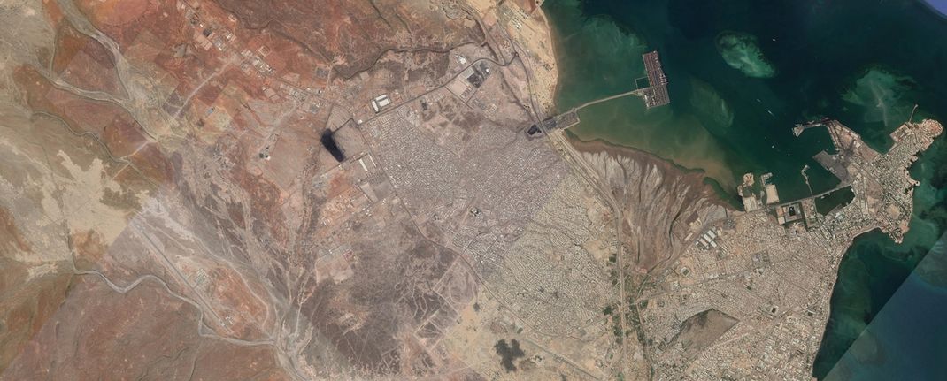
Germany / Europe / ( Solar & Green Productivity ) Friedrich Merz ( CDU ) Chancellor / Bundeskanzler 2025 ( EU) Protokoll 27.05.2025 AD n.Chr
So, Germany and its Green Energy Productivity is seldom in Europe.Chances & Possibilities is wide-reaching. Billions of Euro Bank Notes should be an investment for great sourcing & resources for Renewables in Germany till 2050. Also Europe have multiple billions just over 300 billions of euro investment & major reserves just capacity of Hydrogen to invest from the European Union on the continent. In Germany the Photovoltaic & Green Eco Develpment is since 30 years under strong growth & immense qualitative comfortability under futuristic portrayal. Germany has efficiency targets & diverse standard for green science under immense investment of operating resources. Human Resources of this green topic is formidable & promising for the whole country and energy & electricity operating systems and than transforming this energy for people in the civilization. Not only us as Europeans but also people in the middle east. All kingdoms, nations,countries from middle east have since decades great manufacturing & growth of solar energy possibilities. If you observe the arabian sector on andreaspennophotography you see that the arabian kingdom has a spectrum of human unthinkable 200 Billion of Dollar & 200 GW resources to build up till 2030 & further time under this project for the Vision 2030. Also Dubai has Solar Productivity immense going on in the UAE Emirates just Abu Dhabi or Kuwait and Israel or Bahrain Solar Development Green Resources. So Germany in the EU is one of the most Renewables & Energy propagating developed country in the whole world. The federal republic of Germany is very lucrative also for business of Intercontinenal Diplomatically Procedure.
Wikipedia Source / 27.05.2025 AD n.Chr
Germany,[d] officially the Federal Republic of Germany,[e] is a country in Central Europe. It lies between the Baltic Sea and the North Sea to the north and the Alps to the south. Its sixteen constituent states have a total population of over 84 million in an area of 357,596 km2 (138,069 sq mi), making it the most populous member state of the European Union. It borders Denmark to the north, Poland and the Czech Republic to the east, Austria and Switzerland to the south, and France, Luxembourg, Belgium, and the Netherlands to the west. The nation's capital and most populous city is Berlin and its main financial centre is Frankfurt; the largest urban area is the Ruhr.Settlement in the territory of modern Germany began in the Lower Paleolithic, with various tribes inhabiting it from the Neolithic onward, chiefly the Celts. Various Germanic tribes have inhabited the northern parts of modern Germany since classical antiquity. A region named Germania was documented before AD 100. In 962, the Kingdom of Germany formed the bulk of the Holy Roman Empire. During the 16th century, northern German regions became the centre of the Protestant Reformation. Following the Napoleonic Wars and the dissolution of the Holy Roman Empire in 1806, the German Confederation was formed in 1815.Formal unification of Germany into the modern nation-state commenced on 18 August 1866 with the North German Confederation Treaty establishing the Prussia-led North German Confederation, which became the German Empire in 1871. After World War I and the German Revolution of 1918–1919, the Empire was replaced by the Weimar Republic. The Nazi rise to power in 1933 led to the establishment of a totalitarian dictatorship, World War II, and the Holocaust. In 1949, after the war and a period of Allied occupation, Germany was organised into two separate polities with limited sovereignty: the Federal Republic of Germany, or West Germany, and the German Democratic Republic, or East Germany. Berlin continued its de jure Four Power status. The Federal Republic of Germany was a founding member of the Council of Europe, the European Economic Community and the European Union in 1951, while the German Democratic Republic was a communist Eastern Bloc state and member of the Warsaw Pact. After the fall of the communist led-government in East Germany, German reunification saw the former East German states join the Federal Republic of Germany on 3 October 1990.Germany is a developed country with a strong economy; it has the largest economy in Europe by nominal GDP. As a major force in several industrial, scientific and technological sectors, it is both the world's third-largest exporter and importer. It offers social security, a universal health care system, and tuition-free university education. Germany is part of multiple international organisations and forums. It has the third-highest number of UNESCO World Heritage Sites: 54, of which 51 are cultural.
East and West Germany
The fall of the Berlin Wall in 1989 was one of the first developments in the end of the Cold War, leading ultimately to the dissolution of the Soviet Union.
After the surrender of Nazi Germany, the Allies de jure abolished the German state and partitioned Berlin and Germany's remaining territory into four occupation zones. The western sectors, controlled by France, the United Kingdom, and the United States, were merged on 23 May 1949 to form the Federal Republic of Germany (German: Bundesrepublik Deutschland); on 7 October 1949, the Soviet Zone became the German Democratic Republic (GDR) (Deutsche Demokratische Republik; DDR). They were informally known as West Germany and East Germany.[94] East Germany selected East Berlin as its capital, while West Germany chose Bonn as a provisional capital, to emphasise its stance that the two-state solution was temporary.[95]West Germany was established as a federal parliamentary republic with a social market economy. In 1948, West Germany became a major recipient of reconstruction aid under the American Marshall Plan.[96] Konrad Adenauer was elected the first federal chancellor of Germany in 1949. The country enjoyed prolonged economic growth (Wirtschaftswunder) beginning in the early 1950s.[97] West Germany joined NATO in 1955 and was a founding member of the European Economic Community.[98] On 1 January 1957, the Saarland joined West Germany.[99]East Germany was an Eastern Bloc state under political and military control by the Soviet Union via occupation forces and the Warsaw Pact. Although East Germany claimed to be a democracy, political power was exercised solely by leading members (Politbüro) of the communist-controlled Socialist Unity Party of Germany, supported by the Stasi, an immense secret service.[100] While East German propaganda was based on the benefits of the GDR's social programmes and the alleged threat of a West German invasion, many of its citizens looked to the West for freedom and prosperity.[101] The Berlin Wall, built in 1961, prevented East German citizens from escaping to West Germany, becoming a symbol of the Cold War.[102]Tensions between East and West Germany were reduced in the late 1960s by Chancellor Willy Brandt's Ostpolitik.[103] In 1989, Hungary decided to dismantle the Iron Curtain and open its border with Austria, causing the emigration of thousands of East Germans to West Germany via Hungary and Austria. This had devastating effects on the GDR, where regular mass demonstrations received increasing support. In an effort to help retain East Germany as a state, the East German authorities eased border restrictions, but this actually led to an acceleration of the Wende reform process culminating in the Two Plus Four Treaty under which Germany regained full sovereignty. This permitted German reunification on 3 October 1990, with the accession of the five re-established states of the former GDR.[104] The fall of the Berlin Wall in 1989 became a symbol of the Fall of Communism, the dissolution of the Soviet Union, German reunification and Die Wende ("the turning point").[105]
Reunified Germany and the European Union
The Berlin/Bonn Act made Berlin the capital of Germany again, with the Reichstag becoming the seat of the German parliament in 1999.
United Germany was considered the enlarged continuation of West Germany, so it retained its memberships in international organisations.[106] Based on the Berlin/Bonn Act (1994), Berlin again became the capital of Germany, while Bonn obtained the unique status of a Bundesstadt (federal city), retaining some federal ministries.[107] The relocation of the government was completed in 1999,[108] and modernisation of the East German economy was scheduled to last until 2019.[109]
Since reunification, Germany has taken a more active role in the European Union, signing the Maastricht Treaty in 1992 and the Lisbon Treaty in 2007,[110] and co-founding the eurozone.[111] Germany sent a peacekeeping force to secure stability in the Balkans and sent German troops to Afghanistan as part of a NATO effort to provide security in that country after the ousting of the Taliban.[112][113]
In the 2005 elections, Angela Merkel became the first female chancellor. In 2009, the German government approved a €50 billion stimulus plan.[114] Among the major German political projects of the early 21st century are the advancement of European integration, the energy transition (Energiewende) for a sustainable energy supply, the debt brake for balanced budgets, measures to increase the fertility rate (pronatalism), and high-tech strategies for the transition of the German economy, summarised as Industry 4.0.[115] During the 2015 European migrant crisis, the country took in over a million refugees and migrants.[116]
Geography
Germany is the seventh-largest country in Europe.[117] It borders Denmark to the north, Poland and the Czech Republic to the east, Austria and Switzerland to the south, and France, Luxembourg, Belgium, and the Netherlands to the west. Germany is also bordered by the North Sea and, at the north-northeast, by the Baltic Sea. German territory covers 357,596 km2 (138,069 sq mi).[5] Elevation ranges from the mountains of the Alps (highest point: the Zugspitze at 2,963 metres or 9,721 feet) in the south to the shores of the North Sea (Nordsee) in the northwest and the Baltic Sea (Ostsee) in the northeast. The forested uplands of central Germany and the lowlands of northern Germany (lowest point: in the municipality Neuendorf-Sachsenbande, Wilstermarsch at 3.54 metres or 11.6 feet below sea level[118]) are traversed by such major rivers as the Rhine, Danube and Elbe. Significant natural resources include iron ore, coal, potash, timber, lignite, uranium, copper, natural gas, salt, and nickel.[117]
Climate
Most of Germany has a temperate climate, ranging from oceanic in the north and west to continental in the east and southeast. Winters range from the cold in the Southern Alps to cool and are generally overcast with limited precipitation, while summers can vary from hot and dry to cool and rainy. The northern regions have prevailing westerly winds that bring in moist air from the North Sea, moderating the temperature and increasing precipitation. Conversely, the southeast regions have more extreme temperatures.[119]
From February 2019–February 2020, average monthly temperatures in Germany ranged from a low of 3.3 °C (37.9 °F) in January 2020 to a high of 19.8 °C (67.6 °F) in June 2019.[120] Average monthly precipitation ranged from 30 litres per square metre in February and April 2019 to 125 litres per square metre in February 2020.[121] Average monthly hours of sunshine ranged from 45 in November 2019 to 300 in June 2019.[122]
Climate change in Germany is leading to long-term impacts on agriculture, more intense heatwaves and coldwaves, flash and coastal flooding, and reduced water availability.[123] Climate change could cost Germany up to €900 billion by 2050.[124]
Biodiversity
The territory of Germany can be divided into five terrestrial ecoregions: Atlantic mixed forests, Baltic mixed forests, Central European mixed forests, Western European broadleaf forests, and Alps conifer and mixed forests.[125] As of 2016, 51% of Germany's land area is devoted to agriculture, while 30% is forested and 14% is covered by settlements or infrastructure.[126]
Plants and animals include those generally common to Central Europe. According to the National Forest Inventory, beeches, oaks, and other deciduous trees constitute just over 40% of the forests; roughly 60% are conifers, particularly spruce and pine.[127] There are many species of ferns, flowers, fungi, and mosses. Wild animals include roe deer, wild boar, mouflon (a subspecies of wild sheep), fox, badger, hare, and small numbers of the Eurasian beaver.[128] The blue cornflower was once a German national symbol.[129]
The 16 national parks in Germany include the Jasmund National Park, the Vorpommern Lagoon Area National Park, the Müritz National Park, the Wadden Sea National Parks, the Harz National Park, the Hainich National Park, the Black Forest National Park, the Saxon Switzerland National Park, the Bavarian Forest National Park and the Berchtesgaden National Park.[130] In addition, there are 17 Biosphere Reserves,[131] and 105 nature parks.[132] More than 400 zoos and animal parks operate in Germany.[133] The Berlin Zoo, which opened in 1844, is the oldest in Germany, and claims the most comprehensive collection of species in the world.[134]
Bahrain / ( Middle East / ) / Green Systematically Development / Protokoll 30.10.2021
Well, Bahrain is very pristine in Megaprojects. Its resources for finanically internally inquiry of Solar Energy Eco Development is greatly to resolve. It's a Kingdom of further Kingdoms in the Middle East. The Human Civilization of Bahrain is very strong at growth as well as highly at recommendation of corporations & companies infrastructure for its reputation. It's a member of the ( GCC ) just a product of of the Gulf Cooperations Council Member States. Bahrain has a King & a Prince. Its prince stands under great civilized arabian friendship to Mohammed Bin Salman the prince from arabia kingdom. Bahrain has Sustainability Planning & Structures of high Gulf Cooperational Status to take investment in different economically prinicples. As well as Bapco it's most hugh & popular centralized oil corporation in the Kingdom of Bahrain is very high as well as Aramco under differentiated status for oil export delivery in the whole wide world.Bahrain has futuristically outlook for Green Energy highly disciplined. It's currency is Bahrain Dinar. It's improvement for highly future purpose & future planning for locally internally great wind turbines & solar energy panels operations & build-up structured is in it's society is hugh possible. Bahrain is recruited on the Persian Gulf and is a Gulf States Member State. It's Archipelago Isle Countries Industrialization was in past 30 years till now under great growing influx. Bahrain is very pristine and has exotically resorts to offer on the persian gulf.The kingdom from Bahrain is socially very islamically assessed & established. There's is also a King in the state of Bahrain. It's productivity & social values are precise & graduating from a country where also pilgrims coming to the western region of the GCC Member Kingdom of Saudi Arabia to the holy place of Makkah. Also from Abu Dhabi or Dubai or further Emirates or Kuwait just Pakistan or Turkey people is pilgrims for the holy land of Makkah. This to that. Europe the continent has strong affiliated cooperation ideals & promulgated connection to Bahrain and the Gulf States. Bahrain is in a GCC Gulf metamorphosis just evolution & develpment since early decades from now. And it's futuristic planning in the Vision 2030 is highly engaged of Green Systematically Development just Green Politics & Green Energy Confidence.
Recommendations of Green Investment. The Kingdom of Bahrain is very confident in it's Vision 2030. Somehow the middle east is all about investing & initiating in green technology and an update of solar & wind power.
Bahrain's Vision is very great but also in obstacles. The resources of the infrastructure is somehow missing in different sectors. But now the industrialization of the Middle East & Africa Continents is splendid & future well-coined established. This country has a islamically constitution and is GCC high optimistically engaged. The plan & goal to achieve values like other GCC states e.G Qatar or UAE or Kingdom of Saudi Arabia is to achieve CRUDE Oil Independence .
Bahrain is welcomed in different continents as a kingdom for cooperational industrial pacts. Mohammed Bin Salman from Arabian Kingdom is very standing in friendship to the prince of Bahrain. They have a great relationship. Especially a lot of Princes & Sheiks stand in collaboration in pristine contact for decades from now in the middle east from several kingdoms. The green spectrum & operating goodwill of the values of Bahrain is under hugh also civilized hugh phases till 2030. This country has even not only Green Energy in it's groundbreaking state but also trading possibilities & confident sharing development. Also different commodity & products is fostered & established in the ports, harbours and coastal ares of the bordering water named Persian Gulf. This country has a wide standing evolution just growth like ancient thoughts just alike the Persian Kingdom and Empire. The prince is having enormous responsibility of this land of oil. Anyway God Bless Bahrain and the whole middle east.
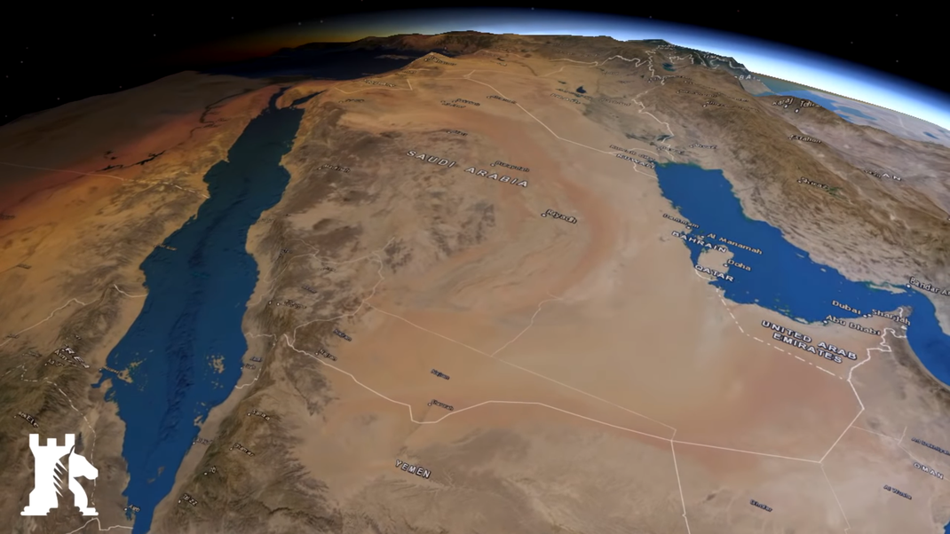
Portugal / EU Affiliated / Prime Minister Antonio Costa + Luis Montenegro 2.April 2024/ Main Capital is Lisbon / Western Region / Protokoll 09.04.2025 ( Update )
So Lisbon is the capital from Portugal. This is country is geographically situated southwest european on the scale. It's an peninsula on the atlantic ocean & basin. It't has great resorts and the civilization is very cultivated especially the younger generation. It's population chiffre is about 10 Millions of humankind living in this country. Head of State and President is Marcelo Rebelo de Sousa. The Gross Domestic Product 2020 was approximately 230 Billion of Dollar and GDP Worth. Portugal has a language as same as the origin like the country itself portuguese lingo which is resembling the hispanic language which is oftenly talked in different regions in the continent South America. The financially currrency is the Euro like all other 26 Partnership & Cooperational Members from the EU does carry just the European Commission & Parliament as member. This peninsula is bordering to Spain the country. Portugal is oftenly visited from people all over the world in the humanity we is about. To Spain the Portuguese economically leadership individuals to export just serve as a exporter from Portugal to Spain as much as the most from it's native country. The second export countries from Portugal is France and the third export country is belonging to Germany, so all the Eurozone. As well as does the geoecologically sites from the most western country of the European Continent import from Spain as much as they do. So Portugal is a beautifully country also carrying a city named Porto.It's also in membership of the OECD ( Organization of Economic Cooperation & Development ) or WTO ( World Trade Organization) and the EU.In the 12 Century a.D Portugal was created as kingdom in 1139. And the democratically state of Portugal came 1976. It's spectrum of the size of the country is 92.212 km² so enormous size like the Kingdom of Saudi Arabia or India or the US in comparison just Australia or in nexus to China, Portugal is not suited it's small from it's area. The five greatest and biggest airports from the country are from Lisbon, Porto, Faro, Ponta Delgada or Funcha.As far as the architecture is centralized through all epochs of European Builidings Time Ages & Very Build by diligently manufacture all the way up .The legislature is the Assembly of the Republic.Portugals Confessional Religious Belief is 84 Percent Christianity. Like all other most of the membership carrying states of the European Union just Christology.
Portugal has also green energy just solar panel complexes & estates nationwide exemplified. The prime minister Antonio Costa is a great politician & economist . This premier is well established and has worlwide connections & governmentally systematic relationships to almost every continent of humanity and is fostering a great foreign affairs model to Spain and further hispanic countries. Portugal has also a great flag constituted. Solar structured green productivity & development is country wide representated on hugh establishment. As far as Tourism a lot of people have Portugal and the coastal areas under portrayal just on the holidays, leisure & resort list cause it's climate is very Tourism friendly engaging people. Portugal has also native meals & receipts for it's own budget & modern nourishments civilization. This land was also a decisive & important factor for the development & creation of the NATO ( North Atlantic Treaty Organization ) in the year a.D 1949 of world history.
United Kingdom / Independence from EU / Monarchy / Queen Elizabeth 2 + Successor King Charles III / London U.K / Commonwealth Australia & New Zealand / 12.09.2022
The United Kingdom of Great Britain and Northern Ireland, commonly known as the United Kingdom (UK) or Britain is a sovereign country in north-western Europe, off the north-western coast of the European mainland. The United Kingdom includes the island of Great Britain, the north-eastern part of the island of Ireland, and many smaller islands within the British Isles. Northern Ireland shares a land border with the Republic of Ireland. Otherwise, the United Kingdom is surrounded by the Atlantic Ocean, with the North Sea to the east, the English Channel to the south and the Celtic Sea to the south-west, giving it the 12th-longest coastline in the world. The Irish Sea separates Great Britain and Ireland. The total area of the United Kingdom is 242,500 square kilometres (93,628 sq mi), with an estimated population in 2020 of 68 million.
The United Kingdom is a unitary parliamentary democracy and constitutional monarchy.The monarch, Queen Elizabeth II, has reigned since 1952.The capital and largest city is London, a global city and financial centre with a metropolitan area population of 14 million. The United Kingdom consists of four countries: England, Scotland, Wales and Northern Ireland.Other than England, the constituent countries have their own devolved governments, each with varying powers.
The United Kingdom has evolved from a series of annexations, unions and separations of constituent countries over several hundred years. The Treaty of Union between the Kingdom of England (which included Wales, annexed in 1542) and the Kingdom of Scotland in 1707 formed the Kingdom of Great Britain. Its union in 1801 with the Kingdom of Ireland created the United Kingdom of Great Britain and Ireland. Most of Ireland seceded from the UK in 1922, leaving the present United Kingdom of Great Britain and Northern Ireland, which formally adopted that name in 192.

The nearby Isle of Man, Guernsey and Jersey are not part of the UK, being Crown Dependencies with the British Government responsible for defence and international representation.There are also 14 British Overseas Territories, the last remnants of the British Empire which, at its height in the 1920s, encompassed almost a quarter of the world's landmass and a third of the world's population, and was the largest empire in history. British influence can be observed in the language, culture and the legal and political systems of many of its former colonies.
The United Kingdom has the world's fifth-largest economy by nominal gross domestic product (GDP), and the tenth-largest by purchasing power parity (PPP). It has a high-income economy and a very high human development index rating, ranking 13th in the world. The UK became the world's first industrialised country and was the world's foremost power during the 19th and early 20th centuries. Today the UK remains one of the world's great powers, with considerable economic, cultural, military, scientific, technological and political influence internationally.It is a recognised nuclear state and is ranked fourth globally in military expenditure.It has been a permanent member of the United Nations Security Council since its first session in 1946.
The United Kingdom is a member of the Commonwealth of Nations, the Council of Europe, the G7, the Group of Ten, the G20, the United Nations, NATO, AUKUS, the Organisation for Economic Co-operation and Development (OECD), Interpol, and the World Trade Organization (WTO). It was a member state of the European Communities (EC) and its successor, the European Union (EU), from its accession in 1973 until its withdrawal in 2020 following a referendum held in 2016.
The Acts of Union 1707 declared that the Kingdom of England and Kingdom of Scotland were "United into One Kingdom by the Name of Great Britain". The term "United Kingdom" has occasionally been used as a description for the former kingdom of Great Britain, although its official name from 1707 to 1800 was simply "Great Britain". The Acts of Union 1800 united the kingdom of Great Britain and the kingdom of Ireland in 1801, forming the United Kingdom of Great Britain and Ireland. Following the partition of Ireland and the independence of the Irish Free State in 1922, which left Northern Ireland as the only part of the island of Ireland within the United Kingdom, the name was changed to the "United Kingdom of Great Britain and Northern Ireland".
Although the United Kingdom is a sovereign country, England, Scotland, Wales and Northern Ireland are also widely referred to as countries. The UK Prime Minister's website has used the phrase "countries within a country" to describe the United Kingdom. Some statistical summaries, such as those for the twelve NUTS 1 regions of the United Kingdom refer to Scotland, Wales and Northern Ireland as "regions".Northern Ireland is also referred to as a "province".With regard to Northern Ireland, the descriptive name used "can be controversial, with the choice often revealing one's political preferences"
The term "Great Britain" conventionally refers to the island of Great Britain, or politically to England, Scotland and Wales in combination.It is sometimes used as a loose synonym for the United Kingdom as a whole.
The term "Britain" is used both as a synonym for Great Britain, and as a synonym for the United Kingdom.Usage is mixed: the UK Government prefers to use the term "UK" rather than "Britain" or "British" on its own website (except when referring to embassies)while acknowledging that both terms refer to the United Kingdom and that elsewhere '"British government" is used at least as frequently as "United Kingdom government". The UK Permanent Committee on Geographical Names recognises "United Kingdom", "UK" and "U.K." as shortened and abbreviated geopolitical terms for the United Kingdom of Great Britain and Northern Ireland in its toponymic guidelines; it does not list "Britain" but notes 'it is only the one specific nominal term "Great Britain" which invariably excludes Northern Ireland.The BBC historically preferred to use "Britain" as shorthand only for Great Britain, though the present style guide does not take a position except that "Great Britain" excludes Northern Ireland.
The adjective "British" is commonly used to refer to matters relating to the United Kingdom and is used in law to refer to United Kingdom citizenship and matters to do with nationality.People of the United Kingdom use a number of different terms to describe their national identity and may identify themselves as being British, English, Scottish, Welsh, Northern Irish, or Irish;or as having a combination of different national identities. The official designation for a citizen of the United Kingdom is "British citizen".
France ( EU ) 2022 Presidential Election / Paris / Emmanuel Macron President since 2017/ Eiffel Tower / Air France & Airbus Airplane Creator in France / Protokoll 12.09.2022
France (French: [fʁɑ̃s] Listen), officially the French Republic (French: République française), is a transcontinental country spanning Western Europe and overseas regions and territories in the Americas and the Atlantic, Pacific and Indian Oceans.[XIII] Including all of its territories, France has twelve time zones, the most of any country. Its metropolitan area extends from the Rhine to the Atlantic Ocean and from the Mediterranean Sea to the English Channel and the North Sea; overseas territories include French Guiana in South America, Saint Pierre and Miquelon in the North Atlantic, the French West Indies, and several islands in Oceania and the Indian Ocean. Due to its several coastal territories, France has the largest exclusive economic zone in the world. France borders Belgium, Luxembourg, Germany, Switzerland, Monaco, Italy, Andorra and Spain in Europe, as well as the Netherlands, Suriname and Brazil in the Americas. Its eighteen integral regions (five of which are overseas) span a combined area of 643,801 km2 (248,573 sq mi) and over 67 million people (as of May 2021). France is a unitary semi-presidential republic with its capital in Paris, the country's largest city and main cultural and commercial centre; other major urban areas include Lyon, Marseille, Toulouse, Bordeaux, Lille and Nice.
Inhabited since the Palaeolithic era, the territory of Metropolitan France was settled by Celtic tribes known as Gauls during the Iron Age. Rome annexed the area in 51 BC, leading to a distinct Gallo-Roman culture that laid the foundation of the French language. The Germanic Franks arrived in 476 and formed the Kingdom of Francia, which became the heartland of the Carolingian Empire. The Treaty of Verdun of 843 partitioned the empire, with West Francia becoming the Kingdom of France in 987.
In the High Middle Ages, France was a powerful but highly decentralised feudal kingdom in which the king's authority was barely felt. King Philip Augustus achieved remarkable success in the strengthening of royal power and the expansion of his realm, defeating his rivals and doubling its size. By the end of his reign, the kingdom had emerged as the most powerful state in Europe. From the mid-14th to the mid-15th century, France was plunged into a series of dynastic conflicts for the French throne, collectively known as the Hundred Years' War, and a distinct French identity emerged as a result. The French Renaissance saw art and culture flourish, various wars with rival powers, and the establishment of a global colonial empire, which by the 20th century would become the second-largest in the world. The second half of the 16th century was dominated by religious civil wars between Catholics and Huguenots that severely weakened the country. But France once again emerged as Europe's dominant cultural, political and military power in the 17th century under Louis XIV following the Thirty Years' War.Inadequate economic policies, an inequitable taxation system as well as endless wars (notably a defeat in the Seven Years' War and costly involvement in the American War of Independence), left the kingdom in a precarious economic situation by the end of the 18th century. This precipitated the French Revolution of 1789, which overthrew the absolute monarchy, replaced the Ancien Régime with one of history's first modern republics and produced the Declaration of the Rights of Man and of the Citizen, which expresses the nation's ideals to this day.
France reached its political and military zenith in the early 19th century under Napoleon Bonaparte, subjugating much of continental Europe and establishing the First French Empire. The French Revolutionary and Napoleonic Wars shaped the course of European and world history. The collapse of the empire initiated a period of relative decline, in which France endured a tumultuous succession of governments until the founding of the French Third Republic during the Franco-Prussian War in 1870. Subsequent decades saw a period of optimism, cultural and scientific flourishing, as well as economic prosperity known as the Belle Époque. France was one of the major participants of World War I, from which it emerged victorious at great human and economic cost. It was among the Allied powers of the World War II, but was soon occupied by the Axis in 1940. Following liberation in 1944, the short-lived Fourth Republic was established and later dissolved in the course of the Algerian War. The current Fifth Republic was formed in 1958 by Charles de Gaulle. Algeria and most French colonies became independent in the 1960s, with the majority retaining close economic and military ties with France.
France retains its centuries-long status as a global centre of art, science and philosophy. It hosts the fifth-largest number of UNESCO World Heritage Sites and is the world's leading tourist destination, receiving over 89 million foreign visitors in 2018. France is a developed country with the world's seventh-largest economy by nominal GDP and ninth-largest by PPP; in terms of aggregate household wealth, it ranks fourth in the world. France performs well in international rankings of education, health care, life expectancy and human development.It remains a great power in global affairs, being one of the five permanent members of the United Nations Security Council and an official nuclear-weapon state. France is a founding and leading member of the European Union and the Eurozone, as well as a key member of the Group of Seven, North Atlantic Treaty Organization (NATO), Organisation for Economic Co-operation and Development (OECD) and La Francophonie.

Revolutionary France (1789–1799)
Facing financial troubles, King Louis XVI summoned the Estates-General (gathering the three Estates of the realm) in May 1789 to propose solutions to his government. As it came to an impasse, the representatives of the Third Estate formed into a National Assembly, signalling the outbreak of the French Revolution. Fearing that the king would suppress the newly created National Assembly, insurgents stormed the Bastille on 14 July 1789, a date which would become France's National Day.
In early August 1789, the National Constituent Assembly abolished the privileges of the nobility such as personal serfdom and exclusive hunting rights. Through the Declaration of the Rights of Man and of the Citizen (27 August 1789) France established fundamental rights for men. The Declaration affirms "the natural and imprescriptible rights of man" to "liberty, property, security and resistance to oppression". Freedom of speech and press were declared, and arbitrary arrests were outlawed. It called for the destruction of aristocratic privileges and proclaimed freedom and equal rights for all men, as well as access to public office based on talent rather than birth. In November 1789, the Assembly decided to nationalise and sell all property of the Catholic Church which had been the largest landowner in the country. In July 1790, a Civil Constitution of the Clergy reorganized the French Catholic Church, cancelling the authority of the Church to levy taxes, et cetera. This fueled much discontent in parts of France, which would contribute to the civil war breaking out some years later. While King Louis XVI still enjoyed popularity among the population, his disastrous flight to Varennes (June 1791) seemed to justify rumours he had tied his hopes of political salvation to the prospects of foreign invasion. His credibility was so deeply undermined that the abolition of the monarchy and establishment of a republic became an increasing possibility.
In August 1791, the Emperor of Austria and the King of Prussia in the Declaration of Pillnitz threatened revolutionary France to intervene by force of arms to restore the French absolute monarchy. In September 1791, the National Constituent Assembly forced King Louis XVI to accept the French Constitution of 1791, thus turning the French absolute monarchy into a constitutional monarchy. In the newly established Legislative Assembly (October 1791), enmity developed and deepened between a group, later called the 'Girondins', who favoured war with Austria and Prussia, and a group later called 'Montagnards' or 'Jacobins', who opposed such a war. A majority in the Assembly in 1792 however saw a war with Austria and Prussia as a chance to boost the popularity of the revolutionary government and thought that France would win a war against those gathered monarchies. On 20 April 1792, therefore, they declared war on Austria.
Le Serment du Jeu de paume by Jacques-Louis David, 1791
On 10 August 1792, an angry crowd threatened the palace of King Louis XVI, who took refuge in the Legislative Assembly.A Prussian Army invaded France later in August 1792. In early September, Parisians, infuriated by the Prussian Army capturing Verdun and counter-revolutionary uprisings in the west of France, murdered between 1,000 and 1,500 prisoners by raiding the Parisian prisons. The Assembly and the Paris City Council seemed unable to stop that bloodshed.The National Convention, chosen in the first elections under male universal suffrage, on 20 September 1792 succeeded the Legislative Assembly and on 21 September abolished the monarchy by proclaiming the French First Republic. Ex-King Louis XVI was convicted of treason and guillotined in January 1793. France had declared war on Great Britain and the Dutch Republic in November 1792 and did the same on Spain in March 1793; in the spring of 1793, Austria and Prussia invaded France; in March, France created a "sister republic" in the "Republic of Mainz", and kept it under control.
Also in March 1793, the civil war of the Vendée against Paris started, evoked by both the Civil Constitution of the Clergy of 1790 and the nationwide army conscription early 1793; elsewhere in France rebellion was brewing too. A factionalist feud in the National Convention, smouldering ever since October 1791, came to a climax with the group of the 'Girondins' on 2 June 1793 being forced to resign and leave the convention. The counter-revolution, begun in March 1793 in the Vendée, by July had spread to Brittany, Normandy, Bordeaux, Marseilles, Toulon, and Lyon. Paris' Convention government between October and December 1793 with brutal measures managed to subdue most internal uprisings, at the cost of tens of thousands of lives. Some historians consider the civil war to have lasted until 1796 with a toll of possibly 450,000 lives. By the end of 1793 the allies had been driven from France. France in February 1794 abolished slavery in its American colonies, but would reintroduce it later.
Political disagreements and enmity in the National Convention between October 1793 and July 1794 reached unprecedented levels, leading to dozens of Convention members being sentenced to death and guillotined. Meanwhile, France's external wars in 1794 were going prosperous, for example in Belgium. In 1795, the government seemed to return to indifference towards the desires and needs of the lower classes concerning freedom of (Catholic) religion and fair distribution of food. Until 1799, politicians, apart from inventing a new parliamentary system (the 'Directory'), busied themselves with dissuading the people from Catholicism and from royalism.
Spain ( EU Affiliated ) / Kingdom / King Felipe VI King and Head of State / Also in Geoecology of Archipelago in Eurozone / 09.01.2022 Protokoll
Spain (Spanish: España, [esˈpaɲa] (About this soundlisten)), officially the Kingdom of Spain[12] (Spanish: Reino de España),[a][b] is a country in southwestern Europe with some pockets of territory in the Mediterranean Sea, offshore in the Atlantic Ocean and in northern Africa across the Strait of Gibraltar.[12] Its continental European territory is situated on the Iberian Peninsula, and its insular territory includes the Balearic Islands in the Mediterranean Sea, several small islands in the Alboran Sea and the Canary Islands in the Atlantic Ocean. The Spanish territory also includes the African semi-exclaves of Ceuta, Melilla and Peñon de Vélez across the Strait of Gibraltar.[13][h] The country's mainland is bordered to the south by Gibraltar, to the south and east by the Mediterranean Sea; to the north by France, Andorra and the Bay of Biscay; and to the west by Portugal and the Atlantic Ocean.
With an area of 505,990 km2 (195,360 sq mi), Spain is the largest country in Southern Europe, the second-largest country in Western Europe and the European Union, and the fourth-largest country by area on the European continent. With a population exceeding 47.4 million, Spain is the sixth-most populous country in Europe, and the fourth-most populous country in the European Union. Spain's capital and largest city is Madrid; other major urban areas include Barcelona, Valencia, Seville, Zaragoza, Málaga, Murcia, Palma de Mallorca, Las Palmas de Gran Canaria and Bilbao.
Anatomically modern humans first arrived in the Iberian Peninsula around 42,000 years ago.[14] The first cultures and peoples that developed in current Spanish territory were Pre-Roman peoples such as the ancient Iberians, Celts, Celtiberians, Vascones, and Turdetani. Later, foreign Mediterranean peoples such as the Phoenicians and ancient Greeks developed coastal trading colonies, and the Carthaginians briefly controlled part of the Spanish Mediterranean coastline. From the year 218 BCE, with the taking of the city of Ampurias, the Roman colonization of Hispania began and, with the exception of the Atlantic cornice, they quickly controlled the territory of present-day Spain. The Romans had driven the Carthaginians out of the Iberian peninsula by 206 BCE, and divided it into two administrative provinces, Hispania Ulterior and Hispania Citerior.[15][16] The Romans laid the foundations for modern Spanish culture and identity, and was the birthplace of important Roman emperors such as Trajan, Hadrian or Theodosius I.
Spain remained under Roman rule until the collapse of the Western Roman Empire in the fourth century, which ushered in Germanic tribal confederations from Central and Northern Europe. During this period, present-day Spain was divided between different Germanic powers, including the Suevi, Alans, Vandals and Visigoths, the latter maintaining an alliance with Rome via foedus, while part of Southern Spain belonged to the Byzantine Empire. Eventually, the Visigoths emerged as the dominant faction by the fifth century, with the Visigothic Kingdom spanning the vast majority of the Iberian Peninsula, and established its capital in what is now the city of Toledo. The creation of the code of laws Liber Iudiciorum by the King Recceswinth during the Visigothic period deeply influenced the structural and legal bases of Spain and the survival of Roman Law after the fall of the Roman Empire.
In the early eighth century, the Visigothic Kingdom was invaded by the Umayyad Caliphate, ushering in over 700 years of Muslim rule in Southern Iberia. During this period, Al-Andalus became a major economic and intellectual centre, with the city of Córdoba being among the largest and richest in Europe. Several Christian kingdoms emerged in the northern periphery of Iberia, chief among them León, Castile, Aragón, Portugal, and Navarre. Over the next seven centuries, an intermittent southward expansion of these kingdoms—metahistorically framed as a reconquest, or Reconquista—culminated with the Christian seizure of the last Muslim polity, the Nasrid Kingdom of Granada, and the control of all Iberia by the Christian kingdoms in 1492. That same year, Christopher Columbus arrived in the New World on behalf of the Catholic Monarchs, whose dynastic union of the Crown of Castile and the Crown of Aragon is usually considered the emergent Spain as a unified country. During the centuries after the Reconquista, the Christian kings of Spain persecuted and expelled ethnic and religious minorities such as Jews and Muslims through the Spanish Inquisition.
From the 16th until the early 19th century, Spain ruled one of the largest empires in history. It was among the first global empires, and its immense cultural and linguistic legacy includes over 570 million Hispanophones, making Spanish the world's second-most spoken native language.[17] Spanish art, music, literature and cuisine have been influential worldwide, particularly in the Americas. As a reflection of its large cultural wealth, Spain has the world's fourth-largest number of World Heritage Sites (49) and is the world's second-most visited country.
Today, Spain is a secular parliamentary democracy and a constitutional monarchy,[18] with King Felipe VI as head of state. It is a highly developed country[19] and a high income country, with the world's fourteenth-largest economy by nominal GDP and the sixteenth-largest by PPP. Spain has one of the longest life expectancies in the world at 83.5 years in 2019.[20] It ranks particularly high in healthcare quality,[21] with its healthcare system considered to be one of the most efficient worldwide.[22] It is a world leader in organ transplants and organ donation.[23][24] Spain is a member of the United Nations (UN), the European Union (EU), the Eurozone, the Council of Europe (CoE), the Organization of Ibero-American States (OEI), the Union for the Mediterranean, the North Atlantic Treaty Organization (NATO), the Organisation for Economic Co-operation and Development (OECD), Organization for Security and Co-operation in Europe (OSCE), the World Trade Organization (WTO) and many other international organisations.
Italy ( EU Member ) / 2022 Mario Draghi Prime Minister / 4th Quarter Giorgia Meloni New PM / Rome Capital / Southern Isle Sicily / Mediterranean / Protokoll 26.10.2022
Italy (Italian: Italia [iˈtaːlja] (About this soundlisten)), officially the Italian Republic (Italian: Repubblica Italiana [reˈpubblika itaˈljaːna]),[13][14] is a country consisting of a peninsula delimited by the Alps and several islands surrounding it,[15] whose territory largely coincides with the homonymous geographical region.[16] Italy is located in the centre of the Mediterranean Sea, in Southern Europe;[17][18][19] it is also considered part of Western Europe.[20][21] A unitary parliamentary republic with Rome as its capital and largest city, the country covers a total area of 301,340 km2 (116,350 sq mi) and shares land borders with France, Switzerland, Austria, Slovenia, as well as the enclaved microstates of Vatican City and San Marino. Italy has a territorial exclave in Switzerland (Campione) and a maritime exclave in Tunisian waters (Lampedusa). With around 60 million inhabitants, Italy is the third-most populous member state of the European Union.
Due to its central geographic location in Southern Europe and the Mediterranean, Italy has historically been home to myriad peoples and cultures. In addition to the various ancient peoples dispersed throughout what is now modern-day Italy, the most predominant being the Indo-European Italic peoples who gave the peninsula its name, beginning from the classical era, Phoenicians and Carthaginians founded colonies mostly in insular Italy,[22] Greeks established settlements in the so-called Magna Graecia of Southern Italy, while Etruscans and Celts inhabited central and northern Italy respectively. An Italic tribe known as the Latins formed the Roman Kingdom in the 8th century BC, which eventually became a republic with a government of the Senate and the People. The Roman Republic initially conquered and assimilated its neighbours on the Italian peninsula, eventually expanding and conquering parts of Europe, North Africa and Asia. By the first century BC, the Roman Empire emerged as the dominant power in the Mediterranean Basin and became a leading cultural, political and religious centre, inaugurating the Pax Romana, a period of more than 200 years during which Italy's law, technology, economy, art, and literature developed.[23][24]
During the Early Middle Ages, Italy endured the fall of the Western Roman Empire and barbarian invasions, but by the 11th century numerous rival city-states and maritime republics, mainly in the northern and central regions of Italy, became prosperous through trade, commerce, and banking, laying the groundwork for modern capitalism.[25] These mostly independent statelets served as Europe's main trading hubs with Asia and the Near East, often enjoying a greater degree of democracy than the larger feudal monarchies that were consolidating throughout Europe; however, part of central Italy was under the control of the theocratic Papal States, while Southern Italy remained largely feudal until the 19th century, partially as a result of a succession of Byzantine, Arab, Norman, Angevin, Aragonese, and other foreign conquests of the region.[26] The Renaissance began in Italy and spread to the rest of Europe, bringing a renewed interest in humanism, science, exploration, and art. Italian culture flourished, producing famous scholars, artists, and polymaths. During the Middle Ages, Italian explorers discovered new routes to the Far East and the New World, helping to usher in the European Age of Discovery. Nevertheless, Italy's commercial and political power significantly waned with the opening of trade routes that bypassed the Mediterranean.[27] Centuries of foreign meddling and conquest, and the rivalry and infighting between the Italian city-states, such as the Italian Wars of the 15th and 16th centuries, left Italy politically fragmented, and it was further conquered and divided among multiple foreign European powers over the centuries.
By the mid-19th century, rising Italian nationalism and calls for independence from foreign control led to a period of revolutionary political upheaval. After centuries of foreign domination and political division, Italy was almost entirely unified in 1861 following a war of independence, establishing the Kingdom of Italy.[28] From the late 19th century to the early 20th century, Italy rapidly industrialised, mainly in the north, and acquired a colonial empire,[29] while the south remained largely impoverished and excluded from industrialisation, fuelling a large and influential diaspora.[30] Despite being one of the victorious allied powers in World War I, Italy entered a period of economic crisis and social turmoil, leading to the rise of the Italian fascist dictatorship in 1922. Participation in World War II on the Axis side ended in military defeat, economic destruction, and civil war. Following the rise of the Italian Resistance and the liberation of Italy, the country abolished its monarchy, established a democratic Republic, enjoyed a prolonged economic boom, and became a highly developed country.[31]
Italy has an advanced economy. The country is the eighth-largest by nominal GDP (third in the European Union), the sixth-largest by national wealth and the third-largest by central bank gold reserve. It ranks highly in life expectancy, quality of life,[32] healthcare,[33] and education. The country is a great power and it has a significant role in regional[34][35] and global [36][37] economic, military, cultural, and diplomatic affairs. Italy is a founding and leading member of the European Union and a member of numerous international institutions, including the United Nations, NATO, the OECD, the Organization for Security and Co-operation in Europe, the World Trade Organization, the Group of Seven, the G20, the Union for the Mediterranean, the Latin Union, the Council of Europe, Uniting for Consensus, the Schengen Area, and many more. The source of many inventions and discoveries, the country has long been a global centre of art, music, literature, philosophy, science and technology, and fashion, and has greatly influenced and contributed to diverse fields including cinema, cuisine, sports, jurisprudence, banking, and business.[38] As a reflection of its cultural wealth, Italy has the world's largest number of World Heritage Sites (58), and is the fifth-most visited country.
Poland / ( EU Member ) Warsaw Capital / President Karol Nawrocki since 2025 / ( Update )Protokoll 05.06.2025
Poland,[c] officially the Republic of Poland,[d] is a country located in Central Europe.[15] It is divided into 16 administrative provinces, covering an area of 312,696 km2 (120,733 sq mi), and has a largely temperate seasonal climate.[9] Poland has a population of nearly 38.5 million people, and is the fifth-most populous member state of the European Union.[9] Warsaw is the nation's capital and largest metropolis. Other major cities include Kraków, Łódź, Wrocław, Poznań, Gdańsk, and Szczecin.
Poland's territory extends from the Baltic Sea in the north to the Sudetes and Carpathian Mountains in the south. The country is bordered by Lithuania and Russia (Kaliningrad Oblast) to the northeast, Belarus and Ukraine to the east, Slovakia and the Czech Republic to the south, and Germany to the west.[16]
The history of human activity on Polish soil spans thousands of years. Throughout the late antiquity period it became extensively diverse, with various cultures and tribes settling on the vast Central European Plain. However, it was the Western Polans who dominated the region and gave Poland its name. The establishment of Polish statehood can be traced to 966, when the pagan ruler of a realm coextensive with the territory of present-day Poland embraced Christianity and converted to Catholicism.[17] The Kingdom of Poland was founded in 1025 and in 1569 cemented its longstanding political association with Lithuania by signing the Union of Lublin. This union formed the Polish–Lithuanian Commonwealth, one of the largest (over one million square kilometres or 400,000 square miles in area) and most populous nations of 16th and 17th century Europe, with a uniquely liberal political system which adopted Europe's first modern constitution, the Constitution of 3 May 1791.[18][19][20]
With the end of the prosperous Polish Golden Age, the country was partitioned by neighbouring states at the end of the 18th century, and regained independence in 1918 with the Treaty of Versailles. After a series of territorial conflicts, the new multi-ethnic Poland restored its position as a key player in European politics. In September 1939, World War II began with the invasion of Poland by Germany, followed by the Soviets invading Poland in accordance with the Molotov–Ribbentrop Pact. Approximately six million Polish citizens, including three million of the country's Jews, perished during the course of the war.[21][22] As a member of the Eastern Bloc, the Polish People's Republic proclaimed forthwith was a chief signatory of the Warsaw Treaty amidst global Cold War tensions. In the wake of the 1989 events, notably through the emergence and contributions of the Solidarity movement, the communist government was dissolved and Poland re-established itself as a democratic republic.
Poland is a developed market,[23] and a middle power; it has the sixth largest economy in the European Union by nominal GDP and the fifth largest by GDP (PPP).[24] It provides very high standards of living, safety and economic freedom,[25][26][27] as well as free university education and a universal health care system.[28][29] The country has 17 UNESCO World Heritage Sites, 15 of which are cultural.[30] Poland is a member state of the Schengen Area, European Union, European Economic Area, the United Nations, NATO, the OECD, the Three Seas Initiative and the Visegrád Group.
Etymology ( Origin of Countries Name )
The country's native name Polska is derived from the Lechitic tribe of Western Polans, who inhabited the Warta river basin of present-day Greater Poland region starting in the mid-6th century.[31] The tribe's name itself stems from the Proto-Indo European *pleh₂- (flatland) and the Proto-Slavic word pole (field).[31][32] The etymology eludes to the topography of the region and the flat landscape of Greater Poland.[33] The English name Poland was formed in the 1560s from Middle High German Pole(n) and the suffix land, denoting a people or nation.[34][35] Prior to its adoption, the Latin form Polonia was widely used throughout medieval Europe.[36]
In some languages, such as Hungarian, Lithuanian, Persian and Old Norse, the country's exonym stems from Lechia, which derives from Lech, a legendary ruler of the Polish tribes (Lechites),[37] or from the Lendians who dwelled on the south-easternmost edge of present-day Lesser Poland region.[31] The origin of the tribe's name lies in the Old Polish word lęda (plain), which is a cognate of the German "das Land", Spanish "landa" and English "land".[38] Initially, both names Lechia and Polonia were used interchangeably when referring to Poland by chroniclers during the Early and High Middle Ages.
Geography ( EU Continent ) Weltwirtschaftserforschungmodell
Poland covers an area of approximately 312,696 km2 (120,733 sq mi), of which 98.52% is dry land and 1.48% is water.[210] Extending across several geographical regions, the country is the 9th-largest by area in Europe and 69th largest in the world. Topographically, Poland is diverse and has access to the sea, the mountains and open terrain.[211] Although most of the central parts of the country are flat, there is an abundance of lakes, rivers, hills, swamps, beaches, islands and forests elsewhere.[211]
In the north-west is the Baltic seacoast spanning from the Bay of Pomerania to the Gulf of Gdańsk. The coast is marked by several spits, coastal lakes (former bays that have been cut off from the sea), and dunes.[212] The largely straight coastline is indented by the Szczecin Lagoon, the Bay of Puck, and the Vistula Lagoon.
The central and northern parts of the country lie within the North European Plain. Rising above these lowlands is a geographical region comprising four hilly districts of moraines and moraine-dammed lakes formed during and after the Pleistocene ice age, notably the Pomeranian Lake District, the Greater Polish Lake District, the Kashubian Lake District, and the Masurian Lake District.[213] The Masurian Lake District is the largest of the four and covers much of north-eastern Poland. The lake districts form a series of moraine belts along the southern shore of the Baltic Sea.[213]
South of the Northern European Plain are the regions of Lusatia, Silesia and Masovia, which are marked by broad ice-age river valleys.[214] The extreme south of Poland is mountainous; it runs from the Sudetes in the west to the Carpathian Mountains in the east. The highest part of the Carpathian massif is the Tatra Mountain range, along Poland's southern border.
Geology ( Geologically )
The geological structure of Poland has been shaped by the continental collision of Europe and Africa over the past 60 million years and, more recently, by the Quaternary glaciations of northern Europe.[216] Both processes shaped the Sudetes and the Carpathian Mountains. The moraine landscape of northern Poland contains soils made up mostly of sand or loam, while the ice age river valleys of the south often contain loess. The Polish Jura, the Pieniny, and the Western Tatras consist of limestone, whereas the High Tatras, the Beskids, and the Karkonosze mountain ranges are made up mainly of granite and basalts. The Polish Jura Chain has some of the oldest rock formations on the continent of Europe.[217]
Poland has over 70 mountains over 2,000 metres (6,600 feet) in elevation, all situated in the Tatras.[218] Poland's highest point is the north-western summit of Mount Rysy at 2,501 metres (8,205 ft) in elevation.[219] At its foot lie the mountain lakes of Czarny Staw (Black Lake) and Morskie Oko (Eye of the Sea), both naturally-made tarns.[220] Other notable uplands include the Pieniny and Holy Cross Mountains, the Table Mountains noted for their unusual rock formations, the Bieszczady in the far southeast of the country in which the highest peak is Tarnica at 1,346 metres (4,416 ft),[221] and the Gorce Mountains whose highest point is Turbacz at 1,310 metres (4,298 ft).[222] The highest point of the Sudeten massif is Mount Śnieżka (1,603.3 metres (5,260 ft)), shared with the Czech Republic.[223]
The Table Mountains are part of the Sudetes range in Lower Silesia.
The lowest point in Poland – at 1.8 metres (5.9 ft) below sea level – is at Raczki Elbląskie, near Elbląg in the Vistula Delta.[224]
In the Zagłębie Dąbrowskie (the Coal Fields of Dąbrowa) region in the Silesian Voivodeship in southern Poland is an area of sparsely vegetated sand known as the Błędów Desert. It covers an area of 32 square kilometres (12 sq mi).[225] It is not a natural desert and was formed by human activity from the Middle Ages onwards.[226]
The Baltic Sea activity in Słowiński National Park created sand dunes which in the course of time separated the bay from the sea creating two lakes. As waves and wind carry sand inland the dunes slowly move, at a rate of 3 to 10 metres (9.8 to 32.8 ft) per year. Some dunes reach the height of up to 30 metres (98 ft). The highest peak of the park is Rowokol at 115 metres or 377 feet above sea level.[227]
Waters ( Weltwirtschaftserforschungmodell )
The longest rivers are the Vistula (Polish: Wisła), 1,047 kilometres (651 mi) long; the Oder (Polish: Odra) which forms part of Poland's western border, 854 kilometres (531 mi) long; its tributary, the Warta, 808 kilometres (502 mi) long; and the Bug, a tributary of the Vistula, 772 kilometres (480 mi) long. The Vistula and the Oder flow into the Baltic Sea, as do numerous smaller rivers in Pomerania.[228] Poland's lengthy waterways have been used since early times for navigation; the Vikings ventured up the Polish rivers in their longships.[229] In the Middle Ages and in early modern times, the shipment of tangible goods down the Vistula toward Gdańsk and onward to other parts of Europe took on great importance.[230]
With almost ten thousand closed bodies of water covering more than 1 hectare (2.47 acres) each, Poland has one of the highest numbers of lakes in the world. In Europe, only Finland has a greater density of lakes.[231] The largest lakes, covering more than 100 square kilometres (39 sq mi), are Lake Śniardwy and Lake Mamry in Masuria as well as Lake Łebsko and Lake Drawsko in Pomerania. The lake with the greatest depth—of more than 100 metres (328 ft)—is Lake Hańcza in the Wigry Lake District, east of Masuria in Podlaskie Voivodeship.
The Masurian Lake District, located in the Masuria region of Poland, contains more than 2,000 lakes.
The Polish Baltic coast is approximately 770 kilometres (478 mi) long and extends from Świnoujście on the islands of Usedom and Wolin in the west to Krynica Morska on the Vistula Spit in the east.[232] For the most part, Poland has a smooth coastline, which has been shaped by the continual movement of sand by currents and winds. This continual erosion and deposition has formed cliffs, dunes, and spits, many of which have migrated landwards to close off former lagoons, such as Łebsko Lake in the Słowiński National Park.
The largest spits are Hel Peninsula and the Vistula Spit. The coast line is varied also by Szczecin and Vistula Lagoons and several lakes, including Jamno. The largest Polish Baltic island is Wolin, located within Wolin National Park. The largest sea harbours are Szczecin, Świnoujście, Gdańsk, Gdynia, Police and Kołobrzeg and the main coastal resorts – Świnoujście, Międzydzdroje, Kołobrzeg, Łeba, Sopot, Władysławowo and the Hel Peninsula.
In the valley of Pilica river in Tomaszów Mazowiecki there is a unique natural karst spring of water containing calcium salts, that is an object of protection at Blue Springs Nature Reserve in the Sulejów Landscape Park. The red waves are absorbed by water, hence only blue and green are reflected from the bottom of the spring, giving the water atypical colour.[233]
Land use ( Poland ) EU ( Weltveranschaulichungsmodell )
Wheat fields in Greater Poland
Forests cover about 29.6% of Poland's land area based on international standards.[234] Its overall percentage is still increasing. Forests of Poland are managed by the national program of reforestation (KPZL), aiming at an increase of forest-cover to 33% in 2050. The largest forest complex in Poland is Lower Silesian Wilderness.[234]
More than 1% of Poland's territory, 3,145 square kilometres (1,214 sq mi), is protected within 23 Polish national parks.[235] Three more national parks are projected for Masuria, the Polish Jura, and the eastern Beskids. In addition, wetlands along lakes and rivers in central Poland are legally protected, as are coastal areas in the north. There are 123 areas designated as landscape parks, along with numerous nature reserves and other protected areas under the Natura 2000 network.[236]
In 2017, approximately 16,400,000 hectares (164,000 km2) of land was occupied by farms and farmsteads, over half of Poland's total area.
Ireland / EU Affiliated / Central Bank Of Ireland / NON United Kingdom / Mountains on Countryside / Dublin / Protokoll 09.01.2022
Ireland (Irish: Éire [ˈeːɾʲə] (About this soundlisten)), also known as the Republic of Ireland (Poblacht na hÉireann),[a] is a country in north-western Europe consisting of 26 of the 32 counties of the island of Ireland. The capital and largest city is Dublin, on the eastern side of the island. Around 40% of the country's population of 5 million people resides in the Greater Dublin Area.[10] The sovereign state shares its only land border with Northern Ireland, which is part of the United Kingdom. It is otherwise surrounded by the Atlantic Ocean, with the Celtic Sea to the south, St George's Channel to the south-east, and the Irish Sea to the east. It is a unitary, parliamentary republic.[11] The legislature, the Oireachtas, consists of a lower house, Dáil Éireann, an upper house, Seanad Éireann, and an elected President (Uachtarán) who serves as the largely ceremonial head of state, but with some important powers and duties. The head of government is the Taoiseach (Prime Minister, literally 'Chief', a title not used in English), who is elected by the Dáil and appointed by the President; the Taoiseach in turn appoints other government ministers.
The Irish Free State was created, with Dominion status, in 1922 following the Anglo-Irish Treaty. In 1937, a new constitution was adopted, in which the state was named "Ireland" and effectively became a republic, with an elected non-executive president. It was officially declared a republic in 1949, following the Republic of Ireland Act 1948. Ireland became a member of the United Nations in December 1955. It joined the European Communities (EC), the predecessor of the European Union, in 1973. The state had no formal relations with Northern Ireland for most of the twentieth century, but during the 1980s and 1990s the British and Irish governments worked with the Northern Ireland parties towards a resolution to "the Troubles". Since the signing of the Good Friday Agreement in 1998, the Irish government and Northern Ireland Executive have co-operated on a number of policy areas under the North/South Ministerial Council created by the Agreement.
One of Europe's major financial hubs is centred around Dublin. Ireland ranks among the top ten wealthiest countries in the world in terms of GDP per capita,[12] although this has been partially ascribed to distortions caused by the tax inversion practices of various multinationals operating in Ireland.[13][14][15][16] From 2017, a modified gross national income (GNI*) was enacted by the Central Bank of Ireland, as the standard deviation was considered too materially distorted to accurately measure or represent the Irish economy.[17][18] After joining the EC, the country's government enacted a series of liberal economic policies that resulted in economic growth between 1995 and 2007 now known as the Celtic Tiger period, before its subsequent reversal during the Great Recession.[19]
A developed country, Ireland performs well in several national performance metrics including healthcare, economic freedom and freedom of the press.[20] Ireland is a member of the European Union and is a founding member of the Council of Europe and the OECD. The Irish government has followed a policy of military neutrality through non-alignment since immediately prior to World War II and the country is consequently not a member of NATO,[21] although it is a member of Partnership for Peace and aspects of PESCO.
Bulgaria / Sofia Capital / Slavic Culture / 56th Ranking in Human Development / EU Affiliated / EU / Protokoll 09.01.2022
Bulgaria (/bʌlˈɡɛəriə, bʊl-/ (About this soundlisten); Bulgarian: България, romanized: Bǎlgariya), officially the Republic of Bulgaria,[a] is a country in Southeast Europe. It occupies the whole eastern part of the Balkans, and is bordered by Romania to the north, Serbia and North Macedonia to the west, Greece and Turkey to the south, and the Black Sea to the east. Bulgaria covers a territory of 110,994 square kilometres (42,855 sq mi), and is the sixteenth-largest country in Europe. Sofia is the nation's capital and largest city; other major cities are Plovdiv, Varna and Burgas.
One of the earliest societies in the lands of modern-day Bulgaria was the Neolithic Karanovo culture, which dates back to 6,500 BC. In the 6th to 3rd century BC the region was a battleground for ancient Thracians, Persians, Celts and Ancient Macedonians; stability came when the Roman Empire conquered the region in AD 45. After the Roman state splintered, tribal invasions in the region resumed. Around the 6th century, these territories were settled by the early Slavs. The Bulgars leaded by Asparuh of Bulgaria attacked from the lands of (Old Great) Bulgaria and permanently invaded the Balkans in the late 7th century. They established (Danubian) Bulgaria, victoriously recognized by treaty in AD 681 by the Eastern Roman Empire. It dominated most of the Balkans and significantly influenced Slavic cultures by developing the Cyrillic script. The First Bulgarian Empire lasted until the early 11th century, when Byzantine emperor Basil II conquered and dismantled it. A successful Bulgarian revolt in 1185 established a Second Bulgarian Empire, which reached its apex under Ivan Asen II (1218–1241). After numerous exhausting wars and feudal strife, the empire disintegrated in 1396 and fell under Ottoman rule for nearly five centuries.
The Russo-Turkish War of 1877–78 resulted in the formation of the third and current Bulgarian state. Many ethnic Bulgarians were left outside the new nation's borders, which stoked irredentist sentiments that led to several conflicts with its neighbours and alliances with Germany in both world wars. In 1946, Bulgaria came under the Soviet-led Eastern Bloc and became a socialist state. The ruling Communist Party gave up its monopoly on power after the revolutions of 1989 and allowed multiparty elections. Bulgaria then transitioned into a democracy and a market-based economy. Since adopting a democratic constitution in 1991, Bulgaria has been a unitary parliamentary republic composed of 28 provinces, with a high degree of political, administrative, and economic centralisation.
Bulgaria is a developing country, with an upper-middle-income economy, ranking 56th in the Human Development Index. Its market economy is part of the European Single Market and is largely based on services, followed by industry—especially machine building and mining—and agriculture. Widespread corruption is a major socioeconomic issue; Bulgaria ranked as the most corrupt country in the European Union in 2018.[9] The country also faces a demographic crisis, with its population shrinking annually since around 1990; it currently numbers roughly seven million, down from a peak of nearly nine million in 1988. Bulgaria is a member of the European Union, NATO, and the Council of Europe; it is also a founding member of the OSCE, and has taken a seat on the United Nations Security Council three times.
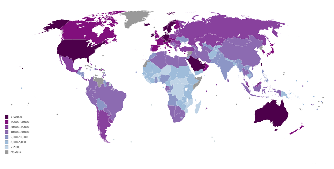
Biodiversity & Environment ( Bulgaria European Continent ) Eastern EU
The interaction of climatic, hydrological, geological and topographical conditions has produced a relatively wide variety of plant and animal species.[121] Bulgaria's biodiversity, one of the richest in Europe,[122] is conserved in three national parks, 11 nature parks, 10 biosphere reserves and 565 protected areas.[123][124][125] Ninety-three of the 233 mammal species of Europe are found in Bulgaria, along with 49% of butterfly and 30% of vascular plant species.[126] Overall, 41,493 plant and animal species are present.[126] Larger mammals with sizable populations include deer (106,323 individuals), wild boars (88,948), jackals (47,293) and foxes (32,326). Partridges number some 328,000 individuals, making them the most widespread gamebird.[127] A third of all nesting birds in Bulgaria can be found in Rila National Park, which also hosts Arctic and alpine species at high altitudes.[128] Flora includes more than 3,800 vascular plant species of which 170 are endemic and 150 are considered endangered.[121] A checklist of larger fungi in Bulgaria by the Institute of Botany identifies more than 1,500 species.[129] More than 35% of the land area is covered by forests.[130]
In 1998, the Bulgarian government adopted the National Biological Diversity Conservation Strategy, a comprehensive programme seeking the preservation of local ecosystems, protection of endangered species and conservation of genetic resources.[131] Bulgaria has some of the largest Natura 2000 areas in Europe covering 33.8% of its territory.[132] It also achieved its Kyoto Protocol objective of reducing carbon dioxide emissions by 30% from 1990 to 2009.[133]
Bulgaria ranks 30th in the 2018 Environmental Performance Index, but scores low on air quality.[134] Particulate levels are the highest in Europe,[135] especially in urban areas affected by automobile traffic and coal-based power stations.[136][137] One of these, the lignite-fired Maritsa Iztok-2 station, is causing the highest damage to health and the environment in the European Union.[138] Pesticide use in agriculture and antiquated industrial sewage systems produce extensive soil and water pollution.[139] Water quality began to improve in 1998 and has maintained a trend of moderate improvement. Over 75% of surface rivers meet European standards for good quality.
( Weltveranschaulichungsmodell )
Finland / President Sauli Niinisto + Alexander Stubb 2024 / Nordic Country Across with Sweden + Norway + Denmark & Iceland / EU Bloc / Protokoll 30.04.2024
Finland (Finnish: Suomi [ˈsuo̯mi] (About this soundlisten); Swedish: Finland [ˈfɪ̌nland] (About this soundlisten)), officially the Republic of Finland (Finnish: Suomen tasavalta; Swedish: Republiken Finland (About this soundlisten to all)),[note 1] is a Nordic country and a member state of the European Union in Northern Europe. It shares land borders with Sweden to the west, Russia to the east, Norway to the north, and is defined by the Gulf of Bothnia to the west, and the Gulf of Finland of the Baltic Sea across Estonia to the south. Finland covers an area of 338,455 square kilometres (130,678 sq mi), with a population of 5.5 million. Helsinki is the country's capital and largest city, but together with the neighbouring cities of Espoo, Kauniainen, and Vantaa, it forms a larger metropolitan area. Finland is officially bilingual, with Finnish and Swedish being official.[11] The climate varies relative to latitude, from the southern humid continental climate to the northern boreal climate. The land cover is primarily a boreal forest biome, with more than 180,000 recorded lakes.[12]
Finland was inhabited around 9000 BC after the Last glacial period.[13] The Stone Age introduced several different ceramic styles and cultures. The Bronze Age and Iron Age were characterized by extensive contacts with other cultures in Fennoscandia and the Baltic region.[14] From the late 13th century, Finland gradually became an integral part of Sweden as a consequence of the Northern Crusades. In 1809, as a result of the Finnish War, Finland was annexed by Russia as the autonomous Grand Duchy of Finland, during which Finnish art flourished and the idea of independence began to take hold. In 1906, Finland became the first European state to grant universal suffrage, and the first in the world to give all adult citizens the right to run for public office.[15][16] Nicholas II, the last Tsar of Russia, tried to russify Finland and terminate its political autonomy, but after the 1917 Russian Revolution, Finland declared independence from Russia. In 1918, the fledgling state was divided by the Finnish Civil War. During World War II, Finland fought the Soviet Union in the Winter War and the Continuation War, and Nazi Germany in the Lapland War. After the wars, Finland lost parts of its territory, including the culturally and historically significant town of Vyborg,[17] but maintained its independence.
Finland largely remained an agrarian country until the 1950s. After World War II, the country rapidly industrialized and developed an advanced economy, while building an extensive welfare state based on the Nordic model, resulting in widespread prosperity and a high per capita income.[18] Finland joined the United Nations in 1955 and adopted an official policy of neutrality. Finland joined the OECD in 1969, the NATO Partnership for Peace in 1994,[19] the European Union in 1995, the Euro-Atlantic Partnership Council in 1997,[19] and the Eurozone at its inception in 1999. Finland is a top performer in numerous metrics of national performance, including education, economic competitiveness, civil liberties, quality of life and human development.[20][21][22][23] In 2015, Finland was ranked first in the World Human Capital[24] and the Press Freedom Index and as the most stable country in the world during 2011–2016 in the Fragile States Index,[25] and second in the Global Gender Gap Report.[26] It also ranked first on the World Happiness Report report for 2018, 2019, 2020 and 2021.[27][28]
Swedish Era ( Finland ) Scandinavia ( Weltwirtschaftsprodukt )
As a result of the crusades (mostly with the second crusade led by Birger Jarl) and the colonization of some Finnish coastal areas with Christian Swedish population during the Middle Ages,[53] including the old capital Turku, Finland gradually became part of the kingdom of Sweden and the sphere of influence of the Catholic Church. Due to the Swedish conquest, the Finnish upper class lost its position and lands to the new Swedish and German nobility and to the Catholic Church.[54] In Sweden even in the 17th and 18th centuries, it was clear that Finland was a conquered country and its inhabitants could be treated arbitrarily. Swedish kings visited Finland rarely and in Swedish contemporary texts Finns were portrayed to be primitive and their language inferior.[55]
Swedish became the dominant language of the nobility, administration, and education; Finnish was chiefly a language for the peasantry, clergy, and local courts in predominantly Finnish-speaking areas. During the Protestant Reformation, the Finns gradually converted to Lutheranism.[56]
In the 16th century, Mikael Agricola published the first written works in Finnish, and Finland's current capital city, Helsinki, was founded by Gustav I of Sweden.[57] The first university in Finland, the Royal Academy of Turku, was established in 1640. The Finns reaped a reputation in the Thirty Years' War (1618–1648) as a well-trained cavalrymen called "Hakkapeliitta", that division excelled in sudden and savage attacks, raiding and reconnaissance, which King Gustavus Adolphus took advantage of in his significant battles, like in the Battle of Breitenfeld (1631) and the Battle of Rain (1632).[58][59] Finland suffered a severe famine in 1696–1697, during which about one third of the Finnish population died,[60] and a devastating plague a few years later.
Now lying within Helsinki, Suomenlinna is a UNESCO World Heritage Site consisting of an inhabited 18th-century sea fortress built on six islands. It is one of Finland's most popular tourist attractions.
In the 18th century, wars between Sweden and Russia twice led to the occupation of Finland by Russian forces, times known to the Finns as the Greater Wrath (1714–1721) and the Lesser Wrath (1742–1743).[17][60] It is estimated that almost an entire generation of young men was lost during the Great Wrath, due mainly to the destruction of homes and farms, and to the burning of Helsinki.[61] By this time Finland was the predominant term for the whole area from the Gulf of Bothnia to the Russian border.[citation needed]
Two Russo-Swedish wars in twenty-five years served as reminders to the Finnish people of the precarious position between Sweden and Russia.[17] An increasingly vocal elite in Finland soon determined that Finnish ties with Sweden were becoming too costly, and following the Russo-Swedish War (1788–1790), the Finnish elite's desire to break with Sweden only heightened.[62]
Even before the war there were conspiring politicians, among them Georg Magnus Sprengtporten, who had supported Gustav III's coup in 1772. Sprengtporten fell out with the king and resigned his commission in 1777. In the following decade he tried to secure Russian support for an autonomous Finland, and later became an adviser to Catherine II.[62] In the spirit of the notion of Adolf Ivar Arwidsson (1791–1858) – "we are not Swedes, we do not want to become Russians, let us therefore be Finns" – a Finnish national identity started to become established.[63]
Notwithstanding the efforts of Finland's elite and nobility to break ties with Sweden, there was no genuine independence movement in Finland until the early 20th century. As a matter of fact, at this time the Finnish peasantry was outraged by the actions of their elite and almost exclusively supported Gustav's actions against the conspirators. (The High Court of Turku condemned Sprengtporten as a traitor around 1793.)[62] The Swedish era ended in the Finnish War in 1809.
Counties ( Weltveranschaulichungsmodell )
Finland consists of 19 counties, called maakunta in Finnish and landskap in Swedish. The counties are governed by regional councils which serve as forums of cooperation for the municipalities of a county. The main tasks of the counties are regional planning and development of enterprise and education. In addition, the public health services are usually organized on the basis of counties. Currently, the only county where a popular election is held for the council is Kainuu. Other regional councils are elected by municipal councils, each municipality sending representatives in proportion to its population.
In addition to inter-municipal cooperation, which is the responsibility of regional councils, each county has a state Employment and Economic Development Centre which is responsible for the local administration of labour, agriculture, fisheries, forestry, and entrepreneurial affairs. The Finnish Defence Forces regional offices are responsible for the regional defence preparations and for the administration of conscription within the county.
Counties represent dialectal, cultural, and economic variations better than the former provinces, which were purely administrative divisions of the central government. Historically, counties are divisions of historical provinces of Finland, areas which represent dialects and culture more accurately.
Six Regional State Administrative Agencies were created by the state of Finland in 2010, each of them responsible for one of the counties called alue in Finnish and region in Swedish; in addition, Åland was designated a seventh county. These take over some of the tasks of the earlier Provinces of Finland (lääni/län), which were abolished.
Constitution ( Finland ) Nordic Country ( Weltwirtschaftsprodukt )
The Constitution of Finland defines the political system; Finland is a parliamentary republic within the framework of a representative democracy. The Prime Minister is the country's most powerful person. The current version of the constitution was enacted on 1 March 2000, and was amended on 1 March 2012. Citizens can run and vote in parliamentary, municipal, presidential and European Union elections.

Brazil / ( Largest Country from South American Continent ) Amazon Terrain / Brasilia / Establishment 1822 in World / Protokoll 09.01.2022
Brazil (Portuguese: Brasil; Brazilian Portuguese: [bɾaˈziw]),[nt 4] officially the Federative Republic of Brazil (Portuguese: About this soundRepública Federativa do Brasil),[11] is the largest country in both South America and Latin America. At 8.5 million square kilometers (3,300,000 sq mi)[12] and with over 211 million people, Brazil is the world's fifth-largest country by area and the sixth most populous. Its capital is Brasília, and its most populous city is São Paulo. The federation is composed of the union of the 26 states and the Federal District. It is the largest country to have Portuguese as an official language and the only one in the Americas;[13][14] it is also one of the most multicultural and ethnically diverse nations, due to over a century of mass immigration from around the world;[15] as well as the most populous Roman Catholic-majority country.
Bounded by the Atlantic Ocean on the east, Brazil has a coastline of 7,491 kilometers (4,655 mi).[16] It borders all other countries in South America except Ecuador and Chile and covers 47.3% of the continent's land area.[17] Its Amazon basin includes a vast tropical forest, home to diverse wildlife, a variety of ecological systems, and extensive natural resources spanning numerous protected habitats.[16] This unique environmental heritage makes Brazil one of 17 megadiverse countries, and is the subject of significant global interest, as environmental degradation through processes like deforestation has direct impacts on global issues like climate change and biodiversity loss.
Brazil was inhabited by numerous tribal nations prior to the landing in 1500 of explorer Pedro Álvares Cabral, who claimed the area for the Portuguese Empire. Brazil remained a Portuguese colony until 1808 when the capital of the empire was transferred from Lisbon to Rio de Janeiro. In 1815, the colony was elevated to the rank of kingdom upon the formation of the United Kingdom of Portugal, Brazil and the Algarves. Independence was achieved in 1822 with the creation of the Empire of Brazil, a unitary state governed under a constitutional monarchy and a parliamentary system. The ratification of the first constitution in 1824 led to the formation of a bicameral legislature, now called the National Congress. The country became a presidential republic in 1889 following a military coup d'état. An authoritarian military junta came to power in 1964 and ruled until 1985, after which civilian governance resumed. Brazil's current constitution, formulated in 1988, defines it as a democratic federal republic.[18] Due to its rich culture and history, the country ranks thirteenth in the world by number of UNESCO World Heritage Sites.[19]
Brazil is classified as an upper-middle income economy by the World Bank[20] and a newly industrialized country,[21] with the largest share of global wealth in South America. It is considered an advanced emerging economy,[22] having the twelfth largest GDP in the world by nominal, and eighth by PPP measures.[23][24] It is one of the world's major breadbaskets, being the largest producer of coffee for the last 150 years.[25] Brazil is a regional and middle power,[26][27][28] and is also classified as an emerging power.[29][30][31][32] However, the country maintains high amounts of corruption, crime and social inequality. Brazil is a founding member of the United Nations, the G20, BRICS, Mercosul, Organization of American States, Organization of Ibero-American States and the Community of Portuguese Language Countries.
Visual arts ( Weltwirtschaftserforschungsmodell ) ( Weltwirtschaftsprodukt )
Candido Portinari in 1958, one of the most important Brazilian painters
Brazilian painting emerged in the late 16th century,[509] influenced by Baroque, Rococo, Neoclassicism, Romanticism, Realism, Modernism, Expressionism, Surrealism, Cubism and Abstracionism making it a major art style called Brazilian academic art.[510][511] The Missão Artística Francesa (French Artistic Mission) arrived in Brazil in 1816 proposing the creation of an art academy modeled after the respected Académie des Beaux-Arts, with graduation courses both for artists and craftsmen for activities such as modeling, decorating, carpentry and others and bringing artists like Jean-Baptiste Debret.[511]
Upon the creation of the Imperial Academy of Fine Arts, new artistic movements spread across the country during the 19th century and later the event called Week of Modern Art broke definitely with academic tradition in 1922 and started a nationalist trend which was influenced by modernist arts. Among the best-known Brazilian painters are Ricardo do Pilar and Manuel da Costa Ataíde (baroque and rococo), Victor Meirelles, Pedro Américo and Almeida Junior (romanticism and realism), Anita Malfatti, Ismael Nery, Lasar Segall, Emiliano di Cavalcanti, Vicente do Rego Monteiro, and Tarsila do Amaral (expressionism, surrealism and cubism), Aldo Bonadei, José Pancetti and Cândido Portinari (modernism).
Canada / North America / Ottawa / Maple Leaf Canadian Flag / Green Energy / Sovereign & Dominant World Country / Mark Carney Prime Minister / Protokoll 14.09.2025
Canada is a country in North America. Its ten provinces and three territories extend from the Atlantic to the Pacific and northward into the Arctic Ocean, covering 9.98 million square kilometres (3.85 million square miles), making it the world's second-largest country by total area. Its southern and western border with the United States, stretching 8,891 kilometres (5,525 mi), is the world's longest bi-national land border. Canada's capital is Ottawa, and its three largest metropolitan areas are Toronto, Montreal, and Vancouver.
Indigenous peoples have continuously inhabited what is now Canada for thousands of years. Beginning in the 16th century, British and French expeditions explored and later settled along the Atlantic coast. As a consequence of various armed conflicts, France ceded nearly all of its colonies in North America in 1763. In 1867, with the union of three British North American colonies through Confederation, Canada was formed as a federal dominion of four provinces. This began an accretion of provinces and territories and a process of increasing autonomy from the United Kingdom. This widening autonomy was highlighted by the Statute of Westminster 1931 and culminated in the Canada Act 1982, which severed the vestiges of legal dependence on the Parliament of the United Kingdom.
Canada is a parliamentary democracy and a constitutional monarchy in the Westminster tradition. The country's head of government is the prime minister—who holds office by virtue of their ability to command the confidence of the elected House of Commons—and is appointed by the governor general, representing the monarch, who serves as head of state. The country is a Commonwealth realm and is officially bilingual at the federal level. It ranks among the highest in international measurements of government transparency, civil liberties, quality of life, economic freedom, and education. It is one of the world's most ethnically diverse and multicultural nations, the product of large-scale immigration from many other countries. Canada's long and complex relationship with the United States has had a significant impact on its economy and culture.
A highly developed country, Canada has the 26th highest nominal per-capita income globally and the sixteenth-highest ranking in the Human Development Index. Its advanced economy is the ninth-largest in the world, relying chiefly upon its abundant natural resources and well-developed international trade networks. Canada is part of several major international and intergovernmental institutions or groupings including the United Nations, NATO, the G7, the Group of Ten, the G20, the Organisation for Economic Co-operation and Development (OECD), the World Trade Organization (WTO), the Commonwealth of Nations, the Arctic Council, the Organisation internationale de la Francophonie, the Asia-Pacific Economic Cooperation forum, and the Organization of American States.
Etymology
While a variety of theories have been postulated for the etymological origins of Canada, the name is now accepted as coming from the St. Lawrence Iroquoian word kanata, meaning "village" or "settlement".[12] In 1535, Indigenous inhabitants of the present-day Quebec City region used the word to direct French explorer Jacques Cartier to the village of Stadacona.[13] Cartier later used the word Canada to refer not only to that particular village but to the entire area subject to Donnacona (the chief at Stadacona);[13] by 1545, European books and maps had begun referring to this small region along the Saint Lawrence River as Canada.[13]
From the 16th to the early 18th century, "Canada" referred to the part of New France that lay along the Saint Lawrence River.[14] In 1791, the area became two British colonies called Upper Canada and Lower Canada. These two colonies were collectively named the Canadas until their union as the British Province of Canada in 1841.[15]
Upon Confederation in 1867, Canada was adopted as the legal name for the new country at the London Conference, and the word Dominion was conferred as the country's title.[16] By the 1950s, the term Dominion of Canada was no longer used by the United Kingdom, which considered Canada a "Realm of the Commonwealth".[17] The government of Louis St. Laurent ended the practice of using Dominion in the statutes of Canada in 1951.[18][19][20]
The Canada Act 1982, which brought the constitution of Canada fully under Canadian control, referred only to Canada. Later that year, the name of the national holiday was changed from Dominion Day to Canada Day.[21] The term Dominion was used to distinguish the federal government from the provinces, though after the Second World War the term federal had replaced dominion.[22]
European colonization
It is believed that the first European to explore the east coast of Canada was Norse explorer Leif Erikson.[43][44] In approximately 1000 AD, the Norse built a small encampment that only lasted a few years at L'Anse aux Meadows on the northern tip of Newfoundland.[45] No further European exploration occurred until 1497, when Italian seafarer John Cabot explored and claimed Canada's Atlantic coast in the name of King Henry VII of England.[46] In 1534, French explorer Jacques Cartier explored the Gulf of Saint Lawrence where, on July 24, he planted a 10-metre (33 ft) cross bearing the words "Long Live the King of France" and took possession of the territory New France in the name of King Francis I.[47] The early 16th century saw European mariners with navigational techniques pioneered by the Basque and Portuguese establish seasonal whaling and fishing outposts along the Atlantic coast.[48] In general, early settlements during the Age of Discovery appear to have been short-lived due to a combination of the harsh climate, problems with navigating trade routes and competing outputs in Scandinavia.[49][50]
In 1583, Sir Humphrey Gilbert, by the royal prerogative of Queen Elizabeth I, founded St. John's, Newfoundland, as the first North American English seasonal camp.[51] In 1600, the French established their first seasonal trading post at Tadoussac along the Saint Lawrence.[45] French explorer Samuel de Champlain arrived in 1603 and established the first permanent year-round European settlements at Port Royal (in 1605) and Quebec City (in 1608).[52] Among the colonists of New France, Canadiens extensively settled the Saint Lawrence River valley and Acadians settled the present-day Maritimes, while fur traders and Catholic missionaries explored the Great Lakes, Hudson Bay, and the Mississippi watershed to Louisiana.[53] The Beaver Wars broke out in the mid-17th century over control of the North American fur trade.[54]
The English established additional settlements in Newfoundland, beginning in 1610 and the Thirteen Colonies to the south were founded soon after.[55][56] A series of four wars erupted in colonial North America between 1689 and 1763; the later wars of the period constituted the North American theatre of the Seven Years' War.[57] Mainland Nova Scotia came under British rule with the 1713 Treaty of Utrecht, and Canada and most of New France came under British rule in 1763 after the Seven Years' War.

Foreign relations and military
Canadian Delegation to the United Nations seated around conference table
The Canadian delegation to the United Nations Conference on International Organization, San Francisco, May 1945
Canada is recognized as a middle power for its role in international affairs with a tendency to pursue multilateral solutions.[212] Canada's foreign policy based on international peacekeeping and security is carried out through coalitions and international organizations, and through the work of numerous federal institutions.[213][214] Canada's peacekeeping role during the 20th century has played a major role in its global image.[215][216] The strategy of the Canadian government's foreign aid policy reflects an emphasis to meet the Millennium Development Goals, while also providing assistance in response to foreign humanitarian crises.[217]
Canada was a founding member of the United Nations and has membership in the World Trade Organization, the G20 and the Organisation for Economic Co-operation and Development (OECD).[212] Canada is also a member of various other international and regional organizations and forums for economic and cultural affairs.[218] Canada acceded to the International Covenant on Civil and Political Rights in 1976.[219] Canada joined the Organization of American States (OAS) in 1990 and hosted the OAS General Assembly in 2000 and the 3rd Summit of the Americas in 2001.[220] Canada seeks to expand its ties to Pacific Rim economies through membership in the Asia-Pacific Economic Cooperation forum (APEC).[221]
Canada and the United States share the world's longest undefended border, co-operate on military campaigns and exercises, and are each other's largest trading partner.[222][223] Canada nevertheless has an independent foreign policy.[224] For example, it maintains full relations with Cuba and declined to participate in the 2003 invasion of Iraq.[225]
Canada maintains historic ties to the United Kingdom and France and to other former British and French colonies through Canada's membership in the Commonwealth of Nations and the Organisation internationale de la Francophonie.[226] Canada is noted for having a positive relationship with the Netherlands, owing, in part, to its contribution to the Dutch liberation during World War II.[95]
Canada's strong attachment to the British Empire and Commonwealth led to major participation in British military efforts in the Second Boer War (1899–1902), World War I (1914–1918) and World War II (1939–1945).[227] Since then, Canada has been an advocate for multilateralism, making efforts to resolve global issues in collaboration with other nations.[228][229] During the Cold War, Canada was a major contributor to UN forces in the Korean War and founded the North American Aerospace Defense Command (NORAD) in cooperation with the United States to defend against potential aerial attacks from the Soviet Union.[230]
During the Suez Crisis of 1956, future prime minister Lester B. Pearson eased tensions by proposing the inception of the United Nations Peacekeeping Force, for which he was awarded the 1957 Nobel Peace Prize.[231] As this was the first UN peacekeeping mission, Pearson is often credited as the inventor of the concept.[232] Canada has since served in over 50 peacekeeping missions, including every UN peacekeeping effort until 1989,[88] and has since maintained forces in international missions in Rwanda, the former Yugoslavia, and elsewhere; Canada has sometimes faced controversy over its involvement in foreign countries, notably in the 1993 Somalia affair.[233]
In 2001, Canada deployed troops to Afghanistan as part of the U.S. stabilization force and the UN-authorized, NATO-led International Security Assistance Force.[234] In February 2007, Canada, Italy, the United Kingdom, Norway, and Russia announced their joint commitment to a $1.5-billion project to help develop vaccines for developing nations, and called on other countries to join them.[235] In August 2007, Canada's territorial claims in the Arctic were challenged after a Russian underwater expedition to the North Pole; Canada has considered that area to be sovereign territory since 1925.[236] In September 2020, Canada joined the COVID-19 Vaccines Global Access (COVAX) program, which aims to ensure equal access to a potential COVID-19 vaccine for all member countries and to help lower-income countries secure doses.[237]
The nation employs a professional, volunteer military force of approximately 79,000 active personnel and 32,250 reserve personnel.[238] The unified Canadian Forces (CF) comprise the Canadian Army, Royal Canadian Navy, and Royal Canadian Air Force. In 2013, Canada's military expenditure totalled approximately CA$19 billion, or around one percent of the country's gross domestic product (GDP).[239][240] Following the 2016 Defence Policy Review, called "Strong, Secure, Engaged", the Canadian government announced a 70 percent increase to the country's defence budget over the next decade.[241] The Canadian Forces will acquire 88 fighter planes and 15 naval surface combatants based on the Type 26 frigate design, the latter as part of the National Shipbuilding Procurement Strategy.[242][243] Canada's total military expenditure is expected to reach CA$32.7 billion by 2027.[244] Canada's military currently has over 3000 personnel deployed overseas, including in Iraq, Ukraine, and the Caribbean Sea.
USA / United States of America / Economically ( Richest Country ) in World / Extraordinary Human Resources & Technology / Donald Trump 2025-2029 Term in USA / Opulent / Protokoll ( Update ) 20.01.2026
The United States of America (U.S.A. or USA), commonly known as the United States (U.S. or US) or America, is a country primarily located in North America. It consists of 50 states, a federal district, five major unincorporated territories, 326 Indian reservations, and some minor possessions.[h] At 3.8 million square miles (9.8 million square kilometers), it is the world's third- or fourth-largest country by geographic area.[c] The United States shares significant land borders with Canada to the north and Mexico to the south as well as limited maritime borders with the Bahamas, Cuba, and Russia.[22] With a population of more than 331 million people, it is the third most populous country in the world. The national capital is Washington, D.C., and the most populous city is New York City.
Paleo-Indians migrated from Siberia to the North American mainland at least 12,000 years ago, and European colonization began in the 16th century. The United States emerged from the thirteen British colonies established along the East Coast. Disputes with Great Britain over taxation and political representation led to the American Revolutionary War (1775–1783), which established the nation's independence. In the late 18th century, the U.S. began expanding across North America, gradually obtaining new territories, sometimes through war, frequently displacing Native Americans, and admitting new states; by 1848, the United States spanned the continent. Slavery was legal in the southern United States until the second half of the 19th century, when the American Civil War led to its abolition. The Spanish–American War and World War I established the U.S. as a world power, a status confirmed by the outcome of World War II. During the Cold War, the United States fought the Korean War and the Vietnam War but avoided direct military conflict with the Soviet Union. The two superpowers competed in the Space Race, culminating in the 1969 spaceflight that first landed humans on the Moon. The Soviet Union's dissolution in 1991 ended the Cold War, leaving the United States as the world's sole superpower.
The United States is a federal republic and a representative democracy with three separate branches of government, including a bicameral legislature. It is a founding member of the United Nations, World Bank, International Monetary Fund, Organization of American States, NATO, and other international organizations. It is a permanent member of the United Nations Security Council. Considered a melting pot of cultures and ethnicities, its population has been profoundly shaped by centuries of immigration. The United States ranks high in international measures of economic freedom, quality of life, education, and human rights; it has low levels of perceived corruption. However, it has been criticized for inequality related to race, wealth, and income; use of capital punishment; high incarceration rates; and lack of universal health care.
The United States is a highly developed country, accounts for approximately a quarter of global GDP, and is the world's largest economy by GDP at market exchange rates. By value, the United States is the world's largest importer and second-largest exporter of goods. Although its population is only 4.2% of the world's total, it holds 29.4% of the total wealth in the world, the largest share held by any country. Making up more than a third of global military spending, it is the foremost military power in the world and internationally a leading political, cultural, and scientific force.[23]
Etymology
The first known use of the name "America" dates back to 1507, when it appeared on a world map produced by the German cartographer Martin Waldseemüller in the French city of Saint-Dié-des-Vosges. On his map, the name is shown in large letters on what would now be considered South America, in honor of Amerigo Vespucci. The Italian explorer was the first to postulate that the West Indies did not represent Asia's eastern limit but were part of a previously unknown landmass.[24][25] In 1538, the Flemish cartographer Gerardus Mercator used the name "America" on his own world map, applying it to the entire Western Hemisphere.[26]
The first documentary evidence of the phrase "United States of America" dates from a January 2, 1776 letter written by Stephen Moylan to George Washington's aide-de-camp Joseph Reed. Moylan expressed his wish to go "with full and ample powers from the United States of America to Spain" to seek assistance in the revolutionary war effort.[27][28][29] The first known publication of the phrase "United States of America" was in an anonymous essay in The Virginia Gazette newspaper in Williamsburg, on April 6, 1776.[30]
The second draft of the Articles of Confederation, prepared by John Dickinson and completed no later than June 17, 1776, declared "The name of this Confederation shall be the 'United States of America'."[31] The final version of the Articles, sent to the states for ratification in late 1777, stated that "The Stile of this Confederacy shall be 'The United States of America'."[32] In June 1776, Thomas Jefferson wrote the phrase "UNITED STATES OF AMERICA" in all capitalized letters in the headline of his "original Rough draught" of the Declaration of Independence.[31] This draft of the document did not surface until June 21, 1776, and it is unclear whether it was written before or after Dickinson used the term in his June 17 draft of the Articles of Confederation.[31]
The short form "United States" is also standard. Other common forms are the "U.S.", the "USA", and "America". Colloquial names are the "U.S. of A." and, internationally, the "States". "Columbia", a name popular in American poetry and songs of the late 18th century, derives its origin from Christopher Columbus; both "Columbus" and "Columbia" appear frequently in U.S. place-names, including Columbus, Ohio; Columbia, South Carolina; and the District of Columbia. Places and institutions throughout the Western Hemisphere bear the two names, including Colón, Panama, the country of Colombia, the Columbia River, and Columbia University.
The phrase "United States" was originally plural in American usage. It described a collection of states—e.g., "the United States are." The singular form became popular after the end of the Civil War and is now standard usage in the U.S. A citizen of the United States is an "American". "United States", "American" and "U.S." refer to the country adjectivally ("American values", "U.S. forces"). In English, the word "American" rarely refers to topics or subjects not directly connected with the United States.[33]
Indigenous peoples and pre-Columbian history
It has been generally accepted that the first inhabitants of North America migrated from Siberia by way of the Bering land bridge and arrived at least 12,000 years ago; however, some evidence suggests an even earlier date of arrival.[34][35][36] The Clovis culture, which appeared around 11,000 BC, is believed to represent the first wave of human settlement of the Americas.[37][38] This was likely the first of three major waves of migration into North America; later waves brought the ancestors of present-day Athabaskans, Aleuts, and Eskimos.[39]
Over time, indigenous cultures in North America grew increasingly complex, and some, such as the pre-Columbian Mississippian culture in the southeast, developed advanced agriculture, architecture, and complex societies.[40] The city-state of Cahokia is the largest, most complex pre-Columbian archaeological site in the modern-day United States.[41] In the Four Corners region, Ancestral Puebloan culture developed from centuries of agricultural experimentation.[42] The Haudenosaunee, located in the southern Great Lakes region, was established at some point between the twelfth and fifteenth centuries.[43] Most prominent along the Atlantic coast were the Algonquian tribes, who practiced hunting and trapping, along with limited cultivation.
Estimating the native population of North America at the time of European contact is difficult.[44][45] Douglas H. Ubelaker of the Smithsonian Institution estimated that there was a population of 92,916 in the south Atlantic states and a population of 473,616 in the Gulf states,[46] but most academics regard this figure as too low.[44] Anthropologist Henry F. Dobyns believed the populations were much higher, suggesting around 1.1 million along the shores of the Gulf of Mexico, 2.2 million people living between Florida and Massachusetts, 5.2 million in the Mississippi Valley and tributaries, and around 700,000 people in the Florida peninsula.[44][45]
European settlements
Claims of very early colonization of coastal New England by the Norse are disputed and controversial. The first documented arrival of Europeans in the continental United States is that of Spanish conquistadors such as Juan Ponce de León, who made his first expedition to Florida in 1513. Even earlier, Christopher Columbus had landed in Puerto Rico on his 1493 voyage, and San Juan was settled by the Spanish a decade later.[47] The Spanish set up the first settlements in Florida and New Mexico, such as Saint Augustine, often considered the nation's oldest city,[48] and Santa Fe. The French established their own settlements along the Mississippi River, notably New Orleans.[49] Successful English settlement of the eastern coast of North America began with the Virginia Colony in 1607 at Jamestown and with the Pilgrims' colony at Plymouth in 1620.[50][51] The continent's first elected legislative assembly, Virginia's House of Burgesses, was founded in 1619. Documents such as the Mayflower Compact and the Fundamental Orders of Connecticut established precedents for representative self-government and constitutionalism that would develop throughout the American colonies.[52][53] Many English settlers were dissenting Christians who came seeking religious freedom. In 1784, the Russians were the first Europeans to establish a settlement in Alaska, at Three Saints Bay. Russian America once spanned much of the present-day state of Alaska.
In the early days of colonization, many European settlers were subject to food shortages, disease, and attacks from Native Americans. Native Americans were also often at war with neighboring tribes and European settlers. In many cases, however, the natives and settlers came to depend on one another. Settlers traded for food and animal pelts; natives for guns, tools and other European goods.[55] Natives taught many settlers to cultivate corn, beans, and other foodstuffs. European missionaries and others felt it was important to "civilize" the Native Americans and urged them to adopt European agricultural practices and lifestyles.[56][57] However, with the increased European colonization of North America, the Native Americans were displaced and often killed.[58] The native population of America declined after European arrival for various reasons,[59][60][61] primarily diseases such as smallpox and measles.
European settlers also began trafficking of African slaves into Colonial America via the transatlantic slave trade.[64] Because of a lower prevalence of tropical diseases and better treatment, slaves had a much higher life expectancy in North America than in South America, leading to a rapid increase in their numbers.[65][66] Colonial society was largely divided over the religious and moral implications of slavery, and several colonies passed acts both against and in favor of the practice.[67][68] However, by the turn of the 18th century, African slaves had supplanted European indentured servants as cash crop labor, especially in the American South.[69]
The Thirteen Colonies (New Hampshire, Massachusetts, Connecticut, Rhode Island, New York, New Jersey, Pennsylvania, Delaware, Maryland, Virginia, North Carolina, South Carolina, and Georgia) that would become the United States of America were administered by the British as overseas dependencies.[70] All nonetheless had local governments with elections open to most free men.[71] With extremely high birth rates, low death rates, and steady settlement, the colonial population grew rapidly, eclipsing Native American populations.[72] The Christian revivalist movement of the 1730s and 1740s known as the Great Awakening fueled interest both in religion and in religious liberty.[73]
During the Seven Years' War (1756–1763), known in the U.S. as the French and Indian War, British forces captured Canada from the French. With the creation of the Province of Quebec, Canada's francophone population would remain isolated from the English-speaking colonial dependencies of Nova Scotia, Newfoundland and the Thirteen Colonies. Excluding the Native Americans who lived there, the Thirteen Colonies had a population of over 2.1 million in 1770, about a third that of Britain. Despite continuing new arrivals, the rate of natural increase was such that by the 1770s only a small minority of Americans had been born overseas.[74] The colonies' distance from Britain had allowed the development of self-government, but their unprecedented success motivated British monarchs to periodically seek to reassert royal authority.
Independence & Expansion
The American Revolutionary War fought by the Thirteen Colonies against the British Empire was the first successful war of independence by a non-European entity against a European power in modern history. Americans had developed an ideology of "republicanism", asserting that government rested on the will of the people as expressed in their local legislatures. They demanded their "rights as Englishmen" and "no taxation without representation". The British insisted on administering the empire through Parliament, and the conflict escalated into war.
The Second Continental Congress unanimously adopted the Declaration of Independence on July 4, 1776; this day is celebrated annually as Independence Day. In 1777, the Articles of Confederation established a decentralized government that operated until 1789.
After its defeat at the Siege of Yorktown in 1781, Britain signed a peace treaty. American sovereignty became internationally recognized, and the country was granted all lands east of the Mississippi River. Tensions with Britain remained, however, leading to the War of 1812, which was fought to a draw.[78] Nationalists led the Philadelphia Convention of 1787 in writing the United States Constitution, ratified in state conventions in 1788. Going into force in 1789, this constitution reorganized the federal government into three branches, on the principle of creating salutary checks and balances. George Washington, who had led the Continental Army to victory, was the first president elected under the new constitution. The Bill of Rights, forbidding federal restriction of personal freedoms and guaranteeing a range of legal protections, was adopted in 1791.[79]
Map of the U.S. depicting its westward expansion
Territorial acquisitions of the United States between 1783 and 1917
Although the federal government outlawed American participation in the Atlantic slave trade in 1807, after 1820, cultivation of the highly profitable cotton crop exploded in the Deep South, and along with it, the slave population.[80][81][82] The Second Great Awakening, especially in the period 1800–1840, converted millions to evangelical Protestantism. In the North, it energized multiple social reform movements, including abolitionism;[83] in the South, Methodists and Baptists proselytized among slave populations.[84]
Beginning in the late 18th century, American settlers began to expand westward,[85] prompting a long series of American Indian Wars.[86] The 1803 Louisiana Purchase almost doubled the nation's area,[87] Spain ceded Florida and other Gulf Coast territory in 1819,[88] the Republic of Texas was annexed in 1845 during a period of expansionism,[89] and the 1846 Oregon Treaty with Britain led to U.S. control of the present-day American Northwest.[90] Victory in the Mexican–American War resulted in the 1848 Mexican Cession of California and much of the present-day American Southwest, making the U.S. span the continent.[85][91]
The California Gold Rush of 1848–1849 spurred migration to the Pacific coast, which led to the California Genocide[92] and the creation of additional western states.[93] The giving away of vast quantities of land to white European settlers as part of the Homestead Acts, nearly 10% of the total area of the United States, and to private railroad companies and colleges as part of land grants spurred economic development.[94] After the Civil War, new transcontinental railways made relocation easier for settlers, expanded internal trade, and increased conflicts with Native Americans.[95] In 1869, a new Peace Policy nominally promised to protect Native Americans from abuses, avoid further war, and secure their eventual U.S. citizenship. Nonetheless, large-scale conflicts continued throughout the West into the 1900s.
Civil War and Reconstruction Era
Drawing of the Battle of Gettysburg, depicting soldiers charging forward and firing a cannon
Irreconcilable sectional conflict regarding the enslavement of Africans and African Americans ultimately led to the American Civil War.[96] With the 1860 election of Republican Abraham Lincoln, conventions in thirteen slave states declared secession and formed the Confederate States of America (the "South" or the "Confederacy"), while the federal government (the "Union") maintained that secession was illegal.[97] In order to bring about this secession, military action was initiated by the secessionists, and the Union responded in kind. The ensuing war would become the deadliest military conflict in American history, resulting in the deaths of approximately 618,000 soldiers as well as many civilians.[98] The Union initially simply fought to keep the country united. Nevertheless, as casualties mounted after 1863 and Lincoln delivered his Emancipation Proclamation, the main purpose of the war from the Union's viewpoint became the abolition of slavery. Indeed, when the Union ultimately won the war in April 1865, each of the states in the defeated South was required to ratify the Thirteenth Amendment, which prohibited slavery except as penal labor. Two other amendments were also ratified, ensuring citizenship for blacks and, at least in theory, voting rights for them as well.
Reconstruction began in earnest following the war. While President Lincoln attempted to foster friendship and forgiveness between the Union and the former Confederacy, his assassination on April 14, 1865 drove a wedge between North and South again. Republicans in the federal government made it their goal to oversee the rebuilding of the South and to ensure the rights of African Americans. They persisted until the Compromise of 1877 when the Republicans agreed to cease protecting the rights of African Americans in the South in order for Democrats to concede the presidential election of 1876.
Southern white Democrats, calling themselves "Redeemers", took control of the South after the end of Reconstruction, beginning the nadir of American race relations. From 1890 to 1910, the Redeemers established so-called Jim Crow laws, disenfranchising most blacks and some poor whites throughout the region. Blacks would face racial segregation nationwide, especially in the South.[99] They also occasionally experienced vigilante violence, including lynching.[100]
Further immigration, expansion, and industrialization
In the North, urbanization and an unprecedented influx of immigrants from Southern and Eastern Europe supplied a surplus of labor for the country's industrialization and transformed its culture.[102] National infrastructure, including telegraph and transcontinental railroads, spurred economic growth and greater settlement and development of the American Old West. The later invention of electric light and the telephone would also affect communication and urban life.[103]
The United States fought Indian Wars west of the Mississippi River from 1810 to at least 1890.[104] Most of these conflicts ended with the cession of Native American territory and their confinement to Indian reservations. Additionally, the Trail of Tears in the 1830s exemplified the Indian removal policy that forcibly resettled Indians. This further expanded acreage under mechanical cultivation, increasing surpluses for international markets.[105] Mainland expansion also included the purchase of Alaska from Russia in 1867.[106] In 1893, pro-American elements in Hawaii overthrew the Hawaiian monarchy and formed the Republic of Hawaii, which the U.S. annexed in 1898. Puerto Rico, Guam, and the Philippines were ceded by Spain in the same year, following the Spanish–American War.[107] American Samoa was acquired by the United States in 1900 after the end of the Second Samoan Civil War.[108] The U.S. Virgin Islands were purchased from Denmark in 1917.[109]
Rapid economic development during the late 19th and early 20th centuries fostered the rise of many prominent industrialists. Tycoons like Cornelius Vanderbilt, John D. Rockefeller, and Andrew Carnegie led the nation's progress in the railroad, petroleum, and steel industries. Banking became a major part of the economy, with J. P. Morgan playing a notable role. The American economy boomed, becoming the world's largest.[110] These dramatic changes were accompanied by growing inequality and social unrest, which prompted the rise of organized labor along with populist, socialist, and anarchist movements.[111] This period eventually ended with the advent of the Progressive Era, which saw significant reforms including women's suffrage, alcohol prohibition, regulation of consumer goods, and greater antitrust measures to ensure competition and attention to worker conditions.[112][113][114]
World War I, Great Depression, and World War II
The Empire State Building in the 1940s, towering above its neighbors in Midtown Manhattan
The Empire State Building was the tallest building in the world when completed in 1931, during the Great Depression.
The United States remained neutral from the outbreak of World War I in 1914 until 1917 when it joined the war as an "associated power" alongside the Allies of World War I, helping to turn the tide against the Central Powers. In 1919, President Woodrow Wilson took a leading diplomatic role at the Paris Peace Conference and advocated strongly for the U.S. to join the League of Nations. However, the Senate refused to approve this and did not ratify the Treaty of Versailles that established the League of Nations.[115]
In 1920, the women's rights movement won passage of a constitutional amendment granting women's suffrage.[116] The 1920s and 1930s saw the rise of radio for mass communication and the invention of early television.[117] The prosperity of the Roaring Twenties ended with the Wall Street Crash of 1929 and the onset of the Great Depression. After his election as president in 1932, Franklin D. Roosevelt responded with the New Deal.[118] The Great Migration of millions of African Americans out of the American South began before World War I and extended through the 1960s;[119] whereas the Dust Bowl of the mid-1930s impoverished many farming communities and spurred a new wave of western migration.[120]
Four soldiers plant a U.S. flag on a long pole on a bare mountaintop
U.S. Marines raising the American flag on Mount Suribachi during the Battle of Iwo Jima in one of the most iconic images of the war
At first effectively neutral during World War II, the United States began supplying materiel to the Allies in March 1941 through the Lend-Lease program. On December 7, 1941, the Empire of Japan launched a surprise attack on Pearl Harbor, prompting the United States to join the Allies against the Axis powers, and in the following year, to intern about 120,000[121] U.S. residents (including American citizens) of Japanese descent.[122] Although Japan attacked the United States first, the U.S. nonetheless pursued a "Europe first" defense policy.[123] The United States thus left its vast Asian colony, the Philippines, isolated and fighting a losing struggle against Japanese invasion and occupation. During the war, the United States was one of the "Four Powers"[124] who met to plan the postwar world, along with Britain, the Soviet Union, and China.[125][126] Although the nation lost around 400,000 military personnel,[127] it emerged relatively undamaged from the war with even greater economic and military influence.[128]
The United States played a leading role in the Bretton Woods and Yalta conferences, which signed agreements on new international financial institutions and Europe's postwar reorganization. As an Allied victory was won in Europe, a 1945 international conference held in San Francisco produced the United Nations Charter, which became active after the war.[129] The United States and Japan then fought each other in the largest naval battle in history, the Battle of Leyte Gulf.[130][131] The United States developed the first nuclear weapons and used them on Japan in the cities of Hiroshima and Nagasaki in August 1945; the Japanese surrendered on September 2, ending World War II.[132][133]
Peak Cold War years and civil rights
After World War II, the United States and the Soviet Union competed for power, influence, and prestige during what became known as the Cold War, driven by an ideological divide between capitalism and communism.[134] They dominated the military affairs of Europe, with the U.S. and its NATO allies on one side and the Soviet Union and its Warsaw Pact allies on the other. The U.S. developed a policy of containment towards the expansion of communist influence. While the U.S. and Soviet Union engaged in proxy wars and developed powerful nuclear arsenals, the two countries avoided direct military conflict.[135]
The United States often opposed Third World movements that it viewed as Soviet-sponsored and occasionally pursued direct action for regime change against left-wing governments, occasionally supporting authoritarian right-wing regimes.[136] American troops fought communist Chinese and North Korean forces in the Korean War of 1950–1953.[137] The Soviet Union's 1957 launch of the first artificial satellite and its 1961 launch of the first crewed spaceflight initiated a "Space Race" in which the United States became the first nation to land a man on the Moon in 1969.[137] The United States became increasingly involved in the Vietnam War (1955–1975), introducing combat forces in 1965.[138]
At home, the U.S. had experienced sustained economic expansion and a rapid growth of its population and middle class following World War II. After a surge in female labor participation, especially in the 1970s, by 1985, the majority of women aged 16 and over were employed.[139] Construction of an Interstate Highway System transformed the nation's infrastructure over the following decades. Millions moved from farms and inner cities to large suburban housing developments.[140][141] In 1959, the United States formally expanded beyond the contiguous United States when the territories of Alaska and Hawaii became, respectively, the 49th and 50th states admitted into the Union.[142] The growing Civil Rights Movement used nonviolence to confront segregation and discrimination, with Martin Luther King Jr. becoming a prominent leader and figurehead.[143] A combination of court decisions and legislation, culminating in the Civil Rights Act of 1968, sought to end racial discrimination.[144][145][146] Meanwhile, a counterculture movement grew, which was fueled by opposition to the Vietnam war, the Black Power movement, and the sexual revolution.[147]

Late 20th century
The launch of a "War on Poverty" expanded entitlements and welfare spending, including the creation of Medicare and Medicaid, two programs that provide health coverage to the elderly and poor, respectively, and the means-tested Food Stamp Program and Aid to Families with Dependent Children.[148]
The 1970s and early 1980s saw the onset of stagflation. The United States supported Israel during the Yom Kippur War; in response, the country faced an oil embargo from OPEC nations, sparking the 1973 oil crisis. In 1979, President Jimmy Carter brokered a peace treaty between Egypt and Israel, marking the first time an Arab nation recognized Israeli existence.[relevant?] After his election, President Ronald Reagan responded to economic stagnation with free-market oriented reforms. Following the collapse of détente, he abandoned "containment" and initiated the more aggressive "rollback" strategy towards the Soviet Union.[149][150] The late 1980s brought a "thaw" in relations with the Soviet Union, and its collapse in 1991 finally ended the Cold War.[151][152][153] This brought about unipolarity[154] with the U.S. unchallenged as the world's dominant superpower.[155]
After the Cold War, the conflict in the Middle East triggered a crisis in 1990, when Iraq invaded and annexed Kuwait, an ally of the United States. Fearing the spread of instability, in August, President George H. W. Bush launched and led the Gulf War against Iraq; waged until February 1991 by coalition forces from 34 nations, it ended in the expulsion of Iraqi forces from Kuwait and restoration of the monarchy.[156]
Originating within U.S. military defense networks, the Internet spread to international academic platforms and then to the public in the 1990s, greatly affecting the global economy, society, and culture.[157] Due to the dot-com boom, stable monetary policy, and reduced social welfare spending, the 1990s saw the longest economic expansion in modern U.S. history.[158] Beginning in 1994, the U.S. signed the North American Free Trade Agreement (NAFTA), causing trade among the U.S., Canada, and Mexico to soar.[159]
21st century
On September 11, 2001, al-Qaeda terrorist hijackers flew passenger planes into the World Trade Center in New York City and the Pentagon near Washington, D.C., killing nearly 3,000 people.[160] Hundreds more died later from illnesses related to the attacks, and perhaps thousands of first responders, cleanup workers, and survivors suffer from long-term effects.[161] In response, President George W. Bush launched the War on Terror, which included a nearly 20-year war in Afghanistan from 2001 to 2021 and the 2003–2011 Iraq War.[162][163] A 2011 military operation in Pakistan led to the killing of Osama bin Laden.[164]
Government policy designed to promote affordable housing,[165] widespread failures in corporate and regulatory governance,[166] and historically low interest rates set by the Federal Reserve[167] led to the United States housing bubble in 2006, which culminated with the financial crisis of 2007–2008 and the Great Recession, the nation's largest economic contraction since the Great Depression.[168] During the crisis, assets owned by Americans lost about a quarter of their value.[169] Barack Obama, the first multiracial[170] president, with African-American ancestry was elected in 2008 amid the crisis,[171] and subsequently passed American Recovery and Reinvestment Act of 2009 economic stimulus and the Dodd–Frank Wall Street Reform and Consumer Protection Act in an attempt to mitigate its negative effects and ensure there would not be a repeat of the crisis.
Republican Donald Trump was elected as the 45th president in 2016, a result viewed as one of the biggest political upsets in American history.[172] Trump led the country through the first waves of the COVID-19 pandemic in the United States, which as of December 2021 is estimated to have killed over 900,000 Americans.[173] In 2020, in what was seen as a repudiation of Trump's divisive leadership, Democrat Joe Biden was elected as the 46th president.[174] On January 6, 2021, supporters of outgoing President Trump stormed the United States Capitol in an unsuccessful effort to disrupt the presidential Electoral College vote count.
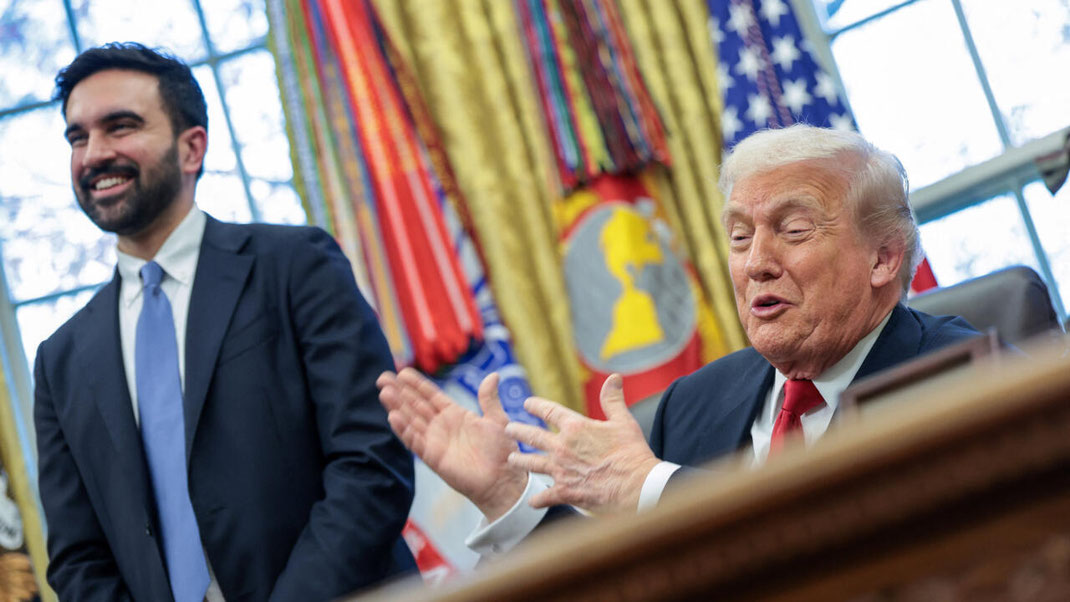
Military
The president is the commander-in-chief of the United States Armed Forces and appoints its leaders, the secretary of defense and the Joint Chiefs of Staff. The Department of Defense administers five of the six service branches, which are made up of the Army, Marine Corps, Navy, Air Force, and Space Force. The Coast Guard, also a branch of the armed forces, is normally administered by the Department of Homeland Security in peacetime and can be transferred to the Department of the Navy in wartime.[274] In 2019, all six branches of the U.S. Armed Forces reported 1.4 million personnel on active duty.[275] The Reserves and National Guard brought the total number of troops to 2.3 million.[275] The Department of Defense also employed about 700,000 civilians, not including contractors.[276]
World map depicting U.S. military presence in many countries around the world
Global presence of the United States military, showing Unified combatant commands
Military service in the United States is voluntary, although conscription may occur in wartime through the Selective Service System.[277] From 1940 until 1973, conscription was mandatory even during peacetime.[278] Today, American forces can be rapidly deployed by the Air Force's large fleet of transport aircraft, the Navy's 11 active aircraft carriers, and Marine expeditionary units at sea with the Navy, and Army's XVIII Airborne Corps and 75th Ranger Regiment deployed by Air Force transport aircraft. The Air Force can strike targets across the globe through its fleet of strategic bombers, maintains the air defense across the United States, and provides close air support to Army and Marine Corps ground forces.[279][280][281] The Space Force operates the Global Positioning System, operates the Eastern and Western Ranges for all space launches, and operates the United States' Space Surveillance and Missile Warning networks.[282][283][284] The military operates about 800 bases and facilities abroad,[285] and maintains deployments greater than 100 active duty personnel in 25 foreign countries.[286]
The United States spent $649 billion on its military in 2019, 36% of global military spending.[287] At 4.7% of GDP, the rate was the second-highest among the top 15 military spenders, after Saudi Arabia.[287] Defense spending plays a major role in science and technology investment, with roughly half of U.S. federal research and development funded by the Department of Defense.[288] Defense's share of the overall U.S. economy has generally declined in recent decades, from early Cold War peaks of 14.2% of GDP in 1953 and 69.5% of federal spending in 1954 to 4.7% of GDP and 18.8% of federal spending in 2011.[289] In total number of personnel, the United States has the third-largest combined armed forces in the world, behind the Chinese People's Liberation Army and Indian Armed Forces.[290]
The United States is one of the five recognized nuclear weapons states, and one of nine countries to possess nuclear weapons. It has the world's second-largest stockpile of nuclear weapons, after that of Russia. The United States also owns more than 40% of the world's 14,000 nuclear weapons.
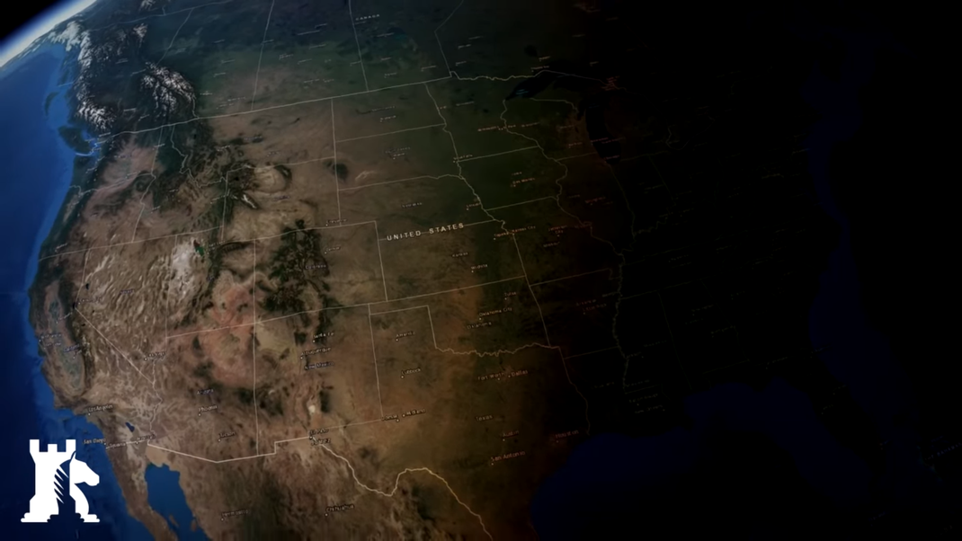
Australia + Continent / Scott Morrison Prime Minister / Successor Anthony Albanese / Commonwealth / Canberra Capital of Land / Pacific Ocean / Great Country / Protokoll 14.07.2022
Australia, officially the Commonwealth of Australia, is a sovereign country comprising the mainland of the Australian continent, the island of Tasmania, and numerous smaller islands.[13] With an area of 7,617,930 square kilometres (2,941,300 sq mi),[14] Australia is the largest country by area in Oceania and the world's sixth-largest country. Australia is the oldest,[15] flattest,[16] and driest inhabited continent,[17][18] with the least fertile soils.[19][20] It is a megadiverse country, and its size gives it a wide variety of landscapes and climates, with deserts in the centre, tropical rainforests in the north-east, and mountain ranges in the south-east.
Politically, Australia is a federal parliamentary constitutional monarchy, comprising six states and ten territories. Australia's population of nearly 26 million[7] is highly urbanised and heavily concentrated on the eastern seaboard.[21] Canberra is the nation's capital, while the largest cities are Sydney, Melbourne, Brisbane, Perth, and Adelaide. Australia's demographics have been shaped by centuries of immigration, with immigrants accounting for 30% of the country's population,[22] the highest proportion among major Western nations.[23] Australia's abundant natural resources and well-developed international trade relations are crucial to the country's economy, which generates its income from various sources including services, mining exports, banking, manufacturing, agriculture and international education.[24][25][26]
Indigenous Australians have inhabited the continent for approximately 65,000 years.[27] The European maritime exploration of Australia commenced in the early 17th century with the arrival of Dutch explorers. In 1770, Australia's eastern half was claimed by Great Britain and initially settled through penal transportation to the colony of New South Wales from 26 January 1788, a date which became Australia's national day. The European population grew steadily in subsequent decades, and by the time of an 1850s gold rush, most of the continent had been explored by European settlers and an additional five self-governing crown colonies established. On 1 January 1901, the six colonies federated, forming the Commonwealth of Australia. Australia has since maintained a stable liberal democratic political system and wealthy market economy.
Australia is a highly developed country with a high-income economy; it has the world's twelfth-largest economy, tenth-highest per capita income and eighth-highest Human Development Index.[28] Australia is a regional power, and has the world's thirteenth-highest military expenditure.[29] Australia ranks highly in quality of life, democracy, health, education, economic freedom, civil liberties, and political rights,[30] with all its major cities faring exceptionally in global comparative livability surveys.[31] It is a member of international groupings including the United Nations, the G20, the OECD, the WTO, ANZUS, AUKUS, Five Eyes, the Quad, APEC, the Pacific Islands Forum, the Pacific Community and the Commonwealth of Nations.
States and Territories ( Weltwirtschaftserforschungmodell )
Australia has six states — New South Wales (NSW), Queensland (QLD), South Australia (SA), Tasmania (TAS), Victoria (VIC) and Western Australia (WA) — and three mainland territories—the Australian Capital Territory (ACT), the Northern Territory (NT), and the Jervis Bay Territory (JBT). In most respects, the ACT and NT function as states, except that the Commonwealth Parliament has the power to modify or repeal any legislation passed by the territory parliaments.[212]
Under the constitution, the states essentially have plenary legislative power to legislate on any subject, whereas the Commonwealth (federal) Parliament may legislate only within the subject areas enumerated under section 51. For example, state parliaments have the power to legislate with respect to education, criminal law and state police, health, transport, and local government, but the Commonwealth Parliament does not have any specific power to legislate in these areas.[213] However, Commonwealth laws prevail over state laws to the extent of the inconsistency.[214]
Each state and major mainland territory has its own parliament — unicameral in the Northern Territory, the ACT and Queensland, and bicameral in the other states. The states are sovereign entities, although subject to certain powers of the Commonwealth as defined by the Constitution. The lower houses are known as the Legislative Assembly (the House of Assembly in South Australia and Tasmania); the upper houses are known as the Legislative Council. The head of the government in each state is the Premier and in each territory the Chief Minister. The Queen is represented in each state by a governor; and in the Northern Territory, the administrator.[215] In the Commonwealth, the Queen's representative is the governor-general.[216]
The Commonwealth Parliament also directly administers the external territories of Ashmore and Cartier Islands, Christmas Island, the Cocos (Keeling) Islands, the Coral Sea Islands, Heard Island and McDonald Islands, and the claimed region of Australian Antarctic Territory, as well as the internal Jervis Bay Territory, a naval base and sea port for the national capital in land that was formerly part of New South Wales.[193] The external territory of Norfolk Island previously exercised considerable autonomy under the Norfolk Island Act 1979 through its own legislative assembly and an Administrator to represent the Queen.[217] In 2015, the Commonwealth Parliament abolished self-government, integrating Norfolk Island into the Australian tax and welfare systems and replacing its legislative assembly with a council.[218] Macquarie Island is part of Tasmania,[219] and Lord Howe Island of New South Wales.[220]
Israel / Cities like Jerusalem or Tel Aviv / Red Sea & Mediterranean Border / UNESCO Affiliated / Protokoll 12.09.2022
Israel (/ˈɪzriəl, ˈɪzreɪəl/; Hebrew: יִשְׂרָאֵל, romanized: Yīsrāʾēl; Arabic: إِسْرَائِيل, romanized: ʾIsrāʾīl), officially the State of Israel (מְדִינַת יִשְׂרָאֵל, Medīnat Yīsrāʾēl; دَوْلَة إِسْرَائِيل, Dawlat ʾIsrāʾīl), is a country in Western Asia. It is situated on the southeastern shore of the Mediterranean Sea and the northern shore of the Red Sea, and shares borders with Lebanon to the north, Syria to the northeast, Jordan to the east, and Egypt to the southwest; it is also bordered by the Palestinian territories of the West Bank and the Gaza Strip to the east and west,[24] respectively. Tel Aviv is the economic and technological center of the country,[25] while its seat of government is in its proclaimed capital of Jerusalem, although international recognition of Israeli sovereignty over the city is limited.[26][27][fn 5]
Israel has evidence of the earliest hominid migrations out of Africa.[28] Canaanite tribes are archaeologically attested in the region since the Middle Bronze Age,[29][30] while the kingdoms of Israel and Judah emerged during the Iron Age.[31][32] The Neo-Assyrian Empire destroyed the northern Kingdom of Israel around 720 BCE;[33] the Kingdom of Judah was later conquered by the Babylonian, Persian, and Hellenistic empires, but continued to exist in the form of various Jewish autonomous provinces.[34][35] The successful Maccabean Revolt led to an independent Hasmonean kingdom by 110 BCE,[36] which, however, became a client state of the Roman Republic in 63 BCE, following which the Herodian dynasty was installed by 37 BCE. In 6 CE, the regions of Judea, Samaria, and Idumea were incorporated by the Roman Empire to form the Roman province of Judaea (Latin: Iudaea).[37] Large-scale Jewish revolts against the Romans broke out by 66 CE, and were ultimately unsuccessful; the Second Jewish Temple at Jerusalem's Temple Mount as well as the city itself were destroyed by Roman forces in 70 CE,[36] and its Jewish population was subsequently expelled.[36][38] Following the failed Jewish revolts, the region was renamed by the Romans from Iudaea to Syria Palaestina.[39] Since the expulsion, the Jewish presence in the region has persisted to a certain extent over the centuries; in the 7th century CE, the Levant—then under the Diocese of the East—was taken by Arab forces from the Byzantine Empire and incorporated into the Rashidun Caliphate. It remained in Muslim hands until the First Crusade of 1096–1099 re-established a Christian sovereign presence; Crusader control was partly dismantled by the Ayyubids in 1187, but ultimately lasted until 1291. The Mamluk Sultanate of Egypt extended its control over the region by the end of the 13th century, and maintained control until its defeat in 1516 to the Ottoman Empire. During the 19th century, a national awakening among Jews led to the founding of Zionism, a movement that espouses the return of a Jewish homeland in Palestine, also known as the Land of Israel. The emergence of the Zionist movement was followed by the immigration of diaspora Jews to Palestine.
Following World War I, Britain controlled the entirety of the territory of what makes up Israel, the Palestinian territories, and Jordan as a League of Nations mandate. After World War II, the newly formed United Nations adopted the Partition Plan for Palestine in 1947, recommending the creation of independent Arab and Jewish states, and an internationalized Jerusalem.[40] The plan was accepted by the Jewish Agency but rejected by Arab leaders.[41][42][43] Following a civil war within Mandatory Palestine between Yishuv forces and Palestinian Arab forces, Israel declared independence at the termination of the British Mandate. The war internationalized into the 1948 Arab–Israeli War between Israel and several surrounding Arab states and concluded with the 1949 Armistice Agreements that saw Israel in control of most of the former mandate territory, while the West Bank and Gaza were held by Jordan and Egypt respectively. Israel has since fought several wars with Arab countries,[44] and since the Six-Day War in June 1967 has occupied several territories, and continues to occupy the Golan Heights and the Palestinian territories of the West Bank, including East Jerusalem, and the Gaza Strip, though whether Gaza remains occupied following the Israeli disengagement is disputed. Israel has extended its civil law to East Jerusalem and the Golan Heights, though these actions have been rejected as illegal by the international community, and established settlements within the occupied territories, which the international community considers illegal under international law, though Israel disputes this. Efforts to resolve the Israeli–Palestinian conflict have not resulted in a final peace agreement, while Israel has signed peace treaties with both Egypt and Jordan and more recently has normalized relations with a number of other Arab countries.
In its Basic Laws, Israel defines itself as a Jewish and democratic state, and as the nation-state of the Jewish people.[45] The country is a liberal democracy with a parliamentary system, proportional representation, and universal suffrage. The Israeli prime minister serves as the head of its government and the Knesset is its unicameral legislature.[46] Israel is a developed country and an OECD member,[47] and has a population of over 9 million people as of 2021.[48] It has the world's 31st-largest economy by nominal GDP, and is the most developed country that is currently in conflict.[49] The standard of living in Israel is the highest in the Middle East,[23] and the country ranks high on the global HDI list. Israel also ranks among the world's top countries by percentage of citizens with military training,[50] percentage of citizens holding a tertiary education degree,[51] research and development spending by GDP percentage,[52] women's safety,[53] life expectancy,[54] innovativeness,[55] and happiness.[56]
Jordan / Middle East / Kingdom / Crossroads of Asia Africa & Europe Intercontinental & Transcontinental / Affiliation of NEOM from Saudi Arabia / Protokoll 20.01.2022
Jordan (Arabic: الأردن; tr. Al-ʾUrdunn [al.ʔur.dunː]), officially the Hashemite Kingdom of Jordan,[a] is a country in Western Asia. It is situated at the crossroads of Asia, Africa and Europe,[8] within the Levant region, on the East Bank of the Jordan River. Jordan is bordered by Saudi Arabia to the south and east, Iraq to the northeast, Syria to the north, and Israel, West Bank of Palestine, and the Dead Sea to the west. In the southwest, it has a 26 km (16 mi) coastline on the Gulf of Aqaba in the Red Sea. The Gulf of Aqaba separates Jordan from Egypt.[9] Amman is Jordan's capital and largest city, as well as its economic, political, and cultural centre.[10]
Modern-day Jordan has been inhabited by humans since the Paleolithic period. Three stable kingdoms emerged there at the end of the Bronze Age: Ammon, Moab and Edom. Later rulers include the Nabataean Kingdom, the Persian Empire, the Roman Empire, the Ra
shidun, Umayyad, and Abbasid Caliphates, and the Ottoman Empire. After the Great Arab Revolt against the Ottomans in 1916 during World War I, the Ottoman Empire was partitioned by Britain and France. The Emirate of Transjordan was established in 1921 by the Hashemite, then Emir, Abdullah I, and the emirate became a British protectorate. In 1946, Jordan became an independent state officially known as the Hashemite Kingdom of Transjordan, but was renamed in 1949 to the Hashemite Kingdom of Jordan after the country captured the West Bank during the 1948 Arab–Israeli War and annexed it until it was lost to Israel in 1967. Jordan renounced its claim to the territory in 1988, and became the second Arab state to sign a peace treaty with Israel in 1994.[11] Jordan is a founding member of the Arab League and the Organisation of Islamic Co-operation. The sovereign state is a constitutional monarchy, but the king holds wide executive and legislative powers.
Jordan is a semi-arid country, covering an area of 89,342 km2 (34,495 sq mi), with a population of 10 million, making it the eleventh-most populous Arab country. The dominant majority, or around 95% of the country's population, is Sunni Muslim, with a native Christian minority. Jordan has been repeatedly referred to as an "oasis of stability" in the turbulent region of the Middle East. It has been mostly unscathed by the violence that swept the region following the Arab Spring in 2010.[12] From as early as 1948, Jordan has accepted refugees from multiple neighbouring countries in conflict. An estimated 2.1 million Palestinian and 1.4 million Syrian refugees are present in Jordan as of a 2015 census.[4] The kingdom is also a refuge to thousands of Iraqi Christians fleeing persecution by ISIL.[13] While Jordan continues to accept refugees, the recent large influx from Syria placed substantial strain on national resources and infrastructure.[14]
Jordan ranks 102nd in the Human Development Index, and has an upper middle income economy. The Jordanian economy, one of the smallest economies in the region, is attractive to foreign investors based upon a skilled workforce.[15] The country is a major tourist destination, also attracting medical tourism due to its well developed health sector.[16] Nonetheless, a lack of natural resources, large flow of refugees and regional turmoil have hampered economic growth.[17]
Etymology
Jordan takes its name from the Jordan River which forms much of the country's northwestern border.[18] While several theories for the origin of the river's name have been proposed, it is most plausible that it derives from the Hebrew word Yarad, meaning "the descender", reflecting the river's declivity.[19] Much of the area that makes up modern Jordan was historically called Transjordan, meaning "across the Jordan", used to denote the lands east of the river.[19] The Old Testament refers to the area as "the other side of the Jordan".[19] Early Arab chronicles referred to the river as Al-Urdunn, corresponding to the Hebrew Yarden.[20] Jund Al-Urdunn was a military district around the river in the early Islamic era.[20] Later, during the Crusades in the beginning of the second millennium, a lordship was established in the area under the name of Oultrejordain.
Modern Era
Four centuries of stagnation during Ottoman rule came to an end during World War I by the 1916 Arab Revolt, driven by long-term resentment towards the Ottoman authorities and growing Arab nationalism.[75] The revolt was led by Sharif Hussein of Mecca, and his sons Abdullah, Faisal and Ali, members of the Hashemite family of the Hejaz, descendants of the Prophet Muhammad.[75] Locally, the revolt garnered the support of the Transjordanian tribes, including Bedouins, Circassians and Christians.[77] The Allies of World War I, including Britain and France, whose imperial interests converged with the Arabist cause, offered support.[78] The revolt started on 5 June 1916 from Medina and pushed northwards until the fighting reached Transjordan in the Battle of Aqaba on 6 July 1917.[79] The revolt reached its climax when Faisal entered Damascus in October 1918, and established an Arab-led military administration in OETA East, later declared as the Arab Kingdom of Syria, both of which Transjordan was part of.[77] During this period, the southernmost region of the country, including Ma'an and Aqaba, was also claimed by the neighbouring Kingdom of Hejaz.
The nascent Hashemite Kingdom over Greater Syria was forced to surrender to French troops on 24 July 1920 during the Battle of Maysalun;[80] the French occupied only the northern part of the Syrian Kingdom, leaving Transjordan in a period of interregnum. Arab aspirations failed to gain international recognition, due mainly to the secret 1916 Sykes–Picot Agreement, which divided the region into French and British spheres of influence, and the 1917 Balfour Declaration, which promised Palestine to Jews.[81] This was seen by the Hashemites and the Arabs as a betrayal of their previous agreements with the British,[82] including the 1915 McMahon–Hussein Correspondence, in which the British stated their willingness to recognize the independence of a unified Arab state stretching from Aleppo to Aden under the rule of the Hashemites.[83]
Al-Salt residents gather on 20 August 1920 during the British High Commissioner's visit to Transjordan.
The British High Commissioner, Herbert Samuel, travelled to Transjordan on 21 August 1920 to meet with Al-Salt's residents. He there declared to a crowd of six hundred Transjordanian notables that the British government would aid the establishment of local governments in Transjordan, which is to be kept separate from that of Palestine. The second meeting took place in Umm Qais on 2 September, where the British government representative Major Fitzroy Somerset received a petition that demanded: an independent Arab government in Transjordan to be led by an Arab prince (emir); land sale in Transjordan to Jews be stopped as well as the prevention of Jewish immigration there; that Britain establish and fund a national army; and that free trade be maintained between Transjordan and the rest of the region.[84]
Abdullah, the second son of Sharif Hussein, arrived from Hejaz by train in Ma'an in southern Transjordan on 21 November 1920 to redeem the Greater Syrian Kingdom his brother had lost.[85] Transjordan then was in disarray, widely considered to be ungovernable with its dysfunctional local governments.[86] Abdullah gained the trust of Transjordan's tribal leaders before scrambling to convince them of the benefits of an organized government.[87] Abdullah's successes drew the envy of the British, even when it was in their interest.[88] The British reluctantly accepted Abdullah as ruler of Transjordan after having given him a six-month trial.[89] In March 1921, the British decided to add Transjordan to their Mandate for Palestine, in which they would implement their "Sharifian Solution" policy without applying the provisions of the mandate dealing with Jewish settlement. On 11 April 1921, the Emirate of Transjordan was established with Abdullah as Emir.[90]
In September 1922, the Council of the League of Nations recognized Transjordan as a state under the terms of the Transjordan memorandum.[91][92] Transjordan remained a British mandate until 1946, but it had been granted a greater level of autonomy than the region west of the Jordan River.[93] Multiple difficulties emerged upon the assumption of power in the region by the Hashemite leadership.[94] In Transjordan, small local rebellions at Kura in 1921 and 1923 were suppressed by the Emir's forces with the help of the British.[94] Wahhabis from Najd regained strength and repeatedly raided the southern parts of his territory in (1922–1924), seriously threatening the Emir's position.[94] The Emir was unable to repel those raids without the aid of the local Bedouin tribes and the British, who maintained a military base with a small RAF detachment close to Amman.[94]
Abu Dhabi / Leading Role in ( UAE ) United Arab Emirates / Middle East With Mohammed Bin Zayed Al Nahyan / Absolute Monarchy / Protokoll 20.01.2022
The Emirate of Abu Dhabi (/ˌوbuː ˈdɑːbi/, /ˌɑː-/, or /-ˈdو-/;[3][4] Arabic: إِمَـارَة أَبُـوظَـبِي Imārat Abū Ẓaby, pronounced [ʔabuː ˈًˤɑbi])[3] is one of seven emirates that constitute the United Arab Emirates (UAE). It is by far the largest emirate by area (67,340 km2 (26,000 sq mi)), accounting for approximately 87 percent of the total land area of the federation. Abu Dhabi also has the second-largest population of the seven emirates. In June 2011 this was estimated to be 2,120,700 people, of which 439,100 people (less than 21%) were Emirati citizens.[1] The city of Abu Dhabi, after which the emirate is named, is both the capital of the emirate and federation.[5]
In the early 1970s, two important developments influenced the status of the Emirate of Abu Dhabi. The first was the establishment of the United Arab Emirates in December 1971, with Abu Dhabi as its political and administrative capital. The second was the sharp increase in oil prices following the October 1973 War, which accompanied a change in the relationship between the oil countries and foreign oil companies, leading to a dramatic rise in oil revenues.[6] Abu Dhabi's Gross Domestic Product (GDP) estimates, in 2014, amounted to (EUR 0.24 tril.) AED 960 billion at current prices. Mining and quarrying (includes crude oil and natural gas) account for the largest contribution to GDP (58.5 per cent in 2011). Construction-related industries are the next largest contributor (10.1 per cent in 2011).[1] GDP grew to AED 911.6 billion in 2012, or over US$100,000 per capita.[7] In recent times, the Emirate of Abu Dhabi has continuously contributed around 60 per cent of the GDP of the United Arab Emirates, while its population constitutes only 34 per cent of the total UAE population according to the 2005 census.[6]

History / GEOECOLOGY / Weltwirtschaftsmodell
Al-Hosn Fort in Abu Dhabi, dating to the 18th century CE
Parts of Abu Dhabi were settled millennia ago, and its early history fits the nomadic herding and fishing pattern typical of the broader region. The Emirate shares the historical region of Al-Buraimi or Tawam (which includes modern-day Al Ain) with Oman,[10][11][12][13] and is demonstrated to have been inhabited for over 7000 years.[14] Modern Abu Dhabi traces its origins to the rise of an important tribal confederation, the Bani Yas, in the late 18th century, which also assumed control of Dubai. In the 19th century, the Dubai and Abu Dhabi branches parted ways.
Into the mid-20th century, the economy of Abu Dhabi continued to be sustained mainly by camel herding, production of dates and vegetables at the inland oases of Al-Ain and Liwa, and fishing and pearl diving off the coast of Abu Dhabi city, which was occupied mainly during the summer months. Most dwellings in Abu Dhabi city were, at this time, constructed of palm fronds (barasti), with the wealthier families occupying mud huts. The growth of the cultured pearl industry in the first half of the twentieth century created hardship for residents of Abu Dhabi as pearls represented the largest export and main source of cash earnings.
In 1939, Sheikh Shakhbut Bin-Sultan Al Nahyan granted petroleum concessions, and oil was first found in 1958. At first, oil money had a marginal impact. A few low-rise concrete buildings were erected, and the first paved road was completed in 1961, but Sheikh Shakbut, uncertain whether the new oil royalties would last, took a cautious approach, preferring to save the revenue rather than investing it in development.[citation needed]
Sheikh Zayed bin Sultan Al Nahyan, the emir of Abu Dhabi and founder of the federation (stamp from 1967)
His brother, Sheikh Zayed bin Sultan Al Nahyan, saw that oil wealth had the potential to transform Abu Dhabi. The ruling Nahyan family decided that Sheikh Zayed should replace his brother as ruler and carry out his vision of developing the country. On August 6, 1966, with the assistance of the British, Zayed became the new ruler.[15]
With the announcement by the UK in 1968 that it would withdraw from the area of the Persian Gulf by 1971, Sheikh Zayed became the main driving force behind the formation of the UAE. After the Emirates gained independence in 1971, oil wealth continued to flow to the area, and traditional mud-brick huts were rapidly replaced with banks, boutiques and modern highrises.
Geography ( Weltwirtschaftsmodell ) World Economic Model
The United Arab Emirates is located in the oil-rich and strategic Arabian or Persian Gulf region. It adjoins the Kingdom of Saudi Arabia and the Sultanate of Oman.
Abu Dhabi is located in the far west and southwest part of the United Arab Emirates along the southern coast of the Persian Gulf between latitudes 22°40' and around 25° north and longitudes 51° and around 56° east.[1] It borders the emirate of Dubai and emirate of Sharjah to its north.
The total area of the Emirate is 67,340 square kilometres (26,000 square miles), occupying about 87% of the total area of the UAE, excluding islands. The territorial waters of the Emirate embrace about 200 islands off its 700 km (430 mi) coastline. The topography of the Emirate is dominated by low-lying sandy terrain dotted with sand dunes exceeding 300 m (980 ft) in height in some areas southwards. The eastern part of the Emirate borders the western fringes of the Hajar Mountains. Hafeet Mountain, Abu Dhabi's highest elevation and sole mountain,[14] rising 1,100–1,400 m (3,600–4,600 ft),[16][17][18] is located south of Al-Ain City.[1][19]
Land cultivation and irrigation for agriculture and forestation over the past decade has increased the size of "green" areas in the emirate to about 5% of the total land area, including parks and roadside plantations. About 1.2% of the total land area is used for agriculture. A small part of the land area is covered by mountains, containing several caves. The coastal area contains pockets of wetland and mangrove colonies. Abu Dhabi also has dozens of islands, mostly small and uninhabited, some of which have been designated as sanctuaries for wildlife.[20]
Climate ( GEOECOLOGY )
The emirate is located in the tropical dry region. The Tropic of Cancer runs through the southern part of the Emirate, giving its climate an arid nature characterised by high temperatures throughout the year, and a very hot summer. The Emirate's high summer (June to August) temperatures are associated with high relative humidity, especially in coastal areas. Abu Dhabi has warm winters with occasionally low temperatures. The air temperatures show variations between the coastal strip, the desert interior and areas of higher elevation, which together make up the topography of the Emirate.
Abu Dhabi receives scant rainfall but totals vary greatly from year to year. Seasonal northerly winds blow across the country, helping to ameliorate the weather, when they are not laden with dust, in addition to the brief moisture-laden south-easterly winds. The winds often vary between southerly, south-easterly, westerly, northerly and northwesterly. Another characteristic of the Emirate's weather is the high rate of evaporation of water due to several factors, namely high temperature, wind speed, and low rainfall.[1]
The oasis city of Al Ain, about 150 km (93 mi) away, bordering Oman, regularly records the highest summer temperatures in the country; however, the dry desert air and cooler evenings make it a traditional retreat from the intense summer heat and year-round humidity of the capital city.[21]
Demographics
The extraordinary increase in population in the Emirate of Abu Dhabi during the past half-century has made the size, structure and distribution of the population a key concern for future development.
The population of Abu Dhabi reached 1.968 million in mid-2010, with an average annual growth rate of 9.6% since 1960 - among the highest in the world. The total population has increased 99 times in 50 years. The number of citizens increased 39 times and Non-citizens 173 times in the half-century from 1960 to 2010. The most important reason behind the increase in the population growth of citizens is the increase in naturalization (before 1971, and later from other UAE emirates), while immigration constitutes the main factor in increasing the population overall.[6]
The resident population of the Abu Dhabi Emirate exceeded 2 million people in 2011. In mid-year 2011 the estimated population in Abu Dhabi Region was 1.31 million (61.8%), Al Ain Region 0.58 million (27.6%), and Al Gharbia 0.23 million (10.6%), making the total mid-year population for the Abu Dhabi Emirate 2.12 million.[22]
In Abu Dhabi, fertility is higher than in most developed regions of the world, and mortality remains extremely low. In 2011, Crude Birth Rates and Crude Death Rates among Citizens were 15.1 births per 1,000 people and 1.4 deaths per 1,000 people respectively.[22]

Luxembourg / EU Affiliated / Great Established Country / GDP Hugh / Very Small Sized Country / Bordering to France / Protokoll a.D 20.01.2022
Luxembourg (/ˈlʌksəmbɜːrɡ/ (About this soundlisten) LUK-səm-burg;[8] Luxembourgish: Lëtzebuerg [ˈlətsəbuəɕ] (About this soundlisten); French: Luxembourg; German: Luxemburg), officially the Grand Duchy of Luxembourg,[c] is a landlocked country in Western Europe. It is bordered by Belgium to the west and north, Germany to the east, and France to the south. Its capital, Luxembourg City,[9] is one of the four official capitals of the European Union (together with Brussels, Frankfurt, and Strasbourg) and the seat of the Court of Justice of the European Union, the highest judicial authority in the EU.[10] Its culture, people, and languages are highly intertwined with its neighbors, making it a mixture of French and German cultures. Luxembourgish is the only national language of the Luxembourgish people, as defined by law.[11] In addition to Luxembourgish, French and German are used in administrative and judicial matters; the three languages are jointly considered administrative languages of Luxembourg.[12]
With an area of 2,586 square kilometers (998 sq mi), it is one of the smallest sovereign states in Europe.[13] In 2019, Luxembourg had a population of 634,730, which makes it one of the least-populous countries in Europe,[14] but by far the one with the highest population growth rate.[15] Foreigners account for nearly half of Luxembourg's population.[16] As a representative democracy with a constitutional monarch, it is headed by Grand Duke Henri and is the world's only remaining sovereign grand duchy. Luxembourg is a developed country, with an advanced economy and one of the world's highest GDP (PPP) per capita. The City of Luxembourg, with its old quarters and fortifications, was declared a UNESCO World Heritage Site in 1994 due to the exceptional preservation of the vast fortifications and the old city.[17]
The history of Luxembourg is considered to begin in 963, when count Siegfried acquired a rocky promontory and its Roman-era fortifications known as Lucilinburhuc, "little castle", and the surrounding area from the Imperial Abbey of St. Maximin in nearby Trier.[18][19] Siegfried's descendants increased their territory through marriage, war and vassal relations. At the end of the 13th century, the counts of Luxembourg reigned over a considerable territory.[20] In 1308, Count of Luxembourg Henry VII became King of the Germans and later Holy Roman Emperor.[21] The House of Luxembourg produced four German emperors during the High Middle Ages. In 1354, Charles IV elevated the county to the Duchy of Luxembourg.[22] The duchy eventually became part of the Burgundian Circle and then one of the Seventeen Provinces of the Habsburg Netherlands.[23] Over the centuries, the City and Fortress of Luxembourg, of great strategic importance situated between the Kingdom of France and the Habsburg territories, was gradually built up to be one of the most reputed fortifications in Europe.[24] After belonging to both the France of Louis XIV and the Austria of Maria Theresa, Luxembourg became part of the First French Republic and Empire under Napoleon.[25]
The present-day state of Luxembourg first emerged at the Congress of Vienna in 1815. The Grand Duchy, with its powerful fortress, became an independent state under the personal possession of William I of the Netherlands with a Prussian garrison to guard the city against another invasion from France.[26][22] In 1839, following the turmoil of the Belgian Revolution, the purely French-speaking part of Luxembourg was ceded to Belgium and the Luxembourgish-speaking part (except the Arelerland, the area around Arlon) became what is the present state of Luxembourg.[27]
Luxembourg is a founding member of the European Union,[28] OECD, United Nations, NATO, and Benelux.[29][30] The city of Luxembourg, which is the country's capital and largest city, is the seat of several institutions and agencies of the EU.[31] Luxembourg served on the United Nations Security Council for the years 2013 and 2014, which was a first in the country's history.[32] As of 2020, Luxembourg citizens had visa-free or visa-on-arrival access to 187 countries and territories, ranking the Luxembourgish passport fifth in the world, tied with Denmark and Spain.[33]
Venezuela / 300 Billion Barrel Oil Reserves / Officially Language Spanish / Protokoll 20.01.2022
Venezuela (/ˌvɛnəˈzweɪlə/; American Spanish: [beneˈswela] (audio speaker iconlisten)), officially the Bolivarian Republic of Venezuela (Spanish: Repْblica Bolivariana de Venezuela),[10] is a country on the northern coast of South America, consisting of a continental landmass and many islands and islets in the Caribbean Sea. It has a territorial extension of 916,445 km2 (353,841 sq mi), and the population of Venezuela was estimated at 28 million in 2019.[6] The capital and largest urban agglomeration is the city of Caracas.
The continental territory is bordered on the north by the Caribbean Sea and the Atlantic Ocean, on the west by Colombia, Brazil on the south, Trinidad and Tobago to the north-east and on the east by Guyana. The Venezuelan government maintains a claim against Guyana to Guayana Esequiba.[11] Venezuela is a federal presidential republic consisting of 23 states, the Capital District and federal dependencies covering Venezuela's offshore islands. Venezuela is among the most urbanized countries in Latin America;[12][13] the vast majority of Venezuelans live in the cities of the north and in the capital.
The territory of Venezuela was colonized by Spain in 1522 amid resistance from indigenous peoples. In 1811, it became one of the first Spanish-American territories to declare independence from the Spanish and to form part, as a department, of the first federal Republic of Colombia (historiographically known as Gran Colombia). It separated as a full sovereign country in 1830. During the 19th century, Venezuela suffered political turmoil and autocracy, remaining dominated by regional military dictators until the mid-20th century. Since 1958, the country has had a series of democratic governments, as an exception where most of the region was ruled by military dictatorships, and the period was characterized by economic prosperity. Economic shocks in the 1980s and 1990s led to major political crises and widespread social unrest, including the deadly Caracazo riots of 1989, two attempted coups in 1992, and the impeachment of a President for embezzlement of public funds charges in 1993. The collapse in confidence in the existing parties saw the 1998 Venezuelan presidential election, the catalyst for the Bolivarian Revolution, which began with a 1999 Constituent Assembly, where a new Constitution of Venezuela was imposed. The government's populist social welfare policies were bolstered by soaring oil prices,[14] temporarily increasing social spending,[15] and reducing economic inequality and poverty in the early years of the regime.[16] The 2013 Venezuelan presidential election was widely disputed leading to widespread protest, which triggered another nationwide crisis that continues to this day.[17]
Venezuela is a developing country and ranks 113th on the Human Development Index. It has the world's largest known oil reserves and has been one of the world's leading exporters of oil. Previously, the country was an underdeveloped exporter of agricultural commodities such as coffee and cocoa, but oil quickly came to dominate exports and government revenues. The excesses and poor policies of the incumbent government led to the collapse of Venezuela's entire economy.[18][19] The country struggles with record hyperinflation,[20][21] shortages of basic goods,[22] unemployment,[23] poverty,[24] disease, high child mortality, malnutrition, severe crime and corruption. These factors have precipitated the Venezuelan migrant crisis where more than three million people have fled the country.[25] By 2017, Venezuela was declared to be in default regarding debt payments by credit rating agencies.[26][27] The crisis in Venezuela has contributed to a rapidly deteriorating human rights situation, including increased abuses such as torture, arbitrary imprisonment, extrajudicial killings and attacks on human rights advocates. Venezuela is a charter member of the UN, OAS, UNASUR, ALBA, Mercosur, LAIA and OEI.
Pre-Columbian history ( World Economic Model )
Evidence exists of human habitation in the area now known as Venezuela from about 15,000 years ago. Leaf-shaped tools from this period, together with chopping and plano-convex scraping implements, have been found exposed on the high riverine terraces of the Rio Pedregal in western Venezuela.[31] Late Pleistocene hunting artifacts, including spear tips, have been found at a similar series of sites in northwestern Venezuela known as "El Jobo"; according to radiocarbon dating, these date from 13,000 to 7,000 BC.[32]
It is not known how many people lived in Venezuela before the Spanish conquest; it has been estimated at around one million.[33] In addition to indigenous peoples known today, the population included historical groups such as the Kalina (Caribs), Auaké, Caquetio, Mariche, and Timoto–Cuicas. The Timoto–Cuica culture was the most complex society in Pre-Columbian Venezuela, with pre-planned permanent villages, surrounded by irrigated, terraced fields. They also stored water in tanks.[34] Their houses were made primarily of stone and wood with thatched roofs. They were peaceful, for the most part, and depended on growing crops. Regional crops included potatoes and ullucos.[35] They left behind works of art, particularly anthropomorphic ceramics, but no major monuments. They spun vegetable fibers to weave into textiles and mats for housing. They are credited with having invented the arepa, a staple in Venezuelan cuisine.[36]
After the conquest, the population dropped markedly, mainly through the spread of new infectious diseases from Europe.[33] Two main north–south axes of pre-Columbian population were present, who cultivated maize in the west and manioc in the east.[33] Large parts of the llanos were cultivated through a combination of slash and burn and permanent settled agriculture.[33]
Colonization
The German Welser Armada exploring Venezuela.
In 1498, during his third voyage to the Americas, Christopher Columbus sailed near the Orinoco Delta and landed in the Gulf of Paria.[37] Amazed by the great offshore current of freshwater which deflected his course eastward, Columbus expressed in a letter to Isabella and Ferdinand that he must have reached Heaven on Earth (terrestrial paradise):
Great signs are these of the Terrestrial Paradise, for the site conforms to the opinion of the holy and wise theologians whom I have mentioned. And likewise, the [other] signs conform very well, for I have never read or heard of such a large quantity of fresh water being inside and in such close proximity to salt water; the very mild temperateness also corroborates this; and if the water of which I speak does not proceed from Paradise then it is an even greater marvel, because I do not believe such a large and deep river has ever been known to exist in this world.[38]
Spain's colonization of mainland Venezuela started in 1522, establishing its first permanent South American settlement in the present-day city of Cumanل. In the 16th century, Venezuela was contracted as a concession by the King of Spain to the German Welser banking family (Klein-Venedig, 1528–1546). Native caciques (leaders) such as Guaicaipuro (c. 1530–1568) and Tamanaco (died 1573) attempted to resist Spanish incursions, but the newcomers ultimately subdued them; Tamanaco was put to death by order of Caracas' founder, Diego de Losada.[39]
In the 16th century, during the Spanish colonization, indigenous peoples such as many of the Mariches, themselves descendants of the Kalina, converted to Roman Catholicism. Some of the resisting tribes or leaders are commemorated in place names, including Caracas, Chacao and Los Teques. The early colonial settlements focused on the northern coast,[33] but in the mid-18th century, the Spanish pushed farther inland along the Orinoco River. Here, the Ye'kuana (then known as the Makiritare) organized serious resistance in 1775 and 1776.[40]
Spain's eastern Venezuelan settlements were incorporated into New Andalusia Province. Administered by the Royal Audiencia of Santo Domingo from the early 16th century, most of Venezuela became part of the Viceroyalty of New Granada in the early 18th century, and was then reorganized as an autonomous Captaincy General starting in 1777. The town of Caracas, founded in the central coastal region in 1567, was well-placed to become a key location, being near the coastal port of La Guaira whilst itself being located in a valley in a mountain range, providing defensive strength against pirates and a more fertile and healthy climate.

Russia / President Vladimir Putin / Moscow Capital / Most Big Country in Humanity / Enriched with Natural Reserves / Protokoll 20.01.2022
Russia (Russian: Россия, tr. Rossiya, pronounced [rɐˈsʲijə]), or the Russian Federation,[b] is a country spanning Eastern Europe and Northern Asia. It is the largest country in the world, covering over 17,125,191 square kilometres (6,612,073 sq mi), and encompassing one-eighth of Earth's inhabitable landmass. Russia extends across eleven time zones, and has the most borders of any country in the world, with sixteen sovereign nations.[c] It has a population of 146.2 million; and is the most populous country in Europe, and the ninth-most populous country in the world. Moscow, the capital, is the largest city entirely within Europe; while Saint Petersburg is the country's second-largest city and cultural centre.
The East Slavs emerged as a recognisable group in Europe between the 3rd and 8th centuries AD. The medieval state of Rus' arose in the 9th century. In 988, it adopted Orthodox Christianity from the Byzantine Empire. Rus' ultimately disintegrated, and the Grand Duchy of Moscow rose during the 15th century. By the 18th century, the nation had vastly expanded through conquest, annexation, and exploration to evolve into the Russian Empire, the third-largest empire in history. Following the Russian Revolution, the Russian SFSR became the largest and leading constituent of the Soviet Union, the world's first constitutionally socialist state. The Soviet Union played a decisive role in the Allied victory in World War II, and emerged as a superpower and rival to the United States during the Cold War. The Soviet era saw some of the most significant technological achievements of the 20th century, including the world's first human-made satellite and the launching of the first human in space.
Following the dissolution of the Soviet Union in 1991, the Russian SFSR reconstituted itself as the Russian Federation. In the aftermath of the constitutional crisis of 1993, a new constitution was adopted, and Russia has since been governed as a federal semi-presidential republic. Vladimir Putin has dominated Russia's political system since 2000; during the period Russia has experienced democratic backsliding, and has shifted to an authoritarian state.
Russia is a great power, and a potential superpower. It is ranked 52nd in the Human Development Index, with a universal healthcare system, and a free university education. Russia's economy is the world's eleventh-largest by nominal GDP and the sixth-largest by PPP. It is a recognized nuclear-weapons state, possessing the world's largest stockpile of nuclear weapons; with the second-most powerful military, and the fourth-highest military expenditure. Russia's extensive mineral and energy resources are the world's largest, and it is among the leading producers of oil and natural gas globally. It is a permanent member of the United Nations Security Council, a member of the G20, the SCO, the Council of Europe, BRICS, the APEC, the OSCE, the IIB and the WTO, as well as the leading member of the CIS, the CSTO, and the EAEU. Russia is also home to 30 UNESCO World Heritage Sites.
Early history
Flint tools, possibly 1.5 million years old, have been discovered in the North Caucasus.[21] Radiocarbon dated specimens from Denisova Cave in the Altai Mountains estimate the oldest Denisovan specimen lived 195-122,700 years ago.[22] Fossils of "Denny", an archaic human hybrid that was half Neanderthal and half Denisovan, and lived some 90,000 years ago, was also found within the latter cave.[23] Russia was home to some of the last surviving Neanderthals, from about 45,000 years ago, found in Mezmaiskaya Cave.[24]
The first trace of a early modern human in Russia dates back to 45,000 years, in western Siberia.[25] The discovery of high concentration cultural remains of anatomically modern humans, from at least 40,000 years ago, was found at Kostyonki and Borshchyovo,[26] and at Sungir, dating back to 34,600 years ago—both, respectively in western Russia.[27] Humans reached Arctic Russia at least 40,000 years ago, in Mamontovaya Kurya.[28]
Nomadic pastoralism developed in the Pontic–Caspian steppe beginning in the Chalcolithic.[30] Remnants of these steppe civilizations were discovered in places such as Ipatovo,[30] Sintashta,[31] Arkaim,[32] and Pazyryk,[33] which bear the earliest known traces of horses in warfare.[31] In classical antiquity, the Pontic-Caspian Steppe was known as Scythia.[34]
In late 8th century BCE, Ancient Greek traders brought classical civilization to the trade emporiums in Tanais and Phanagoria.[35]
In the 3rd to 4th centuries AD, the Gothic kingdom of Oium existed in Southern Russia, which was later overrun by Huns.[14] Between the 3rd and 6th centuries AD, the Bosporan Kingdom, which was a Hellenistic polity that succeeded the Greek colonies,[36] was also overwhelmed by nomadic invasions led by warlike tribes such as the Huns and Eurasian Avars.[37] The Khazars, who were of Turkic origin, ruled the lower Volga basin steppes between the Caspian and Black Seas until the 10th century.[38]
The ancestors of ethnic Russians are the were among the Slavic tribes that separated from the Proto-Indo-Europeans, who appeared in the northeastern part of Europe ca. 1500 years ago.[39] The East Slavs gradually settled Western Russia in two waves: one moving from Kiev towards present-day Suzdal and Murom and another from Polotsk towards Novgorod and Rostov.[38] From the 7th century onwards, the East Slavs constituted the bulk of the population in western Russia,[38] and slowly but peacefully assimilated the native Finnic peoples, including the Merya,[40] the Muromians,[41] and the Meshchera.[42]
Kievan Rus
The establishment of the first East Slavic states in the 9th century coincided with the arrival of Varangians, the Vikings who ventured along the waterways extending from the eastern Baltic to the Black and Caspian Seas.[43] According to the Primary Chronicle, a Varangian from the Rus' people, named Rurik, was elected ruler of Novgorod in 862.[14] In 882, his successor Oleg ventured south and conquered Kiev,[44] which had been previously paying tribute to the Khazars.[38] Rurik's son Igor and Igor's son Sviatoslav subsequently subdued all local East Slavic tribes to Kievan rule, destroyed the Khazar Khaganate,[45] and launched several military expeditions to Byzantium and Persia.[46][47]
In the 10th to 11th centuries, Kievan Rus' became one of the largest and most prosperous states in Europe.[48] The reigns of Vladimir the Great (980–1015) and his son Yaroslav the Wise (1019–1054) constitute the Golden Age of Kiev, which saw the acceptance of Orthodox Christianity from Byzantium, and the creation of the first East Slavic written legal code, the Russkaya Pravda.[14]
In the 11th and 12th centuries, constant incursions by nomadic Turkic tribes, such as the Kipchaks and the Pechenegs, caused a massive migration of the East Slavic populations to the safer, heavily forested regions of the north, particularly to the area known as Zalesye.
The age of feudalism and decentralization had come, marked by constant in-fighting between members of the Rurikid Dynasty that ruled Kievan Rus' collectively. Kiev's dominance waned, to the benefit of Vladimir-Suzdal in the north-east, Novgorod Republic in the north-west and Galicia-Volhynia in the south-west.[48]
Ultimately Kievan Rus' disintegrated, with the final blow being the Mongol invasion of 1237–40, that resulted in the destruction of Kiev, and the death of about half the population of Rus'.[48] The invaders, later known as Tatars, formed the state of the Golden Horde, which pillaged the Russian principalities and ruled the southern and central expanses of Russia for over two centuries.[50]
Galicia-Volhynia was eventually assimilated by the Kingdom of Poland, while the Novgorod Republic and Mongol-dominated Vladimir-Suzdal, two regions on the periphery of Kiev, established the basis for the modern Russian nation.[14] The Novgorod Republic escaped Mongol occupation and together with Pskov retained some degree of autonomy during the time of the Mongol yoke; they were largely spared the atrocities that affected the rest of the country. Led by Prince Alexander Nevsky, Novgorodians repelled the invading Swedes in the Battle of the Neva in 1240,[51] as well as the Germanic crusaders in the Battle of the Ice in 1242.[52]
Grand Duchy of Moscow
The most powerful state to eventually arise after the destruction of Kievan Rus' was the Grand Duchy of Moscow, initially a part of Vladimir-Suzdal.[53] While still under the domain of the Mongol-Tatars and with their connivance, Moscow began to assert its influence in the Central Rus' in the early 14th century, gradually becoming the leading force in the process of the Rus' lands' reunification and expansion of Russia.[54] Moscow's last rival, the Novgorod Republic, prospered as the chief fur trade centre and the easternmost port of the Hanseatic League.[55]
Times remained difficult, with frequent Mongol-Tatar raids. Agriculture suffered from the beginning of the Little Ice Age. As in the rest of Europe, plague was a frequent occurrence between 1350 and 1490.[56] However, because of the lower population density and better hygiene—widespread practicing of banya, a wet steam bath—the death rate from plague was not as severe as in Western Europe,[57] and population numbers recovered by 1500.[56]
Led by Prince Dmitry Donskoy of Moscow and helped by the Russian Orthodox Church, the united army of Russian principalities inflicted a milestone defeat on the Mongol-Tatars in the Battle of Kulikovo in 1380.[58] Moscow gradually absorbed the surrounding principalities, including formerly strong rivals such as Tver and Novgorod.[53]
Ivan III ("the Great") finally threw off the control of the Golden Horde and consolidated the whole of Central and Northern Rus' under Moscow's dominion, and was the first Russian ruler to take the title title "Grand Duke of all Rus'". After the fall of Constantinople in 1453, Moscow claimed succession to the legacy of the Eastern Roman Empire.[53] Ivan III married Sophia Palaiologina, the niece of the last Byzantine Emperor Constantine XI, and made the Byzantine double-headed eagle his own, and eventually Russia's, coat-of-arms.[59]
Tsardom of Russia
Tsar Ivan the Terrible, in an evocation by Viktor Vasnetsov, 1897.
In development of the Third Rome ideas, the Grand Duke Ivan IV (the "Terrible") was officially crowned first Tsar of Russia in 1547. The Tsar promulgated a new code of laws (Sudebnik of 1550), established the first Russian feudal representative body (Zemsky Sobor), revamped the military, curbed the influence of the clergy, and reorganized local government.[53]
During his long reign, Ivan the Terrible nearly doubled the already large Russian territory by annexing the three Tatar khanates (parts of the disintegrated Golden Horde): Kazan and Astrakhan along the Volga, and the Siberian Khanate in southwestern Siberia. Thus, by the end of the 16th century, Russia expanded east of the Ural Mountains, thus east of Europe, and into Asia, being transformed into a transcontinental state.[53]
However, the Tsardom was weakened by the long and unsuccessful Livonian War against the coalition of the Kingdom of Poland and the Grand Duchy of Lithuania (later the Polish-Lithuanian Commonwealth), the Kingdom of Sweden, and Denmark–Norway for access to the Baltic coast and sea trade.[60] At the same time, the southern borders were often raided by the Tatars of the Crimean Khanate, the only remaining successor to the Golden Horde.[61] In an effort to restore the Volga khanates, Crimeans and their Ottoman allies invaded central Russia and were even able to burn down parts of Moscow in 1571. However, in the following year, the large invading army was thoroughly defeated by the Russians in the crucial Battle of Molodi, forever eliminating the threat of an Ottoman–Crimean expansion into Russia.[62] The slave raids of Crimeans, however, did not cease until the late 17th century though the construction of new fortification lines across Southern Russia, such as the Great Abatis Line, constantly narrowed the area accessible to incursions.[63]
Kuzma Minin appeals to the people of Nizhny Novgorod to raise a volunteer army against the Polish invaders.
The death of Ivan's sons marked the end of the ancient Rurik Dynasty in 1598, and in combination with the disastrous famine of 1601–03, led to a civil war, the rule of pretenders, and foreign intervention during the Time of Troubles in the early 17th century.[64] The Polish–Lithuanian Commonwealth, taking advantage, occupied parts of Russia, extending into the capital Moscow.[65] In 1612, the Poles were forced to retreat by the Russian volunteer corps, led by two national heroes, merchant Kuzma Minin and Prince Dmitry Pozharsky.[66] The Romanov Dynasty acceded to the throne in 1613 by the decision of Zemsky Sobor, and the country started its gradual recovery from the crisis.[67]
Russia continued its territorial growth through the 17th century, which was the age of the Cossacks.[68] In 1648, the peasants of Ukraine joined the Zaporozhian Cossacks in rebellion against the Polish-Lithuanian Commonwealth during the Khmelnytsky Uprising.[69] In 1654, the Ukrainian leader, Bohdan Khmelnytsky, offered to place Ukraine under the protection of the Russian Tsar, Aleksey I. Aleksey's acceptance of this offer led to another Russo-Polish War. Ultimately, Ukraine was split along the Dnieper River, leaving the western part, right-bank Ukraine, under Polish rule and the eastern part (Left-bank Ukraine and Kiev) under Russian rule.[60] Later, in 1670–71, the Don Cossacks led by Stenka Razin initiated a major uprising in the Volga Region, but the Tsar's troops were successful in defeating the rebels.[70]
In the east, the rapid Russian exploration and colonisation of vast Siberia was led mostly by the Cossacks, hunting for valuable furs and ivory.[68] Russian explorers pushed eastward primarily along the Siberian River Routes, and by the mid-17th century, there were Russian settlements in eastern Siberia, on the Chukchi Peninsula, along the Amur River, and on the coast of the Pacific Ocean.[71] In 1648, Semyon Dezhnyov, a Russian explorer, became the first European to navigate through the Bering Strait.[72][73]
Imperial Russia ( Weltwirtschaftsprodukt )
Peter the Great, Tsar of All Russia in 1682–1721 and the first Emperor of All Russia in 1721–1725
Under Peter the Great, Russia was proclaimed an Empire in 1721, and became one of the European great powers. Ruling from 1682 to 1725, Peter defeated Sweden in the Great Northern War (1700−1721), forcing it to cede western Karelia and Ingria (two regions lost by Russia in the Time of Troubles), as well as the Governorate of Estonia and Livonia, securing Russia's access to the sea and sea trade. In 1703, on the Baltic Sea, Peter founded Saint Petersburg as Russia's new capital. Throughout his rule, sweeping reforms were made, which brought significant Western European cultural influences to Russia.[74]
The reign of Peter I's daughter Elizabeth in 1741–62 saw Russia's participation in the Seven Years' War (1756–63). During the conflict, Russian troops overran East Prussia, and even reached the gates of Berlin.[75] However, upon Elizabeth's death, all these conquests were returned to the Kingdom of Prussia by pro-Prussian Peter III of Russia, who during his short rule, remained highly unpopular, and was later deposed.[76]
Catherine II ("the Great"), who ruled in 1762–96, presided over the Age of Russian Enlightenment. She extended Russian political control over the Polish-Lithuanian Commonwealth and incorporated most of its territories into Russia during the Second Partition of Poland, pushing the Russian frontier westward into Central Europe, and thus making Russia the most populous country in Europe.[77] In the south, after the successful Russo-Turkish Wars against the Ottoman Empire, Catherine advanced Russia's boundary to the Black Sea, by defeating the Crimean Khanate, and annexing Crimea.[78] As a result of victories over Qajar Iran through the Russo-Persian Wars, by the first half of the 19th century, Russia also made significant territorial gains in Transcaucasia and the North Caucasus.[79] Catherine's successor, her son Paul, was unstable and focused predominantly on domestic issues.[80] Following his short reign, Catherine's strategy was continued with Alexander I's (1801–25) wresting of Finland from the weakened Sweden in 1809,[81] and of Bessarabia from the Ottomans in 1812.[82] In North America, the Russians became the first Europeans to reach and colonize Alaska.[83]
Russian expansion and territorial evolution between the 14th and 20th centuries.[84]
In 1803–1806, the first Russian circumnavigation was made, later followed by other notable Russian sea exploration voyages.[85] In 1820, a Russian expedition discovered the continent of Antarctica.[86]
During the Napoleonic Wars, Russia joined alliances with various European powers, and fought against France. The French invasion of Russia at the height of Napoleon's power in 1812 reached Moscow, but eventually failed miserably as the obstinate resistance in combination with the bitterly cold Russian winter led to a disastrous defeat of invaders, in which the pan-European Grande Armée faced utter destruction. Led by Mikhail Kutuzov and Barclay de Tolly, the Imperial Russian Army ousted Napoleon from the country and drove throughout Europe in the war of the Sixth Coalition, ultimately entering Paris.[87] Alexander I controlled Russia's delegation at the Congress of Vienna, which defined the map of post-Napoleonic Europe.[88]
Napoleon's retreat from Moscow by Albrecht Adam (1851).
The officers who pursued Napoleon into Western Europe brought ideas of liberalism back to Russia with them and attempted to curtail the Tsar's powers during the abortive Decembrist revolt of 1825.[89] At the end of the conservative reign of Nicholas I (1825–55), a zenith period of Russia's power and influence in Europe, was disrupted by defeat in the Crimean War.[90]
Nicholas's successor Alexander II (1855–81) enacted significant changes throughout the country, including the emancipation reform of 1861.[91] These reforms spurred industrialisation, and modernized the Imperial Russian Army, which liberated much of the Balkans from Ottoman rule in the aftermath of the 1877–78 Russo-Turkish War.[92] During most of the 19th and early 20th century, Russia and Britain colluded over Afghanistan and its neighboring territories in Central and South Asia; the rivalry between the two major European empires came to be known as The Great Game.[93]
The late 19th century saw the rise of various socialist movements in Russia. Alexander II was assassinated in 1881 by revolutionary terrorists.[94] The reign of his son Alexander III (1881–94) was less liberal but more peaceful.[95] The last Russian Emperor, Nicholas II (1894–1917), was unable to prevent the events of the Russian Revolution of 1905, triggered by the humiliating Russo-Japanese War and the demonstration incident known as Bloody Sunday.[96][97] The uprising was put down, but the government was forced to concede major reforms (Russian Constitution of 1906), including granting the freedoms of speech and assembly, the legalisation of political parties, and the creation of an elected legislative body, the State Duma.[98]
February Revolution and Russian Republic
Emperor Nicholas II of Russia and his family were murdered by the Bolsheviks in 1918.
In 1914, Russia entered World War I in response to Austria-Hungary's declaration of war on Russia's ally Serbia,[99] and fought across multiple fronts while isolated from its Triple Entente allies.[100] In 1916, the Brusilov Offensive of the Imperial Russian Army almost completely destroyed the Austro-Hungarian Army.[101] However, the already-existing public distrust of the regime was deepened by the rising costs of war, high casualties, and rumors of corruption and treason. All this formed the climate for the Russian Revolution of 1917, carried out in two major acts.[102]
The February Revolution forced Nicholas II to abdicate; he and his family were imprisoned and later executed in Yekaterinburg during the Russian Civil War.[103] The monarchy was replaced by a shaky coalition of political parties that declared itself the Provisional Government.[104] On 1 September (14), 1917, upon a decree of the Provisional Government, the Russian Republic was proclaimed. On 6 January (19), 1918, the Russian Constituent Assembly declared Russia a democratic federal republic (thus ratifying the Provisional Government's decision). The next day the Constituent Assembly was dissolved by the All-Russian Central Executive Committee.[102]
Russian Civil War
Vladimir Lenin, Leon Trotsky, and Lev Kamenev motivate troops to fight on the Soviet-Polish War, 1 May 1920.
An alternative socialist establishment co-existed, the Petrograd Soviet, wielding power through the democratically elected councils of workers and peasants, called Soviets.[102] The rule of the new authorities only aggravated the crisis in the country instead of resolving it, and eventually, the October Revolution, led by Bolshevik leader Vladimir Lenin, overthrew the Provisional Government and gave full governing power to the Soviets, leading to the creation of the world's first socialist state.[105]
Following the October Revolution, the Russian Civil War broke out between the anti-Communist White movement and the new Soviet regime with its Red Army.[106] In the aftermath of signing the Treaty of Brest-Litovsk, the first diplomatic treaty ever filmed, that concluded hostilities with the Central Powers of World War I; Bolshevist Russia surrendered most of its western territories, which spanned over 2,600,000 square kilometres (1,000,000 sq mi), and hosted a third of its population—about 55 million.[107] The territory was also home to over 54% of its industries, about 32% of its agricultural land, and roughly 90% of its coal mines.[108]
The Allied powers launched an unsuccessful military intervention in support of anti-Communist forces.[109] In the meantime, both the Bolsheviks and White movement carried out campaigns of deportations and executions against each other, known respectively as the Red Terror and White Terror.[110] By the end of the violent civil war, Russia's economy and infrastructure were heavily damaged, and as many as 10 million perished during the war, mostly civilians.[111] Millions became White émigrés,[112] and the Russian famine of 1921–22 claimed up to five million victims.[113]
Soviet Union
Joseph Stalin confers with an ailing Lenin at Gorky, September 1922.
On 30 December 1922, Lenin and his aides formed the Soviet Union, by joining the Russian SFSR into a single state with the Byelorussian, Transcaucasian, and Ukrainian republics. Eventually internal border changes and annexations during World War II created a union of 15 republics; the largest in size and population being the Russian SFSR, which dominated the union for its entire history politically, culturally, and economically.[114]
Following Lenin's death in 1924, a troika was designated to take charge. Eventually Joseph Stalin, the General Secretary of the Communist Party, managed to suppress all opposition factions and consolidate power in his hands to become the country's dictator by the 1930s.[115] Leon Trotsky, the main proponent of world revolution, was exiled from the Soviet Union in 1929,[116] and Stalin's idea of Socialism in One Country became the official line.[117] The continued internal struggle in the Bolshevik party culminated in the Great Purge, a period of mass repressions in 1937–38, during which hundreds of thousands of people were executed, including original party members and military leaders forced to confess to nonexistent plots.[118]
Under Stalin's leadership, the government launched a command economy, industrialisation of the largely rural country, and collectivisation of its agriculture. During this period of rapid economic and social change, millions of people were sent to penal labor camps, including many political convicts for their suspected or real opposition to Stalin's rule;[119] and millions were deported and exiled to remote areas of the Soviet Union.[120] The transitional disorganisation of the country's agriculture, combined with the harsh state policies and a drought, led to the Soviet famine of 1932–1933; which killed over 8.7 million.[121] The Soviet Union, ultimately, made the costly transformation from a largely agrarian economy to a major industrial powerhouse within a short span of time.[122]
World War II
The Battle of Stalingrad, the largest and bloodiest battle in the history of warfare, ended in 1943 with a decisive Soviet victory against the German Army.
Raising a Flag over the Reichstag, an iconic photograph taken during the Battle of Berlin by Yevgeny Khaldei, 2 May 1945.
The Soviet Union joined World War II on 17 September 1939, as the Soviet Army invaded Poland,[123] in accordance with a secret protocol within the Molotov–Ribbentrop Pact with Nazi Germany; that divided Europe into German and Soviet spheres of influence.[124] On 30 November 1939, the Soviet Union invaded Finland, and started the Winter War; after which Finland ceded roughly one-tenth of its territory.[125] In June 1940, the Red Army invaded and occupied the Baltic states; and a month later, the latter were annexed into the Soviet Union as constituent republics.[126] During the same period, the Soviet Union occupied parts of Romania.[127]: 91–95
On 22 June 1941, Nazi Germany broke the pact; and invaded the ill-prepared Soviet Union with the largest and most powerful invasion force in human history,[128] opening the largest theater of World War II.[129] The German Hunger Plan foresaw the starvation and extinction of a great part of the Soviet population,[130] and Generalplan Ost called for the elimination of over 70 million Russians for Lebensraum.[131]
Nearly 3 million Soviet POWs in German captivity were murdered in just eight months of 1941–42.[132] Although the Wehrmacht had considerable early success, their attack was halted in the Battle of Moscow.[133] Subsequently, the Germans were dealt major defeats first at the Battle of Stalingrad in the winter of 1942–43,[134] and then in the Battle of Kursk in the summer of 1943.[135] Another German failure was the Siege of Leningrad, in which the city was fully blockaded on land between 1941 and 1944 by German and Finnish forces, and suffered starvation and more than a million deaths, but never surrendered.[136] Under Stalin's administration and the leadership of such commanders as Georgy Zhukov and Konstantin Rokossovsky, Soviet forces steamrolled through Eastern and Central Europe in 1944–45 and captured Berlin in May 1945.[137] In August 1945, the Soviet Army ousted the Japanese from China's Manchukuo and North Korea, contributing to the Allied victory over Japan.[138]
The 1941–45 period of World War II is known in Russia as the Great Patriotic War.[139] The Soviet Union together with the United States, the United Kingdom and China were considered as the Big Four of Allied powers in World War II,[140] and later became the Four Policemen which was the foundation of the United Nations Security Council.[141] During this war, which included many of the most lethal battle operations in human history, Soviet civilian and military death were about 26-27 million, accounting for about a third of all World War II casualties.[142] The full demographic loss of Soviet citizens was far greater, as at least 60% of Soviets lost a member of their nuclear family to the war.[143] The Soviet economy and infrastructure suffered massive devastation, which caused the Soviet famine of 1946–47.[144] However, at the expense of a large sacrifice, the Soviet Union emerged as a global superpower.[145]
Cold War
After World War II, parts of Eastern and Central Europe, including East Germany and eastern parts of Austria were occupied by Red Army according to the Potsdam Conference.[146] Dependent communist governments were installed in the Eastern Bloc satellite states.[147] After becoming the world's second nuclear power,[148] the Soviet Union established the Warsaw Pact alliance,[149] and entered into a struggle for global dominance, known as the Cold War, with the rivaling United States and NATO.[150]
After Stalin's death in 1953 and a short period of collective rule, the new leader Nikita Khrushchev denounced Stalin and launched the policy of de-Stalinization, releasing many political prisoners from the Gulag labor camps.[151] The general easement of repressive policies became known later as the Khrushchev Thaw.[152] At the same time, Cold War tensions reached its peak when the two rivals clashed over the deployment of the United States Jupiter missiles in Turkey and Soviet missiles in Cuba.[153]
Sputnik 1 was the world's first artificial satellite.
In 1957, the Soviet Union launched the world's first artificial satellite, Sputnik 1, thus starting the Space Age.[154] Russian cosmonaut Yuri Gagarin became the first human to orbit the Earth, aboard the Vostok 1 manned spacecraft on 12 April 1961.[155] Following the ousting of Khrushchev in 1964, another period of collective rule ensued, until Leonid Brezhnev became the leader. The era of the 1970s and the early 1980s was later designated as the Era of Stagnation, a period when economic growth slowed and social policies became static. The 1965 Kosygin reform aimed for partial decentralisation of the Soviet economy and shifted the emphasis from heavy industry and weapons to light industry and consumer goods.[156] In 1979, after a Communist-led revolution in Afghanistan, Soviet forces invaded the country, ultimately starting the Soviet–Afghan War.[157] The occupation drained economic resources and dragged on without achieving meaningful political results. Finally, the Soviets withdrew from Afghanistan in 1989 due to international opposition, persistent anti-Soviet guerrilla warfare, and a lack of support by Soviet citizens.[158]
Mikhail Gorbachev in one-to-one discussions with Ronald Reagan in the Reykjavيk Summit, 1986.[159]
From 1985 onwards, the last Soviet leader Mikhail Gorbachev, who sought to enact liberal reforms in the Soviet system, introduced the policies of glasnost (openness) and perestroika (restructuring) in an attempt to end the period of economic stagnation and to democratize the government.[160] This, however, led to the rise of strong nationalist and separatist movements across the country.[161] Prior to 1991, the Soviet economy was the world's second-largest, but during its final years, it went into a crisis.[162]
By 1991, economic and political turmoil began to boil over as the Baltic states chose to secede from the Soviet Union.[163] On 17 March, a referendum was held, in which the vast majority of participating citizens voted in favour of changing the Soviet Union into a renewed federation.[164] In June 1991, Boris Yeltsin became the first directly elected president in Russian history when he was elected President of the Russian SFSR.[165] In August 1991, a coup d'état attempt by members of Gorbachev's government, directed against Gorbachev and aimed at preserving the Soviet Union, instead led to the end of the Communist Party of the Soviet Union.[166] On 25 December 1991, following the dissolution of the Soviet Union, along with contemporary Russia, fourteen other post-Soviet states emerged.[167]
Post-Soviet Russia (1991–present)
Vladimir Putin takes the oath of office as president on his first inauguration, with Boris Yeltsin looking over, 2000.
The economic and political collapse of the Soviet Union led Russia into a deep and prolonged depression. During and after the disintegration of the Soviet Union, wide-ranging reforms including privatisation and market and trade liberalisation were undertaken, including radical changes along the lines of "shock therapy".[168]
The privatisation largely shifted control of enterprises from state agencies to individuals with inside connections in the government, which led to the rise of the infamous Russian oligarchs.[169] Many of the newly rich moved billions in cash and assets outside of the country in an enormous capital flight.[170] The depression of the economy led to the collapse of social services; the birth rate plummeted while the death rate skyrocketed, and millions plunged into poverty—while extreme corruption and lawlessness, as well as criminal gangs and violent crime rose significantly.[171]
In late 1993, tensions between Yeltsin and the Russian parliament culminated in a constitutional crisis which ended after military force. During the crisis, Yeltsin was backed by Western governments, and over 100 people were killed. In December, a referendum was held and approved, which introduced a new constitution, giving the president enormous powers.[172]
Dmitry Medvedev and Barack Obama after signing the New START nuclear reduction treaty, 2010.[173]
The 1990s were plagued by armed conflicts in the North Caucasus, both local ethnic skirmishes and separatist Islamist insurrections. From the time Chechen separatists declared independence in the early 1990s, an intermittent guerrilla war was fought between the rebel groups and Russian forces.[174] Terrorist attacks against civilians were carried out by separatists, claiming thousands of lives.[d]
After the dissolution of the Soviet Union, Russia took up the responsibility for settling the latter's external debts.[179] In 1992, most consumer price controls were eliminated, causing extreme inflation and significantly devaluing the ruble.[180] With a devalued ruble, the Russian government struggled to pay back its debts to internal debtors, as well as to international institutions. Despite significant attempts at economic restructuring, Russia's debt outpaced GDP growth. High budget deficits coupled with increasing capital flight and inability to pay back debts, caused the 1998 Russian financial crisis, which resulted in a further GDP decline.[181]
Putin era
On 31 December 1999, President Yeltsin unexpectedly resigned, handing the post to the recently appointed prime minister and his chosen successor, Vladimir Putin.[182] Yeltsin left office widely unpopular, with an approval rating as low as 2% by some estimates.[183] Putin then won the 2000 presidential election,[184] and suppressed the Chechen insurgency.[174] Putin went on to win a second presidential term in 2004.[185] As a result of high oil prices, a rise in foreign investment, and prudent economic and fiscal policies, the Russian economy grew significantly; dramatically improving Russia's standard of living, and increasing its influence in global politics.[186]
Vladimir Putin (third, left), Sergey Aksyonov (first, left), Vladimir Konstantinov (second, left) and Aleksei Chalyi (right) sign the Treaty on Accession of the Republic of Crimea to Russia in 2014
On 2 March 2008, Dmitry Medvedev was elected president while Putin became prime minister, as the constitution barred Putin from serving a third consecutive presidential term.[187] Putin returned to the presidency following the 2012 presidential elections,[188] and Medvedev was appointed prime minister.[189] This four year joint leadership by the two was coined "tandemocracy" by foreign media.[190]
In 2014, when President Viktor Yanukovych of Ukraine fled as a result of a revolution, Putin deployed Russian troops to Ukraine to seize the Crimean parliament, leading to the takeover of Crimea.[191][192] Following a Crimean referendum in which separation was favoured by a large majority of voters,[193] the Russian leadership announced the accession of Crimea into Russia, though this and the referendum that preceded it were not accepted internationally.[194] The annexation of Crimea led to sanctions by Western countries,[195] following which the Russian government responded with counter-sanctions against the latter.[196]
In September 2015, Russia started military intervention in the Syrian Civil War in support of the Syrian government, consisting of airstrikes against militant groups of the Islamic State, al-Nusra Front (al-Qaeda in the Levant), the Army of Conquest and other rebel groups.[197] In March 2018, Putin was elected for a fourth presidential term overall.[198]
In January 2020, substantial amendments to the constitution were proposed,[199] and the entire Russian government resigned,[200] leading to Mikhail Mishustin becoming the new prime minister.[201] It took effect in July following a national vote, allowing Putin to run for two more six-year presidential terms after his current term ends.[202] In April 2021, Putin signed the constitutional changes into law.[203]
Geography
Russia is a transcontinental country stretching vastly over two continents, Europe and Asia.[204] It spans the northernmost edge of Eurasia; and has the world's fourth-longest coastline, of over 37,653 km (23,396 mi).[e][206] Russia lies between latitudes 41° and 82° N, and longitudes 19° E and 169° W; and most of it lies within an area that extends 2,500 to 4,000 km (1,600 to 2,500 mi) from north to south, and some 9,000 km (5,600 mi) east to west.[207][f][g] Even along a geodesic, some non-contiguous parts of Russia are about 8,000 km (5,000 mi) apart from each other.[h] Russia is larger than three continents of the world,[i] and has the same surface area as Pluto.[209]
Russia has nine major mountain ranges, and they are found along the southern regions, which share a significant portion of the Caucasus Mountains (containing Mount Elbrus, which at 5,642 m (18,510 ft) is the highest peak in Russia and Europe);[6] the Altai and Sayan Mountains in Siberia; and in the East Siberian Mountains and the Kamchatka Peninsula in the Russian Far East (containing Klyuchevskaya Sopka, which at 4,750 m (15,584 ft) is the highest active volcano in Eurasia).[210][211] The Ural Mountains, running north to south through the country's west, are rich in mineral resources, and form the traditional boundary between Europe and Asia.[212]
Russia, as one of the world's only two countries bordering three oceans,[204] has links with a great number of seas.[j][213] Its major islands and archipelagos include Novaya Zemlya, Franz Josef Land, Severnaya Zemlya, the New Siberian Islands, Wrangel Island, the Kuril Islands, and Sakhalin.[214][215] The Diomede Islands, administered by Russia and the United States, are just 3.8 km (2.4 mi) apart;[216] and Kunashir Island in the extreme southeast of Russia is just 20 km (12.4 mi) from Hokkaido, Japan.
Russia, home to over 100,000 rivers,[204] has one of the world's largest surface water resources, with its lakes containing approximately one-quarter of the world's liquid fresh water.[211] Lake Baikal, the largest and most prominent among Russia's fresh water bodies, is the world's deepest, purest, oldest and most capacious fresh water lake, containing over one-fifth of the world's fresh surface water.[217] Ladoga and Onega in northwestern Russia are two of the largest lakes in Europe.[204] Russia is second only to Brazil by total renewable water resources.[218] The Volga in western Russia, widely regarded as Russia's national river, is the longest river in Europe;[219] while the rivers of Ob, Yenisey, Lena, and Amur in Siberia are among the longest rivers in the world.[220]
Climate
The sheer size of Russia and the remoteness of many of its areas from the sea result in the dominance of the humid continental climate throughout most of the country, except for the tundra and the extreme southwest. Mountain ranges in the south and east obstruct the flow of warm air masses from the Indian and Pacific oceans, while the European Plain spanning its west and north opens it to influence from the Alantic and Arctic oceans.[222] Most of northwest Russia and Siberia have a subarctic climate, with extremely severe winters in the inner regions of northeast Siberia (mostly Sakha, where the Northern Pole of Cold is located with the record low temperature of −71.2 °C or −96.2 °F),[214] and more moderate winters elsewhere. Russia's vast coastline along the Arctic Ocean and the Russian Arctic islands have a polar climate.[222]
The coastal part of Krasnodar Krai on the Black Sea, most notably Sochi, and some coastal and interior strips of the North Caucasus possess a humid subtropical climate with mild and wet winters.[222] In many regions of East Siberia and the Russian Far East, winter is dry compared to summer; while other parts of the country experience more even precipitation across seasons. Winter precipitation in most parts of the country usually falls as snow. The westernmost parts of Kaliningrad Oblast and some parts in the south of Krasnodar Krai and the North Caucasus have an oceanic climate.[222] The region along the Lower Volga and Caspian Sea coast, as well as some southernmost slivers of Siberia, possess a semi-arid climate.[221]
Throughout much of the territory, there are only two distinct seasons, winter and summer; as spring and autumn are usually brief periods of change between extremely low and extremely high temperatures.[222] The coldest month is January (February on the coastline); the warmest is usually July. Great ranges of temperature are typical. In winter, temperatures get colder both from south to north and from west to east. Summers can be quite hot, even in Siberia.[223]
Biodiversity
Yugyd Va National Park in the Komi Republic is the largest national park in Europe.[212]
Russia, owing to its gigantic size, has diverse ecosystems, including polar deserts, tundra, forest tundra, taiga, mixed and broadleaf forest, forest steppe, steppe, semi-desert, and subtropics.[224] About half of Russia's territory is forested,[6] and it has the world's largest forest reserves,[225] which are known as the "Lungs of Europe"; coming second only to the Amazon rainforest in the amount of carbon dioxide it absorbs.[226]
Russian biodiversity includes 12,500 species of vascular plants, 2,200 species of bryophytes, about 3,000 species of lichens, 7,000-9,000 species of algae, and 20,000-25,000 species of fungi. Russian fauna is composed of 320 species of mammals, over 732 species of birds, 75 species of reptiles, about 30 species of amphibians, 343 species of freshwater fish (high endemism), approximately 1,500 species of saltwater fishes, 9 species of cyclostomata, and approximately 100–150,000 invertebrates (high endemism).[224][227] Approximately 1,100 of rare and endangered plant and animal species are included in the Russian Red Data Book.[224]
Russia's entirely natural ecosystems are conserved in nearly 15,000 specially protected natural territories of various statuses, occupying more than 10% of the country's total area.[224] They include 45 UNESCO biosphere reserves,[228] 64 national parks, and 101 nature reserves.[229] Russia still has many ecosystems which are still untouched by man; mainly in the northern taiga areas, and the subarctic tundra of Siberia. Russia had a Forest Landscape Integrity Index mean score of 9.02 in 2019, ranking 10th out of 172 countries; and the first ranked major nation globally.
Government and politics
Vladimir Putin
President Mikhail Mishustin
Prime Minister
Russia, by constitution, is an asymmetric federation and semi-presidential republic, wherein the president is the head of state,[231] and the prime minister is the head of government. The Russian Federation is fundamentally structured as a multi-party representative democracy, with the federal government composed of three branches:[232]
Legislative: The bicameral Federal Assembly of Russia, made up of the 450-member State Duma and the 170-member Federation Council, adopts federal law, declares war, approves treaties, has the power of the purse and the power of impeachment of the president.
Executive: The president is the commander-in-chief of the Armed Forces, can veto legislative bills before they become law, and appoints the Government of Russia (Cabinet) and other officers, who administer and enforce federal laws and policies.
Judiciary: The Constitutional Court, Supreme Court and lower federal courts, whose judges are appointed by the Federation Council on the recommendation of the president, interpret laws and can overturn laws they deem unconstitutional.
The president is elected by popular vote for a six-year term (eligible for a second term, but not for a third consecutive term).[233] Ministries of the government are composed of the premier and his deputies, ministers, and selected other individuals; all are appointed by the president on the recommendation of the prime minister (whereas the appointment of the latter requires the consent of the State Duma). United Russia is the dominant political party in Russia, and has been described as "big tent".[234]
Federal districts
The federal districts of Russia were established by president Vladimir Putin in 2000 to facilitate the federal government's task of controlling the then 89 federal subjects across the country.[240] Originally seven, currently there are eight federal districts,[241] each headed by a presidential envoy appointed by the president. Federal districts are not mentioned in the nation's constitution, and do not have competences of their own and do not manage regional affairs. They exist solely to monitor consistency between the federal and regional bodies of law, and ensuring governmental control over the civil service, judiciary, and federal agencies, operating in the regions.[242]
Foreign relations
Russia had the world's fifth-largest diplomatic network in 2019. It maintains diplomatic relations with 190 United Nations member states, two partially-recognized states, and three United Nations observer states; along with 144 embassies.[243] Russia is one of the five permanent members of the United Nations Security Council, and is a potential superpower. It has historically been a major great power, and a significant regional power. Russia is a member of the G20, the Council of Europe, the OSCE, and the APEC. It also takes a leading role in organisations such as the CIS, the EAEU, the CSTO, the SCO, and BRICS, as well as forums such as the Arctic Council.
Russia maintains close relations with neighbouring Belarus, which is in the Union State, a supranational confederation of the latter with Russia.[244] Serbia has been a historically close ally of Russia, as both countries share a strong mutual cultural, ethnic, and religious affinity.[245] India is the largest customer of Russian military equipment, and the two countries share a strong strategic and diplomatic relationship since the Soviet era.[246] Russia wields enormous influence across the geopolitically important South Caucasus and Central Asia—the two regions have been described as Russia's "backyard".[247][248]
In the 21st century, relations between Russia and China have significantly strengthened bilaterally and economically; due to shared political interests.[249] Turkey and Russia share a complex strategic, energy, and defense relationship.[250] Russia maintains cordial relations with Iran, as it is a strategic and economic ally.[251] Russia has also increasingly pushed to expand its influence across the Arctic,[252] Asia-Pacific,[253] Africa,[254] the Middle East,[255] and Latin America.[256] In contrast, Russia's relations with the Western world; especially the United States, the European Union, and NATO—have worsened gradually, mainly due to its ongoing conflict with neighboring Ukraine since 2014.[186]
Military
The Russian Armed Forces are divided into the Ground Forces, the Navy, and the Aerospace Forces—and there are also two independent arms of service: the Strategic Missile Troops and the Airborne Troops.[6] As of 2021, the military have around a million active-duty personnel, which is the world's fifth-largest, and about 2-20 million reserve personnel.[258][259] It is mandatory for all male citizens aged 18–27 to be drafted for a year of service in the Armed Forces.[6]
Russia boasts the world's second-most powerful military.[260] It is among the five recognized nuclear-weapons states, with the world's largest stockpile of nuclear weapons; over half of the world's nuclear weapons are owned by Russia.[261] Russia possesses the second-largest fleet of ballistic missile submarines,[262] and is one of the only three countries operating strategic bombers.[263] It has the world's most powerful ground force,[264] and the second-most powerful air force and navy fleet.[265][266] Russia maintains the world's fourth-highest military expenditure, spending $61.7 billion in 2020.[267] It is the world's second-largest arms exporter, and has a large and entirely indigenous defence industry, producing most of its own military equipment.[268]
Human rights and corruption
In 2021, Russia saw nationwide protests in support of jailed opposition leader Alexei Navalny, which led to at least 1,700 being arrested in the aftermath.[269]
Russia is widely considered to be an authoritarian state. Its human rights management has been increasingly criticized by leading democracy and human rights watchdogs. In particular, organisations such as Amnesty International and Human Rights Watch consider Russia to have not enough democratic attributes and to allow few political rights and civil liberties to its citizens.[270][271] Putin, in response, has argued Western liberalism has become "obsolete" in Russia, while maintaining that the country is still democratic.[272]
Since 2004, Freedom House has ranked Russia as "not free" in its Freedom in the World survey.[273] Since 2011, the Economist Intelligence Unit has ranked Russia as an "authoritarian regime" in its Democracy Index, ranking it 124th out of 167 countries for 2020.[274] In regards to media freedom, Russia was ranked 150th out of 180 countries in Reporters Without Borders' Press Freedom Index for 2021.[275] Justly, the Russian government has been widely criticized by political dissidents and human rights activists for unfair elections,[276] crackdowns on opposition political parties and protests,[277][278] persecution of non-governmental organisations and independent journalists,[279][280] and censorship of media and internet.[281] In 2017, Jehovah's Witnesses were labelled as "extremist" and were outlawed in Russia, facing persecution ever since.[282]
Russia has been described as a kleptocracy. It was the lowest rated European country in Transparency International's Corruption Perceptions Index for 2020, ranking 129th out of 180 countries.[283] The phenomenon of corruption in Russia has been strongly established in the historical model of public governance, and is perceived as a significant problem.[284] It impacts various aspects of life, including the economy,[285] business,[286] public administration,[287] law enforcement,[288] healthcare,[289][290] and education.[291]

Economy ( WELTWIRTSCHAFTSMODELL ) World Economic Model (Weltveranschaulichungsmodell )
Moscow is a major financial hub in Europe, and has one of the world's largest urban economies.[292]
A map showing major Russian gas pipelines to Europe. Russia is a major player in the European energy sector, supplying most of the continent's crude oil, natural gas, and solid fossil fuels.[293]
Russia has a mixed economy,[294] with enormous natural resources, particularly oil and natural gas.[295] It has the world's eleventh-largest economy by nominal GDP and the sixth-largest by PPP. In 2017, the large service sector contributed to 62% of the total GDP, the industrial sector 32%, and the small agricultural sector roughly 5%.[6] Russia has a low unemployment rate of 4.5%,[296] and more than 70% of its population is categorized as middle class officially.[297][l] Russia's foreign exchange reserves are worth $630 billion, and are the world's fifth-largest.[301] It has a labour force of roughly 70 million, which is the world's sixth-largest.[302] Russia's large automotive industry ranks as the world's tenth-largest by production.[303]
Russia is the world's twentieth-largest exporter and importer.[304][305] In 2016, the oil-and-gas sector accounted for 36% of federal budget revenues.[306] In 2019, the Natural Resources and Environment Ministry estimated the value of natural resources to 60% of the country's GDP.[307] Russia has one of the lowest external debts among major developed countries,[308] and ranked high among the "very easy" countries in the 2019 Ease of Doing Business Index.[309] It has a flat tax rate of 13%, and has the world's second-most attractive personal tax system for single managers after the United Arab Emirates.[310] However, inequality of household income and wealth in the country has also been noted.[311][312]
Transport and energy ( Weltwirtschaftserforschungsmodell )
Railway transport in Russia is mostly under the control of the state-run Russian Railways. The total length of common-used railway tracks is the world's third-longest, and exceeds 87,157 km (54,157 mi).[313] As of 2016, Russia has the world's fifth-largest road network, with some 1,452.2 thousand km of roads,[314] while its road density is among the world's lowest.[315] Russia's inland waterways are the world's second-longest, and total 102,000 km (63,380 mi).[316] Its pipelines total some 251,800 km (156,461 mi), and are the world's third-longest.[317] Among Russia's 1,218 airports,[318] the busiest is Sheremetyevo International Airport in Moscow, which is also the fifth-busiest airport in Europe.
The Trans-Siberian Railway is the longest railway line in the world, connecting Moscow to Vladivostok.[319]
Russia's largest port is the Port of Novorossiysk in Krasnodar Krai along the Black Sea.[320] It is the world's sole country which constructs nuclear-powered icebreakers; as the latter advances the economic exploitation of the Arctic continental shelf of Russia, and the development of sea trade through the Northern Sea Route.[321]
Russia has been widely described as an energy superpower.[322] It has the world's largest proven gas reserves,[323] the second-largest coal reserves,[324] the eighth-largest oil reserves,[325] and the largest oil shale reserves in Europe.[326] Russia is also the world's leading natural gas exporter,[327] the second-largest natural gas producer,[328] and the second-largest oil producer and exporter.[329][330]
Russia is committed to the Paris Agreement, after joining the pact formally in 2019.[331] It is the world's fourth-largest greenhouse gas emitter.[332] Russia is the world's fourth-largest electricity producer,[333] and the ninth-largest renewable energy producer in 2019.[334] It was also the world's first country to develop civilian nuclear power, and to construct the world's first nuclear power plant.[335] Russia was also the world's fourth-largest nuclear energy producer in 2019,[336] and was the fifth-largest hydroelectric producer in 2021.[337]
Agriculture and fishery
A combine harvester in Rostov Oblast
Russia's agriculture sector contributes about 5% of the country's total GDP, although the sector employs about one-eighth of the total labour force.[338] It has the world's third-largest cultivated area, at 1,265,267 square kilometres (488,522 sq mi). However, due to the harshness of its environment, about 13.1% of its land is agricultural,[6] and only 7.4% of its land is arable.[339] The main product of Russian farming has always been grain, which occupies considerably more than half of the cropland.[338] Russia is the world's largest exporter of wheat,[340] and is the largest producer of barley,[341] buckwheat, oats,[342] and rye,[343] and the second-largest producer of sunflower seed.[344] Various analysts of climate change adaptation foresee large opportunities for Russian agriculture during the rest of the 21st century as arability increases in Siberia, which would lead to both internal and external migration to the region.[345]
More than one-third of the sown area is devoted to fodder crops, and the remaining farmland is devoted to industrial crops, vegetables, and fruits.[338] Owing to its large coastline along three oceans and twelve marginal seas, Russia maintains the world's sixth-largest fishing industry; capturing 4,773,413 tons of fish in 2018.[346] It is home to the world's finest caviar, the beluga; and produces about one-third of all canned fish, and some one-fourth of the world's total fresh and frozen fish.[338]
Science and technology
Mikhail Lomonosov (1711–1765), polymath scientist, inventor, poet and artist
Russia's research and development budget is the world's ninth-highest, with an expenditure of approximately 422 billion rubles on domestic research and development.[347] In 2019, Russia was ranked tenth worldwide in the number of scientific publications.[348] Russia ranked 45th in the Global Innovation Index in 2021.[349] Since 1904, Nobel Prize were awarded to twenty-six Soviets and Russians in Physics, chemistry, medicine, economy, literature and peace.[350]
Mikhail Lomonosov proposed the conservation of mass in chemical reactions, discovered the atmosphere of Venus, and founded modern geology.[351] Since the times of Nikolay Lobachevsky, who pioneered the non-Euclidean geometry, and a prominent tutor Pafnuty Chebyshev, Russian mathematicians became among the world's most influential.[352] Dmitry Mendeleev invented the Periodic table, the main framework of modern chemistry.[353] Sofya Kovalevskaya was a pioneer among women in mathematics in the 19th century.[354] Nine Soviet/Russian mathematicians have been awarded with the Fields Medal. Grigori Perelman was offered the first ever Clay Millennium Prize Problems Award for his final proof of the Poincaré conjecture in 2002, as well as the Fields Medal in 2006, both of which he infamously declined.[355][356]
Alexander Popov was among the inventors of radio,[357] while Nikolai Basov and Alexander Prokhorov were co-inventors of laser and maser.[358] Vladimir Vernadsky is considered one of the founders of geochemistry, biogeochemistry, and radiogeology.[359] ةlie Metchnikoff is known for his groundbreaking research in immunology.[360] Ivan Pavlov is known chiefly for his work in classical conditioning.[361] Lev Landau made fundamental contributions to many areas of theoretical physics.[362] Trofim Lysenko was known mainly for Lysenkoism.[363] Many famous Russian scientists and inventors were émigrés, such as Igor Sikorsky, who was an aviation pioneer;[364] and Vladimir Zworykin, who was the inventor of the iconoscope and kinescope television systems.[365] Many foreign scientists lived and worked in Russia for a long period, such as Leonard Euler and Alfred Nobel.
Space Exploration ( World Economic Model )
Mir, Soviet and Russian space station that operated in low Earth orbit from 1986 to 2001.[368]
Roscosmos is Russia's national space agency. The country's achievements in the field of space technology and space exploration can be traced back to Konstantin Tsiolkovsky, the father of theoretical astronautics, whose works had inspired leading Soviet rocket engineers, such as Sergey Korolyov, Valentin Glushko, and many others who contributed to the success of the Soviet space program in the early stages of the Space Race and beyond.[369]: 6–7, 333
In 1957, the first Earth-orbiting artificial satellite, Sputnik 1, was launched. In 1961, the first human trip into space was successfully made by Yuri Gagarin. Many other Soviet and Russian space exploration records ensued. In 1963, Valentina Tereshkova became the first and youngest woman in space, having flown a solo mission on Vostok 6.[370] In 1965, Alexei Leonov became the first human to conduct a spacewalk, exiting the space capsule during Voskhod 2.[371]
In 1957, Laika, a Soviet space dog, became the first animal to orbit the Earth, aboard Sputnik 2.[372] In 1966, Luna 9 became the first spacecraft to achieve a survivable landing on a celestial body, the Moon.[373] In 1968, Zond 5 brought the first Earthlings (two tortoises and other life forms) to circumnavigate the Moon.[374] In 1970, Venera 7 became the first spacecraft to land on another planet, Venus.[375] In 1971, Mars 3 became the first spacecraft to land on Mars.[376]: 34–60 During the same period, Lunokhod 1 became the first space exploration rover,[377] while Salyut 1 became the world's first space station.[378] Russia had 176 active satellites in space in 2021,[379] the world's third-highest.[380]
Ukraine / Flag Blue Yellow / President Volodymyr Zelensky / Kyiv Headquarters & Capital / Great Country in European Continent / Protokoll 24.01.2022
Ukraine (Ukrainian: سêًà؟يà, romanized: Ukraïna, pronounced [ʊkrɐˈjinɐ] (audio speaker iconlisten)) is a country in Eastern Europe. It is the second-largest country by area in Europe after Russia, which it borders to the east and north-east.[a] Ukraine also shares borders with Belarus to the north; Poland, Slovakia, and Hungary to the west; Romania and Moldova to the south; and has a coastline along the Sea of Azov and the Black Sea. It spans an area of 603,628 km2 (233,062 sq mi),[b] with a population of 41.3 million,[c] and is the eighth-most populous country in Europe. The nation's capital and largest city is Kyiv.
The territory of modern Ukraine has been inhabited since 32,000 BC. During the Middle Ages, the area was a key centre of East Slavic culture, with the powerful state of Kievan Rus' forming the basis of Ukrainian identity. Following its fragmentation into several principalities in the 13th century and the devastation created by the Mongol invasion, the territorial unity collapsed and the area was contested, ruled, and divided by a variety of powers, including the Polish–Lithuanian Commonwealth, Austria-Hungary, the Ottoman Empire, and Tsardom of Russia. A Cossack Hetmanate emerged and prospered during the 17th and 18th centuries, but its territory was eventually split between Poland and the Russian Empire. In the aftermath of the Russian Revolution, a Ukrainian national movement for self-determination emerged, and the internationally recognized Ukrainian People's Republic was declared on 23 June 1917. After World War II, the western part of Ukraine merged into the Ukrainian Soviet Socialist Republic, and the whole country became a part of the Soviet Union. Ukraine gained its independence in 1991, following the dissolution of the Soviet Union.
Following its independence, Ukraine declared itself a neutral state;[11] it formed a limited military partnership with Russia and other CIS countries while also establishing a partnership with NATO in 1994. In 2013, after the government of President Viktor Yanukovych had decided to suspend the Ukraine–European Union Association Agreement and seek closer economic ties with Russia, a several-months-long wave of demonstrations and protests known as the Euromaidan began, which later escalated into the Revolution of Dignity that led to the overthrow of Yanukovych and the establishment of a new government. These events formed the background for the annexation of Crimea by Russia in March 2014 and the War in Donbas in April 2014. On 1 January 2016, Ukraine applied for the economic component of the Deep and Comprehensive Free Trade Area with the European Union.[12]
Ukraine is a developing country ranking 74th in the Human Development Index. It is the poorest country in Europe, suffering from a very high poverty rate as well as severe corruption.[13][14] However, because of its extensive fertile farmlands, Ukraine is one of the largest grain exporters in the world.[15][16] It also maintains the third-largest military in Europe after Russia and France.[17] Ukraine is a unitary republic under a semi-presidential system with separate powers: legislative, executive, and judicial branches. The country is a member of the United Nations, the Council of Europe, the OSCE, the GUAM organization, and the Lublin Triangle, and is one of the founding states of the CIS, even though it never became a member of the organization.
19th century, World War I and revolution
In the eighteenth and nineteenth centuries, the territory of today's Ukraine was included in the governorates of Chernihiv (Chernigov in Russian), Kharkiv (Kharkov), Kyiv 1708–1764, and Little Russia 1764–1781, Podillia (Podolie), and Volyn (Volhynia)—with all but the first two informally grouped into the Southwestern Krai.
After the Russo-Turkish War (1768–1774), Catherine the Great and her immediate successors encouraged German immigration into Ukraine and especially into Crimea, to thin the previously dominant Turk population and encourage agriculture.[67] Numerous Ukrainians, Russians, Germans, Bulgarians, Serbs and Greeks moved into the northern Black Sea steppe formerly known as the "Wild Fields".[68][69]
With growing urbanization and modernization, and a cultural trend toward romantic nationalism, a Ukrainian intelligentsia committed to national rebirth and social justice emerged. The serf-turned-national-poet Taras Shevchenko (1814–1861) and the political theorist Mykhailo Drahomanov (1841–1895) led the growing nationalist movement.[70][71]
Beginning in the 19th century, there was migration from Ukraine to distant areas of the Russian Empire. According to the 1897 census, there were 223,000 ethnic Ukrainians in Siberia and 102,000 in Central Asia.[72] An additional 1.6 million emigrated to the east in the ten years after the opening of the Trans-Siberian Railway in 1906.[73] Far Eastern areas with an ethnic Ukrainian population became known as Green Ukraine.[74]
Nationalist and socialist parties developed in the late 19th century. Austrian Galicia, under the relatively lenient rule of the Habsburgs, became the centre of the nationalist movement.[75]
Ukrainians entered World War I on the side of both the Central Powers, under Austria, and the Triple Entente, under Russia. Three-and-a-half million Ukrainians fought with the Imperial Russian Army, while 250,000 fought for the Austro-Hungarian Army.[76] Austro-Hungarian authorities established the Ukrainian Legion to fight against the Russian Empire. This became the Ukrainian Galician Army that fought against the Bolsheviks and Poles in the post-World War I period (1919–23). Those suspected of Russophile sentiments in Austria were treated harshly.[77]
World War I destroyed both empires. The Russian Revolution of 1917 led to the founding of the Soviet Union under the Bolsheviks, and subsequent civil war in Russia. A Ukrainian national movement for self-determination emerged, with heavy Communist and Socialist influence. Several Ukrainian states briefly emerged: the internationally recognized Ukrainian People's Republic (UNR, the predecessor of modern Ukraine, was declared on 23 June 1917 proclaimed at first as a part of the Russian Republic; after the Bolshevik Revolution, the Ukrainian People's Republic proclaimed its independence on 25 January 1918), the Hetmanate, the Directorate and the Bolshevik Ukrainian Soviet Socialist Republic (or Soviet Ukraine) successively established territories in the former Russian Empire; while the West Ukrainian People's Republic and the Hutsul Republic emerged briefly in the Ukrainian lands of former Austro-Hungarian territory.[78]
The short-lived Act Zluky (Unification Act) was an agreement signed on 22 January 1919 by the Ukrainian People's Republic and the West Ukrainian People's Republic on the St. Sophia Square in Kyiv.[79] This led to civil war, and an anarchist movement called the Black Army (later renamed to the Revolutionary Insurrectionary Army of Ukraine) developed in Southern Ukraine under the command of the anarchist Nestor Makhno during the Russian Civil War.[80] They protected the operation of "free soviets" and libertarian communes in the Free Territory, an attempt to form a stateless anarchist society from 1918 to 1921 during the Ukrainian Revolution, fighting both the tsarist White Army under Denikin and later the Red Army under Trotsky, before being defeated by the latter in August 1921.
Poland defeated Western Ukraine in the Polish–Ukrainian War, but failed against the Bolsheviks in an offensive against Kyiv. According to the Peace of Riga, western Ukraine was incorporated into Poland, which in turn recognised the Ukrainian Soviet Socialist Republic in March 1919. With establishment of the Soviet power, Ukraine lost half of its territory, while Moldavian autonomy was established on the left bank of the Dniester River. Ukraine became a founding member of the Union of Soviet Socialist Republics in December 1922.
Orange Revolution
In 2004, Viktor Yanukovych, then Prime Minister, was declared the winner of the presidential elections, which had been largely rigged, as the Supreme Court of Ukraine later ruled.[151] The results caused a public outcry in support of the opposition candidate, Viktor Yushchenko, who challenged the outcome. During the tumultuous months of the revolution, candidate Yushchenko suddenly became gravely ill, and was soon found by multiple independent physician groups to have been poisoned by TCDD dioxin.[152][153] Yushchenko strongly suspected Russian involvement in his poisoning.[154] All of this eventually resulted in the peaceful Orange Revolution, bringing Viktor Yushchenko and Yulia Tymoshenko to power, while casting Viktor Yanukovych in opposition.[155]
Activists of the Orange Revolution were funded and trained in tactics of political organisation and nonviolent resistance by Western pollsters[clarification needed] and professional consultants[who?] who were partly funded by Western government and non-government agencies but received most of their funding from domestic sources.[nb 1][156] According to The Guardian, the foreign donors included the U.S. State Department and USAID along with the National Democratic Institute for International Affairs, the International Republican Institute, the NGO Freedom House and George Soros's Open Society Institute.[157] The National Endowment for Democracy has supported democracy-building efforts in Ukraine since 1988.[158] Writings on nonviolent struggle by Gene Sharp contributed in forming the strategic basis of the student campaigns.[159]
Russian authorities provided support through advisers such as Gleb Pavlovsky, consulting on blackening the image of Yushchenko through the state media, pressuring state-dependent voters to vote for Yanukovych and on vote-rigging techniques such as multiple "carousel voting" and "dead souls" voting.[156]
Yanukovych returned to power in 2006 as Prime Minister in the Alliance of National Unity,[160] until snap elections in September 2007 made Tymoshenko Prime Minister again.[161] Amid the 2008–09 Ukrainian financial crisis the Ukrainian economy plunged by 15%.[162] Disputes with Russia briefly stopped all gas supplies to Ukraine in 2006 and again in 2009, leading to gas shortages in other countries.[163][164] Viktor Yanukovych was elected President in 2010 with 48% of votes.[165]
Cuisine
The traditional Ukrainian diet includes chicken, pork, beef, fish and mushrooms. Ukrainians also tend to eat a lot of potatoes, grains, fresh, boiled or pickled vegetables. Popular traditional dishes include varenyky (boiled dumplings with mushrooms, potatoes, sauerkraut, cottage cheese, cherries or berries), nalysnyky (pancakes with cottage cheese, poppy seeds, mushrooms, caviar or meat), kapuœniak (soup made with meat, potatoes, carrots, onions, cabbage, millet, tomato paste, spices and fresh herbs), borscht (soup made of beets, cabbage and mushrooms or meat), holubtsy (stuffed cabbage rolls filled with rice, carrots, onion and minced meat) and pierogi (dumplings filled with boiled potatoes and cheese or meat). Ukrainian specialties also include Chicken Kiev and Kyiv cake. Ukrainians drink stewed fruit, juices, milk, buttermilk (they make cottage cheese from this), mineral water, tea and coffee, beer, wine and horilka.[413]
Japan / Tokyo / Sumo Culture in Empire / Prime Minister Fumio Kishida Since 2021 + Shigeru Ishiba 2024 / Sanae Takaichi 2025 21.October / Cherry Flowers Native / 6800 Isles Archipelago / Protokoll 24.11.2025 ( Update )
Japan (Japanese: 日本, Nippon or Nihon,[nb 1] and formally 日本国)[nb 2] is an island country in East Asia. It is situated in the northwest Pacific Ocean, and is bordered on the west by the Sea of Japan, while extending from the Sea of Okhotsk in the north toward the East China Sea and Taiwan in the south. Japan is a part of the Ring of Fire, and spans an archipelago of 6852 islands covering 377,975 square kilometers (145,937 sq mi); the five main islands are Hokkaido, Honshu (the "mainland"), Shikoku, Kyushu, and Okinawa. Tokyo is the nation's capital and largest city; other major cities include Yokohama, Osaka, Nagoya, Sapporo, Fukuoka, Kobe, and Kyoto.
Japan is the eleventh-most populous country in the world, as well as one of the most densely populated and urbanized. About three-fourths of the country's terrain is mountainous, concentrating its population of 125.36 million on narrow coastal plains. Japan is divided into 47 administrative prefectures and eight traditional regions. The Greater Tokyo Area is the most populous metropolitan area in the world, with more than 37.4 million residents.
Japan has been inhabited since the Upper Paleolithic period (30,000 BC), though the first written mention of the archipelago appears in a Chinese chronicle (the Book of Han) finished in the 2nd century AD. Between the 4th and 9th centuries, the kingdoms of Japan became unified under an emperor and the imperial court based in Heian-kyō. Beginning in the 12th century, political power was held by a series of military dictators (shōgun) and feudal lords (daimyō), and enforced by a class of warrior nobility (samurai). After a century-long period of civil war, the country was reunified in 1603 under the Tokugawa shogunate, which enacted an isolationist foreign policy. In 1854, a United States fleet forced Japan to open trade to the West, which led to the end of the shogunate and the restoration of imperial power in 1868. In the Meiji period, the Empire of Japan adopted a Western-modeled constitution and pursued a program of industrialization and modernization. Amidst a rise in militarism and overseas colonization, Japan invaded China in 1937 and entered World War II as an Axis power in 1941. After suffering defeat in the Pacific War and two atomic bombings, Japan surrendered in 1945 and came under a seven-year Allied occupation, during which it adopted a new constitution. Under the 1947 constitution, Japan has maintained a unitary parliamentary constitutional monarchy with a bicameral legislature, the National Diet.
Japan is a great power and a member of numerous international organizations, including the United Nations (since 1956), the OECD, and the Group of Seven. Although it has renounced its right to declare war, the country maintains Self-Defense Forces that rank as one of the world's strongest militaries. After World War II, Japan experienced record growth in an economic miracle, becoming the second-largest economy in the world by 1990. As of 2021, the country's economy is the third-largest by nominal GDP and the fourth-largest by PPP. Ranked "very high" on the Human Development Index, Japan has one of the world's highest life expectancies, though it is experiencing a decline in population. A global leader in the automotive and electronics industries, Japan has made significant contributions to science and technology. The culture of Japan is well known around the world, including its art, cuisine, music, and popular culture, which encompasses prominent comic, animation and video game industries.
Transportation ( Weltwirtschaftsmodell )
Japan Airlines, the flag carrier of Japan
Japan has invested heavily in transportation infrastructure.[197] The country has approximately 1,200,000 kilometers (750,000 miles) of roads made up of 1,000,000 kilometers (620,000 miles) of city, town and village roads, 130,000 kilometers (81,000 miles) of prefectural roads, 54,736 kilometers (34,011 miles) of general national highways and 7641 kilometers (4748 miles) of national expressways as of 2017.[198]
Since privatization in 1987,[199] dozens of Japanese railway companies compete in regional and local passenger transportation markets; major companies include seven JR enterprises, Kintetsu, Seibu Railway and Keio Corporation. The high-speed Shinkansen (bullet trains) that connect major cities are known for their safety and punctuality.[200]
There are 175 airports in Japan as of 2013.[74] The largest domestic airport, Haneda Airport in Tokyo, was Asia's second-busiest airport in 2019.[201] The Keihin and Hanshin superport hubs are among the largest in the world, at 7.98 and 5.22 million TEU respectively as of 2017.[202]
Energy ( Weltwirtschaftserforschungsmodell )
The Kashiwazaki-Kariwa Nuclear Power Plant
As of 2019, 37.1% of energy in Japan was produced from petroleum, 25.1% from coal, 22.4% from natural gas, 3.5% from hydropower and 2.8% from nuclear power, among other sources. Nuclear power was down from 11.2 percent in 2010.[203] By May 2012 all of the country's nuclear power plants had been taken offline because of ongoing public opposition following the Fukushima Daiichi nuclear disaster in March 2011, though government officials continued to try to sway public opinion in favor of returning at least some to service.[204] The Sendai Nuclear Power Plant restarted in 2015,[205] and since then several other nuclear power plants have been restarted.[206] Japan lacks significant domestic reserves and has a heavy dependence on imported energy.[207] The country has therefore aimed to diversify its sources and maintain high levels of energy efficiency.[208]
Water supply and sanitation
Main article: Water supply and sanitation in Japan
Responsibility for the water and sanitation sector is shared between the Ministry of Health, Labour and Welfare, in charge of water supply for domestic use; the Ministry of Land, Infrastructure, Transport and Tourism, in charge of water resources development as well as sanitation; the Ministry of the Environment, in charge of ambient water quality and environmental preservation; and the Ministry of Internal Affairs and Communications, in charge of performance benchmarking of utilities.[209] Access to an improved water source is universal in Japan. About 98% of the population receives piped water supply from public utilities.
South Korea / Asia Continent / Seoul / Moon Jae In / Successor Yoon Suk-yeol + Lee Jae-Myung 2025 / ROK / Human Civilization In Intelligent Society / Peninsula / Protokoll 08.06.2025 ( Update )
South Korea,[b] officially the Republic of Korea (ROK),[c] is a country in East Asia, constituting the southern part of the Korean Peninsula and sharing a land border with North Korea. Its western border is formed by the Yellow Sea, while its eastern border is defined by the Sea of Japan. About 25 million people, around half of the country's population of 51 million, live in the Seoul Capital Area.
The Korean Peninsula was inhabited as early as the Lower Paleolithic period. Its first kingdom was noted in Chinese records in the early 7th century BCE. Following the unification of the Three Kingdoms of Korea into Silla and Balhae in the late 7th century, Korea was ruled by the Goryeo dynasty (918–1392) and the Joseon dynasty (1392–1897). The succeeding Korean Empire was annexed in 1910 into the Empire of Japan. Japanese rule in Korea ended following the former's surrender in World War II, after which Korea was divided into two zones; a northern zone occupied by the Soviet Union and a southern zone occupied by the United States. After negotiations on reunification failed, the latter became the Republic of Korea in August 1948 while the former became North Korea.
In 1950, a North Korean invasion began the Korean War, which saw extensive United States-led U.N. intervention in support of the South, while China intervened to support the North with Soviet assistance. After the war's end in 1953, the country's economy began to soar, recording the fastest rise in average GDP per capita in the world between 1980 and 1990. The June Struggle led to the end of authoritarian rule in 1987 and the country is now considered among the most advanced democracies in Asia, with the highest level of press freedom.[10] However, political scandals have been problems in recent years; both living former South Korean presidents have been sentenced to prison for various crimes ranging from abuse of authority to bribery and embezzlement, with one still serving his sentence.[13]
South Korea is a developed country and is ranked as the seventh-highest country on the Human Development Index (HDI) in the Asia and Oceania region. Its economy ranks as the world's tenth-largest by nominal GDP. Its citizens enjoy one of the world's fastest Internet connection speeds and the densest high-speed railway network. The country is the world's fifth-largest exporter and eighth-largest importer. South Korea was in 2017 the world's 7th largest emitter of carbon emissions and the 5th largest emitter per capita. Since the 21st century, South Korea has been renowned for its globally influential pop culture, particularly in music (K-pop), TV dramas and cinema, a phenomenon referred to as the Korean Wave.[14][15][16][17][18] It is a member of the OECD's Development Assistance Committee, the G20, and the Paris Club.
Geography
South Korea occupies the southern portion of the Korean Peninsula, which extends some 1,100 km (680 mi) from the Asian mainland. This mountainous peninsula is flanked by the Yellow Sea to the west, and the Sea of Japan to the east. Its southern tip lies on the Korea Strait and the East China Sea.
The country, including all its islands, lies between latitudes 33° and 39°N, and longitudes 124° and 130°E. Its total area is 100,032 square kilometers (38,622.57 sq mi).[141]
South Korea can be divided into four general regions: an eastern region of high mountain ranges and narrow coastal plains; a western region of broad coastal plains, river basins, and rolling hills; a southwestern region of mountains and valleys; and a southeastern region dominated by the broad basin of the Nakdong River.[142] South Korea is home to three terrestrial ecoregions: Central Korean deciduous forests, Manchurian mixed forests, and Southern Korea evergreen forests.[143]
South Korea's terrain is mostly mountainous, most of which is not arable. Lowlands, located primarily in the west and southeast, make up only 30% of the total land area.
About three thousand islands, mostly small and uninhabited, lie off the western and southern coasts of South Korea. Jeju-do is about 100 kilometers (62 miles) off the southern coast of South Korea. It is the country's largest island, with an area of 1,845 square kilometers (712 square miles). Jeju is also the site of South Korea's highest point: Hallasan, an extinct volcano, reaches 1,950 meters (6,400 feet) above sea level. The easternmost islands of South Korea include Ulleungdo and Liancourt Rocks (Dokdo/Takeshima), while Marado and Socotra Rock are the southernmost islands of South Korea.[142]
South Korea has 20 national parks and popular nature places like the Boseong Tea Fields, Suncheon Bay Ecological Park, and the first national park of Jirisan.
North South Korea Relationship / Asia Pacific Korean Peninsula / Pyongyang & Seoul Main Capital / Since 2018 to South Korea in Great Relationship
Formerly a single nation that was annexed by Japan in 1910, the Korean Peninsula has been divided into North Korea and South Korea since the end of World War II in 1945. The two countries engaged in the Korean War from 1950 to 1953 which ended in an armistice agreement but without a peace treaty. North Korea is a one-party Socialist state run by the Kim family. South Korea was formerly governed by a succession of military dictatorships until democratization in 1987 when it held direct elections. Both nations claim the entire Korean peninsula and outlying islands. Both nations joined the United Nations in 1991 and are recognized by most member states. Since the 1970s, both nations have held informal diplomatic dialogues in order to ease military tensions. In 2000, President Kim Dae-jung became the first President of South Korea to visit North Korea, 55 years after the peninsula was divided.
Under President Kim, South Korea adopted the Sunshine Policy in pursuit of more peaceful relationships with North Korea.[1] The policy established the Kaesong Industrial Region, among other things. This policy was continued by the next president Roh Moo-hyun who also visited North Korea in 2007 and met with North Korean leader Kim Jong-il. Through this meeting both leaders signed a declaration to pursue peace and recover inter-Korean relations. However, faced with growing criticism, the Sunshine Policy was discontinued under the next two governments. During Lee Myung-bak and Park Geun-Hye's presidencies, the relationship between North and South Korea became more hostile.
In 2018, beginning with North Korea's participation in the 2018 Winter Olympics, the relationship has seen a major diplomatic breakthrough and become significantly warmer. In April 2018, the two countries signed the Panmunjom Declaration for Peace, Prosperity and Unification of the Korean Peninsula.[2] In 2018, a majority of South Koreans approved the new relationship.[3] The summits between North and South Korea have also facilitated positive relationships between North Korea and the United States. However, tensions between the two countries remain.
Division of Korea
The Korean peninsula had been occupied by Japan from 1910. On 9 August 1945, in the closing days of World War II, the Soviet Union declared war on Japan and advanced into Korea. Though the Soviet declaration of war had been agreed by the Allies at the Yalta Conference, the US government became concerned at the prospect of all of Korea falling under Soviet control. The US government therefore requested Soviet forces halt their advance at the 38th parallel north, leaving the south of the peninsula, including the capital, Seoul, to be occupied by the US. This was incorporated into General Order No. 1 to Japanese forces after the Surrender of Japan on 15 August. On 24 August, the Red Army entered Pyongyang and established a military government over Korea north of the parallel. American forces landed in the south on 8 September and established the United States Army Military Government in Korea.[4]
The Allies had originally envisaged a joint trusteeship which would steer Korea towards independence, but most Korean nationalists wanted independence immediately.[5] Meanwhile, the wartime co-operation between the Soviet Union and the US deteriorated as the Cold War took hold. Both occupying powers began promoting into positions of authority Koreans aligned with their side of politics and marginalizing their opponents. Many of these emerging political leaders were returning exiles with little popular support.[6][7] In North Korea, the Soviet Union supported Korean Communists. Kim Il-sung, who from 1941 had served in the Soviet Army, became the major political figure.[8] Society was centralized and collectivized, following the Soviet model.[9] Politics in the South was more tumultuous, but the strongly anti-Communist Syngman Rhee emerged as the most prominent politician.[10]
The US government took the issue to the United Nations, which led to the formation of the United Nations Temporary Commission on Korea (UNTCOK) in 1947. The Soviet Union opposed this move and refused to allow UNTCOK to operate in the North. UNTCOK organized a general election in the South, which was held on 10 May 1948.[11] The Republic of Korea was established with Syngman Rhee as president, and formally replaced the US military occupation on 15 August. In North Korea, the Democratic People's Republic of Korea was declared on 9 September, with Kim Il-sung as prime minister. Soviet occupation forces left the North on 10 December 1948. US forces left the South the following year, though the US Korean Military Advisory Group remained to train the Republic of Korea Army.[12]
Both opposing governments considered themselves to be the government of the whole of Korea, and both saw the division as temporary.[13][14] The DPRK proclaimed Seoul to be its official capital, a position not changed until 1972.[15]
Korean War
Delegates sign the Korean Armistice Agreement in P'anmunjŏm.
North Korea invaded the South on 25 June 1950, and swiftly overran most of the country. In September 1950 the United Nations force, led by the United States, intervened to defend the South, and advanced into North Korea. As they neared the border with China, Chinese forces intervened on behalf of North Korea, shifting the balance of the war again. Fighting ended on 27 July 1953, with an armistice that approximately restored the original boundaries between North and South Korea.[16] Syngman Rhee refused to sign the armistice, but reluctantly agreed to abide by it.[17] The armistice inaugurated an official ceasefire but did not lead to a peace treaty. It established the Korean Demilitarized Zone (DMZ), a buffer zone between the two sides, that intersected the 38th parallel but did not follow it.[17] North Korea has announced that it will no longer abide by the armistice at least six times, in the years 1994, 1996, 2003, 2006, 2009, and 2013.[18][19]
Large numbers of people were displaced as a result of the war, and many families were divided by the reconstituted border. In 2007 it was estimated that around 750,000 people remained separated from immediate family members, and family reunions have long been a diplomatic priority for the South.[20]
North Korea / Pyongyang Main Capital / Kim Jong-Un / DPRK / Asia Continent / Korean Peninsula /
North Korea,[c] officially the Democratic People's Republic of Korea (DPRK),[d] is a country in East Asia, constituting the northern part of the Korean Peninsula. It borders China and Russia to the north, at the Yalu (Amnok) and Tumen rivers, and South Korea to the south at the Korean Demilitarized Zone. Its western border is formed by the Yellow Sea, while its eastern border is defined by the Sea of Japan. North Korea, like its southern counterpart, claims to be the legitimate government of the entire peninsula and adjacent islands. Pyongyang is the country's capital and largest city.
In 1910, Korea was annexed by the Empire of Japan. In 1945, after the Japanese surrender at the end of World War II, Korea was divided into two zones along the 38th parallel, with the north occupied by the Soviet Union and the south occupied by the United States. Negotiations on reunification failed, and in 1948, separate governments were formed: the socialist DPRK in the north, and the capitalist Republic of Korea in the south. The Korean War began in 1950, with an invasion by North Korea, and lasted to 1953. The Korean Armistice Agreement brought about a ceasefire and established a demilitarized zone (DMZ), but no formal peace treaty was ever signed.
According to Article 1 of the state constitution, North Korea is an "independent socialist state".[e][15] It holds elections, though they have been described by independent observers as sham elections, as North Korea is a totalitarian dictatorship,[16][17][18][19] with an elaborate cult of personality around the Kim dynasty. The Workers' Party of Korea, led by a member of the ruling family, is the dominant party and leads the Democratic Front for the Reunification of Korea, of which all political officers are required to be members.
According to Article 3 of the constitution, Juche is the official ideology of North Korea.[15] The means of production are owned by the state through state-run enterprises and collectivized farms. Most services—such as healthcare, education, housing, and food production—are subsidized or state-funded. From 1994 to 1998, North Korea suffered a famine that resulted in the deaths of between 240,000 and 420,000 people, and the population continues to suffer from malnutrition.[20]
North Korea follows Songun, or "military first" policy, for its Korean People's Army. It possesses nuclear weapons, and is the country with the second highest number of military and paramilitary personnel, with a total of 7.769 million active, reserve, and paramilitary personnel, or approximately 30% of its population. Its active duty army of 1.28 million soldiers is the fourth-largest in the world, consisting of 5% of its population. A 2014 inquiry by the United Nations into abuses of human rights in North Korea concluded that "the gravity, scale and nature of these violations reveal a state that does not have any parallel in the contemporary world," with Amnesty International and Human Rights Watch holding similar views.[21][22][23][24] The North Korean government denies these abuses.[25][26][27] In addition to being a member of the United Nations since 1991, North Korea is also a member of the Non-Aligned Movement, G77, and the ASEAN Regional Forum.
India / New Delhi / Asia / Indian Ocean / Narendra Modi Prime Minister / Ganges River / Hugh Population short to 1.4 Billion / Protokoll 24.01.2022
India, officially the Republic of India (Hindi: Bhārat Gaṇarājya),[23] is a country in South Asia. It is the seventh-largest country by area, the second-most populous country, and the most populous democracy in the world. Bounded by the Indian Ocean on the south, the Arabian Sea on the southwest, and the Bay of Bengal on the southeast, it shares land borders with Pakistan to the west;[f] China, Nepal, and Bhutan to the north; and Bangladesh and Myanmar to the east. In the Indian Ocean, India is in the vicinity of Sri Lanka and the Maldives; its Andaman and Nicobar Islands share a maritime border with Thailand, Myanmar and Indonesia.
Modern humans arrived on the Indian subcontinent from Africa no later than 55,000 years ago.[24][25][26] Their long occupation, initially in varying forms of isolation as hunter-gatherers, has made the region highly diverse, second only to Africa in human genetic diversity.[27] Settled life emerged on the subcontinent in the western margins of the Indus river basin 9,000 years ago, evolving gradually into the Indus Valley Civilisation of the third millennium BCE.[28] By 1200 BCE, an archaic form of Sanskrit, an Indo-European language, had diffused into India from the northwest,[29][30] unfolding as the language of the Rigveda, and recording the dawning of Hinduism in India.[31] The Dravidian languages of India were supplanted in the northern and western regions.[32] By 400 BCE, stratification and exclusion by caste had emerged within Hinduism,[33] and Buddhism and Jainism had arisen, proclaiming social orders unlinked to heredity.[34] Early political consolidations gave rise to the loose-knit Maurya and Gupta Empires based in the Ganges Basin.[35] Their collective era was suffused with wide-ranging creativity,[36] but also marked by the declining status of women,[37] and the incorporation of untouchability into an organised system of belief.[g][38] In South India, the Middle kingdoms exported Dravidian-languages scripts and religious cultures to the kingdoms of Southeast Asia.[39]
In the early medieval era, Christianity, Islam, Judaism, and Zoroastrianism put down roots on India's southern and western coasts.[40] Muslim armies from Central Asia intermittently overran India's northern plains,[41] eventually establishing the Delhi Sultanate, and drawing northern India into the cosmopolitan networks of medieval Islam.[42] In the 15th century, the Vijayanagara Empire created a long-lasting composite Hindu culture in south India.[43] In the Punjab, Sikhism emerged, rejecting institutionalised religion.[44] The Mughal Empire, in 1526, ushered in two centuries of relative peace,[45] leaving a legacy of luminous architecture.[h][46] Gradually expanding rule of the British East India Company followed, turning India into a colonial economy, but also consolidating its sovereignty.[47] British Crown rule began in 1858. The rights promised to Indians were granted slowly,[48][49] but technological changes were introduced, and ideas of education, modernity and the public life took root.[50] A pioneering and influential nationalist movement emerged, which was noted for nonviolent resistance and became the major factor in ending British rule.[51] In 1947 the British Indian Empire was partitioned into two independent dominions, a Hindu-majority Dominion of India and a Muslim-majority Dominion of Pakistan, amid large-scale loss of life and an unprecedented migration.[52]
India has been a federal republic since 1950, governed in a democratic parliamentary system. It is a pluralistic, multilingual and multi-ethnic society. India's population grew from 361 million in 1951 to 1.211 billion in 2011.[53] During the same time, its nominal per capita income increased from US$64 annually to US$1,498, and its literacy rate from 16.6% to 74%. From being a comparatively destitute country in 1951,[54] India has become a fast-growing major economy and a hub for information technology services, with an expanding middle class.[55] It has a space programme which includes several planned or completed extraterrestrial missions. Indian movies, music, and spiritual teachings play an increasing role in global culture.[56] India has substantially reduced its rate of poverty, though at the cost of increasing economic inequality.[57] India is a nuclear-weapon state, which ranks high in military expenditure. It has disputes over Kashmir with its neighbours, Pakistan and China, unresolved since the mid-20th century.[58] Among the socio-economic challenges India faces are gender inequality, child malnutrition,[59] and rising levels of air pollution.[60] India's land is megadiverse, with four biodiversity hotspots.[61] Its forest cover comprises 21.7% of its area. [62] India's wildlife, which has traditionally been viewed with tolerance in India's culture,[63] is supported among these forests, and elsewhere, in protected habitats.
By 55,000 years ago, the first modern humans, or Homo sapiens, had arrived on the Indian subcontinent from Africa, where they had earlier evolved.[24][25][26] The earliest known modern human remains in South Asia date to about 30,000 years ago.[24] After 6500 BCE, evidence for domestication of food crops and animals, construction of permanent structures, and storage of agricultural surplus appeared in Mehrgarh and other sites in what is now Balochistan, Pakistan.[74] These gradually developed into the Indus Valley Civilisation,[75][74] the first urban culture in South Asia,[76] which flourished during 2500–1900 BCE in what is now Pakistan and western India.[77] Centred around cities such as Mohenjo-daro, Harappa, Dholavira, and Kalibangan, and relying on varied forms of subsistence, the civilisation engaged robustly in crafts production and wide-ranging trade.[76]
During the period 2000–500 BCE, many regions of the subcontinent transitioned from the Chalcolithic cultures to the Iron Age ones.[78] The Vedas, the oldest scriptures associated with Hinduism,[79] were composed during this period,[80] and historians have analysed these to posit a Vedic culture in the Punjab region and the upper Gangetic Plain.[78] Most historians also consider this period to have encompassed several waves of Indo-Aryan migration into the subcontinent from the north-west.[79] The caste system, which created a hierarchy of priests, warriors, and free peasants, but which excluded indigenous peoples by labelling their occupations impure, arose during this period.[81] On the Deccan Plateau, archaeological evidence from this period suggests the existence of a chiefdom stage of political organisation.[78] In South India, a progression to sedentary life is indicated by the large number of megalithic monuments dating from this period,[82] as well as by nearby traces of agriculture, irrigation tanks, and craft traditions.[82]
In the late Vedic period, around the 6th century BCE, the small states and chiefdoms of the Ganges Plain and the north-western regions had consolidated into 16 major oligarchies and monarchies that were known as the mahajanapadas.[89][90] The emerging urbanisation gave rise to non-Vedic religious movements, two of which became independent religions. Jainism came into prominence during the life of its exemplar, Mahavira.[91] Buddhism, based on the teachings of Gautama Buddha, attracted followers from all social classes excepting the middle class; chronicling the life of the Buddha was central to the beginnings of recorded history in India.[92][93][94] In an age of increasing urban wealth, both religions held up renunciation as an ideal,[95] and both established long-lasting monastic traditions. Politically, by the 3rd century BCE, the kingdom of Magadha had annexed or reduced other states to emerge as the Mauryan Empire.[96] The empire was once thought to have controlled most of the subcontinent except the far south, but its core regions are now thought to have been separated by large autonomous areas.[97][98] The Mauryan kings are known as much for their empire-building and determined management of public life as for Ashoka's renunciation of militarism and far-flung advocacy of the Buddhist dhamma.[99][100]
The Sangam literature of the Tamil language reveals that, between 200 BCE and 200 CE, the southern peninsula was ruled by the Cheras, the Cholas, and the Pandyas, dynasties that traded extensively with the Roman Empire and with West and South-East Asia.[101][102] In North India, Hinduism asserted patriarchal control within the family, leading to increased subordination of women.[103][96] By the 4th and 5th centuries, the Gupta Empire had created a complex system of administration and taxation in the greater Ganges Plain; this system became a model for later Indian kingdoms.[104][105] Under the Guptas, a renewed Hinduism based on devotion, rather than the management of ritual, began to assert itself.[106] This renewal was reflected in a flowering of sculpture and architecture, which found patrons among an urban elite.[105] Classical Sanskrit literature flowered as well, and Indian science, astronomy, medicine, and mathematics made significant advances.[105]
Medieval India ( WORLD ECONOMIC MODEL )
Brihadeshwara temple, Thanjavur, completed in 1010 CE
The Indian early medieval age, from 600 to 1200 CE, is defined by regional kingdoms and cultural diversity.[107] When Harsha of Kannauj, who ruled much of the Indo-Gangetic Plain from 606 to 647 CE, attempted to expand southwards, he was defeated by the Chalukya ruler of the Deccan.[108] When his successor attempted to expand eastwards, he was defeated by the Pala king of Bengal.[108] When the Chalukyas attempted to expand southwards, they were defeated by the Pallavas from farther south, who in turn were opposed by the Pandyas and the Cholas from still farther south.[108] No ruler of this period was able to create an empire and consistently control lands much beyond their core region.[107] During this time, pastoral peoples, whose land had been cleared to make way for the growing agricultural economy, were accommodated within caste society, as were new non-traditional ruling classes.[109] The caste system consequently began to show regional differences.[109]
In the 6th and 7th centuries, the first devotional hymns were created in the Tamil language.[110] They were imitated all over India and led to both the resurgence of Hinduism and the development of all modern languages of the subcontinent.[110] Indian royalty, big and small, and the temples they patronised drew citizens in great numbers to the capital cities, which became economic hubs as well.[111] Temple towns of various sizes began to appear everywhere as India underwent another urbanisation.[111] By the 8th and 9th centuries, the effects were felt in South-East Asia, as South Indian culture and political systems were exported to lands that became part of modern-day Myanmar, Thailand, Laos, Cambodia, Vietnam, Philippines, Malaysia, and Java.[112] Indian merchants, scholars, and sometimes armies were involved in this transmission; South-East Asians took the initiative as well, with many sojourning in Indian seminaries and translating Buddhist and Hindu texts into their languages.[112]
The Qutub Minar, 73 m (240 ft) tall, completed by the Sultan of Delhi, Iltutmish
After the 10th century, Muslim Central Asian nomadic clans, using swift-horse cavalry and raising vast armies united by ethnicity and religion, repeatedly overran South Asia's north-western plains, leading eventually to the establishment of the Islamic Delhi Sultanate in 1206.[113] The sultanate was to control much of North India and to make many forays into South India. Although at first disruptive for the Indian elites, the sultanate largely left its vast non-Muslim subject population to its own laws and customs.[114][115] By repeatedly repulsing Mongol raiders in the 13th century, the sultanate saved India from the devastation visited on West and Central Asia, setting the scene for centuries of migration of fleeing soldiers, learned men, mystics, traders, artists, and artisans from that region into the subcontinent, thereby creating a syncretic Indo-Islamic culture in the north.[116][117] The sultanate's raiding and weakening of the regional kingdoms of South India paved the way for the indigenous Vijayanagara Empire.[118] Embracing a strong Shaivite tradition and building upon the military technology of the sultanate, the empire came to control much of peninsular India,[119] and was to influence South Indian society for long afterwards.
Early modern India
In the early 16th century, northern India, then under mainly Muslim rulers,[120] fell again to the superior mobility and firepower of a new generation of Central Asian warriors.[121] The resulting Mughal Empire did not stamp out the local societies it came to rule. Instead, it balanced and pacified them through new administrative practices[122][123] and diverse and inclusive ruling elites,[124] leading to more systematic, centralised, and uniform rule.[125] Eschewing tribal bonds and Islamic identity, especially under Akbar, the Mughals united their far-flung realms through loyalty, expressed through a Persianised culture, to an emperor who had near-divine status.[124] The Mughal state's economic policies, deriving most revenues from agriculture[126] and mandating that taxes be paid in the well-regulated silver currency,[127] caused peasants and artisans to enter larger markets.[125] The relative peace maintained by the empire during much of the 17th century was a factor in India's economic expansion,[125] resulting in greater patronage of painting, literary forms, textiles, and architecture.[128] Newly coherent social groups in northern and western India, such as the Marathas, the Rajputs, and the Sikhs, gained military and governing ambitions during Mughal rule, which, through collaboration or adversity, gave them both recognition and military experience.[129] Expanding commerce during Mughal rule gave rise to new Indian commercial and political elites along the coasts of southern and eastern India.
[129] As the empire disintegrated, many among these elites were able to seek and control their own affairs.[130]
India under British East India Company rule
A two mohur Company gold coin, issued in 1835, the obverse inscribed "William IV, King"
By the early 18th century, with the lines between commercial and political dominance being increasingly blurred, a number of European trading companies, including the English East India Company, had established coastal outposts.[131][132] The East India Company's control of the seas, greater resources, and more advanced military training and technology led it to increasingly assert its military strength and caused it to become attractive to a portion of the Indian elite; these factors were crucial in allowing the company to gain control over the Bengal region by 1765 and sideline the other European companies.[133][131][134][135] Its further access to the riches of Bengal and the subsequent increased strength and size of its army enabled it to annexe or subdue most of India by the 1820s.[136] India was then no longer exporting manufactured goods as it long had, but was instead supplying the British Empire with raw materials. Many historians consider this to be the onset of India's colonial period.[131] By this time, with its economic power severely curtailed by the British parliament and having effectively been made an arm of British administration, the company began more consciously to enter non-economic arenas like education, social reform, and culture.[137]
Modern India
Historians consider India's modern age to have begun sometime between 1848 and 1885. The appointment in 1848 of Lord Dalhousie as Governor General of the East India Company set the stage for changes essential to a modern state. These included the consolidation and demarcation of sovereignty, the surveillance of the population, and the education of citizens. Technological changes—among them, railways, canals, and the telegraph—were introduced not long after their introduction in Europe.[138][139][140][141] However, disaffection with the company also grew during this time and set off the Indian Rebellion of 1857. Fed by diverse resentments and perceptions, including invasive British-style social reforms, harsh land taxes, and summary treatment of some rich landowners and princes, the rebellion rocked many regions of northern and central India and shook the foundations of Company rule.[142][143] Although the rebellion was suppressed by 1858, it led to the dissolution of the East India Company and the direct administration of India by the British government. Proclaiming a unitary state and a gradual but limited British-style parliamentary system, the new rulers also protected princes and landed gentry as a feudal safeguard against future unrest.[144][145] In the decades following, public life gradually emerged all over India, leading eventually to the founding of the Indian National Congress in 1885.[146][147][148][149]
The rush of technology and the commercialisation of agriculture in the second half of the 19th century was marked by economic setbacks and many small farmers became dependent on the whims of far-away markets.[150] There was an increase in the number of large-scale famines,[151] and, despite the risks of infrastructure development borne by Indian taxpayers, little industrial employment was generated for Indians.[152] There were also salutary effects: commercial cropping, especially in the newly canalled Punjab, led to increased food production for internal consumption.[153] The railway network provided critical famine relief,[154] notably reduced the cost of moving goods,[154] and helped nascent Indian-owned industry.[153]
Jawaharlal Nehru sharing a light moment with Mohandas Karamchand Gandhi, Mumbai, 6 July 1946
After World War I, in which approximately one million Indians served,[155] a new period began. It was marked by British reforms but also repressive legislation, by more strident Indian calls for self-rule, and by the beginnings of a nonviolent movement of non-co-operation, of which Mohandas Karamchand Gandhi would become the leader and enduring symbol.[156] During the 1930s, slow legislative reform was enacted by the British; the Indian National Congress won victories in the resulting elections.[157] The next decade was beset with crises: Indian participation in World War II, the Congress's final push for non-co-operation, and an upsurge of Muslim nationalism. All were capped by the advent of independence in 1947, but tempered by the partition of India into two states: India and Pakistan.[158]
Vital to India's self-image as an independent nation was its constitution, completed in 1950, which put in place a secular and democratic republic.[159] It has remained a democracy with civil liberties, an active Supreme Court, and a largely independent press.[160] Economic liberalisation, which began in the 1990s, has created a large urban middle class, transformed India into one of the world's fastest-growing economies,[161] and increased its geopolitical clout. Indian movies, music, and spiritual teachings play an increasing role in global culture.[160] Yet, India is also shaped by seemingly unyielding poverty, both rural and urban;[160] by religious and caste-related violence;[162] by Maoist-inspired Naxalite insurgencies;[163] and by separatism in Jammu and Kashmir and in Northeast India.[164] It has unresolved territorial disputes with China[165] and with Pakistan.[165] India's sustained democratic freedoms are unique among the world's newer nations; however, in spite of its recent economic successes, freedom from want for its disadvantaged population remains a goal yet to be achieved.[166]
Geography ( Weltwirtschaftsprodukt )
India accounts for the bulk of the Indian subcontinent, lying atop the Indian tectonic plate, a part of the Indo-Australian Plate.[167] India's defining geological processes began 75 million years ago when the Indian Plate, then part of the southern supercontinent Gondwana, began a north-eastward drift caused by seafloor spreading to its south-west, and later, south and south-east.[167] Simultaneously, the vast Tethyan oceanic crust, to its northeast, began to subduct under the Eurasian Plate.[167] These dual processes, driven by convection in the Earth's mantle, both created the Indian Ocean and caused the Indian continental crust eventually to under-thrust Eurasia and to uplift the Himalayas.[167] Immediately south of the emerging Himalayas, plate movement created a vast trough that rapidly filled with river-borne sediment[168] and now constitutes the Indo-Gangetic Plain.[169] Cut off from the plain by the ancient Aravalli Range lies the Thar Desert.[170]
Fishing boats lashed together before a monsoon storm in a tidal creek in Anjarle village, Maharashtra.
The original Indian Plate survives as peninsular India, the oldest and geologically most stable part of India. It extends as far north as the Satpura and Vindhya ranges in central India. These parallel chains run from the Arabian Sea coast in Gujarat in the west to the coal-rich Chota Nagpur Plateau in Jharkhand in the east.[172] To the south, the remaining peninsular landmass, the Deccan Plateau, is flanked on the west and east by coastal ranges known as the Western and Eastern Ghats;[173] the plateau contains the country's oldest rock formations, some over one billion years old. Constituted in such fashion, India lies to the north of the equator between 6° 44′ and 35° 30′ north latitude[j] and 68° 7′ and 97° 25′ east longitude.[174]
India's coastline measures 7,517 kilometres (4,700 mi) in length; of this distance, 5,423 kilometres (3,400 mi) belong to peninsular India and 2,094 kilometres (1,300 mi) to the Andaman, Nicobar, and Lakshadweep island chains.[175] According to the Indian naval hydrographic charts, the mainland coastline consists of the following: 43% sandy beaches; 11% rocky shores, including cliffs; and 46% mudflats or marshy shores.[175]
Major Himalayan-origin rivers that substantially flow through India include the Ganges and the Brahmaputra, both of which drain into the Bay of Bengal.[176] Important tributaries of the Ganges include the Yamuna and the Kosi; the latter's extremely low gradient, caused by long-term silt deposition, leads to severe floods and course changes.[177][178] Major peninsular rivers, whose steeper gradients prevent their waters from flooding, include the Godavari, the Mahanadi, the Kaveri, and the Krishna, which also drain into the Bay of Bengal;[179] and the Narmada and the Tapti, which drain into the Arabian Sea.[180] Coastal features include the marshy Rann of Kutch of western India and the alluvial Sundarbans delta of eastern India; the latter is shared with Bangladesh.[181] India has two archipelagos: the Lakshadweep, coral atolls off India's south-western coast; and the Andaman and Nicobar Islands, a volcanic chain in the Andaman Sea.[182]
The Indian climate is strongly influenced by the Himalayas and the Thar Desert, both of which drive the economically and culturally pivotal summer and winter monsoons.[183] The Himalayas prevent cold Central Asian katabatic winds from blowing in, keeping the bulk of the Indian subcontinent warmer than most locations at similar latitudes.[184][185] The Thar Desert plays a crucial role in attracting the moisture-laden south-west summer monsoon winds that, between June and October, provide the majority of India's rainfall.[183] Four major climatic groupings predominate in India: tropical wet, tropical dry, subtropical humid, and montane.[186]
Temperatures in India have risen by 0.7 °C (1.3 °F) between 1901 and 2018.[187] Climate change in India is often thought to be the cause. The retreat of Himalayan glaciers has adversely affected the flow rate of the major Himalayan rivers, including the Ganges and the Brahmaputra.[188] According to some current projections, the number and severity of droughts in India will have markedly increased by the end of the present century.[189]
Biodiversity ( Weltveranschaulichungsmodell)
A 2010 map showing India's forest cover averaged out for each state.
India is a megadiverse country, a term employed for 17 countries which display high biological diversity and contain many species exclusively indigenous, or endemic, to them.[190] India is a habitat for 8.6% of all mammal species, 13.7% of bird species, 7.9% of reptile species, 6% of amphibian species, 12.2% of fish species, and 6.0% of all flowering plant species.[191][192] Fully a third of Indian plant species are endemic.[193] India also contains four of the world's 34 biodiversity hotspots,[61] or regions that display significant habitat loss in the presence of high endemism.[k][194]

According to official statistics, India's forest cover is 713,789 km2 (275,595 sq mi), which is 21.71% of the country's total land area.[62] It can be subdivided further into broad categories of canopy density, or the proportion of the area of a forest covered by its tree canopy.[195] Very dense forest, whose canopy density is greater than 70%, occupies 3.02% of India's land area.[195][196] It predominates in the tropical moist forest of the Andaman Islands, the Western Ghats, and Northeast India.[197] Moderately dense forest, whose canopy density is between 40% and 70%, occupies 9.39% of India's land area.[195][196] It predominates in the temperate coniferous forest of the Himalayas, the moist deciduous sal forest of eastern India, and the dry deciduous teak forest of central and southern India.[197] Open forest, whose canopy density is between 10% and 40%, occupies 9.26% of India's land area,[195][196] and predominates in the babul-dominated thorn forest of the central Deccan Plateau and the western Gangetic plain.[197]
Among the Indian subcontinent's notable indigenous trees are the astringent Azadirachta indica, or neem, which is widely used in rural Indian herbal medicine,[198] and the luxuriant Ficus religiosa, or peepul,[199] which is displayed on the ancient seals of Mohenjo-daro,[200] and under which the Buddha is recorded in the Pali canon to have sought enlightenment.[201]
China / Different Dynasties since Historically Onset / Xi Jinping President / Beijing Capital / Belt & Road Initiative ( Globally Major Project ) / Protokoll 24.01.2022 / Update 14.09.2025
China (Chinese: 中国; pinyin: Zhōngguó), officially the People's Republic of China (PRC; Chinese: 中华人民共和国; pinyin: Zhōnghuá Rénmín Gònghéguó), is a country in East Asia. It is the world's most populous country, with a population of more than 1.4 billion. China spans five geographical time zones and borders 14 different countries, the second most of any country in the world after Russia. Covering an area of approximately 9.6 million square kilometers (3,700,000 sq mi), it is the world's third or fourth largest country.[i] The country consists of 23 provinces,[j] four municipalities, five autonomous regions, and two Special Administrative Regions (Hong Kong and Macau). The national capital is Beijing.
China emerged as one of the world's first civilizations in the fertile basin of the Yellow River in the North China Plain. China was one of the world's foremost economic powers for most of the two millennia from the 1st until the 19th century. For millennia, China's political system was based on absolute hereditary monarchies, or dynasties, beginning with the semi-legendary Xia dynasty in the 21st century BCE. Since then, China has expanded, fractured, and re-unified numerous times. In the 3rd century BCE, the Qin reunited core China and established the first Chinese empire. The succeeding Han dynasty (206 BCE – 220 CE) saw some of the most advanced technology at that time, including papermaking and the compass, along with agricultural and medical improvements. The invention of gunpowder and movable type in the Tang dynasty (618–907) and Northern Song dynasty (960–1127) completed the Four Great Inventions. Tang culture spread widely in Asia, as the new Silk Road brought traders to as far as Mesopotamia and the Horn of Africa. The Qing dynasty, China's last dynasty, which formed the territorial basis for modern China, suffered heavy losses to foreign imperialism in the 19th century.
The Chinese monarchy collapsed in 1912 with the Xinhai Revolution, when the Republic of China (ROC) replaced the Qing dynasty. China was invaded by the Empire of Japan during World War II. The Civil War resulted in a division of territory in 1949 when the Chinese Communist Party (CCP) established the People's Republic of China on the mainland while the Kuomintang-led ROC government retreated to the island of Taiwan.[k] Both claim to be the sole legitimate government of China, although the United Nations has recognized the PRC as the sole representation since 1971. China conducted a series of economic reforms since 1978, and entered into the World Trade Organization in 2001.
China is currently governed as a unitary one-party socialist republic by the CCP. China is a permanent member of the United Nations Security Council and a founding member of several multilateral and regional cooperation organizations such as the Asian Infrastructure Investment Bank, the Silk Road Fund, the New Development Bank, the Shanghai Cooperation Organization, and the RCEP, and is a member of the BRICS, the G8+5, the G20, the APEC, and the East Asia Summit. It ranks among the lowest in international measurements of civil liberties, government transparency, freedom of the press, freedom of religion and ethnic minorities. Chinese authorities have been criticized by political dissidents and human rights activists for widespread human rights abuses, including political repression, mass censorship, mass surveillance of their citizens and violent suppression of protests.
China is the world's largest economy by GDP at purchasing power parity and the second-largest economy by nominal GDP and the world's second wealthiest country by total wealth. The nation has a fast growing major economy, the world's largest manufacturer and exporter and has the world's largest standing army by military personnel, with the second-largest defense budget and is an officially recognized nuclear-weapon state. China is known for its well-known culture, cuisine, manufacturing, scientific and technological innovations with the second largest number of UNESCO sites in the world and the fourth-most visited country with 65.7 million visitors.
Etymology
China (today's Guangdong), Mangi (inland of Xanton), and Cataio (inland of China and Chequan, and including the capital Cambalu, Xandu, and a marble bridge) are all shown as separate regions on this 1570 map by Abraham Ortelius
The word "China" has been used in English since the 16th century; however, it was not a word used by the Chinese themselves during this period. Its origin has been traced through Portuguese, Malay, and Persian back to the Sanskrit word Chīna, used in ancient India.[19] "China" appears in Richard Eden's 1555 translation[l] of the 1516 journal of the Portuguese explorer Duarte Barbosa.[m][19] Barbosa's usage was derived from Persian Chīn (چین), which was in turn derived from Sanskrit Cīna (चीन).[24] Cīna was first used in early Hindu scripture, including the Mahābhārata (5th century BCE) and the Laws of Manu (2nd century BCE).[25] In 1655, Martino Martini suggested that the word China is derived ultimately from the name of the Qin dynasty (221–206 BCE).[26][25] Although usage in Indian sources precedes this dynasty, this derivation is still given in various sources.[27] The origin of the Sanskrit word is a matter of debate, according to the Oxford English Dictionary.[19] Alternative suggestions include the names for Yelang and the Jing or Chu state.[25][28] The official name of the modern state is the "People's Republic of China" (simplified Chinese: 中华人民共和国; traditional Chinese: 中華人民共和國; pinyin: Zhōnghuá Rénmín Gònghéguó). The shorter form is "China" Zhōngguó (中国; 中國) from zhōng ("central") and guó ("state"),[n] a term which developed under the Western Zhou dynasty in reference to its royal demesne.[o] It was then applied to the area around Luoyi (present-day Luoyang) during the Eastern Zhou and then to China's Central Plain before being used as an occasional synonym for the state under the Qing.[30] It was often used as a cultural concept to distinguish the Huaxia people from perceived "barbarians".[30] The name Zhongguo is also translated as "Middle Kingdom" in English.[32] China (PRC) is sometimes referred to as the Mainland when distinguishing the ROC from the PRC.[33][34][35][36]
History
Prehistory
10,000 years old pottery, Xianren Cave culture (18000–7000 BCE)
Archaeological evidence suggests that early hominids inhabited China 2.25 million years ago.[37] The hominid fossils of Peking Man, a Homo erectus who used fire,[38] were discovered in a cave at Zhoukoudian near Beijing; they have been dated to between 680,000 and 780,000 years ago.[39] The fossilized teeth of Homo sapiens (dated to 125,000–80,000 years ago) have been discovered in Fuyan Cave in Dao County, Hunan.[40] Chinese proto-writing existed in Jiahu around 7000 BCE,[41] at Damaidi around 6000 BCE,[42] Dadiwan from 5800 to 5400 BCE, and Banpo dating from the 5th millennium BCE. Some scholars have suggested that the Jiahu symbols (7th millennium BCE) constituted the earliest Chinese writing system.[41]
Early dynastic rule
Further information: Three Sovereigns and Five Emperors, Xia dynasty, Shang dynasty, Zhou dynasty, Spring and Autumn period, and Warring States period
Yinxu, the ruins of the capital of the late Shang dynasty (14th century BCE)
According to Chinese tradition, the first dynasty was the Xia, which emerged around 2100 BCE.[43] The Xia dynasty marked the beginning of China's political system based on hereditary monarchies, or dynasties, which lasted for a millennium.[44] The dynasty was considered mythical by historians until scientific excavations found early Bronze Age sites at Erlitou, Henan in 1959.[45] It remains unclear whether these sites are the remains of the Xia dynasty or of another culture from the same period.[46] The succeeding Shang dynasty is the earliest to be confirmed by contemporary records.[47] The Shang ruled the plain of the Yellow River in eastern China from the 17th to the 11th century BCE.[48] Their oracle bone script (from c. 1500 BCE)[49][50] represents the oldest form of Chinese writing yet found[51] and is a direct ancestor of modern Chinese characters.[52]
The Shang was conquered by the Zhou, who ruled between the 11th and 5th centuries BCE, though centralized authority was slowly eroded by feudal warlords. Some principalities eventually emerged from the weakened Zhou, no longer fully obeyed the Zhou king, and continually waged war with each other in the 300-year Spring and Autumn period. By the time of the Warring States period of the 5th–3rd centuries BCE, there were only seven powerful states left.[53]
Imperial China ( WORLD ECONOMIC MODEL )
China's first emperor, Qin Shi Huang, is famed for having united the Warring States' walls to form the Great Wall of China. Most of the present structure, however, dates to the Ming dynasty.
The Warring States period ended in 221 BCE after the state of Qin conquered the other six kingdoms, reunited China and established the dominant order of autocracy. King Zheng of Qin proclaimed himself the First Emperor of the Qin dynasty. He enacted Qin's legalist reforms throughout China, notably the forced standardization of Chinese characters, measurements, road widths (i.e., cart axles' length), and currency. His dynasty also conquered the Yue tribes in Guangxi, Guangdong, and Vietnam.[54] The Qin dynasty lasted only fifteen years, falling soon after the First Emperor's death, as his harsh authoritarian policies led to widespread rebellion.[55][56]
Following a widespread civil war during which the imperial library at Xianyang was burned,[p] the Han dynasty emerged to rule China between 206 BCE and CE 220, creating a cultural identity among its populace still remembered in the ethnonym of the Han Chinese.[55][56] The Han expanded the empire's territory considerably, with military campaigns reaching Central Asia, Mongolia, South Korea, and Yunnan, and the recovery of Guangdong and northern Vietnam from Nanyue. Han involvement in Central Asia and Sogdia helped establish the land route of the Silk Road, replacing the earlier path over the Himalayas to India. Han China gradually became the largest economy of the ancient world.[58] Despite the Han's initial decentralization and the official abandonment of the Qin philosophy of Legalism in favor of Confucianism, Qin's legalist institutions and policies continued to be employed by the Han government and its successors.[59]
Map showing the expansion of Han dynasty in the 2nd century BC
After the end of the Han dynasty, a period of strife known as Three Kingdoms followed,[60] whose central figures were later immortalized in one of the Four Classics of Chinese literature. At its end, Wei was swiftly overthrown by the Jin dynasty. The Jin fell to civil war upon the ascension of a developmentally disabled emperor; the Five Barbarians then invaded and ruled northern China as the Sixteen States. The Xianbei unified them as the Northern Wei, whose Emperor Xiaowen reversed his predecessors' apartheid policies and enforced a drastic sinification on his subjects, largely integrating them into Chinese culture. In the south, the general Liu Yu secured the abdication of the Jin in favor of the Liu Song. The various successors of these states became known as the Northern and Southern dynasties, with the two areas finally reunited by the Sui in 581. The Sui restored the Han to power through China, reformed its agriculture, economy and imperial examination system, constructed the Grand Canal, and patronized Buddhism. However, they fell quickly when their conscription for public works and a failed war in northern Korea provoked widespread unrest.[61][62]
Under the succeeding Tang and Song dynasties, Chinese economy, technology, and culture entered a golden age.[63] The Tang Empire retained control of the Western Regions and the Silk Road,[64] which brought traders to as far as Mesopotamia and the Horn of Africa,[65] and made the capital Chang'an a cosmopolitan urban center. However, it was devastated and weakened by the An Lushan Rebellion in the 8th century.[66] In 907, the Tang disintegrated completely when the local military governors became ungovernable. The Song dynasty ended the separatist situation in 960, leading to a balance of power between the Song and Khitan Liao. The Song was the first government in world history to issue paper money and the first Chinese polity to establish a permanent standing navy which was supported by the developed shipbuilding industry along with the sea trade.[67]
A detail from Along the River During the Qingming Festival, a 12th-century painting showing everyday life in the Song dynasty's capital, Bianjing (present-day Kaifeng)
Between the 10th and 11th centuries, the population of China doubled in size to around 100 million people, mostly because of the expansion of rice cultivation in central and southern China, and the production of abundant food surpluses. The Song dynasty also saw a revival of Confucianism, in response to the growth of Buddhism during the Tang,[68] and a flourishing of philosophy and the arts, as landscape art and porcelain were brought to new levels of maturity and complexity.[69][70] However, the military weakness of the Song army was observed by the Jurchen Jin dynasty. In 1127, Emperor Huizong of Song and the capital Bianjing were captured during the Jin–Song Wars. The remnants of the Song retreated to southern China.[71]
The Mongol conquest of China began in 1205 with the gradual conquest of Western Xia by Genghis Khan,[72] who also invaded Jin territories.[73] In 1271, the Mongol leader Kublai Khan established the Yuan dynasty, which conquered the last remnant of the Song dynasty in 1279. Before the Mongol invasion, the population of Song China was 120 million citizens; this was reduced to 60 million by the time of the census in 1300.[74] A peasant named Zhu Yuanzhang led a rebellion that overthrew the Yuan in 1368 and founded the Ming dynasty as the Hongwu Emperor. Under the Ming dynasty, China enjoyed another golden age, developing one of the strongest navies in the world and a rich and prosperous economy amid a flourishing of art and culture. It was during this period that admiral Zheng He led the Ming treasure voyages throughout the Indian Ocean, reaching as far as East Africa.[75]
The Qing conquest of the Ming and expansion of the empire
In the early years of the Ming dynasty, China's capital was moved from Nanjing to Beijing. With the budding of capitalism, philosophers such as Wang Yangming further critiqued and expanded Neo-Confucianism with concepts of individualism and equality of four occupations.[76] The scholar-official stratum became a supporting force of industry and commerce in the tax boycott movements, which, together with the famines and defense against Japanese invasions of Korea (1592–1598) and Manchu invasions led to an exhausted treasury.[77] In 1644, Beijing was captured by a coalition of peasant rebel forces led by Li Zicheng. The Chongzhen Emperor committed suicide when the city fell. The Manchu Qing dynasty, then allied with Ming dynasty general Wu Sangui, overthrew Li's short-lived Shun dynasty and subsequently seized control of Beijing, which became the new capital of the Qing dynasty.[citation needed]
The Qing dynasty, which lasted from 1644 until 1912, was the last imperial dynasty of China. Its conquest of the Ming (1618–1683) cost 25 million lives and the economy of China shrank drastically.[78] After the Southern Ming ended, the further conquest of the Dzungar Khanate added Mongolia, Tibet and Xinjiang to the empire.[79] The centralized autocracy was strengthened to suppress anti-Qing sentiment with the policy of valuing agriculture and restraining commerce, the Haijin ("sea ban"), and ideological control as represented by the literary inquisition, causing social and technological stagnation.[80][81]
Fall of the Qing dynasty
The Eight-Nation Alliance invaded China to defeat the anti-foreign Boxers and their Qing backers. The image shows a celebration ceremony inside the Chinese imperial palace, the Forbidden City after the signing of the Boxer Protocol in 1901.
In the mid-19th century, the Qing dynasty experienced Western imperialism in the Opium Wars with Britain and France. China was forced to pay compensation, open treaty ports, allow extraterritoriality for foreign nationals, and cede Hong Kong to the British[82] under the 1842 Treaty of Nanking, the first of the Unequal Treaties. The First Sino-Japanese War (1894–1895) resulted in Qing China's loss of influence in the Korean Peninsula, as well as the cession of Taiwan to Japan.[83] The Qing dynasty also began experiencing internal unrest in which tens of millions of people died, especially in the White Lotus Rebellion, the failed Taiping Rebellion that ravaged southern China in the 1850s and 1860s and the Dungan Revolt (1862–1877) in the northwest. The initial success of the Self-Strengthening Movement of the 1860s was frustrated by a series of military defeats in the 1880s and 1890s.[citation needed]
In the 19th century, the great Chinese diaspora began. Losses due to emigration were added to by conflicts and catastrophes such as the Northern Chinese Famine of 1876–1879, in which between 9 and 13 million people died.[84] The Guangxu Emperor drafted a reform plan in 1898 to establish a modern constitutional monarchy, but these plans were thwarted by the Empress Dowager Cixi. The ill-fated anti-foreign Boxer Rebellion of 1899–1901 further weakened the dynasty. Although Cixi sponsored a program of reforms, the Xinhai Revolution of 1911–1912 brought an end to the Qing dynasty and established the Republic of China.[85] Puyi, the last Emperor of China, abdicated in 1912.
Establishment of the Republic and World War II ( Weltveranschaulichungsmodell )
Sun Yat-sen, the founding father of Republic of China, the first republic in Asia.
On 1 January 1912, the Republic of China was established, and Sun Yat-sen of the Kuomintang (the KMT or Nationalist Party) was proclaimed provisional president.[87] On 12 February 1912, regent Empress Dowager Longyu sealed the imperial abdication decree on behalf of 4 year old Puyi, the last emperor of China, ending 5,000 years of monarchy in China.[88] In March 1912, the presidency was given to Yuan Shikai, a former Qing general who in 1915 proclaimed himself Emperor of China. In the face of popular condemnation and opposition from his own Beiyang Army, he was forced to abdicate and re-establish the republic in 1916.[89]
After Yuan Shikai's death in 1916, China was politically fragmented. Its Beijing-based government was internationally recognized but virtually powerless; regional warlords controlled most of its territory.[90][91] In the late 1920s, the Kuomintang under Chiang Kai-shek, the then Principal of the Republic of China Military Academy, was able to reunify the country under its own control with a series of deft military and political maneuverings, known collectively as the Northern Expedition.[92][93] The Kuomintang moved the nation's capital to Nanjing and implemented "political tutelage", an intermediate stage of political development outlined in Sun Yat-sen's San-min program for transforming China into a modern democratic state.[94][95] The political division in China made it difficult for Chiang to battle the communist-led People's Liberation Army (PLA), against whom the Kuomintang had been warring since 1927 in the Chinese Civil War. This war continued successfully for the Kuomintang, especially after the PLA retreated in the Long March, until Japanese aggression and the 1936 Xi'an Incident forced Chiang to confront Imperial Japan.[96]
Chiang Kai-shek and Mao Zedong toasting together in 1945 following the end of World War II
The Second Sino-Japanese War (1937–1945), a theater of World War II, forced an uneasy alliance between the Kuomintang and the Communists. Japanese forces committed numerous war atrocities against the civilian population; in all, as many as 20 million Chinese civilians died.[97] An estimated 40,000 to 300,000 Chinese were massacred in the city of Nanjing alone during the Japanese occupation.[98] During the war, China, along with the UK, the United States, and the Soviet Union, were referred to as "trusteeship of the powerful"[99] and were recognized as the Allied "Big Four" in the Declaration by United Nations.[100][101] Along with the other three great powers, China was one of the four major Allies of World War II, and was later considered one of the primary victors in the war.[102][103] After the surrender of Japan in 1945, Taiwan, including the Pescadores, was returned to Chinese control. China emerged victorious but war-ravaged and financially drained. The continued distrust between the Kuomintang and the Communists led to the resumption of civil war. Constitutional rule was established in 1947, but because of the ongoing unrest, many provisions of the ROC constitution were never implemented in mainland China.
Civil War and the People's Republic ( Weltwirtschaftsprodukt )
Mao Zedong proclaiming the establishment of the PRC in 1949.
Major combat in the Chinese Civil War ended in 1949 with the CCP gain control of most of mainland China, and the Kuomintang retreating offshore to Taiwan, reducing its territory to only Taiwan, Hainan, and their surrounding islands. On 1 October 1949, CCP Chairman Mao Zedong formally proclaimed the establishment of the People's Republic of China at the new nation's founding ceremony and inaugural military parade in Tiananmen Square, Beijing.[105][106] In 1950, the People's Liberation Army captured Hainan from the ROC[107] and incorporated Tibet.[108] However, remaining Kuomintang forces continued to wage an insurgency in western China throughout the 1950s.[109]
The government consolidated its popularity among the peasants through land reform, which included the execution of between 1 and 2 million landlords.[110] China developed an independent industrial system and its own nuclear weapons.[111] The Chinese population increased from 550 million in 1950 to 900 million in 1974.[112] However, the Great Leap Forward, an idealistic massive reform project, resulted in an estimated 15 to 35 million deaths between 1958 and 1961, mostly from starvation.[113][114] In 1966, Mao and his allies launched the Cultural Revolution, sparking a decade of political recrimination and social upheaval that lasted until Mao's death in 1976. In October 1971, the PRC replaced the Republic of China in the United Nations, and took its seat as a permanent member of the Security Council.[115]
Reforms and contemporary history
After Mao's death, the Gang of Four was quickly arrested by Hua Guofeng and held responsible for the excesses of the Cultural Revolution. Elder Deng Xiaoping took power in 1978, and instituted significant economic reforms. The CCP loosened governmental control over citizens' personal lives, and the communes were gradually disbanded in favor of working contracted to households. This marked China's transition from a planned economy to a mixed economy with an increasingly open-market environment.[116] China adopted its current constitution on 4 December 1982. In 1989, the suppression of student protests in Tiananmen Square brought condemnations and sanctions against the Chinese government from various foreign countries.[117]
Jiang Zemin, Li Peng and Zhu Rongji led the nation in the 1990s. Under their administration, China's economic performance pulled an estimated[by whom?] 150 million peasants out of poverty and sustained an average annual gross domestic product growth rate of 11.2%.[118][better source needed] British Hong Kong returned to China in 1997, and Portuguese Macau returned to China in 1999, as the Hong Kong and Macau special administrative regions under the principle of One Country, Two Systems. The country joined the World Trade Organization in 2001, and maintained its high rate of economic growth under Hu Jintao and Wen Jiabao's leadership in the 2000s. However, the growth also severely impacted the country's resources and environment,[119][120] and caused major social displacement.[121][122]
Chinese Communist Party general secretary Xi Jinping has ruled since 2012 and has pursued large-scale efforts to reform China's economy [123][124] (which has suffered from structural instabilities and slowing growth),[125][126][127] and has also reformed the one-child policy and penal system,[128] as well as instituting a vast anti corruption crackdown.[129] In 2013, China initiated the Belt and Road Initiative, a global infrastructure investment project.[130]
On 1 July 2021, the People's Republic of China celebrated the 100th anniversary of the establishment of the CCP (first of the Two Centenaries) with a huge gathering in Tiananmen Square and cultural artistic performance in Beijing National Stadium in Beijing.[131]
Infrastructure
After a decades-long infrastructural boom,[439] China has produced numerous world-leading infrastructural projects: China has the world's largest bullet train network,[440] the most supertall skyscrapers in the world,[441] the world's largest power plant (the Three Gorges Dam),[442] the largest energy generation capacity in the world,[443] a global satellite navigation system with the largest number of satellites in the world,[444] and has initiated the Belt and Road Initiative, a large global infrastructure building initiative with funding on the order of $50–100 billion per year.[445] The Belt and Road Initiative could be one of the largest development plans in modern history.
Telecommunications ( Weltwirtschaftsmodell )
Internet penetration rates in China in the context of East Asia and Southeast Asia, 1995–2012
China is the largest telecom market in the world and currently has the largest number of active cellphones of any country in the world, with over 1.5 billion subscribers, as of 2018.[447] It also has the world's largest number of internet and broadband users, with over 800 million Internet users as of 2018—equivalent to around 60% of its population—and almost all of them being mobile as well.[448] By 2018, China had more than 1 billion 4G users, accounting for 40% of world's total.[449] China is making rapid advances in 5G—by late 2018, China had started large-scale and commercial 5G trials.[450]
China Mobile, China Unicom and China Telecom, are the three large providers of mobile and internet in China. China Telecom alone served more than 145 million broadband subscribers and 300 million mobile users; China Unicom had about 300 million subscribers; and China Mobile, the biggest of them all, had 925 million users, as of 2018.[451][452][453] Combined, the three operators had over 3.4 million 4G base-stations in China.[454] Several Chinese telecommunications companies, most notably Huawei and ZTE, have been accused of spying for the Chinese military.[455]
China has developed its own satellite navigation system, dubbed Beidou, which began offering commercial navigation services across Asia in 2012[456] as well as global services by the end of 2018.[457][458] Upon the completion of the 35th Beidou satellite, which was launched into orbit on 23 June 2020, Beidou followed GPS and GLONASS as the third completed global navigation satellite in the world.[459]
Transport
Since the late 1990s, China's national road network has been significantly expanded through the creation of a network of national highways and expressways. In 2018, China's highways had reached a total length of 142,500 km (88,500 mi), making it the longest highway system in the world.[460] China has the world's largest market for automobiles, having surpassed the United States in both auto sales and production. A side-effect of the rapid growth of China's road network has been a significant rise in traffic accidents,[461] though the number of fatalities in traffic accidents fell by 20% from 2007 to 2017.[462] In urban areas, bicycles remain a common mode of transport, despite the increasing prevalence of automobiles – as of 2012, there are approximately 470 million bicycles in China.[463]
The Beijing Daxing International Airport features the world's largest single-building airport terminal.
China's railways, which are state-owned, are among the busiest in the world, handling a quarter of the world's rail traffic volume on only 6 percent of the world's tracks in 2006.[464][better source needed] As of 2017, the country had 127,000 km (78,914 mi) of railways, the second longest network in the world.[465] The railways strain to meet enormous demand particularly during the Chinese New Year holiday, when the world's largest annual human migration takes place.[466]
China's high-speed rail (HSR) system started construction in the early 2000s. By the end of 2020, high speed rail in China had reached 37,900 kilometers (23,550 miles) of dedicated lines alone, making it the longest HSR network in the world.[467][468] Services on the Beijing–Shanghai, Beijing–Tianjin, and Chengdu–Chongqing Lines reach up to 350 km/h (217 mph), making them the fastest conventional high speed railway services in the world. With an annual ridership of over 2.29 billion passengers in 2019 it is the world's busiest.[469][better source needed] The network includes the Beijing–Guangzhou–Shenzhen High-Speed Railway, the single longest HSR line in the world, and the Beijing–Shanghai High-Speed Railway, which has three of longest railroad bridges in the world.[470] The Shanghai Maglev Train, which reaches 431 km/h (268 mph), is the fastest commercial train service in the world.[471]
The Port of Shanghai's deep water harbor on Yangshan Island in the Hangzhou Bay is the world's busiest container port since 2010.
Since 2000, the growth of rapid transit systems in Chinese cities has accelerated.[472] As of January 2021, 44 Chinese cities have urban mass transit systems in operation[473] and 39 more have metro systems approved.[474] As of 2020, China boasts the five longest metro systems in the world with the networks in Shanghai, Beijing, Guangzhou, Chengdu and Shenzhen being the largest.
There were approximately 229 airports in 2017, with around 240 planned by 2020. China has over 2,000 river and seaports, about 130 of which are open to foreign shipping.[citation needed] In 2017, the Ports of Shanghai, Hong Kong, Shenzhen, Ningbo-Zhoushan, Guangzhou, Qingdao and Tianjin ranked in the Top 10 in the world in container traffic and cargo tonnage.[475]
Water supply and sanitation
Water supply and sanitation infrastructure in China is facing challenges such as rapid urbanization, as well as water scarcity, contamination, and pollution.[476] According to data presented by the Joint Monitoring Program for Water Supply and Sanitation of WHO and UNICEF in 2015, about 36% of the rural population in China still did not have access to improved sanitation.[477] The ongoing South–North Water Transfer Project intends to abate water shortage in the north.[478]
The reason given is: China's Census for 2020 is out. Update all population data to this year. In addition, China has announced it would be replacing its two-child policy with a three-child policy.. Please help update this article to reflect recent events or newly available information. (June 2021)
A 2009 population density map of the People's Republic of China and Taiwan. The eastern coastal provinces are much more densely populated than the western interior.
The national census of 2010 recorded the population of the People's Republic of China as approximately 1,370,536,875. About 16.60% of the population were 14 years old or younger, 70.14% were between 15 and 59 years old, and 13.26% were over 60 years old.[479] The population growth rate for 2013 is estimated to be 0.46%.[480] China used to make up much of the world's poor; now it makes up much of the world's middle class.[481] Although a middle-income country by Western standards, China's rapid growth has pulled hundreds of millions—800 million, to be more precise[482]—of its people out of poverty since 1978. By 2013, less than 2% of the Chinese population lived below the international poverty line of US$1.9 per day, down from 88% in 1981.[340] China's own standards for poverty are higher and still the country is on its way to eradicate national poverty completely by 2019.[483] From 2009 to 2018, the unemployment rate in China has averaged about 4%.[484]
Given concerns about population growth, China implemented a two-child limit during the 1970s, and, in 1979, began to advocate for an even stricter limit of one child per family. Beginning in the mid 1980s, however, given the unpopularity of the strict limits, China began to allow some major exemptions, particularly in rural areas, resulting in what was actually a "1.5"-child policy from the mid-1980s to 2015 (ethnic minorities were also exempt from one child limits). The next major loosening of the policy was enacted in December 2013, allowing families to have two children if one parent is an only child.[485] In 2016, the one-child policy was replaced in favor of a two-child policy.[486] Data from the 2010 census implies that the total fertility rate may be around 1.4, although due to under-reporting of births it may be closer to 1.5–1.6.[487]
According to one group of scholars, one-child limits had little effect on population growth[488] or the size of the total population.[489] However, these scholars have been challenged. Their own counterfactual model of fertility decline without such restrictions implies that China averted more than 500 million births between 1970 and 2015, a number which may reach one billion by 2060 given all the lost descendants of births averted during the era of fertility restrictions, with one-child restrictions accounting for the great bulk of that reduction.[490]
The policy, along with traditional preference for boys, may have contributed to an imbalance in the sex ratio at birth.[491][492] According to the 2010 census, the sex ratio at birth was 118.06 boys for every 100 girls,[493] which is beyond the normal range of around 105 boys for every 100 girls.[494] The 2010 census found that males accounted for 51.27 percent of the total population.[493] However, China's sex ratio is more balanced than it was in 1953, when males accounted for 51.82 percent of the total population.[493]
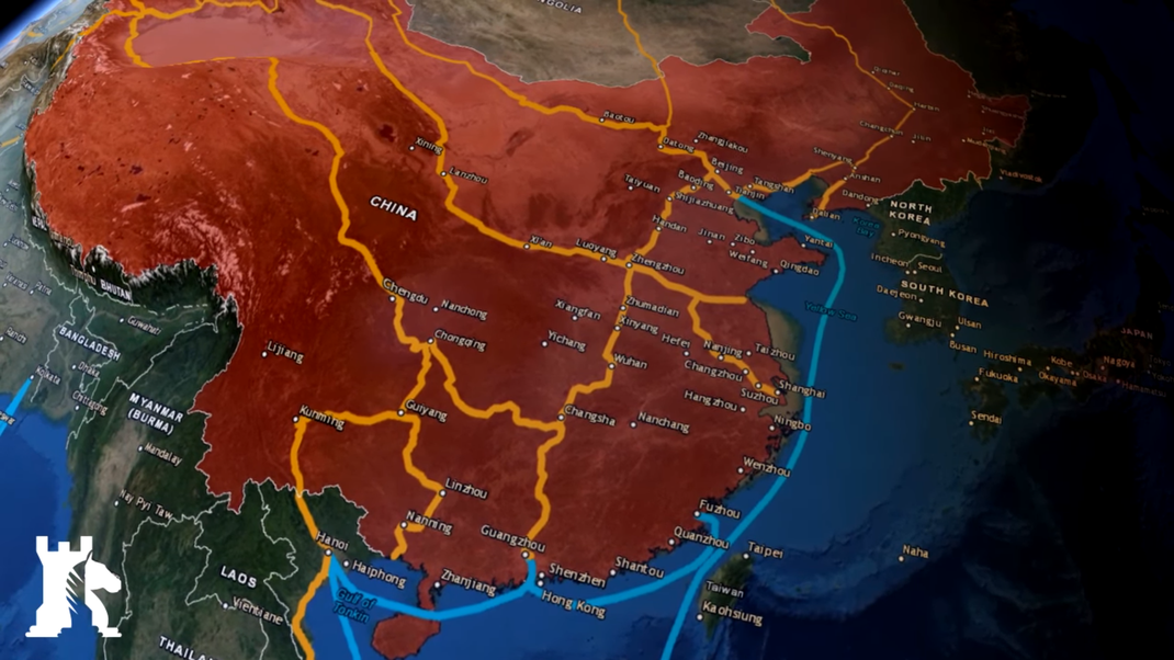
Geography
China's landscape is vast and diverse, ranging from the Gobi and Taklamakan Deserts in the arid north to the subtropical forests in the wetter south. The Himalaya, Karakoram, Pamir and Tian Shan mountain ranges separate China from much of South and Central Asia. The Yangtze and Yellow Rivers, the third- and sixth-longest in the world, respectively, run from the Tibetan Plateau to the densely populated eastern seaboard. China's coastline along the Pacific Ocean is 14,500 km (9,000 mi) long and is bounded by the Bohai, Yellow, East China and South China seas. China connects through the Kazakh border to the Eurasian Steppe which has been an artery of communication between East and West since the Neolithic through the Steppe route – the ancestor of the terrestrial Silk Road(s).[citation needed]
The territory of China lies between latitudes 18° and 54° N, and longitudes 73° and 135° E. The geographical center of China is marked by the Center of the Country Monument at 35°50′40.9″N 103°27′7.5″E. China's landscapes vary significantly across its vast territory. In the east, along the shores of the Yellow Sea and the East China Sea, there are extensive and densely populated alluvial plains, while on the edges of the Inner Mongolian plateau in the north, broad grasslands predominate. Southern China is dominated by hills and low mountain ranges, while the central-east hosts the deltas of China's two major rivers, the Yellow River and the Yangtze River. Other major rivers include the Xi, Mekong, Brahmaputra and Amur. To the west sit major mountain ranges, most notably the Himalayas. High plateaus feature among the more arid landscapes of the north, such as the Taklamakan and the Gobi Desert. The world's highest point, Mount Everest (8,848 m), lies on the Sino-Nepalese border.[132] The country's lowest point, and the world's third-lowest, is the dried lake bed of Ayding Lake (−154 m) in the Turpan Depression.[133]
Climate
Köppen-Geiger climate classification map for mainland China.[134]
China's climate is mainly dominated by dry seasons and wet monsoons, which lead to pronounced temperature differences between winter and summer. In the winter, northern winds coming from high-latitude areas are cold and dry; in summer, southern winds from coastal areas at lower latitudes are warm and moist.[135]
A major environmental issue in China is the continued expansion of its deserts, particularly the Gobi Desert.[136][137] Although barrier tree lines planted since the 1970s have reduced the frequency of sandstorms, prolonged drought and poor agricultural practices have resulted in dust storms plaguing northern China each spring, which then spread to other parts of East Asia, including Japan and Korea. China's environmental watchdog, SEPA, stated in 2007 that China is losing 4,000 km2 (1,500 sq mi) per year to desertification.[138] Water quality, erosion, and pollution control have become important issues in China's relations with other countries. Melting glaciers in the Himalayas could potentially lead to water shortages for hundreds of millions of people.[139] According to academics, in order to limit climate change in China to 1.5 °C (2.7 °F) electricity generation from coal in China without carbon capture must be phased out by 2045.[140] Official government statistics about Chinese agricultural productivity are considered unreliable, due to exaggeration of production at subsidiary government levels.[141][142] Much of China has a climate very suitable for agriculture and the country has been the world's largest producer of rice, wheat, tomatoes, eggplant, grapes, watermelon, spinach, and many other crops.[143]
Biodiversity
China is one of 17 megadiverse countries,[144] lying in two of the world's major biogeographic realms: the Palearctic and the Indomalayan. By one measure, China has over 34,687 species of animals and vascular plants, making it the third-most biodiverse country in the world, after Brazil and Colombia.[145] The country signed the Rio de Janeiro Convention on Biological Diversity on 11 June 1992, and became a party to the convention on 5 January 1993.[146] It later produced a National Biodiversity Strategy and Action Plan, with one revision that was received by the convention on 21 September 2010.[147]
China is home to at least 551 species of mammals (the third-highest such number in the world),[148] 1,221 species of birds (eighth),[149] 424 species of reptiles (seventh)[150] and 333 species of amphibians (seventh).[151] Wildlife in China shares habitat with, and bears acute pressure from, the world's largest population of humans. At least 840 animal species are threatened, vulnerable or in danger of local extinction in China, due mainly to human activity such as habitat destruction, pollution and poaching for food, fur and ingredients for traditional Chinese medicine.[152] Endangered wildlife is protected by law, and as of 2005, the country has over 2,349 nature reserves, covering a total area of 149.95 million hectares, 15 percent of China's total land area.[153][better source needed] Most wild animals have been eliminated from the core agricultural regions of east and central China, but they have fared better in the mountainous south and west.[154][155] The Baiji was confirmed extinct on 12 December 2006.[156]
China has over 32,000 species of vascular plants,[157] and is home to a variety of forest types. Cold coniferous forests predominate in the north of the country, supporting animal species such as moose and Asian black bear, along with over 120 bird species.[158] The understory of moist conifer forests may contain thickets of bamboo. In higher montane stands of juniper and yew, the bamboo is replaced by rhododendrons. Subtropical forests, which are predominate in central and southern China, support a high density of plant species including numerous rare endemics. Tropical and seasonal rainforests, though confined to Yunnan and Hainan Island, contain a quarter of all the animal and plant species found in China.[158] China has over 10,000 recorded species of fungi,[159] and of them, nearly 6,000 are higher fungi.[160]
Environment
The Three Gorges Dam is the largest hydroelectric dam in the world.
In the early 2000s, China has suffered from environmental deterioration and pollution due to its rapid pace of industrialization.[161][162] While regulations such as the 1979 Environmental Protection Law are fairly stringent, they are poorly enforced, as they are frequently disregarded by local communities and government officials in favor of rapid economic development.[163] China is the country with the second highest death toll because of air pollution, after India. There are approximately 1 million deaths caused by exposure to ambient air pollution.[164][165] Although China ranks as the highest CO2 emitting country in the world,[166] it only emits 8 tons of CO2 per capita, significantly lower than developed countries such as the United States (16.1), Australia (16.8) and South Korea (13.6).[167]
In recent years, China has clamped down on pollution. In March 2014, CCP General Secretary Xi Jinping "declared war" on pollution during the opening of the National People's Congress.[168] After extensive debate lasting nearly two years, the parliament approved a new environmental law in April. The new law empowers environmental enforcement agencies with great punitive power and large fines for offenders, defines areas which require extra protection, and gives independent environmental groups more ability to operate in the country.[citation needed] In 2020, Chinese Communist Party general secretary Xi Jinping announced that China aims to peak emissions before 2030 and go carbon-neutral by 2060 in accordance with the Paris climate accord.[169] According to Climate Action Tracker, if accomplished it would lower the expected rise in global temperature by 0.2 - 0.3 degrees - "the biggest single reduction ever estimated by the Climate Action Tracker".[170] In September 2021 Xi Jinping announced that China will not build "coal-fired power projects abroad". The decision can be "pivotal" in reducing emissions. The Belt and Road Initiative did not include financing such projects already in the first half of 2021.[171]
The country also had significant water pollution problems: 8.2% of China's rivers had been polluted by industrial and agricultural waste in 2019.[172][173] China had a 2018 Forest Landscape Integrity Index mean score of 7.14/10, ranking it 53rd globally out of 172 countries.[174] In 2020, a sweeping law was passed by the Chinese government to protect the ecology of the Yangtze River. The new laws include strengthening ecological protection rules for hydropower projects along the river, banning chemical plants within 1 kilometer of the river, relocating polluting industries, severely restricting sand mining as well as a complete fishing ban on all the natural waterways of the river, including all its major tributaries and lakes.[175]
China is also the world's leading investor in renewable energy and its commercialization, with $52 billion invested in 2011 alone;[176][177][178] it is a major manufacturer of renewable energy technologies and invests heavily in local-scale renewable energy projects.[179][180][181] By 2015, over 24% of China's energy was derived from renewable sources, while most notably from hydroelectric power: a total installed capacity of 197 GW makes China the largest hydroelectric power producer in the world.[182][183] China also has the largest power capacity of installed solar photovoltaics system and wind power system in the world.[184][185] Greenhouse gas emissions by China are the world's largest,[167] as is renewable energy in China.[186]
Political Geography
The People's Republic of China is the second-largest country in the world by land area after Russia.[q][r] China's total area is generally stated as being approximately 9,600,000 km2 (3,700,000 sq mi).[187][better source needed] Specific area figures range from 9,572,900 km2 (3,696,100 sq mi) according to the Encyclopædia Britannica,[188] to 9,596,961 km2 (3,705,407 sq mi) according to the UN Demographic Yearbook,[5] and the CIA World Factbook.[8]
China has the longest combined land border in the world, measuring 22,117 km (13,743 mi) and its coastline covers approximately 14,500 km (9,000 mi) from the mouth of the Yalu River (Amnok River) to the Gulf of Tonkin.[8] China borders 14 nations and extends across much of East Asia, bordering Vietnam, Laos, and Myanmar (Burma) in Southeast Asia; India, Bhutan, Nepal, Afghanistan, and Pakistan[s] in South Asia; Tajikistan, Kyrgyzstan and Kazakhstan in Central Asia; and Russia, Mongolia, and North Korea in Inner Asia and Northeast Asia. Additionally, China shares maritime boundaries with South Korea, Japan, Vietnam, and the Philippines.[citation needed]
Politics ( WORLD ECONOMIC MODEL )
The Zhongnanhai, a headquarter of the Chinese government and Chinese Communist Party.
The Chinese constitution states that The People's Republic of China "is a socialist state governed by a people’s democratic dictatorship that is led by the working class and based on an alliance of workers and peasants," and that the state institutions "shall practice the principle of democratic centralism."[189] The PRC is one of the world's only socialist states governed by a communist party. The Chinese government has been variously described as communist and socialist, but also as authoritarian[190] and corporatist,[191] with heavy restrictions in many areas, most notably against free access to the Internet, freedom of the press, freedom of assembly, the right to have children, free formation of social organizations and freedom of religion.[192] Its current political, ideological and economic system has been termed by its leaders as a "consultative democracy" "people's democratic dictatorship", "socialism with Chinese characteristics" (which is Marxism adapted to Chinese circumstances) and the "socialist market economy" respectively.
Communist Party
Chinese Communist Party is the founding and ruling political party of China.
Since 2018, the main body of the Chinese constitution declares that "the defining feature of socialism with Chinese characteristics is the leadership of the Chinese Communist Party (CCP)."[195] The 2018 amendments constitutionalized the de facto one-party state status of China,[195] wherein the CCP General Secretary (party leader) holds ultimate power and authority over state and government and serves as the informal Paramount leader.[196] The current General Secretary is Xi Jinping, who took office on 15 November 2012, and was re-elected on 25 October 2017.[197] The electoral system is pyramidal. Local People's Congresses are directly elected, and higher levels of People's Congresses up to the National People's Congress (NPC) are indirectly elected by the People's Congress of the level immediately below.[189]
Since both the CCP and the People's Liberation Army (PLA) promote according to seniority, it is possible to discern distinct generations of Chinese leadership.[200] In official discourse, each group of leadership is identified with a distinct extension of the ideology of the party. Historians have studied various periods in the development of the government of the People's Republic of China by reference to these "generations".
China is a one-party state led by the Chinese Communist Party (CCP). The National People's Congress in 2018 altered the country's constitution to remove the two-term limit on holding the Presidency of China, permitting the current leader, Xi Jinping, to remain president of China (and General Secretary of the Chinese Communist Party) for an unlimited time, earning criticism for creating dictatorial governance.[201][202] The President is the titular head of state, elected by the National People's Congress. The Premier is the head of government, presiding over the State Council composed of four vice premiers and the heads of ministries and commissions. The incumbent president is Xi Jinping, who is also the General Secretary of the Chinese Communist Party and the Chairman of the Central Military Commission, making him China's paramount leader. The incumbent premier is Li Keqiang, who is also a senior member of the CCP Politburo Standing Committee, China's de facto top decision-making body.[203][204]
In 2017, Xi called on the communist party to further tighten its grip on the country, to uphold the unity of the party leadership, and achieve the "Chinese Dream of national rejuvenation".[193][205] Political concerns in China include the growing gap between rich and poor and government corruption.[206] Nonetheless, the level of public support for the government and its management of the nation is high, with 80–95% of Chinese citizens expressing satisfaction with the central government, according to a 2011 survey.[207] A 2020 survey from the Canadian Institutes of Health Research also found that 75% of Chinese were satisfied with the government on information dissemination amidst the COVID-19 pandemic, while 67% were satisfied with its delivery of daily necessities.[208][209]
Administrative divisions
Main articles: Administrative divisions of China, Districts of Hong Kong, and Municipalities and parishes of Macau
The People's Republic of China is officially divided into 23 provinces,[210] five autonomous regions (each with a designated minority group), and four municipalities—collectively referred to as "mainland China"—as well as the special administrative regions (SARs) of Hong Kong and Macau. Geographically, all 31 provincial divisions of mainland China can be grouped into six regions: North China, Northeast China, East China, South Central China, Southwest China, and Northwest China.[211]
China considers Taiwan to be its 23rd province,[210] although Taiwan is governed by the Republic of China (ROC)
Provinces (省)
Anhui (安徽省)
Fujian (福建省)
Gansu (甘肃省)
Guangdong (广东省)
Guizhou (贵州省)
Hainan (海南省)
Hebei (河北省)
Heilongjiang (黑龙江省)
Henan (河南省)
Hubei (湖北省)
Hunan (湖南省)
Jiangsu (江苏省)
Jiangxi (江西省)
Jilin (吉林省)
Liaoning (辽宁省)
Qinghai (青海省)
Shaanxi (陕西省)
Shandong (山东省)
Shanxi (山西省)
Sichuan (四川省)
Yunnan (云南省)
Zhejiang (浙江省)
Taiwan (台湾省)
governed by R.O.China
Autonomous regions (自治区) Municipalities (直辖市) Special administrative regions (特别行政区)
Guangxi (广西壮族自治区)
Inner Mongolia / Nei Menggu (内蒙古自治区)
Ningxia (宁夏回族自治区)
Xinjiang (新疆维吾尔自治区)
Tibet / Xizang (西藏自治区)
Beijing (北京市)
Chongqing (重庆市)
Shanghai (上海市)
Tianjin (天津市)
Hong Kong / Xianggang (香港特别行政区)
Macau / Aomen (澳门特别行政区)
Foreign relations / ( Weltwirtschaftserforschungsmodell )
The PRC has diplomatic relations with 175 countries and maintains embassies in 162. In 2019, China had the largest diplomatic network in the world.[213][214] Its legitimacy is disputed by the Republic of China and a few other countries; it is thus the largest and most populous state with limited recognition, with a population of more than 1.4 billion.[215] In 1971, the PRC replaced the Republic of China as the sole representative of China in the United Nations and as one of the five permanent members of the United Nations Security Council.[216] China was also a former member and leader of the Non-Aligned Movement, and still considers itself an advocate for developing countries.[217] Along with Brazil, Russia, India and South Africa, China is a member of the BRICS group of emerging major economies and hosted the group's third official summit at Sanya, Hainan in April 2011.[218]
Under its interpretation of the One-China policy, Beijing has made it a precondition to establishing diplomatic relations that the other country acknowledges its claim to Taiwan and severs official ties with the government of the Republic of China.[citation needed] Chinese officials have protested on numerous occasions when foreign countries have made diplomatic overtures to Taiwan,[219] especially in the matter of armament sales.[220]
Much of current Chinese foreign policy is reportedly based on Premier Zhou Enlai's Five Principles of Peaceful Coexistence, and is also driven by the concept of "harmony without uniformity", which encourages diplomatic relations between states despite ideological differences.[221] This policy may have led China to support states that are regarded as dangerous or repressive by Western nations, such as Zimbabwe, North Korea and Iran.[222] China has a close economic and military relationship with Russia,[223] and the two states often vote in unison in the UN Security Council.
Trade relations
On 21 May 2014, China and Russia signed a $400 billion gas deal. Currently, Russia is supplying natural gas to China.
China became the world's largest trading nation in 2013, as measured by the sum of imports and exports, as well as the world's biggest commodity importer. comprising roughly 45% of maritime's dry-bulk market.[227][228] By 2016, China was the largest trading partner of 124 other countries.[229] China is the largest trading partner for the ASEAN nations, with a total trade value of $345.8 billion in 2015 accounting for 15.2% of ASEAN's total trade.[230] ASEAN is also China's largest trading partner.[231] In 2020, China became the largest trading partner of the European Union for goods, with the total value of goods trade reaching nearly $700 billion.[232] China, along with ASEAN, Japan, South Korea, Australia and New Zealand, is a member of the Regional Comprehensive Economic Partnership, the world's largest free-trade area covering 30% of the world's population and economic output.[233] China became a member of the World Trade Organization (WTO) in 2001. In 2004, it proposed an entirely new East Asia Summit (EAS) framework as a forum for regional security issues.[234] The EAS, which includes ASEAN Plus Three, India, Australia and New Zealand, held its inaugural summit in 2005.[235]
China has had a long and complex trade relationship with the United States. In 2000, the United States Congress approved "permanent normal trade relations" (PNTR) with China, allowing Chinese exports in at the same low tariffs as goods from most other countries.[236] China has a significant trade surplus with the United States, its most important export market.[237] In the early 2010s, US politicians argued that the Chinese yuan was significantly undervalued, giving China an unfair trade advantage.[238][239][240][needs update]
Since the turn of the century, China has followed a policy of engaging with African nations for trade and bilateral co-operation;[241][242][243] in 2019, Sino-African trade totalled $208 billion, having grown 20 times over two decades.[244] According to Madison Condon "China finances more infrastructure projects in Africa than the World Bank and provides billions of dollars in low-interest loans to the continent’s emerging economies."[245] China maintains extensive and highly diversified trade links with the European Union.[232] China has furthermore strengthened its trade ties with major South American economies,[246] and is the largest trading partner of Brazil, Chile, Peru, Uruguay, Argentina, and several others.[247]
China's Belt and Road Initiative has expanded significantly over the last six years and, as of April 2020, includes 138 countries and 30 international organizations. In addition to intensifying foreign policy relations, the focus here is particularly on building efficient transport routes. The focus is particularly on the maritime Silk Road with its connections to East Africa and Europe and there are Chinese investments or related declarations of intent at numerous ports such as Gwadar, Kuantan, Hambantota, Piraeus and Trieste. However many of these loans made under the Belt and Road program are unsustainable and China has faced a number of calls for debt relief from debtor nations.[248][249]
Land border disputes
China has resolved its land borders with 12 out of 14 neighboring countries, having pursued substantial compromises in most of them.[251][252][253] As of 2020, China currently has a disputed land border with only India and Bhutan.[citation needed]
Maritime border disputes
China is additionally involved in maritime disputes with multiple countries over the ownership of several small islands in the East and South China Seas, such as the Senkaku Islands and the Scarborough Shoal.[254][255]
Sociopolitical issues and human rights
March in memory of Chinese Nobel Peace Prize laureate Liu Xiaobo who died of organ failure while in government custody in 2017
China uses a massive espionage network of cameras, facial recognition software, sensors, surveillance of personal technology, and a social credit system as a means of social control of persons living in China.[256] The Chinese democracy movement, social activists, and some members of the Chinese Communist Party believe in the need for social and political reform. While economic and social controls have been significantly relaxed in China since the 1970s, political freedom is still tightly restricted. The Constitution of the People's Republic of China states that the "fundamental rights" of citizens include freedom of speech, freedom of the press, the right to a fair trial, freedom of religion, universal suffrage, and property rights. However, in practice, these provisions do not afford significant protection against criminal prosecution by the state.[257][258] Although some criticisms of government policies and the ruling Communist Party are tolerated, censorship of political speech and information, most notably on the Internet,[259][260] are routinely used to prevent collective action.[261] By 2020, China plans to give all its citizens a personal "Social Credit" score based on how they behave.[262][needs update] The Social Credit System, now being piloted in a number of Chinese cities,[needs update] is considered a form of mass surveillance which uses big data analysis technology.[263][264]
A number of foreign governments, foreign press agencies, and NGOs have criticized China's human rights record, alleging widespread civil rights violations such as detention without trial, forced abortions,[265] forced confessions, torture, restrictions of fundamental rights,[192][266] and excessive use of the death penalty.[267][268] The government suppresses popular protests and demonstrations that it considers a potential threat to "social stability", as was the case with the Tiananmen Square protests of 1989.[269]
Western governments accused China of committing genocide against Uyghurs and detaining more than one million Uyghurs and other Xinjiang minorities in camps.[270]
The Chinese state is regularly accused of large-scale repression and human rights abuses in Tibet[271][272] and Xinjiang,[273] including violent police crackdowns and religious suppression throughout the Chinese nation.[274][275] At least one million members of China's Muslim Uyghur minority have been detained in mass detention camps, termed "Vocational Education and Training Centers", aimed at changing the political thinking of detainees, their identities, and their religious beliefs.[276] According to the U.S. Department of State, actions including political indoctrination, torture, physical and psychological abuse, forced sterilization, sexual abuse, and forced labor are common in these facilities.[277] The state has also sought to control offshore reporting of tensions in Xinjiang, intimidating foreign-based reporters by detaining their family members.[278] According to a 2020 report, China's treatment of Uyghurs meets UN definition of genocide,[279] and several groups called for a UN investigation.[280] On 19 January 2021, the United States Secretary of State, Mike Pompeo, announced that the United States Department of State had determined that "genocide and crimes against humanity" had been perpetrated by China against the Uyghurs.[281]
2019–20 Hong Kong protests
Global studies from Pew Research Center in 2014 and 2017 ranked the Chinese government's restrictions on religion as among the highest in the world, despite low to moderate rankings for religious-related social hostilities in the country.[282][283] The Global Slavery Index estimated that in 2016 more than 3.8 million people were living in "conditions of modern slavery", or 0.25% of the population, including victims of human trafficking, forced labor, forced marriage, child labor, and state-imposed forced labor. The state-imposed forced system was formally abolished in 2013, but it is not clear to which extent its various practices have stopped.[284] The Chinese penal system includes labor prison factories, detention centers, and re-education camps, which fall under the heading Laogai ("reform through labor"). The Laogai Research Foundation in the United States estimated that there were over a thousand slave labor prisons and camps, known collectively as the Laogai.[285]
In 2019, a study called for the mass retraction of more than 400 scientific papers on organ transplantation, because of fears the organs were obtained unethically from Chinese prisoners. While the government says 10,000 transplants occur each year, a report by the Falun Gong-linked IETAC alleged that between 60,000 and 100,000 organs are transplanted each year and claimed that this gap was being made up by executed prisoners of conscience.
Military
Chengdu J-20 5th generation stealth fighter
With nearly 2.2 million active troops, the People's Liberation Army (PLA) is the largest standing military force in the world, commanded by the Central Military Commission (CMC).[287] China has the second-biggest military reserve force, only behind North Korea. The PLA consists of the Ground Force (PLAGF), the Navy (PLAN), the Air Force (PLAAF), the Rocket Force (PLARF) and the Strategic Support Force (PLASSF). According to the Chinese government, military budget for 2017 totalled US$151.5 billion, constituting the world's second-largest military budget, although the military expenditures-GDP ratio with 1.3% of GDP is below world average.[288] However, many authorities – including SIPRI and the U.S. Office of the Secretary of Defense claim that China hides its real level of military spending, which is allegedly much higher than the official budget.[288][289]
China boasts the world's third-most powerful military,[290] with the world's third-largest stockpile of nuclear weapons.[291]
Economy
China and other major developing economies by GDP per capita at purchasing-power parity, 1990–2013. The rapid economic growth of China (blue) is readily apparent.[292]
A proportional representation of Chinese exports, 2019
Since 2010, China has had the world's second-largest economy in terms of nominal GDP,[293] totaling approximately US$15.66 trillion (101.6 trillion Yuan) as of 2020.[294][295] In terms of purchasing power parity (PPP GDP), China's economy has been the largest in the world since 2014, according to the World Bank.[296] China is also the world's fastest-growing major economy.[297] According to the World Bank, China's GDP grew from $150 billion in 1978 to $14.28 trillion by 2019.[298] China's economic growth has been consistently above 6 percent since the introduction of economic reforms in 1978.[299] China is also the world's largest exporter and second-largest importer of goods.[300] Between 2010 and 2019, China's contribution to global GDP growth has been 25% to 39%.[301][302]
China had one of the largest economies in the world for most of the past two thousand years,[303] during which it has seen cycles of prosperity and decline.[304][305] Since economic reforms began in 1978, China has developed into a highly diversified economy and one of the most consequential players in international trade. Major sectors of competitive strength include manufacturing, retail, mining, steel, textiles, automobiles, energy generation, green energy, banking, electronics, telecommunications, real estate, e-commerce, and tourism. China has three out of the ten largest stock exchanges in the world[306]—Shanghai, Hong Kong and Shenzhen—that together have a market capitalization of over $15.9 trillion, as of October 2020.[307] China has four (Shanghai, Hong Kong, Beijing, and Shenzhen) out of the world's top ten most competitive financial centers, which is more than any country in the 2020 Global Financial Centres Index.[308] By 2035, China's four cities (Shanghai, Beijing, Guangzhou and Shenzhen) are projected to be among the global top ten largest cities by nominal GDP according to a report by Oxford Economics.[309]
China has been the world's No. 1 manufacturer since 2010, after overtaking the US, which had been No. 1 for the previous hundred years.[310][311] China has also been No. 2 in high-tech manufacturing since 2012, according to US National Science Foundation.[312] China is the second largest retail market in the world, next to the United States.[313] China leads the world in e-commerce, accounting for 40% of the global market share in 2016[314] and more than 50% of the global market share in 2019.[315] China is the world's leader in electric vehicles, manufacturing and buying half of all the plug-in electric cars (BEV and PHEV) in the world in 2018.[316] China is also the leading producer of batteries for electric vehicles as well as several key raw materials for batteries.[317] China had 174 GW of installed solar capacity by the end of 2018, which amounts to more than 40% of the global solar capacity.
Foreign and some Chinese sources have claimed that official Chinese government statistics overstate China's economic growth. However, several Western academics and institutions have stated that China's economic growth is higher than indicated by official figures.
China has a large informal economy, which arose as a result of the country's economic opening. The informal economy is a source of employment and income for workers, but it is unrecognized and suffers from lower productivity.[330]
Wealth in China
As of 2020, China was second in the world, after the US, in total number of billionaires and total number of millionaires, with 698 Chinese billionaires and 4.4 million millionaires.[331][332] In 2019, China overtook the US as the home to the highest number of people who have a net personal wealth of at least $110,000, according to the global wealth report by Credit Suisse.[333][334] According to the Hurun Global Rich List 2020, China is home to five of the world's top ten cities (Beijing, Shanghai, Hong Kong, Shenzhen, and Guangzhou in the 1st, 3rd, 4th, 5th, and 10th spots, respectively) by the highest number of billionaires, which is more than any other country.[335] China had 85 female billionaires as of January 2021, two-thirds of the global total, and minted 24 new female billionaires in 2020.[336]
However, it ranks behind over 60 countries (out of around 180) in per capita economic output, making it an upper-middle income country.[337] Additionally, its development is highly uneven. Its major cities and coastal areas are far more prosperous compared to rural and interior regions.[338] China brought more people out of extreme poverty than any other country in history[339]—between 1978 and 2018, China reduced extreme poverty by 800 million. China reduced the extreme poverty rate—per international standard, it refers to an income of less than $1.90/day—from 88% in 1981 to 1.85% by 2013.[340] According to the World Bank, the number of Chinese in extreme poverty fell from 756 million to 25 million between 1990 and 2013.[341] The portion of people in China living below the international poverty line of $1.90 per day (2011 PPP) fell to 0.3% in 2018 from 66.3% in 1990. Using the lower-middle income poverty line of $3.20 per day, the portion fell to 2.9% in 2018 from 90.0% in 1990. Using the upper-middle income poverty line of $5.50 per day, the portion fell to 17.0% from 98.3% in 1990.[342]
Economic growth
China's nominal GDP trend from 1952 to 2015
From its founding in 1949 until late 1978, the People's Republic of China was a Soviet-style centrally planned economy. Following Mao's death in 1976 and the consequent end of the Cultural Revolution, Deng Xiaoping and the new Chinese leadership began to reform the economy and move towards a more market-oriented mixed economy under one-party rule. Agricultural collectivization was dismantled and farmlands privatized, while foreign trade became a major new focus, leading to the creation of Special Economic Zones (SEZs). Inefficient state-owned enterprises (SOEs) were restructured and unprofitable ones were closed outright, resulting in massive job losses.[citation needed] Modern-day China is mainly characterized as having a market economy based on private property ownership,[343] and is one of the leading examples of state capitalism.[344][345] The state still dominates in strategic "pillar" sectors such as energy production and heavy industries, but private enterprise has expanded enormously, with around 30 million private businesses recorded in 2008.[346][347][better source needed][348][349] In 2018, private enterprises in China accounted for 60% of GDP, 80% of urban employment and 90% of new jobs.[350]
In the early 2010s, China's economic growth rate began to slow amid domestic credit troubles, weakening international demand for Chinese exports and fragility in the global economy.[351][352][353] China's GDP was slightly larger than Germany's in 2007; however, by 2017, China's $12.2 trillion-economy became larger than those of Germany, UK, France and Italy combined.[354] In 2018, the IMF reiterated its forecast that China will overtake the US in terms of nominal GDP by the year 2030.[355] Economists also expect China's middle class to expand to 600 million people by 2025.[356]
In 2020, China was the only major economy in the world to grow, recording a 2.3% growth due to its success in taming the coronavirus within its borders.[357]
China in the global economy
Share of world GDP (PPP)
Year Share
1980 2.32%
1990 4.11%
2000 7.40%
2010 13.89%
2018 18.72%
China is a member of the WTO and is the world's largest trading power, with a total international trade value of US$4.62 trillion in 2018.[359] Its foreign exchange reserves reached US$3.1 trillion as of 2019,[360] making its reserves by far the world's largest.[361][362] In 2012, China was the world's largest recipient of inward foreign direct investment (FDI), attracting $253 billion.[363] In 2014, China's foreign exchange remittances were $US64 billion making it the second largest recipient of remittances in the world.[364] China also invests abroad, with a total outward FDI of $62.4 billion in 2012,[363] and a number of major takeovers of foreign firms by Chinese companies.[365] China is a major owner of US public debt, holding trillions of dollars worth of U.S. Treasury bonds.[366][367] China's undervalued exchange rate has caused friction with other major economies,[239] and it has also been widely criticized for manufacturing large quantities of counterfeit goods.[368][369]
Largest economies by nominal GDP in 2018
Following the 2007–08 financial crisis, Chinese authorities sought to actively wean off of its dependence on the U.S. dollar as a result of perceived weaknesses of the international monetary system.[371] To achieve those ends, China took a series of actions to further the internationalization of the Renminbi. In 2008, China established dim sum bond market and expanded the Cross-Border Trade RMB Settlement Pilot Project, which helps establish pools of offshore RMB liquidity.[372][373] This was followed with bilateral agreements to settle trades directly in renminbi with Russia,[374] Japan,[375] Australia,[376] Singapore,[377] the United Kingdom,[378] and Canada.[379] As a result of the rapid internationalization of the renminbi, it became the eighth-most-traded currency in the world, an emerging international reserve currency,[380] and a component of the IMF's special drawing rights; however, partly due to capital controls that make the renminbi fall short of being a fully convertible currency, it remains far behind the Euro, Dollar and Japanese Yen in international trade volumes.[381]
Class and income inequality
China has had the world's largest middle class population since 2015,[382] and the middle class grew to a size of 400 million by 2018.[383] In 2020, a study by the Brookings Institution forecast that China's middle-class will reach 1.2 billion by 2027 (almost 4 times the entire U.S. population today), making up one fourth of the world total.[384] Wages in China have grown a lot in the last 40 years—real (inflation-adjusted) wages grew seven-fold from 1978 to 2007.[385] By 2018, median wages in Chinese cities such as Shanghai were about the same as or higher than the wages in Eastern European countries.[386] China has the world's highest number of billionaires, with nearly 878 as of October 2020, increasing at the rate of roughly five per week.[387][388][389] China has a high level of economic inequality,[390] which has increased in the past few decades.[391] In 2018 China's Gini coefficient was 0.467, according to the World Bank.[12]

Science and technology
Earliest known written formula for gunpowder, from the Wujing Zongyao of 1044 CE
China was a world leader in science and technology until the Ming dynasty.[392] Ancient Chinese discoveries and inventions, such as papermaking, printing, the compass, and gunpowder (the Four Great Inventions), became widespread across East Asia, the Middle East and later Europe. Chinese mathematicians were the first to use negative numbers.[393][394] By the 17th century, the Western hemisphere surpassed China in scientific and technological advancement.[395] The causes of this early modern Great Divergence continue to be debated by scholars.[396]
After repeated military defeats by the European colonial powers and Japan in the 19th century, Chinese reformers began promoting modern science and technology as part of the Self-Strengthening Movement. After the Communists came to power in 1949, efforts were made to organize science and technology based on the model of the Soviet Union, in which scientific research was part of central planning.[397] After Mao's death in 1976, science and technology was promoted as one of the Four Modernizations,[398] and the Soviet-inspired academic system was gradually reformed.

Modern era /( World Economic Model ) Weltwirtschaftsprodukt
Huawei headquarters in Shenzhen. Huawei is the world's largest telecoms-equipment-maker and the second-largest manufacturer of smartphones in the world.[400]
Since the end of the Cultural Revolution, China has made significant investments in scientific research[401] and is quickly catching up with the US in R&D spending.[402][403] In 2017, China spent $279 billion on scientific research and development.[404] According to the OECD, China spent 2.11% of its GDP on research and development (R&D) in 2016.[405] Science and technology are seen as vital for achieving China's economic and political goals, and are held as a source of national pride to a degree sometimes described as "techno-nationalism".[406] According to the World Intellectual Property Indicators, China received 1.54 million patent applications in 2018, representing nearly half of patent applications worldwide, more than double the US.[407] In 2019, China was No. 1 in international patents application.[408] China was ranked 12th, 3rd in Asia & Oceania region and 2nd for countries with a population of over 100 million in the Global Innovation Index in 2021, it has increased its ranking considerably since 2013, where it was ranked 35th.[409][410][411][412] China ranks first globally in the important indicators, including patents, utility models, trademarks, industrial designs, and creative goods exports and it also has 2 (Shenzhen-Hong Kong-Guangzhou and Beijing in the 2nd and 3rd spots respectively) of the global top 5 science and technology clusters, which is more than any other country.[409] Chinese tech companies Huawei and ZTE were the top 2 filers of international patents in 2017.[413][414] Chinese-born academicians have won the Nobel Prize in Physics four times, the Nobel Prize in Chemistry, Nobel Prize in Physiology or Medicine and Fields Medal once respectively, though most of them conducted their prize-winning research in western nations.[t][improper synthesis?]
Jiuquan Satellite Launch Center, one of the first Chinese spaceports
China is developing its education system with an emphasis on science, technology, engineering and mathematics (STEM); in 2009, China graduated over 10,000 PhD engineers, and as many as 500,000 BSc graduates, more than any other country.[421] China also became the world's largest publisher of scientific papers in 2016.[422] Chinese technology companies such as Huawei and Lenovo have become world leaders in telecommunications and personal computing,[423][424][425] and Chinese supercomputers are consistently ranked among the world's most powerful.[426][427] China has been the world's largest market for industrial robots since 2013 and will account for 45% of newly installed robots from 2019 to 2021.[428]
The Chinese space program is one of the world's most active. In 1970, China launched its first satellite, Dong Fang Hong I, becoming the fifth country to do so independently.[429] In 2003, China became the third country to independently send humans into space, with Yang Liwei's spaceflight aboard Shenzhou 5; as of 2021, thirteen Chinese nationals have journeyed into space, including two women. In 2011, China's first space station module, Tiangong-1, was launched, marking the first step in a project to assemble a large crewed station by the early 2020s.[430] In 2013, China successfully landed the Chang'e 3 lander and Yutu rover onto the lunar surface.[431] In 2016, the first quantum science satellite was launched in partnership with Austria dedicated to testing the fundamentals of quantum communication in space.[432][433] In 2019, China became the first country to land a probe—Chang'e 4—on the far side of the moon.[434] In 2020, the first experimental 6G test satellite was launched[435][436] and Chang'e 5 successfully returned moon samples to the Earth, making China the third country to do so independently after the United States and the Soviet Union.[437] In 2021, China became the second nation in history to independently land a rover (Zhurong) on Mars, joining the United States.[438]
Thailand / King Vajiralongkorn / Monarchy / 70 Million Population / ASEAN STATES Member in Asia / Bangkok / 501.8 Billion Dollar ( GDP ) of 2020 / Protokoll 24.01.2022
Thailand (Thai: ประเทศไทย),[a] historically known as Siam,[b] officially the Kingdom of Thailand, is a country in Southeast Asia. It is located at the centre of the Indochinese Peninsula, spanning 513,120 square kilometres (198,120 sq mi), with a population of almost 70 million people.[5] It is bordered to the north by Myanmar and Laos, to the east by Laos and Cambodia, to the south by the Gulf of Thailand and Malaysia, and to the west by the Andaman Sea and Myanmar. Thailand also shares maritime borders with Vietnam in the Gulf of Thailand to the southeast, and Indonesia and India (Andaman and Nicobar Islands) on the Andaman Sea to the southwest. Nominally, Thailand is a constitutional monarchy and parliamentary democracy; however, in recent history, its government has experienced multiple coups and periods of military dictatorships. Bangkok is the nation's capital and largest city.
Tai peoples migrated from southwestern China to mainland Southeast Asia from the 11th century; the oldest known mention of their presence in the region by the exonym Siamese dates to the 12th century. Various Indianised kingdoms such as the Mon kingdoms, Khmer Empire and Malay states ruled the region, competing with Thai states such as the Kingdoms of Ngoenyang, Sukhothai, Lan Na and Ayutthaya, which rivalled each other. Documented European contact began in 1511 with a Portuguese diplomatic mission to Ayutthaya, which became a regional power by the end of the 15th century. Ayutthaya reached its peak during cosmopolitan Narai's reign, gradually declining thereafter until being ultimately destroyed in the 1767 Burmese–Siamese War. Taksin quickly reunified the fragmented territory and established the short-lived Thonburi Kingdom. He was succeeded in 1782 by Buddha Yodfa Chulaloke, the first monarch of the current Chakri dynasty.
Throughout the era of Western imperialism in Asia, Siam remained the only nation in the region to avoid being colonised by foreign powers, although it was often forced to cede both territory and trade concessions in unequal treaties. The Siamese system of government was centralised and transformed into a modern unitary absolute monarchy in the reign of Chulalongkorn. In World War I, Siam sided with the allies, a political decision to amend the unequal treaties. Following a bloodless revolution in 1932, it became a constitutional monarchy and changed its official name to Thailand, which was an ally of Japan in World War II. In the late 1950s, a military coup under Field Marshal Sarit Thanarat revived the monarchy's historically influential role in politics. Thailand became a major ally of the United States, and played an anti-communist role in the region as a member of the failed SEATO, but since 1975, had sought to improve relations with Communist China and Thailand's neighbors. Apart from a brief period of parliamentary democracy in the mid-1970s, Thailand has periodically alternated between democracy and military rule. Since the 2000s, it has been caught in a series of bitter political conflict between supporters and opponents of Thaksin Shinawatra, which culminated in two coups, most recently in 2014 and the establishment of its current and 20th constitution and faces the ongoing pro-democracy protests.
Thailand is a middle power in global affairs, and a founding member of ASEAN; ranking high in the Human Development Index. It has the second-largest economy in Southeast Asia, and the 22nd-largest in the world by PPP. Thailand is classified as a newly industrialised economy; manufacturing, agriculture, and tourism are leading sectors of the economy.
History
There is evidence of continuous human habitation in present-day Thailand from 20,000 years ago to the present day.[23]: 4 The earliest evidence of rice growing is dated at 2,000 BCE.[22]: 4 Bronze appeared circa 1,250–1,000 BCE.[22]: 4 The site of Ban Chiang in northeast Thailand currently ranks as the earliest known centre of copper and bronze production in Southeast Asia.[24] Iron appeared around 500 BCE.[22]: 5 The Kingdom of Funan was the first and most powerful Southeast Asian kingdom at the time (2nd century BCE).[23]: 5 The Mon people established the principalities of Dvaravati and Kingdom of Hariphunchai in the 6th century. The Khmer people established the Khmer empire, centred in Angkor, in the 9th century.[23]: 7 Tambralinga, a Malay state controlling trade through the Malacca Strait, rose in the 10th century.[23]: 5 The Indochina peninsula was heavily influenced by the culture and religions of India from the time of the Kingdom of Funan to that of the Khmer Empire.[25]
The Thai people are of the Tai ethnic group, characterised by common linguistic roots.[26]: 2 Chinese chronicles first mention the Tai peoples in the 6th century BCE. While there are many assumptions regarding the origin of Tai peoples, David K. Wyatt, a historian of Thailand, argued that their ancestors which at the present inhabit Laos, Thailand, Myanmar, India, and China came from the Điện Biên Phủ area between the 5th and the 8th century.[26]: 6 Thai people began migrating into present-day Thailand around the 11th century, which Mon and Khmer people occupied at the time.[27] Thus Thai culture was influenced by Indian, Mon, and Khmer cultures.[28]
According to French historian George Cœdès, "The Thai first enter history of Farther India in the eleventh century with the mention of Syam slaves or prisoners of war in Champa epigraphy", and "in the twelfth century, the bas-reliefs of Angkor Wat" where "a group of warriors" are described as Syam.[15]: 190–191, 194–195
After the decline of the Khmer Empire and Kingdom of Pagan in the early-13th century, various states thrived in their place. The domains of Tai people existed from the northeast of present-day India to the north of present-day Laos and to the Malay peninsula.[26]: 38–9 During the 13th century, Tai people had already settled in the core land of Dvaravati and Lavo Kingdom to Nakhon Si Thammarat in the south. There are, however, no records detailing the arrival of the Tais.[26]: 50–1
Around 1240, Pho Khun Bang Klang Hao, a local Tai ruler, rallied the people to rebel against the Khmer. He later crowned himself the first king of Sukhothai Kingdom in 1238.[26]: 52–3 Mainstream Thai historians count Sukhothai as the first kingdom of Thai people. Sukhothai expanded furthest during the reign of Ram Khamhaeng (r. 1279–1298). However, it was mostly a network of local lords who swore fealty to Sukhothai, not directly controlled by it.[26]: 55–6 He is believed have invented Thai script and Thai ceramics were an important export in his era. Sukhothai embraced Theravada Buddhism in the reign of Maha Thammaracha I (1347–1368).
To the north, Mangrai, who descended from a local ruler lineage of Ngoenyang, founded the kingdom of Lan Na in 1292, centered in Chiang Mai. He unified the surrounding area and his dynasty would rule the kingdom continuously for the next two centuries. He also created a network of states through political alliances to the east and north of the Mekong.[20]: 8 While in the port in Lower Chao Phraya Basin, a federation around Phetchaburi, Suphan Buri, Lopburi, and the Ayutthaya area was created in the 11th century.
Malaysia / Southeast Asia / ASEAN States Member / Yang Di Pertuan Agong King / Monarchy / Human Development Index 62 Rank / Protokoll 16.02.2022
Malaysia (/məˈleɪziə, -ʒə/ (audio speaker iconlisten) mə-LAY-zee-ə, -zhə; Malay: [məlejsiə])[nb 1] is a country in Southeast Asia. The federal constitutional monarchy consists of thirteen states and three federal territories, separated by the South China Sea into two regions, Peninsular Malaysia and Borneo's East Malaysia. Peninsular Malaysia shares a land and maritime border with Thailand and maritime borders with Singapore, Vietnam, and Indonesia. East Malaysia shares land and maritime borders with Brunei and Indonesia and a maritime border with the Philippines and Vietnam. Kuala Lumpur is the national capital, largest city and the seat of the legislative branch of the federal government. The nearby planned capital of Putrajaya is the administrative capital; which represents the seat of both the executive branch (Cabinet, federal ministries and agencies) and the judicial branch of the federal government. With a population of over 32 million, Malaysia is the world's 43rd-most populous country. The southernmost point of continental Eurasia is in Tanjung Piai. In the tropics, Malaysia is one of 17 megadiverse countries, home to a number of endemic species.
Malaysia has its origins in the Malay kingdoms which, from the 18th century, became subject to the British Empire, along with the British Straits Settlements protectorate. Peninsular Malaysia was unified as the Malayan Union in 1946. Malaya was restructured as the Federation of Malaya in 1948 and achieved independence on 31 August 1957. The independent Malaya united with the then British crown colonies of North Borneo, Sarawak, and Singapore on 16 September 1963 to become Malaysia. In August 1965, Singapore was expelled from the federation and became a separate independent country.[13]
The country is multi-ethnic and multi-cultural, which has a significant effect on its politics. About half the population is ethnically Malay, with minorities of Chinese, Indians, and indigenous peoples. The country's official language is Malaysian, a standard form of the Malay language. English remains an active second language. While recognising Islam as the country's established religion, the constitution grants freedom of religion to non-Muslims. The government is modelled on the Westminster parliamentary system and the legal system is based on common law. The head of state is an elected monarch, chosen from among the nine state sultans every five years. The head of government is the Prime Minister.
After independence, the Malaysian GDP grew at an average of 6.5% per annum for almost 50 years. The economy has traditionally been fuelled by its natural resources but is expanding in the sectors of science, tourism, commerce and medical tourism. Malaysia has a newly industrialised market economy, ranked third-largest in Southeast Asia and 33rd-largest in the world.[14] It is a founding member of ASEAN, EAS, OIC and a member of APEC, the Commonwealth and the Non-Aligned Movement.
History ( Weltwirtschaftsprodukt ) World Economic Model
Evidence of modern human habitation in Malaysia dates back 40,000 years.[41] In the Malay Peninsula, the first inhabitants are thought to be Negritos.[42] Traders and settlers from India and China arrived as early as the first century AD, establishing trading ports and coastal towns in the second and third centuries. Their presence resulted in strong Indian and Chinese influences on the local cultures, and the people of the Malay Peninsula adopted the religions of Hinduism and Buddhism. Sanskrit inscriptions appear as early as the fourth or fifth century.[43] The Kingdom of Langkasuka arose around the second century in the northern area of the Malay Peninsula, lasting until about the 15th century.[37] Between the 7th and 13th centuries, much of the southern Malay Peninsula was part of the maritime Srivijayan empire. By the 13th and the 14th century, the Majapahit empire had successfully wrested control over most of the peninsula and the Malay Archipelago from Srivijaya.[44] Islam began to spread among Malays in the 14th century.[45] In the early 15th century, Parameswara, a runaway king of the former Kingdom of Singapura linked to the old Srivijayan court, founded the Malacca Sultanate. Malacca was an important commercial centre during this time, attracting trade from around the region.
In 1511, Malacca was conquered by Portugal,[45] after which it was taken by the Dutch in 1641. In 1786, the British Empire established a presence in Malaya, when the Sultan of Kedah leased Penang Island to the British East India Company. The British obtained the town of Singapore in 1819,[46] and in 1824 took control of Malacca following the Anglo-Dutch Treaty. By 1826, the British directly controlled Penang, Malacca, Singapore, and the island of Labuan, which they established as the crown colony of the Straits Settlements. By the 20th century, the states of Pahang, Selangor, Perak, and Negeri Sembilan, known together as the Federated Malay States, had British residents appointed to advise the Malay rulers, to whom the rulers were bound to defer by treaty.[47] The remaining five states in the peninsula, known as the Unfederated Malay States, while not directly under British rule, also accepted British advisers around the turn of the 20th century. Development on the peninsula and Borneo were generally separate until the 19th century. Under British rule the immigration of Chinese and Indians to serve as labourers was encouraged.[48] The area that is now Sabah came under British control as North Borneo when both the Sultan of Brunei and the Sultan of Sulu transferred their respective territorial rights of ownership, between 1877 and 1878.[49] In 1842, Sarawak was ceded by the Sultan of Brunei to James Brooke, whose successors ruled as the White Rajahs over an independent kingdom until 1946, when it became a crown colony.[50]
In the Second World War, the Japanese Army invaded and occupied Malaya, North Borneo, Sarawak, and Singapore for over three years. During this time, ethnic tensions were raised and nationalism grew.[51] Popular support for independence increased after Malaya was reconquered by Allied forces.[52] Post-war British plans to unite the administration of Malaya under a single crown colony called the "Malayan Union" met with strong opposition from the Malays, who opposed the weakening of the Malay rulers and the granting of citizenship to the ethnic Chinese. The Malayan Union, established in 1946, and consisting of all the British possessions in the Malay Peninsula with the exception of Singapore, was quickly dissolved and replaced on 1 February 1948 by the Federation of Malaya, which restored the autonomy of the rulers of the Malay states under British protection.[53]
During this time, the mostly ethnically Chinese rebels under the leadership of the Malayan Communist Party launched guerrilla operations designed to force the British out of Malaya. The Malayan Emergency (1948–1960) involved a long anti-insurgency campaign by Commonwealth troops in Malaya.[54] On 31 August 1957, Malaya became an independent member of the Commonwealth of Nations.[55] After this a plan was put in place to federate Malaya with the crown colonies of North Borneo (which joined as Sabah), Sarawak, and Singapore. The date of federation was planned to be 31 August 1963 so as to coincide with the anniversary of Malayan independence; however, federation was delayed until 16 September 1963 in order for a United Nations survey of support for federation in Sabah and Sarawak, called for by parties opposed to federation including Indonesia's Sukarno and the Sarawak United Peoples' Party, to be completed.[56][57][58][59]
Federation brought heightened tensions including a conflict with Indonesia as well continuous conflicts against the Communists in Borneo and the Malayan Peninsula which escalates to the Sarawak Communist Insurgency and Second Malayan Emergency together with several other issues such as the cross border attacks into North Borneo by Moro pirates from the southern islands of the Philippines, Singapore being expelled from the Federation in 1965,[60][61] and racial strife. This strife culminated in the 13 May race riots in 1969.[62] After the riots, the controversial New Economic Policy was launched by Prime Minister Tun Abdul Razak, trying to increase the share of the economy held by the bumiputera.[63] Under Prime Minister Mahathir Mohamad there was a period of rapid economic growth and urbanisation beginning in the 1980s. The economy shifted from being agriculturally based to one based on manufacturing and industry. Numerous mega-projects were completed, such as the Petronas Towers, the North–South Expressway, the Multimedia Super Corridor, and the new federal administrative capital of Putrajaya.[39] However, in the late 1990s the Asian financial crisis almost caused the collapse of the currency and the stock and property markets, although they later recovered.[64] The 1MDB scandal was a major global corruption scandal that implicated then-Prime Minister Najib Razak in 2015.[65] The scandal contributed to the first change in ruling political party since independence in the 2018 general election.[66] In the 2020s, the country was gripped by political crisis that coincided with health and economic crises caused by the COVID-19 pandemic.
Philippines / Currency Peso / Rodrigo Duterte +Ferdinand Marcos Jr. since 2022 President / South East Asian Continental Rift / ASEAN Member / Protokoll 16.09.2022
The Philippines (/ˈfɪlɪpiːnz/ (audio speaker iconlisten); Filipino: Pilipinas),[13] officially the Republic of the Philippines (Filipino: Republika ng Pilipinas),[d] is an archipelagic country in Southeast Asia. It is situated in the western Pacific Ocean, and consists of about 7,640 islands, that are broadly categorized under three main geographical divisions from north to south: Luzon, Visayas, and Mindanao. The Philippines is bounded by the South China Sea to the west, the Philippine Sea to the east, and the Celebes Sea to the southwest, and shares maritime borders with Taiwan to the north, Japan to the northeast, Palau to the east and southeast, Indonesia to the south, Malaysia and Brunei to the southwest, Vietnam to the west, and China to the northwest. The Philippines covers an area of 300,000 km2 (120,000 sq mi) and, as of 2020, had a population of around 109 million people, making it the world's twelfth-most populous country. The Philippines is a multinational state, with diverse ethnicities and cultures throughout its islands. Manila is the nation's capital, while the largest city is Quezon City, both lying within the urban area of Metro Manila.
Negritos, some of the archipelago's earliest inhabitants, were followed by successive waves of Austronesian peoples. Adoption of Animism, Hinduism and Islam established island-kingdoms called Kedatuans, Rajahnates and Sultanates. The arrival of Ferdinand Magellan, a Portuguese explorer leading a fleet for Spain, marked the beginning of Spanish colonization. In 1543, Spanish explorer Ruy Lَpez de Villalobos named the archipelago Las Islas Filipinas in honor of Philip II of Spain. Spanish settlement through Mexico, beginning in 1565, led to the Philippines becoming part of the Spanish Empire for more than 300 years. During this time, Catholicism became the dominant religion, and Manila became the western hub of trans-Pacific trade. In 1896, the Philippine Revolution began, which then became entwined with the 1898 Spanish–American War. Spain ceded the territory to the United States, while Filipino revolutionaries declared the First Philippine Republic. The ensuing Philippine–American War ended with the United States establishing control over the territory, which they maintained until the Japanese invasion of the islands during World War II. Following liberation, the Philippines became independent in 1946. Since then, the unitary sovereign state has often had a tumultuous experience with democracy, which included the overthrow of a dictatorship by the People Power Revolution.
It is considered to be an emerging market and a newly industrialized country, which has an economy transitioning from being based on agriculture to being based more on services and manufacturing. The Philippines is a founding member of the United Nations, World Trade Organization, Association of Southeast Asian Nations, the Asia-Pacific Economic Cooperation forum, and the East Asia Summit. The Philippines' position as an island country on the Pacific Ring of Fire and close to the equator makes the country prone to earthquakes and typhoons. The country has a variety of natural resources and a globally significant level of biodiversity.
Geography & Environment( Weltwirtschaftserforschungsmodell ) Weltwirtschaftsmodell
The Philippines is an archipelago composed of about 7,640 islands,[179][180] covering a total area, including inland bodies of water, of around 300,000 square kilometers (115,831 sq mi),[181][182] with cadastral survey data suggesting it may be larger.[183] Its 36,289 kilometers (22,549 mi) coastline gives it the world's fifth-longest coastline.[184] The EEZ of the Philippines covers 2,263,816 km2 (874,064 sq mi).[185] It is located between 116° 40', and 126° 34' E longitude and 4° 40' and 21° 10' N latitude and is bordered by the Philippine Sea to the east,[186][187] the South China Sea to the west,[188] and the Celebes Sea to the south.[189] The island of Borneo is located a few hundred kilometers southwest,[190] and Taiwan is located directly to the north. Sulawesi is located to the southwest and Palau is located to the east of the islands.[191][192]
The highest mountain is Mount Apo. It measures up to 2,954 meters (9,692 ft) above sea level and is located on the island of Mindanao.[193] Running east of the archipelago, the Philippine Trench extendes 10,540-metre (34,580 ft) down at the Emden Deep.[194][195][196] The longest river is the Cagayan River in northern Luzon, measuring about 520 kilometers (320 mi).[197] Manila Bay,[198] upon the shore of which the capital city of Manila lies, is connected to Laguna de Bay,[199] the largest lake in the Philippines, by the Pasig River.[200] The Puerto Princesa Subterranean River, which runs 8.2 kilometers (5.1 mi) underground through a karst landscape before reaching the ocean, is a UNESCO World Heritage Site.[201]
Situated on the western fringes of the Pacific Ring of Fire, the Philippines experiences frequent seismic and volcanic activity.[202] The Benham Plateau to the east in the Philippine Sea is an undersea region active in tectonic subduction.[203][failed verification] Around 20 earthquakes are registered daily, though most are too weak to be felt. The last major earthquake was the 1990 Luzon earthquake.[204][failed verification] There are many active volcanoes such as the Mayon Volcano, Mount Pinatubo, and Taal Volcano.[205] The eruption of Mount Pinatubo in June 1991 produced the second largest terrestrial eruption of the 20th century.[206] The Philippines is the world's second-biggest geothermal energy producer behind the United States, with 18% of the country's electricity needs being met by geothermal power.[207]
The country has valuable[208] mineral deposits as a result of its complex geologic structure and high level of seismic activity.[209][210] The Philippines are thought to have the second-largest gold deposits after South Africa, along with a large amount of copper deposits,[211] and the world's largest deposits of palladium.[212] Other minerals include chromite, nickel, and zinc. Despite this, a lack of law enforcement, poor management, opposition due to the presence of indigenous communities, and past instances of environmental damage and disaster, have resulted in these mineral resources remaining largely untapped.
Biodiversity ( Weltwirtschaftsmodell )
The Philippines is a megadiverse country.[214][215] Eight major types of forests are distributed throughout the Philippines; dipterocarp, beach forest, pine forest, molave forest, lower montane forest, upper montane or mossy forest, mangroves, and ultrabasic forest.[216] As of 2021, the Philippines has only 7 million hectares of forest cover left, according to official estimates (roughly 23% of the country's total land area), though experts contend that the actual figure is likely much lower.[217] Deforestation, often the result of illegal logging, is an acute problem in the Philippines. Forest cover declined from 70% of the Philippines's total land area in 1900 to about 18.3% in 1999.[218]
Around 1,100 land vertebrate species can be found in the Philippines including over 100 mammal species and 243 bird species not thought to exist elsewhere.[219][220] The Philippines has among the highest rates of discovery in the world with sixteen new species of mammals discovered in the last ten years. Because of this, the rate of endemism for the Philippines has risen and likely will continue to rise.[221] Parts of its marine waters contain the highest diversity of shorefish species in the world.[222]
Large reptiles include the Philippine crocodile[223] and saltwater crocodile.[224] The largest crocodile in captivity, known locally as Lolong, was captured in the southern island of Mindanao,[225] and died on February 10, 2013, from pneumonia and cardiac arrest.[226] The national bird, known as the Philippine eagle, has the longest body of any eagle; it generally measures 86 to 102 cm (2.82 to 3.35 ft) in length and weighs 4.7 to 8.0 kg (10.4 to 17.6 lb).[227][228] The Philippine eagle is part of the family Accipitridae and is endemic to the rainforests of Luzon, Samar, Leyte, and Mindanao.[229] The Philippines has the third highest number of endemic birds in the world (behind Indonesia and Australia) with 243 endemics. Notable birds include the Celestial monarch, flame-templed babbler, Red-vented cockatoo, Whiskered pitta, Sulu hornbill, Rufous hornbill, Luzon bleeding-heart and the Flame-breasted fruit dove.[220]
Philippine maritime waters encompass as much as 2,200,000 square kilometers (849,425 sq mi) producing unique and diverse marine life,[230] an important part of the Coral Triangle, a territory shared with other countries.[231][232] The total number of corals and marine fish species was estimated at 500 and 2,400 respectively.[219] New records[233][234] and species discoveries continue.[235][236][237] The Tubbataha Reef in the Sulu Sea was declared a World Heritage Site in 1993.[238] Philippine waters also sustain the cultivation of fish, crustaceans, oysters, and seaweeds.[239] One species of oyster, Pinctada maxima, produces pearls that are naturally golden in color.[240] Pearls have been declared a "National Gem".[241]
With an estimated 13,500 plant species in the country, 3,200 of which are unique to the islands,[219] Philippine rainforests boast an array of flora,[242] including many rare types of orchids[243] and rafflesia.[244] Many species are endangered and scientists say that Southeast Asia, which the Philippines is part of, faces a catastrophic extinction rate of 20% by the end of the 21st century due in part to habitat loss resulting from deforestation.[245]
Climate
The Philippines has a tropical maritime climate that is usually hot and humid. There are three seasons: a hot dry season or summer from March to May; a rainy season from June to November; and a cool dry season from December to February. The southwest monsoon lasts from May to October, and the northeast monsoon from November to April. Temperatures usually range from 21 °C (70 °F) to 32 °C (90 °F). The coolest month is January; the warmest is May.[246]
The average yearly temperature is around 26.6 °C (79.9 °F). In considering temperature, location in terms of latitude and longitude is not a significant factor, and temperatures at sea level tend to be in the same range. Altitude usually has more of an impact. The average annual temperature of Baguio at an elevation of 1,500 meters (4,900 ft) above sea level is 18.3 °C (64.9 °F), making it a popular destination during hot summers.[246] Annual rainfall measures as much as 5,000 millimeters (200 in) in the mountainous east coast section but less than 1,000 millimeters (39 in) in some of the sheltered valleys.[247]
Sitting astride the typhoon belt, the islands experience 15–20 typhoons annually from July to October,[247] with around nineteen typhoons[248] entering the Philippine area of responsibility in a typical year and eight or nine making landfall.[249][250] Historically typhoons were sometimes referred to as baguios.[251] The wettest recorded typhoon to hit the Philippines dropped 2,210 millimeters (87 in) in Baguio from July 14 to 18, 1911.[252] The Philippines is highly exposed to climate change and is among the world's ten countries that are most vulnerable to climate change risks.
Chile / South America Location / Sebastian Pinera + Successor Gabriel Boric/ 63 % Christianity / Chilenean Peso Currency / Protokoll 12.09.2022
Chile,[a] officially the Republic of Chile,[b] is a country in the western part of South America. It occupies a long, narrow strip of land between the Andes to the east and the Pacific Ocean to the west. Chile covers an area of 756,096 square kilometers (291,930 sq mi), with a population of 17.5 million as of 2017.[5] Chile is the southernmost country in the world, the closest to Antarctica, and share land borders with Peru to the north, Bolivia to the north-east, Argentina to the east, and the Drake Passage in the far south. Chile also controls the Pacific islands of Juan Fernلndez, Isla Salas y Gَmez, Desventuradas, and Easter Island in Oceania. It also claims about 1,250,000 square kilometers (480,000 sq mi) of Antarctica under the Chilean Antarctic Territory.[nb 2] The country's capital and largest city is Santiago, and its national language is Spanish.
Spain conquered and colonized the region in the mid-16th century, replacing Inca rule, but failing to conquer the independent Mapuche who inhabited what is now south-central Chile. In 1818, after declaring independence from Spain, Chile emerged in the 1830s as a relatively stable authoritarian republic. In the 19th century, Chile saw significant economic and territorial growth, ending Mapuche resistance in the 1880s and gaining its current northern territory in the War of the Pacific (1879–83) after defeating Peru and Bolivia. In the 20th century up to the 1970s Chile saw a process of democratization,[10][11] rapid population growth and urbanization[12] and increasing reliance on exports from copper mining for its economy.[13][14] During the 1960s and 1970s, the country experienced severe left-right political polarization and turmoil. This development culminated with the 1973 Chilean coup d'état that overthrew Salvador Allende's democratically elected left-wing government and instituted a 16-year right-wing military dictatorship of Augusto Pinochet that left more than 3,000 people dead or missing.[15] The regime ended in 1990 after a referendum in 1988 and was succeeded by a center-left coalition which ruled until 2010.
Chile is a developing country[16] with a high-income economy and ranks 43rd in the Human Development Index. It is among the most economically and socially stable nations in South America, leading Latin America in rankings of competitiveness, per capita income, globalization, state of peace, economic freedom, and low perception of corruption.[17] Chile also ranks high regionally in sustainability of the state, democratic development,[18] and has the lowest homicide rate in the Americas after Canada. It is a founding member of the United Nations, the Community of Latin American and Caribbean States (CELAC) and the Pacific Alliance, and joined the OECD in 2010.
Spanish colonization / WORLD ECONOMIC MODEL
In 1520, while attempting to circumnavigate the globe, Ferdinand Magellan discovered the southern passage now named after him (the Strait of Magellan) thus becoming the first European to set foot on what is now Chile. The next Europeans to reach Chile were Diego de Almagro and his band of Spanish conquistadors, who came from Peru in 1535 seeking gold. The Spanish encountered various cultures that supported themselves principally through slash-and-burn agriculture and hunting.[31]
The conquest of Chile began in earnest in 1540 and was carried out by Pedro de Valdivia, one of Francisco Pizarro's lieutenants, who founded the city of Santiago on 12 February 1541. Although the Spanish did not find the extensive gold and silver they sought, they recognized the agricultural potential of Chile's central valley, and Chile became part of the Spanish Empire.[31]
Conquest took place gradually, and the Europeans suffered repeated setbacks. A massive Mapuche insurrection that began in 1553 resulted in Valdivia's death and the destruction of many of the colony's principal settlements. Subsequent major insurrections took place in 1598 and in 1655. Each time the Mapuche and other native groups revolted, the southern border of the colony was driven northward. The abolition of slavery by the Spanish crown in 1683 was done in recognition that enslaving the Mapuche intensified resistance rather than cowing them into submission. Despite royal prohibitions, relations remained strained from continual colonialist interference.[32]
Cut off to the north by desert, to the south by the Mapuche, to the east by the Andes Mountains, and to the west by the ocean, Chile became one of the most centralized, homogeneous colonies in Spanish America. Serving as a sort of frontier garrison, the colony found itself with the mission of forestalling encroachment by both the Mapuche and Spain's European enemies, especially the English and the Dutch. Buccaneers and pirates menaced the colony in addition to the Mapuche, as was shown by Sir Francis Drake's 1578 raid on Valparaيso, the colony's principal port. Chile hosted one of the largest standing armies in the Americas, making it one of the most militarized of the Spanish possessions, as well as a drain on the treasury of the Viceroyalty of Peru.[23]
The first general census was conducted by the government of Agustيn de Jلuregui between 1777 and 1778; it indicated that the population consisted of 259,646 inhabitants: 73.5% of European descent, 7.9% mestizos, 8.6% indigenous peoples and 9.8% blacks. Francisco Hurtado, Governor of the province of Chiloé, conducted a census in 1784 and found the population consisted of 26,703 inhabitants, 64.4% of whom were whites and 33.5% of whom were natives.
The Diocese of Concepciَn conducted a census in areas south of the Maule river in 1812, but did not include the indigenous population or the inhabitants of the province of Chiloé. The population is estimated at 210,567, 86.1% of whom were Spanish or of European descent, 10% of whom were indigenous and 3.7% of whom were mestizos, blacks and mulattos.[33]
A 2021 study by Baten and Llorca-Jaٌa shows that regions with a relatively high share of North European migrants developed faster in terms of numeracy, even if the overall number of migrants was small. This effect might be related to externalities: the surrounding population adopted a similar behavior as the small non-European immigrant group, and new schools were created. Ironically, there might have been positive spillover effects from the educational investment made by migrants, at the same time numeracy might have been reduced by the greater inequality in these regions. However, the positive effects of immigration were apparently stronger.
Independence and nation building ( Weltwirtschaftsmodell )
In 1808, Napoleon's enthronement of his brother Joseph as the Spanish King precipitated the drive by the colony for independence from Spain. A national junta in the name of Ferdinand – heir to the deposed king – was formed on 18 September 1810. The Government Junta of Chile proclaimed Chile an autonomous republic within the Spanish monarchy (in memory of this day, Chile celebrates its National Day on 18 September each year).
After these events, a movement for total independence, under the command of José Miguel Carrera (one of the most renowned patriots) and his two brothers Juan José and Luis Carrera, soon gained a wider following. Spanish attempts to re-impose arbitrary rule during what was called the Reconquista led to a prolonged struggle, including infighting from Bernardo O'Higgins, who challenged Carrera's leadership.
Intermittent warfare continued until 1817. With Carrera in prison in Argentina, O'Higgins and anti-Carrera cohort José de San Martيn, hero of the Argentine War of Independence, led an army that crossed the Andes into Chile and defeated the royalists. On 12 February 1818, Chile was proclaimed an independent republic. The political revolt brought little social change, however, and 19th-century Chilean society preserved the essence of the stratified colonial social structure, which was greatly influenced by family politics and the Roman Catholic Church. A strong presidency eventually emerged, but wealthy landowners remained powerful.[31]
Chile slowly started to expand its influence and to establish its borders. By the Tantauco Treaty, the archipelago of Chiloé was incorporated in 1826. The economy began to boom due to the discovery of silver ore in Chaٌarcillo, and the growing trade of the port of Valparaيso, which led to conflict over maritime supremacy in the Pacific with Peru. At the same time, attempts were made to strengthen sovereignty in southern Chile intensifying penetration into Araucanيa and colonizing Llanquihue with German immigrants in 1848. Through the founding of Fort Bulnes by the Schooner Ancud under the command of John Williams Wilson, the Magallanes region joined the country in 1843, while the Antofagasta region, at the time part of Bolivia, began to fill with people.
Toward the end of the 19th century, the government in Santiago consolidated its position in the south by the Occupation of Araucanيa. The Boundary treaty of 1881 between Chile and Argentina confirmed Chilean sovereignty over the Strait of Magellan. As a result of the War of the Pacific with Peru and Bolivia (1879–83), Chile expanded its territory northward by almost one-third, eliminating Bolivia's access to the Pacific, and acquired valuable nitrate deposits, the exploitation of which led to an era of national affluence. Chile had joined the stand as one of the high-income countries in South America by 1870.[35]
The 1891 Chilean Civil War brought about a redistribution of power between the President and Congress, and Chile established a parliamentary style democracy. However, the Civil War had also been a contest between those who favored the development of local industries and powerful Chilean banking interests, particularly the House of Edwards who had strong ties to foreign investors. Soon after, the country engaged in a vastly expensive naval arms race with Argentina that nearly led to war.
20th century
The Chilean economy partially degenerated into a system protecting the interests of a ruling oligarchy. By the 1920s, the emerging middle and working classes were powerful enough to elect a reformist president, Arturo Alessandri, whose program was frustrated by a conservative congress. In the 1920s, Marxist groups with strong popular support arose.[31]
A military coup led by General Luis Altamirano in 1924 set off a period of political instability that lasted until 1932. Of the ten governments that held power in that period, the longest lasting was that of General Carlos Ibلٌez del Campo, who briefly held power in 1925 and then again between 1927 and 1931 in what was a de facto dictatorship (although not really comparable in harshness or corruption to the type of military dictatorship that have often bedeviled the rest of Latin America).[36][37]
By relinquishing power to a democratically elected successor, Ibلٌez del Campo retained the respect of a large enough segment of the population to remain a viable politician for more than thirty years, in spite of the vague and shifting nature of his ideology. When constitutional rule was restored in 1932, a strong middle-class party, the Radicals, emerged. It became the key force in coalition governments for the next 20 years. During the period of Radical Party dominance (1932–52), the state increased its role in the economy. In 1952, voters returned Ibلٌez del Campo to office for another six years. Jorge Alessandri succeeded Ibلٌez del Campo in 1958, bringing Chilean conservatism back into power democratically for another term.
The 1964 presidential election of Christian Democrat Eduardo Frei Montalva by an absolute majority initiated a period of major reform. Under the slogan "Revolution in Liberty", the Frei administration embarked on far-reaching social and economic programs, particularly in education, housing, and agrarian reform, including rural unionization of agricultural workers. By 1967, however, Frei encountered increasing opposition from leftists, who charged that his reforms were inadequate, and from conservatives, who found them excessive. At the end of his term, Frei had not fully achieved his party's ambitious goals.[31]
In the 1970 election, Senator Salvador Allende of the Socialist Party of Chile (then part of the "Popular Unity" coalition which included the Communists, Radicals, Social-Democrats, dissident Christian Democrats, the Popular Unitary Action Movement, and the Independent Popular Action),[31] achieved a partial majority in a plurality of votes in a three-way contest, followed by candidates Radomiro Tomic for the Christian Democrat Party and Jorge Alessandri for the Conservative Party. Allende was not elected with an absolute majority, receiving fewer than 35% of votes.
The Chilean Congress conducted a runoff vote between the leading candidates, Allende and former president Jorge Alessandri, and, keeping with tradition, chose Allende by a vote of 153 to 35. Frei refused to form an alliance with Alessandri to oppose Allende, on the grounds that the Christian Democrats were a workers' party and could not make common cause with the right wing.[38][39]
An economic depression that began in 1972 was exacerbated by capital flight, plummeting private investment, and withdrawal of bank deposits in response to Allende's socialist program. Production fell and unemployment rose. Allende adopted measures including price freezes, wage increases, and tax reforms, to increase consumer spending and redistribute income downward.[40] Joint public-private public works projects helped reduce unemployment.[41][page needed] Much of the banking sector was nationalized. Many enterprises within the copper, coal, iron, nitrate, and steel industries were expropriated, nationalized, or subjected to state intervention. Industrial output increased sharply and unemployment fell during the Allende administration's first year.[41]
Allende's program included advancement of workers' interests,[41][42] replacing the judicial system with "socialist legality",[43] nationalization of banks and forcing others to bankruptcy,[43] and strengthening "popular militias" known as MIR.[43] Started under former President Frei, the Popular Unity platform also called for nationalization of Chile's major copper mines in the form of a constitutional amendment. The measure was passed unanimously by Congress.
As a result,[44] the Richard Nixon administration organized and inserted secret operatives in Chile, in order to swiftly destabilize Allende's government.[45] In addition, US financial pressure restricted international economic credit to Chile.[46]
The economic problems were also exacerbated by Allende's public spending which was financed mostly by printing money and poor credit ratings given by commercial banks.[47] Simultaneously, opposition media, politicians, business guilds and other organizations helped to accelerate a campaign of domestic political and economical destabilization, some of which was backed by the United States.[46][48] By early 1973, inflation was out of control. The crippled economy was further battered by prolonged and sometimes simultaneous strikes by physicians, teachers, students, truck owners, copper workers, and the small business class. On 26 May 1973, Chile's Supreme Court, which was opposed to Allende's government, unanimously denounced the Allende disruption of the legality of the nation. Although illegal under the Chilean constitution, the court supported and strengthened Pinochet's soon-to-be seizure of power.[43][49]
Pinochet era (1973–1990) ( Weltwirtschaftsprodukt )
A military coup overthrew Allende on 11 September 1973. As the armed forces bombarded the presidential palace, Allende apparently committed suicide.[50][51] After the coup, Henry Kissinger told U.S. president Richard Nixon that the United States had "helped" the coup.[52]
A military junta, led by General Augusto Pinochet, took control of the country. The first years of the regime were marked by human rights violations. Chile actively participated in Operation Condor.[53] In October 1973, at least 72 people were murdered by the Caravan of Death.[54] According to the Rettig Report and Valech Commission, at least 2,115 were killed,[55] and at least 27,265[56] were tortured (including 88 children younger than 12 years old).[56] In 2011, Chile recognized an additional 9,800 victims, bringing the total number of killed, tortured or imprisoned for political reasons to 40,018.[57] At the national stadium, filled with detainees, one of those tortured and killed was internationally known poet-singer Vيctor Jara (see "Music and Dance", below). The stadium was renamed for Jara in 2003.
A new Constitution was approved by a controversial plebiscite on 11 September 1980, and General Pinochet became president of the republic for an eight-year term. After Pinochet obtained rule of the country, several hundred committed Chilean revolutionaries joined the Sandinista army in Nicaragua, guerrilla forces in Argentina or training camps in Cuba, Eastern Europe and Northern Africa.[58]
In the late 1980s, largely as a result of events such as the 1982 economic collapse[59] and mass civil resistance in 1983–88, the government gradually permitted greater freedom of assembly, speech, and association, to include trade union and political activity.[60] The government launched market-oriented reforms with Hernلn Büchi as Minister of Finance. Chile moved toward a free market economy that saw an increase in domestic and foreign private investment, although the copper industry and other important mineral resources were not opened for competition. In a plebiscite on 5 October 1988, Pinochet was denied a second eight-year term as president (56% against 44%). Chileans elected a new president and the majority of members of a bicameral congress on 14 December 1989. Christian Democrat Patricio Aylwin, the candidate of a coalition of 17 political parties called the Concertaciَn, received an absolute majority of votes (55%).[61] President Aylwin served from 1990 to 1994, in what was considered a transition period.
Montenegro / South Eastern Europe / European Continent / 93 % Christianity / Milo Dukanovic President + Jakov Milatovic ( 2023 ) / UTC +1+2 / Protokoll 30.04.2024
Montenegro (/ˌmɒntɪˈniːɡroʊ, -ˈneɪɡroʊ, -ˈnɛɡroʊ/ (audio speaker iconlisten);[8] Montenegrin: Crna Gora,[a] Црна Гора,[b] lit. 'Black Mountain', pronounced [tsr̩̂ːnaː ɡǒra]; Albanian: Mali i zi)[9][10] is a country in Southeastern Europe.[11] It is located on the Adriatic Sea and is a part of the Balkans, sharing borders with Serbia to the northeast, Bosnia and Herzegovina to the north and west, Kosovo[c] to the east, Albania to the southeast, the Adriatic Sea and Croatia to the southwest, and maritime boundary with Italy.[12] Podgorica, the capital and largest city, covers 10.4% of Montenegro's territory of 13,812 square kilometres (5,333 sq mi), and is home to roughly 30% of its total population of 621,000.[13]
During the Early Medieval period, three principalities were located on the territory of modern-day Montenegro: Duklja, roughly corresponding to the southern half; Travunia, the west; and Rascia proper, the north.[14][15][16] The Principality of Zeta emerged in the 14th and 15th centuries. From the late 14th century to the late 18th century, large parts of southern Montenegro were ruled by the Venetian Republic and incorporated into Venetian Albania.[17] The name Montenegro was first used to refer to the country in the late 15th century. After falling under Ottoman rule, Montenegro regained its independence in 1696 under the rule of the House of Petrović-Njegoš, first as a theocracy and later as a secular principality. Montenegro's independence was recognised by the Great Powers at the Congress of Berlin in 1878. In 1910, the country became a kingdom.
After World War I, the kingdom became part of Yugoslavia. Following the breakup of Yugoslavia, the republics of Serbia and Montenegro together proclaimed a federation. Following an independence referendum held in May 2006, Montenegro declared its independence and the confederation peacefully dissolved.[18]
Montenegro has an upper middle-income economy[19] and ranks 48th in the Human Development Index.[20] It is a member of the United Nations, NATO, the World Trade Organization, the Organization for Security and Co-operation in Europe, the Council of Europe, and the Central European Free Trade Agreement.[21] Montenegro is also a founding member of the Union for the Mediterranean,[22] and is currently in the process of joining the European Union.
Vatican City / Catholic Church / Pope / Rome / Conclave / Unitary Christian Absolute Monarchy Government ( Jesus Christ ) / EU / Protokoll 30.04.2024
Vatican City (/ˈvوtɪkən/ (audio speaker iconlisten)), officially the Vatican City State (Italian: Stato della Città del Vaticano;[e] Latin: Status Civitatis Vaticanae),[f][g] is an independent city-state and enclave located within Rome, Italy.[11][12] The Vatican City State, also known simply as the Vatican, became independent from Italy with the Lateran Treaty (1929), and it is a distinct territory under "full ownership, exclusive dominion, and sovereign authority and jurisdiction" of the Holy See, itself a sovereign entity of international law, which maintains the city state's temporal, diplomatic, and spiritual independence.[h][13] With an area of 49 hectares (121 acres)[b] and a population of about 825,[8] it is the smallest state in the world by both area and population.[14] As governed by the Holy See, the Vatican City State is an ecclesiastical or sacerdotal-monarchical state (a type of theocracy) ruled by the pope who is the bishop of Rome and head of the Catholic Church.[3][15] The highest state functionaries are all Catholic clergy of various national origins. After the Avignon Papacy (1309–1377) the popes have mainly resided at the Apostolic Palace within what is now Vatican City, although at times residing instead in the Quirinal Palace in Rome or elsewhere.
The Holy See dates back to Early Christianity and is the principal episcopal see of the Catholic Church, which has approximately 1.329 billion baptised Catholic Christians in the world as of 2018 in the Latin Church and 23 Eastern Catholic Churches.[16] The independent state of Vatican City, on the other hand, came into existence on 11 February 1929 by the Lateran Treaty between the Holy See and Italy, which spoke of it as a new creation,[17] not as a vestige of the much larger Papal States (756–1870), which had previously encompassed much of central Italy.
Within Vatican City are religious and cultural sites such as St. Peter's Basilica, the Sistine Chapel, and the Vatican Museums. They feature some of the world's most famous paintings and sculptures. The unique economy of Vatican City is supported financially by donations from the faithful, by the sale of postage stamps and souvenirs, fees for admission to museums, and sales of publications.
Early History ( Weltveranschaulichungsmodell)
The name "Vatican" was already in use in the time of the Roman Republic for the Ager Vaticanus, a marshy area on the west bank of the Tiber across from the city of Rome, located between the Janiculum, the Vatican Hill and Monte Mario, down to the Aventine Hill and up to the confluence of the Cremera creek.[21]
Because of its vicinity to their arch-fiend, the Etruscan city of Veii (another naming for the Ager Vaticanus was Ripa Veientana or Ripa Etrusca) and for being subjected to the floods of the Tiber, the Romans considered this originally uninhabited part of Rome insalubrious and ominous.[22]
The particularly low quality of Vatican wine, even after the reclamation of the area, was commented on by the poet Martial (40 – between AD 102 and 104).[23] Tacitus wrote, that in AD 69, the Year of the Four Emperors, when the northern army that brought Vitellius to power arrived in Rome, "a large proportion camped in the unhealthy districts of the Vatican, which resulted in many deaths among the common soldiery; and the Tiber being close by, the inability of the Gauls and Germans to bear the heat and the consequent greed with which they drank from the stream weakened their bodies, which were already an easy prey to disease".[24]
The toponym Ager Vaticanus is attested until the 1st century AD: afterwards, another toponym appeared, Vaticanus, denoting an area much more restricted: the Vatican hill, today's St. Peter's Square, and possibly today's Via della Conciliazione.[21]
An early interpretation of the relative locations of the circus, and the medieval and current Basilicas of St. Peter.
One possible modern interpretation[25]
Under the Roman Empire, many villas were constructed there, after Agrippina the Elder (14 BC–18 October AD 33) drained the area and laid out her gardens in the early 1st century AD. In AD 40, her son, Emperor Caligula (31 August AD 12–24 January AD 41; r. 37–41) built in her gardens a circus for charioteers (AD 40) that was later completed by Nero, the Circus Gaii et Neronis,[26] usually called, simply, the Circus of Nero.[27]
The Vatican Obelisk was originally taken by Caligula from Heliopolis in Egypt to decorate the spina of his circus and is thus its last visible remnant.[28] This area became the site of martyrdom of many Christians after the Great Fire of Rome in AD 64. Ancient tradition holds that it was in this circus that Saint Peter was crucified upside-down.[29]
Opposite the circus was a cemetery separated by the Via Cornelia. Funeral monuments and mausoleums, and small tombs, as well as altars to pagan gods of all kinds of polytheistic religions, were constructed lasting until before the construction of the Constantinian Basilica of St. Peter in the first half of the 4th century. A shrine dedicated to the Phrygian goddess Cybele and her consort Attis remained active long after the ancient Basilica of St. Peter was built nearby.[30] Remains of this ancient necropolis were brought to light sporadically during renovations by various popes throughout the centuries, increasing in frequency during the Renaissance until it was systematically excavated by orders of Pope Pius XII from 1939 to 1941. The Constantinian basilica was built in 326 over what was believed to be the tomb of Saint Peter, buried in that cemetery.[31]
From then on, the area became more populated in connection with activity at the basilica. A palace was constructed nearby as early as the 5th century during the pontificate of Pope Symmachus (reigned 498–514).[32]
Papal States(World Economic Model ) ( Weltwirtschaftsmodell )
The Italian peninsula in 1796. The Papal States in central Italy are coloured purple.
Popes gradually came to have a secular role as governors of regions near Rome. They ruled the Papal States, which covered a large portion of the Italian peninsula, for more than a thousand years until the mid-19th century, when all the territory belonging to the papacy was seized by the newly created Kingdom of Italy.
For most of this time, the popes did not live at the Vatican. The Lateran Palace, on the opposite side of Rome, was their habitual residence for about a thousand years. From 1309 to 1377, they lived at Avignon in France. On their return to Rome, they chose to live at the Vatican. They moved to the Quirinal Palace in 1583, after work on it was completed under Pope Paul V (1605–1621), but on the capture of Rome in 1870 retired to the Vatican, and what had been their residence became that of the King of Italy.
Italian unification ( WORLD ECONOMIC MODEL)
In 1870, the Pope's holdings were left in an uncertain situation when Rome itself was annexed by the Piedmont-led forces which had united the rest of Italy, after a nominal resistance by the papal forces. Between 1861 and 1929 the status of the Pope was referred to as the "Roman Question".
Italy made no attempt to interfere with the Holy See within the Vatican walls. However, it confiscated church property in many places. In 1871, the Quirinal Palace was confiscated by the King of Italy and became the royal palace. Thereafter, the popes resided undisturbed within the Vatican walls, and certain papal prerogatives were recognized by the Law of Guarantees, including the right to send and receive ambassadors. But the Popes did not recognise the Italian king's right to rule in Rome, and they refused to leave the Vatican compound until the dispute was resolved in 1929; Pope Pius IX (1846–1878), the last ruler of the Papal States, was referred to as a "prisoner in the Vatican". Forced to give up secular power, the popes focused on spiritual issues
Uruguay / South America / Sol De Mayo / Oriental Republic of Uruguay / President Yamandu Orsi since 2025 / Repْblica Oriental del Uruguay (Spanish) / Protokoll ( Update ) 18.04.2025
Uruguay (/ˈjʊərəɡwaɪ/ (audio speaker iconlisten);[9] Spanish: [uɾuˈɣwaj] (audio speaker iconlisten); Portuguese: Uruguai), officially the Oriental Republic of Uruguay (Spanish: Repْblica Oriental del Uruguay), is a country in South America. It shares borders with Argentina to its west and southwest and Brazil to its north and northeast; while bordering the Rيo de la Plata to the south and the Atlantic Ocean to the southeast. Uruguay covers an area of approximately 176,000 square kilometers (68,000 sq mi) and has a population of an estimated 3.51 million, of whom 2 million live in the metropolitan area of its capital and largest city, Montevideo.
The area that became Uruguay was first inhabited by groups of hunter–gatherers 13,000 years ago.[10] The predominant tribe at the moment of the arrival of Europeans was the Charrْa people, when the Portuguese first established Colَnia do Sacramento in 1680; Uruguay was colonized by Europeans late relative to neighboring countries. The Spanish founded Montevideo as a military stronghold in the early 18th century because of the competing claims over the region. Uruguay won its independence between 1811 and 1828, following a four-way struggle between Portugal and Spain, and later Argentina and Brazil. It remained subject to foreign influence and intervention throughout the 19th century, with the military playing a recurring role in domestic politics. A series of economic crises and the fight against left-wing guerrilla activity in the late 1960s and early 1970s put an end to a democratic period that had begun in the early 20th century,[clarification needed] culminating in a 1973 coup, which established a civic-military dictatorship. The military government persecuted leftists, socialists, and political opponents, resulting in several deaths and numerous instances of torture by the military; the military relinquished power to a civilian government in 1985. Uruguay is today a democratic constitutional republic, with a president who serves as both head of state and head of government.

Uruguay is a developed country with a high-income economy, and is ranked first in Latin America in democracy, peace, low perception of corruption,[11] and e-government.[12][13] It is first in South America when it comes to press freedom, size of the middle class, and prosperity.[11] On a per-capita basis, Uruguay contributes more troops to United Nations peacekeeping missions than any other country.[11] It is the lowest ranking South American nation in the Global Terrorism Index, and ranks second in the continent on economic freedom, income equality, per-capita income, and inflows of FDI.[11] Uruguay is the third-best country on the continent in terms of Human Development Index, GDP growth,[14] innovation, and infrastructure.[11] Uruguay is regarded as one of the most socially progressive countries in Latin America.[15] It ranks high on global measures of personal rights, tolerance, and inclusion issues,[16] including its acceptance of the LGBT community.[17] The country has legalized cannabis, same-sex marriage and abortion. Uruguay is a founding member of the United Nations, OAS and Mercosur.

Cuba / Caribbean / Havana Main Capital / Motto: ،Patria o Muerte, Venceremos!("Homeland or Death, We Shall Overcome!") / Protokoll 20.02.2022
Cuba (/ˈkjuːbə/ (audio speaker iconlisten) KEW-bə, Spanish: [ˈkuβa] (audio speaker iconlisten)), officially the Republic of Cuba (Spanish: Repْblica de Cuba [reˈpuβlika ًe ˈkuβa] (audio speaker iconlisten)), is a country comprising the island of Cuba, as well as Isla de la Juventud and several minor archipelagos. Cuba is located where the northern Caribbean Sea, Gulf of Mexico, and Atlantic Ocean meet. Cuba is located at the east of the Yucatلn Peninsula (Mexico), south of both the American state of Florida and the Bahamas, west of Hispaniola (Haiti/Dominican Republic), and north of both Jamaica and the Cayman Islands. Havana is the largest city and capital; other major cities include Santiago de Cuba and Camagüey. The official area of the Republic of Cuba is 109,884 km2 (42,426 sq mi) (without the territorial waters). The main island of Cuba is the largest island in Cuba and in the Caribbean, with an area of 104,556 km2 (40,369 sq mi). Cuba is the second-most populous country in the Caribbean after Haiti, with over 11 million inhabitants.[12]
The territory that is now Cuba was inhabited by the Ciboney Taيno people from the 4th millennium BC until Spanish colonization in the 15th century.[13] From the 15th century, it was a colony of Spain until the Spanish–American War of 1898, when Cuba was occupied by the United States and gained nominal independence as a de facto United States protectorate in 1902. As a fragile republic, in 1940 Cuba attempted to strengthen its democratic system, but mounting political radicalization and social strife culminated in a coup and subsequent dictatorship under Fulgencio Batista in 1952.[14] Open corruption and oppression under Batista's rule led to his ousting in January 1959 by the 26th of July Movement, which afterwards established communist rule under the leadership of Fidel Castro.[15][16][17] Since 1965, the state has been governed by the Communist Party of Cuba. The country was a point of contention during the Cold War between the Soviet Union and the United States, and a nuclear war nearly broke out during the Cuban Missile Crisis of 1962. Cuba is one of a few extant Marxist–Leninist socialist states, where the role of the vanguard Communist Party is enshrined in the Constitution. Under Castro, Cuba was involved in a broad range of military and humanitarian activities throughout both Africa and Asia.[18]
Culturally, Cuba is considered part of Latin America.[19] It is a multiethnic country whose people, culture and customs derive from diverse origins, including the Taيno Ciboney peoples, the long period of Spanish colonialism, the introduction of enslaved Africans and a close relationship with the Soviet Union in the Cold War.
Cuba is a founding member of the United Nations, the G77, the Non-Aligned Movement, the Organisation of African, Caribbean and Pacific States, ALBA and the Organization of American States. It has currently one of the world's only planned economies, and its economy is dominated by the tourism industry and the exports of skilled labor, sugar, tobacco, and coffee. Cuba has historically – both before and during Communist rule – performed better than other countries in the region on several socioeconomic indicators, such as literacy,[20][21] infant mortality and life expectancy.[22][23]
Cuba has a single-party authoritarian regime where political opposition is not permitted.[24][25][26] There are elections in Cuba, but they are not considered democratic.[27][28] Censorship of information (including limits to internet access) is extensive,[29][30][31] and independent journalism is repressed in Cuba;[32] Reporters Without Borders has characterized Cuba as one of the worst countries in the world for press freedom.
Administrative divisions ( Weltwirtschaftserforschungsmodell)
The country is subdivided into 15 provinces and one special municipality (Isla de la Juventud). These were formerly part of six larger historical provinces: Pinar del Rيo, Habana, Matanzas, Las Villas, Camagüey and Oriente. The present subdivisions closely resemble those of the Spanish military provinces during the Cuban Wars of Independence, when the most troublesome areas were subdivided. The provinces are divided into municipalities.
Provinces of Cuba ( World Economic Model )
Pinar del Rيo
Artemisa
Havana
Mayabeque
Matanzas
Cienfuegos
Villa Clara
Sancti Spيritus
Ciego de ءvila
Camagüey
Las Tunas
Granma
Holguيn
Santiago de Cuba
Guantلnamo
Isla de la Juventud

Mexico / North America / Latin America / Mexico City Main Capital / López Obrador President / 2024 + Claudia Sheinbaum President / Motto: La Patria Es Primero (Spanish) / Protokoll 04.07.2024
Mexico,[a][b] officially the United Mexican States,[c] is a country in the southern portion of North America. It is bordered to the north by the United States; to the south and west by the Pacific Ocean; to the southeast by Guatemala, Belize, and the Caribbean Sea; and to the east by the Gulf of Mexico.[11] Mexico covers 1,972,550 square kilometers (761,610 sq mi),[12] making it the world's 13th-largest country by area; with approximately 126,014,024 inhabitants,[1] it is the 10th-most-populous country and has the most Spanish-speakers. Mexico is organized as a federation comprising 31 states and Mexico City,[13] its capital and largest metropolis. Other major urban areas include Guadalajara, Monterrey, Puebla, Toluca, Tijuana, Ciudad Juلrez, and Leَn.[14]
Pre-Columbian Mexico traces its origins to 8,000 BC and is identified as one of the six cradles of civilization;[15] it was home to many advanced Mesoamerican civilizations, most notably the Maya and the Aztecs. In 1521, the Spanish Empire conquered and colonized the region from its base in Mexico City, establishing the colony of New Spain. The Catholic Church played an important role in spreading Christianity and the Spanish language, while also preserving some indigenous elements.[16] Native populations were subjugated and heavily exploited to mine rich deposits of precious metals, which contributed to Spain's status as a major world power for the next three centuries,[17] and to a massive influx of wealth and a price revolution in Western Europe.[18] Over time, a distinct Mexican identity formed, based on a fusion of European and indigenous customs; this contributed to the successful Mexican War of Independence against Spain in 1821.[19]
Mexico's early history as a nation state was marked by political and socioeconomic upheaval. The Texas Revolution and the Mexican–American War in the mid 19th century led to huge territorial losses to the United States. Liberal reforms were enshrined in the Constitution of 1857, which sought to integrate indigenous communities and curtail the power of the church and the military. This triggered an internal war of Reform and intervention by France, in which conservatives installed Maximilian Habsburg as emperor against the Republican resistance led by Benito Juلrez. The last decades of the 19th century were marked by the dictatorship of Porfirio Dيaz, who sought to modernize Mexico and restore order.[19] The Porfiriato era ended in 1910 with the decade-long Mexican civil war, which killed approximately 10% of the population and after which the victorious Constitutionalist faction drafted a new 1917 Constitution, which remains in effect to this day. The revolutionary generals ruled as a succession of presidents until the assassination of Alvaro Obregَn in 1928. This led to the formation of the Institutional Revolutionary Party the following year, which governed Mexico until 2000.[20][21][22][23]
Mexico is a developing country, ranking 74th on the Human Development Index, but has the world's 15th-largest economy by nominal GDP and the 11th-largest by PPP, with the United States being its largest economic partner.[24][25] Its large economy and population, global cultural influence, and steady democratization make Mexico a regional and middle power;[26][27][28][29] it is often identified as an emerging power but is considered a newly industrialized state by several analysts.[30][31][32][33][34] However, the country continues to struggle with social inequality, poverty and extensive crime; it ranks poorly on the Global Peace Index,[35] due in large part to ongoing conflict between the government and drug trafficking syndicates that led to over 120,000 deaths since 2006.[36]
Mexico ranks first in the Americas and seventh in the world for the number of UNESCO World Heritage Sites.[37][38][39] It is also one of the world's 17 megadiverse countries, ranking fifth in natural biodiversity.[40] Mexico's rich cultural and biological heritage, as well as varied climate and geography, makes it a major tourist destination: as of 2018, it was the sixth most-visited country in the world, with 39 million international arrivals.[41] Mexico is a member of United Nations, the G20, the Organisation for Economic Co-operation and Development (OECD), the World Trade Organization (WTO), the Asia-Pacific Economic Cooperation forum, the Organization of American States, Community of Latin American and Caribbean States, and the Organization of Ibero-American States.
Slovenia / Country in Central Europe / 78 % Christianity & Ljubljana Capital / Borut Pahor President + Natasa Pirc Musar / / EU Affiliated UTC +1+2 / Protokoll 30.04.2024
Slovenia (/sloʊˈviːniə, slə-/ (audio speaker iconlisten)[10][11] sloh-VEE-nee-ə; Slovene: Slovenija [slɔˈʋèːnija]),[12] officially the Republic of Slovenia (Slovene: audio speaker iconRepublika Slovenija (help·info),[13] abbr.: RS[14]), is a country in Central Europe.[15] It is bordered by Italy to the west, Austria to the north, Hungary to the northeast, Croatia to the southeast, and the Adriatic Sea to the southwest.[16] Slovenia is mostly mountainous and forested,[17] covers 20,271 square kilometres (7,827 sq mi), and has a population of 2.1 million (2,107,007 people).[18] Slovenes form the vast majority of the country's population.[19] Slovene, a South Slavic language, is the official language.[20] Slovenia has a predominantly continental climate,[21] with the exception of the Slovene Littoral and the Julian Alps. A sub-mediterranean climate reaches to the northern extensions of the Dinaric Alps that traverse the country in a northwest–southeast direction. The Julian Alps in the northwest have an alpine climate.[22] Continental climate is increasingly more pronounced towards the Pannonian Plain in the Northeast. The nation's capital and largest city—Ljubljana—is situated at roughly the centre of the country.[23]
Slovenia has historically been the crossroads of Slavic, Germanic, and Romance languages and cultures.[15] The territory of modern-day Slovenia has been part of many different states: the Roman Empire, the Byzantine Empire, the Carolingian Empire, the Holy Roman Empire, the Kingdom of Hungary, the Republic of Venice, the Illyrian Provinces of Napoleon's First French Empire, the Austrian Empire and Austro-Hungarian Empire.[16] In October 1918, the Slovenes co-founded the State of Slovenes, Croats, and Serbs.[24] In December 1918, they merged with the Kingdom of Serbia into the Kingdom of Yugoslavia.[25] During World War II, Germany, Italy, and Hungary occupied and annexed Slovenia, with a tiny area transferred to Croatia, a Nazi puppet state at that time.[26] In 1945, It became a founding member of Yugoslavia. Post-war, Yugoslavia was initially allied with the Eastern Bloc, but after the Tito-Stalin split of 1948, it never subscribed to the Warsaw Pact, and in 1961, it became one of the founders of the Non-Aligned Movement.[27] In June 1991, Slovenia became the first republic that split from Yugoslavia and became an independent sovereign state.[4]
Slovenia is a developed country, with an advanced high-income economy; ranking very high in the Human Development Index.[28] Measured by Gini, it has one of the lowest rates of income inequality in the world.[29] It is a member of various international organizations, including the United Nations, the European Union, the Eurozone, the Schengen Area, the OSCE, the OECD, the Council of Europe, and NATO.[30]
Etymology ( WELTWIRTSCHAFTSPRODUKT )
Slovenia's name means the "Land of the Slovenes" in Slovene and other South Slavic languages. It is thus a cognate of the words Slavonia, Slovakia and Slavia. The etymology of Slav itself remains uncertain.
The reconstructed autonym *Slověninъ is usually derived from the word slovo ("word"), originally denoting "people who speak (the same language)," i. e. people who understand each other. This is in contrast to the Slavic word denoting German people, namely *němьcь, meaning "silent, mute people" (from Slavic *němъ "mute, mumbling"). The word slovo ("word") and the related slava ("glory, fame") and slukh ("hearing") originate from the Proto-Indo-European root *ḱlew- ("be spoken of, glory"), cognate with Ancient Greek κλέος (kléos "fame"), as in the name Pericles, Latin clueo ("be called"), and English loud.[citation needed]
The modern Slovene state originates from the Slovene National Liberation Committee (SNOS) held on 19 February 1944. They officially named the state as Federal Slovenia (Federalna Slovenija), a unit within the Yugoslav federation. On 20 February 1946, Federal Slovenia was renamed the People's Republic of Slovenia (Ljudska republika Slovenija).[31] It retained this name until 9 April 1963, when its name was changed again, this time to the Socialist Republic of Slovenia (Slovene: Socialistična republika Slovenija).[32] On 8 March 1990, SR Slovenia removed the prefix "Socialist" from its name, becoming the Republic of Slovenia; it remained a part of the SFRY until 25 June 1991.
Official names
Date Name Notes
1945–1946 Federal Slovenia Part of Democratic Federal Yugoslavia
1946–1963 People's Republic of Slovenia Part of the Federal People's Republic of Yugoslavia
1963–1990 Socialist Republic of Slovenia Part of the Socialist Federal Republic of Yugoslavia
1990–present Republic of Slovenia Independent country from 1991

Lithuania / Baltic Sea / Developed Country / UTC +2+3 / GDP ( Gross Domestic Product )56 Billion of Dollars Estimate 2021(80th) / Protokoll 23.02.2022
Lithuania (/ˌlɪθjuˈeɪniə/ (audio speaker iconlisten);[13] Lithuanian: Lietuva [lʲɪɛtʊˈvɐ]), officially the Republic of Lithuania (Lithuanian: Lietuvos Respublika), is a country in the Baltic region of Europe.[a] It is one of three Baltic states and lies on the eastern shore of the Baltic Sea. Lithuania shares land borders with Latvia to the north, Belarus to the east and south, Poland to the south, and Kaliningrad Oblast of Russia to the southwest. Lithuania covers an area of 65,300 km2 (25,200 sq mi), with a population of 2.8 million. Its capital and largest city is Vilnius; other major cities are Kaunas and Klaipėda. Lithuanians belong to the ethno-linguistic group of the Balts and speak Lithuanian, one of only a few living Baltic languages.
For millennia the southeastern shores of the Baltic Sea were inhabited by various Baltic tribes. In the 1230s, Lithuanian lands were united by Mindaugas, founding the Kingdom of Lithuania on 6 July 1253. In the 14th century, the Grand Duchy of Lithuania was the largest country in Europe;[19] present-day Lithuania, Belarus, Ukraine, and parts of Poland and Russia were all lands of the Grand Duchy. The Crown of the Kingdom of Poland and the Grand Duchy of Lithuania were in a de facto personal union from 1386 with the marriage of the Polish queen Hedwig and Lithuania's Grand Duke Jogaila, who was crowned King jure uxoris Władysław II Jagiełło of Poland. The Commonwealth of Poland and Lithuania was established by the Union of Lublin in July 1569. The Commonwealth lasted more than two centuries, until neighbouring countries dismantled it in 1772–1795, with the Russian Empire annexing most of Lithuania's territory. As World War I ended, Lithuania's Act of Independence was signed on 16 February 1918, founding the modern Republic of Lithuania. In World War II, Lithuania was occupied first by the Soviet Union and then by Nazi Germany. Towards the end of the war in 1944, when the Germans were retreating, the Soviet Union reoccupied Lithuania. Lithuanian armed resistance to the Soviet occupation lasted until the early 1950s. On 11 March 1990, a year before the formal dissolution of the Soviet Union, Lithuania passed the Act of the Re-Establishment of the State of Lithuania, becoming the first Soviet republic to proclaim its independence.[20]
Lithuania is a developed country, with a high income advanced economy; ranking very high in the Human Development Index. It ranks favourably in terms of civil liberties, press freedom, internet freedom, democratic governance, and peacefulness. Lithuania is a member of the European Union, the Council of Europe, eurozone, the Nordic Investment Bank, Schengen Agreement, NATO and OECD. It participates in the Nordic-Baltic Eight (NB8) regional co-operation format.
South Africa / African Continent / Motto: "Unity in Diversity" / Time Zone UTC+2(SAST) / GDP 415 Billion 2021 Estimate / Protokoll 23.02.2022
South Africa, officially the Republic of South Africa (RSA), is the southernmost country in Africa. With over 60 million people, the country is the world's 23rd-most populous nation and covers an area of 1,221,037 square kilometres (471,445 square miles). South Africa has three capital cities: executive Pretoria, judicial Bloemfontein and legislative Cape Town. The largest city is Johannesburg. About 80% of South Africans are of Black African ancestry,[9] divided among a variety of ethnic groups speaking different African languages.[15] The remaining population consists of Africa's largest communities of European (White South Africans), Asian (Indian South Africans and Chinese South Africans), and Multiracial (Coloured South Africans) ancestry.
The RSA is bounded to the south by 2,798 kilometres (1,739 mi) of coastline of Southern Africa stretching along the South Atlantic and Indian Oceans;[16][17][15] to the north by the neighbouring countries of Namibia, Botswana, and Zimbabwe; and to the east and northeast by Mozambique and Eswatini (former Swaziland); and it surrounds the enclaved country of Lesotho.[18] It is the southernmost country on the mainland of the Old World, and the most populous country located entirely south of the equator. South Africa is a biodiversity hotspot, with a diversity of unique biomes and plant and animal life.
South Africa is a multiethnic society encompassing a wide variety of cultures, languages, and religions. Its pluralistic makeup is reflected in the constitution's recognition of 11 official languages, the fourth-highest number in the world.[15] According to the 2011 census, the two most spoken first languages are Zulu (22.7%) and Xhosa (16.0%).[9] The two next ones are of European origin: Afrikaans (13.5%) developed from Dutch and serves as the first language of most Coloured and White South Africans; English (9.6%) reflects the legacy of British colonialism, and is commonly used in public and commercial life. The country is one of the few in Africa never to have had a coup d'état, and regular elections have been held for almost a century. However, the vast majority of black South Africans were not enfranchised until 1994.
During the 20th century, the black majority sought to claim more rights from the dominant white minority, which played a large role in the country's recent history and politics. The National Party imposed apartheid in 1948, institutionalising previous racial segregation. After a long and sometimes violent struggle by the African National Congress (ANC) and other anti-apartheid activists both inside and outside the country, the repeal of discriminatory laws began in the mid-1980s. Since 1994, all ethnic and linguistic groups have held political representation in the country's liberal democracy, which comprises a parliamentary republic and nine provinces. South Africa is often referred to as the "rainbow nation" to describe the country's multicultural diversity, especially in the wake of apartheid.[19]
South Africa is an upper-middle power in international affairs; it maintains significant regional influence and is a member of both the Commonwealth of Nations and G20.[20][21] It is a developing country, ranking 114th on the Human Development Index. It has been classified by the World Bank as a newly industrialised country, with the second-largest economy in Africa, and the 35th-largest in the world.[22][23] South Africa also has the most UNESCO World Heritage Sites in Africa. Since the end of apartheid, government accountability and quality of life have substantially improved in South Africa.[24] However, crime, poverty and inequality remain widespread, with about a quarter of the population unemployed and living on less than US$1.25 a day.
Ivory Coast / République de Côte d'Ivoire (French) / 44 % Christianity ( African Continent ) Enriched with Natural Reserves UTC(GMT) World Time / Protokoll 23.02.2022
Ivory Coast, also known as Côte d'Ivoire,[a] officially the Republic of Côte d'Ivoire, is a country located on the southern coast of West Africa. Its political capital is Yamoussoukro in the centre of the country, while its largest city and "economic capital" is the port city of Abidjan. It borders Guinea to the northwest,
to the west, Mali to the northwest, Burkina Faso to the northeast, Ghana to the east, and the Gulf of Guinea (Atlantic Ocean) to the south. The official language of the republic is French, with local indigenous languages also being widely used that include Bété, Baoulé, Dioula, Dan, Anyin, and Cebaara Senufo. In total, there are around 78 different languages spoken in Ivory Coast. The country has large populations of the adherents of Christianity, Islam and various indigenous religions.
Before its colonization by Europeans, Ivory Coast was home to several states, including Gyaaman, the Kong Empire and Baoulé. The area became a protectorate of France in 1843 and was consolidated as a French colony in 1893 amid the European scramble for Africa. It achieved independence in 1960, led by Félix Houphouët-Boigny, who ruled the country until 1993. Relatively stable by regional standards, Ivory Coast established close political and economic ties with its West African neighbours while at the same time maintaining close relations to the West, especially France. Its stability was diminished by a coup d'état in 1999 and two civil wars, first between 2002 and 2007[8] and again during 2010–2011. In 2000, the country adopted a new constitution.[8]
Ivory Coast is a republic with strong executive power vested in its president. Through the production of coffee and cocoa, the country was an economic powerhouse in West Africa during the 1960s and 1970s, though it went through an economic crisis in the 1980s, contributing to a period of political and social turmoil. It was not until around 2014 that the gross domestic product again reached the level of its peak in the 1970s.[9] In 2020, Ivory Coast was the world's largest exporter of cocoa beans and had high levels of income for its region.[10] In the 21st century, the Ivorian economy has been largely market-based, and it still relies heavily on agriculture, with smallholder cash-crop production being predominant.[2]
Gambia / Motto: "Progress, Peace, and Prosperity" /1 .8 Billion of Dollars 2020 Estimate / Time Zone / UTC (GMT) / Protokoll 23.02.2022
The Gambia[6] (/ˈɡوmbiə/ Listen), officially the Republic of The Gambia, is a country in West Africa. It is the smallest country within mainland Africa[7] and is surrounded by Senegal, except for its western coast on the Atlantic Ocean. The Gambia is situated on both sides of the lower reaches of the Gambia River, the nation's namesake, which flows through the centre of the Gambia and empties into the Atlantic Ocean. It has an area of 10,689 square kilometres (4,127 sq mi) with a population of 1,857,181 as of the April 2013 census. Banjul is the Gambian capital and the country's largest metropolitan area.[8] The largest cities are Serekunda and Brikama.[9]
The Portuguese in 1455 entered the Gambian region, the first Europeans to do so, but never established important trade there.[10] In 1765, The Gambia was made a part of the British Empire by establishment of the Gambia Colony and Protectorate.[11] In 1965, the Gambia gained independence under the leadership of Dawda Jawara, who ruled until Yahya Jammeh seized power in a bloodless 1994 coup. Adama Barrow became the Gambia's third president in January 2017, after defeating Jammeh in the December 2016 elections.[12] Jammeh initially accepted the results, then refused to accept them, which triggered a constitutional crisis and military intervention by the Economic Community of West African States, resulting in his exile.[13][14][15]
The Gambia's economy is dominated by farming, fishing, and especially, tourism. In 2015, 48.6% of the population lived in poverty.[16] In rural areas, poverty is even more widespread, at almost 70%.
Political history
During the Jawara era, there were initially four political parties, the PPP, the United Party (UP), the Democratic Party (DP), and the Muslim Congress Party (MCP). The 1960 constitution had established a House of Representatives, and in the 1960 election no party won a majority of seats. However, in 1961 the British Governor chose UP leader Pierre Sarr N'Jie to serve as the country's first head of government, in the form of a Chief Minister. This was an unpopular decision, and the 1962 election was notable as parties were able to appeal to ethnic and religious differences across the Gambia. The PPP won a majority, and formed a coalition with the Democratic Congress Alliance (DCA; a merger of the DP and MCP). They invited the UP to the coalition in 1963, but it left in 1965.[55]
The UP was seen as the main opposition party, but it lost power from 1965 to 1970. In 1975, the National Convention Party (NCP) was formed by Sheriff Mustapha Dibba, and became the new main opposition party to the PPP's dominance.[55] Both the PPP and NCP were ideologically similar, so in the 1980s a new opposition party emerged, in the form of the radical socialist People's Democratic Organisation for Independence and Socialism (PDOIS). However, between the 1966 and 1992 elections, the PPP was "overwhelmingly dominant", winning between 55% and 70% of the vote in each election and a large majority of seats continually.[56]
In principle, competitive politics existed during the Jawara era, however, it was stated that there was in reality a "one-party monopoly of state power centred around the dominant personality of Dawda Jawara." Civil society was limited post-independence, and opposition parties were weak and at the risk of being declared subversive. The opposition did not have equal access to resources, as the business class refused to finance them. The government had control over when they could make public announcements and press briefings, and there were also allegations of vote-buying and improprieties in the preparation of the electoral register. A 1991 court challenge by the PDOIS against irregularities on the electoral register in Banjul was dismissed on a technicality.[57]
In July 1994, a bloodless military coup d'état brought an end to the Jawara era. The Armed Forces Provisional Ruling Council (AFPRC), led by Yahya Jammeh, ruled dictatorially for two years. The council suspended the constitution, banned all political parties, and imposed a dusk-to-dawn curfew on the populace.[58] A transition back to democracy occurred in 1996, and a new constitution was written, though the process was manipulated to benefit Jammeh.[59] In a 1996 referendum, 70% of voters approved the constitution, and in December 1996 Jammeh was elected as president. All but PDOIS of the pre-coup parties were banned, and former ministers were barred from public office.[60]
During Jammeh's rule, the opposition was again fragmented. An example was the infighting between members of the National Alliance for Democracy and Development (NADD) that was formed in 2005. Jammeh used the police forces to harass opposition members and parties. Jammeh was also accused of human rights abuses, especially towards human rights activists, civil society organisations, political opponents, and the media. Their fates included being sent into exile, harassment, arbitrary imprisonment, murder, and forced disappearance. Particular examples include the murder of journalist Deyda Hydara in 2004, a student massacre at a protest in 2000, public threats to kill human rights defenders in 2009, and public threats towards homosexuals in 2013. Furthermore, Jammeh made threats to the religious freedom of non-Muslims, used 'mercenary judges' to weaken the judiciary, and faced numerous accusations of election rigging.[61]
In the December 2016 presidential election, Jammeh was beaten by Adama Barrow, who was backed by a coalition of opposition parties. Jammeh's initial agreement to step down followed by a change of mind induced a constitutional crisis that culminated in a military intervention by ECOWAS forces in January 2017. Barrow pledged to serve at the head of a three-year transitional government.[62] The Nigerian Centre for Democracy and Development describe the challenges facing Barrow as needing to restore "citizen's trust and confidence in the public sector". They describe a "fragile peace" with tensions in rural areas between farmers and the larger communities. They also reported on tensions between ethnic groups developing. An example is that in February 2017, 51 supporters of Jammeh were arrested for harassing supporters of Barrow. Although his election was initially met with enthusiasm, the Centre notes that this has been dampened by Barrow's initial constitutional faux pas with his vice president, the challenge of inclusion, and high expectations post-Jammeh.[61]
On 5 December 2021, Incumbent president Adama Barrow was declared the winner of The Gambia's presidential election by the electoral commission. The 4 December 2021 election, the first since former dictator Yahya Jammeh fled into exile, was seen as crucial for the young democracy.[63
Senegal / North Africa / President Macky Sall + Bassirou Diomaye Faye / Motto: "Un Peuple, Un But, Une Foi" (French) / Time Zone World UTC(GMT) / Protokoll 30.04.2024
Senegal (/ˌsɛnɪˈɡɔːl, -ˈɡɑːl/ (audio speaker iconlisten);[9][10] French: Sénégal; Wolof: Senegaal; Arabic: السنغال As-Sinighal), officially the Republic of Senegal (French: République du Sénégal; Wolof: Réewum Senegaal; Arabic: جمهورية السنغال Jumhuriat As-Sinighal), is a country in West Africa. Senegal is bordered by Mauritania in the north, Mali to the east, Guinea to the southeast, and Guinea-Bissau to the southwest. Senegal nearly surrounds The Gambia, a country occupying a narrow sliver of land along the banks of the Gambia River, which separates Senegal's southern region of Casamance from the rest of the country. Senegal also shares a maritime border with Cape Verde. Senegal's economic and political capital is Dakar.
It is a unitary presidential republic and is the westernmost country in the mainland of the Old World, or Afro-Eurasia.[11] It owes its name to the Senegal River, which borders it to the east and north. Senegal covers a land area of almost 197,000 square kilometres (76,000 sq mi) and has a population of around 16 million.[2][3] The state was formed as part of the independence of French West Africa from French colonial rule. Because of this history, the official language is French. Like other post-colonial African states, the country includes a wide mix of ethnic and linguistic communities, with the largest being the Wolof, Fula, and Serer people, and the Wolof and French languages acting as lingua francas. Senegal is classified as a heavily indebted poor country, with a relatively low Human Development Index. Most of the population is on the coast and works in agriculture or other food industries. Other major industries include mining, tourism and services.[12] The climate is typically Sahelian, though there is a rainy season.
Senegal is a member state of the African Union, the United Nations, the Economic Community of West African States (ECOWAS), and the Community of Sahel-Saharan States.
Kenya / Motto: "Harambee" (English: "Let us all pull together") / North East Africa / Time Zone Humankind UTC+3 East Africa ) / Protokoll 23.02.2022
Kenya, officially the Republic of Kenya (Swahili: Jamhuri ya Kenya), is a country in Eastern Africa. At 580,367 square kilometres (224,081 sq mi), Kenya is the world's 48th largest country by area. With a population of more than 47.6 million in the 2019 census,[12] Kenya is the 29th most populous country.[6] Kenya's capital and largest city is Nairobi, while its oldest city and first capital is the coastal city of Mombasa. Kisumu City is the third-largest city and also an inland port on Lake Victoria. Other important urban centres include Nakuru and Eldoret. As of 2020, Kenya is the third-largest economy in sub-Saharan Africa after Nigeria and South Africa.[13] Kenya is bordered by South Sudan to the northwest, Ethiopia to the north, Somalia to the east, Uganda to the west, Tanzania to the south, and the Indian Ocean to the southeast. Its geography, climate and population vary widely, ranging from cold snow-capped mountaintops (Batian, Nelion and Point Lenana on Mount Kenya) with vast surrounding forests, wildlife and fertile agricultural regions to temperate climates in western and rift valley counties and dry less fertile arid and semi-arid areas and absolute deserts (Chalbi Desert and Nyiri Desert).
Kenya's earliest inhabitants were hunter-gatherers, like the present-day Hadza people.[14][15] According to archaeological dating of associated artifacts and skeletal material, Cushitic speakers first settled in Kenya's lowlands between 3,200 and 1,300 BC, a phase known as the Lowland Savanna Pastoral Neolithic. Nilotic-speaking pastoralists (ancestral to Kenya's Nilotic speakers) began migrating from present-day South Sudan into Kenya around 500 BC.[16] Bantu people settled at the coast and the interior between 250 BC and 500 AD.[17] European contact began in 1500 AD with the Portuguese Empire, and effective colonisation of Kenya began in the 19th century during the European exploration of the interior. Modern-day Kenya emerged from a protectorate established by the British Empire in 1895 and the subsequent Kenya Colony, which began in 1920. Numerous disputes between the UK and the colony led to the Mau Mau revolution, which began in 1952, and the declaration of independence in 1963. After independence, Kenya remained a member of the Commonwealth of Nations. The current constitution was adopted in 2010 to replace the 1963 independence constitution.
Kenya is a presidential representative democratic republic, in which elected officials represent the people and the president is the head of state and government.[18] Kenya is a member of the United Nations, Commonwealth of Nations, World Bank, International Monetary Fund, COMESA, International Criminal Court, and other international organisations. With a GNI of 1,460,[19] Kenya is a lower-middle-income economy. Kenya's economy is the largest in eastern and central Africa,[20][21] with Nairobi serving as a major regional commercial hub.[21] Agriculture is the largest sector: tea and coffee are traditional cash crops, while fresh flowers are a fast-growing export. The service industry is also a major economic driver, particularly tourism. Kenya is a member of the East African Community trade bloc, though some international trade organisations categorise it as part of the Greater Horn of Africa.[22] Africa is Kenya's largest export market, followed by the European Union.[23]
Madagascar / Eastern African Isle on the Indian Ocean of Humanity / President Andry Rayoelina / Isle / UTC+3 (EAT) / Protokoll 23.02.2022
Madagascar (/ˌmوdəˈɡوskər, -kɑːr/; Malagasy: Madagasikara), officially the Republic of Madagascar (Malagasy: Repoblikan'i Madagasikara, Malagasy pronunciation: [republiˈkʲan madaɡasˈkʲarə̥]; French: République de Madagascar), and previously known as the Malagasy Republic, is an island country in the Indian Ocean, approximately 400 kilometres (250 miles) off the coast of East Africa across the Mozambique Channel. At 592,800 square kilometres (228,900 sq mi) Madagascar is the world's second-largest island country, after Indonesia.[13] The nation consists of the island of Madagascar (the fourth-largest island in the world) and numerous smaller peripheral islands. Following the prehistoric breakup of the supercontinent Gondwana, Madagascar split from the Indian subcontinent around 88 million years ago, allowing native plants and animals to evolve in relative isolation. Consequently, Madagascar is a biodiversity hotspot; over 90% of its wildlife is found nowhere else on Earth. The island's diverse ecosystems and unique wildlife are threatened by the encroachment of the rapidly growing human population and other environmental threats.
Human settlement of Madagascar occurred during or before the mid first millennium AD[14] by Austronesian peoples, arriving on outrigger canoes from present-day Indonesia.[15] These were joined around the 9th century AD by Bantu migrants crossing the Mozambique Channel from East Africa.[16] Other groups continued to settle on Madagascar over time, each one making lasting contributions to Malagasy cultural life. The Malagasy ethnic group is often divided into 18 or more subgroups, of which the largest are the Merina of the central highlands.
Until the late 18th century, the island of Madagascar was ruled by a fragmented assortment of shifting sociopolitical alliances. Beginning in the early 19th century, most of the island was united and ruled as the Kingdom of Madagascar by a series of Merina nobles. The monarchy ended in 1897 when the island was absorbed into the French colonial empire, from which the island gained independence in 1960. The autonomous state of Madagascar has since undergone four major constitutional periods, termed republics. Since 1992, the nation has officially been governed as a constitutional democracy from its capital at Antananarivo. However, in a 2009 political crisis, president Marc Ravalomanana was made to resign and presidential power was transferred in March 2009 to Andry Rajoelina. Constitutional governance was restored in January 2014, when Hery Rajaonarimampianina was named president following a 2013 election deemed fair and transparent by the international community. Madagascar is a member of the United Nations, the African Union (AU), the Southern African Development Community (SADC), and the Organisation Internationale de la Francophonie.
Madagascar belongs to the group of least developed countries, according to the United Nations.[17] Malagasy and French are both official languages of the state. The majority of the population adheres to Christianity, traditional beliefs, or an amalgamation of both. Ecotourism and agriculture, paired with greater investments in education, health, and private enterprise, are key elements of Madagascar's development strategy. Under Ravalomanana, these investments produced substantial economic growth, but the benefits were not evenly spread throughout the population, producing tensions over the increasing cost of living and declining living standards among the poor and some segments of the middle class. As of 2017, the economy has been weakened by the 2009–2013 political crisis, and quality of life remains low for the majority of the Malagasy population.
Ghana / African Continental Country / Anthem: "God Bless Our Homeland Ghana" / President Nana Akufo-Addo + John Mahama 2025 / Protokoll 13.01.2025 AD
Ghana (/ˈɡɑːnə/ (audio speaker iconlisten)), officially the Republic of Ghana, is a country in Africa.[10] It spans the Gulf of Guinea and the Atlantic Ocean to the south, sharing borders with the Ivory Coast in the west, Burkina Faso in the north, and Togo in the east.[11] Ghana covers an area of 238,535 km2 (92,099 sq mi), spanning a diverse geography and ecology that ranges from coastal savannas to tropical rain forests. With over 31 million people, Ghana is the second-most populous country in West Africa, after Nigeria.[12] The capital and largest city is Accra; other major cities include Kumasi, Tamale, and Sekondi-Takoradi.
The first permanent state in present-day Ghana was the Bono state of the 11th century.[13] Numerous kingdoms and empires emerged over the centuries, of which the most powerful were the Kingdom of Dagbon in the north[14] and the Ashanti Empire in the south.[15] Beginning in the 15th century, the Portuguese Empire, followed by numerous other European powers, contested the area for trading rights, until the British ultimately established control of the coast by the late 19th century. Following over a century of colonization, Ghana's current borders took shape, encompassing four separate British colonial territories: Gold Coast, Ashanti, the Northern Territories and British Togoland. These were unified as an independent dominion within the Commonwealth of Nations on 6 March 1957, becoming the first colony in sub-Saharan Africa to achieve sovereignty.[16][17][18] Ghana subsequently became influential in decolonisation efforts and the Pan-African movement.[19]
Ghana is a multinational state, home to a variety of ethnic, linguistic and religious groups;[5] while the Akan are the largest ethnic group, they constitute only a plurality. The vast majority of Ghanaians are Christian (71.2%), with close to a fifth being Muslim and a tenth practising traditional faiths or reporting no religion.[20] Ghana is a unitary constitutional democracy led by a president who is both head of state and head of government.[21] Since 1993, it has maintained one of the freest and most stable governments on the continent, and performs relatively well in metrics of healthcare, economic growth, and human development.[19] Ghana consequently enjoys significant influence in West Africa,[22] and is highly integrated in international affairs, being a member of the Non-Aligned Movement, the African Union, the Economic Community of West African States (ECOWAS), the Group of 24 (G24) and the Commonwealth of Nations.[23]
Ethiopia / Addis Ababa + Taye Atske Selassie/ 70 % Christianity / Time Zone UTC + 3 ( EAT ) / 90 Billion GDP 2021 Estimation / Currency Birr / Protokoll 13.01.2025
Ethiopia, officially the Federal Democratic Republic of Ethiopia, is a landlocked country in the Horn of Africa. It shares borders with Eritrea and Djibouti to the north, Somaliland[a] to the northeast, Somalia to the east, Kenya to the south, South Sudan to the west, and Sudan to the northwest. Ethiopia has a total area of 1,100,000 square kilometres (420,000 sq mi). It is home to 117 million inhabitants[10] and is the 12th-most populous country in the world and the 2nd-most populous in Africa after Nigeria.[16][17][18] The national capital and largest city, Addis Ababa, lies several kilometres west of the East African Rift that splits the country into the African and Somali tectonic plates.[19]
Anatomically modern humans emerged from modern-day Ethiopia and set out to the Near East and elsewhere in the Middle Paleolithic period.[20][21][22][23][24] The Afro-Asiatic speaking people reportedly settled in the Nile Valley during Neolithic age, then dispersing thereafter.[25] In the 1st century, the Kingdom of Aksum emerged as a great power in what is now northern Ethiopia, Eritrea, and eastern Sudan. During this time, a strong assimilating culture for an Ethiopian national identity flourished, Orthodox Tewahedo Christianity was conceived as the state religion and Islam was introduced in the early 7th century.[26] Aksum suffered from recurring external sieges in the Early Middle Ages and collapsed in the early 10th century when a female anti-Christian pagan ruler Gudit conducted a raid.[27] The remnant of Aksum fled southward and formed the Zagwe dynasty, ruling for over three centuries.
In 1270, the Ethiopian Empire was formed by Yekuno Amlak, who claimed that the Solomonic dynasty descended from Biblical Solomon and Queen of Sheba via their child Menelik I. The empire saw significant territorial evolution in the Middle Ages, albeit challenged by Muslim polities, the Sultanate of Ifat and its successor Adal Sultanate. Both the Christian (Ethiopia) and Muslim (Adal) polities fought 13 years lasted religious war, until the Ethiopian Empire recaptured its lost vassal state in 1543.[28] In the mid-18th century, Ethiopia experienced decentralization known as Zemene Mesafint – the Emperor became a figurehead controlled by powerful lords such as Yejju Oromos until imperial power was restored by Emperor Tewodros II at the beginning of his reign in 1855, inaugurating modernization for subsequent emperors.[29] During the late–19th-century, Ethiopia defended itself against foreign invasions, including from Egypt and Italy; eventually, Ethiopia and Liberia became the only African nations that preserved their sovereignty from European colonization during the Scramble for Africa.[30][31] Emperor Menelik II proceeded extensive annexations of remaining kingdoms that would later concluded with the modern border.[32] Ethiopia was the first independent African nation member of League of Nations and the United Nations.[33] In 1935, the Fascist Italian force invaded Ethiopia and annexed with the former colonies of Eritrea and Somaliland that later formed Italian East Africa, but Ethiopia was soon liberated by British army in 1941 and entered a short period of British military administration.[34]
Emperor Haile Selassie worked to modernize Ethiopia until the Derg, a communist military junta backed by the Soviet Union, overthrew him in a coup in 1974 and abolished the monarchy.[35] The Derg waged a 16-year civil war with Tigray-Eritrean separatist rebels and Somalia before finally being overthrown by the Ethiopian People's Revolutionary Democratic Front (EPDRF) in 1991.[36] The EPRDF coalition-led government, led by the Tigray People's Liberation Front (TPLF), was an authoritarian regime and brought the country into the current form of ethnic federalism.[37] After Prime Minister Abiy Ahmed came to power 2018, he ousted the EPDRF and substituted it with his Prosperity Party in 2019.[38] While the country has shown amendments of policies to some degree, Abiy's tenure is often characterized as authoritarian and accused of promoting a cult of personality,[39] driving further civil conflict, and exacerbating hostility with TPLF members which led to the Tigray War in 2020.[40]
Ethiopia is a multiethnic state with 80 different ethnic groups. Christianity is the largest religion followed by Islam. This sovereign state is a founding member of the UN, the Group of 24 (G-24), the Non-Aligned Movement, the G77 and the Organisation of African Unity. Addis Ababa is the headquarters of the African Union, the Pan African Chamber of Commerce and Industry, the United Nations Economic Commission for Africa, the African Standby Force and many of the global NGOs focused on Africa. Ethiopia is classified as a developing country, with a growth rate of 9.4% from 2010 to 2020. Despite being based on a mixed economy system, its private sectors are encouraged to invest in properties. Meanwhile, the country is regarded as poor in terms of per capita income and the Human Development Index,[41] with high rates of poverty,[42] poor respect for human rights, and a literacy rate of only 49%.[43] Ethiopia remains a predominantly agrarian society, with agriculture accounting for nearly half of the national GDP and over 80% of the nation's workforce as of 2015.
Morocco / Motto: Motto: الله، الوطن، الملك (Standard Moroccan Tamazight)"God, Homeland, King" / Protokoll 23.02.2022
Morocco,[a] officially the Kingdom of Morocco,[b] is the northwesternmost country in the Maghreb region of North Africa. It overlooks the Mediterranean Sea to the north and the Atlantic Ocean to the west, and has land borders with Algeria to the east, and the disputed territory of Western Sahara to the south. Morocco also claims the Spanish exclaves of Ceuta, Melilla and Peٌَn de Vélez de la Gomera, and several small Spanish-controlled islands off its coast.[13] It spans an area of 446,550 km2 (172,410 sq mi) or 710,850 km2 (274,460 sq mi),[b] with a population of roughly 37 million. Its official and predominant religion is Islam, and the official languages are Arabic and Berber; the Moroccan dialect of Arabic and French are also widely spoken. Moroccan identity and culture is a vibrant mix of Berber, Arab, and European cultures. Its capital is Rabat, while its largest city is Casablanca.[14]
Inhabited since the Paleolithic Era over 90,000 years ago, the first Moroccan state was established by Idris I in 788. It was subsequently ruled by a series of independent dynasties, reaching its zenith as a regional power in the 11th and 12th centuries, under the Almoravid and Almohad dynasties, when it controlled most of the Iberian Peninsula and the Maghreb.[15] In the 15th and 16th centuries, Morocco faced external threats to its sovereignty, with Portugal seizing some territory and the Ottoman Empire encroaching from the east. The Marinid and Saadi dynasties otherwise resisted foreign domination, and Morocco was the only North African nation to escape Ottoman dominion. The Alaouite dynasty, which rules the country to this day, seized power in 1631, and over the next two centuries expanded diplomatic and commercial relations with the Western world. Morocco's strategic location near the mouth of the Mediterranean drew renewed European interest; in 1912, France and Spain divided the country into respective protectorates, reserving an international zone in Tangier. Following intermittent riots and revolts against colonial rule, in 1956 Morocco regained its independence and reunified.
Since independence, Morocco has remained relatively stable. It has the fifth-largest economy in Africa and wields significant influence in both Africa and the Arab world; it is considered a middle power in global affairs and holds membership in the Arab League, the Union for the Mediterranean, and the African Union.[16] Morocco is a unitary semi-constitutional monarchy with an elected parliament. The executive branch is led by the King of Morocco and the prime minister, while legislative power is vested in the two chambers of parliament: the House of Representatives and the House of Councillors. Judicial power rests with the Constitutional Court, which may review the validity of laws, elections, and referenda.[17] The king holds vast executive and legislative powers, especially over the military, foreign policy and religious affairs; he can issue decrees called dahirs, which have the force of law, and can also dissolve the parliament after consulting the prime minister and the president of the constitutional court.
Morocco claims ownership of the non-self-governing territory of Western Sahara, which it has designated its Southern Provinces. In 1975, after Spain agreed to decolonise the territory and cede its control to Morocco and Mauritania, a guerrilla war broke out between those powers and some of the local inhabitants. In 1979, Mauritania relinquished its claim to the area, but the war continued to rage. In 1991, a ceasefire agreement was reached, but the issue of sovereignty remained unresolved. Today, Morocco occupies two-thirds of the territory, and efforts to resolve the dispute have thus far failed to break the political deadlock.
Congo / Democratic Republic of the Congo / République démocratique du Congo (French) / Time Zone ( UTC+1 to +2 ( WAT CAT) / Protokollierung 23.02.2022
The Democratic Republic of the Congo (audio speaker iconpronunciation (help·info) French: République démocratique du Congo (RDC) [kɔ̃ɡo]), also known as Congo-Kinshasa, DR Congo, the DRC, the DROC,[7] or the Congo, and formerly Zaire, is a country in Central Africa. It is, by area, the second largest country in Africa (after Algeria), and the 11th-largest in the world. It is a member of the United Nations, Non-Aligned Movement, African Union, and COMESA. Since 2015, the Eastern DR Congo has been the site of an ongoing military conflict in Kivu. The capital and largest city is Kinshasa.
Centered on the Congo Basin, the territory of the DRC was first inhabited by Central African foragers around 90,000 years ago and was reached by the Bantu expansion about 3,000 years ago.[8] In the west, the Kingdom of Kongo ruled around the mouth of the Congo River from the 14th to 19th centuries. In the northeast, center and east, the kingdoms of Azande, Luba and Lunda ruled from the 16th and 17th centuries to the 19th century.
In the 1870s, just before the onset of the Scramble for Africa, European exploration of the Congo Basin was carried out, first led by Henry Morton Stanley under the sponsorship of Leopold II of Belgium. Leopold formally acquired rights to the Congo territory at the Berlin Conference in 1885 and declared the land his private property, naming it the Congo Free State. During the Free State, his colonial military unit, the Force Publique, forced the local population to produce rubber. From 1885 to 1908, millions of Congolese people died as a consequence of disease and exploitation. In 1908, Leopold, despite his initial reluctance, ceded to Belgium the so-called Free State, which thus became known as the Belgian Congo.
Congo achieved independence from Belgium on 30 June 1960 under the name Republic of the Congo. Congolese nationalist Patrice Lumumba was elected the first Prime Minister, while Joseph Kasa-Vubu became the first President. During the Congo Crisis, Joseph-Désiré Mobutu, who later renamed himself Mobutu Sese Seko, officially came into power through a coup d'état and renamed the country Zaire in 1971. The country was run as a dictatorial one-party state, with his Popular Movement of the Revolution as the sole legal party. By the early 1990s, Mobutu's government began to weaken. Destabilisation in the east resulting from the 1994 Rwandan genocide led to a 1996 invasion led by Rwanda, which led to Mobutu's ousting in the First Congo War the following year.[2]
Laurent-Désiré Kabila then became the new president, reverting the country's name to the Democratic Republic of the Congo. Tensions between President Kabila and the Rwandan and Tutsi presence in the country led to the Second Congo War from 1998 to 2003. Ultimately, nine African countries and around twenty armed groups became involved in the war,[9] which resulted in the deaths of 5.4 million people.[10][11][12][13] The two wars devastated the country. Kabila was assassinated by one of his bodyguards on 16 January 2001 and was succeeded eight days later by his son Joseph,[14] under whom human rights in the country remained poor and included frequent abuses such as forced disappearances, torture, arbitrary imprisonment and restrictions on civil liberties according to NGOs.[15] Following the 2018 general election, in the country's first peaceful transition of power since independence, Kabila was succeeded as president by Félix Tshisekedi, who has served as president since.[16]
The Democratic Republic of the Congo is extremely rich in natural resources but has suffered from political instability, a lack of infrastructure, corruption, and centuries of commercial extraction with little widespread development. Besides the capital Kinshasa, the two next largest cities, Lubumbashi and Mbuji-Mayi, are both mining communities. The DRC's largest export is raw minerals, with China accepting over 50% of its exports in 2019.[2] In 2019, DR Congo's level of human development was ranked 175th out of 189 countries by the Human Development Index.[6] As of 2018, around 600,000 Congolese have fled to neighbouring countries from conflicts in the centre and east of the DRC.[17] Two million children risk starvation, and the fighting has displaced 4.5 million people.[18]
Tanzania / African Continent / GDP 60 Billion Dollar 2020 Resource WORLDBANK / Currency Tanzanian shilling (TZS) / President Samia Suluhu / Protokoll 23.02.2022
Tanzania (/ˌtوnzəˈniːə/;[10][11][b] Swahili: [tanzaˈni.a]), officially the United Republic of Tanzania (Swahili: Jamhuri ya Muungano wa Tanzania), is a country in East Africa within the African Great Lakes region. It borders Uganda to the north; Kenya to the northeast; Comoro Islands and the Indian Ocean to the east; Mozambique and Malawi to the south; Zambia to the southwest; and Rwanda, Burundi, and the Democratic Republic of the Congo to the west. Mount Kilimanjaro, Africa's highest mountain, is in northeastern Tanzania.
Many important hominid fossils have been found in Tanzania, such as 6-million-year-old Pliocene hominid fossils. The genus Australopithecus ranged all over Africa 4 to 2 million years ago; and the oldest remains of the genus Homo are found near Lake Olduvai. Following the rise of Homo erectus 1.8 million years ago, humanity spread all over the Old World, and later in the New World and Australia under the species Homo sapiens. H. sapiens also overtook Africa and absorbed the older species of humanity.
Later in the Stone and Bronze Age, prehistoric migrations into Tanzania included Southern Cushitic speakers who moved south from present-day Ethiopia;[12] Eastern Cushitic people who moved into Tanzania from north of Lake Turkana about 2,000 and 4,000 years ago;[12] and the Southern Nilotes, including the Datoog, who originated from present-day South Sudan–Ethiopia border region between 2,900 and 2,400 years ago.[12]: page 18 These movements took place at about the same time as the settlement of the Mashariki Bantu from West Africa in the Lake Victoria and Lake Tanganyika areas. They subsequently migrated across the rest of Tanzania between 2,300 and 1,700 years ago.[12][13]
German rule began in mainland Tanzania during the late 19th century when Germany formed German East Africa. This was followed by British rule after World War I. The mainland was governed as Tanganyika, with the Zanzibar Archipelago remaining a separate colonial jurisdiction. Following their respective independence in 1961 and 1963, the two entities merged in 1964 to form the United Republic of Tanzania.[14] The countries had joined the British Commonwealth in 1961 and Tanzania is still a member of the Commonwealth as one republic.[15]
The United Nations estimated Tanzania's population at 56.31 million, which is slightly smaller than South Africa and makes it the second most populous country located entirely south of the Equator. The population is composed of about 120 ethnic,[16] linguistic, and religious groups. The sovereign state of Tanzania is a presidential constitutional republic and since 1996 its official capital city has been Dodoma where the president's office, the National Assembly, and all government ministries are located.[17] Dar es Salaam, the former capital, retains most government offices and is the country's largest city, principal port, and leading commercial centre.[14][18][19] Tanzania is a de facto one-party state with the democratic socialist Chama Cha Mapinduzi party in power.
Tanzania is mountainous and densely forested in the north-east, where Mount Kilimanjaro is located. Three of Africa's Great Lakes are partly within Tanzania. To the north and west lie Lake Victoria, Africa's largest lake, and Lake Tanganyika, the continent's deepest lake, known for its unique species of fish. To the south lies Lake Malawi. The eastern shore is hot and humid, with the Zanzibar Archipelago just offshore. The Menai Bay Conservation Area is Zanzibar's largest marine protected area. The Kalambo Falls, located on the Kalambo River at the Zambian border, is the second highest uninterrupted waterfall in Africa.[20]
Christianity is the largest religion in Tanzania, but there are also substantial Muslim and Animist minorities.[21] Over 100 different languages are spoken in Tanzania, making it the most linguistically diverse country in East Africa.[22] The country does not have a de jure official language,[23] although the national language is Swahili.[24] Swahili is used in parliamentary debate, in the lower courts, and as a medium of instruction in primary school. English is used in foreign trade, in diplomacy, in higher courts, and as a medium of instruction in secondary and higher education;[22] although the Tanzanian government is planning to discontinue English as the primary language of instruction, it will be available as an optional course.[25] Approximately 10 per cent of Tanzanians speak Swahili as a first language, and up to 90 per cent speak it as a second language
EGYPT / African Continent / Abdel Fattah El-Sisi / ARABIAN NEOM GIGANTICALLY CITY Bridging Egypt ( NEOM ) / Time Zone ( UTC +2) / 103 Million Population / Protokoll 23.02.2022
Egypt (Arabic: مِصر, romanized: Miṣr), officially the Arab Republic of Egypt, is a transcontinental country spanning the northeast corner of Africa and southwest corner of Asia by a land bridge formed by the Sinai Peninsula. It is bordered by the Mediterranean Sea to the north, the Gaza Strip (Palestine) and Israel to the northeast, the Red Sea to the east, Sudan to the south, and Libya to the west. The Gulf of Aqaba in the northeast, whose maximum width is 24 km (15 mi), separates Egypt from Jordan and Saudi Arabia. Cairo is the country's capital and largest city.
Egypt has one of the longest histories of any country, tracing its heritage along the Nile Delta back to the 6th–4th millennia BCE. Considered a cradle of civilisation, Ancient Egypt saw some of the earliest developments of writing, agriculture, urbanisation, organised religion and central government.[14] Iconic monuments such as the Giza Necropolis and its Great Sphinx, as well the ruins of Memphis, Thebes, Karnak, and the Valley of the Kings, reflect this legacy and remain a significant focus of scientific and popular interest. Egypt's long and rich cultural heritage is an integral part of its national identity, which reflects its unique transcontinental location being simultaneously Mediterranean, Middle Eastern and North African.[15] Egypt was an early and important centre of Christianity, but was largely Islamised in the seventh century and remains a predominantly Muslim country, albeit with a significant Christian minority.
Modern Egypt dates back to 1922, when it gained independence from the British Empire as a monarchy. Following the 1952 revolution, Egypt declared itself a republic, and in 1958 it merged with Syria to form the United Arab Republic, which dissolved in 1961. Throughout the second half of the 20th century, Egypt endured social and religious strife and political instability, fighting several armed conflicts with Israel in 1948, 1956, 1967 and 1973, and occupying the Gaza Strip intermittently until 1967. In 1978, Egypt signed the Camp David Accords, officially withdrawing from the Gaza Strip and recognising Israel. The country continues to face challenges, from political unrest, including the recent 2011 revolution and its aftermath, to terrorism and economic underdevelopment. Egypt's current government, a semi-presidential republic led by Abdel Fattah el-Sisi, has been described by a number of watchdogs as authoritarian or heading an authoritarian regime, responsible for perpetuating the country's problematic human rights record.
Islam is the official religion of Egypt and Arabic is its official language.[16] With over 100 million inhabitants, Egypt is the most populous country in North Africa, the Middle East, and the Arab world, the third-most populous in Africa (after Nigeria and Ethiopia), and the fourteenth-most populous in the world. The great majority of its people live near the banks of the Nile River, an area of about 40,000 square kilometres (15,000 sq mi), where the only arable land is found. The large regions of the Sahara desert, which constitute most of Egypt's territory, are sparsely inhabited. About half of Egypt's residents live in urban areas, with most spread across the densely populated centres of greater Cairo, Alexandria and other major cities in the Nile Delta.
Egypt is considered to be a regional power in North Africa, the Middle East and the Muslim world, and a middle power worldwide.[17] It is a developing country, ranking 116th on the Human Development Index. It has a diversified economy, which is the second-largest in Africa, the 33rd-largest economy by nominal GDP, and the 20th-largest globally by PPP. Egypt is a founding member of the United Nations, the Non-Aligned Movement, the Arab League, the African Union, Organisation of Islamic Cooperation and the World Youth Forum.
Algeria / Official languages Arabic Berber / African Continent & President Abdelmadjid Tebboune / Time Zone UTC+1CET / Protokoll 23.02.2022
Algeria,[c] officially the People's Democratic Republic of Algeria, is a country in the Maghreb region of North Africa. The country is the largest country by total area in Africa and in the Arab world, and is bordered to the northeast by Tunisia; to the east by Libya; to the southeast by Niger; to the southwest by Mali, Mauritania, and Western Sahara; to the west by Morocco; and to the north by the Mediterranean Sea. It has a semi-arid geography, with most of the population living in the fertile north and the Sahara dominating the geography of the south. Algeria covers an area of 2,381,741 square kilometres (919,595 sq mi), making it the world's tenth largest nation by area. With a population of 44 million, Algeria is the ninth-most populous country in Africa, and the 32nd-most populous country in the world. The capital and largest city is Algiers, located in the far north on the Mediterranean coast.
Pre-1962 Algeria has seen many empires and dynasties, including ancient Numidians, Phoenicians, Carthaginians, Romans, Vandals, Byzantines, Umayyads, Abbasids, Rustamids, Idrisids, Aghlabids, Fatimids, Zirids, Hammadids, Almoravids, Almohads, Zayyanids, Spaniards, Ottomans and finally, the French Colonial Empire. The vast majority of Algeria's population is Arab-Berber, practicing Islam, and using the official languages of Arabic and Berber. However, French serves as an administrative and educational language in some contexts. The main spoken language is Algerian Arabic.
Algeria is a semi-presidential republic, with local constituencies consisting of 58 provinces and 1,541 communes. Algeria is a regional power in North Africa, and a middle power in global affairs. It has the highest Human Development Index of all non-island African countries and one of the largest economies on the continent, based largely on energy exports. Algeria has the world's sixteenth-largest oil reserves and the ninth-largest reserves of natural gas. Sonatrach, the national oil company, is the largest company in Africa, supplying large amounts of natural gas to Europe. Algeria's military is one of the largest in Africa, and has the largest defence budget on the continent. It is a member of the African Union, the Arab League, the OIC, OPEC, the United Nations, and the Arab Maghreb Union, of which it is a founding member.
Angola / 93 % Christianity ) Capital Luanda / Motto: Virtus Unita Fortior (Latin) / Time Zone UTC+1 ( WAT ) / Protokoll 23.02.2022
Angola (/وnˈɡoʊlə/ (audio speaker iconlisten); Portuguese: [ɐ̃ˈɡɔlɐ]), officially the Republic of Angola (Portuguese: Repْblica de Angola), is a country on the west coast of Southern Africa. It is the second-largest Lusophone (Portuguese-speaking) country in both total area and population (behind Brazil), and is the seventh-largest country in Africa. It is bordered by Namibia to the south, the DR Congo to the north, Zambia to the east, and the Atlantic Ocean to the west. Angola has an exclave province, the province of Cabinda, that borders the Republic of the Congo and the Democratic Republic of the Congo. The capital and most populated city is Luanda.
Angola has been inhabited since the Paleolithic Age. Its formation as a nation-state originates from Portuguese colonisation, which initially began with coastal settlements and trading posts founded in the 16th century. In the 19th century, European settlers gradually began to establish themselves in the interior. The Portuguese colony that became Angola did not have its present borders until the early 20th century, owing to resistance by native groups such as the Cuamato, the Kwanyama and the Mbunda.
After a protracted anti-colonial struggle, Angola achieved independence in 1975 as a Marxist–Leninist one-party Republic. The country descended into a devastating civil war the same year, between the ruling People's Movement for the Liberation of Angola (MPLA), backed by the Soviet Union and Cuba, the insurgent anti-communist National Union for the Total Independence of Angola (UNITA), supported by the United States and South Africa, and the militant organisation National Liberation Front of Angola (FNLA), backed by the Democratic Republic of the Congo. The country has been governed by MPLA ever since its independence in 1975. Following the end of the war in 2002, Angola emerged as a relatively stable unitary, presidential constitutional republic.
Angola has vast mineral and petroleum reserves, and its economy is among the fastest-growing in the world, especially since the end of the civil war. However, economic growth is highly uneven, with most of the nation's wealth concentrated in a disproportionately small sector of the population and highly concentrated in China and in the United States.[7] The standard of living remains low for most Angolans; life expectancy is among the lowest in the world, while infant mortality is among the highest.[8] Since 2017, the government of Joمo Lourenço has made fighting corruption its flagship, so much so that many individuals of the previous government are either jailed or awaiting trial. Whilst this effort has been recognised by foreign diplomats to be legitimate,[9] some skeptics see the actions as being politically motivated.[10]
Angola is a member of the United Nations, OPEC, African Union, the Community of Portuguese Language Countries, and the Southern African Development Community. As of 2021, the Angolan population is estimated at 32.87 million. Angola is multicultural and multiethnic. Angolan culture reflects centuries of Portuguese rule, namely the predominance of the Portuguese language and of the Catholic Church, intermingled with a variety of indigenous customs and traditions.
Botswana / African Country & Africa / Currency Pula / Time Zone Central African Time / Southern Africa Location / Protokollierung 23.02.2022
Botswana (/bɒtˈswɑːnə/ (audio speaker iconlisten), also UK: /bʊt-, bʊˈtʃw-/[14]), officially the Republic of Botswana (Setswana: Lefatshe la Botswana [lɪˈfatsʰɪ la bʊˈtswana]; is a landlocked country in Southern Africa. Botswana is topographically flat, with up to 70 percent of its territory being the Kalahari Desert. It is bordered by South Africa to the south and southeast,
to the west and north, and Zimbabwe to the north-east. It is connected to Zambia across the short Zambezi River border by the Kazungula Bridge.[15]
A country of slightly over 2.3 million people,[16] Botswana is one of the most sparsely populated countries in the world. About 11.6 percent of the population lives in the capital and largest city, Gaborone. Formerly one of the world's poorest countries—with a GDP per capita of about US$70 per year in the late 1960s—it has since transformed itself into an upper-middle-income country, with one of the world's fastest-growing economies.[17]
Homo sapiens first inhabited the country over 200,000 years ago. The Tswana ethnic group were descended mainly from Bantu-speaking tribes who migrated southward of Africa to modern Botswana around 600 AD, living in tribal enclaves as farmers and herders. In 1885, the British colonised the area and declared a protectorate under the name of Bechuanaland. As decolonisation occurred, Bechuanaland became an independent Commonwealth republic under its current name on 30 September 1966.[18] Since then, it has been a representative republic, with a consistent record of uninterrupted democratic elections and the lowest perceived corruption ranking in Africa since at least 1998.[19]
The economy is dominated by mining, cattle, and tourism. Botswana has a GDP (purchasing power parity) per capita of about $18,113 as of 2021, one of the highest in Africa.[1] Its relatively high gross national income per capita (by some estimates the fourth-largest in Africa) gives the country a relatively high standard of living and the highest Human Development Index of continental Sub-Saharan Africa.[20]
Botswana is a member of the African Union, the Southern African Customs Union, the Southern African Development Community, the Commonwealth of Nations, and the United Nations. The country has been adversely affected by the HIV/AIDS epidemic. Despite the success in programmes to make treatments available, and to educate the populace about how to stop the spread of HIV/AIDS, the number of people with AIDS rose from 290,000 in 2005 to 320,000 in 2013.[21]: A20 As of 2014, Botswana has the third-highest prevalence rate for HIV/AIDS, with roughly 20% of the population infected.
Cape Verde / Motto: Unidade, Trabalho, Progresso (Portuguese) (English: "Unity, Work, Progress") / Archipelago in Atlantic / Protokoll 23.02.2022
Cape Verde (/ˈvɜːrd(i)/ (audio speaker iconlisten)) or Cabo Verde (/ˌkɑːboʊ ˈvɜːrdeɪ/ (audio speaker iconlisten), /ˌkوb-/; Portuguese: [ˈkabu ˈveɾdɨ]), officially the Republic of Cabo Verde, is an archipelago and island country in the central Atlantic Ocean, consisting of ten volcanic islands with a combined land area of about 4,033 square kilometres (1,557 sq mi).[9] These islands lie between 600 to 850 kilometres (320 to 460 nautical miles) west of Cap-Vert, the westernmost point of continental Africa. The Cape Verde islands form part of the Macaronesia ecoregion, along with the Azores, the Canary Islands, Madeira, and the Savage Isles.
The Cape Verde archipelago was uninhabited until the 15th century, when Portuguese explorers discovered and colonized the islands, thus establishing the first European settlement in the tropics. Because the Cape Verde islands were located in a convenient location to play a role in the Atlantic slave trade, Cape Verde became economically prosperous during the 16th and 17th centuries, attracting merchants, privateers, and pirates. It declined economically in the 19th century due to the suppression of the Atlantic slave trade, and many of its inhabitants emigrated during that period. However, Cape Verde gradually recovered economically by becoming an important commercial center and useful stopover point along major shipping routes. In 1951, Cape Verde was incorporated as an overseas department of Portugal, but its inhabitants continued to campaign for independence, which they achieved in 1975.
Since the early 1990s, Cape Verde has been a stable representative democracy, and has remained one of the most developed and democratic countries in Africa. Lacking natural resources, its developing economy is mostly service-oriented, with a growing focus on tourism and foreign investment. Its population of around 483,628 (as of the 2021 Census) is mostly of mixed African and European heritage, and predominantly Roman Catholic, reflecting the legacy of Portuguese rule. A sizeable Cape Verdean diaspora community exists across the world, especially in the United States and Portugal, considerably outnumbering the inhabitants on the islands. Cape Verde is a member state of the African Union.
Cape Verde's official language is Portuguese.[10] It is the language of instruction and government. It is also used in newspapers, television, and radio. The recognized national language is Cape Verdean Creole, which is spoken by the vast majority of the population.
Comoros /Union of the Comoros / Umoja wa Komori (Ngazidja Comorian) Union des Comores (French) / Protokoll 23.02.2022
The Comoros // (audio speaker iconlisten),[nb 1] officially the Union of the Comoros,[nb 2] is an archipelagic country in the Indian Ocean, at the northern end of the Mozambique Channel off the eastern coast of Africa. It shares maritime borders with Madagascar and Mayotte to the southeast, Tanzania to the northwest, Mozambique to the west, and the Seychelles to the northeast. Its capital and largest city is Moroni. The religion of the majority of the population, and the official state religion, is Sunni Islam. As a member of the Arab League, it is the only country in the Arab world which is entirely in the Southern Hemisphere. It is also a member state of the African Union, the Organisation internationale de la Francophonie, the Organisation of Islamic Cooperation, and the Indian Ocean Commission. The country has three official languages: Comorian, French and Arabic.
At 1,861 km2 (719 sq mi), excluding the contested island of Mayotte, the Comoros is the fourth-smallest African nation by area. Its population, excluding Mayotte, is estimated at 850,886 residents as of 2019.[6][7] As a nation formed at a crossroads of different civilisations, the archipelago is noted for its diverse culture and history.
The sovereign state consists of three major islands and numerous smaller islands, all in the volcanic Comoro Islands. The major islands are commonly known by their French names: northwesternmost Grande Comore (Ngazidja), Mohéli (Mwali), and Anjouan (Ndzwani). The country also claims a fourth major island, southeasternmost Mayotte (Maore), although Mayotte voted against independence from France in 1974. Since that referendum Mayotte has never been administered by an independent Comoros government, and continues to be administered by France as an overseas department. France has vetoed United Nations Security Council resolutions that would affirm Comorian sovereignty over the island.[8][9][10][11] In addition, Mayotte became an overseas department and a region of France in 2011 following a referendum which was passed overwhelmingly.
Comoros was probably first settled by Austronesians subsequently followed by Bantu speakers from East Africa along with Arabs. It then became part of the French colonial empire during the 19th century, before its independence in 1975. Since then, it has experienced more than 20 coups or attempted coups, with various heads of state assassinated.[12][13] Along with this constant political instability, it has the worst income inequality of any nation, with a Gini coefficient over 60%, and ranks in the worst quartile on the Human Development Index. As of 2008, about half the population lived below the international poverty line of US$1.25 a day.[14] The French insular region of Mayotte, the most prosperous territory in the Mozambique Channel, is a major destination for migrants from the independent islands.
Equatorial Guinea / Anthem: Caminemos pisando las sendas de nuestra inmensa felicidad (Spanish) Let Us Tread the Path of Our Immense Happiness / African Continent / Time Zone UTC+1(WAT) / Protokoll 23.02.2022
Equatorial Guinea (Spanish: Guinea Ecuatorial;[a] French: Guinée équatoriale; Portuguese: Guiné Equatorial), officially the Republic of Equatorial Guinea (Spanish: Repْblica de Guinea Ecuatorial, French: République de Guinée équatoriale, Portuguese: Repْblica da Guiné Equatorial),[b] is a country on the west coast of Central Africa, with an area of 28,000 square kilometres (11,000 sq mi). Formerly the colony of Spanish Guinea, its post-independence name evokes its location near both the Equator and the Gulf of Guinea. As of 2021, the country had a population of 1,468,777.[12]
Equatorial Guinea consists of two parts, an insular and a mainland region. The insular region consists of the islands of Bioko (formerly Fernando Pَ) in the Gulf of Guinea and Annobَn, a small volcanic island which is the only part of the country south of the equator. Bioko Island is the northernmost part of Equatorial Guinea and is the site of the country's capital, Malabo. The Portuguese-speaking island nation of Sمo Tomé and Prيncipe is located between Bioko and Annobَn. The mainland region, Rيo Muni, is bordered by Cameroon (/ˌkوməˈruːn/ (audio speaker iconlisten), French: Cameroun), officially the Republic of
on (French: République du Cameroun), is a country in west-central Africa. It is bordered by Nigeria to the west and north; Chad to the northeast; the Central African Republic to the east; and Equatorial Guinea, Gabon and the Republic of the Congo to the south. Its coastline lies on the Bight of Biafra, part of the Gulf of Guinea and the Atlantic Ocean. The country is sometimes identified as West African and other times as Central African, due to its strategic position at the crossroads between West and Central Africa. Its nearly 25 million people speak 250 native languages.[9][10][11]
Early inhabitants of the territory included the Sao civilisation around Lake Chad, and the Baka hunter-gatherers in the southeastern rainforest. Portuguese explorers reached the coast in the 15th century and named the area Rio dos Camarُes (Shrimp River), which became Cameroon in English. Fulani soldiers founded the Adamawa Emirate in the north in the 19th century, and various ethnic groups of the west and northwest established powerful chiefdoms and fondoms. Cameroon became a German colony in 1884 known as Kamerun. After World War I, it was divided between France and the United Kingdom as League of Nations mandates. The Union des Populations du Cameroun (UPC) political party advocated independence, but was outlawed by France in the 1950s, leading to the national liberation insurgency fought between French and UPC militant forces until early 1971. In 1960, the French-administered part of Cameroon became independent, as the Republic of Cameroun, under President Ahmadou Ahidjo. The southern part of British Cameroons federated with it in 1961 to form the Federal Republic of Cameroon. The federation was abandoned in 1972. The country was renamed the United Republic of Cameroon in 1972 and the Republic of Cameroon in 1984. Paul Biya, the incumbent president, has led the country since 1982 following Ahidjo's resignation; he previously held office as prime minister from 1975 on. Cameroon is governed as a unitary presidential republic.
The official languages of Cameroon are French and English, the official languages of former French Cameroons and British Cameroons. Its religious population is predominantly Christian, with a significant minority practicing Islam, and others following traditional faiths. It has experienced tensions from the English-speaking territories, where politicians have advocated for greater decentralisation and even complete separation or independence (as in the Southern Cameroons National Council). In 2017, tensions over the creation of an Ambazonian state in the English-speaking territories escalated into open warfare.
Large numbers of Cameroonians live as subsistence farmers. The country is often referred to as "Africa in miniature" for its geological, linguistic and cultural diversity.[12][9] Its natural features include beaches, deserts, mountains, rainforests, and savannas. Its highest point, at almost 4,100 metres (13,500 ft), is Mount Cameroon in the Southwest Region. Its cities with largest populations are Douala on the Wouri River, its economic capital and main seaport; Yaoundé, its political capital; and Garoua. Cameroon is well known for its native music styles, particularly Makossa and Bikutsi, and for its successful national football team. It is a member state of the African Union, the United Nations, the Organisation Internationale de la Francophonie (OIF), the Commonwealth of Nations, Non-Aligned Movement and the Organisation of Islamic Cooperation.oon on the north and Gabon on the south and east. It is the location of Bata, Equatorial Guinea's largest city, and Ciudad de la Paz, the country's planned future capital. Rio Muni also includes several small offshore islands, such as Corisco, Elobey Grande, and Elobey Chico. The country is a member of the African Union, Francophonie, OPEC and the CPLP.
After becoming independent from Spain in 1968, Equatorial Guinea was ruled by President for life Francisco Macيas Nguema until he was overthrown in a coup in 1979 by his nephew Teodoro Obiang Nguema Mbasogo who has served as the country's president since. Both presidents have been widely characterized as dictators by foreign observers. Since the mid-1990s, Equatorial Guinea has become one of sub-Saharan Africa's largest oil producers.[13] It has subsequently become the richest country per capita in Africa,[14] and its gross domestic product (GDP) adjusted for purchasing power parity (PPP) per capita ranks 43rd in the world;[15] however, the wealth is distributed extremely unevenly, with few people benefiting from the oil riches. The country ranks 144th on the 2019 Human Development Index,[16] with less than half the population having access to clean drinking water and around 1 in 12 children dying before the age of five.[17][18]
Equatorial Guinea gained its independence from Spain on 12 October 1968, but maintains Spanish as its official language alongside French and recently (as of 2010) Portuguese,[19] being the only African country (aside from the largely unrecognized Sahrawi Arab Democratic Republic) where Spanish is an official language.[20] It is also the most widely spoken language (considerably more than the other two official languages); according to the Instituto Cervantes, 87.7% of the population has a good command of Spanish.[21]
Equatorial Guinea's government is authoritarian and has one of the worst human rights records in the world, consistently ranking among the "worst of the worst" in Freedom House's annual survey of political and civil rights.[22] Reporters Without Borders ranks President Obiang among its "predators" of press freedom.[23] Human trafficking is a significant problem, with the U.S. Trafficking in Persons Report identifying Equatorial Guinea as a source and destination country for forced labour and sex trafficking. The report also noted that Equatorial Guinea "does not fully meet the minimum standards for the elimination of trafficking but is making significant efforts to do so."[24]
World / News / African Continent / Eritrea / Country in Northern Africa / Red Sea Bordering & Spot in Africa / Eastern Region of Africa / Time Zone ( UTC+3) (EAT) / Anthem: "Ertra, Ertra, Ertra" / Protokoll 23.02.2022
Eritrea (/ˌɛrɪˈtreɪə, ˌɛrɪˈtriːə/[15] (audio speaker iconlisten)),[16] officially the State of Eritrea, is a country in the Horn of Africa region of Eastern Africa, with its capital (and largest city) at Asmara. It is bordered by Ethiopia in the south, Sudan in the west, and Djibouti in the southeast. The northeastern and eastern parts of Eritrea have an extensive coastline along the Red Sea. The nation has a total area of approximately 117,600 km2 (45,406 sq mi), and includes the Dahlak Archipelago and several of the Hanish Islands.
Eritrea is a multi-ethnic country with nine recognised ethnic groups. Nine different languages are spoken by the nine recognised ethnic groups, the most widely spoken language being Tigrinya, the others being Tigre, Saho, Kunama, Nara, Afar, Beja, Bilen and Arabic.[17] Tigrinya, Arabic, and English serve as the three working languages.[2][18][19][20] Most residents speak languages from the Afroasiatic family, either of the Ethiopian Semitic languages or Cushitic branches. Among these communities, the Tigrinyas make up about 55% of the population, with the Tigre people constituting around 30% of inhabitants. In addition, there are several Nilo-Saharan-speaking Nilotic ethnic groups. Most people in the territory adhere to Christianity or Islam, with a small minority adhering to traditional faiths.[21]
The Kingdom of Aksum, covering much of modern-day Eritrea and northern Ethiopia, was established during the first or second century AD.[22][23] It adopted Christianity around the middle of the fourth century.[24] In medieval times much of Eritrea fell under the Medri Bahri kingdom, with a smaller region being part of Hamasien. The creation of modern-day Eritrea is a result of the incorporation of independent, distinct kingdoms (for example, Medri Bahri and the Sultanate of Aussa) eventually resulting in the formation of Italian Eritrea. After the defeat of the Italian colonial army in 1942, Eritrea was administered by the British Military Administration until 1952. Following the UN General Assembly decision in 1952, Eritrea would govern itself with a local Eritrean parliament, but for foreign affairs and defense, it would enter into a federal status with Ethiopia for ten years. However, in 1962, the government of Ethiopia annulled the Eritrean parliament and formally annexed Eritrea. The Eritrean secessionist movement organised the Eritrean Liberation Front in 1961 and fought the Eritrean War of Independence until Eritrea gained de facto independence in 1991. Eritrea gained de jure independence in 1993 after an independence referendum.
Eritrea is a unitary one-party presidential republic in which national legislative and presidential elections have never been held.[25][7] Isaias Afwerki has served as president since its official independence in 1993. According to Human Rights Watch, the Eritrean government's human rights record is among the worst in the world.[26] The Eritrean government has dismissed these allegations as politically motivated.[27] Freedom of the press in Eritrea is extremely limited, the Press Freedom Index consistently ranks it as one of the least free countries. As of 2021 Reporters Without Borders considers the country to have the overall worst press freedom in the world as all media publications and access are heavily controlled by the government.[28]
Eritrea is a member of the African Union, the United Nations, and the Intergovernmental Authority on Development, and is an observer state in the Arab League alongside Brazil and Venezuela.
Mauritius / Motto: "Stella Clavisque Maris Indici" (Latin) / Capital Port Louis / President Prithvirajsing Roopun / 50 % Hinduism Religion in Country / Motto: "Stella Clavisque Maris Indici" (Latin) / Protokollierung 23.02.2022
Mauritius (/məˈrɪʃ(i)əs, mɔːˈ-/ (audio speaker iconlisten) mə-RIH-shəs, maw-, -REE-; French: Maurice [mɔʁis, moʁis] (audio speaker iconlisten); Mauritian Creole: Moris [moʁis]), officially the Republic of Mauritius, is an island nation in the Indian Ocean about 2,000 kilometres (1,200 mi) off the southeast coast of the African continent, east of Madagascar. It includes the main island (also called Mauritius), as well as Rodrigues, Agaléga and St. Brandon.[9][10] The islands of Mauritius and Rodrigues, along with nearby Réunion (a French overseas department), are part of the Mascarene Islands. The capital and largest city, Port Louis, is located in Mauritius, where most of the population is concentrated. The country spans 2,040 square kilometres (790 sq mi) and has an exclusive economic zone covering 2.3 million square kilometres.[11]
Arab sailors were the first to discover the uninhabited island, around 975, and they called it Dina Arobi.[12][13] The earliest confirmed discovery was in 1507 by Portuguese sailors, who otherwise took little interest in the islands. The Dutch took possession in 1598, establishing a succession of short-lived settlements over a period of about 120 years, before abandoning their efforts in 1710. France took control in 1715, renaming it Isle de France. In 1810, the island was seized by Great Britain, and four years later France ceded Mauritius and its dependencies to Britain. As a British colony, Mauritius included Rodrigues, Agaléga, St. Brandon, Tromelin, the Chagos Archipelago, and, until 1906, the Seychelles.[9][14] Sovereignty over Tromelin is disputed between Mauritius and France, as it was not specifically mentioned in the Treaty of Paris.[15] Mauritius remained a primarily plantation-based colony of the United Kingdom until independence in 1968.
In 1965, three years before Mauritius became independent, the UK split off the Chagos Archipelago from Mauritian territory, and also split off the islands of Aldabra, Farquhar, and Desroches from the Seychelles, to form the British Indian Ocean Territory (BIOT).[16] The local population was forcibly expelled and the largest island, Diego Garcia, was leased to the United States. The UK has restricted access to the Chagos Archipelago, barring entry to casual tourists, the media, and former inhabitants.[17] The sovereignty of the Chagos is disputed between Mauritius and the UK. In February 2019, the International Court of Justice issued an advisory opinion ordering the UK to return the Chagos Islands to Mauritius as rapidly as possible to complete the decolonisation of Mauritius.
Owing to its geographic location and centuries of colonialism, the people of Mauritius are highly diverse in ethnicity, culture, language and faith. It is the only country in Africa where Hinduism is the most practised religion.[18][19] The island's government is closely modelled on the Westminster parliamentary system, and Mauritius is highly ranked for democracy and for economic and political freedom. Mauritius is the only African country to be in the "very high" category on the Human Development Index. According to the World Bank, the country is classified as a high-income economy.[20] Mauritius is also ranked as the most competitive, and one of the most developed economies in the African region.[21] The country is a welfare state. The government provides free universal healthcare, free education up through the tertiary level and free public transportation for students, senior citizens, and the disabled.[22] In 2019, Mauritius was ranked the most peaceful African country by the Global Peace Index.[23]
Along with the other Mascarene Islands, Mauritius is known for its varied flora and fauna. Many species are endemic to the island. The island was the only known home of the dodo, which, along with several other avian species, was made extinct by human activities relatively soon after the island's settlement.
Eswatini / African Continent/ Kingdom of Eswatini ( Umbuso weSwatini ) (Swazi) / UTC+2 ( SAST ) / Protokoll 23.02.2022 ( World Economic Model )
Eswatini (/ˌɛswɑːˈtiːni/ ESS-wah-TEE-nee; Swazi: eSwatini [ɛswلˈtʼiːni]), officially the Kingdom of Eswatini and formerly named in English as Swaziland (/ˈswɑːzilوnd/ SWAH-zee-land; officially renamed in 2018),[10][11] is a landlocked country in Southern Africa. It is bordered by Mozambique to its northeast and South Africa to its north, west, south and southeast. At no more than 200 kilometres (120 mi) north to south and 130 kilometres (81 mi) east to west, Eswatini is one of the smallest countries in Africa; despite this, its climate and topography are diverse, ranging from a cool and mountainous highveld to a hot and dry lowveld.
The population is composed primarily of ethnic Swazis. The prevalent language is Swazi (siSwati in native form). The Swazis established their kingdom in the mid-18th century under the leadership of Ngwane III.[12] The country and the Swazi take their names from Mswati II, the 19th-century king under whose rule Swazi territory was expanded and unified; the present boundaries were drawn up in 1881 in the midst of the Scramble for Africa.[13] After the Second Boer War, the kingdom, under the name of Swaziland, was a British protectorate from 1903 until it regained its independence on 6 September 1968.[14] In April 2018, the official name was changed from Kingdom of Swaziland to Kingdom of Eswatini, mirroring the name commonly used in Swazi.[15][16][11]
The government is an absolute monarchy, the last of its kind in Africa, and has been ruled by King Mswati III since 1986.[17][18] Elections are held every five years to determine the House of Assembly and the Senate majority. The current constitution was adopted in 2005. Umhlanga, the reed dance held in August/September,[19] and incwala, the kingship dance held in December/January, are the nation's most important events.[20]
Eswatini is a developing country and is classified as a lower-middle income economy. As a member of the Southern African Customs Union (SACU) and the Common Market for Eastern and Southern Africa (COMESA), its main local trading partner is South Africa; to ensure economic stability, Eswatini's currency, the lilangeni, is pegged to the South African rand. Eswatini's major overseas trading partners are the United States[21] and the European Union.[22] The majority of the country's employment is provided by its agricultural and manufacturing sectors. Eswatini is a member of the Southern African Development Community (SADC), the African Union, the Commonwealth of Nations, and the United Nations.
The Swazi population faces major health issues: HIV/AIDS and (to a lesser extent) tuberculosis are widespread.[23][24] It is estimated that 26% of the adult population is HIV-positive. As of 2018, Eswatini has the 12th-lowest life expectancy in the world, at 58 years.[25] The population of Eswatini is young, with, as of 2018, a median age of 22 years and people aged 14 years or younger constituting 35% of the country's total population.
Gabon / Gabonese Republic / République gabonaise (French) / Motto: "Union, Travail, Justice" (French) / President Ali Bongo Ondimba / Protokoll 23.02.2022
Gabon (/ɡəˈbɒn/; French pronunciation: [ɡabɔ̃]), officially the Gabonese Republic (French: République gabonaise), is a country on the west coast of Central Africa. Located on the equator, Gabon is bordered by Equatorial Guinea to the northwest, Cameroon to the north, the Republic of the Congo on the east and south, and the Gulf of Guinea to the west. It has an area of nearly 270,000 square kilometres (100,000 sq mi) and its population is estimated at 2.1 million people. There are three distinct regions: the coastal plains, the mountains (the Cristal Mountains and the Chaillu Massif in the centre), and the savanna in the east. Gabon's capital and largest city is Libreville. The official language is French.
Originally settled by Pygmy peoples, they were largely replaced and absorbed by Bantu tribes as they migrated. By the 18th century, a Myeni-speaking kingdom known as the Kingdom of Orungu formed in Gabon. It was able to become a powerful trading center mainly due to its ability to purchase and sell slaves. The kingdom fell with the demise of the slave trade in the 1870s. Since its independence from France in 1960, the sovereign state of Gabon has had three presidents. In the early 1990s, Gabon introduced a multi-party system and a new democratic constitution that allowed for a more transparent electoral process and reformed many governmental institutions.
Abundant petroleum and foreign private investment have helped make Gabon one of the most prosperous countries in Sub-Saharan Africa, with the fifth highest HDI[7] in the region (after Mauritius, Seychelles, Botswana and South Africa) and the fifth highest GDP per capita (PPP) in all of Africa (after Seychelles, Mauritius, Equatorial Guinea and Botswana). Its GDP grew by more than 6% per year from 2010 to 2012. However, because of inequality in income distribution, a significant proportion of the population remains poor.
Gabon is rich in folklore and mythology. "Raconteurs" keep traditions alive such as the mvett among the Fangs and the ingwala among the Nzebis. Gabon is also known for its masks, such as the n'goltang (Fang) and the reliquary figures of the Kota. Musically, Gabon boasts an array of folk styles, as well as singers who perform in non-traditional styles like Patience Dabany and Annie-Flore Batchiellilys. Also known are guitarists like Georges Oyendze, La Rose Mbadou and Sylvain Avara, and the singer Oliver N'Goma. Gabonese folk instruments include the obala, the ngombi, the balafon and traditional drums.
Chad / African Continent / Great Country / Motto: "Unité, Travail, Progrès" (French) / الاتحاد، العمل، التقدم (Arabic)"Unity, Work, Progress" / Time Zone UTC+1 ( WAT ) / 50 % Islamically / Protokoll 23.02.2022
Chad (/tʃوd/ (audio speaker iconlisten); Arabic: تشاد Tڑād, Arabic pronunciation: [tʃaːd]; French: Tchad, pronounced [tʃa(d)]), officially known as the Republic of Chad,[a] is a landlocked country at the crossroads of North and Central Africa. It is bordered by Libya to the north, Sudan to the east, the Central African Republic to the south, Cameroon to the south-west,
to the southwest (at Lake Chad), and Niger to the west. Chad has a population of 16 million, of which 1.6 million live in the capital and largest city N'Djamena.
Chad has several regions: a desert zone in the north, an arid Sahelian belt in the centre and a more fertile Sudanian Savanna zone in the south. Lake Chad, after which the country is named, is the second-largest wetland in Africa. Chad's official languages are Arabic and French. It is home to over 200 different ethnic and linguistic groups. Islam (51.8%) and Christianity (44.1%) are the main religions practiced in Chad.[2]
Beginning in the 7th millennium BC, human populations moved into the Chadian basin in great numbers. By the end of the 1st millennium AD, a series of states and empires had risen and fallen in Chad's Sahelian strip, each focused on controlling the trans-Saharan trade routes that passed through the region. France conquered the territory by 1920 and incorporated it as part of French Equatorial Africa. In 1960, Chad obtained independence under the leadership of François Tombalbaye. Resentment towards his policies in the Muslim north culminated in the eruption of a long-lasting civil war in 1965. In 1979 the rebels conquered the capital and put an end to the South's hegemony. The rebel commanders then fought amongst themselves until Hissène Habré defeated his rivals. The Chadian–Libyan conflict erupted in 1978 by the
n invasion which stopped in 1987 with a French military intervention (Operation ةpervier). Hissène Habré was overthrown in turn in 1990 by his general Idriss Déby. With French support, a modernization of the Chad National Army was initiated in 1991. From 2003, the Darfur crisis in Sudan spilt over the border and destabilised the nation. Already poor, the nation and people struggled to accommodate the hundreds of thousands of Sudanese refugees who live in and around camps in eastern Chad.
While many political parties participated in Chad's legislature, the National Assembly, power laid firmly in the hands of the Patriotic Salvation Movement during the presidency of Idriss Déby, whose rule was described as authoritarian.[13][14][15] After President Déby was killed by FACT rebels in April 2021, the Transitional Military Council led by his son Mahamat Déby assumed control of the government and dissolved the Assembly.[16] Chad remains plagued by political violence and recurrent attempted coups d'état. It is a least developed country, ranking among the lowest in the Human Development Index. Chad is one of the poorest and most corrupt countries in the world; most of its inhabitants live in poverty as subsistence herders and farmers. Since 2003 crude oil has become the country's primary source of export earnings, superseding the traditional cotton industry. Chad has a poor human rights record, with frequent abuses such as arbitrary imprisonment, extrajudicial killings, and limits on civil liberties by both security forces and armed militias.
Burkina Faso / Country in the Civilization of Africa / Ouagadougou Capital / Anthem: Une Seule Nuit / Ditanyè (French) / Protokoll 23.02.2022
Burkina Faso (UK: /bɜːrˌkiːnə ˈfوsoʊ/, US: /- ˈfɑːsoʊ/ (audio speaker iconlisten);[9] French: [buʁkina faso]) is a landlocked country in West Africa with an area of 274,200 square kilometres (105,900 sq mi), bordered by Mali to the northwest, Niger to the northeast, Benin to the southeast, Togo and Ghana to the south, and the Ivory Coast to the southwest. It has a population of 20,321,378.[10] Previously called Republic of Upper Volta (1958–1984), it was renamed Burkina Faso by President Thomas Sankara. Its citizens are known as Burkinabè (/bɜːrˈkiːnəbeɪ/ bur-KEE-nə-bay), and its capital and largest city is Ouagadougou.
The largest ethnic group in Burkina Faso is the Mossi people, who settled the area in the 11th and 13th centuries. They established powerful kingdoms such as the Ouagadougou, Tenkodogo, and Yatenga. In 1896, it was colonized by the French as part of French West Africa; in 1958, Upper Volta became a self-governing colony within the French Community. In 1960, it gained full independence with Maurice Yaméogo as President. In its early years, the country was subject to instability, droughts, famines and corruption. Various coups have also taken place in the country, in 1966, 1980, 1982, 1983, 1987, an attempt in 1989, 2015, and 2022. Thomas Sankara ruled the country from 1982 until he was killed in the 1987 coup led by Blaise Compaoré who became president and ruled the country until his removal on 31 October 2014. Sankara launched an ambitious socioeconomic programme which included a nationwide literacy campaign, land redistribution to peasants, railway and road construction, and the outlawing of female genital mutilation, forced marriages, and polygamy.[11][12][13][14][15][16][17]
Burkina Faso has been severely affected by the rise of Islamist terror in the Sahel since the mid-2010s. Several militias, partly allied with Islamic State (IS) or al-Qaeda, operate across the borders to Mali and Niger. More than one million of the country's 21 million inhabitants are internally displaced persons. On January 24, 2022 the military and its "Patriotic Movement for Safeguard and Restoration" (MPSR) declared itself to be in power. Previously the military had executed a coup against President Roch Marc Kaboré. On 31 January, the military junta restored the constitution and appointed Paul-Henri Sandaogo Damiba as interim president.[18]
Burkina Faso is a least developed country with a GDP of $16.226 billion. 63% of its population practices Islam and 22% practice Christianity. Due to French colonialism, the country's official language of government and business is French. There are 59 native languages spoken in Burkina, with the most common language, Mooré, spoken by roughly 50% of Burkinabé.[19][20] The country is governed as a semi-presidential republic with executive, legislative and judicial powers. Burkina Faso is a member of the United Nations, La Francophonie and the Organisation of Islamic Cooperation. It is currently suspended from ECOWAS and the African Union.
South Sudan / African Continent / 60 % Christianity in Religion / Legislature + Transitional National Legislature / Time Zone ( UTC+2 Central Africa Time ) / Protokoll 23.02.2022
South Sudan (/suːˈdɑːn, -ˈdوn/),[17][18] officially known as the Republic of South Sudan,[19] is a landlocked country in east/central Africa.[20][21] It is landlocked by Ethiopia, Sudan, Central African Republic, Democratic Republic of the Congo, Uganda and Kenya. It has a population of 11.06 million, of which 525,953 live in the capital and largest city Juba.
It gained independence from Sudan in 2011, making it the most recent sovereign state or country with widespread recognition as of 2022.[22] It includes the vast swamp region of the Sudd, formed by the White Nile and known locally as the Bahr al Jabal meaning "Mountain River".[23] Sudan was occupied by Egypt under the Muhammad Ali dynasty and was governed as an Anglo-Egyptian condominium until Sudanese independence in 1956. Following the First Sudanese Civil War, the Southern Sudan Autonomous Region was formed in 1972 and lasted until 1983. A second Sudanese civil war soon broke out in 1983 and ending in 2005 with the Comprehensive Peace Agreement. Later that year, southern autonomy was restored when an Autonomous Government of Southern Sudan was formed. South Sudan became an independent state on 9 July 2011, following 98.83% support for independence in a January 2011 referendum.[24][25] It has suffered ethnic violence and endured a civil war characterised by rampant human rights abuses, including various ethnic massacres and killings of journalists by various parties to the conflict from December 2013 until February 2020, when competing combat leaders Salva Kiir Mayardit and Riek Machar struck a unity deal and formed a coalition government,[26] paving the way for refugees to return home.[27]
The South Sudanese population is composed mostly of Nilotic peoples, and it is demographically among the youngest nations in the world, with roughly half under 18 years old.[28] The majority of inhabitants adhere to Christianity or various Indigenous faiths. The country is a member of the United Nations,[29][30] the African Union,[31] the East African Community[32] the Intergovernmental Authority on Development[33] and is a party to the Geneva Conventions.[34] As of 2019, South Sudan ranks third-lowest in the latest UN World Happiness Report,[35] third lowest on the Global Peace Index, and has the fourth-highest score on the American Fund for Peace's Fragile States Index.[36]
Tunisia / North Africa / Arabian Mondial Affiliated in Region / Republic of Tunisia / الجمهورية التونسية (Arabic)al-Jumhūrīyah at-Tūnisīyah République tunisienne (French) / Time Zone ( UTC+1) CET / Protokollierung 23.02.2022
Tunisia,[a] officially the Republic of Tunisia,[b][19] is the northernmost country in Africa. It is a part of the Maghreb region of North Africa, and is bordered by Algeria to the west and southwest, Libya to the southeast, and the Mediterranean Sea to the north and east; covering 163,610 km2 (63,170 sq mi), with a population of 11 million. It contains the eastern end of the Atlas Mountains and the northern reaches of the Sahara desert, with much of its remaining territory arable land. Its 1,300 km (810 mi) of coastline include the African conjunction of the western and eastern parts of the Mediterranean Basin. Tunisia is home to Africa's northernmost point, Cape Angela; and its capital and largest city is Tunis, located on its northeastern coast, which lends the country its name.
From early antiquity, Tunisia was inhabited by the indigenous Berbers. Phoenicians began to arrive in the 12th century BC, establishing several settlements, of which Carthage emerged as the most powerful by the 7th century BC. A major mercantile empire and a military rival of the Roman Republic, Carthage was defeated by the Romans in 146 BC, who occupied Tunisia for most of the next 800 years, introducing Christianity and leaving architectural legacies like the amphitheatre of El Jem. After several attempts starting in 647, Muslims conquered all of Tunisia by 697, bringing Islam and Arab culture to the local inhabitants. The Ottoman Empire established control in 1574 and held sway for over 300 years, until the French conquered Tunisia in 1881. Tunisia gained independence under the leadership of Habib Bourguiba, who declared the Tunisian Republic in 1957. Today, Tunisia is the smallest nation in North Africa, and its culture and identity are rooted in this centuries-long intersection of different cultures and ethnicities.
In 2011, the Tunisian Revolution, triggered by the lack of freedom and democracy under the 24-year rule of president Zine El Abidine Ben Ali, overthrew his regime and catalyzed the broader Arab Spring across the region. Free multiparty parliamentary elections were held shortly after; the country again voted for parliament on 26 October 2014,[20] and for president on 23 November 2014.[21] Tunisia remains a unitary semi-presidential representative democratic republic; and is the only North African country classified as "Free" by Freedom House,[22] and considered the only fully democratic state in the Arab World in the Economist Intelligence Unit's Democracy Index.[23][c] It is one of the few countries in Africa ranking high in the Human Development Index, with one of the highest per capita incomes in the continent.
Tunisia is well integrated into the international community. It is a member of the United Nations, La Francophonie, the Arab League, the OIC, the African Union, the Non-Aligned Movement, the International Criminal Court, and the Group of 77, among others. It maintains close economic and political relations with some European countries, particularly with France,[24] and Italy,[25][26] which geographically lie very close to it. Tunisia also has an association agreement with the European Union, and has also attained the status of a major non-NATO ally of the United States.
Rwanda / African Central on Continent / Area 26.338km² / Centric Africa / Independence from Belgium • Proclamation of Rwanda 1 July 1962 / Time Zone UTC+2 ( Central African Time ) / Protokoll 23.02.2022
Rwanda,[a] officially the Republic of Rwanda,[10] is a landlocked country in the Great Rift Valley, where the African Great Lakes region and East Africa converge. Located a few degrees south of the Equator, Rwanda is bordered by Uganda, Tanzania,
, and the Democratic Republic of the Congo. It is highly elevated, giving it the soubriquet "land of a thousand hills", with its geography dominated by mountains in the west and savanna to the east, with numerous lakes throughout the country. The climate is temperate to subtropical, with two rainy seasons and two dry seasons each year. Rwanda has a population of over 12.6 million[11] living on 26,338 km2 (10,169 sq mi) of land, and is the most densely populated mainland African country; among countries larger than 10,000 km2, it is the fifth most densely populated country in the world. A million people live in the capital and largest city Kigali.
The population is young and predominantly rural; Rwanda has one of the youngest populations in the world, with the average age being 19 years. Rwandans are drawn from just one cultural and linguistic group, the Banyarwanda. However, within this group there are three subgroups: the Hutu, Tutsi and Twa. The Twa are a forest-dwelling pygmy people and are often considered descendants of Rwanda's earliest inhabitants. Scholars disagree on the origins of and differences between the Hutu and Tutsi; some believe differences are derived from former social castes within a single people, while others believe the Hutu and Tutsi arrived in the country separately, and from different locations. Christianity is the largest religion in the country; the principal language is Kinyarwanda, spoken by most Rwandans, with English and French serving as additional official languages. The sovereign state of Rwanda has a presidential system of government. The president is Paul Kagame of the Rwandan Patriotic Front (RPF), who has served continuously since 2000. Today, Rwanda has low levels of corruption compared with neighbouring countries, although human rights organisations report suppression of opposition groups, intimidation and restrictions on freedom of speech. The country has been governed by a strict administrative hierarchy since precolonial times; there are five provinces delineated by borders drawn in 2006. Rwanda is one of only three countries in the world with a female majority in the national parliament, the two other countries being Bolivia and Cuba.
Hunter-gatherers settled the territory in the Stone and Iron Ages, followed later by Bantu peoples. The population coalesced first into clans and then into kingdoms. The Kingdom of Rwanda dominated from the mid-eighteenth century, with the Tutsi kings conquering others militarily, centralising power and later enacting anti-Hutu policies. Germany colonised Rwanda in 1884 as part of German East Africa, followed by Belgium, which invaded in 1916 during World War I. Both European nations ruled through the kings and perpetuated a pro-Tutsi policy. The Hutu population revolted in 1959. They massacred numerous Tutsi and ultimately established an independent, Hutu-dominated republic in 1962 led by President Grégoire Kayibanda. A 1973 military coup overthrew Kayibanda and brought Juvénal Habyarimana to power, who retained the pro-Hutu policy. The Tutsi-led Rwandan Patriotic Front launched a civil war in 1990. Habyarimana was assassinated in April 1994. Social tensions erupted in the Rwandan genocide that followed, in which Hutu extremists killed an estimated 500,000–1,000,000 Tutsi and Hutu in the span of one hundred days. The RPF ended the genocide with a military victory in July 1994.
Rwanda's developing economy suffered heavily in the wake of the 1994 genocide, but has since strengthened. The economy is based mostly on subsistence agriculture. Coffee and tea are the major cash crops for export. Tourism is a fast-growing sector and is now the country's leading foreign exchange earner. Rwanda is one of only two countries in which mountain gorillas can be visited safely, and visitors pay high prices for gorilla tracking permits. Music and dance are an integral part of Rwandan culture, particularly drums and the highly choreographed intore dance. Traditional arts and crafts are produced throughout the country, including imigongo, a unique cow dung art.
Rwanda has been governed as a unitary presidential system with a bicameral parliament ruled by the Rwandan Patriotic Front since 1994. The country is a member of the African Union, the United Nations, the Commonwealth of Nations, COMESA, OIF and the East African Community.
Somalia / President Mohamed Abdullahi Mohamed / Anthem Qolobaa Calankeed علم أي امة / Region Africa & Indian Ocean / Protokoll 23.02.2022
Somalia,[a] officially the Federal Republic of Somalia[10] (Somali: Jamhuuriyadda Federaalka Soomaaliya; Arabic: جمهورية الصومال الفيدرالية), is a country in the Horn of Africa. The country is bordered by Ethiopia to the west, Djibouti[11] to the northwest, the Gulf of Aden to the north, the Indian Ocean to the east, and Kenya to the southwest. Somalia has the longest coastline on Africa's mainland.[12] Its terrain consists mainly of plateaus, plains, and highlands.[1] Hot conditions prevail year-round, with periodic monsoon winds and irregular rainfall.[13] Somalia has an estimated population of around 15 million[14][15], of which over 2 million live in the capital and largest city Mogadishu, and has been described as Africa's most culturally homogeneous country.[16][17] Around 85% of its residents are ethnic Somalis,[1] who have historically inhabited the country's north. Ethnic minorities are largely concentrated in the south.[18] The official languages of Somalia are Somali and Arabic.[1] Most people in the country are Muslims,[19] the majority of them Sunni.[20]
In antiquity, Somalia was an important commercial center.[21][22] It is among the most probable locations of the fabled ancient Land of Punt.[23][24][25] During the Middle Ages, several powerful Somali empires dominated the regional trade, including the Ajuran Sultanate, the Adal Sultanate, and the Sultanate of the Geledi.
In the late 19th century, Somali Sultanates like the Isaaq Sultanate and the Majeerteen Sultanate were colonized by Italy, Britain and Ethiopia.[1][26] European colonists merged the tribal territories into two colonies, which were Italian Somaliland and the British Somaliland Protectorate.[27][28] Meanwhile, in the interior, the Dervishes lead by Mohammed Abdullah Hassan engaged in a two-decade confrontation against Abyssinia, Italian Somaliland, and British Somaliland and were finally defeated in the 1920 Somaliland Campaign.[29][30][31] Italy acquired full control of the northeastern, central, and southern parts of the area after successfully waging the Campaign of the Sultanates against the ruling Majeerteen Sultanate and Sultanate of Hobyo.[28] In 1960, the two territories united to form the independent Somali Republic under a civilian government.[32]
The Supreme Revolutionary Council seized power in 1969 and established the Somali Democratic Republic, brutally attempting to squash the Somaliland War of Independence in the north of the country.[33] The SRC subsequently collapsed 22 years later, in 1991, with the onset of the Somali Civil War and Somaliland soon declared independence. During this period most regions returned to customary and religious law. In the early 2000s, a number of interim federal administrations were created. The Transitional National Government (TNG) was established in 2000, followed by the formation of the Transitional Federal Government (TFG) in 2004, which reestablished the Somali Armed Forces.[1][34] In 2006, with a US backed Ethiopian intervention, the TFG assumed control of most of the nation's southern conflict zones from the newly formed Islamic Courts Union (ICU). The ICU subsequently splintered into more radical groups, such as Al-Shabaab, which battled the TFG and its AMISOM allies for control of the region.[1]
By mid-2012, the insurgents had lost most of the territory they had seized, and a search for more permanent democratic institutions began.[35] A new provisional constitution was passed in August 2012,[36][37] reforming Somalia as a federation.[38] The same month, the Federal Government of Somalia was formed[39] and a period of reconstruction began in Mogadishu.[35][40] Somalia has maintained an informal economy mainly based on livestock, remittances from Somalis working abroad, and telecommunications.[1][41] It is a member of the United Nations,[42] the Arab League,[43] African Union,[44] Non-Aligned Movement,[45] and the Organisation of Islamic Cooperation.[46]
Sierra Leone / UTC (GMT) Time Region in the African Continent / Islamically State 79 % of Population / Capital Freetown / Protokoll 23.02.2022
Sierra Leone (/siˌɛrə liˈoʊn(i)/ (audio speaker iconlisten), also UK: /siˌɛərə -/, US: /ˌsɪərə -/),[7][8] officially the Republic of Sierra Leone, informally Salone,[9] is a country on the southwest coast of West Africa. It is bordered by Liberia to the southeast and Guinea surrounds the northern half of the nation. Sierra Leone has a tropical climate with a diverse environment ranging from savanna to rainforests, a total area of 71,740 km2 (27,699 sq mi)[10] and a population of 7,092,113 as of the 2015 census.[11] The capital and largest city is Freetown. The country is divided into five administrative regions which are subdivided into sixteen districts.[12][13] Sierra Leone is a constitutional republic with a unicameral parliament and a directly elected president serving a five-year term with a maximum of two terms. The current president is Julius Maada Bio. Sierra Leone is a secular nation with the constitution providing for the separation of state and religion and freedom of conscience (which includes freedom of thoughts and religion).[14] Muslims make up about three-quarters of the population, though with an influential Christian minority. Religious tolerance in the West African nation is very high and is generally considered a norm and part of Sierra Leone's cultural identity.[15]
Although inhabited for millennia, Sierra Leone, as the country and its borders are known today, was founded by the British Crown in two phases: first, the coastal Sierra Leone Colony in 1808 (for returning Africans after the abolition of slavery); second, the inland Protectorate in 1896 (as the Crown needed to establish more dominion inland following the outcome of the Berlin Conference of 1884-1885). Hence, the country formally became known as the "Sierra Leone Colony and Protectorate" or simply British Sierra Leone.[16][17] Sierra Leone gained independence from the United Kingdom on 27 April 1961, and became a Commonwealth realm on the same day; the country's name changed to the Dominion of Sierra Leone. Sir Milton Margai became Sierra Leone's first prime minister.[18]
During the few decades following independence, Sierra Leone witnessed an increase in political activities, transformations, turmoil, humanitarian and socio-economic crises.[19] The country had its first general elections as an independent nation on 27 May 1961. Margai's Sierra Leone People's Party (SLPP) won a plurality of parliamentary seats and he was re-elected Prime Minister.[20] A new constitution was adopted in 1971, paving the way for Sierra Leone becoming a republic, and Siaka Stevens, leader of the All People's Congress (APC), becoming the first executive president of the Republic of Sierra Leone. Stevens held on to this position for 14 years (until 1985) under a one-party system of government facilitated by the controversial 1978 Constitution. However, Stevens' hand-picked successor Joseph Saidu Momoh promised to return the country back to a multi-party system; a new constitution was adopted in 1991 that provided the means for a multi-party democracy. A brutal civil war broke out the same year, which went on for 11 years with devastating effects on almost everything that defined Sierra Leone as a nation. In just a year after the war broke out (in 1992), President Momoh was ousted in a coup led by Sierra Leone Army captain Valentine Strasser. Strasser was later "ousted" by his army colleague and second-in-command Julius Maada Bio, for failing to commit to a quick transfer to civilian rule. Bio would then return the country back to a democratic republic in 1996 through a general election.[21]
In early 1996, despite the country going through a brutal civil war, the emergence of the prospect of a transformation back to a multi-party democracy brought fresh hopes and great expectations among a majority of Sierra Leoneans, as the national debate "Peace before Elections vs Elections before Peace" became a hot topic. Eventually, "Elections before Peace" won the debate.[22] Ahmad Tejan Kabbah won the 1996 presidential election and became the first multi-party democratically elected president of Sierra Leone. Since then, there has been a smooth succession to the presidency all via elections. However, a brief coup in 1997 led by Sierra Leone Army major Johnny Paul Koroma ousted Kabbah, who went into exile in Guinea. He was reinstated after nine months through military intervention by ECOMOG. Kabbah's presidency marked the dawn of a new Sierra Leone, which included the end of the civil war in 2002, a focus on fostering national unity and reconciliation, trust in government, peace and stability, the improvement in relations with many countries, and the refounding of the Sierra Leone Armed Forces with special assistance and training led by the Government of the United Kingdom.[23][24]
About 18 ethnic groups inhabit Sierra Leone; the two largest and most influential ones are the Temne and Mende peoples. About 2% of the country's population are Creole people, descendants of freed African American and West Indian slaves. English is the official language used in schools and government administration; however, Krio is the most widely spoken language across Sierra Leone, spoken by 97% of the country's population. Sierra Leone is rich in natural resources, especially diamond, gold, bauxite and aluminium. The country is a member of the United Nations, African Union, Economic Community of West African States (ECOWAS), Mano River Union, Commonwealth of Nations, IMF, World Bank, WTO, African Development Bank, and Organisation of Islamic Cooperation. Sierra Leone is home to Sub-Saharan Africa's first Western-style university: Fourah Bay College (established in 1827).[25]
Nigeria / African Country in Continent / Motto: "Unity and Faith, Peace and Progress" /Official languages English / Protokoll 23.02.2022
Nigeria (/naɪˈdʒɪəriə/ Listen), officially the Federal Republic of Nigeria, is a country in West Africa. It is the most populous country in Africa; geographically situated between the Sahel to the north, and the Gulf of Guinea to the south in the Atlantic Ocean; covering an area of 923,769 square kilometres (356,669 sq mi), with a population of over 211 million. Nigeria borders Niger in the north, Chad in the northeast, Cameroon in the east, and Benin in the west. Nigeria is a federal republic comprising 36 states and the Federal Capital Territory, where the capital, Abuja, is located. The largest city in Nigeria is Lagos, one of the largest metropolitan areas in the world and the second-largest in Africa.
Nigeria has been home to several indigenous pre-colonial states and kingdoms since the second millennium BC, with the Nok civilization in the 15th century BC marking the first internal unification in the country. The modern state originated with British colonialization in the 19th century, taking its present territorial shape with the merging of the Southern Nigeria Protectorate and Northern Nigeria Protectorate in 1914 by Lord Lugard. The British set up administrative and legal structures while practising indirect rule through traditional chiefdoms in the Nigeria region.[9] Nigeria became a formally independent federation on October 1, 1960. It experienced a civil war from 1967 to 1970, followed by a succession of democratically elected civilian governments and military dictatorships, until achieving a stable democracy in the 1999 presidential election; the 2015 election was the first time an incumbent president had lost re-election.[10]
Nigeria is a multinational state inhabited by more than 250 ethnic groups speaking 500 distinct languages, all identifying with a wide variety of cultures.[11][12][13] The three largest ethnic groups are the Hausa in the north, Yoruba in the west, and Igbo in the east, together comprising over 60% of the total population.[14] The official language is English, chosen to facilitate linguistic unity at the national level.[15] Nigeria's constitution ensures freedom of religion[16] and it is home to some of the world's largest Muslim and Christian populations, simultaneously.[17] Nigeria is divided roughly in half between Muslims, who live mostly in the north, and Christians, who live mostly in the south; indigenous religions, such as those native to the Igbo and Yoruba ethnicities, are in the minority.[18]
Nigeria is a regional power in Africa, a middle power in international affairs, and is an emerging global power. Nigeria's economy is the largest in Africa, the 25th-largest in the world by nominal GDP, and 25th-largest by PPP. Nigeria is often referred to as the Giant of Africa owing to its large population and economy[19] and is considered to be an emerging market by the World Bank. However, the country ranks very low in the Human Development Index and remains one of the most corrupt nations in the world.[20][21] Nigeria is a founding member of the African Union and a member of many international organizations, including the United Nations, the Commonwealth of Nations, NAM,[22] the Economic Community of West African States, and OPEC. It is also a member of the informal MINT group of countries and is one of the Next Eleven economies.
Uganda / Republic of Uganda /Jamhuri ya Uganda (Swahili) Time Zone (UTC+3 ( East African Time )/ Protokoll 23.02.2022
Uganda (Ugandan Languages: Yuganda), officially the Republic of Uganda (Swahili: Jamhuri ya Uganda[11]), is a landlocked country in East Africa. The country is bordered to the east by Kenya, to the north by South Sudan, to the west by the Democratic Republic of the Congo, to the south-west by Rwanda, and to the south by Tanzania. The southern part of the country includes a substantial portion of Lake Victoria, shared with Kenya and Tanzania. Uganda is in the African Great Lakes region. Uganda also lies within the Nile basin and has a varied but generally a modified equatorial climate. It has a population of over 42 million, of which 8.5 million live in the capital and largest city of Kampala.
Uganda is named after the Buganda kingdom, which encompasses a large portion of the south of the country, including the capital Kampala. The people of Uganda were hunter-gatherers until 1,700 to 2,300 years ago, when Bantu-speaking populations practicing agriculture migrated to the southern parts of the country.
Beginning in 1894, the area was ruled as a protectorate by the UK, which established administrative law across the territory. Uganda gained independence from the UK on 9 October 1962. The period since then has been marked by violent conflicts, including an eight-year-long military dictatorship led by Idi Amin.
The official languages are English and Swahili, although "any other language" may be used as a medium of instruction in schools or other educational institutions or for legislative, administrative or judicial purposes as may be prescribed by law."[12][1] Luganda, a central region-based language, is widely spoken across the Central and South Eastern regions of the country, and several other languages are also spoken, including Lango, Acholi, Runyoro, Runyankole, Rukiga, Luo,[4] Rutooro, Samia, Jopadhola, and Lusoga.
Uganda's current president is Yoweri Kaguta Museveni, who took power in January 1986 after a protracted six-year guerrilla war. Following constitutional amendments that removed term limits for the president, he was able to stand and was elected president of Uganda in the 2011, 2016 and in the 2021 general elections.
جمهورية السودان (Arabic) Jumhūriyyat as-Sūdān / Sudan / Africa / Republic of the Sudan / Red Sea / Cooperation Saudi Arabia / Protokoll 23.02.2022
Sudan (English: /suːˈdɑːn/ or /suːˈdوn/; Arabic: السودان, romanized: as-Sūdān), officially the Republic of the Sudan (Arabic: جمهورية السودان, romanized: Jumhūriyyat as-Sūdān), is a country in Northeast Africa. It borders the countries of Central African Republic, Chad, Egypt, Eritrea, Ethiopia, Libya, South Sudan, and the Red Sea. It has a population of 44.91 million people as of 2021[13] and occupies 1,886,068 square kilometres (728,215 square miles), making it Africa's third-largest country by area, and the third-largest by area in the Arab League. It was the largest country by area in Africa and the Arab League until the secession of South Sudan in 2011,[14] since which both titles have been held by Algeria. Its capital is Khartoum and its most populated city is Omdurman (part of metro Khartoum).
During the Mamluk and Ottoman periods, slave trade played a big role and was demanded from the Sudanese Kashif than the regular remittance of tribute. In 1811 these Mamluks established a state at Dunqulah as a base for their slave trading. Under Turco-Egyptian rule of Sudan beginning in the 1820s, slave trading practice was entrenched along a north-south axis, with slave raids taking place in southern part of the country and slaves where transported to Egypt and the Ottoman empire.[15]
Ottoman Turks controlled some of its territory for a short period of time. After Sudan became independent the Jaafar Nimeiry regime, began Islamist rule.[16] This exacerbated the rift between the Islamic north, the seat of the government and the Animists and Christians in the south.
Sudan's history goes back to the Pharaonic period, witnessing the Kingdom of Kerma (c. 2500–1500 BC), the subsequent rule of the Egyptian New Kingdom (c. 1500 BC–1070 BC) and the rise of the Kingdom of Kush (c. 785 BC–350 AD), which would in turn control Egypt itself for nearly a century. After the fall of Kush, the Nubians formed the three Christian kingdoms of Nobatia, Makuria and Alodia, with the latter two lasting until around 1500. Between the 14th and 15th centuries, most of Sudan was settled by Arab nomads. From the 16th–19th centuries, central and eastern Sudan were dominated by the Funj sultanate, while Darfur ruled the west and the Ottomans the east. From the 19th century, the entirety of Sudan was conquered by Egypt under the Muhammad Ali dynasty. It was under Egyptian rule that Sudan acquired its modern borders, and began the process of political, agricultural, and economic development. In 1881, nationalist sentiment in Egypt led to the Orabi Revolt, "weakening" the power of the Egyptian monarchy, and eventually leading to the occupation of Egypt by the United Kingdom. At the same time, religious-nationalist fervour in Sudan erupted in the Mahdist Revolt led by the self-proclaimed Mahdi Muhammad Ahmad, resulting in the establishment of the rebel Caliphate of Omdurman. The Mahdist forces were eventually defeated by a joint Egyptian-British military force, restoring the authority of the Egyptian monarch. However, Egyptian sovereignty in Sudan would henceforth be somewhat nominal, as the true power in both Egypt and Sudan was now the United Kingdom. In 1899, under British pressure, Egypt agreed to share sovereignty over Sudan with the United Kingdom as a condominium. In effect, Sudan was governed as a British possession.[17] The 20th century saw the growth of both Egyptian and Sudanese nationalism focusing on ending the United Kingdom's occupation. The Egyptian Revolution of 1952 toppled the monarchy, and demanded the withdrawal of British forces from all of Egypt and Sudan. Muhammad Naguib, one of the two co-leaders of the revolution, and Egypt's first President, who was half-Sudanese and raised in Sudan, made securing Sudanese independence a priority of the revolutionary government. The following year, under Egyptian and Sudanese pressure, the United Kingdom agreed to Egypt's demand for both governments to terminate their shared sovereignty over Sudan, and to grant Sudan independence. On 1 January 1956, Sudan was duly declared an independent state.
Differences in language, religion, and political power erupted in a civil war between government forces, influenced by the National Islamic Front (NIF), and the southern rebels, whose most influential faction was the Sudan People's Liberation Army (SPLA), eventually concluding in the independence of South Sudan in 2011.[18] Between 1989 and 2019, Sudan experienced a 30-year-long military dictatorship led by Omar al-Bashir accused of human rights abuses including torture, persecution of minorities, allegations of sponsoring global terrorism, and ethnic genocide due to its role in the War in the Darfur region that broke out in 2003. Overall, the regime's actions killed between 300,000 and 400,000 people. Protests erupted in 2018, demanding Bashir's resignation, which resulted in a coup d'état on 11 April 2019.[19]
Islam was Sudan's state religion and Islamic laws applied from 1983 until 2020 when the country became a secular state.[16] The economy has been described as lower-middle income and relies on oil production despite long-term international sanctions and isolation. Sudan is a member of the United Nations, the Arab League, African Union, COMESA, Non-Aligned Movement and the Organisation of Islamic Co-operation.
Republic of Cameroon / ( République du Cameroun ) (French)African Country in Continent / ( Central African )CFA Franc / Capital Yaounde / Protokoll 23.02.2022
Cameroon (/ˌkوməˈruːn/ (audio speaker iconlisten), French: Cameroun), officially the Republic of Cameroon (French: République du Cameroun), is a country in west-central Africa. It is bordered by Nigeria to the west and north; Chad to the northeast; the Central African Republic to the east; and Equatorial Guinea, Gabon and the Republic of the Congo to the south. Its coastline lies on the Bight of Biafra, part of the Gulf of Guinea and the Atlantic Ocean. The country is sometimes identified as West African and other times as Central African, due to its strategic position at the crossroads between West and Central Africa. Its nearly 25 million people speak 250 native languages.[9][10][11]
Early inhabitants of the territory included the Sao civilisation around Lake Chad, and the Baka hunter-gatherers in the southeastern rainforest. Portuguese explorers reached the coast in the 15th century and named the area Rio dos Camarُes (Shrimp River), which became Cameroon in English. Fulani soldiers founded the Adamawa Emirate in the north in the 19th century, and various ethnic groups of the west and northwest established powerful chiefdoms and fondoms. Cameroon became a German colony in 1884 known as Kamerun. After World War I, it was divided between France and the United Kingdom as League of Nations mandates. The Union des Populations du Cameroun (UPC) political party advocated independence, but was outlawed by France in the 1950s, leading to the national liberation insurgency fought between French and UPC militant forces until early 1971. In 1960, the French-administered part of Cameroon became independent, as the Republic of Cameroun, under President Ahmadou Ahidjo. The southern part of British Cameroons federated with it in 1961 to form the Federal Republic of Cameroon. The federation was abandoned in 1972. The country was renamed the United Republic of Cameroon in 1972 and the Republic of Cameroon in 1984. Paul Biya, the incumbent president, has led the country since 1982 following Ahidjo's resignation; he previously held office as prime minister from 1975 on. Cameroon is governed as a unitary presidential republic.
The official languages of Cameroon are French and English, the official languages of former French Cameroons and British Cameroons. Its religious population is predominantly Christian, with a significant minority practicing Islam, and others following traditional faiths. It has experienced tensions from the English-speaking territories, where politicians have advocated for greater decentralisation and even complete separation or independence (as in the Southern Cameroons National Council). In 2017, tensions over the creation of an Ambazonian state in the English-speaking territories escalated into open warfare.
Large numbers of Cameroonians live as subsistence farmers. The country is often referred to as "Africa in miniature" for its geological, linguistic and cultural diversity.[12][9] Its natural features include beaches, deserts, mountains, rainforests, and savannas. Its highest point, at almost 4,100 metres (13,500 ft), is Mount Cameroon in the Southwest Region. Its cities with largest populations are Douala on the Wouri River, its economic capital and main seaport; Yaoundé, its political capital; and Garoua. Cameroon is well known for its native music styles, particularly Makossa and Bikutsi, and for its successful national football team. It is a member state of the African Union, the United Nations, the Organisation Internationale de la Francophonie (OIF), the Commonwealth of Nations, Non-Aligned Movement and the Organisation of Islamic Cooperation.
Republic of Mozambique / President Filipe Nyusi (Official language Portuguese ) East Coast of African Continent / Protokoll 23.02.2022
Mozambique (/ˌmoʊzوmˈbiːk/), officially the Republic of Mozambique (Portuguese: Moçambique or Repْblica de Moçambique, Portuguese pronunciation: [ʁɛˈpuâlikɐ ًɨ musɐ̃ˈbikɨ]; Chichewa: Mozambiki; Swahili: Msumbiji; Tsonga: Muzambhiki), is a country located in Southeastern Africa bordered by the Indian Ocean to the east, Tanzania to the north, Malawi and Zambia to the northwest, Zimbabwe to the west, and Eswatini (Swaziland) and South Africa to the southwest. The sovereign state is separated from the Comoros, Mayotte and Madagascar by the Mozambique Channel to the east. The capital and largest city of Mozambique is Maputo (known as Lourenço Marques from 1876 to 1976).
Between the first and fifth centuries AD, Bantu-speaking peoples migrated to present-day Mozambique from farther north and west. Northern Mozambique lies within the monsoon trade winds of the Indian Ocean. Between the 7th and 11th centuries, a series of Swahili port towns developed there, which contributed to the development of a distinct Swahili culture and language. In the late medieval period, these towns were frequented by traders from Somalia, Ethiopia, Egypt, Arabia, Persia, and India.[9]
The voyage of Vasco da Gama in 1498 marked the arrival of the Portuguese, who began a gradual process of colonisation and settlement in 1505. After over four centuries of Portuguese rule, Mozambique gained independence in 1975, becoming the People's Republic of Mozambique shortly thereafter. After only two years of independence, the country descended into an intense and protracted civil war lasting from 1977 to 1992. In 1994, Mozambique held its first multiparty elections, and has since remained a relatively stable presidential republic, although it still faces a low-intensity insurgency.[10]
Mozambique is endowed with rich and extensive natural resources. The country's economy is based largely on agriculture, but industry is growing, mainly food and beverages, chemical manufacturing and aluminium and petroleum production. The tourism sector is also expanding. South Africa is Mozambique's main trading partner and source of foreign direct investment, while Belgium, Brazil, Portugal and Spain are also among the country's most important economic partners. Since 2001, Mozambique's annual average GDP growth has been among the world's highest. However, the country is still one of the poorest and most underdeveloped countries in the world,[11] ranking low in GDP per capita, human development, measures of inequality and average life expectancy.[12]
The only official language of Mozambique is Portuguese, which is spoken mostly as a second language by about half the population. Common native languages include Tsonga, Makhuwa, Sena, and Swahili. The country's population of around 29 million is composed of overwhelmingly Bantu people. The largest religion in Mozambique is Christianity, with significant minorities following Islam and African traditional religions. Mozambique is a member of the United Nations, the African Union, the Commonwealth of Nations, the Organisation of the Islamic Cooperation, the Community of Portuguese Language Countries, the Non-Aligned Movement, the Southern African Development Community, and is an observer at La Francophonie.
Mali / TIME ZONE UTC (GMT) /West African CFA Franc / 2020 Estimation Population 20.25 Million Civilization / Protokoll 23.02.2022
Mali (/ˈmɑːli/ (audio speaker iconlisten); French pronunciation: [mali]), officially the Republic of Mali is a landlocked country in West Africa. Mali is the eighth-largest country in Africa, with an area of over 1,240,000 square kilometres (480,000 sq mi). The population of Mali is 19.1 million.[9][10] 67% of its population was estimated to be under the age of 25 in 2017.[11] Its capital and largest city is Bamako. The sovereign state of Mali consists of eight regions and its borders on the north reach deep into the middle of the Sahara Desert. The country's southern part is in the Sudanian savanna, where the majority of inhabitants live, and both the Niger and Senegal rivers pass through. The country's economy centres on agriculture and mining. One of Mali's most prominent natural resources is gold, and the country is the third largest producer of gold on the African continent.[12] It also exports salt.[13]
Present-day Mali was once part of three West African empires that controlled trans-Saharan trade: the Ghana Empire (for which Ghana is named), the Mali Empire (for which Mali is named), and the Songhai Empire. At its peak in 1300, the Mali Empire covered an area about twice the size of modern-day France and stretched to the west coast of Africa.[14] In the late 19th century, during the Scramble for Africa, France seized control of Mali, making it a part of French Sudan. French Sudan (then known as the Sudanese Republic) joined with Senegal in 1959, achieving independence in 1960 as the Mali Federation. Shortly thereafter, following Senegal's withdrawal from the federation, the Sudanese Republic declared itself the independent Republic of Mali. After a long period of one-party rule, a coup in 1991 led to the writing of a new constitution and the establishment of Mali as a democratic, multi-party state.
In January 2012, an armed conflict broke out in northern Mali, in which Tuareg rebels took control of a territory in the north, and in April declared the secession of a new state, Azawad.[15] The conflict was complicated by a military coup that took place in March[16] and later fighting between Tuareg and other rebel factions. In response to territorial gains, the French military launched Opération Serval in January 2013.[17] A month later, Malian and French forces recaptured most of the north. Presidential elections were held on 28 July 2013, with a second-round run-off held on 11 August, and legislative elections were held on 24 November and 15 December 2013.
In the early 2020s Mali experienced two military takeovers by Assimi Goïta.
Malawi / African Continent ( AFRICA ) Republic of MalawiDziko la Malaŵi (Chichewa) Charu cha Malaŵi (Chitumbuka) Time Zone UTC+2 (CAT) Civilization Black Folk / Protokoll 23.02.2022
Malawi (/məˈlɔːwi, məˈlɑːwi, ˈmæləwi/; Chewa: [maláâi] or [maláwi]),[9] officially the Republic of Malawi, is a landlocked country in Southeastern Africa that was formerly known as Nyasaland. It is bordered by Zambia to the west, Tanzania to the north and northeast, and Mozambique to the east, south and southwest. Malawi spans over 118,484 km2 (45,747 sq mi) and has an estimated population of 19,431,566 (as of January 2021).[10] Malawi's capital (and largest city) is Lilongwe. Its second-largest is Blantyre, its third-largest is Mzuzu and its fourth-largest is its former capital, Zomba. The name Malawi comes from the Maravi, an old name for the Chewa people who inhabit the area. The country is nicknamed "The Warm Heart of Africa" because of the friendliness of its people.[11]
The part of Africa now known as Malawi was settled around the 10th century by migrating Bantu groups. Centuries later, in 1891, the area was colonized by the British and became a protectorate of the United Kingdom known as Nyasaland. In 1953, it became a protectorate within the semi-independent Federation of Rhodesia and Nyasaland. The Federation was dissolved in 1963. In 1964, the protectorate was ended: Nyasaland became an independent country under Queen Elizabeth II, and was renamed Malawi. Two years later it became a republic. It gained full independence from the United Kingdom, and by 1970 had become a totalitarian one-party state under the presidency of Hastings Banda, who remained in this role until 1994.[12][13][14] Today, Malawi has a democratic, multi-party republic headed by an elected president. Lazarus Chakwera of the Malawi Congress Party led the Tonse Alliance grouping of nine political parties and won the court-mandated Presidential Election rerun held on 23 June 2020 after the May 2019 Presidential Election was annulled due to massive electoral irregularities. The country's military, the Malawian Defence Force, includes an army, a navy, and an air wing. Malawi's foreign policy is pro-Western. It maintains positive diplomatic relations with most countries, and participates in several international organisations, including the United Nations, the Commonwealth of Nations, the Southern African Development Community (SADC), the Common Market for Eastern and Southern Africa (COMESA), and the African Union (AU).
Malawi is among the world's least-developed countries. The economy is heavily based on agriculture, and it has a largely rural and rapidly growing population. The Malawian government depends heavily on outside aid to meet its development needs, although the amount needed (and the aid offered) has decreased since 2000. The Malawian government faces challenges in its efforts to build and expand the economy, improve education, healthcare, and environmental protection, and become financially independent despite widespread unemployment. Since 2005, Malawi has developed several programs that focus on addressing these issues, and the country's outlook appears to be improving: Key indicators of progress in the economy, education, and healthcare were seen in 2007 and 2008.
Malawi has a low life expectancy and high infant mortality. HIV/AIDS is highly prevalent, which both reduces the labor force and requires increased government expenditures. The country has a diverse population that includes native peoples, Asians, and Europeans. Several languages are spoken, and there is an array of religious beliefs. Although in the past there was a periodic regional conflict fueled in part by ethnic divisions, by 2008 this internal conflict had considerably diminished, and the idea of identifying with one's Malawian nationality had reemerged.
Zimbabwe / Civilization of 15.092.171 Million of People / President Emmerson Mnangagwa / Time Zone UTC+2 ( CAT) ( World Zone) / Protokoll 23.02.2022
Zimbabwe (/zɪmˈbɑːbweɪ, -wi/), officially the Republic of Zimbabwe, is a landlocked country located in Southeast Africa, between the Zambezi and Limpopo Rivers, bordered by South Africa to the south, Botswana to the south-west, Zambia to the north, and Mozambique to the east. The capital and largest city is Harare. The second largest city is Bulawayo. A country of roughly 15 million people,[7] Zimbabwe has 16 official languages,[3] with English, Shona, and Ndebele the most common.
Since the 11th century, the region that is now Zimbabwe has been the site of several organised states and kingdoms such as the Rozvi, Mutapa and Mthwakazi kingdoms, as well as being a major route for migration and trade. The British South Africa Company of Cecil Rhodes first demarcated the present territory during 1890 when they conquered Mashonaland and later in 1893 Matabeleland after a fierce resistance by Matabele people known as the First Matabele War. Company rule ended in 1923 with the establishment of Southern Rhodesia as a self-governing British colony. In 1965, the conservative white minority government unilaterally declared independence as Rhodesia.
The state endured international isolation and a 15-year guerrilla war with black nationalist forces; this culminated in a peace agreement that established universal enfranchisement and de jure sovereignty as Zimbabwe in April 1980. Zimbabwe then joined the Commonwealth of Nations, from which it was suspended in 2002 for breaches of international law by its then-government under Robert Mugabe, and from which it withdrew in December 2003. The sovereign state is a member of the United Nations, the Southern African Development Community (SADC), the African Union (AU), and the Common Market for Eastern and Southern Africa (COMESA). It was once known as the "Jewel of Africa" for its great prosperity.[13][14][15]
Robert Mugabe became Prime Minister of Zimbabwe in 1980, when his ZANU–PF party won the elections following the end of white minority rule; he was the President of Zimbabwe from 1987 until his resignation in 2017. Under Mugabe's authoritarian regime, the state security apparatus dominated the country and was responsible for widespread human rights violations.[16] From the 2000 to 2009 the economy experienced decline and hyperinflation before rebounding after the use of currencies other than the Zimbabwean dollar was permitted, though growth has since faltered.
On 15 November 2017, in the wake of over a year of protests against his government as well as Zimbabwe's rapidly declining economy, Mugabe was placed under house arrest by the country's national army in a coup d'état and eventually resigned six days later. Emmerson Mnangagwa has since served as Zimbabwe's president.
Zambia / News & / African Civilization in Continent / Motto: One Zambia, One Nation"/ Time Zone UTC+2 / Lusaka / Protokoll 23.02.2022
Zambia (/ˈzæmbiə, ˈzɑːm-/), officially the Republic of Zambia (Bemba: Icalo ca Zambia; Tonga: Cisi ca Zambia; Tumbuka: Chalo cha Zambia; Lozi: Naha ya Zambia; Chichewa: Dziko la Zambia), is a landlocked country at the crossroads of Central, Southern and East Africa.[10] Its neighbours are the Democratic Republic of the Congo to the north, Tanzania to the north-east, Malawi to the east, Mozambique to the southeast, Zimbabwe and Botswana to the south, Namibia to the southwest, and Angola to the west. The capital city of Zambia is Lusaka, located in the south-central part of Zambia. The population is concentrated mainly around Lusaka in the south and the Copperbelt Province to the north, the core economic hubs of the country.
Originally inhabited by Khoisan peoples, the region was affected by the Bantu expansion of the thirteenth century. Following European explorers in the eighteenth century, the British colonised the region into the British protectorates of Barotseland-North-Western Rhodesia and North-Eastern Rhodesia towards the end of the nineteenth century. These were merged in 1911 to form Northern Rhodesia. For most of the colonial period, Zambia was governed by an administration appointed from London with the advice of the British South Africa Company.[11]
On 24 October 1964, Zambia became independent of the United Kingdom and prime minister Kenneth Kaunda became the inaugural president. Kaunda's socialist United National Independence Party (UNIP) maintained power from 1964 until 1991. Kaunda played a key role in regional diplomacy, cooperating closely with the United States in search of solutions to conflicts in Southern Rhodesia (Zimbabwe), Angola, and Namibia.[12] From 1972 to 1991 Zambia was a one-party state with UNIP as the sole legal political party under the motto "One Zambia, One Nation" coined by Kaunda. Kaunda was succeeded by Frederick Chiluba of the social-democratic Movement for Multi-Party Democracy in 1991, beginning a period of socio-economic development and government decentralisation. Zambia has since become a multi-party state and has experienced several peaceful transitions of power.
Zambia contains abundant natural resources, including minerals, wildlife, forestry, freshwater and arable land.[13] In 2010, the World Bank named Zambia one of the world's fastest economically reformed countries.[14] The Common Market for Eastern and Southern Africa (COMESA) is headquartered in Lusaka.
Guinea ( Western Region of African Continent ) Civilization of French Language / Independence from France 1958 / Protokoll 23.02.2022
Guinea (/ˈɡɪni/ (audio speaker iconlisten)), officially the Republic of Guinea (French: République de Guinée), is a coastal country in West Africa. Guinea borders the Atlantic Ocean to the west, Guinea-Bissau to the northwest, Senegal to the north, Mali to the northeast, Cote d'Ivoire to the southeast, and Sierra Leone and Liberia to the south. Formerly known as French Guinea (French: Guinée française), the modern country is sometimes referred to as Guinea-Conakry after its capital Conakry, to distinguish it from other territories in the eponymous region such as Guinea-Bissau and Equatorial Guinea.[9][10][11][12] Guinea has a population of 12.4 million and an area of 245,857 square kilometres (94,926 sq mi).[13]
Guinea achieved independence from France in 1958.[14] It has a long history of military coups d'état.[15][16][17] In 2010, after decades of authoritarian rule, Guinea held its first democratic election.[17][18][19] Although Guinea continued to hold multi-party elections, the country continued to face ethnic conflicts, widespread corruption, and abuses by military and police.[19][20] Human rights in Guinea remain a controversial issue. In 2011, the United States government claimed that torture by security forces and abuse of women and children (including female genital mutilation) were ongoing human rights issues.[21] In 2021, a military faction overthrew president Alpha Condé and suspended the constitution.[15][16][17]
Guinea is a predominantly Islamic country, with Muslims representing 85 per cent of the population.[9][22][23] Guinea's people belong to twenty-four ethnic groups. The country is divided into four geographic regions: Maritime Guinea on the low-lying Atlantic coast, the Fouta Djallon or Middle Guinea highlands, the Upper Guinea savanna region in the northeast, and the Guinée forestière region of tropical forests. French, the official language of Guinea, is the main language of communication in schools, in government administration, and the media, but more than twenty-four indigenous languages are also spoken. The largest are by far Susu, Pular, and Maninka, which dominate respectively in Maritime Guinea, Fouta Djallon, and Upper Guinea, while Guinée forestière is ethnolinguistically diverse.
Guinea's economy is largely dependent on agriculture and mineral production.[24] It is the world's second largest producer of bauxite, and has rich deposits of diamonds and gold.[25] The country was at the core of the 2014 Ebola outbreak.
Benin / Republic / AFRICAN CIVILIZATION & Patrice Talon President of Benin / Minimal Country from Africa / Protokoll 23.02.2022
Benin (/bɛˈniːn/ (audio speaker iconlisten) ben-EEN, /bɪˈniːn/ bin-EEN;[8] French: Bénin [benɛ̃]), officially the Republic of Benin (French: République du Bénin) and formerly known as Dahomey, is a country in West Africa. It is bordered by Togo to the west, Nigeria to the east, Burkina Faso to the north-west, and Niger to the north-east. The majority of its population lives on the small southern coastline of the Bight of Benin, part of the Gulf of Guinea in the northernmost tropical portion of the Atlantic Ocean.[9] The capital of Benin is Porto-Novo, but the seat of government is in Cotonou, the country's largest city and economic capital. Benin covers an area of 114,763 square kilometres (44,310 sq mi)[3] and its population in 2018 was estimated to be approximately 11.49 million.[10][11] Benin is a tropical nation, highly dependent on agriculture, and is a large exporter of palm oil and cotton. Substantial employment and income arise from subsistence farming.[12]
The official language of Benin is French, with several indigenous languages such as Fon, Bariba, Yoruba and Dendi also being commonly spoken. The largest religious group in Benin is Roman Catholicism, followed closely by Islam, Vodun (commonly referred to as Voodoo outside the country) and Protestantism. Benin is a member of the United Nations, the African Union, the Economic Community of West African States, the Organisation of Islamic Cooperation, the South Atlantic Peace and Cooperation Zone, La Francophonie, the Community of Sahel–Saharan States, the African Petroleum Producers Association and the Niger Basin Authority.[13]
From the 17th to the 19th century, the main political entities in the area were the Kingdom of Dahomey, along with the city-state of Porto-Novo, and a large area with many different nations to the north. This region was referred to as the Slave Coast from as early as the 17th century due to the large number of people who were kidnapped and trafficked to the New World during the Trans-Atlantic slave trade. After slavery was abolished, France took over the country and renamed it French Dahomey. In 1960, Dahomey gained full independence from France. The sovereign state has had a tumultuous history since then, with many different democratic governments, military coups, and military governments. A self-described Marxist–Leninist state called the People's Republic of Benin existed between 1975 and 1990. In 1991, it was replaced by the current multi-party Republic of Benin.
Burundi /Black Folk Race & Humanity Black / Black CIVILIZATION & Country in Africa & Time Zone UTC+2 (CAT) / Protokoll 23.02.2022
Burundi (/bəˈrʊndi/ (audio speaker iconlisten), /-ˈrʌn-/), officially the Republic of Burundi (Kirundi: Repubulika y’Uburundi,[11] [u.âu.ɾǔː.ndi]; Swahili: Jamuhuri ya Burundi; French: République du Burundi, [buʁundi] or [byʁyndi]), is a landlocked country in the Great Rift Valley where the African Great Lakes region and East Africa converge. It is bordered by Rwanda to the north, Tanzania to the east and southeast, and the Democratic Republic of the Congo to the west; Lake Tanganyika lies along its southwestern border. The capital cities are Gitega and Bujumbura, the latter of which is also the largest city.[12]
The Twa, Hutu and Tutsi peoples have lived in Burundi for at least 500 years. For more than 200 of those years, Burundi was an independent kingdom, until the beginning of the 20th century, when Germany ruled the region.[13] After the First World War and Germany's defeat, the League of Nations "mandated" the territory to Belgium. After the Second World War this transformed into a United Nations Trust Territory. Both Germans and Belgians ruled Burundi and Rwanda as a European colony known as Ruanda-Urundi.[14] Burundi and Rwanda had never been under common rule until the time of European invasion of Africa.[14]
Burundi gained independence in 1962 and initially had a monarchy, but a series of assassinations, coups and a general climate of regional instability culminated in the establishment of a republic and one-party state in 1966. Bouts of ethnic cleansing and ultimately two civil wars and genocides during the 1970s and again in the 1990s resulted in hundreds of thousands of deaths and left the economy undeveloped and the population as one of the world's poorest.[15] The year 2015 witnessed large-scale political strife as President Pierre Nkurunziza opted to run for a third term in office, a coup attempt failed and the country's parliamentary and presidential elections were broadly criticised by members of the international community.
The sovereign state of Burundi's political system is that of a presidential representative democratic republic based upon a multi-party state. The President of Burundi is the head of state and head of government. There are currently 21 registered parties in Burundi.[16] On 13 March 1992, Tutsi coup leader Pierre Buyoya established a constitution,[17] which provided for a multi-party political process and reflected multi-party competition.[18] Six years later, on 6 June 1998, the constitution was changed, broadening National Assembly's seats and making provisions for two vice-presidents. Because of the Arusha Accord, Burundi enacted a transitional government in 2000.[19] In October 2016, Burundi informed the UN of its intention to withdraw from the International Criminal Court.[20]
Burundi remains primarily a rural society, with just 13.4% of the population living in urban areas in 2019.[7] The population density of around 315 people per square kilometre (753 per sq mi) is the second highest in Sub-Saharan Africa.[16] Roughly 85% of the population are of Hutu ethnic origin, 15% are Tutsi, and fewer than 1% are indigenous Twa.[21] The official languages of Burundi are Kirundi, French, and English, Kirundi being recognised officially as the sole national language.[22]
One of the smallest countries in Africa, Burundi's land is used mostly for subsistence agriculture and grazing, which has led to deforestation, soil erosion and habitat loss.[23] As of 2005 the country was almost completely deforested, with less than 6% of its land covered by trees and over half of that being commercial plantations.[24] In addition to poverty, Burundi often suffers from corruption, weak infrastructure, poor access to health and education services, and hunger.[25] Burundi is densely populated and many young people emigrate in search of opportunities elsewhere. The World Happiness Report 2018 ranked the nation as the world's least happy with a rank of 156.[26] Burundi is a member of the African Union, Common Market for Eastern and Southern Africa, United Nations and the Non-Aligned Movement. Burundi has the lowest GDP per capita as of 2022.
Niger / Republic of the Niger / West Africa / Largest City & Capital Niamey / UTC+1 WAT ( West Africa Time ) / Protokoll 23.02.2022
Niger or the Niger[12][13] (/niːˈʒɛər/ or /ˈnaɪdʒər/;[14][15] French: [niʒɛʁ]), officially the Republic of the Niger,[12][13] (Hausa: Jamhuriyar Nijar, Zarma-Songhai: Nigér Laabo, Arabic: جمهورية النيجر) is a landlocked country in West Africa named after the Niger River. Niger is a unitary state bordered by Libya to the northeast, Chad to the east, Nigeria to the south, Benin and Burkina Faso to the southwest, Mali to the west, and Algeria to the northwest. Niger covers a land area of almost 1,270,000 km2 (490,000 sq mi), making it the second-largest landlocked country in West Africa (behind Chad). Over 80% of its land area lies in the Sahara Desert. The country's predominantly Muslim population of about 22 million[16][17] live mostly in clusters in the far south and west of the country. The capital and largest city is Niamey, located in Niger's southwest corner.
Niger is a developing country, which consistently ranks near the bottom in the United Nations' Human Development Index (HDI); it was ranked 187th of 188 countries for 2015 and 189th out of 189 countries in the 2018 and 2019 reports.[18] Many of the non-desert portions of the country are threatened by periodic drought and desertification. The economy is concentrated around subsistence agriculture, with some export agriculture in the more fertile south, and export of raw materials, especially uranium ore. Niger faces serious challenges to development due to its landlocked position, desert terrain, inefficient agriculture, high fertility rates without birth control and resulting overpopulation,[19] the poor educational level and poverty of its people, lack of infrastructure, poor healthcare, and environmental degradation.
Nigerien society reflects a diversity drawn from the long independent histories of its several ethnic groups and regions and their relatively short period living in a single state. Historically, what is now Niger has been on the fringes of several large states. Since independence, Nigeriens have lived under five constitutions and three periods of military rule. After the military coup in 2010, Niger became a democratic, multi-party state. A majority of the population lives in rural areas and has little access to advanced education.
Togo / African Black Civilized Country from African Continent / République togolaise (French) / FR / Protokoll 23.02.2022
Togo (/ˈtoʊɡoʊ/ (audio speaker iconlisten)), officially the Togolese Republic (French: République togolaise), is a country in West Africa. It is bordered by Ghana to the west, Benin to the east and Burkina Faso to the north.[7] The country extends south to the Gulf of Guinea, where its capital and largest city Lomé is located.[8] Togo covers 57,000 square kilometres (22,008 square miles), making it one of the smallest countries in Africa, with a population of approximately 8 million,[9] as well as one of the narrowest countries in the world with a width of less than 115 km (71 mi) between Ghana and its eastern neighbor Benin, which is also quite narrow, except for its northern parts.[10][11]
From the 11th to the 16th century, various tribes entered the region from all directions. From the 16th century to the 18th century, the coastal region was a major trading center for Europeans to purchase slaves, earning Togo and the surrounding region the name "The Slave Coast". In 1884, Germany declared a region including present-day Togo as a protectorate called Togoland. After World War I, rule over Togo was transferred to France. Togo gained its independence from France in 1960.[12][2] In 1967, Gnassingbé Eyadéma led a successful military coup d'état after which he became president of an anti-communist, single-party state. Eventually, in 1993, Eyadéma faced multiparty elections, which were marred by irregularities, and he won the presidency three times. At the time of his death, Eyadéma was the longest-serving leader in modern African history, having been president for 38 years.[13] In 2005, his son Faure Gnassingbé was elected president. He continues to hold the office as of 2021.
Togo is a tropical, sub-Saharan nation,[7] whose economy depends highly on agriculture,[12] with a climate that provides good growing seasons. While the official language is French,[12] many other languages are spoken, particularly those of the Gbe family. The largest religious group consists of those with indigenous beliefs, and there are significant Christian and Muslim minorities.[12] Togo is a member of the United Nations, African Union, Organisation of Islamic Cooperation, South Atlantic Peace and Cooperation Zone, Francophonie, and Economic Community of West African States.
دولة ليبيا (Arabic) Dawlat Lībiyā / Libya ( North Africa ) East European Time Zone / Civilization enriched with Oil / Protokoll 23.02.2022
Libya (/ˈlɪbiə/ (audio speaker iconlisten); Arabic: ليبيا, romanized: Lībiyā), officially the State of Libya (Arabic: دولة ليبيا, romanized: Dawlat Lībiyā),[7][8][9][10] is a country in the Maghreb region in North Africa. It is bordered by the Mediterranean Sea to the north, Egypt to the east, Sudan to the southeast, Chad to the south, Niger to the southwest, Algeria to the west, and Tunisia to the northwest. It has maritime borders with Malta, Greece, and Turkey in the eastern Mediterranean. Libya is made of three historical regions: Tripolitania, Fezzan, and Cyrenaica. With an area of almost 700,000 square miles (1.8 million km2), it is the fourth-largest country in Africa and the Arab world, and the 16th-largest in the world.[11] Libya has the 10th-largest proven oil reserves in the world.[12] The largest city and capital, Tripoli, is located in western Libya and contains over three million of Libya's seven million people.[13]
Libya has been inhabited by Berbers since the late Bronze Age as descendants from Iberomaurusian and Capsian cultures.[14] In ancient times the Phoenicians established city-states and trading posts in western Libya. Parts of Libya were variously ruled by Carthaginians, Persians, Egyptians and Macedonians then becoming part of the Byzantine Empire. Libya was an early center of Christianity. After the fall of the Western Roman Empire, the area of Libya was mostly occupied by the Vandals until the 7th century when invasions brought Islam to the region. In the 16th century, the Spanish Empire and the Knights of St John occupied Tripoli until Ottoman rule began in 1551. Libya was involved in the Barbary Wars of the 18th and 19th centuries. Ottoman rule continued until the Italo-Turkish War which resulted in the Italian occupation of Libya and the establishment of two colonies, Italian Tripolitania and Italian Cyrenaica (1911–1934), later unified in the Italian Libya colony from 1934 to 1947.
During the Second World War, Libya was an area of warfare in the North African Campaign. The Italian population then went into decline. Libya became independent as a kingdom in 1951. A bloodless military coup in 1969, initiated by a coalition led by Colonel Muammar Gaddafi, overthrew King Idris I and created a republic.[15] Gaddafi was often described by critics as a dictator, and was one of the world's longest serving non-royal leaders, ruling for 42 years.[16] He ruled until being overthrown and killed in the 2011 Libyan Civil War, with authority transferred to the General National Congress. By 2014 two rival authorities claimed to govern Libya,[17][18][19] destabilizing the country and leading to a second civil war, with parts of Libya split between the Tobruk and Tripoli-based governments as well as various tribal and Islamist militias.[20] The two main warring sides signed a permanent ceasefire on 23 October 2020 and a unity government took authority.[21]
Libya is a member of the United Nations, the Non-Aligned Movement, the African Union, the Arab League, the OIC and OPEC. The country's official religion is Islam, with 96.6% of the Libyan population being Sunni Muslims.
Liberia / Civilization from the US / Western Region from Africa on the Harbour & Coast just Shore / Time Zone (GMT) / Protokoll 23.02.2022
Liberia (/laɪˈbɪəriə/ (audio speaker iconlisten)), officially the Republic of Liberia, is a country on the West African coast. It is bordered by Sierra Leone to its northwest, Guinea to its north, Ivory Coast to its east, and the Atlantic Ocean to its south and southwest. It has a population of around 5 million and covers an area of 111,369 square kilometers (43,000 sq mi). English is the official language, but over 20 indigenous languages are spoken, reflecting the country's ethnic and cultural diversity. The country's capital and largest city is Monrovia.
Liberia began in the early 19th century as a project of the American Colonization Society (ACS), which believed black people would face better chances for freedom and prosperity in Africa than in the United States.[7] Between 1822 and the outbreak of the American Civil War in 1861, more than 15,000 freed and free-born black people who faced social and legal oppression in the U.S., along with 3,198 Afro-Caribbeans, relocated to Liberia.[8] Gradually developing an "Americo-Liberian" identity, the settlers carried their culture and tradition with them; the Liberian constitution and flag were modeled after those of the U.S., while its capital was named after ACS supporter and U.S. President James Monroe. Liberia declared independence on July 26, 1847, which the U.S. did not recognize until February 5, 1862. On January 3, 1848, Joseph Jenkins Roberts, a wealthy, free-born African American from the U.S. state of Virginia who settled in Liberia, was elected Liberia's first president after the people proclaimed independence.[8]
Liberia was the first African republic to proclaim its independence and is Africa's first and oldest modern republic. It was among the few countries to maintain its sovereignty during the Scramble for Africa. During World War II, Liberia supported the United States war effort against Germany, and in turn received considerable American investment in infrastructure, which aided the country's wealth and development. President William Tubman encouraged economic and political changes that heightened the country's prosperity and international profile; Liberia was a founding member of the League of Nations, United Nations, and the Organisation of African Unity.
The Americo-Liberian settlers did not relate well to the indigenous peoples they encountered, especially those living in the more isolated interior. Colonial settlements were raided by the Kru and Grebo from their inland chiefdoms. Americo-Liberians promoted religious organizations to set up missions and schools to educate the native populace.[9] Americo-Liberians formed into a small elite that held disproportionate political power; indigenous Africans were excluded from birthright citizenship in their own land until 1904.[9][10]
In 1980, political tensions from the rule of William R. Tolbert resulted in a military coup during which Tolbert was killed, marking the end of Americo-Liberian rule in the country and beginning over two decades of political instability. Five years of military rule by the People's Redemption Council and five years of civilian rule by the National Democratic Party of Liberia were followed by the First and Second Liberian Civil Wars. These resulted in the deaths of 250,000 people (about 8% of the population) and the displacement of many more, with Liberia's economy shrinking by 90%.[11] A peace agreement in 2003 led to democratic elections in 2005, in which Ellen Johnson Sirleaf was elected president, making history as the first female president in the continent. National infrastructure and basic social services were severely affected by the conflicts as well as by the 2013–2016 outbreak of Ebola virus, with 83% of the population living below the international poverty line as of 2015.[12]
Central African Republic / République centrafricaine (French) / Protokoll 23.02.2022
The Central African Republic (CAR; Sango: Ködörösêse tî Bêafrîka;[needs IPA] French: République centrafricaine, RCA;[9] French: [ʁepyblik sɑ̃tʁafʁikɛn], or Centrafrique, [sɑ̃tʁafʁik]) is a landlocked country in Central Africa. It is bordered by Chad to the north, Sudan to the northeast, South Sudan to the southeast, the DR Congo to the south, the Republic of the Congo to the southwest, and Cameroon to the west.
The Central African Republic covers a land area of about 620,000 square kilometres (240,000 sq mi). As of 2018, it had an estimated population of around 4.7 million. As of 2022, the Central African Republic is the scene of a civil war, ongoing since 2012.[10] Most of the Central African Republic consists of Sudano-Guinean savannas, but the country also includes a Sahelo-Sudanian zone in the north and an equatorial forest zone in the south. Two-thirds of the country is within the Ubangi River basin (which flows into the Congo), while the remaining third lies in the basin of the Chari, which flows into Lake Chad.
What is today the Central African Republic has been inhabited for millennia; however, the country's current borders were established by France, which ruled the country as a colony starting in the late 19th century. After gaining independence from France in 1960, the Central African Republic was ruled by a series of autocratic leaders, including an abortive attempt at a monarchy.[11]
By the 1990s, calls for democracy led to the first multi-party democratic elections in 1993. Ange-Félix Patassé became president, but was later removed by General François Bozizé in the 2003 coup. The Central African Republic Bush War began in 2004 and, despite a peace treaty in 2007 and another in 2011, civil war resumed in 2012. The civil war perpetuated the country's poor human rights record: it was characterized by widespread and increasing abuses by various participating armed groups, such as arbitrary imprisonment, torture, and restrictions on freedom of the press and freedom of movement.
Despite its significant mineral deposits and other resources, such as uranium reserves, crude oil, gold, diamonds, cobalt, lumber, and hydropower,[12] as well as significant quantities of arable land, the Central African Republic is among the ten poorest countries in the world, with the lowest GDP per capita at purchasing power parity in the world as of 2017.[13] As of 2019, according to the Human Development Index (HDI), the country had the second-lowest level of human development (only ahead of Niger), ranking 188 out of 189 countries. The country had the lowest inequality-adjusted Human Development Index (IHDI), ranking 150th out of 150 countries.[14] The Central African Republic is also estimated to be the unhealthiest country[15] as well as the worst country in which to be young.[16]
The Central African Republic is a member of the United Nations, the African Union, the Economic Community of Central African States, the Organisation internationale de la Francophonie and the Non-Aligned Movement.
Mauritania / Islamic Republic of Mauritania / الجمهورية الإسلامية الموريتانية (Arabic) / Protokoll 23.02.2022
Mauritania (/ˌmɒrɪˈteɪniə, ˌmɔːrɪ-/ (audio speaker iconlisten);[9] Arabic: موريتانيا, Mūrītānyā, French: Mauritanie; Berber: Agawej or Cengit; Pulaar: 𞤃𞤮𞤪𞤭𞤼𞤢𞤲𞤭 Moritani; Wolof: Gànnaar; Soninke: Murutaane), officially the Islamic Republic of Mauritania (Arabic: الجمهورية الإسلامية الموريتانية), is a sovereign state in Northwest Africa. It is bordered by the Atlantic Ocean to the west, Western Sahara to the north and northwest, Algeria to the northeast, Mali to the east and southeast, and Senegal to the southwest. Mauritania is the eleventh largest country in Africa, and 90 percent of its territory is situated in the Sahara. Most of its population of 4.4 million lives in the temperate south of the country, with roughly one third concentrated in the capital and largest city, Nouakchott, located on the Atlantic coast.
The country's name derives from the ancient Berber kingdom of Mauretania, located in present-day Morocco and Algeria. Berbers occupied what is now Mauritania beginning in the third century AD. Arabs conquered the area in the eighth century, bringing Islam, Arab culture, and the Arabic language. In the early 20th century, Mauritania was colonized by France as part of French West Africa. It achieved independence in 1960, but has since experienced recurrent coups and periods of military dictatorship. The most recent coup, in 2008, was led by General Mohamed Ould Abdel Aziz, who won subsequent presidential elections in 2009 and 2014.[10] He was succeeded by Mohamed Ould Ghazouani following the 2019 elections, which were considered Mauritania's first peaceful transition of power since independence.[11]
Mauritania is culturally and politically part of the Arab world: it is a member of the Arab League and Arabic is the sole official language. Reflecting its colonial heritage, French is widely spoken and serves as a lingua franca. The official religion is Islam, and almost all inhabitants are Sunni Muslims. Despite its prevailing Arab identity, Mauritanian society is multiethnic: the Bidhan, or so-called "white moors", make up 30 percent of the population,[12] while the Haratin, or so-called "black moors", comprise 40 percent.[12] Both groups reflect a fusion of Arab-Berber ethnicity, language, and culture. The remaining 30 percent of the population is made up of various sub-Saharan ethnic groups.
Despite an abundance of natural resources, including iron ore and petroleum, Mauritania remains poor; its economy is based primarily on agriculture, livestock, and fishing. Mauritania is known for its poor human rights record, most notably the continued practice of slavery, a result of a historical caste system between the Bidhan and Haratin. It was the last country in the world to abolish slavery, in 1981 and criminalized it only in 2007.
Namibia / Actually a Great Country / Civilization & Society Black African Dark Race in Humankind / Protokoll 23.02.2022
Namibia (/nəˈmɪbiə/ (audio speaker iconlisten), /næˈ-/),[15][16] officially the Republic of Namibia, is a country in Southern Africa. Its western border is the Atlantic Ocean. It shares land borders with Zambia and Angola to the north, Botswana to the east and South Africa to the south and east. Although it does not border Zimbabwe, less than 200 metres (660 feet) of the Botswanan right bank of the Zambezi River separates the two countries. Namibia gained independence from South Africa on 21 March 1990, following the Namibian War of Independence. Its capital and largest city is Windhoek. Namibia is a member state of the United Nations (UN), the Southern African Development Community (SADC), the African Union (AU) and the Commonwealth of Nations.
The driest country in sub-Saharan Africa,[17] Namibia has been inhabited since pre-historic times by the San, Damara and Nama people. Around the 14th century, immigrating Bantu peoples arrived as part of the Bantu expansion. Since then, the Bantu groups, the largest being the Ovambo, have dominated the population of the country; since the late 19th century, they have constituted a majority.
In 1878, the Cape of Good Hope, then a British colony, annexed the port of Walvis Bay and the offshore Penguin Islands; these became an integral part of the new Union of South Africa at its creation in 1910. In 1884, the German Empire established rule over most of the territory, forming a colony known as German South West Africa. It developed farming and infrastructure. Between 1904 and 1908, it perpetrated a genocide against the Herero and Nama people. German rule ended in 1915 with a defeat by South African forces. In 1920, after the end of World War I, the League of Nations mandated administration of the colony to South Africa. As Mandatory power, South Africa imposed its laws, including racial classifications and rules. From 1948, with the National Party elected to power, this included South Africa applying apartheid to what was then known as South West Africa.
In the later 20th century, uprisings and demands for political representation by native African political activists seeking independence resulted in the UN assuming direct responsibility over the territory in 1966, but South Africa maintained de facto rule. In 1973, the UN recognised the South West Africa People's Organisation (SWAPO) as the official representative of the Namibian people; the party is dominated by the Ovambo, who are a large plurality in the territory. Following continued guerrilla warfare, South Africa installed an interim administration in Namibia in 1985. Namibia obtained full independence from South Africa in 1990. However, Walvis Bay and the Penguin Islands remained under South African control until 1994.
Namibia has a population of 2.55 million people and is a stable multi-party parliamentary democracy. Agriculture, tourism and the mining industry – including mining for gem diamonds, uranium, gold, silver and base metals – form the basis of its economy, while the manufacturing sector is comparatively small. The large, arid Namib Desert from which the country derived its name has resulted in Namibia being overall one of the least densely populated countries in the world.
Lesotho / Region South Africa / Monarchy / Monarch Letsie 3 / African Continent / UTC+2 South African Standard Time ( Currrency Rand ) / Protokoll 23.02.2022
Lesotho (/ləˈsuːtuː/ (audio speaker iconlisten) lə-SOO-too,[7] Sotho pronunciation: [lɪˈsʊːtʰʊ]), officially the Kingdom of Lesotho (Sotho: Naha ea Lesotho), is an enclaved country surrounded entirely by South Africa. It is a mountainous country situated in the Maloti Mountains, and contains the highest mountains in Southern Africa.[8] Lesotho has an area of just over 30,000 km2 (11,600 sq mi) and has a population of about 2 million. Its capital and largest city is Maseru. The official languages are Sesotho and English.
Lesotho was previously the British Crown Colony of Basutoland, but it declared independence from the United Kingdom on 4 October 1966. It is now a fully sovereign state and is a member of the United Nations, the Commonwealth of Nations, the African Union, and the Southern African Development Community (SADC). The name Lesotho roughly translates to "land of the Sotho".[9][10] By 2021, Lesotho has a 22.8% HIV prevalence rate among people between 15 and 49 years of age, one of the highest worldwide.
World / Africa / Guinea-Bissau / Republic of Guinea-Bissau / República da Guiné-Bissau (Portuguese) Protokoll 23.02.2022
Guinea-Bissau (/ˌɡɪni bɪˈsaʊ/ (audio speaker iconlisten); Portuguese: Guiné-Bissau, Fula: 𞤘𞤭𞤲𞤫 𞤄𞤭𞤧𞤢𞥄𞤱𞤮 Gine-Bisaawo, Mandinka: ߖߌߣߍ ߺ ߓߌߛߊߥߏ߫ Gine-Bisawo), officially the Republic of Guinea-Bissau (Portuguese: República da Guiné-Bissau [ʁɛˈpuâlikɐ ðɐ ɣiˈnɛ âiˈsaw]), is a country in West Africa that covers 36,125 square kilometres (13,948 sq mi) with an estimated population of 1,726,000. It borders Senegal to the north and Guinea to the south-east.[7]
Guinea-Bissau was once part of the kingdom of Kaabu,[8] as well as part of the Mali Empire.[8] Parts of this kingdom persisted until the 18th century, while a few others were under some rule by the Portuguese Empire since the 16th century. In the 19th century, it was colonised as Portuguese Guinea.[8] Upon independence, declared in 1973 and recognised in 1974, the name of its capital, Bissau, was added to the country's name to prevent confusion with Guinea (formerly French Guinea). Guinea-Bissau has a history of political instability since independence, and only one elected president (José Mário Vaz) has successfully served a full five-year term.[9] The current president is Umaro Sissoco Embaló, who was elected on 29 December 2019.[10]
Only about 2% of the population speaks Portuguese, the official language, as a first language, and 33% speak it as a second language. However, Guinea-Bissau Creole, a Portuguese-based creole, is the national language and also considered the language of unity. According to a 2012 study, 54% of the population speak Creole as a first language and about 40% speak it as a second language.[11] The remainder speak a variety of native African languages. There are diverse religions in Guinea-Bissau. Christianity and Islam are the main religions practised in the country.[12][13] The country's per-capita gross domestic product is one of the lowest in the world.
Guinea-Bissau is a member of the United Nations, African Union, Economic Community of West African States, Organisation of Islamic Cooperation, Community of Portuguese Language Countries, Organisation internationale de la Francophonie, and the South Atlantic Peace and Cooperation Zone, and was a member of the now-defunct Latin Union.
Western Sahara / Africa Continent / 500.000 Population / &الصحراء الغربية (Arabic) Taneẓroft Tutrimt (Berber languages) Protokoll 23.02.2022
Western Sahara (Arabic: الصحراء الغربية aṣ-Ṣaḥrā' al-Gharbiyyah; Berber languages: Taneẓroft Tutrimt; Spanish: Sáhara Occidental) is a disputed territory on the northwest coast and in the Maghreb region of North and West Africa. About 20% of the territory is controlled by the self-proclaimed Sahrawi Arab Democratic Republic, while the remaining 80% of the territory is occupied[3][4] and administered by neighboring Morocco. Its surface area amounts to 266,000 square kilometres (103,000 sq mi). It is one of the most sparsely populated territories in the world, mainly consisting of desert flatlands. The population is estimated at just over 500,000,[5] of which nearly 40% live in Laayoune, the largest city in Western Sahara.
Occupied by Spain until 1975, Western Sahara has been on the United Nations list of non-self-governing territories since 1963 after a Moroccan demand.[6] It is the most populous territory on that list, and by far the largest in area. In 1965, the United Nations General Assembly adopted its first resolution on Western Sahara, asking Spain to decolonize the territory.[7] One year later, a new resolution was passed by the General Assembly requesting that a referendum be held by Spain on self-determination.[8] In 1975, Spain relinquished the administrative control of the territory to a joint administration by Morocco (which had formally claimed the territory since 1957)[9] and Mauritania.[8] A war erupted between those countries and a Sahrawi nationalist movement, the Polisario Front, which proclaimed the Sahrawi Arab Democratic Republic (SADR) with a government in exile in Tindouf, Algeria. Mauritania withdrew its claims in 1979, and Morocco eventually secured de facto control of most of the territory, including all major cities and most natural resources. The United Nations considers the Polisario Front to be the legitimate representative of the Sahrawi people, and maintains that the Sahrawis have a right to self-determination.[10][11]
Since a United Nations-sponsored ceasefire agreement in 1991, two-thirds of the territory (including most of the Atlantic coastline—the only part of the coast outside the Moroccan Western Sahara Wall is the extreme south, including the Ras Nouadhibou peninsula) has been administered by the Moroccan government, with tacit support from France and the United States, and the remainder by the SADR, backed by Algeria.[12] Internationally, countries such as Russia have taken a generally ambiguous and neutral position on each side's claims, and have pressed both parties to agree on a peaceful resolution. Both Morocco and Polisario have sought to boost their claims by accumulating formal recognition, especially from African, Asian, and Latin American states in the developing world. The Polisario Front has won formal recognition for SADR from 46 states, and was extended membership in the African Union. Morocco has won support for its position from several African governments and from most of the Muslim world and Arab League.[13][unreliable source?] In both instances, recognitions have, over the past two decades, been extended and withdrawn back and forth, depending on the development of relations with Morocco.
Until 2020, no other member state of the United Nations had ever officially recognized Moroccan sovereignty over parts of Western Sahara.[14][15][16] In 2020, the United States recognized Moroccan sovereignty over Western Sahara in exchange for Moroccan normalization of relations with Israel.[17]
In 1984, the African Union's predecessor, the Organization of African Unity, recognized the Sahrawi Arab Democratic Republic as one of its full members, with the same status as Morocco, and Morocco protested by suspending its membership to the OAU. Morocco was readmitted in the African Union on 30 January 2017 by ensuring that the conflicting claims between Morocco and the SADR would be solved peacefully and stopping the extension of its exclusive military control by building additional walls. Until their conflict is resolved, the African Union has not issued any formal statement about the border separating the sovereign territories of Morocco and the SADR in Western Sahara. Instead, the African Union participates with the United Nations mission, in order to maintain a ceasefire and reach a peace agreement between its two members. The African Union provides peacekeeping contingent to the UN mission which is deployed to control a buffer zone near the ''de facto'' border of walls built by Morocco within Western Sahara.
Arab World ( 22 States Involved ) / Protokoll 23.02.2022
The Arab world (Arabic: العالم العربي al-ʿālam al-ʿarabī), formally the Arab homeland (الوطن العربي al-waṭan al-ʿarabī),[7][8][9] also known as the Arab nation (الأمة العربية al-ummah al-ʿarabīyyah), the Arabsphere, or the Arab states,[10] consists of the 22 Arab countries which are members of the Arab League.[6] A majority of these countries are located in Western Asia, Northern Africa, Western Africa, and Eastern Africa. The region stretches from the Atlantic Ocean in the west to the Arabian Sea in the east, and from the Mediterranean Sea in the north to the Indian Ocean in the southeast.[6] The eastern part of the Arab world is known as the Mashriq, and the western part as the Maghreb. Arabic is used as the lingua franca throughout the Arab world.
Malta, an island country in Southern Europe whose national language also derives from Arabic (through Sicilian Arabic), is not included in the region. Similarly, Chad, Eritrea, and Israel recognize Arabic as one of their official or working languages but are not included in the region because they are not members of the Arab League (although Chad and Eritrea applied for full membership in 2014). The Arab world has a combined population of around 422 million inhabitants (as of 2012)[11] and a gross domestic product of $2.782 trillion (2018).
In post-classical history, the Arab world was synonymous with the historic Arab empires and caliphates. Arab nationalism arose in the second half of the 19th century along with other nationalist movements within the Ottoman Empire. The Arab League was formed in 1945 to represent the interests of Arab people and especially to pursue the political unification of the Arab countries; a project known as Pan-Arabism.
GDP (nominal) $2.782 trillion / ( Weltwirtschaftsprodukt )
The Arab League (Arabic: الجامعة العربية, al-Jāmiʿa al-ʻArabiyya Arabic pronunciation: [al.d͡ʒaː.mi.ʕa al.ʕa.ra.bij.ja] (audio speaker iconlisten)), formally the League of Arab States (Arabic: جامعة الدول العربية, Jāmiʿat ad-Duwal al-ʿArabiyya), is a regional organization in the Arab world, which is located in Northern Africa, Western Africa, Eastern Africa, and Western Asia. The Arab League was formed in Cairo on 22 March 1945 initially with six members: Egypt, Iraq, Transjordan (renamed Jordan in 1949), Lebanon, Saudi Arabia, and Syria.[4] Yemen joined as a member on 5 May 1945. Currently, the League has 22 members, but Syria's participation has been suspended since November 2011.[5]
The League's main goal is to "draw closer the relations between member states and co-ordinate collaboration between them, to safeguard their independence and sovereignty, and to consider in a general way the affairs and interests of the Arab countries".[6] The organization has received a relatively low level of cooperation throughout its history.[7]
Through institutions, notably the Arab League Educational, Cultural and Scientific Organization (ALECSO) and the Economic and Social Council of its Council of Arab Economic Unity (CAEU), the League facilitates political, economic, cultural, scientific, and social programmes designed to promote the interests of the Arab world.[8][9] It has served as a forum for the member states to coordinate policy, arrange studies of and committees as to matters of common concern, settle inter-state disputes and limit conflicts such as the 1958 Lebanon crisis. The League has served as a platform for the drafting and conclusion of many landmark documents promoting economic integration. One example is the Joint Arab Economic Action Charter, which outlines the principles for economic activities in the region.
Arab League of states establishment memorial stamp. Showing flags of the 8 establishing countries: Kingdom of Egypt, Kingdom of Saudi Arabia, the Mutawakkilite Kingdom of Yemen (North Yemen), Syrian Republic, Hashemite Kingdom of Iraq, Hashemite Kingdom of Jordan, Lebanese Republic and Palestine
Each member state has one vote in the Council of the Arab League, and decisions are binding only for those states that have voted for them. The aims of the league in 1945 were to strengthen and coordinate the political, cultural, economic and social programs of its members and to mediate disputes among them or between them and third parties. Furthermore, the signing of an agreement on Joint Defence and Economic Cooperation on 13 April 1950 committed the signatories to coordination of military defence measures. In March 2015, the Arab League General Secretary announced the establishment of a Joint Arab Force with the aim of counteracting extremism and other threats to the Arab States. The decision was reached while Operation Decisive Storm was intensifying in Yemen. Participation in the project is voluntary, and the army intervenes only at the request of one of the member states. Heightened military arsenal in many member states and, in a small minority, civil wars as well as terrorist movements were the impetuts for the JAF, financed by the rich Gulf countries.[10]
In the early 1970s, the Economic Council put forward a proposal to create the Joint Arab Chambers of Commerce across European states. That led, under its decree K1175/D52/G to the setting up of the Arab British Chamber of Commerce, mandated to promote, encourage and facilitate bilateral trade between the Arab world and significant trading partner, the United Kingdom.

GCC / Gulf Cooperation Council / Middle East / Gulf States / Protokoll 23.02.2022
The Cooperation Council for the Arab States of the Gulf[3] (Arabic: مجلس التعاون لدول الخليج العربي), originally (and still colloquially) known as the Gulf Cooperation Council (GCC; Arabic: مجلس التعاون الخليجي), is a regional, intergovernmental political and economic union that consists of Bahrain, Kuwait, Oman, Qatar, Saudi Arabia, and the United Arab Emirates.[4][5] The council's main headquarter is in the city of Riyadh in Saudi Arabia.[1] The Charter of the GCC was signed on 25 May 1981, formally establishing the institution.[6]
All current member states are monarchies, including three constitutional monarchies (Qatar, Kuwait, and Bahrain),[7][8] two absolute monarchies (Saudi Arabia and Oman), and one federal monarchy (the United Arab Emirates, which is composed of seven member states, each of which is an absolute monarchy with its own emir). There have been discussions regarding the future membership of Jordan, Morocco, and Yemen.[9][10]
During the Arab Spring in 2011, Saudi Arabia raised a proposal to transform the GCC into a "Gulf Union" with tighter economic, political and military coordination, regarded as a move to counterbalance the Iranian influence in the region.[11][12] Objections were raised against the proposal by other countries.[13][14] In 2014, Bahrain prime minister Khalifa bin Salman Al Khalifa said that current events in the region highlighted the importance of the proposal.[15] The Peninsula Shield Force is the military arm of the GCC, formed in 1984.[16]
Founding ( WELTWIRTSCHAFTSPRODUKT )
Heads of states of the GCC in Abu Dhabi on 25 May 1981
The original 2,673,110-square-kilometre (1,032,093 sq mi) union comprised Bahrain, Kuwait, Oman, Qatar, Saudi Arabia, and the United Arab Emirates (UAE). The unified economic agreement between the countries of the Gulf Cooperation Council was signed on 11 November 1981 in Abu Dhabi, UAE. These countries are often referred to as "the GCC states" or "Gulf countries".[19]
Objectives ( World Economic Model )
In 2001, the GCC Supreme Council set the following goals:
Customs union in January 2003
Common market by 2007
Common currency by 2010
Oman announced in December 2006 that it would not be able to meet the 2010 target date for a common currency. Following the announcement that the central bank for the monetary union would be located in Riyadh, Saudi Arabia, and not in the UAE, the UAE announced their withdrawal from the monetary union project in May 2009. The name Khaleeji has been proposed as a name for this currency. If realized, the GCC monetary union would be the second-largest supranational monetary union in the world, measured by the GDP of the common-currency area.
Other stated objectives include:( World Economic Model)
Formulating similar regulations in various fields such as religion, finance, trade, customs, tourism, legislation, and administration.
Fostering scientific and technical progress in industry, mining, agriculture, water, and animal resources.
Establishing scientific research centers.
Setting up joint ventures.
Unified military (Peninsula Shield Force).
Encouraging cooperation of the private sector.
Strengthening ties between their people.
This area has some of the fastest-growing economies in the world, mostly due to a boom in oil and natural gas revenues coupled with a building and investment boom backed by decades of saved petroleum revenues. In an effort to build a tax base and economic foundation before the reserves run out, the UAE's investment arms, including Abu Dhabi Investment Authority, retain over US$900 billion in assets. Other regional funds also have several hundreds of billions of dollars of assets under management.[citation needed]
The region is an emerging hotspot for events, including the 2006 Asian Games in Doha, Qatar. Doha also submitted an unsuccessful application for the 2016 Summer Olympics. Qatar was later chosen to host the 2022 FIFA World Cup.
Recovery plans have been criticized for crowding out the private sector, failing to set clear priorities for growth, failing to restore weak consumer and investor confidence, and undermining long-term stability.[24]
Logo
The logo of the GCC consists of two concentric circles. On the upper part of the larger circle, the Bismillah phrase is written in Arabic, which means "In the name of God", and on the lower part the council's full name, in Arabic. The inner-circle contains an embossed hexagonal shape that represents the council's six-member countries. The inside of the hexagon is filled by a map encompassing the Arabian Peninsula, on which the areas of the member countries are borderless and colored in brown. On the edge of the hexagon are colors representing the flags of the six-member countries.[citation needed]
Economy (WELTWIRTSCHAFTSMODELL)
Internal market
A common market was launched on 1 January 2008 with plans to realize a fully integrated single market.[25] It eased the movement of goods and services. However, implementation lagged behind after the 2009 financial crisis. The creation of a customs union began in 2003 and was completed and fully operational on 1 January 2015.[26] In January 2015, the common market was also further integrated, allowing full equality among GCC citizens to work in the government and private sectors, social insurance and retirement coverage, real estate ownership, capital movement, access to education, health and other social services in all member states. However, some barriers remained in the free movement of goods and services.[27] The coordination of taxation systems, accounting standards and civil legislation is currently[when?] in progress. The interoperability of professional qualifications, insurance certificates and identity documents is also underway.[28]
Monetary union
In 2014, Bahrain, Kuwait, Qatar, and Saudi Arabia took major steps to ensure the creation of a single currency. Kuwait's finance minister said the four members are pushing ahead with the monetary union but said some "technical points" need to be cleared. He added, "A common market and common central bank would also position the GCC as one entity that would have great influence on the international financial system". The implementation of a single currency and the creation of a central bank is overseen by the Monetary Council.[29]
There is currently a degree to which a nominal GCC single currency already exists. Businesses trade using a basket of GCC currencies, just as before the euro was introduced, the European Currency Unit (ECU) was long used beforehand as a nominal medium of exchange.[28] Plans to introduce a single currency had been drawn up as far back as 2009, however due to the financial crisis[which?] and political differences, the UAE and Oman withdrew their membership.[when?][30]
Mergers and acquisitions ( Weltwirtschaftsmodell )
Companies and investors from GCC countries are active in mergers and acquisitions (M&A). Since 1999, more than 5,200 transactions with a known value of US$573 billion have been announced.[31] They are active within GCC and in cross-border M&A abroad. The investor group includes in particular a number of sovereign wealth funds.[32]
Infrastructure
The GCC launched common economic projects to promote and facilitate integration. The member states have connected their power grids[when?], and a water connection project was launched with plans to be in use by 2020.[needs update] A project to create common air transport was also unveiled.[33][when?]
The GCC also launched major rail projects to connect the peninsula. The railways are expected to fuel intra-regional trade while helping reduce fuel consumption. Over US$200 billion will be invested to develop about 40,000 kilometres (25,000 mi) of rail network across the GCC, according to Oman's Minister of Transport and Communications.[citation needed] The project, estimated to be worth $15.5 billion, is scheduled to be completed by 2021.[needs update] "It will link the six member states as a regional transport corridor, further integrating with the national railway projects, deepening economic social and political integration, and it is developed from a sustainable perspective." stated, Ramiz Al Assar, Resident World Bank advisor for the GCC.[34]
Saudi Arabian Railways, Etihad Rail, and national governments have poured[when?] billions[of what?] into railway infrastructure to create rail networks for transporting freight, connecting cities, and reducing transport times.[

ASEAN / Asia & Southeast Asian States from Archipelago of Asian Continent / Indonesia & Thailand also established / Protokoll 25.02.2022
ASEAN (/ˈɑːsiɑːn/ AH-see-ahn,[9] /ˈɑːziɑːn/ AH-zee-ahn),[10][11] officially the Association of Southeast Asian Nations,[12] is a political and economic union of 10 member states in Southeast Asia, which promotes intergovernmental cooperation and facilitates economic, political, security, military, educational, and sociocultural integration between its members and other countries in Asia. ASEAN's primary objective was to accelerate economic growth and through that social progress and cultural development. A secondary objective was to promote regional peace and stability based on the rule of law and the principle of United Nations charter. With some of the fastest growing economies in the world, ASEAN has broadened its objective beyond the economic and social spheres. In 2003, ASEAN moved along the path of the European Union by agreeing to establish an ASEAN community comprising three pillars: the ASEAN security community, the ASEAN economic community, and the ASEAN socio-cultural community. The ten stalks of rice in the ASEAN flag and insignia represent the ten southeast Asian countries bound together in solidarity.
ASEAN also regularly engages other countries in the Asia-Pacific region and beyond. A major partner of Shanghai Cooperation Organisation, ASEAN maintains a global network of alliances and dialogue partners and is considered by many as a global powerhouse,[13][14] the central union for cooperation in Asia-Pacific, and a prominent and influential organization. It is involved in numerous international affairs, and hosts diplomatic missions throughout the world.
Switzerland / NON EU State / European Continent / Capital Bern / Currency Swiss Francs / Hugh Tourism & Great GDP / Banks like Credit Suisse and Nestle Foods Industry / Protokoll 26.02.2022
Switzerland, officially the Swiss Confederation, is a landlocked country at the confluence of Western, Central and Southern Europe.[note 4][14] The country is a federal republic composed of 26 cantons, with federal authorities based in Bern.[note 1][2][1] Switzerland is bordered by Italy to the south, France to the west, Germany to the north and Austria and Liechtenstein to the east. It is geographically divided among the Swiss Plateau, the Alps and the Jura, spanning a total area of 41,285 km2 (15,940 sq mi) and land area of 39,997 km2 (15,443 sq mi). Although the Alps occupy the greater part of the territory, the Swiss population of approximately 8.5 million is concentrated mostly on the plateau, where the largest cities and economic centres are, among them Zürich, Geneva, Basel and Lausanne. These cities are home to several offices of international organisations such as the WTO, the WHO, the ILO, the seat of the International Olympic Committee, the headquarters of FIFA, the UN's second-largest office, as well as the main building of the Bank for International Settlements. The main international airports of Switzerland are also located in these cities.
The establishment of the Old Swiss Confederacy in the Late Middle Ages resulted from a series of military successes against Austria and Burgundy. Swiss independence from the Holy Roman Empire was formally recognised in the Peace of Westphalia in 1648. The Federal Charter of 1291 is considered the founding document of Switzerland, which is celebrated on Swiss National Day. Since the Reformation of the 16th century, Switzerland has maintained a firm policy of armed neutrality; it has not fought an international war since 1815 and did not join the United Nations until 2002. Nevertheless, it pursues an active foreign policy. It is frequently involved in peace-building processes worldwide.[15] Switzerland is the birthplace of the Red Cross, one of the world's oldest and best known humanitarian organisations. It is a founding member of the European Free Trade Association, but notably not part of the European Union, the European Economic Area or the Eurozone. However, it participates in the Schengen Area and the European Single Market through bilateral treaties.
Switzerland occupies the crossroads of Germanic and Romance Europe, as reflected in its four main linguistic and cultural regions: German, French, Italian and Romansh. Although the majority of the population are German-speaking, Swiss national identity is rooted in a common historical background, shared values such as federalism and direct democracy,[16] as well as Alpine symbolism.[17][18] Due to its linguistic diversity, Switzerland is known by a variety of native names: Schweiz [ˈʃvaɪts] (German);[note 5] Suisse [sɥis(ə)] (French); Svizzera [ˈzvittsera] (Italian); and Svizra [ˈʒviːtsrɐ, ˈʒviːtsʁɐ] (Romansh).[note 6] On coins and stamps, the Latin name, Confoederatio Helvetica – frequently shortened to "Helvetia" – is used instead of the four national languages. A developed country, it has the highest nominal wealth per adult[19] and the eighth-highest per capita gross domestic product; it has been considered a tax haven.[20][21] It ranks highly on some international metrics, including economic competitiveness and human development. Its cities such as Zürich, Geneva and Basel rank among the highest in the world in terms of quality of life,[22][23] albeit with some of the highest costs of living in the world.[24] In 2020, IMD placed Switzerland first in attracting skilled workers.[25] The WEF ranks it the fifth most competitive country globally.[26]
Etymology ( World Economic Model )
The English name Switzerland is a compound containing Switzer, an obsolete term for a Swiss person which was in use during the 16th to 19th centuries.[27] The English adjective Swiss is a loan from French Suisse, also in use since the 16th century. The name Switzer is from the Alemannic Schwiizer, in origin an inhabitant of Schwyz and its associated territory, one of the Waldstätte cantons which formed the nucleus of the Old Swiss Confederacy. The Swiss began to adopt the name for themselves after the Swabian War of 1499, used alongside the term for "Confederates", Eidgenossen (literally: comrades by oath), used since the 14th century. The data code for Switzerland, CH, is derived from Latin Confoederatio Helvetica (English: Helvetic Confederation).
The toponym Schwyz itself was first attested in 972, as Old High German Suittes, ultimately perhaps related to swedan ‘to burn’ (cf. Old Norse svíða ‘to singe, burn’), referring to the area of forest that was burned and cleared to build.[28] The name was extended to the area dominated by the canton, and after the Swabian War of 1499 gradually came to be used for the entire Confederation.[29][30] The Swiss German name of the country, Schwiiz, is homophonous to that of the canton and the settlement, but distinguished by the use of the definite article (d'Schwiiz for the Confederation,[31] but simply Schwyz for the canton and the town).[32] The long [iː] of Swiss German is historically and still often today spelled ⟨y⟩ rather than ⟨ii⟩, preserving the original identity of the two names even in writing.
The Latin name Confoederatio Helvetica was neologised and introduced gradually after the formation of the federal state in 1848, harking back to the Napoleonic Helvetic Republic, appearing on coins from 1879, inscribed on the Federal Palace in 1902 and after 1948 used in the official seal[33] (e.g., the ISO banking code "CHF" for the Swiss franc, and the country top-level domain ".ch", are both taken from the state's Latin name). Helvetica is derived from the Helvetii, a Gaulish tribe living on the Swiss plateau before the Roman era.
Helvetia appears as a national personification of the Swiss confederacy in the 17th century with a 1672 play by Johann Caspar Weissenbach.

WORLD ECONOMIC FORUM / Switzerland / World Forum in Country / NON EU / Davos / Eastern Alps / Economically Discussion Epoch in Winter Annual in World / Protokoll 26.02.2022
The World Economic Forum (WEF) is an international non-governmental and lobbying organisation[1] based in Cologny, canton of Geneva, Switzerland. It was founded on 24 January 1971 by German engineer and economist Klaus Schwab. The foundation, which is mostly funded by its 1,000 member companies – typically global enterprises with more than five billion US dollars in turnover – as well as public subsidies, views its own mission as "improving the state of the world by engaging business, political, academic, and other leaders of society to shape global, regional, and industry agendas".[2]
The WEF is mostly known for its annual meeting at the end of January in Davos, a mountain resort in the eastern Alps region of Switzerland. The meeting brings together some 3,000 paying members and selected participants – among which are investors, business leaders, political leaders, economists, celebrities and journalists – for up to five days to discuss global issues across 500 sessions.
Next to Davos, the organization convenes regional conferences in locations across Africa, East Asia, Latin America, and India and holds two additional annual meetings in China and the United Arab Emirates. It furthermore produces a series of reports, engages its members in sector-specific initiatives[3] and provides a platform for leaders from selected stakeholder groups to collaborate on multiple projects and initiatives.[4]
The Forum suggests that a globalised world is best managed by a self-selected coalition of multinational corporations, governments and civil society organizations (CSOs),[5][6] which it expresses through initiatives like the "Great Reset"[7] and the "Global Redesign".[8] It sees periods of global instability – such as the financial crisis of 2007–2008 and the COVID-19 pandemic – as windows of opportunity to intensify its programmatic efforts.[9]
The World Economic Forum and its annual meeting in Davos have received criticism over the years. Issues raised about the conference and the WEF include: the public cost of security, the organization's tax-exempt status, unclear decision processes and membership criteria, a lack of financial transparency, the environmental footprint of its annual meetings, and institutional whitewashing initiatives. As a reaction of criticism within Swiss society, the Swiss federal government decided in February 2021 to reduce its annual contributions to the WEF.
Middle East / Qatar / Peninsula / GCC /Gross Domestic Product (GDP) 146 Billion in 2020 / Emir Tamim bin Hamad Al Thani / Gulf State / Vision 2030 / FIFA Football World Cup 2022 4 Quarter in Qatar / Protokoll 26.02.2022
Qatar (/ˈkætɑːr/,[11] /ˈkɑːtɑːr /ˈkɑːtər/ or /kəˈtɑːr;Arabic: قطر, romanized: Qaṭar [ˈqatˤar]; local vernacular pronunciation: [ˈɡɪtˤɑr]),[13][14] officially the State of Qatar,[a] is a country in Western Asia. It occupies the small Qatar Peninsula on the northeastern coast of the Arabian Peninsula, and shares its sole land border with neighbouring Gulf Cooperation Council monarchy Saudi Arabia to the south, with the rest of its territory surrounded by the Persian Gulf. The Gulf of Bahrain, an inlet of the Persian Gulf, separates Qatar from nearby Bahrain. The capital is Doha, home to over 80% of the nation's population.
In early 2017, Qatar's total population was 2.6 million: 313,000 Qatari citizens and 2.3 million expatriates.[15] Its official religion is Islam.[16] In terms of income, the country has the fourth-highest GDP (PPP) per capita in the world,[17] and the sixth-highest GNI per capita (Atlas method).[18] Qatar is classified by the United Nations as a country of very high human development, having the third-highest HDI in the Arab world.[19] It is a high-income economy, backed by the world's third-largest natural gas reserves and oil reserves.[20] Qatar is the world's largest exporter of liquefied natural gas,[21] and the world's largest emitter of carbon dioxide per capita.[22]
Qatar has been ruled by the House of Thani since Mohammed bin Thani signed a treaty with the British in 1868 that recognised its separate status. Following Ottoman rule, Qatar became a British protectorate in the early 20th century until gaining independence in 1971. The hereditary emir of Qatar rules as an autocrat (currently, Tamim bin Hamad Al Thani) and holds all executive and legislative authority, as well as controlling the judiciary.[23] He appoints the prime minister and cabinet.[23]
In the 21st century, Qatar emerged as a significant power in the Arab world through its resource-wealth, as well as its globally expanding media group, Al Jazeera Media Network, and reportedly supporting several rebel groups financially during the Arab Spring.[24][25][26] For its size, Qatar wields disproportionate influence in the world, and has been identified as a middle power.[27][28] The 2022 FIFA World Cup will be held in Qatar, making it the first Muslim and Arab country to host the event.[29] The 2030 Asian Games will also be held in Qatar.

Middle East / Kuwait / GCC State / Crude Oil Enriched / State of Kuwait /دولة الكويت (Arabic) / Dawlat al-Kuwayt / Emir Nawaf Al-Ahmad Al-Jaber Al-Sabah / Vision 2035 / Protokoll 26.02.2022
Kuwait (/kʊˈweɪt/ Arabic: الكويت al-Kuwayt, Gulf Arabic pronunciation: [ɪl‿ɪkweːt] or [lɪkweːt]), officially the State of Kuwait (Arabic: دولة الكويت audio speaker iconDawlat al-Kuwayt), is a country in Western Asia. It is situated in the northern edge of Eastern Arabia at the tip of the Persian Gulf, bordering Iraq to the north and Saudi Arabia to the south.[9] Kuwait also shares maritime borders with Iran. Kuwait has a coastal length of approximately 500 km (311 mi).[10] Most of the country's population reside in the urban agglomeration of the capital city Kuwait City.[11] As of 2021, Kuwait has a population of 4.67 million people of which 1.45 million are Kuwaiti citizens while the remaining 3.2 million are foreign nationals from over 100 countries.[12]
Historically, Kuwait was a strategic trade port between Mesopotamia, Persia and India.[13] Oil reserves were discovered in commercial quantities in 1938. In 1946, crude oil was exported for the first time.[14][15] From 1946 to 1982, the country underwent large-scale modernization, largely based on income from oil production. In the 1980s, Kuwait experienced a period of geopolitical instability and an economic crisis following the stock market crash. In 1990, Kuwait was invaded, and later annexed into one of Iraq's governorates by Iraq under Saddam Hussein. The Iraqi occupation of Kuwait came to an end in 1991 after military intervention by a military coalition led by the United States and various other countries.
Kuwait is an emirate. The Emir is the head of state and the Al Sabah is the ruling family which dominates the country's political system. Kuwait's official state religion is Maliki Sunni Islam. Kuwait is a developed country with a high-income economy backed by the world's sixth largest oil reserves. The Kuwaiti dinar is the highest valued currency in the world.[16] Kuwait is the fifth richest country in the world by gross national income per capita.[17] In 2009, Kuwait had the highest Human Development Index in the Arab world.[18][19]
Kuwait has the largest number of stateless people in the entire region.[20][21][22] Kuwait is a founding member of the GCC and a major non-NATO ally to the United States. Kuwait also has strong economic ties to China and ASEAN.[23][24] In 2020, the Kuwaiti government experienced its first fiscal deficit since 1995.[25][26] Under the Belt and Road Initiative,[27][28] Kuwait and China have many important cooperation projects including South al-Mutlaa and Mubarak Al Kabeer Port.[29][30][31][32][28] Kuwait currently has the largest US military presence in the Middle East.
World / News / Peru / South America Continent / Motto: "Firme y feliz por la uniَn" (Spanish) "Firm and Happy for the Union" / Protokoll 26.02.2022
Peru (/pəˈruː/ (audio speaker iconlisten); Spanish: Perú [peˈɾu]; Quechua: Piruw [pɪɾʊw];[8] Aymara: Piruw [pɪɾʊw]), officially the Republic of Peru (Spanish: audio speaker iconRepública del Perú (help·info)), is a country in western South America. It is bordered in the north by Ecuador and Colombia, in the east by Brazil, in the southeast by Bolivia, in the south by Chile, and in the south and west by the Pacific Ocean. Peru is a megadiverse country with habitats ranging from the arid plains of the Pacific coastal region in the west to the peaks of the Andes mountains extending from the north to the southeast of the country to the tropical Amazon Basin rainforest in the east with the Amazon river.[9] Peru has a population of 34 million, and its capital and largest city is Lima. At 1.28 million km2 (0.5 million mi2), Peru is the 19th largest country in the world, and the third largest in South America.
Peruvian territory was home to several ancient cultures. Ranging from the Norte Chico civilization starting in 3500 BCE, the oldest civilization in the Americas and one of the five cradles of civilization, to the Inca Empire, the largest state in the pre-Columbian Americas, the territory now including Peru has one of the longest histories of civilization of any country, tracing its heritage back to the 10th millennium BCE.
The Spanish Empire conquered the region in the 16th century and established a viceroyalty that encompassed most of its South American territories, with its capital in Lima. Higher education started in the Americas with the official establishment of the National University of San Marcos in Lima in 1551. Peru formally proclaimed independence in 1821, and following the foreign military campaigns of José de San Martín and Simón Bolívar, and the decisive battle of Ayacucho, Peru completed its independence in 1824. In the ensuing years, the country first suffered of political instability until a period of relative economic and political stability begun due to the explotaiton of guano. Later, the War of the Pacific (1879–1884) with Chile brought Peru to a state of crisis from wich the olygarchy seize power through the Civilista Party. In the 20th century, the country endured coups, social unrest, and internal conflicts, as well as periods of stability and economic upswing. In the 1990s, the country implemented a neoliberal economic model which is still in use to this day. As the 2000s commodities boom took place, Peru experienced a period of constant economic growth and a decrease in poverty.
The sovereign state of Peru is a representative democratic republic divided into 25 regions. Peru has a high level of human development[10] with an upper middle income level[11] ranking 82nd on the Human Development Index.[12] It is one of the region's most prosperous economies with an average growth rate of 5.9%[13] and it has one of the world's fastest industrial growth rates at an average of 9.6%.[14] Its main economic activities include mining, manufacturing, agriculture and fishing; along with other growing sectors such as telecommunications and biotechnology.[15] The country forms part of The Pacific Pumas, a political and economic grouping of countries along Latin America's Pacific coast that share common trends of positive growth, stable macroeconomic foundations, improved governance and an openness to global integration. Peru ranks high in social freedom;[16] it is an active member of the Asia-Pacific Economic Cooperation, the Pacific Alliance, the Trans-Pacific Partnership and the World Trade Organization; and is considered as a middle power.[17]
Peru has a population that includes Mestizos, Amerindians, Europeans, Africans and Asians. The main spoken language is Spanish, although a significant number of Peruvians speak Quechua languages, Aymara, or other Indigenous languages. This mixture of cultural traditions has resulted in a wide diversity of expressions in fields such as art, cuisine, literature, and music.
Argentina / South America Continent / Buenos Aires Largest City / 2018 G20 Summit in Argentina / UTC-3 ( ART) & Currency Argentine Peso / Protokoll 26.02.2022
Argentina (Spanish pronunciation: [aɾxenˈtina] (audio speaker iconlisten)), officially the Argentine Republic[A] (Spanish: República Argentina), is a country in the southern half of South America. Argentina covers an area of 2,780,400 km2 (1,073,500 sq mi),[B] making it the largest Spanish-speaking nation in the world by area. It is the second-largest country in South America after Brazil, the fourth-largest country in the Americas, and the eighth-largest country in the world. It shares the bulk of the Southern Cone with Chile to the west, and is also bordered by Bolivia and Paraguay to the north, Brazil to the northeast, Uruguay and the South Atlantic Ocean to the east, and the Drake Passage to the south. Argentina is a federal state subdivided into twenty-three provinces, and one autonomous city, which is the federal capital and largest city of the nation, Buenos Aires. The provinces and the capital have their own constitutions, but exist under a federal system. Argentina claims sovereignty over a part of Antarctica, the Falkland Islands and South Georgia and the South Sandwich Islands.
The earliest recorded human presence in modern-day Argentina dates back to the Paleolithic period.[15] The Inca Empire expanded to the northwest of the country in Pre-Columbian times. The country has its roots in Spanish colonization of the region during the 16th century.[16] Argentina rose as the successor state of the Viceroyalty of the Río de la Plata,[17] a Spanish overseas viceroyalty founded in 1776. The declaration and fight for independence (1810–1818) was followed by an extended civil war that lasted until 1861, culminating in the country's reorganization as a federation. The country thereafter enjoyed relative peace and stability, with several waves of European immigration, mainly Italians and Spaniards, radically reshaping its cultural and demographic outlook; over 60% of the population has full or partial Italian ancestry,[18][19][20] and Argentine culture has significant connections to Italian culture.[21]
The almost-unparalleled increase in prosperity led to Argentina becoming the seventh-wealthiest nation in the world by the early 20th century.[22][23][24] In 1896, Argentina's GDP per capita surpassed that of the United States[25] and was consistently in the top ten before at least 1920.[26][27] Currently, it is ranked 71st in the world. Following the Great Depression in the 1930s, Argentina descended into political instability and economic decline that pushed it back into underdevelopment,[28] although it remained among the fifteen richest countries for several decades.[22] Following the death of President Juan Perón in 1974, his widow and vice president, Isabel Perón, ascended to the presidency, before being overthrown in 1976. The following military junta, which was supported by the United States, persecuted and murdered thousands of political critics, activists, and leftists in the Dirty War, a period of state terrorism and civil unrest that lasted until the election of Raúl Alfonsín as president in 1983.
Argentina is a regional power, and retains its historic status as a middle power in international affairs.[29][30][31] Argentina is a developing country that ranks 46th in the Human Development Index, the second-highest in Latin America after Chile. It maintains the second-largest economy in South America, and is a member of G-15 and G20. Argentina is also a founding member of the United Nations, World Bank, World Trade Organization, Mercosur, Community of Latin American and Caribbean States and the Organization of Ibero-American States.
Ecuador / South America / Republic of Ecuador / República del Ecuador (Spanish) / Time Zone ( UTC-5 /-6 ETC GALT)Currency USA Dollar / Protokoll 26.02.2022
Ecuador (/ˈɛkwədɔːr/ (audio speaker iconlisten) EK-wə-dor; Spanish pronunciation: [ekwaˈðoɾ] (audio speaker iconlisten); Quechua: Ikwayur; Shuar: Ecuador or Ekuatur),[14][15] officially the Republic of Ecuador (Spanish: República del Ecuador, which literally translates as "Republic of the Equator"; Quechua: Ikwadur Ripuwlika; Shuar: Ekuatur Nunka),[16][17] is a country in northwestern South America, bordered by Colombia on the north, Peru on the east and south, and the Pacific Ocean on the west. Ecuador also includes the Galápagos Islands in the Pacific, about 1,000 kilometers (621 mi) west of the mainland. The capital is Quito.[18][19]
The territories of modern-day Ecuador were once home to a variety of Amerindian groups that were gradually incorporated into the Inca Empire during the 15th century. The territory was colonized by Spain during the 16th century, achieving independence in 1820 as part of Gran Colombia, from which it emerged as its own sovereign state in 1830. The legacy of both empires is reflected in Ecuador's ethnically diverse population, with most of its 17.1 million people being mestizos, followed by large minorities of European, Native American, and African descendants. Spanish is the official language and is spoken by a majority of the population, though 13 Native languages are also recognized, including Quechua and Shuar.
The sovereign state of Ecuador is a middle-income representative democratic republic and a developing country[20] that is highly dependent on commodities, namely petroleum and agricultural products. It is governed as a democratic presidential republic. The country is a founding member of the United Nations, Organization of American States, Mercosur, PROSUR and the Non-Aligned Movement.
One of 17 megadiverse countries in the world,[21][22] Ecuador hosts many endemic plants and animals, such as those of the Galápagos Islands. In recognition of its unique ecological heritage, the new constitution of 2008 is the first in the world to recognize legally enforceable Rights of Nature, or ecosystem rights.[23]
According to the Center for Economic and Policy Research, between 2006 and 2016, poverty decreased from 36.7% to 22.5% and annual per capita GDP growth was 1.5 percent (as compared to 0.6 percent over the prior two decades). At the same time, the country's Gini index of economic inequality decreased from 0.55 to 0.47.
Honduras / Central Localized in North & South America / Belonging to South America / Republic of Honduras República de Honduras (Spanish) / Time Zone UTC-6 ( CST )Central Time Zone / Currency Lempira / Protokoll 26.02.2022
Honduras,[a] officially the Republic of Honduras,[b] is a country in Central America. The republic of Honduras is bordered to the west by Guatemala, to the southwest by El Salvador, to the southeast by Nicaragua, to the south by the Pacific Ocean at the Gulf of Fonseca, and to the north by the Gulf of Honduras, a large inlet of the Caribbean Sea. Its capital and largest city is Tegucigalpa.
Honduras was home to several important Mesoamerican cultures, most notably the Maya, before the Spanish Colonization in the sixteenth century. The Spanish introduced Roman Catholicism and the now predominant Spanish language, along with numerous customs that have blended with the indigenous culture. Honduras became independent in 1821 and has since been a republic, although it has consistently endured much social strife and political instability, and remains one of the poorest countries in the Western Hemisphere. In 1960, the northern part of what was the Mosquito Coast was transferred from Nicaragua to Honduras by the International Court of Justice.[8]
The nation's economy is primarily agricultural, making it especially vulnerable to natural disasters such as Hurricane Mitch in 1998.[9] The lower class is primarily agriculturally based while wealth is concentrated in the country's urban centers.[10] Honduras has a Human Development Index of 0.625, classifying it as a nation with medium development.[11] When adjusted for income inequality, its Inequality-adjusted Human Development Index is 0.443.[11]
Honduran society is predominantly Mestizo; however, American Indian, black and white individuals also live in Honduras (2017).[12] The nation had a relatively high political stability until its 2009 coup and again with the 2017 presidential election.[13]
Honduras spans about 112,492 km2 (43,433 sq mi) and has a population exceeding 9 million.[3][4] Its northern portions are part of the western Caribbean zone, as reflected in the area's demographics and culture. Honduras is known for its rich natural resources, including minerals, coffee, tropical fruit, and sugar cane, as well as for its growing textiles industry, which serves the international market.
Bolivia / Estado Plurinacional de Bolivia (Spanish) / President Luis Acre / Time Zone ( UTC-4 ) BOT ) / Protokoll 26.02.2022
Bolivia,[a] officially the Plurinational State of Bolivia,[b][9][10] is a landlocked country located in western-central South America. The constitutional capital is Sucre, while the seat of government and executive capital is La Paz. The largest city and principal industrial center is Santa Cruz de la Sierra, located on the Llanos Orientales (tropical lowlands), a mostly flat region in the east of the country.
The sovereign state of Bolivia is a constitutionally unitary state, divided into nine departments. Its geography varies from the peaks of the Andes in the West, to the Eastern Lowlands, situated within the Amazon basin. It is bordered to the north and east by Brazil, to the southeast by Paraguay, to the south by Argentina, to the southwest by Chile, and to the northwest by Peru. One-third of the country is within the Andean mountain range. With 1,098,581 km2 (424,164 sq mi) of area, Bolivia is the fifth largest country in South America, after Brazil, Argentina, Peru, and Colombia (and alongside Paraguay, one of the only two landlocked countries in the Americas), the 27th largest in the world, the largest landlocked country in the Southern Hemisphere, and the world's seventh largest landlocked country, after Kazakhstan, Mongolia, Chad, Niger, Mali, and Ethiopia.
The country's population, estimated at 11 million,[11] is multiethnic, including Amerindians, Mestizos, Europeans, Asians, and Africans. Spanish is the official and predominant language, although 36 indigenous languages also have official status, of which the most commonly spoken are Guarani, Aymara, and Quechua languages.
Before Spanish colonization, the Andean region of Bolivia was part of the Inca Empire, while the northern and eastern lowlands were inhabited by independent tribes. Spanish conquistadors arriving from Cusco and Asunción took control of the region in the 16th century. During the Spanish colonial period Bolivia was administered by the Real Audiencia of Charcas. Spain built its empire in large part upon the silver that was extracted from Bolivia's mines. After the first call for independence in 1809, 16 years of war followed before the establishment of the Republic, named for Simón Bolívar.[12] Over the course of the 19th and early 20th century Bolivia lost control of several peripheral territories to neighboring countries including the seizure of its coastline by Chile in 1879. Bolivia remained relatively politically stable until 1971, when Hugo Banzer led a CIA-supported coup d'état which replaced the socialist government of Juan José Torres with a military dictatorship headed by Banzer; Torres was murdered in Buenos Aires, Argentina by a right-wing death squad in 1976. Banzer's regime cracked down on left-wing and socialist opposition and other forms of dissent, resulting in the torture and deaths of a number of Bolivian citizens. Banzer was ousted in 1978 and later returned as the democratically elected president of Bolivia from 1997 to 2001.
Modern Bolivia is a charter member of the UN, IMF, NAM,[13] OAS, ACTO, Bank of the South, ALBA, and USAN. Bolivia remains the second poorest country in South America, though it has slashed poverty rates and has the fastest growing economy in South America (in terms of GDP). It is a developing country, with a high ranking in the Human Development Index. Its main economic activities include agriculture, forestry, fishing, mining, and manufacturing goods such as textiles, clothing, refined metals, and refined petroleum. Bolivia is very rich in minerals, including tin, silver, lithium, and copper.
Colombia / President Ivan Duque Marquez + Successor Gustavo Petro since 2022 / Time Zone UTC-5(COT)Columbia Time (Currency Columbian Peso )GDP 270 Billion Dollar + 2020 / Protokoll 12.09.2022
Colombia (/kəˈlʌmbiə/ (audio speaker iconlisten) kə-LUM-bee-ə, /-ˈlɒm-/ -LOM-;[12] Spanish: [koˈlombja] (audio speaker iconlisten)), officially the Republic of Colombia,[a] is a transcontinental country spanning South America and an insular region in North America. It is bordered by the Caribbean Sea to the north, Venezuela to the east, Brazil to the southeast, Ecuador and Peru to the south, the Pacific Ocean to the west, and Panama to the northwest. Colombia comprises 32 departments and the Capital District of Bogotá, the country's largest city. It covers an area of 1,141,748 square kilometers (440,831 sq mi), with a population of 50 million. Colombia's rich cultural heritage reflects influences by various Amerindian civilizations, European settlement, African slaves, and immigration from Europe and the Middle East. Spanish is the nation's official language, besides which over 70 languages are spoken.
Colombia has been inhabited by various indigenous peoples since at least 12,000 BCE, including the Muisca, Quimbaya, and the Tairona. The Spanish landed first in La Guajira in 1499 and by the mid-16th century colonized parts of the region, establishing the New Kingdom of Granada, with Santafé de Bogotá as its capital. Independence from the Spanish Empire was achieved in 1819, with what is now Colombia emerging as the United Provinces of New Granada. The new nation experimented with federalism as the Granadine Confederation (1858), and then the United States of Colombia (1863), before the Republic of Colombia was finally declared in 1886. Panama seceded in 1903, leading to Colombia's present borders. Beginning in the 1960s, the country has suffered from an asymmetric low-intensity armed conflict and political violence, both of which escalated in the 1990s. Since 2005, there has been significant improvement in security, stability, and rule of law, as well as unprecedented economic growth and development.[13][14]
Colombia is one of the world's seventeen megadiverse countries, and has the second-highest level of biodiversity in the world.[15] Its territory encompasses Amazon rainforest, highlands, grasslands, and deserts, and it is the only country in South America with coastlines and islands along both Atlantic and Pacific oceans.
Colombia is a member of major global and regional organizations including the United Nations, the WTO, the OECD, the OAS, the Pacific Alliance, the Andean Community, and a NATO Global Partner. Its diversified economy is the third-largest in South America, with macroeconomic stability and favorable long-term growth prospects.
South America / Continent ( WELTWIRTSCHAFTSPRODUKT)
South America is a continent entirely in the Western Hemisphere[note 5] and mostly in the Southern Hemisphere, with a relatively small portion in the Northern Hemisphere. It can also be described as the southern subregion of a single continent called America (see the United Nations geoscheme for the Americas). The reference to South America instead of other cultural or geographical regions (such as Latin America or the Southern Cone) has increased in recent decades due to changing geopolitical dynamics (in particular, the rise of Brazil).[6][additional citation(s) needed]
South America is bordered on the west by the Pacific Ocean and on the north and east by the Atlantic Ocean; North America and the Caribbean Sea lie to the northwest. The continent generally includes twelve sovereign states: Argentina, Bolivia, Brazil, Chile, Colombia, Ecuador, Guyana, Paraguay, Peru, Suriname, Uruguay, and Venezuela; two dependent territories: the Falkland Islands and South Georgia and the South Sandwich Islands;[note 6] and one internal territory: French Guiana.[note 7] In addition, the ABC islands of the Kingdom of the Netherlands, Ascension Island (dependency of Saint Helena, Ascension and Tristan da Cunha, a British Overseas Territory), Bouvet Island (dependency of Norway), Panama, and Trinidad and Tobago may also be considered parts of South America.
South America has an area of 17,840,000 square kilometers (6,890,000 sq mi). Its population as of 2018 has been estimated at more than 423 million.[1][2] South America ranks fourth in area (after Asia, Africa, and North America) and fifth in population (after Asia, Africa, Europe, and North America). Brazil is by far the most populous South American country, with more than half of the continent's population, followed by Colombia, Argentina, Venezuela and Peru. In recent decades, Brazil has also generated half of the continent's GDP and has become the continent's first regional power.[6]
Most of the population lives near the continent's western or eastern coasts while the interior and the far south are sparsely populated. The geography of western South America is dominated by the Andes mountains; in contrast, the eastern part contains both highland regions and vast lowlands where rivers such as the Amazon, Orinoco and Paraná flow. Most of the continent lies in the tropics, except for a large part of the Southern Cone located in the middle latitudes.
The continent's cultural and ethnic outlook has its origin with the interaction of indigenous peoples with European conquerors and immigrants and, more locally, with African slaves. Given a long history of colonialism, the overwhelming majority of South Americans speak Spanish or Portuguese, and societies and states reflect Western traditions. Relative to Europe, Asia and Africa, 20th-century South America has been a peaceful continent with few wars.
Suriname / Continent South America / 50 % Christianity / Ethnic Groups 27 % Indians / Currency ( Surinamese Dollar) Language Dutch / Protokoll 26.02.2022
Suriname (/ˈsjʊərɪnæm, -nɑːm/ (audio speaker iconlisten)) or Surinam, officially known as the Republic of Suriname (Dutch: Republiek Suriname [reːpyˌblik ˌsyːriˈnaːmə]), is a country on the northeastern Atlantic coast of South America. It is bordered by the Atlantic Ocean to the north, French Guiana to the east, Guyana to the west, and Brazil to the south. At just under 165,000 square kilometers (64,000 square miles), it is the smallest sovereign state in South America.[note 1] Suriname has a population of approximately 575,990,[7][8] most of whom live on the country's north coast, in and around the capital and largest city, Paramaribo.
Situated slightly north of the Equator, Suriname is a tropical country dominated by rain forests. Its extensive tree cover is vital to the country's efforts to mitigate climate change and maintain carbon negativity.[12][note 2] A developing country with a high level of human development, Suriname's economy is heavily dependent on its abundant natural resources, namely bauxite, gold, petroleum and agricultural products.
Suriname was inhabited as early as the fourth millennium BC by various indigenous peoples, including the Arawaks, Caribs, and Wayana. Europeans arrived in the 16th century, with the Dutch establishing control over much of the country's current territory by the late 17th century. During the Dutch colonial period, Suriname was a lucrative source of sugar, its plantation economy driven by African slave labor and, after abolition of slavery in 1863, indentured servants from Asia. In 1954, Suriname became one of the constituent countries of the Kingdom of the Netherlands. On 25 November 1975, Suriname left the Kingdom to become an independent state, but continues to maintain close economic, diplomatic, and cultural ties.
Suriname is considered to be a culturally Caribbean country, and is a member of the Caribbean Community (CARICOM). Suriname is the only sovereign nation outside of Europe where Dutch is the official and prevailing language of government, business, media, and education.[13] According to research by the Dutch Language Union, Dutch is the native language of 60% of the Surinamese.[14] Sranan Tongo, an English-based creole language, is a widely used lingua franca.
Romania / Bucharest / Population 20 Million 2020 ( World Bank ) / President Nicusor Dan ( 2025 ) / EU AFFILIATED / TIME ZONE UTC+2 UTC+3 / Protokoll 27.05.2025
Romania (/roʊˈmeɪniə/ (audio speaker iconlisten) ro-MAY-nee-ə; Romanian: România [romɨˈni.a] (audio speaker iconlisten)) is a country at the crossroads of Central, Eastern and Southeastern Europe. It borders Bulgaria to the south, Ukraine to the north, Hungary to the west, Serbia to the southwest, Moldova to the east and the Black Sea to the southeast. It has a predominantly temperate-continental climate, and an area of 238,397 km2 (92,046 sq mi), with a population of around 19 million. Romania is the twelfth-largest country in Europe, and the sixth-most populous member state of the European Union. Its capital and largest city is Bucharest, and other major urban areas include Iași, Cluj-Napoca, Timișoara, Constanța, Craiova, Brașov, and Galați.
The Danube, Europe's second-longest river, rises in Germany's Black Forest and flows in a southeasterly direction for 2,857 km (1,775 mi), before emptying into Romania's Danube Delta. The Carpathian Mountains, which cross Romania from the north to the southwest, include Moldoveanu Peak, at an altitude of 2,544 m (8,346 ft).[13]
Romania was formed in 1859 through a personal union of the Danubian Principalities of Moldavia and Wallachia. The new state, officially named Romania since 1866, gained independence from the Ottoman Empire in 1877.[14] During World War I, after declaring its neutrality in 1914, Romania fought together with the Allied Powers from 1916. In the aftermath of the war, Bukovina, Bessarabia, Transylvania and parts of Banat, Crișana, and Maramureș became part of the Kingdom of Romania.[15] In June–August 1940, as a consequence of the Molotov–Ribbentrop Pact and Second Vienna Award, Romania was compelled to cede Bessarabia and Northern Bukovina to the Soviet Union, and Northern Transylvania to Hungary. In November 1940, Romania signed the Tripartite Pact and, consequently, in June 1941 entered World War II on the Axis side, fighting against the Soviet Union until August 1944, when it joined the Allies and recovered Northern Transylvania. Following the war and occupation by the Red Army, Romania became a socialist republic and a member of the Warsaw Pact. After the 1989 Revolution, Romania began a transition towards democracy and a market economy.
Romania is a developing country, with a high-income economy,[16] ranking 49th in the Human Development Index. It has the world's 47th largest economy by nominal GDP. Romania experienced rapid economic growth in the early 2000s; its economy is now based predominantly on services. It is a producer and net exporter of machines and electric energy through companies such as Automobile Dacia and OMV Petrom. Romania has been a member of the United Nations since 1955, NATO since 2004, and the European Union since 2007. The majority of Romania's population are ethnic Romanian and religiously identify themselves as Eastern Orthodox Christians, speaking Romanian, a Romance language.
The Netherlands / Motto: "Je maintiendrai" (French) (English: "I will maintain") / Prime Minister Mark Rutte + Dick Schoof 2024 / Monarch Willem Alexander / 40 % Christianity / Protokoll 12.07.2024
The Netherlands (Dutch: Nederland [ˈneːdərlɑnt] (audio speaker iconlisten)), informally Holland,[15][16] is a country located in Western Europe with overseas territories in the Caribbean. It is the largest of four constituent countries of the Kingdom of the Netherlands.[17][18][19] In Europe, the Netherlands consists of twelve provinces, bordering Germany to the east, Belgium to the south, and the North Sea to the northwest, with maritime borders in the North Sea with those countries and the United Kingdom.[20] In the Caribbean, it consists of the three constituent countries Aruba, Curaçao and Sint Maarten, together forming the Kingdom of the Netherlands. Further special municipalities: the islands of Bonaire, Sint Eustatius and Saba.[i] The country's official language is Dutch, with West Frisian as a secondary official language in the province of Friesland, and English and Papiamento as secondary official languages in the Caribbean Netherlands.[1] Dutch Low Saxon and Limburgish are recognised regional languages (spoken in the east and southeast respectively), while Dutch Sign Language, Sinte Romani, and Yiddish are recognised non-territorial languages.[1][2]
The four largest cities in the Netherlands are Amsterdam, Rotterdam, The Hague and Utrecht.[22] Amsterdam is the country's most populous city and nominal capital,[23] while The Hague holds the seat of the States General, Cabinet and Supreme Court.[24] The Port of Rotterdam is the busiest seaport in Europe.[25] Amsterdam Airport Schiphol is the busiest airport in the Netherlands, and the third busiest in Europe. The country is a founding member of the European Union, Eurozone, G10, NATO, OECD, and WTO, as well as a part of the Schengen Area and the trilateral Benelux Union. It hosts several intergovernmental organisations and international courts, many of which are centred in The Hague, which is consequently dubbed 'the world's legal capital'.[26]
Netherlands literally means "lower countries" in reference to its low elevation and flat topography, with only about 50% of its land exceeding 1 m (3.3 ft) above sea level, and nearly 26% falling below sea level.[27] Most of the areas below sea level, known as polders, are the result of land reclamation that began in the 14th century.[28] Colloquially or informally the Netherlands is occasionally referred to by the pars pro toto Holland.[15] In the Republican period, which began in 1588, the Netherlands entered a unique era of political, economic, and cultural greatness, ranked among the most powerful and influential in Europe and the world; this period is known as the Dutch Golden Age.[29] During this time, its trading companies, the Dutch East India Company and the Dutch West India Company, established colonies and trading posts all over the world.[30][31]
With a population of 17.6 million people, all living within a total area of roughly 41,800 km2 (16,100 sq mi)—of which the land area is 33,500 km2 (12,900 sq mi)—the Netherlands is the 16th most densely populated country in the world and the second-most densely populated country in the European Union, with a density of 526 people per square kilometre (1,360 people/sq mi). Nevertheless, it is the world's second-largest exporter of food and agricultural products by value, owing to its fertile soil, mild climate, intensive agriculture, and inventiveness.[32][33][34]
The Netherlands has been a parliamentary constitutional monarchy with a unitary structure since 1848. The country has a tradition of pillarisation and a long record of social tolerance, having legalised abortion, prostitution and human euthanasia, along with maintaining a liberal drug policy. The Netherlands abolished the death penalty in Civil Law in 1870, though it was not completely removed until a new constitution was approved in 1983. The Netherlands allowed women's suffrage in 1919, before becoming the world's first country to legalise same-sex marriage in 2001. Its mixed-market advanced economy had the eleventh-highest per capita income globally.[35] The Netherlands ranks among the highest in international indices of press freedom,[36] economic freedom,[37] human development and quality of life, as well as happiness.[38][j] In 2020, it ranked eighth on the human development index and fifth on the 2021 World Happiness Index.
Czech Republic / Motto: Pravda vítìzí (Czech) (English: "Truth prevails") / President Milos Zeman + Petr Pavel Since 2023 / Prime Minister Petr Fiala / Currency Czech Koruna / EU AFFILIATED / Protokoll 30.04.2024
The Czech Republic,[a][12] also known by its short-form name Czechia[b][13] is a landlocked country in Central Europe. It is bordered by Austria to the south, Germany to the west and northwest, Poland to the northeast, and Slovakia to the east.[14] The Czech Republic has a hilly landscape that covers an area of 78,871 square kilometers (30,452 sq mi) with a mostly temperate continental and oceanic climate. The capital and largest city is Prague, and other major cities include Brno and Ostrava.
The Duchy of Bohemia was founded in the late 9th century under Great Moravia. It was formally recognized as an Imperial State of the Holy Roman Empire in 1002 and became a kingdom in 1198.[15][16] Following the Battle of Mohács in 1526, the whole Crown of Bohemia was gradually integrated into the Habsburg Monarchy. The Protestant Bohemian Revolt led to the Thirty Years' War. After the Battle of the White Mountain, the Habsburgs consolidated their rule. With the dissolution of the Holy Empire in 1806, the Crown lands became part of the Austrian Empire.
In the 19th century, the Czech lands became more industrialized, and in 1918 most of it became part of the First Czechoslovak Republic following the collapse of Austria-Hungary after World War I.[17] Czechoslovakia was the only country in Central and Eastern Europe to remain a parliamentary democracy during the entirety of the interwar period.[18] After the Munich Agreement in 1938, Nazi Germany systematically took control over the Czech lands. Czechoslovakia was restored in 1945 and became an Eastern Bloc communist state following a coup d'état in 1948. Attempts at a liberalization of the government and economy were suppressed by a Soviet-led invasion of the country during the Prague Spring in 1968. In November 1989, the Velvet Revolution ended communist rule in the country, and on 1 January 1993, Czechoslovakia was dissolved, with its constituent states becoming the independent states of the Czech Republic and Slovakia.
The Czech Republic is a unitary parliamentary republic and developed country with an advanced, high-income social market economy. It is a welfare state with a European social model, universal health care and tuition-free university education. It ranks 12th in the UN inequality-adjusted human development and 24th in the World Bank Human Capital Index. It ranks as the 9th safest and most peaceful country and 31st in democratic governance. The Czech Republic is a member of NATO, the EU, OECD, OSCE, and the CoE.
Greece / Part of European Union / EU / Population of Country 11 Million People & Prime Minister Kyriakos Mitsotakis / Time Zone EET + EEST ( East European Time ) ( East European Summer Time ) / Protokoll 26.02.2022
Greece (Greek: ÅëëÜäá, romanized: Elláda, [eˈlaða]), officially the Hellenic Republic,[a] is a country located in Southeastern Europe. Its population is approximately 10.7 million as of 2021; Athens is its largest and capital city, followed by Thessaloniki. Situated on the southern tip of the Balkans, Greece is located at the crossroads of Europe, Asia, and Africa. It shares land borders with Albania to the northwest, North Macedonia and Bulgaria to the north, and Turkey to the northeast. The Aegean Sea lies to the east of the mainland, the Ionian Sea to the west, the Cretan Sea and the Mediterranean Sea to the south. Greece has the longest coastline on the Mediterranean Basin and the 11th longest coastline in the world at 13,676 km (8,498 mi) in length, featuring many islands, of which 227 are inhabited. Eighty percent of Greece is mountainous, with Mount Olympus being the highest peak at 2,918 metres (9,573 ft). The country consists of nine traditional geographic regions: Macedonia, Central Greece, the Peloponnese, Thessaly, Epirus, the Aegean Islands (including the Dodecanese and Cyclades), Thrace, Crete, and the Ionian Islands.
Greece is considered the cradle of Western civilization, being the birthplace of democracy, Western philosophy, Western literature, historiography, political science, major scientific and mathematical principles, theatre and the Olympic Games. From the eighth century BC, the Greeks were organised into various independent city-states, known as poleis (singular polis), which spanned the Mediterranean and the Black Sea. Philip II of Macedon united most of present-day Greece in the fourth century BC, with his son Alexander the Great rapidly conquering much of the ancient world, from the eastern Mediterranean to India. The subsequent Hellenistic period saw the height of Greek culture and influence in antiquity. Greece was annexed by Rome in the second century BC, becoming an integral part of the Roman Empire and its continuation, the Byzantine Empire, which was culturally and linguistically predominantly Greek. The Greek Orthodox Church, which emerged in the first century AD, helped shape modern Greek identity and transmitted Greek traditions to the wider Orthodox world. After falling under Ottoman rule in the mid-15th century, Greece emerged as a modern nation state in 1830 following a war of independence. The country's rich historical legacy is reflected in part by its 18 UNESCO World Heritage Sites.
Greece is a unitary parliamentary republic, and a developed country, with an advanced high-income economy, and a high quality of life, ranking simultaneously very high in the Human Development Index. Its economy is the largest in the Balkans, where it is an important regional investor. A founding member of the United Nations, Greece was the tenth member to join the European Communities (precursor to the European Union) and has been part of the Eurozone since 2001. It is also a member of numerous other international institutions, including the Council of Europe, the North Atlantic Treaty Organization (NATO), the Organisation for Economic Co-operation and Development (OECD), the World Trade Organization (WTO), the Organization for Security and Co-operation in Europe (OSCE), and the Organisation internationale de la Francophonie (OIF). Greece's unique cultural heritage, large tourism industry, prominent shipping sector and geostrategic importance classify it as a middle power.
Sweden / Nordic Country / EU Member / Known for Volvo & Ikea / Time Zone UTC+1UTC+2 / Carl XVI Gustaf Monarch / Prime Minister Magdalena Andersson / Protokoll 26.02.2022
Sweden (Swedish: Sverige [ˈsvæ̌rjɛ] (audio speaker iconlisten)), officially the Kingdom of Sweden (Swedish: Konungariket Sverige [ˈkôːnɵŋaˌriːkɛt ˈsvæ̌rjɛ] (audio speaker iconlisten)), is a Nordic country in Northern Europe.[20] It borders Norway to the west and north, Finland to the east, and is connected to Denmark in the southwest by a bridge-tunnel across the Öresund Strait. At 450,295 square kilometres (173,860 sq mi), Sweden is the largest country in Northern Europe, the third-largest country in the European Union, and the fifth largest country in Europe. The capital and largest city is Stockholm. Sweden has a total population of 10.4 million, the largest of the Nordic countries;[12] and a low population density of 25.5 inhabitants per square kilometre (66/sq mi). 87% of Swedes live in urban areas, which cover 1.5% of the entire land area. The highest concentration is in the central and southern half of the country.
Sweden is part of the geographical area of Fennoscandia. The climate is in general mild for its northerly latitude due to significant maritime influence. In spite of the high latitude, Sweden often has warm continental summers, being located in between the North Atlantic, the Baltic Sea, and vast Russia. The general climate and environment vary significantly from the south and north due to the vast latitudinal difference, and much of Sweden has reliably cold and snowy winters. Southern Sweden is predominantly agricultural, while the north is heavily forested and includes a portion of the Scandinavian Mountains.
Germanic peoples have inhabited Sweden since prehistoric times, emerging into history as the Geats (Swedish: Götar) and Swedes (Svear) and constituting the sea peoples known as the Norsemen. An independent Swedish state emerged during the early 12th century. After the Black Death in the middle of the 14th century killed about a third of the Scandinavian population,[21][22] the dominance of the Hanseatic League in Northern Europe threatened Scandinavia economically and politically. This led to the forming of the Scandinavian Kalmar Union in 1397,[23] which Sweden left in 1523. When Sweden became involved in the Thirty Years' War on the Protestant side, an expansion of its territories began and eventually the Swedish Empire was formed. This became one of the great powers of Europe until the early 18th century. Swedish territories outside the Scandinavian Peninsula were gradually lost during the 18th and 19th centuries, ending with the annexation of present-day Finland by Russia in 1809. The last war in which Sweden was directly involved was in 1814 when Norway was militarily forced into a personal union, which peacefully dissolved in 1905. Since then, Sweden has been at peace, maintaining an official policy of neutrality in foreign affairs.[24] In 2014, Sweden celebrated 200 years of peace, breaking even Switzerland's record for peace.[25] Sweden was formally neutral through both world wars and the Cold War, although Sweden has since 2009 openly moved towards cooperation with NATO.
Sweden is a constitutional monarchy and a parliamentary democracy, with legislative power vested in the 349-member unicameral Riksdag. It is a unitary state, currently divided into 21 counties and 290 municipalities. Sweden maintains a Nordic social welfare system that provides universal health care and tertiary education for its citizens. It has the world's eleventh-highest per capita income and ranks very highly in quality of life, health, education, protection of civil liberties, economic competitiveness, income equality, gender equality, prosperity and human development.[26][27][28] Sweden joined the European Union on 1 January 1995, but has rejected NATO membership, as well as Eurozone membership following a referendum. It is also a member of the United Nations, the Nordic Council, the Council of Europe, the World Trade Organization and the Organisation for Economic Co-operation and Development (OECD).
Hungary / Prime Minister Victor Orban & President Janos Ader Successor Katalin Novak / Government Unitary parliamentary republic / EU Member / Protokoll 24.06.2022
Hungary (Hungarian: Magyarország [ˈmɒɟɒrorsaːɡ] (audio speaker iconlisten)) is a landlocked country in Central Europe.[2] Spanning 93,030 square kilometres (35,920 sq mi) of the Carpathian Basin, it is bordered by Slovakia to the north, Ukraine to the northeast, Romania to the east and southeast, Serbia to the south, Croatia and Slovenia to the southwest and Austria to the west. Hungary has a population of nearly 10 million, mostly ethnic Hungarians and a significant Romani minority. Hungarian, the official language, is the world's most widely spoken Uralic language and among the few non-Indo-European languages widely spoken in Europe.[13] Budapest is the country's capital and largest city; other major urban areas include Debrecen, Szeged, Miskolc, Pécs and Gyõr.
The territory of present-day Hungary has for centuries been a crossroads for various peoples, including Celts, Romans, Germanic tribes, Huns, West Slavs and the Avars. The foundations of the Hungarian state were established in the late ninth century AD with the conquest of the Carpathian Basin by Hungarian grand prince Árpád.[14][15] His great-grandson Stephen I ascended the throne in 1000, converting his realm to a Christian kingdom. By the 12th century, Hungary became a regional power, reaching its cultural and political height in the 15th century.[16] Following the Battle of Mohács in 1526, it was partially occupied by the Ottoman Empire (1541–1699). Hungary came under Habsburg rule at the turn of the 18th century, later joining with the Austrian Empire to form Austria-Hungary, a major power into the early 20th century.[17]
Austria-Hungary collapsed after World War I, and the subsequent Treaty of Trianon established Hungary's current borders, resulting in the loss of 71% of its territory, 58% of its population, and 32% of ethnic Hungarians.[18][19][20] Following the tumultuous interwar period, Hungary joined the Axis Powers in World War II, suffering significant damage and casualties.[21][22] Postwar Hungary became a satellite state of the Soviet Union, leading to the establishment of the Hungarian People's Republic. Following the failed 1956 revolution, Hungary became a comparatively freer, though still repressive, member of the Eastern Bloc. The removal of Hungary's border fence with Austria accelerated the collapse of the Eastern Bloc, and subsequently the Soviet Union.[23] On 23 October 1989, Hungary became a democratic parliamentary republic.[24] Hungary joined the European Union in 2004 and has been part of the Schengen Area since 2007.[25]
Hungary is a middle power in international affairs, owing mostly to its cultural and economic influence.[26] It is considered a developed country with a high-income economy and ranks 40th in the Human Development Index, with citizens enjoying universal health care and free-tuition secondary education.[27][28] Hungary has a long history of significant contributions to arts, music, literature, sports, science and technology.[29][30][31][32] It is the thirteenth-most popular tourist destination in Europe, drawing 15.8 million international tourists in 2017.[33] It is a member of numerous international organisations, including the United Nations, NATO, WTO, World Bank, IIB, the AIIB, the Council of Europe, and the Visegrád Group.
Belarus / Republic of Belarus / President Alexander Lukashenko / Time Zone UTC+3 MSK ( Moscow Time ) / Protokoll 26.02.2022
Belarus,[a] officially the Republic of Belarus,[b] and historically Byelorussia, is a landlocked country in Eastern Europe. It is bordered by Russia to the east and northeast, Ukraine to the south, Poland to the west, and Lithuania and Latvia to the northwest. Covering an area of 207,600 square kilometres (80,200 sq mi) and with a population of 9.3 million, Belarus is the thirteenth-largest and the twentieth-most populous country in Europe. The country is administratively divided into seven regions. Minsk is the capital and largest city.
Until the 20th century, different states at various times controlled the lands of modern-day Belarus, including Kievan Rus', the Principality of Polotsk, the Grand Duchy of Lithuania, the Polish–Lithuanian Commonwealth, and the Russian Empire. In the aftermath of the Russian Revolution in 1917, different states arose competing for legitimacy amidst the Civil War, ultimately ending in the rise of the Byelorussian SSR, which became a founding constituent republic of the Soviet Union in 1922. After the Polish-Soviet War, Belarus lost almost half of its territory to Poland. Much of the borders of Belarus took their modern shape in 1939, when some lands of the Second Polish Republic were reintegrated into it after the Soviet invasion of Poland, and were finalized after World War II.[11][12][13] During World War II, military operations devastated Belarus, which lost about a quarter of its population and half of its economic resources.[14] The republic was redeveloped in the post-war years. In 1945, the Byelorussian SSR became a founding member of the United Nations, along with the Soviet Union.
The parliament of the republic proclaimed the sovereignty of Belarus on 27 July 1990, and during the dissolution of the Soviet Union, Belarus declared independence on 25 August 1991.[15] Following the adoption of a new constitution in 1994, Alexander Lukashenko was elected Belarus's first president in the country's first and only free election post-independence, serving as president ever since.[16] Lukashenko's government is authoritarian with a poor human rights record due to widespread human rights abuses.[17][18][19][20] Lukashenko has continued a number of Soviet-era policies, such as state ownership of large sections of the economy. Belarus is the only country in Europe officially using the death penalty. In 2000, Belarus and Russia signed a treaty for greater cooperation, forming the Union State.
Belarus is a developing country, ranking 53rd in the Human Development Index. It has been a member of the United Nations since its founding and has joined the CIS, the CSTO, the EAEU, the OSCE, and the Non-Aligned Movement. It has shown no aspirations of joining the European Union but nevertheless maintains a bilateral relationship with the bloc and also participates in two EU projects, the Baku Initiative and the Eastern Partnership. Belarus suspended its participation in the latter on 28 june 2021, after the EU imposed more sanctions against the country.
Bangladesh / Asian Continent / People's Republic of Bangladesh / Currency Taka / 90 % Islamically / Prime Minister Sheikh Hasina / Protokoll 26.02.2022
Bangladesh (/bæŋləˈdɛʃ/;[15] Bengali: বাংলাদেশ, pronounced [ˈbaŋlaˌdeʃ] (audio speaker iconlisten)), officially the People's Republic of Bangladesh, is a country in South Asia. It is the eighth-most populous country in the world, with a population exceeding 163 million people in an area of either 148,460 square kilometres (57,320 sq mi) or 147,570 square kilometres (56,980 sq mi),[7][16] making it one of the most densely populated countries in the world. Bangladesh shares land borders with India to the west, north, and east, Myanmar to the southeast, and the Bay of Bengal to the south. It is narrowly separated from Nepal and Bhutan by the Siliguri Corridor; and from China by 100 km of the Indian state of Sikkim in the north.[17] Dhaka, the capital and largest city, is the nation's economic, political, and cultural hub. Chittagong, the largest seaport, is the second-largest city.
Bangladesh forms the sovereign part of the historic and ethnolinguistic region of Bengal, which was divided during the Partition of British India in 1947.[18] The country has a Bengali Muslim majority. Ancient Bengal was an important cultural center in the Indian subcontinent as the home of the states of Vanga, Pundra, Gangaridai, Gauda, Samatata, and Harikela. The Mauryan, Gupta, Pala, Sena, Chandra and Deva dynasties were the last pre-Islamic rulers of Bengal. The Muslim conquest of Bengal began in 1204 when Bakhtiar Khalji overran northern Bengal and invaded Tibet. Becoming part of the Delhi Sultanate, three city-states emerged in the 14th century with much of eastern Bengal being ruled from Sonargaon. Sufi missionary leaders like Sultan Balkhi, Shah Jalal and Shah Makhdum Rupos helped in spreading Muslim rule. The region was unified into an independent, unitary Bengal Sultanate. Under Mughal rule, eastern Bengal continued to prosper as the melting pot of Muslims in the eastern subcontinent and attracted traders from around the world. Mughal Bengal became increasingly assertive and independent under the Nawabs of Bengal in the 18th century. In 1757, the betrayal of Mir Jafar resulted in the defeat of Nawab Siraj-ud-Daulah to the British East India Company and eventual British dominance across South Asia. The Bengal Presidency grew into the largest administrative unit in British India. The creation of Eastern Bengal and Assam in 1905 set a precedent for the emergence of Bangladesh. In 1940, the first Prime Minister of Bengal supported the Lahore Resolution with the hope of creating a state in eastern South Asia. Prior to the partition of Bengal, the Prime Minister of Bengal proposed a Bengali sovereign state. A referendum and the announcement of the Radcliffe Line established the present-day territorial boundary of Bangladesh.
In 1947, East Bengal became the most populous province in the Dominion of Pakistan. It was renamed as East Pakistan with Dhaka becoming the country's legislative capital. The Bengali Language Movement in 1952; the East Bengali legislative election, 1954; the 1958 Pakistani coup d'état; the Six point movement of 1966; and the 1970 Pakistani general election resulted in the rise of Bengali nationalism and pro-democracy movements in East Pakistan. The refusal of the Pakistani military junta to transfer power to the Awami League led by Sheikh Mujibur Rahman led to the Bangladesh Liberation War in 1971, in which the Mukti Bahini aided by India waged a guerrilla war. The conflict saw the 1971 Bangladesh genocide and the massacre of pro-independence Bengali civilians, including intellectuals. The new state of Bangladesh became the first constitutionally secular state in South Asia in 1972.[19] Islam was declared the state religion in 1988.[20][21][22] In 2010, the Bangladesh Supreme Court reaffirmed secular principles in the constitution.[23]
Bangladesh is a unitary parliamentary constitutional republic based on the Westminster system. Bengalis make up 98% of the total population of Bangladesh,[4] and the large Muslim population of Bangladesh makes it the third-largest Muslim-majority country. The country is divided into eight administrative divisions and 64 districts.[24] It maintains the third-largest military in South Asia after India and Pakistan; and has been a major contributor to UN peacekeeping operations. A middle power in the Indo-Pacific,[25] Bangladesh is an emerging economy ranked as the 33rd-largest in the world by nominal GDP, and the 29th-largest by PPP. It hosts one of the largest refugee populations in the world due to the Rohingya genocide.[26] Bangladesh faces many challenges, including the adverse effects of climate change,[27] poverty, illiteracy,[28] corruption, authoritarianism and human rights abuses. However, the poverty rate has halved since 2011 and the country is expected to become a middle income country in this decade.[29][30] Once a historic center of the muslin cloth trade, Bangladesh is now one of the world's largest modern garment exporters.
Vietnam / Socialist Republic of Vietnam / Cộng hòa Xã hội chủ nghĩa Việt Nam (Vietnamese) PresidenNguyễn Xuân Phúc / Time Zone Vietnamese Standard Time ( Globally ) / Protokoll 26.02.2022
Vietnam (Vietnamese: Việt Nam, [vîət nāːm] (audio speaker iconlisten)), officially the Socialist Republic of Vietnam,[n 3] is a country in Southeast Asia. Located at the eastern edge of mainland Southeast Asia, it covers 311,699 square kilometres. With a population of over 96 million, it is the world's fifteenth-most populous country. Vietnam borders China to the north, Laos and Cambodia to the west, and shares maritime borders with Thailand through the Gulf of Thailand, and the Philippines, Indonesia, and Malaysia through the South China Sea. Its capital is Hanoi and its largest city is Ho Chi Minh City.[n 4]
Vietnam was inhabited as early as the Paleolithic age. The first known Vietnamese nation during the first millennium BC centred on the Red River Delta, located in modern-day northern Vietnam. The Han dynasty annexed and put the Vietnamese under Chinese rule from 111 BC, until the first independent dynasty emerged in 939. Successive monarchical dynasties absorbed Chinese influences through Confucianism and Buddhism, and expanded southward to the Mekong Delta. The Nguyễn—the last imperial dynasty—fell to French colonisation in 1887. Following the August Revolution, the nationalist Viet Minh under the leadership of communist revolutionary Ho Chi Minh proclaimed independence from France in 1945.
Vietnam went through prolonged warfare through the 20th century. After World War II, France returned to reclaim colonial power in the First Indochina War, from which Vietnam emerged victorious in 1954. The Vietnam War began shortly after, during which the nation was divided into communist North supported by the Soviet Union and China, and anti-communist South supported by the United States. Upon North Vietnamese victory in 1975, Vietnam reunified as a unitary socialist state under the Communist Party of Vietnam in 1976. An ineffective planned economy, trade embargo by the West, and wars with Cambodia and China crippled the country. In 1986, the Communist Party initiated economic and political reforms, transforming the country to a market-oriented economy.
The reforms facilitated Vietnamese integration into global economy and politics. A developing country with a lower-middle-income economy, Vietnam is one of the fastest growing economies of the 21st century. It is part of international and intergovernmental institutions including the United Nations, the ASEAN, the APEC, the CPTPP, the Non-Aligned Movement, the Organisation internationale de la Francophonie, and the World Trade Organization. It has assumed a seat on the United Nations Security Council twice. Contemporary issues in Vietnam include corruption and a poor human rights record.
Iran / Crude Oil & Liquefied Natural Gas Enriched / Tehran / Iranian RIAL / Masoud Pezeshkian / Time Zone UTC +3:30 IRST UTC+4:30( IRDT ) / Protokoll 12.07.2024
Iran (Persian: ایران Irān [ʔiːˈɾɒːn] (audio speaker iconlisten)), also called Persia,[11] and officially the Islamic Republic of Iran,[a] is a country in Western Asia. It is bordered to the west by Iraq and Turkey, to the northwest by Azerbaijan and Armenia, to the north by the Caspian Sea and to the east by Afghanistan and Pakistan, and to the south by the Gulf of Oman and the Persian Gulf. Iran covers an area of 1,648,195 km2 (636,372 sq mi), making it the fourth-largest country entirely in Asia and the second-largest in Western Asia. Its population is 85 million, the 17th-most populous in the world.[12] Its capital and largest city is Tehran.
Iran is home to one of the world's oldest civilizations,[13][14] beginning with the formation of the Elamite kingdoms in the fourth millennium BC. It was first unified by the Iranian Medes in the seventh century BC,[15] and reached its territorial height in the sixth century BC, when Cyrus the Great founded the Achaemenid Empire, which became one of the largest empires in history and has been described as the world's first superpower.[16] The empire fell to Alexander the Great in the fourth century BC and was divided into several Hellenistic states. An Iranian rebellion established the Parthian Empire in the third century BC, which was succeeded in the third century AD by the Sasanian Empire, a major world power for the next four centuries.[17][18] Arab Muslims conquered the empire in the seventh century AD, which led to the Islamization of Iran. It subsequently became a major center of Islamic culture and learning, with its art, literature, philosophy, and architecture spreading across the Muslim world and beyond during the Islamic Golden Age. Over the next two centuries, a series of native Muslim dynasties emerged before the Seljuq Turks and the Mongols conquered the region. In the 15th century, the native Safavids re-established a unified Iranian state and national identity[4] and converted the country to Shia Islam.[5][19] Under the reign of Nader Shah in the 18th century, Iran once again became a major world power,[20] though by the 19th century a series of conflicts with Russia led to significant territorial losses.[21][22] The early 20th century saw the Persian Constitutional Revolution. Efforts to nationalize its fossil fuel supply from Western companies led to an Anglo-American coup in 1953, which resulted in greater autocratic rule under Mohammad Reza Pahlavi and growing Western political influence.[23] He went on to launch a far-reaching series of reforms in 1963.[24] After the Iranian Revolution, the current Islamic Republic was established in 1979[25] by Ruhollah Khomeini, who became the country's first Supreme Leader.
The Government of Iran is an Islamic theocracy which includes elements of a presidential democracy, with the ultimate authority vested in an autocratic "Supreme Leader",[26] a position held by Ali Khamenei since Khomeini's death in 1989. The Iranian government is widely considered to be authoritarian, and has attracted widespread criticism for its significant constraints and abuses against human rights and civil liberties,[27][28][29][30] including several violent suppressions of mass protests, unfair elections, and limited rights for women and children. It is also a focal point for Shia Islam within the Middle East, countering the long-existing Arab Sunni hegemony within the region, and is often considered Israel's largest adversary. The state is considered one of the biggest players within Middle Eastern affairs, with its government directly or indirectly involved in a majority of modern Middle Eastern conflicts.
Iran is a regional and middle power, with a geopolitically strategic location in the Asian continent.[31] It is a founding member of the United Nations, the ECO, the OIC, and the OPEC. It has large reserves of fossil fuels—including the world's second-largest natural gas supply and the fourth-largest proven oil reserves.[32] The country's rich cultural legacy is reflected in part by its 26 UNESCO World Heritage Sites.[33] Historically a multinational state, Iran remains a pluralistic society comprising numerous ethnic, linguistic, and religious groups, the largest being Persians, Azeris, Kurds, Mazandaranis and Lurs.
United Arab Emirates / Eastern Arabian Peninsula / Monarchy / Seven Emirates / UTC+ 04:00 United Arab Emirates Standard Time / Protokoll 26.02.2022
The United Arab Emirates (UAE; Arabic: الإمارات العربية المتحدة al-ʾImārāt al-ʿArabīyah al-Muttaḥidah), or the Emirates (Arabic: الإمارات al-ʾImārāt), is a country in Western Asia. It is located at the eastern end of the Arabian Peninsula, and shares borders with Oman and Saudi Arabia, while having maritime borders in the Persian Gulf with Qatar and Iran. Abu Dhabi is the nation's capital, while Dubai, the most populous city, is an international hub.
The United Arab Emirates is an elective monarchy formed from a federation of seven emirates, consisting of Abu Dhabi (The capital), Ajman, Dubai, Fujairah, Ras Al Khaimah, Sharjah and Umm Al Quwain.[10] Each emirate is governed by a Sheikh and, together, they form the Federal Supreme Council; one of them serves as President of the United Arab Emirates.[11] In 2013, the country had a population of 9.2 million, of which 1.4 million were Emirati citizens and 7.8 million were expatriates.[12][13][14] As of 2020, the United Arab Emirates has an estimated population of roughly 9.9 million.[6]
Islam is the official religion and Arabic is the official language. The United Arab Emirates' oil and natural gas reserves are the world's sixth and seventh-largest, respectively.[15][16] Zayed bin Sultan Al Nahyan, ruler of Abu Dhabi and the country's first president, oversaw the development of the Emirates by investing oil revenues into healthcare, education, and infrastructure.[17] The United Arab Emirates has the most diversified economy among the members of the Gulf Cooperation Council.[18] In the 21st century, the country has become less reliant on oil and gas, and is economically focusing on tourism and business. The government does not levy income tax, although there is a corporate tax in place and a 5% value-added tax was established in 2018.
The United Arab Emirates is a middle power. It is a member of the United Nations, the Arab League, the Organisation of Islamic Cooperation, OPEC, the Non-Aligned Movement, and the Gulf Cooperation Council (GCC).
European Continent / Malta / EU / North of Libya / Mediterranean / UNESCO Heritage Sites / GDP 15 Billion Dollars ( 2020) / Protokoll 26.02.2022
Malta (/ˈmɒltə/ (audio speaker iconlisten) MOL-tə, UK also /ˈmɔːltə/ MAWL-tə,[12] Maltese: [ˈmɐltɐ]), officially known as the Republic of Malta (Maltese: Repubblika ta' Malta [rɛˈpʊbːlɪkɐ tɐ ˈmɐltɐ]), is an island country of the European Union consisting of an archipelago in the Mediterranean Sea, and considered part of Southern Europe.[13] It lies 80 km (50 mi) south of Sicily (Italy), 284 km (176 mi) east of Tunisia,[14] and 333 km (207 mi) north of Libya.[15] With a population of about 516,000[5] over an area of 316 km2 (122 sq mi),[4] Malta is the world's tenth smallest country in area[16][17] and fourth most densely populated sovereign country. Its capital is Valletta, which is the smallest national capital in the European Union by area at 0.61 km2 (0.24 sq mi). The official languages are Maltese and English, and 66% of the current Maltese population is at least conversational in the Italian language.
Malta has been inhabited since approximately 5900 BC.[18] Its location in the centre of the Mediterranean[19] has historically given it great strategic importance as a naval base, with a succession of powers having contested and ruled the islands, including the Phoenicians and Carthaginians, Romans, Greeks, Arabs, Normans, Aragonese, Knights of St. John, French, and British, amongst others.[20] Most of these foreign influences have left some sort of mark on the country's ancient culture.
Malta became a British colony in 1813, serving as a way station for ships and the headquarters for the British Mediterranean Fleet. It was besieged by the Axis powers during World War II and was an important Allied base for operations in North Africa and the Mediterranean.[21][22] The British parliament passed the Malta Independence Act in 1964, giving Malta independence from the United Kingdom as the State of Malta, with Elizabeth II as its queen.[23] The country became a republic in 1974. It has been a member state of the Commonwealth of Nations and the United Nations since independence, and joined the European Union in 2004; it became part of the eurozone monetary union in 2008.
Malta has had Christians since the time of Early Christianity, though was predominantly Muslim while under Arab rule, at which time Christians were tolerated. Muslim rule ended with the Norman invasion of Malta by Roger I in 1091. Today, Catholicism is the state religion, but the Constitution of Malta guarantees freedom of conscience and religious worship.[24][25]
Malta is a tourist destination with its warm climate, numerous recreational areas, and architectural and historical monuments, including three UNESCO World Heritage Sites: Ħal Saflieni Hypogeum,[26] Valletta,[27] and seven megalithic temples which are some of the oldest free-standing structures in the world.
Monaco / Western Europe / Mediterranean / Second Smallest Sovereign State in the World,after Vatican State/ GDP 7 Billion US Dollar 2019 / Protokoll 26.02.2022
Monaco (/ˈmɒnəkoʊ/ (audio speaker iconlisten); French pronunciation: [mɔnako]), officially the Principality of Monaco (French: Principauté de Monaco; Ligurian: Prinçipatu de Mu̍negu), is a sovereign city-state and microstate on the French Riviera a few kilometres west of the Italian region of Liguria, in Western Europe, on the Mediterranean Sea. It is bordered by France to the north, east and west. The principality is home to 38,682 residents,[11] of whom 9,486 are Monégasque nationals;[12] it is widely recognised as one of the most expensive and wealthiest places in the world. The official language of the principality is French. In addition, Monégasque (a dialect of Ligurian), Italian and English are spoken and understood by many residents.[a]
With an area of 2.1 km2 (0.81 sq mi), it is the second-smallest sovereign state in the world, after Vatican City. Its 19,009 inhabitants per square kilometre (49,230/sq mi) make it the most densely-populated sovereign state in the world. Monaco has a land border of 5.47 km (3.40 mi) and the world's shortest coastline of approximately 3.83 km (2.38 mi);[13] it has a width that varies between 1,700 and 349 m (5,577 and 1,145 ft). The highest point in the state is a narrow pathway named Chemin des Révoires on the slopes of Mont Agel, in the Les Révoires ward, which is 161 metres (528 feet) above sea level. The principality is about 15 km (9.3 mi) from the border with Italy.[14] Its most populous ward is Larvotto/Bas Moulins with a population of 5,443 as of 2008. Through land reclamation, Monaco's land mass has expanded by 20 percent. In 2005, it had an area of only 1.974 km2 (0.762 sq mi).
The principality is governed under a form of constitutional monarchy, with Prince Albert II as head of state, who wields immense political power despite his constitutional status. The Prime Minister, who is the head of government, can be either a Monégasque or a French citizen; the monarch consults with the Government of France before an appointment. Key members of the judiciary in Monaco are detached[clarification needed] French magistrates. The House of Grimaldi has ruled Monaco, with brief interruptions, since 1297.[15] The state's sovereignty was officially recognised by the Franco-Monégasque Treaty of 1861, with Monaco becoming a full United Nations voting member in 1993. Despite Monaco's independence and separate foreign policy, its defence is the responsibility of France. However, Monaco does maintain two small military units.
Economic development was spurred in the late 19th century with the opening of the state's first casino, the Monte Carlo Casino, as well as a railway connection to Paris.[16] Since then, Monaco's mild climate, scenery, and gambling facilities have contributed to the principality's status as a tourist destination and recreation centre for the rich. In more recent years, Monaco has become a major banking centre and has sought to diversify its economy into the services sector and small, high-value-added, non-polluting industries. Monaco is famous as a tax haven: the principality has no personal income tax and low business taxes. Over 30% of the residents are millionaires,[17] with real estate prices reaching €100,000 ($116,374) per square metre in 2018.
Monaco is not formally a part of the European Union (EU), but it participates in certain EU policies, including customs and border controls. Through its relationship with France, Monaco uses the euro as its sole currency; previously it used the French franc. Monaco joined the Council of Europe in 2004 and is a member of the Organisation internationale de la Francophonie (OIF). It is also the host of the annual street circuit motor race, the Monaco Grand Prix, one of the original Grands Prix of Formula One. The principality has a club football team, AS Monaco, which competes in the French Ligue 1 and have become French champions on multiple occasions. A centre of research into marine conservation, Monaco is home to one of the world's first protected marine habitats,[18] an Oceanographic Museum, as well as the International Atomic Energy Agency Environment Labs, which is the only marine laboratory in the United Nations structure.
Cyprus / Republic of Cyprus / Island Country / South of Turkey / Northwest of Lebanon / UTC +2 EET UTC+3ETC / Protokoll 26.02.2022
Cyprus[f] (/ˈsaɪprəs/ (audio speaker iconlisten)), officially the Republic of Cyprus,[g] is an island country in the eastern Mediterranean Sea south of the Anatolian Peninsula. It is the third-largest and third-most populous island in the Mediterranean,[12][13] and is located south of Turkey, west of Syria, northwest of Lebanon, Israel, and the Gaza Strip (Palestine), north of Egypt, and southeast of Greece. Its capital and largest city is Nicosia.
The earliest known human activity on the island dates to around the 10th millennium BC. Archaeological remains from this period include the well-preserved Neolithic village of Khirokitia, and Cyprus is home to some of the oldest water wells in the world.[14] Cyprus was settled by Mycenaean Greeks in two waves in the 2nd millennium BC. As a strategic location in the Eastern Mediterranean, it was subsequently occupied by several major powers, including the empires of the Assyrians, Egyptians and Persians, from whom the island was seized in 333 BC by Alexander the Great. Subsequent rule by Ptolemaic Egypt, the Classical and Eastern Roman Empire, Arab caliphates for a short period, the French Lusignan dynasty and the Venetians was followed by over three centuries of Ottoman rule between 1571 and 1878 (de jure until 1914).[15]
Cyprus was placed under the UK's administration based on the Cyprus Convention in 1878 and was formally annexed by the UK in 1914. The future of the island became a matter of disagreement between the two prominent ethnic communities, Greek Cypriots, who made up 77% of the population in 1960, and Turkish Cypriots, who made up 18% of the population. From the 19th century onwards, the Greek Cypriot population pursued enosis, union with Greece, which became a Greek national policy in the 1950s.[16][17] The Turkish Cypriot population initially advocated the continuation of the British rule, then demanded the annexation of the island to Turkey, and in the 1950s, together with Turkey, established a policy of taksim, the partition of Cyprus and the creation of a Turkish polity in the north.[18] Following nationalist violence in the 1950s, Cyprus was granted independence in 1960.[19] The crisis of 1963–64 brought further intercommunal violence between the two communities, displaced more than 25,000 Turkish Cypriots into enclaves[20]: 56–59 [21] and brought the end of Turkish Cypriot representation in the republic. On 15 July 1974, a coup d'état was staged by Greek Cypriot nationalists[22][23] and elements of the Greek military junta[24] in an attempt at enosis. This action precipitated the Turkish invasion of Cyprus on 20 July,[25] which led to the capture of the present-day territory of Northern Cyprus and the displacement of over 150,000 Greek Cypriots[26][27] and 50,000 Turkish Cypriots.[28] A separate Turkish Cypriot state in the north was established by unilateral declaration in 1983; the move was widely condemned by the international community, with Turkey alone recognising the new state. These events and the resulting political situation are matters of a continuing dispute.
The Republic of Cyprus has de jure sovereignty over the entire island, including its territorial waters and exclusive economic zone, with the exception of the Sovereign Base Areas of Akrotiri and Dhekelia, which remain under the UK's control according to the London and Zürich Agreements. However, the Republic of Cyprus is de facto partitioned into two main parts: the area under the effective control of the Republic, located in the south and west and comprising about 59% of the island's area, and the north,[29] administered by the self-declared Turkish Republic of Northern Cyprus, covering about 36% of the island's area. Another nearly 4% of the island's area is covered by the UN buffer zone. The international community considers the northern part of the island to be territory of the Republic of Cyprus occupied by Turkish forces.[h] The occupation is viewed as illegal under international law and amounting to illegal occupation of EU territory since Cyprus became a member of the European Union.[35]
Cyprus is a major tourist destination in the Mediterranean.[36][37][38] With an advanced,[39] high-income economy and a very high Human Development Index,[40][41] the Republic of Cyprus has been a member of the Commonwealth since 1961 and was a founding member of the Non-Aligned Movement until it joined the European Union on 1 May 2004.[42] On 1 January 2008, the Republic of Cyprus joined the eurozone.
Andorra / Principality of Andorra / On the Iberian Peninsula / Eastern Pyrenees / 77.000 Population ( UTC+1 UTC+2 )Central European Time + Central European Summer Time / Protokoll 26.02.2022
Andorra,[g] officially the Principality of Andorra,[1][h] is a sovereign landlocked microstate on the Iberian Peninsula, in the eastern Pyrenees, bordered by France to the north and Spain to the south. Believed to have been created by Charlemagne, Andorra was ruled by the count of Urgell until 988, when it was transferred to the Roman Catholic Diocese of Urgell. The present principality was formed by a charter in 1278. It is headed by two co-princes: the Bishop of Urgell in Catalonia, Spain and the President of France. Its capital and largest city is Andorra la Vella.
Andorra is the sixth-smallest state in Europe, with an area of 468 square kilometres (181 sq mi) and a population of approximately 77,006.[15][16] The Andorran people are a Romance ethnic group of originally Catalan descent.[17] Andorra is the world's 16th-smallest country by land and 11th-smallest by population.[18] Its capital, Andorra la Vella, is the highest capital city in Europe, at an elevation of 1,023 metres (3,356 feet) above sea level.[19] The official language is Catalan, but Spanish, Portuguese, and French are also commonly spoken.[3][20]
Tourism in Andorra sees an estimated 10.2 million visitors annually.[21] Andorra is not a member state of the European Union, but the euro is its official currency. It has been a member of the United Nations since 1993.[22] In 2013, Andorra had the highest life expectancy in the world at 81 years, according to the Global Burden of Disease Study;[23] in 2019, it had the 23rd-highest at 81.9 years, according to the United Nations Development Programme.
Austria / Landlocked Country / Southern Central Europe / Eastern Alps / Austrian German Official Language / Protokoll 26.02.2022
Austria,[c] officially the Republic of Austria,[d] is a landlocked country in the southern part of Central Europe, located on the Eastern Alps. The country is composed of nine federated states, one of which is Vienna, Austria's capital and largest city. Austria is bordered by Germany to the northwest, the Czech Republic to the north, Slovakia to the northeast, Hungary to the east, Slovenia and Italy to the south, and Switzerland and Liechtenstein to the west. Austria occupies an area of 83,879 km2 (32,386 sq mi) and has a population of nearly 9 million people. While Austrian German is the country's official language,[11] many Austrians communicate informally in a variety of Bavarian dialects.[12]
Austria initially emerged as a margraviate around 976 and developed into a duchy and archduchy. In the 16th century, Austria started serving as the heart of the Habsburg Monarchy and the junior branch of the House of Habsburg – one of the most influential royal dynasties in history. As an archduchy, it was a major component and administrative centre of the Holy Roman Empire. Early in the 19th century, Austria established its own empire, which became a great power and the leading force of the German Confederation, but pursued its own course independently of the other German states following its defeat in the Austro-Prussian War in 1866. In 1867, in compromise with Hungary, the Austria-Hungary Dual Monarchy was established.
Austria is a parliamentary representative democracy with a directly elected Federal President as head of state and a Chancellor as head of the federal government. Major urban areas of Austria include Vienna, Graz, Linz, Salzburg and Innsbruck. Austria is consistently ranked in the top 20 richest countries in the world by GDP per capita terms. The country has achieved a high standard of living and in 2018 was ranked 20th in the world for its Human Development Index. Vienna consistently ranks in the top internationally on quality-of-life indicators.[13]
The Second Republic declared its perpetual neutrality in foreign political affairs in 1955. Austria has been a member of the United Nations since 1955 and[14] joined the European Union in 1995.[15] It plays host to the OSCE and OPEC and is a founding member of the OECD and Interpol.[16] Austria also signed the Schengen Agreement in 1995,[17] and adopted the euro currency in 1999.
Slovakia / European Biosphere & Continent / Slavic Country / Most Mountainous Land / Bratislava / GDP 105 Billion ( 2020 )/ Protokoll 26.02.2022
Slovakia (/sloʊˈvækiə, -ˈvɑːk-/ (audio speaker iconlisten);[7][8] Slovak: Slovensko [ˈslɔʋenskɔ] (audio speaker iconlisten)), officially the Slovak Republic (Slovak: Slovenská republika [ˈslɔʋenskaː ˈrepublika] (audio speaker iconlisten)), is a landlocked country in Central Europe. It is bordered by Poland to the north, Ukraine to the east, Hungary to the south, Austria to the southwest, and the Czech Republic to the northwest. Slovakia's mostly mountainous territory spans about 49,000 square kilometres (19,000 sq mi), with a population of over 5.4 million. The capital and largest city is Bratislava, while the second largest city is Koڑice.
The Slavs arrived in the territory of present-day Slovakia in the fifth and sixth centuries. In the seventh century, they played a significant role in the creation of Samo's Empire. In the ninth century, they established the Principality of Nitra, which was later conquered by the Principality of Moravia to establish Great Moravia. In the tenth century, after the dissolution of Great Moravia, the territory was integrated into the Principality of Hungary, which would then become the Kingdom of Hungary in 1000.[9] In 1241 and 1242, after the Mongol invasion of Europe, much of the territory was destroyed. The area was recovered largely thanks to Béla IV of Hungary, who also settled Germans, leading them to become an important ethnic group in the area, especially in what are today parts of central and eastern Slovakia.[10]
After World War I and the dissolution of Austria-Hungary, the state of Czechoslovakia was established. It was the only country in central and eastern Europe to remain a democracy during the interwar period. Nevertheless, local fascist parties gradually came to power in the Slovak lands, and the first Slovak Republic existed during World War II as a partially-recognised client state of Nazi Germany. At the end of World War II, Czechoslovakia was re-established as an independent country. After a coup in 1948, Czechoslovakia came under communist administration, and became a part of the Soviet-led Eastern Bloc. Attempts to liberalise communism in Czechoslovakia culminated in the Prague Spring, which was crushed by the Warsaw Pact invasion of Czechoslovakia in August 1968. In 1989, the Velvet Revolution peacefully ended the Communist rule in Czechoslovakia. Slovakia became an independent state on 1 January 1993 after the peaceful dissolution of Czechoslovakia, sometimes known as the Velvet Divorce.
Slovakia is a developed country with an advanced high-income economy, ranking very high in the Human Development Index. It also performs favourably in measurements of civil liberties, press freedom, internet freedom, democratic governance, and peacefulness. The country maintains a combination of a market economy with a comprehensive social security system, providing citizens with a universal health care, free education, and one of the longest paid parental leaves in the OECD.[11] Slovakia is a member of the European Union, the Eurozone, the Schengen Area, the United Nations, NATO, CERN, the OECD, the WTO, the Council of Europe, the Visegrád Group, and the OSCE. It is the world's largest per-capita car producer; it manufactured a total of 1.1 million cars in 2019, representing 43% of its total industrial output.
Latvia / Baltic Region / Northern Europe / Maritime Border to Sweden / Capital Riga / UTC +2( Eastern European Times ) UTC+3 ( Eastern European Summer Time )/ Protokoll 26.02.2022
Latvia (/ˈlɑːtviə/ or /ˈlætviə/ (audio speaker iconlisten); Latvian: Latvija [ˈlatvija]; Latgalian: Latveja; Livonian: Lemō), officially known as the Republic of Latvia[16] (Latvian: Latvijas Republika, Latgalian: Latvejas Republika, Livonian: Leþmō Vabāmō), is a country in the Baltic region of Northern Europe. It is one of the Baltic states; and is bordered by Estonia to the north, Lithuania to the south, Russia to the east, Belarus to the southeast, and shares a maritime border with Sweden to the west. Latvia covers an area of 64,589 km2 (24,938 sq mi), with a population of 1.9 million. The country has a temperate seasonal climate.[17] Its capital and largest city is Riga. Latvians belong to the ethno-linguistic group of the Balts; and speak Latvian, one of the only two surviving Baltic languages. Russians are the most prominent minority in the country, at almost a quarter of the population.
After centuries of German, Swedish, Polish-Lithuanian and Russian rule, which was mainly executed by the Baltic German aristocracy, the Republic of Latvia was established on 18 November 1918 when it broke away from the German Empire and declared independence in the aftermath of World War I.[4] However, by the 1930s the country became increasingly autocratic after the coup in 1934 establishing an authoritarian regime under Kārlis Ulmanis.[18] The country's de facto independence was interrupted at the outset of World War II, beginning with Latvia's forcible incorporation into the Soviet Union, followed by the invasion and occupation by Nazi Germany in 1941, and the re-occupation by the Soviets in 1944 to form the Latvian SSR for the next 45 years. As a result of extensive immigration during the Soviet occupation, ethnic Russians became the most prominent minority in the country, now constituting nearly a quarter of the population. The peaceful Singing Revolution started in 1987, and ended with the restoration of de facto independence on 21 August 1991.[19] Since then, Latvia has been a democratic unitary parliamentary republic.
Latvia is a developed country, with a high-income advanced economy; ranking very high in the Human Development Index. It performs favorably in measurements of civil liberties, press freedom, internet freedom, democratic governance, living standards, and peacefulness. Latvia is a member of the European Union, Eurozone, NATO, the Council of Europe, the United Nations, the Council of the Baltic Sea States, the International Monetary Fund, the Nordic-Baltic Eight, the Nordic Investment Bank, the Organisation for Economic Co-operation and Development, the Organization for Security and Co-operation in Europe, and the World Trade Organization.
Gibraltar /Monarchy & Affiliation with King Charles III in Dominion of Gibraltar / UTC 01:00 (CET) UTC 02:00 (CEST)/ Protokoll 14.09.2025
Gibraltar (/dʒɪˈbrɔːltər/ jih-BRAWL-tər, Spanish: [xiâɾalˈtaɾ]) is a British Overseas Territory located at the southern tip of the Iberian Peninsula.[5][6][a] It has an area of 6.7 km2 (2.6 sq mi) and is bordered to the north by Spain. The landscape is dominated by the Rock of Gibraltar, at the foot of which is a densely populated town area, home to over 32,000 people, primarily Gibraltarians.[8]
In 1704, Anglo-Dutch forces captured Gibraltar from Spain during the War of the Spanish Succession. The territory was ceded to Great Britain in perpetuity under the Treaty of Utrecht in 1713. It became an important base for the Royal Navy, particularly during the Napoleonic Wars and World War II, as it controlled the narrow entrance and exit to the Mediterranean Sea, the Strait of Gibraltar, which is only 14.3 km (8.9 mi) wide. This choke point remains strategically important, with half the world's seaborne trade passing through it.[9][10][11] Gibraltar's economy is based largely on tourism, online gambling, financial services, and bunkering.[12][13][14][15]
The sovereignty of Gibraltar is a point of contention in Anglo-Spanish relations, as Spain asserts a claim to the territory.[13][16] Gibraltarians overwhelmingly rejected proposals for Spanish sovereignty in a 1967 referendum, and for shared sovereignty in a 2002 referendum. Nevertheless, Gibraltar maintains close economic and cultural links with Spain, with many Gibraltarians speaking Spanish as well as a local dialect known as Llanito.
On 31 January 2020, the UK and Gibraltar left the European Union. In December 2020, the UK and Spain agreed in principle to a basis on which the UK and the EU might negotiate terms for Gibraltar to participate in aspects of the Schengen Agreement.
Estonia / North of the Gulf of Finland / West by the Baltic Sea / Capital City is Tallinn / Inhabited since 9.000 BC / Protokoll 26.02.2022
Estonia (Estonian: Eesti [ˈeːsʲti] (audio speaker iconlisten)), officially the Republic of Estonia (Estonian: Eesti Vabariik), is a country in northern Europe. It is bordered to the north by the Gulf of Finland across from Finland, to the west by the Baltic Sea across from Sweden, to the south by Latvia, and to the east by Lake Peipus and Russia. The territory of Estonia consists of the mainland, the larger islands of Saaremaa and Hiiumaa, and over 2,200 other islands and islets on the eastern coast of the Baltic Sea,[9] covering a total area of 45,339 km2 (17,505 sq mi). The capital city Tallinn and Tartu are the two largest urban areas of the country. The Estonian language is the autochthonous and the official language of Estonia; it is the first language of the majority of its people, as well as the world's second most spoken Finnic language.
The land of what is now modern Estonia has been inhabited by humans since at least 9,000 BC. Ancient Estonians were one of the last "pagan" civilisations in Europe to adopt Christianity following the Papal-sanctioned Livonian Crusade in the 13th century.[10] After centuries of successive rule by the Teutonic Order, Denmark, Sweden, and the Russian Empire, a distinct Estonian national identity began to emerge in the mid-19th century. This culminated in the 24 February 1918 Estonian Declaration of Independence from the then warring Russian and German Empires, and, after the end of World War I, in the 1918–1920 War of Independence where Estonians were able to repel the Bolshevik Russian invasion and successfully defended their newborn freedom. Democratic throughout most of the interwar period, Estonia declared neutrality at the outbreak of World War II, however the country was repeatedly contested, invaded and occupied, first by Stalinist Soviet Union in 1940, then by Nazi Germany in 1941, and ultimately reoccupied in 1944 by, and annexed into, the USSR as an administrative subunit (Estonian SSR). After the loss of its de facto independence to the Soviet Union, Estonia's de jure state continuity was preserved by diplomatic representatives and the government-in-exile. Following the bloodless Estonian "Singing Revolution" of 1988–1990, the nation's de facto independence was restored on 20 August 1991.
Estonia is a developed country, with a high-income advanced economy; ranking very high in the Human Development Index.[11] The sovereign state of Estonia is a democratic unitary parliamentary republic, it is administratively subdivided into 15 maakond (counties). It has a population of 1.3 million, and is one of the least populous members of the European Union, the Eurozone, the OECD, the Schengen Area, and NATO. Estonia is one of the three Baltic countries or "Baltic states" – a modern unofficial geopolitical grouping which also includes Latvia and Lithuania. Estonia has consistently ranked highly in international rankings for quality of life,[12] education,[13] digitalization of public services[14][15] and the prevalence of technology companies.
Seychelles / Archipelago of 115 Islands / Victoria Main Capital / 2nd Highest Human Development Index in Africa / African Continent / Protokoll 26.02.2022
Seychelles (/seɪˈʃɛlz/ (audio speaker iconlisten); French: [sɛʃɛl][5][6][7] or [seʃɛl][8]), officially the Republic of Seychelles (French: République des Seychelles; Creole: La Repiblik Sesel), is an archipelagic island country consisting of 115 islands in the Indian Ocean at the eastern edge of the Somali Sea. Its capital and largest city, Victoria, is 1,500 kilometres (800 nautical miles) east of mainland Africa. Nearby island countries and territories include the Comoros, Madagascar, Mauritius, and the French overseas regions of Mayotte and Réunion to the south; and Maldives and the Chagos Archipelago (administered by the United Kingdom as the British Indian Ocean Territory) to the east. It is the least populous sovereign African country, with an estimated 2020 population of 98,462.[9]
Seychelles was uninhabited prior to being encountered by Europeans in the 16th century. It faced competing French and British interests until coming under full British control in the late 18th century. Since proclaiming independence from the United Kingdom in 1976, it has developed from a largely agricultural society to a market-based diversified economy, characterized by rapidly rising service, public sector, and tourism activities. From 1976 to 2015, nominal GDP grew nearly 700%, and purchasing power parity nearly 1600%. Since the late 2010s, the government has taken steps to encourage foreign investment.
Today, Seychelles boasts the highest nominal per capita GDP of any African nation. It has the second-highest Human Development Index of any African country after Mauritius. It is one of only two African countries classified as a high-income economy by the World Bank (the other being Mauritius).
Seychellois culture and society is an eclectic mix of French, British, and African influences, with more recent infusions of Chinese and Indian elements. The country is a member of the United Nations, the African Union, the Southern African Development Community, and the Commonwealth of Nations.
Turkey / TRANSCONTINENTAL Country between Asia & Europe / Gross Domestic Product 720 Billion Dollar ( 2020) / Protokoll 26.02.2022
Turkey (Turkish: Türkiye [ˈtyɾcije]), officially the Republic of Turkey (Turkish: Türkiye Cumhuriyeti [ˈtyɾcije dʒumˈhuːɾijeti] (audio speaker iconlisten)), is a transcontinental country located mainly on Anatolia in Western Asia, with a portion on the Balkans in Southeast Europe. It shares borders with Greece and Bulgaria to the northwest; the Black Sea to the north; Georgia to the northeast; Armenia, Azerbaijan, and Iran to the east; Iraq to the southeast; Syria and the Mediterranean Sea to the south; and the Aegean Sea to the west. Cyprus is located off the south coast. Turks form the vast majority of the nation's population and Kurds are the largest minority.[4] Ankara is Turkey's capital, while Istanbul is its largest city and financial centre.
One of the world's earliest permanently settled regions, present-day Turkey was home to important Neolithic sites like Göbekli Tepe, and was inhabited by ancient civilisations including the Hattians, Anatolian peoples, Mycenaean Greeks and others.[11][12][13][14] Following the conquests of Alexander the Great which started the Hellenistic period, most of the ancient regions in modern Turkey were culturally Hellenised, which continued during the Byzantine era.[12][15] The Seljuk Turks began migrating in the 11th century, and the Sultanate of Rum ruled Anatolia until the Mongol invasion in 1243, when it disintegrated into small Turkish principalities.[16] Beginning in the late 13th century, the Ottomans united the principalities and conquered the Balkans, and the Turkification of Anatolia increased during the Ottoman period. After Mehmed II conquered Constantinople (Istanbul) in 1453, Ottoman expansion continued under Selim I. During the reign of Suleiman the Magnificent, the Ottoman Empire became a global power.[11][17][18] From the late 18th century onwards, the empire's power declined with a gradual loss of territories.[19] Mahmud II started a period of modernisation in the early 19th century.[20] The Young Turk Revolution of 1908 restricted the authority of the Sultan and restored the Ottoman Parliament after a 30-year suspension, ushering the empire into a multi-party period.[21][22] The 1913 coup d'état put the country under the control of the Three Pashas, who facilitated the Empire's entry into World War I as part of the Central Powers in 1914. During the war, the Ottoman government committed genocides against its Armenian, Greek and Assyrian subjects.[a][25] After its defeat in the war, the Ottoman Empire was partitioned.[26]
The Turkish War of Independence against the occupying Allied Powers resulted in the abolition of the Sultanate on 1 November 1922, the signing of the Treaty of Lausanne (which superseded the Treaty of Sèvres) on 24 July 1923 and the proclamation of the Republic on 29 October 1923. With the reforms initiated by the country's first president, Mustafa Kemal Atatürk, Turkey became a secular, unitary and parliamentary republic. Turkey played a prominent role in the Korean War and joined NATO in 1952. The country endured several military coups in the latter half of the 20th century. The economy was liberalised in the 1980s, leading to stronger economic growth and political stability. The parliamentary republic was replaced with a presidential system by referendum in 2017. Since then, the new Turkish governmental system under president Recep Tayyip Erdoğan and his party, the AKP, has often been described as Islamist and authoritarian.[27][28] The latter's rule over the country has also led to numerous currency crises,[29] increasing inflation and economic decline,[30] as well as a rise in poverty.[31]
Turkey is a regional power and a newly industrialized country,[32] with a geopolitically strategic location.[33] Its economy, which is classified among the emerging and growth-leading economies, is the twentieth-largest in the world by nominal GDP, and the eleventh-largest by PPP. It is a charter member of the United Nations, an early member of NATO, the IMF, and the World Bank, and a founding member of the OECD, OSCE, BSEC, OIC, and G20. After becoming one of the early members of the Council of Europe in 1950, Turkey became an associate member of the EEC in 1963, joined the EU Customs Union in 1995, and started accession negotiations with the European Union in 2005.
Norway / Scandinavia / Anthem: Ja, vi elsker dette landet / (English: "Yes, we love this country") / Capital Oslo / Monarch Harald V / NON EU / Protokoll 26.02.2022
Norway, officially the Kingdom of Norway,[note 5] is a Nordic country in Northern Europe, the mainland territory of which comprises the western and northernmost portion of the Scandinavian Peninsula. The remote Arctic island of Jan Mayen and the archipelago of Svalbard also form part of Norway.[note 6] Bouvet Island, located in the Subantarctic, is a dependency of Norway; it also lays claims to the Antarctic territories of Peter I Island and Queen Maud Land. The capital and largest city in Norway is Oslo.
Norway has a total area of 385,207 square kilometres (148,729 sq mi)[12] and had a population of 5,385,300 in November 2020.[21] The country shares a long eastern border with Sweden at a length of 1,619 km (1,006 mi). It is bordered by Finland and Russia to the north-east and the Skagerrak strait to the south, on the other side of which are Denmark and the United Kingdom. Norway has an extensive coastline, facing the North Atlantic Ocean and the Barents Sea. The maritime influence dominates Norway's climate, with mild lowland temperatures on the sea coasts; the interior, while colder, is also a lot milder than areas elsewhere in the world on such northerly latitudes. Even during polar night in the north, temperatures above freezing are commonplace on the coastline. The maritime influence brings high rainfall and snowfall to some areas of the country.
Harald V of the House of Glücksburg is the current King of Norway. Jonas Gahr Støre has been prime minister since 2021, replacing Erna Solberg. As a unitary sovereign state with a constitutional monarchy, Norway divides state power between the parliament, the cabinet and the supreme court, as determined by the 1814 constitution. The kingdom was established in 872 as a merger of many petty kingdoms and has existed continuously for 1,150 years. From 1537 to 1814, Norway was a part of the Kingdom of Denmark–Norway, and from 1814 to 1905, it was in a personal union with the Kingdom of Sweden. Norway was neutral during the First World War and remained so until April 1940 when the country was invaded and occupied by Germany until the end of World War II.
Norway has both administrative and political subdivisions on two levels: counties and municipalities. The Sámi people have a certain amount of self-determination and influence over traditional territories through the Sámi Parliament and the Finnmark Act. Norway maintains close ties with both the European Union and the United States. Norway is also a founding member of the United Nations, NATO, the European Free Trade Association, the Council of Europe, the Antarctic Treaty, and the Nordic Council; a member of the European Economic Area, the WTO, and the OECD; and a part of the Schengen Area. In addition, the Norwegian languages share mutual intelligibility with Danish and Swedish.
Norway maintains the Nordic welfare model with universal health care and a comprehensive social security system, and its values are rooted in egalitarian ideals.[22] The Norwegian state has large ownership positions in key industrial sectors, having extensive reserves of petroleum, natural gas, minerals, lumber, seafood, and fresh water. The petroleum industry accounts for around a quarter of the country's gross domestic product (GDP).[23] On a per-capita basis, Norway is the world's largest producer of oil and natural gas outside of the Middle East.[24][25]
The country has the fourth-highest per-capita income in the world on the World Bank and IMF lists.[26] On the CIA's GDP (PPP) per capita list (2015 estimate) which includes autonomous territories and regions, Norway ranks as number eleven.[27] It has the world's largest sovereign wealth fund, with a value of US$1 trillion.[28] Norway has had the highest Human Development Index ranking in the world since 2009, a position also held previously between 2001 and 2006;[29] it also has the highest inequality-adjusted ranking per 2018.[30] Norway ranked first on the World Happiness Report for 2017[31] and currently ranks first on the OECD Better Life Index, the Index of Public Integrity, the Freedom Index,[32] and the Democracy Index.[33] Norway also has one of the lowest crime rates in the world.[34]
Although the majority of Norway's population is ethnic Norwegian, in the 21st century, immigration has accounted for more than half of population growth; as of 2021, the five largest minority groups in the country are the descendants of Polish, Lithuanian, Somali, Pakistani, and Swedish immigrants.
Kosovo / Europe / Vjosa Osmani is President / Time Zone / UTC+1( CET)UTC+2 ( CEST) Population 1.8 Million / Protokoll 26.02.2022
Kosovo,[a] officially the Republic of Kosovo,[b] is a partially recognised de facto sovereign state in Southeast Europe. It lies at the centre of the Balkans, occupying an area of 10,887 km2 (4,203 sq mi), with a population of about 1.8 million; it is bordered by Serbia to the north and east, North Macedonia to the southeast, Albania to the southwest, and Montenegro to the west. Most of central Kosovo is dominated by the vast plains and fields of Metohija and Kosovo. The Accursed Mountains and Šar Mountains rise in the southwest and southeast, respectively. Its capital and largest city is Pristina.
In classical antiquity, the central tribe which emerged in the territory of Kosovo were Dardani, who formed an independent polity known as the Kingdom of Dardania in the 4th century BCE. It was annexed by the Roman Empire by the 1st century BCE, and for the next millennium the territory remained part of the Byzantine Empire, whose rule was eroded by Slavic invasions beginning in the 6th–7th century CE. In the centuries thereafter, control of the area alternated between the Byzantines and the First Bulgarian Empire. By the 13th century, Kosovo became the core of the Serbian medieval state, and has also been the seat of the Serbian Orthodox Church from the 14th century, when its status was upgraded to a patriarchate.[15][16] Ottoman expansion in the Balkans in the late 14th and 15th century led to the decline and fall of the Serbian Empire; the Battle of Kosovo of 1389 is considered to be one of the defining moments in Serbian medieval history. The Ottomans fully conquered the region after the Second Battle of Kosovo. The Ottoman Empire ruled the area until the early 20th century.
In the late 19th century, Kosovo was the center of the Albanian National Movement and where the Albanian revolt of 1910 and Albanian revolt of 1912 took place. Following their defeat in the Balkan Wars, the Ottomans ceded Kosovo to Serbia and Montenegro. Both countries joined Yugoslavia after World War I, and following a period of Yugoslav unitarianism in the Kingdom, the post-World War II Yugoslav constitution established the Autonomous Province of Kosovo and Metohija within the Yugoslav constituent republic of Serbia. Tensions between Kosovo's Albanian and Serb communities simmered through the 20th century and occasionally erupted into major violence, culminating in the Kosovo War of 1998 and 1999, which resulted in the withdrawal of the Yugoslav army, and the establishment of the United Nations Interim Administration Mission in Kosovo. Ultimately, Kosovo unilaterally declared its independence from Serbia on 17 February 2008,[17] and has since gained diplomatic recognition as a sovereign state by 97 member states of the United Nations. Serbia does not officially recognise Kosovo as a sovereign state and continues to claim it as its constituent Autonomous Province of Kosovo and Metohija, although it accepts the governing authority of the Kosovo institutions as a part of the 2013 Brussels Agreement.[18]
Kosovo is a developing country, with an upper-middle-income economy. It has experienced solid economic growth over the last decade as measured by international financial institutions, and growth every year since the onset of the financial crisis of 2007–2008. Kosovo is a member of the International Monetary Fund, World Bank, and has applied for membership of Interpol and for observer status in the Organisation of Islamic Cooperation.
Croatia / Crossroads of Central and Southeast Europe / President Zoran Milanovic / GDP 56 Billion Dollar(2020) / Protokoll 26.02.2022
Croatia (/kroʊˈeɪʃə/ (audio speaker iconlisten), kroh-AY-shə; Croatian: Hrvatska, pronounced [xّ̩ʋaːtskaː]), officially the Republic of Croatia (Croatian: Republika Hrvatska, (audio speaker iconlisten)),[e] is a country at the crossroads of Central and Southeast Europe. It shares a coastline along the Adriatic Sea, and borders Slovenia to the northwest, Hungary to the northeast, Serbia to the east, Bosnia and Herzegovina and Montenegro to the southeast, and shares a maritime border with Italy to the west and southwest. Croatia's capital and largest city, Zagreb, forms one of the country's primary subdivisions, with twenty counties. The country spans an area of 56,594 square kilometres (21,851 square miles), with a population of nearly 3.9 million.
The Croats arrived in the 6th century and organised the territory into two duchies by the 9th century. Croatia was first internationally recognised as independent on 7 June 879 during the reign of Duke Branimir. Tomislav became the first king by 925, elevating Croatia to the status of a kingdom. During the succession crisis after the Trpimiroviو dynasty ended, Croatia entered a personal union with Hungary in 1102. In 1527, faced with Ottoman conquest, the Croatian Parliament elected Ferdinand I of Austria to the Croatian throne. In October 1918, the State of Slovenes, Croats and Serbs, independent from Austria-Hungary, was proclaimed in Zagreb, and in December 1918, merged into the Kingdom of Yugoslavia. Following the Axis invasion of Yugoslavia in April 1941, most of Croatia was incorporated into a Nazi installed puppet state, the Independent State of Croatia, which committed genocide against Serbs, Jews, and Roma.[11] A resistance movement led to the creation of the Socialist Republic of Croatia, which after the war became a founding member and constituent of the Socialist Federal Republic of Yugoslavia. On 25 June 1991, Croatia declared independence, and the War of Independence was fought for four years following the declaration.
A sovereign state, Croatia is a republic governed under a parliamentary system. It is a member of the European Union, the United Nations, the Council of Europe, NATO, the World Trade Organization, and a founding member of the Union for the Mediterranean. An active participant in United Nations peacekeeping, Croatia has contributed troops to the International Security Assistance Force and took a nonpermanent seat on the United Nations Security Council for the 2008–2009 term. Since 2000, the Croatian government has invested in infrastructure, especially transport routes and facilities along the Pan-European corridors.
Croatia is classified by the World Bank as a high-income economy and ranks very high on the Human Development Index. Service, industrial sectors, and agriculture dominate the economy, respectively. Tourism is a significant source of revenue, with Croatia ranked among the 20 most popular tourist destinations. The state controls a part of the economy, with substantial government expenditure. The European Union is Croatia's most important trading partner. Croatia provides social security, universal health care, and tuition-free primary and secondary education while supporting culture through public institutions and corporate investments in media and publishing.
Liechtenstein / Principality of Liechtenstein / Monarchy / Europe / World Time Zone UTC+ 01:00 CET UTC+02:00(CEST) / Protokoll 26.02.2022
Liechtenstein (/ˈlɪktənstaɪn/ (audio speaker iconlisten) LIK-tən-styne; German: [ˈlɪçtn̩ʃtaɪn]), officially the Principality of Liechtenstein (German: Fürstentum Liechtenstein),[11] is a German-speaking microstate located in the Alps between Austria and Switzerland.[12] Liechtenstein is a constitutional monarchy headed by the Prince of Liechtenstein.
Liechtenstein is bordered by Switzerland to the west and south and Austria to the east and north. It is Europe's fourth-smallest country, with an area of just over 160 square kilometres (62 square miles) and a population of 38,749 (in 2019).[13] Divided into 11 municipalities, its capital is Vaduz, and its largest municipality is Schaan. It is also the smallest country to border two countries.[14] Liechtenstein is one of only two doubly landlocked countries in the world; the other being Uzbekistan.
Economically, Liechtenstein has one of the highest gross domestic products per person in the world when adjusted for purchasing power parity.[15] The country has a strong financial sector centred in Vaduz. It was once known as a billionaire tax haven, but is no longer on any official blacklists of uncooperative tax haven countries. An Alpine country, Liechtenstein is mountainous, making it a winter sport destination.
Liechtenstein is a member of the United Nations, the European Free Trade Association, and the Council of Europe. Although not a member of the European Union, it participates in both the Schengen Area and the European Economic Area. It has a customs union and a monetary union with Switzerland.
Iceland / Nordic State with Denmark, Sweden, Finland & Norway / Currency Islandic Krona / Time Zone UTC ( GMT+WET) & Protokoll 26.02.2022
Iceland (Icelandic: Ísland; [ˈistlant] (audio speaker iconlisten))[d] is a Nordic island country in the North Atlantic Ocean and the most sparsely populated country in Europe.[e][13] Iceland's capital and largest city is Reykjavík. Reykjavík and the surrounding areas in the southwest of the country are home to over two-thirds of the population. Iceland is the only part of the Mid-Atlantic Ridge that rises above sea-level, and its central volcanic plateau is erupting almost constantly.[14][15] The interior consists of a plateau characterised by sand and lava fields, mountains, and glaciers, and many glacial rivers flow to the sea through the lowlands. Iceland is warmed by the Gulf Stream and has a temperate climate, despite a high latitude just outside the Arctic Circle. Its high latitude and marine influence keep summers chilly, and most of its islands have a polar climate.
According to the ancient manuscript Landnámabók, the settlement of Iceland began in 874 AD when the Norwegian chieftain Ingólfr Arnarson became the first permanent settler on the island.[16] In the following centuries, Norwegians, and to a lesser extent other Scandinavians, emigrated to Iceland, bringing with them thralls (i.e., slaves or serfs) of Gaelic origin.
The island was governed as an independent commonwealth under the native parliament, the Althing, one of the world's oldest functioning legislative assemblies. Following a period of civil strife, Iceland acceded to Norwegian rule in the 13th century. The establishment of the Kalmar Union in 1397 united the kingdoms of Norway, Denmark, and Sweden. Iceland thus followed Norway's integration into that union, coming under Danish rule after Sweden's secession from the union in 1523. Although the Danish kingdom introduced Lutheranism forcefully in 1550, Iceland remained a distant semi-colonial territory in which Danish institutions and infrastructures were conspicuous by their absence.[citation needed]
In the wake of the French Revolution and the Napoleonic Wars, Iceland's struggle for independence took form and culminated in independence in 1918 with the establishment of the Kingdom of Iceland, sharing through a personal union the incumbent monarch of Denmark. During the occupation of Denmark in World War II, Iceland voted overwhelmingly to become a republic in 1944, thus ending the remaining formal ties with Denmark. Although the Althing was suspended from 1799 to 1845, the island republic has been credited with sustaining the world's oldest and longest-running parliament.
Until the 20th century, Iceland relied largely on subsistence fishing and agriculture. Industrialization of the fisheries and Marshall Plan aid following World War II brought prosperity, and Iceland became one of the wealthiest and most developed nations in the world. It became a part of the European Economic Area in 1994; this further diversified the economy into sectors such as finance, biotechnology, and manufacturing.
Iceland has a market economy with relatively low taxes, compared to other OECD countries,[17] as well as the highest trade union membership in the world.[18] It maintains a Nordic social welfare system that provides universal health care and tertiary education for its citizens.[19] Iceland ranks high in economic, democratic, and social stability, as well as equality, ranking third in the world by median wealth per adult. In 2020, it was ranked as the fourth-most developed country in the world by the United Nations' Human Development Index,[20] and it ranks first on the Global Peace Index. Iceland runs almost completely on renewable energy.
Icelandic culture is founded upon the nation's Scandinavian heritage. Most Icelanders are descendants of Norse and Gaelic settlers. Icelandic, a North Germanic language, is descended from Old West Norse and is closely related to Faroese. The country's cultural heritage includes traditional Icelandic cuisine, Icelandic literature, and medieval sagas. Iceland has the smallest population of any NATO member and is the only one with no standing army, with a lightly armed coast guard.
North Macedonia / Country in Southeast Europe / Capital Skopje / President Siljanovska Davkova / Protokollierung 14.09.2025
North Macedonia[c] (Macedonia before February 2019), officially the Republic of North Macedonia,[d] is a country in Southeast Europe. It gained independence in 1991 as one of the successor states of Yugoslavia. North Macedonia is a landlocked country bordering with Kosovo[e] to the northwest, Serbia to the north, Bulgaria to the east, Greece to the south, and Albania to the west.[11] It constitutes approximately the northern third of the larger geographical region of Macedonia. Skopje, the capital and largest city, is home to a quarter of the country's 1.83 million population. The majority of the residents are ethnic Macedonians, a South Slavic people. Albanians form a significant minority at around 25%, followed by Turks, Romani, Serbs, Bosniaks, Aromanians and a few other minorities.
The history of the region begins with the kingdom of Paeonia, a mixed Thraco-Illyrian polity.[12] In the late sixth century BC, the area was subjugated by the Persian Achaemenid Empire, then incorporated into the Kingdom of Macedonia in the fourth century BC. The Roman Empire conquered the region in the second century BC and made it part of the larger province of Macedonia. The area remained part of the Byzantine Empire, but was often raided and settled by Slavic tribes beginning in the sixth century of the Christian era. Following centuries of contention between the Bulgarian, Byzantine, and Serbian Empires, it was part of the Ottoman Empire from the mid-14th until the early 20th century, when, following the Balkan Wars of 1912 and 1913, the modern territory of North Macedonia came under Serbian rule.
During the First World War, it was ruled by Bulgaria, but after the end of the war it returned to being under Serbian rule as part of the newly formed Kingdom of Serbs, Croats and Slovenes. During the Second World War, it was ruled by Bulgaria again and in 1945 it was established as a constituent state of communist Yugoslavia, which it remained until its peaceful secession in 1991. The country became a member of the United Nations in April 1993, but as a result of a dispute with Greece over the name "Macedonia", it was admitted under the provisional description "the former Yugoslav Republic of Macedonia"[f] (abbreviated as "FYR Macedonia" or "FYROM"). In June 2018, Macedonia and Greece resolved the dispute with an agreement that the country should rename itself "Republic of North Macedonia". This renaming came into effect in February 2019.
A unitary parliamentary constitutional republic, North Macedonia is a member of the UN, NATO, the Council of Europe, the World Bank, OSCE, CEFTA, BSEC and the WTO. Since 2005, it has also been a candidate for joining the European Union. North Macedonia is an upper-middle-income country[15] and has undergone considerable economic reform since independence in developing an open economy. North Macedonia is a developing country, ranking 82nd on the Human Development Index, and provides a social security, universal health care system, and free primary and secondary education to its citizens.
Moldova / Eastern Europe / Chisinau Main Headquarters / Maia Sandu is President / European Continent / Protokoll 26.02.2022
Moldova (/mɒlˈdoʊvə/ (audio speaker iconlisten), sometimes UK: /ˈmɒldəvə/; Romanian pronunciation: [molˈdova]),[14][15][16] officially the Republic of Moldova (Romanian: Republica Moldova), is a landlocked country in Eastern Europe.[17] It is bordered by Romania to the west and Ukraine to the north, east, and south.[18] Additionally, the unrecognised state of Transnistria lies across the Dniester on the country's eastern border with Ukraine. The capital and largest city is Chișinãu.
Most of Moldovan territory was a part of the Principality of Moldavia from the 14th century until 1812, when it was ceded to the Russian Empire by the Ottoman Empire (to which Moldavia was a vassal state) and became known as Bessarabia. In 1856, southern Bessarabia was returned to Moldavia, which three years later united with Wallachia to form Romania, but Russian rule was restored over the whole of the region in 1878. During the 1917 Russian Revolution, Bessarabia briefly became an autonomous state within the Russian Republic, known as the Moldavian Democratic Republic. In February 1918, the Moldavian Democratic Republic declared independence and then integrated into Romania later that year following a vote of its assembly. The decision was disputed by Soviet Russia, which in 1924 established, within the Ukrainian SSR, a Moldavian autonomous republic (MASSR) on partially Moldovan-inhabited territories to the east of Bessarabia.
In 1940, as a consequence of the Molotov–Ribbentrop Pact, Romania was compelled to cede Bessarabia and Northern Bukovina to the Soviet Union, leading to the creation of the Moldavian Soviet Socialist Republic (Moldavian SSR), which included the greater part of Bessarabia and the westernmost strip of the former MASSR (east of the Dniester River). On 27 August 1991, as the dissolution of the Soviet Union was underway, the Moldavian SSR declared independence and took the name Moldova.[19] The constitution of Moldova was adopted in 1994. The strip of the Moldovan territory on the east bank of the Dniester has been under the de facto control of the breakaway government of Transnistria since 1990.
Due to a decrease in industrial and agricultural output following the dissolution of the Soviet Union, the service sector has grown to dominate Moldova's economy and is over 60% of the nation's GDP. It is the second poorest country in Europe by GDP per capita.[20] Although Moldova has a relatively high Human Development Index, it is the lowest in the continent, ranking 90th in the world.
Moldova is a parliamentary republic with a president as head of state and a prime minister as head of government. It is a member state of the United Nations, the Council of Europe, the World Trade Organization (WTO), the Organization for Security and Cooperation in Europe (OSCE), the GUAM Organization for Democracy and Economic Development, the Commonwealth of Independent States (CIS), and the Organization of the Black Sea Economic Cooperation (BSEC).
Bosnia & Herzegovina / Capital Sarajevo / • Members of the Presidency Denis Becirovic / Zeljka Cvijanovic / Komsic / / Protokoll 14.09.2025 ( Update )
Bosnia and Herzegovina (Bosna i Hercegovina / Áîñíà è Õåðöåãîâèíà, pronounced [bôsna i xìrtseɡoʋina]),[a] abbreviated BiH or B&H,[b] sometimes called Bosnia–Herzegovina and often known informally as Bosnia, is a country at the crossroads of south and southeast Europe, located in the Balkans. The capital and largest city is Sarajevo. Bosnia and Herzegovina borders Serbia to the east, Montenegro to the southeast, and Croatia to the north and southwest. It is not entirely landlocked; in the south it has a narrow coast on the Adriatic Sea within the Mediterranean, which is about 20 kilometres (12 miles) long and surrounds the town of Neum. Bosnia, which is the inland region of the country, has a moderate continental climate with hot summers and cold, snowy winters. In the central and eastern regions of the country, the geography is mountainous, in the northwest it is moderately hilly, and in the northeast it is predominantly flat. Herzegovina, which is the smaller, southern region of the country, has a Mediterranean climate and is mostly mountainous.
The area that is now Bosnia and Herzegovina has been inhabited by human beings since at least the Upper Paleolithic, but evidence suggests that during the Neolithic age, permanent human settlements were established, including those that belonged to the Butmir, Kakanj, and Vuèedol cultures. After the arrival of the first Indo-Europeans, the area was populated by several Illyrian and Celtic civilizations. Culturally, politically, and socially, the country has a rich and complex history. The ancestors of the South Slavic peoples that populate the area today arrived during the 6th through the 9th century. In the 12th century, the Banate of Bosnia was established; by the 14th century, this had evolved into the Kingdom of Bosnia. In the mid-15th century, it was annexed into the Ottoman Empire, under whose rule it remained until the late 19th century. The Ottomans brought Islam to the region, and altered much of the country's cultural and social outlook.
From the late 19th century until World War I, the country was annexed into the Austro-Hungarian monarchy. In the interwar period, Bosnia and Herzegovina was part of the Kingdom of Yugoslavia. After World War II, it was granted full republic status in the newly formed Socialist Federal Republic of Yugoslavia. In 1992, following the breakup of Yugoslavia, the republic proclaimed independence. This was followed by the Bosnian War, which lasted until late 1995 and was brought to a close with the signing of the Dayton Agreement.
Today, the country is home to three main ethnic groups, designated “constituent peoples” in the country's constitution. The Bosniaks are the largest group of the three, the Serbs are the second-largest, and the Croats are the third-largest. In English, all natives of Bosnia and Herzegovina, regardless of ethnicity, are called Bosnian. Minorities, who under the constitution are categorized as "others", include Jews, Roma, Albanians, Montenegrins, Ukrainians and Turks.
Bosnia and Herzegovina has a bicameral legislature and a three-member presidency made up of one member from each of the three major ethnic groups. However, the central government's power is highly limited, as the country is largely decentralized. It comprises two autonomous entities—the Federation of Bosnia and Herzegovina and Republika Srpska—and a third unit, the Brèko District, which is governed by its own local government. The Federation of Bosnia and Herzegovina furthermore consists of 10 cantons.
Bosnia and Herzegovina is a developing country and ranks 73rd in human development. Its economy is dominated by industry and agriculture, followed by tourism and the service sector. Tourism has increased significantly in recent years.[12][13] The country has a social-security and universal-healthcare system, and primary- and secondary-level education is tuition-free. It is a member of the UN, the Organization for Security and Co-operation in Europe, the Council of Europe, the Partnership for Peace, and the Central European Free Trade Agreement; it is also a founding member of the Union for the Mediterranean, established in July 2008.[14] The country is an applicant for membership in the European Union and has been a candidate for NATO membership since April 2010, when it received a Membership Action Plan.
Serbia / Slavic Migration in the 6th century / Inhabited since the Paleolithic Age / Time Zone UTC+1UTC+2 / Protokoll 26.02.2022
Serbia (/ˈsɜːrbiə/ (audio speaker iconlisten), SUR-bee-ə; Serbian: Ñðáè¼à, Srbija, pronounced [sø̩bija] (audio speaker iconlisten)), officially the Republic of Serbia (Serbian: Ðåïóáëèêà Ñðáè¼à, Republika Srbija, pronounced [repǔblika sø̩bija] (audio speaker iconlisten)), is a landlocked country in Southeast Europe, at the crossroads of the Pannonian Plain and the Balkans, bordering Hungary to the north, Romania to the northeast, Bulgaria to the southeast, North Macedonia to the south, Croatia and Bosnia and Herzegovina to the west, and Montenegro to the southwest, and claiming a border with Albania through the disputed territory of Kosovo.[a] Serbia has a population of almost 7 million, with Belgrade as its capital and largest city.
Continuously inhabited since the Paleolithic Age, the territory of modern-day Serbia faced Slavic migrations in the 6th century, establishing several regional states in the early Middle Ages at times recognised as tributaries to the Byzantine, Frankish and Hungarian kingdoms. The Serbian Kingdom obtained recognition by the Holy See and Constantinople in 1217, reaching its territorial apex in 1346 as Serbian Empire. By the mid-16th century, the Ottomans annexed the entirety of modern-day Serbia; their rule was at times interrupted by the Habsburg Empire, which began expanding towards Central Serbia from the end of the 17th century while maintaining a foothold in Vojvodina. In the early 19th century, the Serbian Revolution established the nation-state as the region's first constitutional monarchy, which subsequently expanded its territory.[6] Following casualties in World War I, and the subsequent unification of the former Habsburg crownland of Vojvodina with Serbia, the country co-founded Yugoslavia with other South Slavic nations, which would exist in various political formations until the Yugoslav Wars of the 1990s. During the breakup of Yugoslavia, Serbia formed a union with Montenegro,[7] which was peacefully dissolved in 2006, restoring Serbia's independence as a sovereign state for the first time since 1918.[8] In 2008, representatives of the Assembly of Kosovo unilaterally declared independence, with mixed responses from the international community while Serbia continues to claim it as part of its own sovereign territory.
Serbia is an upper-middle income economy, ranked 64th in the Human Development Index domain. It is a unitary parliamentary constitutional republic, member of the UN, CoE, OSCE, PfP, BSEC, CEFTA, and is acceding to the WTO. Since 2014, the country has been negotiating its EU accession, with the aim of joining the European Union by 2025.[9] Serbia has been formally adhering to the policy of military neutrality. The country provides universal health care and free primary and secondary education to its citizens.
Uzbekistan / Asian Continent / Central Asia / Tashkent / Legislature Oliy Majlis Upper House Senate Lower House Legislative Chamber / Time Zone UTC+5 ( UZT) Uzbekistan Time / Protokoll 26.02.2022
Uzbekistan (UK: /ʊzˌbɛkɪˈstɑːn, ʌz-, -ˈstæn/, US: /ʊzˈbɛkɪstæn, -stɑːn/;[13][14] Uzbek: Oʻzbekiston, pronounced [ozbekiˈstɒn]), officially the Republic of Uzbekistan (Uzbek: Oʻzbekiston Respublikasi), is a double-landlocked country in Central Asia. It is surrounded by five landlocked countries: Kazakhstan to the north; Kyrgyzstan to the northeast; Tajikistan to the southeast; Afghanistan to the south, Turkmenistan to the south-west. Its capital and largest city is Tashkent. Uzbekistan is part of the Turkic languages world, as well as a member of the Organisation of Turkic States. Uzbek language is the majority-spoken language in Uzbekistan. Islam is the predominant religion in Uzbekistan, most Uzbeks being Sunni Muslims.[15]
The first recorded settlers on what is now Uzbekistan were Eastern Iranian nomads, known as Scythians, who founded kingdoms in Khwarazm (8th–6th centuries BC), Bactria (8th–6th centuries BC), Sogdia (8th–6th centuries BC), Fergana (3rd century BC – 6th century AD), and Margiana (3rd century BC – 6th century AD).[16] The area was incorporated into the Iranian Achaemenid Empire and, after a period of Macedonian rule, was ruled by the Iranian Parthian Empire and later by the Sasanian Empire, until the Muslim conquest of Persia in the 7th century. The Early Muslim conquests and the subsequent Samanid Empire converted most of the people, including the local ruling classes, into adherents of Islam. During this period, cities such as Samarkand, Khiva, and Bukhara began to grow rich from the Silk Road, and witnessed the emergence of leading figures of the Islamic Golden Age, including Muhammad al-Bukhari, Al-Tirmidhi, al Khwarizmi, al-Biruni, Avicenna and Omar Khayyam. The local Khwarazmian dynasty and Central Asia as a whole were decimated by the Mongol invasion in the 13th century, after which the region became dominated by Turkic peoples. The city of Shahrisabz was the birthplace of the Turco-Mongol conqueror Timur (Tamerlane), who in the 14th century established the Timurid Empire and was proclaimed the Supreme Emir of Turan with his capital in Samarkand, which became a centre of science under the rule of Ulugh Beg, giving birth to the Timurid Renaissance. The territories of the Timurid dynasty were conquered by Uzbek Shaybanids in the 16th century, moving the centre of power to Bukhara. The region was split into three states: the Khanate of Khiva, Khanate of Kokand and Emirate of Bukhara. Conquests by Emperor Babur towards the east led to the foundation of India's newest invasions as Mughal Empire. All of Central Asia was gradually incorporated into the Russian Empire during the 19th century, with Tashkent becoming the political center of Russian Turkestan. In 1924, national delimitation created the Uzbek Soviet Socialist Republic as an independent republic within the Soviet Union. Following the dissolution of the Soviet Union, it declared independence as the Republic of Uzbekistan on 31 August 1991.
Uzbekistan is a secular state, with a presidential constitutional government in place. Uzbekistan comprises 12 regions (vilayats), Tashkent City and one autonomous republic, Karakalpakstan. While non-governmental human rights organisations have defined Uzbekistan as "an authoritarian state with limited civil rights",[17][18] significant reforms under Uzbekistan's second president's administration have been made following the death of the first president Islam Karimov. Owing to these reforms, relations with the neighbouring countries of Kyrgyzstan, Tajikistan and Afghanistan have drastically improved.[19][20][21][22] A United Nations report of 2020 found much progress toward achieving the UN's sustainable development goals.[23]
The Uzbek economy is in a gradual transition to the market economy, with foreign trade policy being based on import substitution. In September 2017, the country's currency became fully convertible at market rates. Uzbekistan is a major producer and exporter of cotton. With the gigantic power-generation facilities from the Soviet era and an ample supply of natural gas, Uzbekistan has become the largest electricity producer in Central Asia.[24] From 2018 to 2021, the republic received a BB- rating by both Standard and Poor (S&P) and Fitch.[25] Strengths indicated by Brookings Institution include Uzbekistan having large liquid assets, high economic growth, and low public debt. Among the constraints holding the republic back is the low GDP per capita.[26] Uzbekistan is a member of the CIS, UN and the SCO.
Indonesia / Asia / Motto: Bhinneka Tunggal Ika (Kawi) (English: "Unity in Diversity") National ideology: Pancasila / Time Zone UTC+7 to +9 ( various ) / Protokoll 26.02.2022
Indonesia (/ˌɪndəˈniːʒə/ (audio speaker iconlisten) IN-də-NEE-zhə), officially the Republic of Indonesia,[a] is a country in Southeast Asia and Melanesia between the Indian and Pacific oceans. It consists of over 17,000 islands, including Sumatra, Sulawesi, Java, and parts of Borneo and New Guinea. Indonesia is the world's largest island country and the 14th-largest country by area, at 1,904,569 square kilometres (735,358 square miles). With about 270 million people, Indonesia is the world's fourth-most populous country and the most populous Muslim-majority country. Java, the world's most populous island, is home to more than half of the country's population.
Indonesia is a presidential republic with an elected legislature. It has 34 provinces, of which five have special status. The country's capital, Jakarta, is the world's second-most populous urban area. Indonesia shares land borders with Papua New Guinea, East Timor, and the eastern part of Malaysia, as well as maritime borders with Singapore, Vietnam, Thailand, the Philippines, Australia, Palau, and India (Andaman and Nicobar Islands). Despite its large population and densely populated regions, Indonesia has vast areas of wilderness that support one of the world's highest levels of biodiversity.
The Indonesian archipelago has been a valuable region for trade since at least the 7th century when Srivijaya and later Majapahit traded with entities from mainland China and the Indian subcontinent. Local rulers gradually absorbed foreign influences from the early centuries, and Hindu and Buddhist kingdoms flourished. Sunni traders and Sufi scholars brought Islam, while Christianity was brought mostly through European explorers. Although sometimes interrupted by the Portuguese, French and British, the Dutch were the foremost colonial power for much of their 350-year presence in the archipelago. The concept of "Indonesia" as a nation-state emerged in the early 20th century, culminating later in the proclamation of Indonesian Independence in 1945. However, it was not until 1949 that the Dutch recognised Indonesia's sovereignty following an armed and diplomatic conflict between the two.
Indonesia consists of hundreds of distinct native ethnic and linguistic groups. A shared identity has developed with the motto "Bhinneka Tunggal Ika" ("Unity in Diversity" literally, "many, yet one"), defined by a national language, ethnic diversity, religious pluralism within a Muslim-majority population, and a history of colonialism and rebellion against it. The economy of Indonesia is the world's 16th-largest by nominal GDP and the 7th-largest by PPP. It is a regional power and is considered a middle power in global affairs. The country is a member of several multilateral organisations, including the United Nations, World Trade Organization, G20, and a founding member of the Non-Aligned Movement, Association of Southeast Asian Nations, East Asia Summit, and the Organisation of Islamic Cooperation.
Singapore / Sovereign Island City-State / Southeast Asia / Founded in World History 1819 by Stamford Raffles / GDP 547 Billion ( 2025) / Protokoll 14.09.2025
Singapore (/ˈsɪŋ(ɡ)əpɔːr/ (audio speaker iconlisten)), officially the Republic of Singapore, is a sovereign island city-state in maritime Southeast Asia. It lies about one degree of latitude (137 kilometres or 85 miles) north of the equator, off the southern tip of the Malay Peninsula, bordering the Straits of Malacca to the west, the Riau Islands (Indonesia) to the south, and the South China Sea to the east. The country's territory is composed of one main island, 63 satellite islands and islets, and one outlying islet, the combined area of which has increased by 25% since the country's independence as a result of extensive land reclamation projects. It has the third greatest population density in the world. With a multicultural population and recognising the need to respect cultural identities, Singapore has four official languages; English, Malay, Mandarin, and Tamil. English is the lingua franca. Multiracialism is enshrined in the constitution and continues to shape national policies in education, housing, and politics.
Modern Singapore was founded in 1819 by Sir Stamford Raffles as a trading post of the British Empire. In 1867, the colonies in Southeast Asia were reorganised and Singapore came under the direct control of Britain as part of the Straits Settlements. During the Second World War, Singapore was occupied by Japan in 1942, and returned to British control as a separate crown colony following Japan's surrender in 1945. Singapore gained self-governance in 1959 and in 1963 became part of the new federation of Malaysia, alongside Malaya, North Borneo, and Sarawak. Ideological differences led to Singapore being expelled from the federation two years later and it became an independent country.
After early years of turbulence and despite lacking natural resources and a hinterland, the nation rapidly developed to become one of the Four Asian Tigers based on external trade, becoming a highly developed country; it is ranked ninth on the UN Human Development Index and has the second-highest GDP per capita (PPP) in the world. Singapore is the only country in Asia with a AAA sovereign rating from all major rating agencies. It is a major financial and shipping hub, consistently ranked the most expensive city to live in since 2013, and has been identified as a tax haven. Singapore is placed highly in key social indicators: education, healthcare, quality of life, personal safety, and housing, with a home-ownership rate of 91%. Singaporeans enjoy one of the world's longest life expectancies, fastest Internet connection speeds and one of the lowest infant mortality rates in the world.[7]
Singapore is a unitary parliamentary republic with a Westminster system of unicameral parliamentary government. While elections are considered generally free, the government exercises significant control over politics and society, and the People's Action Party has ruled continuously since independence. One of the five founding members of ASEAN, Singapore is also the headquarters of the Asia-Pacific Economic Cooperation (APEC) Secretariat and Pacific Economic Cooperation Council (PECC) Secretariat, as well as many international conferences and events. Singapore is also a member of the United Nations, World Trade Organization, East Asia Summit, Non-Aligned Movement, and the Commonwealth of Nations.
Hong Kong / China Affiliated & Currency Hong Kong Dollar / Chief Executive John Lee / UTC+08:00 ( HKT ) Hong Kong Time / Protokoll 21.07.2022
Hong Kong (/ˈhɒŋkɒŋ/; Chinese: Ïã¸Û, Cantonese: [hœ́ːŋ.kɔ̌ːŋ] (audio speaker iconlisten)), officially the Hong Kong Special Administrative Region of the People's Republic of China (HKSAR),[d] is a city and special administrative region of China on the eastern Pearl River Delta in South China. With over 7.5 million residents of various nationalities[e] in a 1,104-square-kilometre (426 sq mi) territory, Hong Kong is one of the most densely populated places in the world. Hong Kong is also one of the most developed cities in the world.
Hong Kong was established as a colony of the British Empire after the Qing Empire ceded Hong Kong Island from Xin'an County at the end of the First Opium War in 1841 then again in 1842.[17] The colony expanded to the Kowloon Peninsula in 1860 after the Second Opium War and was further extended when Britain obtained a 99-year lease of the New Territories in 1898.[18][19] British Hong Kong was occupied by Imperial Japan from 1941 to 1945 during World War II; British administration resumed after the surrender of Japan.[20] The whole territory was transferred to China in 1997.[21] As one of China's two special administrative regions (the other being Macau), Hong Kong maintains separate governing and economic systems from that of mainland China under the principle of "one country, two systems".[22][f]
Originally a sparsely populated area of farming and fishing villages,[17] the territory has become one of the world's most significant financial centres and commercial ports.[23] It is the world's tenth-largest exporter and ninth-largest importer.[24][25] Hong Kong has a major capitalist service economy characterised by low taxation and free trade, and its currency, the Hong Kong dollar, is the eighth most traded currency in the world.[26] Hong Kong is home to the third-highest number of billionaires of any city in the world,[27] the second-highest number of billionaires of any city in Asia, and the largest concentration of ultra high-net-worth individuals of any city in the world.[28][29] Although the city has one of the highest per capita incomes in the world, severe income inequality exists among the population.[30]
Hong Kong is a highly developed territory and ranks fourth on the UN Human Development Index.[31] The city has the largest number of skyscrapers of any city in the world,[32] and its residents have some of the highest life expectancies in the world.[31] The dense space has led to a highly developed transportation network with public transport rates exceeding 90%.[33] Hong Kong is ranked 4th in the Global Financial Centres Index.
Pakistan / World Sixth-Largest Standing Armed Forces / Prime Minister Muhammad Sharif/ Islamic Republic of Pakistan / اِسلامی جمہوریہ پاكِستان (Urdu) ( Protokoll 14.09.2025
Pakistan,[c] officially the Islamic Republic of Pakistan,[d] is a country in South Asia. It is the world's fifth-most populous country, with a population of almost 227 million, and has the world's second-largest Muslim population. Pakistan is the 33rd-largest country by area, spanning 881,913 square kilometres (340,509 square miles). It has a 1,046-kilometre (650-mile) coastline along the Arabian Sea and Gulf of Oman in the south, and is bordered by India to the east, Afghanistan to the west, Iran to the southwest, and China to the northeast. It is separated narrowly from Tajikistan by Afghanistan's Wakhan Corridor in the north, and also shares a maritime border with Oman.
Pakistan is the site of several ancient cultures, including the 8,500-year-old Neolithic site of Mehrgarh in Balochistan,[14] and the Indus Valley Civilisation of the Bronze Age, the most extensive of the civilisations of the Old World.[15] The region that comprises the modern state of Pakistan was the realm of multiple empires and dynasties, including the Achaemenid; briefly that of Alexander the Great; the Seleucid, the Maurya, the Kushan, the Gupta;[16] the Umayyad Caliphate in its southern regions, the Hindu Shahi, the Ghaznavids, the Delhi Sultanate, the Mughals,[17] the Durranis, the Sikh Empire, British East India Company rule, and most recently, the British Indian Empire from 1858 to 1947.
Spurred by the Pakistan Movement, which sought a homeland for the Muslims of British India, and election victories in 1946 by the All-India Muslim League, Pakistan gained independence in 1947 after the Partition of the British Indian Empire, which awarded separate statehood to its Muslim-majority regions and was accompanied by an unparalleled mass migration and loss of life.[18] Initially a Dominion of the British Commonwealth, Pakistan officially drafted its constitution in 1956, and emerged as a declared Islamic republic. In 1971, the exclave of East Pakistan seceded as the new country of Bangladesh after a nine-month-long civil war. In the following four decades, Pakistan has been ruled by governments whose descriptions, although complex, commonly alternated between civilian and military, democratic and authoritarian, relatively secular and Islamist.[19] Pakistan elected a civilian government in 2008, and in 2010 adopted a parliamentary system with periodic elections.[20]
Pakistan is a regional[21][22][23] and middle power nation,[24][25][26] and has the world's sixth-largest standing armed forces. It is a declared nuclear-weapons state, and is ranked amongst the emerging and growth-leading economies,[27] with a large and rapidly-growing middle class.[28] Pakistan's political history since independence has been characterized by periods of significant economic and military growth as well as those of political and economic instability. It is an ethnically and linguistically diverse country, with similarly diverse geography and wildlife. However, the country continues to face challenges, including poverty, illiteracy, corruption and terrorism.[29] Pakistan is a member of the United Nations, the Shanghai Cooperation Organisation, the Organisation of Islamic Cooperation, the Commonwealth of Nations, the South Asian Association for Regional Cooperation, and the Islamic Military Counter-Terrorism Coalition, and is designated as a major non-NATO ally by the United States.
Afghanistan / Middle East / Islamic Emirate of Afghanistan / د افغانستان اسلامي امارت (Pashto) Də Afġānistān Islāmī Imārat / امارت اسلامی افغانستان (Dari) Imārat-i Islāmī-yi Afghānistān / Protokoll 26.02.2022
Afghanistan (/وfˈɡænɪstæn, æfˈɡɑːnɪstɑːn/ (audio speaker iconlisten)), officially the Islamic Emirate of Afghanistan, is a landlocked country located at the crossroads of Central and South Asia. It is bordered by Pakistan to the east and south,[23] Iran to the west, Turkmenistan to the northwest, Uzbekistan to the north, Tajikistan to the northeast, and China to the northeast and east. Occupying 652,864 square kilometers (252,072 sq mi) of land, the country is predominately mountainous with plains in the north and the southwest, which are separated by the Hindu Kush mountain range. As of 2021, its population is 40.2 million,[24] composed mostly of ethnic Pashtuns, Tajiks, Hazaras, and Uzbeks. Kabul is the country's largest city and also serves as its capital.
Human habitation in Afghanistan dates back to the Middle Paleolithic era, and the country's strategic location along the historic Silk Road connected it to the cultures of other parts of Asia as well as Europe, leaving behind a mosaic of ethnolinguistic and religious groups that has influenced the modern Afghan nation.[25] The land has historically been home to various peoples and has witnessed numerous military campaigns, including those by Alexander the Great, the Maurya Empire, Arab Muslims, the Mongols, the British, the Soviet Union, and most recently by an American-led coalition. Afghanistan also served as the source from which the Greco-Bactrians and the Mughals, among others, rose to form major empires.[26] The various conquests and periods in both the Iranian and Indian cultural spheres[27][28] made the area a center for Zoroastrianism, Buddhism, Hinduism, and later Islam throughout history.[29]
The modern state of Afghanistan began with the Durrani dynasty in the 18th century, with the Durrani Afghan Empire at its peak having spanned from eastern Iran to northern India.[30][31] Following its decline and the death of Timur Shah, it was divided into the smaller independent kingdoms of Herat, Kandahar and Kabul, before being reunited in the 19th century after wars of unification led by Dost Mohammad Khan. During this time, Afghanistan became a buffer state in the Great Game between the British Empire (in British-ruled India) and the Russian Empire; from India, the British attempted to subjugate Afghanistan but were repelled in the First Anglo-Afghan War; however, the Second Anglo-Afghan War saw a British victory and the successful establishment of British political influence over Afghanistan. Following the Third Anglo-Afghan War in 1919, Afghanistan became free of foreign dominance, and eventually emerged as the independent Kingdom of Afghanistan in June 1926 under Amanullah Khan. This monarchy lasted almost 50 years, until Zahir Shah was overthrown in 1973, following which the Republic of Afghanistan was established. Since the late 1970s, Afghanistan's history has been dominated by extensive warfare, including coups, revolutions, invasions, insurgencies, and civil wars. The country is currently under the control of the Taliban, an Islamist political movement which returned to power in 2021 after a 20-year-long war with the United States and its allies.[32]
The country has high levels of terrorism, poverty, and child malnutrition. Afghanistan's economy is the world's 96th-largest, with a gross domestic product (GDP) of $72.9 billion by purchasing power parity; the country fares much worse in terms of per-capita GDP (PPP), ranking 169th out of 186 countries as of 2018.
East Timor / Asia / República Democrática de Timor-Leste (Portuguese) Repúblika Demokrátika de Timór-Leste (Tetum) / Protokoll 26.02.2022
East Timor (/-ˈtiːmɔːr/ (audio speaker iconlisten)) or Timor-Leste (/tiˈmɔːr ˈlɛʃteɪ/; Tetum: Timór Lorosa'e[10]), officially the Democratic Republic of Timor-Leste[11] (Portuguese: República Democrática de Timor-Leste,[12] Tetum: Repúblika Demokrátika Timór-Leste[10]),[13] is an island country in Southeast Asia.[14] It comprises the eastern half of the island of Timor, the nearby islands of Atauro and Jaco, and Oecusse, an exclave on the northwestern side of the island surrounded by Indonesian West Timor. Australia is the country's southern neighbour, separated by the Timor Sea. The country's size is 15,007 square kilometres (5,794 sq mi).[5] Dili is its capital.
East Timor was colonised by Portugal in the 16th century and was known as Portuguese Timor until 28 November 1975, when the Revolutionary Front for an Independent East Timor (Fretilin) declared the territory's independence. Nine days later, it was invaded and occupied by the Indonesian military; it was declared Indonesia's 27th province the following year. The Indonesian occupation of East Timor was characterised by a violent, decades-long conflict between separatist groups (especially Fretilin) and the Indonesian military.
In 1999, following the United Nations-sponsored act of self-determination, Indonesia relinquished control of the territory. As Timor-Leste, it became the first new sovereign state of the 21st century on 20 May 2002 and joined the United Nations[15] and the Community of Portuguese Language Countries.[16] In 2011, East Timor announced its intention to become the eleventh member of the Association of Southeast Asian Nations (ASEAN).[17] It is one of only two predominantly Catholic nations in Southeast Asia, the other being the Philippines,[18] as well as the only country in Asia to be located completely in the Southern Hemisphere.
Myanmar / Asia / 54 Million Population / Capital Naypyidaw / Aung San Suu Kyi Head of State / GDP 77 Billion Dollar / Time Zone UTC + 06:30 ( MMT)Myanmar Standard Time / Protokoll 26.02.2022
Myanmar,[a] officially the Republic of the Union of Myanmar (Burmese: ပြည်ထောင်စု သမ္မတ မြန်မာနိုင်ငံတော်, [pjìdàuɴzṵ èàɴmədaa̰ mjəmà nàiɴŋàɴdɔ̀]), also called Burma,[b] is a country in Southeast Asia. It is the largest country in Mainland Southeast Asia, and has a population of about 54 million as of 2017.[6] Myanmar is bordered by Bangladesh and India to its northwest, China to its northeast, Laos and Thailand to its east and southeast, and the Andaman Sea and the Bay of Bengal to its south and southwest. The country's capital city is Naypyidaw, and its largest city is Yangon (Rangoon).[2]
Early civilisations in the area included the Tibeto-Burman-speaking Pyu city-states in Upper Myanmar and the Mon kingdoms in Lower Myanmar.[10] In the 9th century, the Bamar people entered the upper Irrawaddy valley, and following the establishment of the Pagan Kingdom in the 1050s, the Burmese language, culture, and Theravada Buddhism slowly became dominant in the country. The Pagan Kingdom fell to Mongol invasions, and several warring states emerged. In the 16th century, reunified by the Taungoo dynasty, the country became the largest empire in the history of Southeast Asia for a short period.[11]
The early 19th-century Konbaung dynasty ruled over an area that included modern Myanmar and briefly controlled Manipur and Assam as well. The British East India Company seized control of the administration of Myanmar after three Anglo-Burmese Wars in the 19th century, and the country became a British colony. After a brief Japanese occupation, Myanmar was reconquered by the Allies and gained independence in 1948. Following a coup d'état in 1962, it became a military dictatorship under the Burma Socialist Programme Party.
For most of its independent years, the country has been engrossed in rampant ethnic strife and its myriad ethnic groups have been involved in one of the world's longest-running ongoing civil wars. During this time, the United Nations and several other organisations have reported consistent and systemic human rights violations in the country.[12] In 2011, the military junta was officially dissolved following a 2010 general election, and a nominally civilian government was installed. This, along with the release of Aung San Suu Kyi and political prisoners and successful elections in 2015, had improved the country's human rights record and foreign relations and had led to the easing of trade and other economic sanctions,[13] although the country's treatment of its ethnic minorities, particularly in connection with the Rohingya conflict, continued to be condemned by international organizations and many nations.[14]
Following the 2020 Myanmar general election, in which Aung San Suu Kyi's party won a clear majority in both houses, the Burmese military again seized power in a coup d'état.[15] The coup, which was widely condemned, led to widespread protests in Myanmar and has been marked by a violent response by the military.[16] The military also arrested Aung San Suu Kyi and charged her with crimes ranging from corruption to the violation of Covid protocols, all of which have been labeled "politically motivated" by independent observers.[17]
Myanmar is a member of the East Asia Summit, Non-Aligned Movement, ASEAN, and BIMSTEC, but it is not a member of the Commonwealth of Nations. It is a country rich in jade and gems, oil, natural gas, and other mineral resources. Myanmar is also endowed with renewable energy; it has the highest solar power potential compared to other countries of the Great Mekong Subregion.[18] In 2013, its GDP (nominal) stood at US$56.7 billion and its GDP (PPP) at US$221.5 billion.[19] The income gap in Myanmar is among the widest in the world, as a large proportion of the economy is controlled by supporters of the military government.[20] As of 2020, according to the Human Development Index, Myanmar ranks 147 out of 189 countries in human development.
Azerbaijan / Asian Continent / Anthem: Azərbaycan marºı "March of Azerbaijan" / Azerbaijan proclaimed Independence on 30.August 1991 / Time Zone UTC +4 Azerbaijan Time ( AZT ) / Protokoll 26.02.2022
Azerbaijan (UK: /ˌæzərbaɪˈdʒɑːn, -ˈdʒæn/ (audio speaker iconlisten), US: /ˌɑːzərbaɪˈdʒɑːn, ˌæz-/;[9] Azerbaijani: Azərbaycan [ɑːzæɾbɑjˈdʒɑn]), officially the Azerbaijan Republic or the Republic of Azerbaijan,[b] is a country located at the boundary of Eastern Europe and Western Asia.[10] It is a part of the South Caucasus region, and is bounded by the Caspian Sea to the east, Russia to the north, Georgia to the northwest, Armenia and Turkey to the west, and Iran to the south. Baku is the capital and largest city.
The Azerbaijan Democratic Republic proclaimed its independence from the Transcaucasian Democratic Federative Republic in 1918 and became the first secular democratic Muslim-majority state, taking its name from the adjacent region of northwestern Iran for political reasons.[11][12][13][14][15] In 1922, the country was incorporated into the Soviet Union as the Azerbaijan SSR.[16][17]
The modern Republic of Azerbaijan proclaimed its independence on 30 August 1991,[18][19] shortly before the dissolution of the Soviet Union in the same year. In September 1991, the ethnic Armenian majority of the Nagorno-Karabakh region formed self-proclaimed Republic of Artsakh.[20] The region and seven surrounding districts are internationally recognized as part of Azerbaijan, while negotiations on the resolution of Nagorno-Karabakh conflict are facilitated by the OSCE. Nagorno-Karabakh became de facto independent with the end of the First Nagorno-Karabakh War in 1994.[21][22][23][24] Following the 2020 Nagorno-Karabakh war, the seven districts and parts of Nagorno-Karabakh were returned to Azerbaijani control.[25]
Azerbaijan is a unitary semi-presidential republic.[4] It is one of six independent Turkic states and an active member of the Turkic Council and the TÜRKSOY community. Azerbaijan has diplomatic relations with 182 countries and holds membership in 38 international organizations,[26] including the United Nations, the Council of Europe, the Non-Aligned Movement, the OSCE, and the NATO PfP program. It is one of the founding members of GUAM, the CIS,[27] and the OPCW. Azerbaijan is also an observer state of the WTO.
The vast majority of the country's population (97%) is Muslim,[28] but the constitution does not declare an official religion and all major political forces in the country are secularist. Azerbaijan is a developing country and ranks 88th on the Human Development Index. It has a high rate of economic development,[29] literacy,[30] and a low rate of unemployment.[31] The ruling party, the New Azerbaijan Party, in power since 1993, has been accused of authoritarian leadership and the deterioration of the country's human rights record, including increasing restrictions on civil liberties, particularly on press freedom and political repression.
Bhutan / Asia / Kingdom of Bhutan / Constitutional Monarchy / Bhutanese Himalayas / GDP 2.5 Billion USD / Protokoll 26.02.2022
Bhutan (/buːˈtɑːn/ (audio speaker iconlisten); Dzongkha: འབྲུག་ཡུལ་, romanized: Druk Yul [ʈuk̚˩.yː˩]), officially known as the Kingdom of Bhutan (Dzongkha: འབྲུག་རྒྱལ་ཁབ་, romanized: Druk Gyal Khap),[12] is a landlocked country in the Eastern Himalayas, located between China and India. "Druk Yul," or "land of the thunder dragon" as Bhutan is known, has been heavily influenced by Tibetan culture and Tibetan Buddhism from the land immediately to its north. Nepal and Bangladesh are located in close proximity to Bhutan but do not share a land border. The country has a population of over 754,000[13] and a territory of 38,394 square kilometers (14,824 sq mi) which ranks 133rd in terms of land area, and 160th in population. Bhutan is a constitutional monarchy with Vajrayana Buddhism as the state religion.
The subalpine Himalayan mountains in the north rise from the country's lush subtropical plains in the south.[14] In the Bhutanese Himalayas, there are peaks higher than 7,000 meters (23,000 ft) above sea level. Gangkhar Puensum is Bhutan's highest peak and may also be the highest unclimbed mountain in the world.[15] The wildlife of Bhutan is notable for its diversity,[16] including the Himalayan takin. The capital and largest city is Thimphu.
Bhutan and neighboring Tibet experienced the spread of Buddhism which originated in the Indian subcontinent during the lifetime of Gautama Buddha. In the first millennium, the Vajrayana school of Buddhism spread to Bhutan from the southern Pala Empire of Bengal. Tibet, Bhutan, Sikkim and parts of Nepal became the vestiges of the Mahayana schools amid the decline of Buddhism in India. Bhutan also came under the influence of the Tibetan Empire. During the 16th century, Ngawang Namgyal unified the valleys of Bhutan into a single state. Namgyal defeated three Tibetan invasions, subjugated rival religious schools, codified the Tsa Yig legal system, and established a government of theocratic and civil administrators. Namgyal became the first Zhabdrung Rinpoche and his successors acted as the spiritual leaders of Bhutan like the Dalai Lama in Tibet. During the 17th century, Bhutan controlled large parts of northeast India, Sikkim and Nepal; it also wielded significant influence in Cooch Behar State.[17] Bhutan ceded the Bengal Duars to British India during the Bhutan War in the 19th century. The House of Wangchuck emerged as the monarchy and pursued closer ties with the British in the subcontinent. In 1910, a treaty guaranteed British advice in foreign policy in exchange for internal autonomy in Bhutan. The arrangement continued under a new treaty with India in 1949 in which both countries recognized each other's sovereignty. Bhutan joined the United Nations in 1971. It has since expanded relations with 55 countries, including Bangladesh,[18] Israel,[19] Kuwait,[20] Brazil,[21] Japan,[22] Thailand,[23] and Turkey;[24] as well as the European Union. While dependent on the Indian military, Bhutan maintains its own military units.
The 2008 Constitution establishes a parliamentary government with an elected National Assembly and a National Council. Bhutan is a founding member of the South Asian Association for Regional Cooperation (SAARC). In 2020, Bhutan ranked third in South Asia after Sri Lanka and the Maldives in the Human Development Index.[25] Bhutan is also a member of the Climate Vulnerable Forum, the Non-Aligned Movement, BIMSTEC, the IMF, the World Bank, UNESCO and the World Health Organization (WHO). Bhutan ranked first in SAARC in economic freedom, ease of doing business, peace and lack of corruption in 2016. Bhutan has one of the largest water reserves for hydropower in the world.[26][27] Melting glaciers caused by climate change are a growing concern in Bhutan.
Brunei / Prime Minister + Hassanal Bolkiah Sultan and Yang di-Pertuan Negara, Prime Minister / Time Zone UTC+8 Brunei Darussalam Time / Protokoll 26.02.2022
Brunei (/bruːˈnaɪ/ (audio speaker iconlisten) broo-NY, Malay: [brunaɪ] (audio speaker iconlisten)), officially the Nation of Brunei, the Abode of Peace[10] (Malay: Negara Brunei Darussalam, Jawi: نڬارا بروني دارالسلام) (also Brunei Darussalam) is a country located on the north coast of the island of Borneo in Southeast Asia. Apart from its South China Sea coast, it is completely surrounded by the Malaysian state of Sarawak. It is separated into two parts by the Sarawak district of Limbang. Brunei is the only sovereign state entirely on Borneo; the remainder of the island is divided between Malaysia and Indonesia. As of 2020, its population was 460,345,[5] of whom about 100,000 live in the capital and largest city, Bandar Seri Begawan. The government is an absolute monarchy ruled by its Sultan, entitled the Yang di-Pertuan, and implements a combination of English common law and sharia law, as well as general Islamic practices.
At the peak of the Bruneian Empire, Sultan Bolkiah (reigned 1485–1528) is claimed to have had control over most regions of Borneo, including modern-day Sarawak and Sabah, as well as the Sulu Archipelago off the northeast tip of Borneo, and the islands off the northwest tip of Borneo. Claims also state that they had control over Seludong (or the Kingdom of Maynila, where the modern-day Philippine capital Manila now stands) but Southeast Asian scholars believe this refers to a settlement Mount Selurong in Indonesia.[11] The maritime state of Brunei was visited by Spain's Magellan Expedition in 1521 and fought against Spain in the 1578 Castilian War.
During the 19th century, the Bruneian Empire began to decline. The Sultanate ceded Sarawak (Kuching) to James Brooke and installed him as the White Rajah, and it ceded Sabah to the British North Borneo Chartered Company. In 1888, Brunei became a British protectorate and was assigned a British resident as colonial manager in 1906. After the Japanese occupation during World War II, in 1959 a new constitution was written. In 1962, a small armed rebellion against the monarchy was ended with the help of the British.
Brunei gained its independence from the United Kingdom on 1 January 1984. Economic growth during the 1990s and 2000s, with the GDP increasing 56% from 1999 to 2008, transformed Brunei into an industrialised country. It has developed wealth from extensive petroleum and natural gas fields. Brunei has the second-highest Human Development Index among the Southeast Asian nations, after Singapore, and is classified as a developed country. According to the International Monetary Fund (IMF), Brunei is ranked fifth in the world by gross domestic product per capita at purchasing power parity. The IMF estimated in 2011 that Brunei was one of two countries (the other being Libya) with a public debt at 0% of the national GDP.
Georgia / Asia / Adjacent to the West by the Black Sea / Demonym Georgian / President Salome Zurabishvili + Mikheil Kavelashvili 2024 / Protokoll 18.04.2025 ( Update )
Georgia (საქართველო, Sakartvelo; IPA: [sɑkʰɑrtʰvɛlɔ] (audio speaker iconlisten)), officially the Republic of Georgia from 1990 to 1995,[a][11][12][13][14] is a country located in the Caucasus, at the intersection of Eastern Europe and Western Asia. It is bounded to the west by the Black Sea, to the north and east by Russia, to the south by Turkey and Armenia, and to the southeast by Azerbaijan. It covers 69,700 square kilometres (26,911 sq mi), and has a population of 3.7 million excluding the occupied territories.[15] Georgia is a representative democracy governed as a unitary parliamentary republic.[16] Tbilisi is the capital and largest city, home to roughly a quarter of the population.
During the classical era, several independent kingdoms became established in what is now Georgia, such as Colchis and Iberia. Georgians officially adopted Christianity in the early fourth century, which contributed to the spiritual and political unification of early Georgian states. In the Middle Ages, the unified Kingdom of Georgia emerged and reached its Golden Age during the reign of King David the Builder and Queen Tamar the Great in the 12th and early 13th centuries. Thereafter, the kingdom declined and eventually disintegrated under the hegemony of various regional powers, including the Mongols, the Ottoman Empire and successive dynasties of Persia. In 1783, one of the Georgian kingdoms entered an alliance with the Russian Empire, which proceeded to annex the territory of modern Georgia in a piecemeal fashion throughout the 19th century.
After the Russian Revolution in 1917, Georgia emerged as an independent republic under German protection.[17] Following World War I, Georgia was forcibly annexed by the Soviet Union in 1922, becoming one of its fifteen constituent republics. By the 1980s, an independence movement emerged and grew quickly, leading to Georgia's secession from the Soviet Union in April 1991. For most of the subsequent decade, post-Soviet Georgia suffered from economic crisis, political instability, ethnic conflict, and secessionist wars in Abkhazia and South Ossetia. Following the bloodless Rose Revolution in 2003, Georgia strongly pursued a pro-Western foreign policy; it introduced a series of democratic and economic reforms aimed at integration into the European Union and NATO. The country's Western orientation soon led to worsening relations with Russia, at one point even resulting in a brief war in 2008.
Georgia is a developing country, classified as "very high" on the Human Development Index. Economic reforms since independence have led to higher levels of economic freedom and ease of doing business, as well as reductions in corruption indicators, poverty, and unemployment. It is one of the first countries in the world to legalize cannabis, becoming the only former-socialist state in the world to do so. The country is a member of international organizations across both Europe and Asia, such as Council of Europe, Organization of the Black Sea Economic Cooperation, Organization for Security and Co-operation in Europe, Eurocontrol, European Bank for Reconstruction and Development, and GUAM Organization for Democracy and Economic Development.
Cambodia / Capital Phnom Penh 11°33′N 104°55′E / Buddhism enshrined as official Religion / Currency Riel / Protokoll 26.02.2022
Cambodia (/kæmˈboʊdiə/ (audio speaker iconlisten);[8] also Kampuchea /ˌkæmpʊˈtʃiːə/; Khmer: កម្ពុជា, Kâmpŭchéa [kampuciə]), officially the Kingdom of Cambodia, is a country located in the southern portion of the Indochinese Peninsula in Southeast Asia. It is 181,035 square kilometres (69,898 square miles) in area, bordered by Thailand to the northwest, Laos to the north, Vietnam to the east, the Gulf of Thailand to the southwest, and maritime borders with Thailand, Malaysia and Indonesia. Phnom Penh is the nation's capital and largest city.
The sovereign state of Cambodia has a population of over 15 million. Buddhism is enshrined in the constitution as the official state religion, and is practised by more than 97% of the population.[9] Cambodia's minority groups include Vietnamese, Chinese, Chams and 30 hill tribes.[10] The capital and largest city is Phnom Penh, the political, economic and cultural centre of Cambodia. The kingdom is an elective constitutional monarchy with a monarch, currently Norodom Sihamoni, chosen by the Royal Council of the Throne as head of state. The head of government is the Prime Minister, currently Hun Sen, the longest serving non-royal leader in Southeast Asia, who has ruled since 1985.
The region now known as Cambodia has been inhabited since prehistoric times. In 802 AD, Jayavarman II declared himself king, uniting the warring Khmer princes of Chenla under the name "Kambuja".[11] This marked the beginning of the Khmer Empire, which flourished for over 600 years. The Indianised kingdom facilitated the spread of first Hinduism and then Buddhism to much of Southeast Asia and undertook many religious infrastructural projects throughout the region. Angkor Wat is the most famous of these structures and is designated as a World Heritage Site. In the fifteenth century, Cambodia experienced a decline of power, while its neighbors Vietnam and Thailand grew stronger. In 1863, Cambodia became a protectorate of France, and later was incorporated into French Indochina. The country was under Japanese occupation during the Second World War before French control was restored.
Cambodia gained independence from France in 1953 and was led by King-turned politician Norodom Sihanouk. Despite Cambodia's neutrality in the Vietnam War, the war extended into the country in 1965 with North Vietnam's expansion of the Ho Chi Minh Trail and establishment of the Sihanouk Trail. This led to the US bombing of Cambodia from 1969 until 1973. Following the 1970 coup which installed the right-wing pro-US Khmer Republic, the deposed King Sihanouk gave his support to his former enemies, the Khmer Rouge led by Pol Pot. With the support of the monarchy and North Vietnam, the Khmer Rouge emerged as a major power, taking Phnom Penh in 1975. The Khmer Rouge ruled the country and carried out the Cambodian genocide from 1975 until 1979, when they were ousted in the Cambodian–Vietnamese War. The Vietnamese-occupied People's Republic of Kampuchea became the de facto government, with attempts to rebuild the country after the genocide mired by limited international recognition and ongoing conflict.
Following the 1991 Paris Peace Accords which formally ended the war with Vietnam, Cambodia was governed briefly by a United Nations mission (1992–93). The UN withdrew after holding elections in which around 90 percent of the registered voters cast ballots. The 1997 coup d'état consolidated power under Prime Minister Hun Sen and the Cambodian People's Party, who remain in power.
Cambodia is a member of the United Nations, ASEAN, the RCEP, the East Asia Summit, the WTO, the Non-Aligned Movement and La Francophonie. According to several foreign organisations, the country has widespread poverty,[12] pervasive corruption,[13] lack of political freedoms,[14] low human development[15] and a high rate of hunger.[16][17][18] Cambodia has been described by Human Rights Watch's Southeast Asian Director, David Roberts, as a "relatively authoritarian coalition via a superficial democracy".[19] Constitutionally a multi-party liberal democracy,[20] the country is de facto governed under one-party rule as of 2018.[21][22]
While per capita income remains low compared to most neighboring countries, Cambodia has one of the fastest-growing economies in Asia, with growth averaging 7.6 percent over the last decade. Agriculture remains the dominant economic sector, with strong growth in textiles, construction, garments, and tourism leading to increased foreign investment and international trade.[23] The United Nations designates Cambodia as a least developed country.[24] The US World Justice Project's 2015 Rule of Law Index ranked Cambodia 125th out of 126 countries, far lower compared to other countries in the region.
Macau / Asia / Administrative Region of the PROC /Population 680.000 Civilization / Time Zone UTC+08:00 Macau Standart Time / Protokoll 26.02.2022
Macau or Macao (/məˈkaʊ/ (audio speaker iconlisten); Chinese: °ÄéT; Cantonese: [ōu.mǔːn]; Portuguese: [mɐˈkaw]), officially the Macao Special Administrative Region of the People's Republic of China (MSAR),[d] is a city and special administrative region of the People's Republic of China in the western Pearl River Delta by the South China Sea. With a population of about 680,000[9] and an area of 32.9 km2 (12.7 sq mi), it is the most densely populated region in the world.
Formerly a Portuguese colony, the territory of Portuguese Macau was first leased to Portugal as a trading post by the Ming dynasty in 1557. Portugal paid an annual rent and administered the territory under Chinese sovereignty up until 1887. Portugal later gained perpetual colonial rights in the Sino-Portuguese Treaty of Peking. The colony remained under Portuguese rule until 1999, when it was transferred to China. Macau is a special administrative region of China, which maintains separate governing and economic systems from those of mainland China under the principle of "one country, two systems".[10] The unique blend of Portuguese and Chinese architecture in the city's historic center led to its inscription on the UNESCO World Heritage List in 2005.[11]
Originally a sparsely populated collection of coastal islands,[12] Macau, often referred to as the "Las Vegas of the East", has become a major resort city and a top destination for gambling tourism, with a gambling industry seven times larger than that of Las Vegas.[13] The city has one of the highest per capita incomes in the world, and its GDP per capita by purchasing power parity is one of the highest in the world.[14][15] It has a very high Human Development Index, as calculated by the Macau government,[8] and the fourth-highest life expectancy in the world.[16] The territory is highly urbanized; two-thirds of the total land area is built on land reclaimed from the sea.
Maledives / Asia Archipelagic Country in Indian Subcontinent / Time Zone UTC+5 Maledives Time / Currency Rufiyaa /USA Dollar used in Maledivian Resort Islands / Protokoll 26.02.2022
Maldives (/ˈmɔːldiːvz/, US: /ˈmɔːldaɪvz/; Dhivehi: ދިވެހިރާއްޖެ, romanized: Dhivehi Raajje, Dhivehi pronunciation: [d̪iʋehiɾəːdʒːe]), officially the Republic of Maldives, is an archipelagic country in the Indian subcontinent of Asia, situated in the Indian Ocean. It lies southwest of Sri Lanka and India, about 750 kilometres (470 miles; 400 nautical miles) from the Asian continent's mainland. The chain of 26 atolls stretches from Ihavandhippolhu Atoll in the north to Addu Atoll in the south (across the Equator). Comprising a territory spanning roughly 90,000 square kilometres (35,000 sq mi) including the sea, land area of all the islands comprises 298 square kilometres (115 sq mi), Maldives is one of the world's most geographically dispersed sovereign states and the smallest Asian country as well as one of the smallest Muslim countries by land area and, with around 557,751 inhabitants, the 2nd least populous country in Asia. Malé is the capital and the most populated city, traditionally called the "King's Island" where the ancient royal dynasties ruled for its central location.[13]
The Maldivian Archipelago is located on the Chagos–Laccadive Ridge, a vast submarine mountain range in the Indian Ocean; this also forms a terrestrial ecoregion, together with the Chagos Archipelago and Lakshadweep.[14] With an average ground-level elevation of 1.5 metres (4 ft 11 in) above sea level,[15] and a highest natural point of only 5.1 metres (17 ft), it is the world's lowest-lying country.[15]
In the 12th century Islam reached the Maldivian Archipelago, which was consolidated as a sultanate, developing strong commercial and cultural ties with Asia and Africa. From the mid-16th century, the region came under the increasing influence of European colonial powers, with the Maldives becoming a British protectorate in 1887. Independence from the United Kingdom came in 1965, and a presidential republic was established in 1968 with an elected People's Majlis. The ensuing decades have seen political instability, efforts at democratic reform,[16] and environmental challenges posed by climate change.[17]
Maldives became a founding member of the South Asian Association for Regional Cooperation (SAARC). It is also a member of the United Nations, the Commonwealth of Nations, the Organisation of Islamic Cooperation, and the Non-Aligned Movement. The World Bank classifies the Maldives as having an upper-middle income economy.[18] Fishing has historically been the dominant economic activity, and remains the largest sector by far, followed by the rapidly growing tourism industry. The Maldives rates "high" on the Human Development Index,[12] with per capita income significantly higher than other SAARC nations.[19]
Maldives was a member of the Commonwealth from July 1982 until withdrawing from the organisation in October 2016 in protest of allegations by other nations of its human rights abuses and failing democracy. The Maldives rejoined the Commonwealth on 1 February 2020 after showing evidence of functioning democratic processes and popular support.
Nepal / Federal Republic since 28.May 2008 / Motto: "Janani Janmabhumishcha Swargadapi Gariyasi" (Sanskrit) "Mother and Motherland Are Greater Than Heaven" / Protokoll 26.02.2022
Nepal (English: /nɪˈpɔːl/;[17] Nepali: नेपाल [nepal]), officially the Federal Democratic Republic of Nepal 18] is a landlocked country in South Asia. It is mainly situated in the Himalayas, but also includes parts of the Indo-Gangetic Plain, bordering Tibet of China to the north, and India in the south, east, and west, while it is narrowly separated from Bangladesh by the Siliguri Corridor, and from Bhutan by the Indian state of Sikkim. Nepal has a diverse geography, including fertile plains, subalpine forested hills, and eight of the world's ten tallest mountains, including Mount Everest, the highest point on Earth. Nepal is a multi-ethnic, multi-lingual, multi-religious and multi-cultural state, with Nepali as the official language. Kathmandu is the nation's capital and the largest city.
The name "Nepal" is first recorded in texts from the Vedic period of the Indian subcontinent, the era in ancient Nepal when Hinduism was founded, the predominant religion of the country. In the middle of the first millennium BC, Gautama Buddha, the founder of Buddhism, was born in Lumbini in southern Nepal. Parts of northern Nepal were intertwined with the culture of Tibet. The centrally located Kathmandu Valley is intertwined with the culture of Indo-Aryans, and was the seat of the prosperous Newar confederacy known as Nepal Mandala. The Himalayan branch of the ancient Silk Road was dominated by the valley's traders. The cosmopolitan region developed distinct traditional art and architecture. By the 18th century, the Gorkha Kingdom achieved the unification of Nepal. The Shah dynasty established the Kingdom of Nepal and later formed an alliance with the British Empire, under its Rana dynasty of premiers. The country was never colonised but served as a buffer state between Imperial China and British India. Parliamentary democracy was introduced in 1951 but was twice suspended by Nepalese monarchs, in 1960 and 2005. The Nepalese Civil War in the 1990s and early 2000s resulted in the establishment of a secular republic in 2008, ending the world's last Hindu monarchy.
The Constitution of Nepal, adopted in 2015, affirms the country as a secular federal parliamentary republic divided into seven provinces. Nepal was admitted to the United Nations in 1955, and friendship treaties were signed with India in 1950 and China in 1960. Nepal hosts the permanent secretariat of the South Asian Association for Regional Cooperation (SAARC), of which it is a founding member. Nepal is also a member of the Non-Aligned Movement and the Bay of Bengal Initiative. The Nepalese Armed Forces are the fifth-largest in South Asia; and are notable for their Gurkha history, particularly during the world wars, and has been a significant contributor to United Nations peacekeeping operations.
Armenia / Republic of Armenia / Asian Continent / President Vahagn Khachaturyan / Time Zone UTC+4(AMT)Armenia Time / Protokoll 14.09.2025
Armenia,[a] officially the Republic of Armenia,[b] is a landlocked country located in the Armenian Highlands of Western Asia.[15] It is a part of the Caucasus region; and is bordered by Turkey to the west, Georgia to the north, the Lachin corridor under a Russian peacekeeping force,[16] and Azerbaijan to the east, and Iran and the Azerbaijani exclave of Nakhchivan to the south.[17] Yerevan is the capital and largest city.
Armenia is a unitary, multi-party, democratic nation-state with an ancient cultural heritage. The first Armenian state of Urartu was established in 860 BC, and by the 6th century BC it was replaced by the Satrapy of Armenia. The Kingdom of Armenia reached its height under Tigranes the Great in the 1st century BC and became the first state in the world to adopt Christianity as its official religion,[18][19][20] in 301.[21] The ancient Armenian kingdom was split between the Byzantine and Sasanian Empires around the early 5th century. Under the Bagratuni dynasty, the Bagratid Kingdom of Armenia was restored in the 9th century. Declining due to the wars against the Byzantines, the kingdom fell in 1045 and Armenia was soon after invaded by the Seljuk Turks. An Armenian principality and later a kingdom Cilician Armenia was located on the coast of the Mediterranean Sea between the 11th and 14th centuries.
Between the 16th and 19th centuries, the traditional Armenian homeland composed of Eastern Armenia and Western Armenia came under the rule of the Ottoman and Persian empires, repeatedly ruled by either of the two over the centuries. By the 19th century, Eastern Armenia had been conquered by the Russian Empire, while most of the western parts of the traditional Armenian homeland remained under Ottoman rule. During World War I, 1.5 million Armenians living in their ancestral lands in the Ottoman Empire were systematically exterminated in the Armenian genocide. In 1918, following the Russian Revolution, all non-Russian countries declared their independence after the Russian Empire ceased to exist, leading to the establishment of the First Republic of Armenia. By 1920, the state was incorporated into the Transcaucasian Socialist Federative Soviet Republic, and in 1922 became a founding member of the Soviet Union. In 1936, the Transcaucasian state was dissolved, transforming its constituent states, including the Armenian Soviet Socialist Republic, into full Union republics. The modern Republic of Armenia became independent in 1991 during the dissolution of the Soviet Union.
Armenia is a developing country and ranks 81st on the Human Development Index (2018).[22] Its economy is primarily based on industrial output and mineral extraction. While Armenia is geographically located in the South Caucasus, it is generally considered geopolitically European. Since Armenia aligns itself in many respects geopolitically with Europe, the country is a member of numerous European organizations including the Council of Europe, the Eastern Partnership, Eurocontrol, the Assembly of European Regions, and the European Bank for Reconstruction and Development. Armenia is also a member of certain regional groups throughout Eurasia, including the Asian Development Bank, the Collective Security Treaty Organization, the Eurasian Union, and the Eurasian Development Bank. Armenia supports the de facto independent Artsakh, which was proclaimed in 1991. Armenia also recognises the Armenian Apostolic Church, the world's oldest National church, as the country's primary religious establishment.[4][23] The unique Armenian alphabet was created by Mesrop Mashtots in 405 AD.
Lebanon / Western Asia / Bordering to the Mediterranean Basin/Arabian Hinterlands /Time Zone UTC+2UTC+3 / Protokoll 26.02.2022
Lebanon (/ˈlɛbənɒn, -nən/ Listen LEB-ə-non, -nən, Arabic: لُبْنَان, romanized: lubnān, Lebanese Arabic pronunciation: [lɪbˈneːn]), officially the Republic of Lebanon or the Lebanese Republic,[a] is a country in Western Asia. It is located between Syria to the north and east and Israel to the south, while Cyprus lies to its west across the Mediterranean Sea; its location at the crossroads of the Mediterranean Basin and the Arabian hinterland has contributed to its rich history and shaped a cultural identity of religious diversity.[16] Lebanon is home to roughly six million people and covers an area of 10,452 square kilometres (4,036 sq mi), making it one of the smallest countries in the world. The official language of the state is Arabic, while French is also formally recognized; the Lebanese dialect of Arabic is used alongside Modern Standard Arabic throughout the country.
The earliest evidence of civilization in Lebanon dates back over 7000 years, predating recorded history.[17] Modern-day Lebanon was home to the Phoenicians, a maritime culture that flourished for almost 3000 years (c. 3200–539 BCE). In 64 BCE, the Roman Empire conquered the region, and it eventually became among the empire's leading centers of Christianity.[18] The Mount Lebanon range saw the emergence of a monastic tradition known as the Maronite Church. Upon the region's conquest by the early Arab Muslims, the Maronites held onto their religion and identity. However, a new religious group known as the Druze eventually established themselves in Mount Lebanon as well, generating a religious divide that has lasted for centuries. During the Crusades, the Maronites re-established contact with the Roman Catholic Church and asserted their communion with Rome. The Maronite Catholic and the Druze founded modern Lebanon in the early eighteenth century, through the ruling and social system known as the "Maronite-Druze dualism" in Mount Lebanon Mutasarrifate.[19]
Lebanon was conquered by the Ottoman Empire in the 16th century and remained under its rule for the next 400 years. Following the empire's collapse after World War I, the five Ottoman provinces constituting modern-day Lebanon came under the French Mandate for Syria and the Lebanon, under which its French-ruled predecessor state of Greater Lebanon was established. Following the invasion and occupation of the French Third Republic by Nazi Germany during World War II, French rule over the region weakened. Upon gaining its independence from Free France in 1943, Lebanon established a unique confessionalist form of government, with the state's major religious sects being apportioned specific political powers. Lebanon initially was relatively stable. [20] This stability was short-lived and was ultimately shattered by the outbreak of large-scale fighting in the Lebanese Civil War (1975–1990) between various political and sectarian factions. During this period, Lebanon was also subjected to overlapping foreign military occupations by Syria from 1976 to 2005 and by Israel from 1985 to 2000. Since the end of the war, there have been extensive efforts to revive the economy and rebuild national infrastructure.[21]
Lebanon is a developing country, ranking 92nd on the Human Development Index and among the highest in the Arab world outside of the oil-rich economies of the Persian Gulf.[22] Its has been classified as an upper middle income state.[23] However, the Lebanese liquidity crisis, corruption as well as recent events have precipitated the collapse of currency, political instability, widespread shortages, high unemployment and poverty.[24] Despite the country's small size,[25] Lebanese culture is renowned both in the Middle East and globally, primarily powered by its extensive diaspora. Lebanon is a founding member of the United Nations and is a member of the Arab League, the Non-Aligned Movement, the Organization of Islamic Cooperation, and the Organisation internationale de la Francophonie.
Syria / Borders the Mediterranean Sea to the West / Western Asia / Country of Fertile Plains / Syrian Arab Republic / Protokoll 26.02.2022
Syria (Arabic: سُورِيَا or سُورِيَة, Sūriyā), officially the Syrian Arab Republic (Arabic: ٱلْجُمْهُورِيَّةُ ٱلْعَرَبِيَّةُ ٱلسُّورِيَّةُ, romanized: al-Jumhūrīyah al-ʻArabīyah as-Sūrīyah), is a country in Western Asia. Syria borders the Mediterranean Sea to the west, Turkey to the north, Iraq to the east and southeast, Jordan to the south, and Israel and Lebanon to the southwest. Cyprus lies to the west across the Mediterranean Sea. A country of fertile plains, high mountains, and deserts, Syria is home to diverse ethnic and religious groups, including the majority Syrian Arabs, Kurds, Turkmens, Assyrians, Armenians, Circassians,[9] Mandaeans,[10] and Greeks. Religious groups include Sunnis, Christians, Alawites, Druze, Isma'ilis, Mandaeans, Shiites, Salafis, and Yazidis. The capital and largest city of Syria is Damascus. Arabs are the largest ethnic group, and Sunnis are the largest religious group.
Syria is a unitary republic consisting of 14 governorates and is the only country that politically espouses Ba'athism. It is a member of one international organization other than the United Nations, the Non-Aligned Movement; it was suspended from the Arab League in November 2011[11] and the Organisation of Islamic Cooperation,[12] and self-suspended from the Union for the Mediterranean.[13]
The name "Syria" historically referred to a wider region, broadly synonymous with the Levant, and known in Arabic as al-Sham. The modern state encompasses the sites of several ancient kingdoms and empires, including the Eblan civilization of the 3rd millennium BC. Aleppo and the capital city Damascus are among the oldest continuously inhabited cities in the world.[14] In the Islamic era, Damascus was the seat of the Umayyad Caliphate and a provincial capital of the Mamluk Sultanate in Egypt.
The modern Syrian state was established in the mid-20th century after centuries of Ottoman rule, and after a brief period as a French mandate, the newly created state represented the largest Arab state to emerge from the formerly Ottoman-ruled Syrian provinces. It gained de jure independence as a parliamentary republic on 24 October 1945, when the Republic of Syria became a founding member of the United Nations, an act which legally ended the former French Mandate, although French troops did not leave the country until April 1946.
The post-independence period was tumultuous, with many military coups and coup attempts shaking the country from 1949 to 1971. In 1958, Syria entered a brief union with Egypt called the United Arab Republic, which was terminated by the 1961 Syrian coup d'état. The republic was renamed as the Arab Republic of Syria in late 1961 after the December 1 constitutional referendum of that year, and was increasingly unstable until the 1963 Ba'athist coup d'état, since which the Ba'ath Party has maintained its power. Syria was under Emergency Law from 1963 to 2011, effectively suspending most constitutional protections for citizens.
Bashar al-Assad has been president since 2000 and was preceded by his father Hafez al-Assad,[15] who was in office from 1971 to 2000. Throughout his rule, Syria and the ruling Ba'ath Party have been condemned and criticized for various human rights abuses, including frequent executions of citizens and political prisoners, and massive censorship.[16][17] Since March 2011, Syria has been embroiled in a multi-sided civil war, with a number of countries in the region and beyond involved militarily or otherwise. As a result, a number of self-proclaimed political entities have emerged on Syrian territory, including the Syrian opposition, Rojava, Tahrir al-Sham and Islamic State of Iraq and the Levant. Syria was ranked last on the Global Peace Index from 2016 to 2018,[18] making it the most violent country in the world due to the war. The conflict has killed more than 570,000 people,[19] caused 7.6 million internally displaced people (July 2015 UNHCR estimate) and over 5 million refugees (July 2017 registered by UNHCR),[20] making population assessment difficult in recent years.
Sri Lanka / Democratic Socialist Republic / Island Country in South Asia/Indian Ocean / President + Anura Kumara Dissanayake / Protokoll 14.09.2025
Sri Lanka (UK: /sri ˈlæŋkə, ʃriː -/, US: /- ˈlɑːŋkə/ (audio speaker iconlisten); Sinhala: , romanized: Œrī Laṅkā (IPA: [ʃriː laŋkaː]); Tamil:, romanized: Ilaṅkai (IPA: [ilaŋɡaj])), formerly known as Ceylon, and officially the Democratic Socialist Republic of Sri Lanka, is an island country in South Asia. It lies in the Indian Ocean, southwest of the Bay of Bengal, and southeast of the Arabian Sea; it is separated from the Indian subcontinent by the Gulf of Mannar and the Palk Strait. Sri Lanka shares a maritime border with India and the Maldives. Sri Jayawardenepura Kotte is its legislative capital, and Colombo is its largest city and financial centre.
Sri Lanka's documented history goes back 3,000 years, with evidence of prehistoric human settlements that dates to at least 125,000 years ago.[14] It has a rich cultural heritage. The earliest known Buddhist writings of Sri Lanka, known collectively as the Pāli canon, date to the fourth Buddhist council, which took place in 29 BCE.[15][16] Sri Lanka's geographic location and deep harbours have made it of great strategic importance, from the earliest days of the ancient Silk Road trade route to today's so-called maritime Silk Road.[17][18][19] Because its location made it a major trading hub, it was already known to both Far Easterners and Europeans as long ago as the Anuradhapura period. The country's trade in luxury goods and spices attracted traders of many nations, which helped to create Sri Lanka's diverse population. During a period of great political crisis in the Sinhalese kingdom of Kotte, the Portuguese arrived in Sri Lanka (largely by accident) and then sought to control the island's maritime regions and its lucrative external trade. Part of Sri Lanka became a Portuguese possession. After the Sinhalese-Portuguese war, the Dutch and the Kingdom of Kandy took control of those areas. The Dutch possessions were then taken by the British, who later extended their control over the whole island, colonising it from 1815 to 1948. A national movement for political independence arose in the early 20th century, and in 1948, Ceylon became a dominion. The dominion was succeeded by the republic named Sri Lanka in 1972. Sri Lanka's more recent history was marred by a 26-year civil war, which began in 1983 and ended decisively in 2009; when the Sri Lanka Armed Forces defeated the Liberation Tigers of Tamil Eelam.[20]
Today, Sri Lanka is a multinational state, home to diverse cultures, languages, and ethnicities. The Sinhalese are the majority of the nation's population. The Tamils, who are a large minority group, have also played an influential role in the island's history. Other long established groups include the Moors, the Burghers, the Malays, the Chinese, and the indigenous Vedda.[21]
The island has had a long history of engagement with modern international groups: it is a founding member of the SAARC and a member of the United Nations, the Commonwealth of Nations, the G77, and the Non-Aligned Movement. Sri Lanka is the highest-ranked South Asian nation on the Human Development Index and has the second-highest per capita income in South Asia.
Laos / Socialist State / Largest & Capital City is Vientiane / Lao People make up 53.2 % of the Population / UTC+7(ICT)Indochina Time in World / Protokoll 26.02.2022
Laos (/ˈlɑːoʊs/ (audio speaker iconlisten),[10] [d], officially the Lao People's Democratic Republic [e], is a socialist state and the only landlocked country in Southeast Asia. At the heart of the Indochinese Peninsula, Laos is bordered by Myanmar and China to the northwest, Vietnam to the east, Cambodia to the southeast, and Thailand to the west and southwest.[13] Its capital and largest city is Vientiane.
Present-day Laos traces its historic and cultural identity to Lan Xang, which existed from the 14th century to the 18th century as one of the largest kingdoms in Southeast Asia.[14] Because of its central geographical location in Southeast Asia, the kingdom became a hub for overland trade and became wealthy economically and culturally.[14] After a period of internal conflict, Lan Xang broke into three separate kingdoms—Luang Phrabang, Vientiane, and Champasak. In 1893, the three territories came under a French protectorate and were united to form what is now known as Laos. It briefly gained independence in 1945 after Japanese occupation but was re-colonised by France until it won autonomy in 1949. Laos became independent in 1953, with a constitutional monarchy under Sisavang Vong. A post-independence civil war began, which saw the communist resistance, supported by the Soviet Union, fight against the monarchy that later came under influence of military regimes supported by the United States. After the Vietnam War ended in 1975, the communist Pathet Lao came to power, ending the civil war. Laos was then dependent on military and economic aid from the Soviet Union until its dissolution in 1991.
Laos is a member of the Asia-Pacific Trade Agreement, the ASEAN, East Asia Summit, and La Francophonie. Laos applied for membership of the World Trade Organization in 1997; on 2 February 2013, it was granted full membership.[15] It is a one-party socialist republic, espousing Marxism–Leninism and governed by the Lao People's Revolutionary Party, under which non-governmental organisations have routinely characterised the country's human rights record as poor, citing repeated abuses such as torture, restrictions on civil liberties, and persecution of minorities.[citation needed]
The politically and culturally dominant Lao people make up 53.2% of the population, mostly in the lowlands. Mon-Khmer groups, the Hmong, and other indigenous hill tribes live in the foothills and mountains. Laos's strategies for development are based on generating electricity from rivers and selling the power to its neighbours, namely Thailand, China, and Vietnam, as well as its initiative to become a "land-linked" nation, as evidenced by the construction of four new railways connecting Laos and neighbours.[16][17] Laos has been referred to as one of Southeast Asia and Pacific's fastest growing economies by the World Bank with annual GDP growth averaging 7.4% since 2009.
Turkmenistan / Central Asia / Currency Turkmenistan Manat / Türkmenistan (Turkmen)GDP 45 Billion USD(2019) Protokoll 26.02.2022
Turkmenistan (/tɜːrkˈmɛnɪstæn/ (audio speaker iconlisten) or /ˌtɜːrkmɛnɪˈstɑːn/ (audio speaker iconlisten); Turkmen: Türkmenistan, pronounced [tʏɾkmønʏˈèːɑːn][11]), also known as Turkmenia, is a landlocked country in Central Asia, bordered by Kazakhstan to the northwest, Uzbekistan to the north, east and northeast, Afghanistan to the southeast, Iran to the south and southwest and the Caspian Sea to the west. Ashgabat is the capital and largest city of the country. The population of the country is about 6 million, the lowest of the Central Asian republics. Turkmenistan is one of the most sparsely populated nations in Asia. Citizens of Turkmenistan are known as Turkmenistanis (where citizenship and not ethnicity is emphasized),[4] Turkmenians[12] or Turkmens.[5]
The area currently known as Turkmenistan has long served as a thoroughfare for many other nations and cultures.[13] Merv is one of the oldest oasis-cities in Central Asia[14] and was once the biggest city in the world.[15] In medieval times, Merv was also one of the great cities of the Islamic world and an important stop on the Silk Road. Annexed by the Russian Empire in 1881, Turkmenistan later figured prominently in the anti-Bolshevik movement in Central Asia. In 1925, Turkmenistan became a constituent republic of the Soviet Union, the Turkmen Soviet Socialist Republic (Turkmen SSR); it became independent after the dissolution of the Soviet Union in 1991.[4]
Turkmenistan possesses the world's fourth largest reserves of natural gas.[16] Most of the country is covered by the Karakum or Black Sand Desert. From 1993 to 2017, citizens received government-provided electricity, water and natural gas free of charge.[17]
The country is widely criticized for its poor human rights.[18][19] Notable issues were its treatment of minorities, press freedoms, and religious freedoms. After its independence from the Soviet Union in 1991, the sovereign state of Turkmenistan has been ruled by two repressive totalitarian regimes. It was ruled by President for Life Saparmurat Niyazov (also known as Türkmenba؛y or "Head of the Turkmens") until his death in 2006. Gurbanguly Berdimuhamedow became president in 2007 after winning a non-democratic election (he had been vice-president and then acting president previously). The use of the death penalty was formally abolished in the 2008 constitution.
Yemen / Arabian Peninsula / South of Middle East / ٱلْجُمْهُورِيَّةُ ٱلْيَمَنِيَّةُ (Arabic) al-Jumhūrīyah al-Yamanīyah / Protokoll 26.02.2022
Yemen (/ˈjɛmən/ (audio speaker iconlisten); Arabic: ٱلْيَمَن, romanized: al-Yaman), officially the Republic of Yemen (Arabic: ٱلْجُمْهُورِيَّةُ ٱلْيَمَنِيَّةُ, romanized: al-Jumhūrīyah al-Yamanīyah, lit. 'the Yemeni Republic'), and historically known as South Arabia (Arabic: العربية الجنوبية), is a country in Western Asia, on the southern end of the Arabian Peninsula. It borders Saudi Arabia to the north and Oman to the northeast and shares maritime borders with Eritrea, Djibouti, Somaliland and Somalia. It is the second-largest Arab sovereign state in the peninsula, occupying 555,000 square kilometres (214,000 square miles). The coastline stretches for about 2,000 kilometres (1,200 miles).[10] Yemen's constitutionally stated capital, and largest city, is the city of Sana’a. As of 2021, the population of the country is estimated at 30,491,000.
In ancient times, Yemen was the home of the Sabaeans,[11][12][13] a trading state that included parts of modern-day Ethiopia and Eritrea. Later in 275 CE, the Himyarite Kingdom was influenced by Judaism.[14] Christianity arrived in the fourth century. Islam spread quickly in the seventh century and Yemenite troops were crucial in the early Islamic conquests.[15] Several dynasties emerged in the 9th to 16th centuries, such as the Rasulid dynasty.[16] The country was divided between the Ottoman and British empires in the 1800s. The Zaydi Mutawakkilite Kingdom of Yemen was established after World War I before the creation of the Yemen Arab Republic in 1962. South Yemen remained a British protectorate as the Aden Protectorate until 1967 when it became an independent state and later, a Marxist-Leninist state. The two Yemeni states united to form the modern Republic of Yemen (al-Jumhūrīyah al-Yamanīyah) in 1990. President Ali Abdullah Saleh was the first president of the new republic until his resignation in 2012 in the wake of the Arab Spring.[17][18]
Since 2011, Yemen has been in a state of political crisis starting with street protests against poverty, unemployment, corruption, and president Saleh's plan to amend Yemen's constitution and eliminate the presidential term limit.[19] President Saleh stepped down and the powers of the presidency were transferred to Abdrabbuh Mansur Hadi. Since then, the country has been in a civil war (alongside the Saudi Arabian-led military intervention aimed at restoring Hadi's government) with several proto-state entities claiming to govern Yemen: the Cabinet of Yemen, Supreme Political Council, and the Southern Transitional Council.[20][21][22][23][24] At least 56,000 civilians and combatants have been killed in armed violence in Yemen since January 2016.[25] The war has resulted in a famine affecting 17 million people.[26] The lack of safe drinking water, caused by depleted aquifers and the destruction of the country's water infrastructure, has also caused the largest, fastest-spreading cholera outbreak in modern history, with the number of suspected cases exceeding 994,751.[27][28] Over 2,226 people have died since the outbreak began to spread rapidly at the end of April 2017.[28][29] The ongoing humanitarian crisis and conflict has received widespread criticism for having a dramatic worsening effect on Yemen's humanitarian situation, that some say has reached the level of a "humanitarian disaster"[30] and some have even labelled it as a genocide.[31][32][33] It has worsened the country's already-poor human rights situation.
Yemen is a member of the Arab League, the United Nations, the Non-Aligned Movement and the Organisation of Islamic Cooperation. It belongs to the least developed country group,[34] referring to its numerous "severe structural impediments to sustainable development".[35] In 2019, the United Nations reported that Yemen is the country with the most people in need of humanitarian aid, about 24 million people, or 85% of its population.[36] As of 2020, the country is placed the highest in the Fragile State Index,[37] the second worst in Global Hunger Index, surpassed only by the Central African Republic,[37] and has the lowest Human Development Index out of all non-African countries.
Kyrgyzstan / Mountainous Landlocked Country / UTC+6 KGT ( Kyrgyzstan Time )President Sadyr Japarov / Protokoll 26.02.2022
Kyrgyzstan,[a] sometimes called Kirghizia,[8][9][10] officially the Kyrgyz Republic, is a mountainous landlocked country in Central Asia. Kyrgyzstan is bordered by Kazakhstan to the north, Uzbekistan to the west, Tajikistan to the south, and China to the east. Its capital and largest city is Bishkek. Ethnic Kyrgyz make up the majority of the country's six million people, followed by significant minorities of Uzbeks and Russians. The Kyrgyz language is closely related to other Turkic languages, although Russian remains spoken and is a co-official language. Ninety percent of Kyrgyzstan's population are Muslim, with the majority of its population following Sunni Islam.[11] In addition to its Turkic origins, Kyrgyz culture bears elements of Iranic, Mongolian and Russian influence.
Kyrgyzstan's history spans a variety of cultures and empires. Although geographically isolated by its highly mountainous terrain, Kyrgyzstan has been at the crossroads of several great civilizations as part of the Silk Road along with other commercial routes. Inhabited by a succession of tribes and clans, Kyrgyzstan has periodically fallen under larger domination. Turkic nomads, who trace their ancestry to many Turkic states such as the First and Second Turkic Khaganates, have inhabited the country throughout its history. In the 13th century, Kyrgyzstan was conquered by the Mongols; it regained independence, but was later invaded by Kalmyks, Manchus and Uzbeks. In 1876, it became part of the Russian Empire, and in 1936, the Kirghiz Soviet Socialist Republic was formed to become a constituent republic of the Soviet Union. Following Mikhail Gorbachev's democratic reforms in the USSR, in 1990 pro-independence candidate Askar Akayev was elected president. On 31 August 1991, Kyrgyzstan declared independence from Moscow and a democratic government was established. Kyrgyzstan attained sovereignty as a nation state after the breakup of the Soviet Union in 1991.
After independence, Kyrgyzstan was officially a unitary presidential republic, then between 2010 and 2021 was officially a unitary parliamentary republic, although it gradually developed an executive president and was governed as a semi-presidential republic before reverting to a presidential system in 2021. Throughout its existence, the country has continued to endure ethnic conflicts,[12][13] revolts,[14] economic troubles,[15][16] transitional governments[17] and political conflict.[18]
Kyrgyzstan is a member of the Commonwealth of Independent States, the Eurasian Economic Union, the Collective Security Treaty Organization, the Shanghai Cooperation Organisation, the Organisation of Islamic Cooperation, the Organisation of Turkic States, the Türksoy community and the United Nations. It is a developing country ranked 120th in the Human Development Index, and the second poorest country in Central Asia. The country's transition economy is heavily dependent on deposits of gold, coal and uranium.
Palestine / Officially State of Palestine / Western Asia / Governed by the Palestine Liberation Organization / Protokoll 26.02.2022
Palestine (Arabic: فلسطين, romanized: Filasṭīn), officially the State of Palestine[a] (Arabic: دولة فلسطين, romanized: Dawlat Filasṭīn) is a de jure sovereign state[22][23] in Western Asia, which is officially governed by the Palestine Liberation Organization (PLO) and claims the West Bank and Gaza Strip. However, the territory has been occupied by Israel since the Six-Day War in 1967;[5][24] the West Bank is currently split into 165 Palestinian "islands" under partial Palestinian National Authority civil rule, and 230 Israeli settlements into which Israeli law is "pipelined", while Gaza is ruled by Hamas and under a long term blockade by Israel.[c]
After World War II, in 1947, the UN adopted a Partition Plan for Mandatory Palestine recommending the creation of independent Arab and Jewish states and an internationalized Jerusalem.[33] This partition plan was accepted by the Jews but rejected by the Arabs. Immediately after adoption of the Resolution by the General Assembly, a civil war broke out[34] and the plan was not implemented.[35] The day after the establishment of the State of Israel on 14 May 1948,[36][37][38] neighboring Arab armies invaded the former British mandate and fought the Israeli forces.[39][40] Later, the All-Palestine Government was established by the Arab League on 22 September 1948 to govern the Egyptian-controlled enclave in Gaza. It was soon recognized by all Arab League members except Transjordan, who had occupied and then annexed the West Bank. Though jurisdiction of the All-Palestine Government was declared to cover the whole of the former Mandatory Palestine, its effective jurisdiction was limited to the Gaza Strip.[41] Israel later captured the Gaza Strip and the Sinai Peninsula from Egypt, the West Bank (including East Jerusalem) from Jordan, and the Golan Heights from Syria in June 1967 during the Six-Day War.
On 15 November 1988 in Algiers, Yasser Arafat, Chairman of the PLO, proclaimed the establishment of the State of Palestine. A year after the signing of the Oslo Accords in 1993, the Palestinian National Authority was formed to govern (in varying degrees) areas A and B in the West Bank, comprising 165 "islands", and the Gaza Strip. After Hamas became the PNA parliament's leading party in the most recent elections (2006), a conflict broke out between it and the Fatah party, leading to Gaza being taken over by Hamas in 2007 (two years after the Israeli disengagement).
Palestine has a population of 5,051,953 as of February 2020, ranked 121st in the world.[42] Although Palestine claims Jerusalem as its capital, the city is under the control of Israel; Palestine and Israel's claims to the city are not recognized by the international community. The State of Palestine has been recognized by 138 of the 193 UN members and since 2012 has had a status of a non-member observer state in the United Nations.[43][44][45] Palestine is a member of the Arab League, the Organisation of Islamic Cooperation, the G77, the International Olympic Committee, as well as UNESCO, UNCTAD and the International Criminal Court.
Oman / Sultanate of Oman / سلطنة عُمان (Arabic) Salṭanat ʻUmān ( Time Zone UTC+4 (GST) Persian Gulf Standard Time / Protokoll 26.02.2022
Oman (/oʊˈmɑːn/ (audio speaker iconlisten) oh-MAHN; Arabic: عُمَان ʿUmān [ʕʊˈmaːn]), officially the Sultanate of Oman (Arabic: سلْطنةُ عُمان Salṭanat(u) ʻUmān), is a country in Western Asia. It is situated on the southeastern coast of the Arabian Peninsula, and spans the mouth of the Persian Gulf. Oman shares land borders with Saudi Arabia, United Arab Emirates, and Yemen; while sharing maritime borders with Iran and Pakistan. The coast is formed by the Arabian Sea on the southeast, and the Gulf of Oman on the northeast. The Madha and Musandam exclaves are surrounded by the United Arab Emirates on their land borders, with the Strait of Hormuz (which it shares with Iran) and the Gulf of Oman forming Musandam's coastal boundaries. Muscat is the nation's capital and largest city.
From the 17th century, the Omani Sultanate was an empire, vying with the Portuguese and British empires for influence in the Persian Gulf and Indian Ocean. At its peak in the 19th century, Omani influence or control extended across the Strait of Hormuz to modern-day Iran, and Pakistan, and as far south as Zanzibar.[10] When its power declined in the 20th century, the sultanate came under the influence of the United Kingdom. For over 300 years, the relations built between the two empires were based on mutual benefit. The UK recognized Oman's geographical importance as a trading hub that secured their trading lanes in the Persian Gulf and Indian Ocean and protected their empire in the Indian sub-continent. Historically, Muscat was the principal trading port of the Persian Gulf region.
Sultan Qaboos bin Said was the hereditary leader of the country which is an absolute monarchy, from 1970 until his death on 10 January 2020.[11] According to the rules for succession to the sultanic throne of Oman, the son of the Sultan is usually announced as the new monarch. Sultan Qaboos bin Said did not have any children. The sultanic family announced that Qaboos bin Said had named his cousin, Haitham bin Tariq, as his successor in a letter, and the family confirmed him as the new Sultan of Oman.[12]
Formerly a maritime empire, Oman is the oldest continuously independent state in the Arab world.[13][14] It is a member of the United Nations, the Arab League, the Gulf Cooperation Council, the Non-Aligned Movement and the Organisation of Islamic Cooperation. It has oil reserves ranked 22nd globally.[13][15] In 2010, the United Nations Development Programme ranked Oman as the most improved nation in the world in terms of development during the preceding 40 years.[16] A portion of its economy involves tourism and trading fish, dates and other agricultural produce. Oman is categorized as a high-income economy and ranks as the 69th most peaceful country in the world according to the Global Peace Index
Tajikistan / Central Asia /Republic of Tajikistan / Protokoll 26.02.2022
Tajikistan (/tɑːˈdʒiːkɪstɑːn/ (audio speaker iconlisten), /tə-, tæ-/; Tajik: Òîҷèêèñòîí, Russian: Òàäæèêèñòàí, romanised: Tadzhikistan), officially the Republic of Tajikistan (Tajik: Ҷóìҳóðèè Òîҷèêèñòîí, romanised: Jumhurii Tojikiston), is a landlocked country in Central Asia. It has an area of 143,100 km2 (55,300 sq mi)[7][8][9] and an estimated population of 9,537,645 people.[16] Its capital and largest city is Dushanbe. It is bordered by Afghanistan to the south, Uzbekistan to the west, Kyrgyzstan to the north and China to the east. The traditional homelands of the Tajik people include present-day Tajikistan as well as parts of Afghanistan and Uzbekistan.
The territory that now constitutes Tajikistan was previously home to several ancient cultures, including the city of Sarazm[17] of the Neolithic and the Bronze Age and was later home to kingdoms ruled by people of different faiths and cultures, including the Oxus Valley Civilisation, Andronovo Culture, Buddhism, Nestorian Christianity, Hinduism, Zoroastrianism, Manichaeism and Islam. The area has been ruled by numerous empires and dynasties, including the Achaemenid Empire, Sasanian Empire, Hephthalite Empire, Samanid Empire and the Mongol Empire. After being ruled by the Timurid dynasty and the Khanate of Bukhara, the Timurid Renaissance flourished. The region was later conquered by the Russian Empire and subsequently by the Soviet Union. Within the Soviet Union, the country's modern borders were drawn when it was part of Uzbekistan as an autonomous republic before becoming a full-fledged Soviet republic in 1929.[18]
On 9 September 1991, Tajikistan became an independent sovereign nation as the Soviet Union disintegrated. A civil war was fought almost immediately after independence, lasting from 1992 to 1997. Since the end of the war, newly established political stability and foreign aid have allowed the country's economy to grow. The country has been led by President Emomali Rahmon since 1994 who rules an authoritarian regime, as there is extensive corruption and widespread violations of human rights, including torture, arbitrary imprisonment, worsening political repression, and a lack of religious freedom and other civil liberties.[19][20]
Tajikistan is a presidential republic consisting of four provinces. Most of Tajikistan's population belongs to the Tajik ethnic group,[21] who speak the Tajik language — the first official language — making it one of the three Persian speaking countries alongside Afghanistan and Iran. Russian is used as the official inter-ethnic language. While the state is constitutionally secular, Islam is practiced by 98% of the population. In the Gorno-Badakhshan oblast, despite its sparse population, there is large linguistic diversity where Rushani, Shughni, Ishkashimi, Wakhi and Tajik are some of the languages spoken. Mountains cover more than 90% of the country. It is a developing country with a transition economy that is highly dependent on remittances, aluminium and cotton production. Tajikistan is a member of the United Nations, CIS, OSCE, OIC, ECO, SCO and CSTO as well as a NATO PfP partner.
Iraq / Republic of Iraq / جمهورية العراق (Arabic) Jumhūriīyah al-ʿIrāq / کۆماری عێراق (Kurdish) / Komarî تraq / Protokoll 26.02.2022
Iraq (Arabic: الْعِرَاق, romanized: al-ʿIrāq; Kurdish: عێراق, romanized: تraq), officially the Republic of Iraq (Arabic: جُمْهُورِيَّة ٱلْعِرَاق audio speaker iconJumhūriīyah al-ʿIrāq; Kurdish: کۆماری عێراق, romanized: Komarî تraq), is a country in Western Asia. It is bordered by Turkey to the north, Iran to the east, the Persian Gulf and Kuwait to the southeast, Saudi Arabia to the south, Jordan to the southwest and Syria to the west. The capital and largest city is Baghdad. Iraq is home to diverse ethnic groups including Arabs, Kurds, Turkmens, Assyrians, Armenians, Yazidis, Persians, Shabakis, Sabian-Mandaeans, Circassians, and Kawliya, with similarly diverse geography and wildlife. The majority of the country's 40 million citizens are Muslims, and other recognized religions include Christians, Yarsans, Yezidis, Zoroastrianism and Mandaeans.[2] The official languages of Iraq are Arabic and Kurdish, with other recognized regional languages being English, Neo-Aramaic, Turkish and Armenian.[12]
During ancient times, lands that now constitute Iraq were known as Mesopotamia (“Land Between the Rivers”), a region whose extensive alluvial plains gave rise to some of the world’s earliest civilizations and empires since the 6th millennium BC, including those of Akkad, Babylon, Assyria and Sumer, the earliest known civilisation.[13] The "Cradle of Civilisation" is a common term for the area comprising modern Iraq and was the birthplace of many valuable inventions and discoveries, including writing system, mathematics, time, calendar, astrology and law code.[14][15] It was here that mankind began first to read, write, create laws and live in cities under an organised government—notably Uruk, from which "Iraq" is derived.[16] Following the Muslim conquest of Mesopotamia, Baghdad became the capital and the largest city of the Abbasid Caliphate, and during Islamic Golden Age, the city evolved into a significant cultural and intellectual center, and garnered it a worldwide reputation for its academic institutions, including House of Wisdom.[17] The city was largely destroyed at the hands of the Mongol Empire in 1258 during the Siege of Baghdad, resulting in a decline that would linger through many centuries due to frequent plagues and multiple successive empires.
Modern Iraq dates back to 1920, when the British Mandate of Mesopotamia, joining three Ottoman vilayets, was created under the authority of the League of Nations. A British-backed Kingdom was established in 1921 under Faisal I of Iraq. The Hashemite Kingdom of Iraq gained independence from the UK in 1932. In 1958, the monarchy was overthrown and the Iraqi Republic created.[18] Iraq was controlled by the Arab Socialist Ba'ath Party from 1968 until 2003. In 1980, Iraq invaded Iran, sparking a protracted war which would last for almost eight years, and end in a stalemate with devastating losses for both countries. After an invasion by the United States and its allies in 2003, Saddam Hussein's Ba'ath Party was removed from power, and multi-party parliamentary elections were held in 2005. The US presence in Iraq ended in 2011.[19]
Iraq is a federal parliamentary republic. The president is the head of state, the prime minister is the head of government, and the constitution provides for two deliberative bodies, the Council of Representatives and the Council of Union. The judiciary is free and independent of the executive and the legislature.[20]
Iraq is considered an emerging middle power[21] with a strategic location[22] and a founding member of the United Nations, the OPEC as well as of the Arab League, OIC, Non-Aligned Movement and the IMF. Since its independence, Iraq's political history has been characterized by periods of significant economic and military growth, as well as periods of political and economic instability.
Taiwan / East Asia / The Capital is Taipei /( ROC) Republic of China / Civilization of 23.45 Population / Protokoll 26.02.2022
Taiwan,[II] officially the Republic of China (ROC),[I][h] is a country in East Asia.[23][24][25][26] It shares maritime borders with the People's Republic of China (PRC) to the northwest, Japan to the northeast, and the Philippines to the south. The main island of Taiwan, formerly known as Formosa, has an area of 35,808 square kilometres (13,826 sq mi), with mountain ranges dominating the eastern two-thirds and plains in the western third, where its highly urbanised population is concentrated. The capital is Taipei, which, along with New Taipei City and Keelung, forms the largest metropolitan area of Taiwan. Other major cities include Kaohsiung, Taichung, Tainan, and Taoyuan. With 23.45 million inhabitants, Taiwan is among the most densely populated countries in the world.
Austronesian-speaking ancestors of Taiwanese indigenous peoples settled the island around 6,000 years ago. In the 17th century, large-scale Han Chinese immigration to western Taiwan began under a Dutch colony and continued under the Kingdom of Tungning. The island was annexed in 1683 by the Qing dynasty of China, and ceded to the Empire of Japan in 1895. The Republic of China, which had overthrown the Qing in 1911, took control of Taiwan on behalf of the World War II Allies following the surrender of Japan in 1945. The resumption of the Chinese Civil War resulted in the ROC's loss of mainland China to forces of the Chinese Communist Party (CCP) and retreat to Taiwan in 1949. Its effective jurisdiction has since been limited to Taiwan and numerous smaller islands.
In the early 1960s, Taiwan entered a period of rapid economic growth and industrialisation called the "Taiwan Miracle". In the late 1980s and early 1990s, the ROC transitioned from a one-party military dictatorship to a multi-party democracy with a semi-presidential system. Taiwan's export-oriented industrial economy is the 21st-largest in the world by nominal GDP, and 20th-largest by PPP measures, with major contributions from steel, machinery, electronics and chemicals manufacturing. Taiwan is a developed country,[27][28] ranking 15th in GDP per capita. It is ranked highly in terms of political and civil liberties,[29] education, health care[30] and human development.[i][21]
The political status of Taiwan is contentious.[34] The ROC no longer represents China as a member of the United Nations, after UN members voted in 1971 to recognize the PRC instead.[35] Meanwhile, the ROC continued to claim to be the legitimate representative of China and its territory, although this has been downplayed since its democratization in the 1990s. Taiwan is claimed by the PRC, which refuses diplomatic relations with countries that recognise the ROC. Taiwan maintains official diplomatic relations with 13 out of 193 UN member states and the Holy See,[35][36][37] though many others maintain unofficial diplomatic ties with Taiwan through representative offices and institutions that function as de facto embassies and consulates. International organisations in which the PRC participates either refuse to grant membership to Taiwan or allow it to participate only on a non-state basis under various names. Domestically, the major political contention is between parties favouring eventual Chinese unification and promoting a pan-Chinese identity contrasted with those aspiring to formal international recognition and promoting a Taiwanese identity, although both sides have moderated their positions to broaden their appeal.
Mongolia / Mongol Nation / Steppe / Population 3.3 Million / 50 % Buddhism / Time Zone UTC+7+8 UTC+8+9 / Protokoll 26.02.2022
Mongolia (/mɒnˈɡoʊliə/ (audio speaker iconlisten), Mongolian: Ìîíãîë Óëñ, romanized: Mongol Uls, Traditional Mongolian: Monggol ulus.svg[a] Moŋğol ulus; lit. "Mongol Nation" or "State of Mongolia") is a landlocked country in East Asia, bordered by Russia to the north and China to the south. It covers an area of 1,564,116 square kilometres (603,909 square miles), with a population of just 3.3 million, making it the world's most sparsely populated sovereign nation. Mongolia is the world's largest landlocked country that does not border a closed sea, and much of its area is covered by grassy steppe, with mountains to the north and west and the Gobi Desert to the south. Ulaanbaatar, the capital and largest city, is home to roughly half of the country's population.
The territory of modern-day Mongolia has been ruled by various nomadic empires, including the Xiongnu, the Xianbei, the Rouran, the First Turkic Khaganate, and others. In 1206, Genghis Khan founded the Mongol Empire, which became the largest contiguous land empire in history. His grandson Kublai Khan conquered China to establish the Yuan dynasty. After the collapse of the Yuan, the Mongols retreated to Mongolia and resumed their earlier pattern of factional conflict, except during the era of Dayan Khan and Tumen Zasagt Khan. In the 16th century, Tibetan Buddhism spread to Mongolia, being further led by the Manchu-founded Qing dynasty, which absorbed the country in the 17th century. By the early 20th century, almost one-third of the adult male population were Buddhist monks.[12][13] After the collapse of the Qing dynasty in 1911, Mongolia declared independence, and achieved actual independence from the Republic of China in 1921. Shortly thereafter, the country became a satellite state of the Soviet Union, which had aided its independence from China. In 1924, the Mongolian People's Republic was founded as a socialist state.[14] After the anti-communist revolutions of 1989, Mongolia conducted its own peaceful democratic revolution in early 1990. This led to a multi-party system, a new constitution of 1992, and transition to a market economy.
Approximately 30% of the population is nomadic or semi-nomadic; horse culture remains integral. Buddhism is the majority religion, with the nonreligious being the second-largest group. Islam is the second-largest religion, concentrated among ethnic Kazakhs. Most citizens are ethnic Mongols, with roughly 5% of the population being Kazakhs, Tuvans, and other minorities, who are especially concentrated in the west. Mongolia is a member of the United Nations, Asia Cooperation Dialogue, G77, Asian Infrastructure Investment Bank, Non-Aligned Movement and a NATO global partner. Mongolia joined the World Trade Organization in 1997 and seeks to expand its participation in regional economic and trade groups.
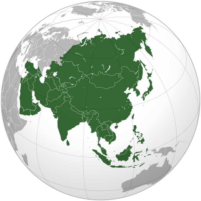
Greenland / North America / 2018 GDP 3 Billion Dollar/ Kalaallit Nunaat (Greenlandic) / Protokoll 21.07.2022
Greenland (Greenlandic: Kalaallit Nunaat, pronounced [kalaːɬit nʉnaːt]; Danish: Grønland, pronounced [ˈkʁɶnˌlænˀ]) is an island country part of the Kingdom of Denmark.[13] It is located between the Arctic and Atlantic oceans, east of the Canadian Arctic Archipelago. Greenland is the world's largest island,[d] it is one of the three constituent countries that form the Kingdom of Denmark, along with Denmark and the Faroe Islands; the citizens of these countries are all Danish nationals.[15] Greenland is divided into five municipalities: Sermersooq, Kujalleq, Qeqqata, Qeqertalik and Avannaata. The northeast of the island composes the unincorporated Northeast Greenland National Park. Thule Air Base is also unincorporated, an enclave within Avannaata municipality administered by the United States Space Force.[16] Greenland's capital is Nuuk.[15]
Though physiographically a part of the continent of North America, Greenland has been politically and culturally associated with Europe (specifically Norway and Denmark, the colonial powers) for more than a millennium, beginning in 986.[17] The majority of its residents are Inuit, whose ancestors migrated from Alaska through Northern Canada, gradually settling across the island by the 13th century.[18]
Today, the population is concentrated mainly on the southwest coast, while the rest of the island is sparsely populated. Three-quarters of Greenland is covered by the only permanent ice sheet outside of Antarctica. With a population of 56,081 (2020),[7] it is the least densely populated region in the world.[19] About a third of the population lives in Nuuk, the capital and largest city; the second-largest city in terms of population is Sisimiut, 320 km (200 mi) north of Nuuk. The Arctic Umiaq Line ferry acts as a lifeline for western Greenland, connecting the various cities and settlements.
Greenland has been inhabited at intervals over at least the last 4,500 years by Arctic peoples whose forebears migrated there from what is now Canada.[20][21] Norsemen settled the uninhabited southern part of Greenland beginning in the 10th century, having previously settled Iceland. These Norsemen later set sail from Greenland and Iceland, with Leif Erikson becoming the first known European to reach North America nearly 500 years before Columbus reached the Caribbean islands. Inuit arrived in the 13th century. Though under continuous influence of Norway and Norwegians, Greenland was not formally under the Norwegian crown until 1261. The Norse colonies disappeared in the late 15th century after Norway was hit by the Black Death and entered a severe decline. Soon after their demise, beginning in 1499, the Portuguese briefly explored and claimed the island, naming it Terra do Lavrador (later applied to Labrador in Canada).[22]
In the early 17th century, Danish explorers reached Greenland again. To strengthen trading and power, Denmark–Norway affirmed sovereignty over the island. Because of Norway's weak status, it lost sovereignty over Greenland in 1814 when the union was dissolved. Greenland became Danish in 1814 and was fully integrated in the Danish state in 1953 under the Constitution of Denmark. With the Constitution of 1953, the people in Greenland became citizens of Denmark. From 1961 Greenland joined the European Free Trade Association (EFTA), which Denmark joined as a founding member of the EFTA in 1960, but its membership ceased with effect from 1973 when Denmark joined the European Communities. In 1973, Greenland joined the European Economic Community (EEC) with Denmark. However, in a referendum in 1982, a majority of the population voted for Greenland to withdraw from the EEC. This was effected in 1985, changing Greenland to an OCT (Overseas Countries and Territories) associated with the EEC, now the European Union (EU). The associated relationship with the EU also means that all Greenlandic nationals (OCT-nationals) are EU citizens.[23]
Greenland contains the world's largest and northernmost national park, Northeast Greenland National Park (Kalaallit Nunaanni nuna eqqissisimatitaq). Established in 1974 and expanded to its present size in 1988, it protects 972,001 km2 (375,292 sq mi) of the interior and northeastern coast of Greenland and is bigger than all but twenty-nine countries in the world.
In 1979, Denmark granted home rule to Greenland; in 2008, Greenlanders voted in favour of the Self-Government Act, which transferred more power from the Danish government to the local Greenlandic government.[24] Under the new structure, Greenland has gradually assumed responsibility for policing, the judicial system, company law, accounting, auditing, mineral resource activities, aviation, law of legal capacity, family law and succession law, immigration and border controls, the working environment, and financial regulation and supervision. The Danish government still retains control of citizenship, monetary policy and foreign affairs including defence. It also provided an initial annual subsidy of DKK 3.4 billion, which will diminish gradually. Greenland expects to grow its economy based on increased income from the extraction of natural resources. The capital, Nuuk, held the 2016 Arctic Winter Games. At 70%, Greenland has one of the highest shares of renewable energy in the world, mostly coming from hydropower.

Costa Rica / Central America / Capital San Jose / Republic of Costa Rica / República de Costa Rica (Spanish) / Protokoll 06.04.2022
Costa Rica (UK: /ˌkɒstə ˈriːkə/, US: /ˌkoʊstə/ (audio speaker iconlisten); Spanish: [ˈkosta ˈrika]; literally "Rich Coast"), officially the Republic of Costa Rica (Spanish: República de Costa Rica), is a country in Central America, bordered by Nicaragua to the north, the Caribbean Sea to the northeast, Panama to the southeast, the Pacific Ocean to the southwest, and maritime border with Ecuador to the south of Cocos Island. It has a population of around five million[10][11] in a land area of 51,060 km2 (19,710 sq mi). An estimated 333,980 people live in the capital and largest city, San José, with around two million people in the surrounding metropolitan area.[12]
The sovereign state is a unitary presidential constitutional republic. It is known for its long-standing and stable democracy, and for its highly educated workforce.[13] The country spends roughly 6.9% of its budget (2016) on education, compared to a global average of 4.4%.[13] Its economy, once heavily dependent on agriculture, has diversified to include sectors such as finance, corporate services for foreign companies, pharmaceuticals, and ecotourism. Many foreign manufacturing and services companies operate in Costa Rica's Free Trade Zones (FTZ) where they benefit from investment and tax incentives.[14]
Costa Rica was inhabited by indigenous peoples before coming under Spanish rule in the 16th century. It remained a peripheral colony of the empire until independence as part of the First Mexican Empire, followed by membership in the Federal Republic of Central America, from which it formally declared independence in 1847. Following the brief Costa Rican Civil War in 1948, it permanently abolished its army in 1949, becoming one of only a few sovereign nations without a standing army.[15][16][17]
The country has consistently performed favorably in the Human Development Index (HDI), placing 62nd in the world as of 2020, and fifth in Latin America.[9] It has also been cited by the United Nations Development Programme (UNDP) as having attained much higher human development than other countries at the same income levels, with a better record on human development and inequality than the median of the region.[18] It also performs well in comparisons of the state of democracy, press freedom and subjective happiness. It has the 7th freest press according to the Press Freedom Index, it is the 37th most democratic country according to the Freedom in the World index and it is the 12th happiest country in the World Happiness Report.
El Salvador / Central America / "God, Union, Liberty"Motto: Dios, Unión, Libertad / Protokoll 21.07.2022
El Salvador (/ɛl ˈsælvədɔːr/ (listen); Spanish: [el salβaˈðoɾ] (listen), meaning "The Saviour"), officially the Republic of El Salvador (Spanish: República de El Salvador), is a country in Central America. It is bordered on the northeast by Honduras, on the northwest by Guatemala, and on the south by the Pacific Ocean. El Salvador's capital and largest city is San Salvador. The country's population in 2021 is estimated to be 6.8 million.[5]
Among the Mesoamerican nations that historically controlled the region are the Lenca[13] (after 600 AD),[14] the Mayans,[15] and then the Cuzcatlecs.[16] Archaeological monuments also suggest an early Olmec presence around the first millennium BC.[17] In the beginning of the 16th century, the Spanish Empire conquered the Central American territory, incorporating it into the Viceroyalty of New Spain ruled from Mexico City. However the Viceroyalty of Mexico had little to no influence in the daily affairs of the isthmus, which was colonized in 1524. In 1609, the area was declared the Captaincy General of Guatemala by the Spanish, which included the territory that would become El Salvador until its independence from Spain in 1821. It was forcibly incorporated into the First Mexican Empire, then seceded, joining the Federal Republic of Central America in 1823. When the federation dissolved in 1841, El Salvador became a sovereign state, then formed a short-lived union with Honduras and Nicaragua called the Greater Republic of Central America, which lasted from 1895 to 1898.[18][19][20]
From the late 19th to the mid-20th century, El Salvador endured chronic political and economic instability characterized by coups, revolts, and a succession of authoritarian rulers. Persistent socioeconomic inequality and civil unrest culminated in the Salvadoran Civil War from 1979 to 1992, fought between the military-led government backed by the United States, and a coalition of left-wing guerrilla groups. The conflict ended with the Chapultepec Peace Accords. This negotiated settlement established a multiparty constitutional republic, which remains in place to this day.
During the civil war, large numbers of Salvadorans emigrated to the United States. By 2008, they were one of the largest immigrant groups in the US.[21]
El Salvador's economy has historically been dominated by agriculture, beginning with the Spanish taking control of the indigenous cacao crop in the 16th century, with production centered in Izalco, along with balsam from the ranges of La Libertad and Ahuachapan. This was followed by a boom in use of the indigo plant in the 19th century, mainly for its use as a dye.[22][23] Thereafter the focus shifted to coffee, which by the early 20th century accounted for 90% of export earnings.[24][25] El Salvador has since reduced its dependence on coffee and embarked on diversifying its economy by opening up trade and financial links and expanding the manufacturing sector.[26] The colón, the currency of El Salvador since 1892, was replaced by the United States dollar in 2001.[27]
El Salvador ranks 124th among 189 countries in the Human Development Index.[28] Despite high rates of poverty and gang-related violent crime, as of 2019 economic improvements had led to El Salvador experiencing the lowest level of income inequality among countries in Latin America and the Caribbean.[29] Among 77 countries included in a 2021 study, El Salvador had one of the least complex economies for doing business.
Guatemala / "Libre Crezca Fecundo"[1] (Spanish) (English: "Grow Free and Fertile") / UTC−6 (CST) / Protokoll 21.07.2022
Guatemala (/ˌɡwɑːtəˈmɑːlə/ (listen) GWAH-tə-MAH-lə; Spanish: [ɡwateˈmala] (listen)), officially the Republic of Guatemala (Spanish: República de Guatemala), is a country in Central America. It is bordered to the north and west by Mexico; to the northeast by Belize and the Caribbean; to the east by Honduras; to the southeast by El Salvador and to the south by the Pacific Ocean. With an estimated population of around 17.6 million,[7][8] it is the most populous country in Central America and is the 11th most populous country in the Americas. Guatemala is a representative democracy; its capital and largest city is Nueva Guatemala de la Asunción, also known as Guatemala City, the largest city in Central America.
The core of the Maya civilization, which extended across Mesoamerica, was historically based in the territory of modern Guatemala. In the 16th century, most of this area was conquered by the Spanish and claimed as part of the viceroyalty of New Spain. Guatemala attained independence in 1821 from Spain and Mexico. In 1823 Guatemala became part of the Federal Republic of Central America, which dissolved by 1841.
From the mid- to late 19th century, Guatemala suffered chronic instability and civil strife. Beginning in the early 20th century, it was ruled by a series of dictators backed by the United Fruit Company and the United States government. In 1944, the authoritarian leader Jorge Ubico was overthrown by a pro-democratic military coup, initiating a decade-long revolution that led to sweeping social and economic reforms. A U.S.-backed military coup in 1954 ended the revolution and installed a dictatorship.[9]
From 1960 to 1996, Guatemala endured a bloody civil war fought between the US-backed government and leftist rebels, including genocidal massacres of the Maya population perpetrated by the military.[10][11][12] Since a United Nations–negotiated peace accord, Guatemala has achieved both economic growth and successful democratic elections, although its people experience high rates of poverty and crime, drug cartels, and instability. As of 2014, Guatemala ranks 31st of 33 Latin American and Caribbean countries in terms of the Human Development Index.[13] Although Guatemala is rich in export goods, around a quarter of the population lived in precarious conditions (2022). The food crisis resulting from the Russian invasion of Ukraine had added another 700,000 people to the number. According to the National Institute for Food Security (Sesan), 4.6 million of Guatemala's 17.4 million people are at risk of food insecurity.[14]
Guatemala's abundance of biologically significant and unique ecosystems includes many endemic species and contributes to Mesoamerica's designation as a biodiversity hotspot.
Nicaragua /Central America / Motto: En Dios confiamos (Spanish) "In God We Trust" / President Daniel Ortega / Protokoll 21.07.2022
Nicaragua (/ˌnɪkəˈrɑːɡwə, -ˈræɡ-, -ɡjuə/ (listen); Spanish: [nikaˈɾaɣwa] (listen)), officially the Republic of Nicaragua (Spanish: República de Nicaragua (help·info)), is the largest country in the Central American isthmus, bordered by Honduras to the northwest, the Caribbean to the east, Costa Rica to the south, and the Pacific Ocean to the southwest. Managua is the country's capital and largest city. As of 2015, it was estimated to be the second largest city in Central America. The multi-ethnic population of six million includes people of mestizo, indigenous, European and African heritage. The main language is Spanish. Indigenous tribes on the Mosquito Coast speak their own languages and English.
Originally inhabited by various indigenous cultures since ancient times, the region was conquered by the Spanish Empire in the 16th century. Nicaragua gained independence from Spain in 1821. The Mosquito Coast followed a different historical path, being colonized by the English in the 17th century and later coming under British rule. It became an autonomous territory of Nicaragua in 1860 and its northernmost part was transferred to Honduras in 1960. Since its independence, Nicaragua has undergone periods of political unrest, dictatorship, occupation and fiscal crisis, including the Nicaraguan Revolution of the 1960s and 1970s and the Contra War of the 1980s.
The mixture of cultural traditions has generated substantial diversity in folklore, cuisine, music, and literature, particularly the latter, given the literary contributions of Nicaraguan poets and writers such as Rubén Darío. Known as the "land of lakes and volcanoes",[11][12] Nicaragua is also home to the Bosawás Biosphere Reserve, the second-largest rainforest of the Americas.[13] The biological diversity, warm tropical climate and active volcanoes make Nicaragua an increasingly popular tourist destination.[14][15] Nicaragua is a founding member of the United Nations,[16] joined the Non-Aligned Movement early,[17] Organization of American States,[18] ALBA[19] and the Community of Latin American and Caribbean States.[20]
Panama / Central America / Panama City / President Laurentino Cortizo / UTC−5 (EST) / Protokoll 21.07.2022
Panama (/ˈpænəmɑː/ (listen) PAN-ə-mah, /pænəˈmɑː/ pan-ə-MAH; Spanish: Panamá IPA: [panaˈma] (listen)), officially the Republic of Panama (Spanish: República de Panamá), is a transcontinental country in Central America[10] and South America, bordered by Costa Rica to the west, Colombia to the southeast, the Caribbean Sea to the north, and the Pacific Ocean to the south. Its capital and largest city is Panama City, whose metropolitan area is home to nearly half the country's 4 million people.
Panama was inhabited by indigenous tribes before Spanish colonists arrived in the 16th century. It broke away from Spain in 1821 and joined the Republic of Gran Colombia, a union of Nueva Granada, Ecuador, and Venezuela. After Gran Colombia dissolved in 1831, Panama and Nueva Granada eventually became the Republic of Colombia. With the backing of the United States, Panama seceded from Colombia in 1903, allowing the construction of the Panama Canal to be completed by the United States Army Corps of Engineers between 1904 and 1914. The 1977 Torrijos–Carter Treaties agreed to transfer the canal from the United States to Panama on December 31, 1999.[13] The surrounding territory was first returned in 1979.[14]
Revenue from canal tolls continues to represent a significant portion of Panama's GDP, although commerce, banking, and tourism are major and growing sectors. It is regarded as having a high-income economy.[15] In 2019 Panama ranked 57th in the world in terms of the Human Development Index.[9] In 2018, Panama was ranked the seventh-most competitive economy in Latin America, according to the World Economic Forum's Global Competitiveness Index.[16] Covering around 40 percent of its land area, Panama's jungles are home to an abundance of tropical plants and animals – some of them found nowhere else on earth.[17] Panama is a founding member of the United Nations and other international organizations such as OAS, LAIA, G77, WHO, and NAM.
CARIBBEAN( World Economic Model )Weltwirtschaftsmodell
Antigua & Barbuda / CARIBBEAN Archipelago / Commonwealth / King Charles III / Explored by Christopher Columbus in1493 / Protokoll 12.09.2022 AD
Antigua and Barbuda (/ænˈtiːɡ(w)ə ... bɑːrˈb(j)uːdə/ (audio speaker iconlisten); an-TEE-g(w)ə ... Barb-YOO-də) is a sovereign island country in the West Indies in the Americas, lying between the Caribbean Sea and the Atlantic Ocean. It consists of two major islands, Antigua and Barbuda separated by around 40 km (25 mi), and smaller islands (including Great Bird, Green, Guiana, Long, Maiden, Prickly Pear, York Islands, Redonda). The permanent population number is about 97,120 (2019 est.), with 97% residing on Antigua.[2] The capital and largest port and city is St. John's on Antigua, with Codrington being the largest town on Barbuda. Lying near each other, Antigua and Barbuda are in the middle of the Leeward Islands, part of the Lesser Antilles, roughly at 17°N of the equator.
The island of Antigua was explored by Christopher Columbus in 1493 and named for the Church of Santa María La Antigua.[6] Antigua was colonized by Britain in 1632; Barbuda island was first colonised in 1678.[6] Having been part of the Federal Colony of the Leeward Islands from 1871, Antigua and Barbuda joined the West Indies Federation in 1958.[7] With the breakup of the federation, it became one of the West Indies Associated States in 1967.[8] Following self-governance in its internal affairs, independence was granted from the United Kingdom on 1 November 1981. Antigua and Barbuda is a member of the Commonwealth and Elizabeth II is the country's queen and head of state.[9]
The economy of Antigua and Barbuda is particularly dependent on tourism, which accounts for 80% of GDP. Like other island nations, Antigua and Barbuda is particularly vulnerable to the effects of climate change, such as sea level rise, and increased intensity of extreme weather like hurricanes, which have direct impacts on the island through coastal erosion, water scarcity, and other challenges.[10] As of 2019, Antigua and Barbuda has a 0% individual income tax rate,[11] as does neighboring St. Kitts and Nevis.
The Bahamas / Caribbean /700 Islands /Commonwealth of The Bahamas/UTC-5(EST)UTC-4 (EDT) Eastern Time Zone / Protokoll 26.02.2022
The Bahamas (/bəˈhɑːməz/ (audio speaker iconlisten)), known officially as the Commonwealth of The Bahamas,[12] is a sovereign country within the Lucayan Archipelago of the West Indies in the Atlantic. It takes up 97% of the Lucayan Archipelago's land area and is home to 88% of the archipelago's population. The archipelagic state consists of more than 700 islands, cays, and islets in the Atlantic Ocean, and is located north of Cuba and northwest of the island of Hispaniola (split between Haiti and the Dominican Republic) and the Turks and Caicos Islands, southeast of the American state of Florida, and east of the Florida Keys. The capital is Nassau on the island of New Providence. The Royal Bahamas Defence Force describes The Bahamas' territory as encompassing 470,000 km2 (180,000 sq mi) of ocean space.
The Bahama Islands were inhabited by the Lucayans, a branch of the Arawakan-speaking Taíno, for many centuries.[13] Columbus was the first European to see the islands, making his first landfall in the "New World" in 1492. Later, the Spanish shipped the native Lucayans to and enslaved them on Hispaniola, after which the Bahama islands were mostly deserted from 1513 until 1648, when English colonists from Bermuda settled on the island of Eleuthera.
The Bahamas became a British crown colony in 1718, when the British clamped down on piracy. After the American Revolutionary War, the Crown resettled thousands of American Loyalists to the Bahamas; they took enslaved people with them and established plantations on land grants. African enslaved people and their descendants constituted the majority of the population from this period on. The slave trade was abolished by the British in 1807; slavery in the Bahamas was abolished in 1834. Subsequently, the Bahamas became a haven for freed African slaves. Africans liberated from illegal slave ships were resettled on the islands by the Royal Navy, while some North American slaves and Seminoles escaped to the Bahamas from Florida. Bahamians were even known to recognise the freedom of enslaved people carried by the ships of other nations which reached the Bahamas. Today Afro-Bahamians make up 90% of the population of 332,634.[13]
The country gained governmental independence in 1973, led by Sir Lynden O. Pindling, with Elizabeth II as its queen.[13] In terms of gross domestic product per capita, The Bahamas is one of the richest countries in the Americas (following the United States and Canada), with an economy based on tourism and offshore finance.[
Barbados / Island Country / West Indies / Caribbean Archipelago / Western Part of North Atlantic / Central America / Protokoll 26.02.2022
Barbados is an island country in the Lesser Antilles of the West Indies, in the Caribbean region of the Americas, and the most easterly of the Caribbean Islands. It is 34 kilometres (21 miles) in length and up to 23 km (14 mi) in width, covering an area of 432 km2 (167 sq mi). It is in the western part of the North Atlantic, 100 km (62 mi) east of the Windward Islands and the Caribbean Sea.[7] Barbados is located roughly 13°N of the equator. It is about 168 km (104 mi) east of both the countries of Saint Lucia and Saint Vincent and the Grenadines and 180 km (110 mi) south-east of Martinique and 400 km (250 mi) north-east of Trinidad and Tobago. Barbados is outside the principal Atlantic hurricane belt. Its capital and largest city is Bridgetown. Inhabited by Kalinago people since the 13th century, and prior to that by other Amerindians, Spanish navigators took possession of Barbados in the late 15th century, claiming it for the Crown of Castile. It first appeared on a Spanish map in 1511.[8] The Portuguese Empire claimed the island between 1532 and 1536, but abandoned it in 1620 with their only remnants being an introduction of wild boars for a good supply of meat whenever the island was visited. An English ship, the Olive Blossom, arrived in Barbados on 14 May 1625; its men took possession of the island in the name of King James I. In 1627, the first permanent settlers arrived from England, and Barbados became an English and later British colony.[9] During this period, the colony operated on a plantation economy, relying on the labour of enslaved Africans who worked on the island's plantations. The slave trade to the island continued until it was outlawed by the Slave Trade Act 1807, with final emancipation of the enslaved population in Barbados occurring over a period of five years following the Slavery Abolition Act 1833.
On 30 November 1966, Barbados became an independent state and Commonwealth realm with Elizabeth II as Queen of Barbados. In October 2021, Sandra Mason was elected by Parliament to become the first President of Barbados. On 30 November 2021, Mason replaced Queen Elizabeth as head of state, with Barbados transitioning to a republic within the Commonwealth of Nations.[10][11]
Barbados's population of 287,000 is predominantly of African descent. While it is an Atlantic island, Barbados is closely associated with the Caribbean and is ranked as one of its leading tourist destinations.
Belize / Maya Civilization / Caribbean Country / Central America / 420 Thousand Population (2020) / Motto: Sub umbra floreo (Latin) "Under the shade I flourish" / Protokoll 26.02.2022
Belize (/bəˈliːz/ (audio speaker iconlisten)) is a Caribbean country located on the northeastern coast of Central America. Belize borders Mexico to the north, the Caribbean Sea to the east and Guatemala to the west and south. It has an area of 22,970 square kilometres (8,867 sq mi) and a population of 419,199 (2020).[6] Its mainland is about 290 km (180 mi) long and 110 km (68 mi) wide. It has the lowest population and population density in Central America. The country's population growth rate of 1.87% per year (2018 estimate) is the second highest in the region and one of the highest in the Western Hemisphere. Its capital is Belmopan, and its largest city is Belize City.
The Maya civilization spread into the area of Belize between 1500 BC and AD 300 and flourished until about 1200.[12] European contact began in 1492 when Christopher Columbus sailed along the Gulf of Honduras.[13] European exploration was begun by English settlers in 1638. This period was also marked by Spain and Britain both laying claim to the land until Britain defeated the Spanish in the Battle of St. George's Caye (1798).[14] It became a British colony in 1840, known as British Honduras, and a Crown colony in 1862. Independence was achieved from the United Kingdom on 21 September 1981.
Belize has a diverse society that is composed of many cultures and languages that reflect its rich history. It is the only Central American country where English is the official language, while Belizean Creole is the most widely spoken dialect. Spanish is the second most commonly spoken language, followed by Mayan languages, German dialects, and Garifuna. Over half the population is multilingual, due to the diverse linguistic backgrounds of the population. It is known for its September Celebrations, its extensive barrier reef coral reefs, and punta music.[15][16]
Belize's abundance of terrestrial and marine species and its diversity of ecosystems give it a key place in the globally significant Mesoamerican Biological Corridor.[17] It is considered a Central American and Caribbean nation with strong ties to both the American and Caribbean regions.[18] It is a member of the Caribbean Community (CARICOM), the Community of Latin American and Caribbean States (CELAC), and the Central American Integration System (SICA), the only country to hold full membership in all three regional organizations. Belize is the only mainland Central American country which is a Commonwealth realm, with Queen Elizabeth II as its monarch and head of state, represented by a Governor General (currently, Froyla Tzalam). Belize is considered a tax haven.
Dominica / Officially Commonwealth of Dominica / Caribbean /Motto : "Apres Bondie, C'est La Ter"[1] (Dominican Creole French) "Post Deum terra est" (Latin) "After God is the earth" / Protokoll 26.02.2022
Dominica (/ˌdɒmɪˈniːkə/ (audio speaker iconlisten)[9][10][11] or /dəˈmɪnɪkə/ (audio speaker iconlisten);[12] Kalinago: Wai‘tu kubuli; French: Dominique; Dominican Creole French: Dominik), officially the Commonwealth of Dominica, is an island country in the Caribbean.[13] The capital, Roseau, is located on the western side of the island. It is geographically situated as part of the Windward Islands chain in the Lesser Antilles archipelago in the Caribbean Sea. The island is surrounded by the French Republic with Guadeloupe to the northwest and Martinique to the south-southeast. Its area is 750 km2 (290 sq mi), and the highest point is Morne Diablotins, at 1,447 m (4,747 ft) in elevation. The population was 71,293 at the 2011 census.[6]
The island was settled by the Arawak arriving from South America in the fifth century. The Kalinago displaced the Arawak by the 15th century. Columbus is said to have passed the island on Sunday, 3 November 1493. It was later colonised by Europeans, predominantly by the French from the 1690s to 1763. The French imported enslaved people from West Africa to Dominica to work on coffee plantations. Great Britain took possession in 1763 after the Seven Years' War, and it gradually established English as its official language. The island gained independence as a republic in 1978.
Dominica has been nicknamed the "Nature Island of the Caribbean" for its natural environment.[14] It is the youngest island in the Lesser Antilles, and in fact it is still being formed by geothermal-volcanic activity, as evidenced by the world's second-largest hot spring, called Boiling Lake. The island has lush mountainous rainforests, and it is the home of many rare plants, animals, and bird species. There are xeric areas in some of the western coastal regions, but heavy rainfall occurs inland. The Sisserou parrot, also known as the imperial amazon and found only on Dominica, is the island's national bird and featured on the national flag, making it one of the only two sovereign nations whose official flag features the color purple.[15][16] The country is a member of the Commonwealth of Nations, the United Nations, the Organization of American States, the Organisation internationale de la Francophonie, and the Non-Aligned Movement.
Grenada / Caribbean Archipelago / Known as Island of Spice / Motto: "Ever Conscious of God We Aspire, Build and Advance as One People" / Protokoll 26.02.2022
Grenada (/ɡrəˈneɪdə/ (audio speaker iconlisten) grə-NAY-də; Grenadian Creole French: Gwenad) is an island country in the West Indies in the Caribbean Sea at the southern end of the Grenadines island chain. Grenada consists of the island of Grenada itself, two smaller islands, Carriacou and Petite Martinique, and several small islands which lie to the north of the main island and are a part of the Grenadines. It is located northwest of Trinidad and Tobago, northeast of Venezuela and southwest of Saint Vincent and the Grenadines. Its size is 348.5 square kilometres (134.6 sq mi), and it had an estimated population of 112,523 in July 2020.[8] Its capital is St. George's.[8] Grenada is also known as the "Island of Spice" due to its production of nutmeg and mace crops.[9]
Coordinates: 12°07′N 61°40′WBefore the arrival of Europeans in the Americas, Grenada was inhabited by the indigenous peoples from South America.[10] Christopher Columbus sighted Grenada in 1498 during his third voyage to the Americas.[8] Following several unsuccessful attempts by Europeans to colonise the island due to resistance from resident Island Caribs, French settlement and colonisation began in 1649 and continued for the next century.[11] On 10 February 1763, Grenada was ceded to the British under the Treaty of Paris. British rule continued until 1974 (except for a brief French takeover between 1779 and 1783).[12] However, on 3 March 1967, it was granted full autonomy over its internal affairs as an Associated State, and from 1958 to 1962 Grenada was part of the Federation of the West Indies, a short-lived federation of British West Indian colonies.
Independence was granted on 7 February 1974 under the leadership of Eric Gairy, who became the first Prime Minister of Grenada of the sovereign state. The new country became a member of the Commonwealth, with Queen Elizabeth as Head of State.[8] In March 1979, the Marxist–Leninist New Jewel Movement overthrew Gairy's government in a bloodless coup d'état and established the People's Revolutionary Government (PRG), headed by Maurice Bishop as Prime Minister.[13] Bishop was later arrested and executed by members of the People's Revolutionary Army, prompting a U.S.-led invasion in October 1983. Since then, the island has returned to a parliamentary representative democracy and has remained politically stable
Guyana / Republic of Guyana / North of the Amazon River / Anthem: "Dear Land of Guyana, of Rivers and Plains"/ Protokoll 26.02.2022
Guyana (/ɡaɪˈɑːnə/ (audio speaker iconlisten) or /ɡaɪˈænə/ (audio speaker iconlisten)),[8][9] officially the Co‑operative Republic of Guyana,[10] is a country on the northern mainland of South America and the capital city is Georgetown. Guyana is bordered by the Atlantic Ocean to the north, Brazil to the south and southwest, Venezuela to the west, and Suriname to the east. With 215,000 square kilometres (83,000 sq mi), Guyana is the third-smallest sovereign state by area in mainland South America after Uruguay and Suriname, and is also the second-least populous sovereign state in South America after Suriname. It has a wide variety of natural habitats and very high biodiversity.
The region known as "the Guianas" consists of the large shield landmass north of the Amazon River and east of the Orinoco River known as the "land of many waters". There are nine indigenous tribes residing in Guyana: the Wai Wai, Macushi, Patamona, Lokono, Kalina, Wapishana, Pemon, Akawaio and Warao. Historically dominated by the Lokono and Kalina tribes, Guyana was colonised by the Dutch before coming under British control in the late 18th century. It was governed as British Guiana, with a mostly plantation-style economy until the 1950s. It gained independence in 1966, and officially became a republic within the Commonwealth of Nations in 1970. The legacy of British rule is reflected in the country's political administration and diverse population, which includes Indian, African, Amerindian, Chinese, Portuguese, other European, and various multiracial groups. In 2017, 41% of the population of Guyana lived below the poverty line.[11]
Guyana is the only South American nation in which English is the official language. The majority of the population, however, speak Guyanese Creole, an English-based creole language, as a first language. Guyana is part of the Anglophone Caribbean. It is part of the mainland Caribbean region maintaining strong cultural, historical, and political ties with other Caribbean countries as well as headquarters for the Caribbean Community (CARICOM). In 2008, the country joined the Union of South American Nations as a founding member.
Haiti / Caribbean Archipelago / Republic of Haiti / East of Cuba & Jamaica South ( President Ariel Henry ) / Protokoll 26.02.2022
Haiti (/ˈheɪti/ (audio speaker iconlisten); French: Haïti [a.iti]; Haitian Creole: Ayiti [ajiti]), officially the Republic of Haiti (French: République d'Haïti; Haitian Creole: Repiblik d Ayiti),[11] and formerly known as Hayti,[note 1] is a country located on the island of Hispaniola in the Greater Antilles archipelago of the Caribbean Sea, to the east of Cuba and Jamaica and south of The Bahamas and the Turks and Caicos Islands. It occupies the western three-eighths of the island which it shares with the Dominican Republic.[17][18] To its south-west lies the small Navassa Island, which is claimed by Haiti but is disputed as a United States territory under federal administration.[19][20] Haiti is 27,750 km2 (10,714 sq mi) in size, the third largest country in the Caribbean by area, and has an estimated population of 11.4 million,[6][7] making it the most populous country in the Caribbean. The capital is Port-au-Prince.
The island was originally inhabited by the indigenous Taíno people, who originated in South America.[21] The first Europeans arrived on 5 December 1492 during the first voyage of Christopher Columbus, who initially believed he had found India or China.[22] Columbus subsequently founded the first European settlement in the Americas, La Navidad, on what is now the northeastern coast of Haiti.[23][24][25][26] The island was claimed by Spain and named La Española, forming part of the Spanish Empire until the early 17th century. However, competing claims and settlements by the French led to the western portion of the island being ceded to France in 1697, which was subsequently named Saint-Domingue. French colonists established lucrative sugarcane plantations, worked by vast numbers of slaves brought from Africa, which made the colony one of the richest in the world.
In the midst of the French Revolution (1789–99), slaves and free people of color launched the Haitian Revolution (1791–1804), led by a former slave and the first black general of the French Army, Toussaint Louverture. After 12 years of conflict, Napoleon Bonaparte's forces were defeated by Louverture's successor, Jean-Jacques Dessalines (later Emperor Jacques I), who declared Haiti's sovereignty on 1 January 1804—the first independent nation of Latin America and the Caribbean, the second republic in the Americas, the first country in the Americas to abolish slavery, and the only state in history established by a successful slave revolt.[27][28] Apart from Alexandre Pétion, the first President of the Republic, all of Haiti's first leaders were former slaves.[29] After a brief period in which the country was split in two, President Jean-Pierre Boyer united the country and then attempted to bring the whole of Hispaniola under Haitian control, precipitating a long series of wars that ended in the 1870s when Haiti formally recognized the independence of the Dominican Republic.
Haiti's first century of independence was characterized by political instability, ostracism by the international community and the payment of a crippling debt to France. Political volatility and foreign economic influence in the country prompted the U.S. to occupy the country from 1915 to 1934. Following a series of short-lived presidencies, François 'Papa Doc' Duvalier took power in 1956, ushering in a long period of autocratic rule continued by his son, Jean-Claude 'Baby Doc' Duvalier, that lasted until 1986; the period was characterized by state-sanctioned violence against the opposition and civilians, corruption, and economic stagnation. After 1986, Haiti began attempting to establish a more democratic political system.
Haiti is a founding member of the United Nations, Organization of American States (OAS),[30] Association of Caribbean States,[31] and the Organisation internationale de la Francophonie. In addition to CARICOM, it is a member of the International Monetary Fund,[32] World Trade Organization,[33] and the Community of Latin American and Caribbean States. Historically poor and politically unstable, Haiti has the lowest Human Development Index in the Americas. Since the turn of the 21st century, the country has endured a coup d'état, which prompted U.N. intervention, as well as a catastrophic earthquake that killed over 250,000 people.
Jamaica / Caribbean Archipelago / Motto: "Out of Many, One People"/ Main Capital / Kingston 17°58′17″N 76°47′35″ / Protokoll 26.02.2022
Jamaica (/dʒəˈmeɪkə/ (audio speaker iconlisten); Jamaican Patois: Jumieka) is an island country situated in the Caribbean Sea. Spanning 10,990 square kilometres (4,240 sq mi) in area, it is the third-largest island of the Greater Antilles and the Caribbean (after Cuba and Hispaniola).[11] Jamaica lies about 145 kilometres (90 mi) south of Cuba, and 191 kilometres (119 mi) west of Hispaniola (the island containing the countries of Haiti and the Dominican Republic); the British Overseas Territory of the Cayman Islands lies some 215 kilometres (134 mi) to the north-west.[11]
Originally inhabited by the indigenous Taíno peoples, the island came under Spanish rule following the arrival of Christopher Columbus in 1494. Many of the indigenous people either were killed or died of diseases, after which the Spanish brought large numbers of African slaves to Jamaica as labourers.[11] The island remained a possession of Spain until 1655, when England (later Great Britain) conquered it, renaming it Jamaica. Under British colonial rule Jamaica became a leading sugar exporter, with a plantation economy dependent on the African slaves and later their descendants. The British fully emancipated all slaves in 1838, and many freedmen chose to have subsistence farms rather than to work on plantations. Beginning in the 1840s, the British began using Chinese and Indian indentured labour to work on plantations. The island achieved independence from the United Kingdom on 6 August 1962.[11]
With 2.9 million people,[12][13] Jamaica is the third-most populous Anglophone country in the Americas (after the United States and Canada), and the fourth-most populous country in the Caribbean. Kingston is the country's capital and largest city. The majority of Jamaicans are of Sub-Saharan African ancestry, with significant European, East Asian (primarily Chinese), Indian, Lebanese, and mixed-race minorities.[11] Due to a high rate of emigration for work since the 1960s, there is a large Jamaican diaspora, particularly in Canada, the United Kingdom, and the United States. The country has a global influence that belies its small size; it was the birthplace of the Rastafari religion, reggae music (and associated genres such as dub, ska and dancehall), and it is internationally prominent in sports, most notably cricket, sprinting and athletics.[14][15][16][17]
Jamaica is an upper-middle income country[17] with an economy heavily dependent on tourism; it has an average of 4.3 million tourists a year.[18] Jamaica performs favourably in measurements of press freedom and democratic governance. It ranked first in the Caribbean on the World Happiness Report for 2021.[19] Politically it is a Commonwealth realm, with Elizabeth II as its queen.[11] Her appointed representative in the country is the Governor-General of Jamaica, an office held by Patrick Allen since 2009. Andrew Holness has served as Prime Minister of Jamaica since March 2016. Jamaica is a parliamentary constitutional monarchy with legislative power vested in the bicameral Parliament of Jamaica, consisting of an appointed Senate and a directly elected House of Representatives.
Montserrat / CARIBBEAN Archipelago /Motto: "A people of excellence, moulded by nature, nurtured by God" Anthem: "God Save the Queen" / Volcanic Dormant Activities / Protokoll 26.02.2022
Montserrat (/ˌmɒntsəˈræt/ MONT-sə-RAT) is a British Overseas Territory in the Caribbean. The island is in the Leeward Islands, which is part of the chain known as the Lesser Antilles, in the West Indies. Montserrat measures approximately 16 km (10 mi) in length and 11 km (7 mi) in width, with approximately 40 km (25 mi) of coastline.[4] Montserrat is nicknamed "The Emerald Isle of the Caribbean" both for its resemblance to coastal Ireland and for the Irish ancestry of many of its inhabitants.[5][6] Montserrat is the only non-fully sovereign full member of the Caribbean Community and the Organisation of Eastern Caribbean States.
On 18 July 1995, the previously dormant Soufrière Hills volcano, in the southern part of the island, became active. Eruptions destroyed Montserrat's Georgian era capital city of Plymouth. Between 1995 and 2000, two-thirds of the island's population was forced to flee, primarily to the United Kingdom, leaving fewer than 1200 people on the island in 1997 (rising to nearly 5000 by 2016).[7][8] The volcanic activity continues, mostly affecting the vicinity of Plymouth, including its docking facilities, and the eastern side of the island around the former W. H. Bramble Airport, the remnants of which were buried by flows from volcanic activity on 11 February 2010.
An exclusion zone, encompassing the southern half of the island to as far north as parts of the Belham Valley, was imposed because of the size of the existing volcanic dome and the resulting potential for pyroclastic activity. Visitors are generally not permitted entry into the exclusion zone, but a view of the destruction of Plymouth can be seen from the top of Garibaldi Hill in Isles Bay. Relatively quiet since early 2010, the volcano continues to be closely monitored by the Montserrat Volcano Observatory.[9][10]
A new town and port are being developed at Little Bay, which is on the northwest coast of the island. While this construction proceeds, the centre of government and businesses is at Brades.
Saint Kitts and Nevis / West Indies & Commonwealth from U.K / Caribbean Archipelago / Protokoll 12.09.2022
Saint Kitts and Nevis (/-ˈkɪts ... ˈniːvɪs/ (audio speaker iconlisten)), officially the Federation of Saint Christopher and Nevis,[8] is an island country in the West Indies. Located in the Leeward Islands chain of the Lesser Antilles, it is the smallest sovereign state in the Western Hemisphere, in both area and population, as well as the world's smallest sovereign federation.[1] The country is a Commonwealth realm, with Elizabeth II as Queen and head of state.[1][9] It is the only sovereign federation in the Caribbean.
The capital city is Basseterre, located on the larger island of Saint Kitts.[1] Basseterre is also the main port for both passenger entry (via cruise ships) and cargo. The smaller island of Nevis lies approximately 3 km (2 mi) to the southeast of Saint Kitts, across a shallow channel called The Narrows.[1]
The British dependency of Anguilla was historically also a part of this union, which was then known collectively as Saint Christopher-Nevis-Anguilla. However, Anguilla chose to secede from the union and remains a British overseas territory.[1] To the north-northwest lie the islands of Sint Eustatius, Saba, Saint Barthélemy, Saint-Martin/Sint Maarten and Anguilla. To the east and northeast are Antigua and Barbuda, and to the southeast is the small uninhabited island of Redonda (part of Antigua and Barbuda) and the island of Montserrat.
Saint Kitts and Nevis were among the first islands in the Caribbean to be colonized by Europeans. Saint Kitts was home to the first British and French colonies in the Caribbean, and thus has also been titled "The Mother Colony of the West Indies".[10] It is also the most recent British territory in the Caribbean to become independent, gaining independence in 1983.
Saint Lucia / Caribbean Isles / Motto: "The Land, The People, The Light" / Time Zone UTC-4(AST)Atlantic Time Zone / Protokoll 26.02.2022
Saint Lucia (UK: /sənt luːˈsiːə, -ˈluːʃə/ (audio speaker iconlisten), US: /seɪnt ˈluːʃə/ (audio speaker iconlisten); French: Sainte-Lucie) is an island country in the West Indies in the eastern Caribbean Sea on the boundary with the Atlantic Ocean.[8] The island was previously called Iyonola, the name given to the island by the native Arawaks, and later Hewanorra, the name given by the native Caribs, two separate Amerindian peoples. Part of the Windward Islands of the Lesser Antilles, it is located north/northeast of the island of Saint Vincent, northwest of Barbados and south of Martinique. It covers a land area of 617 km2 (238 square miles) and reported a population of 165,595 in the 2010 census.[9] St. Lucia's largest city is Castries, its current capital, and its second largest is Soufrière, the first French colonial capital on the island.
The French were the first Europeans to settle on the island. They signed a treaty with the native Island Caribs in 1660. England took control of the island from 1663 to 1667. In ensuing years, it was at war with France fourteen times, and the rule of the island changed frequently. (It was ruled seven times each by the French and British.) In 1814, the British took definitive control of the island. Because it switched so often between British and French control, Saint Lucia was also known as the "Helen of the West" after the Greek mythological character, Helen of Troy.
Representative government came about in 1840. Universal suffrage was established in 1953. From 1958 to 1962, the island was a member of the West Indies Federation. On 22 February 1979, Saint Lucia became an independent state and a member of the Commonwealth of Nations as a Commonwealth realm.[8] Saint Lucia is a mixed jurisdiction,[10] meaning that it has a legal system based in part on both the civil law and English common law. The Civil Code of St. Lucia of 1867 was based on the Quebec Civil Code of 1866, as supplemented by English common law-style legislation. It is also a member of Organisation internationale de la Francophonie.
Saint Vincent and the Grenadines / Caribbean Archipelago / West Indies / Motto: "Pax et Justitia" (Latin)"Peace and Justice" / Protokoll 26.02.2022
Saint Vincent and the Grenadines (/ˌɡrɛnəˈdiːnz/ (audio speaker iconlisten)) is an island country in the Caribbean. It is located in the southeast Windward Islands of the Lesser Antilles, which lie in the West Indies at the southern end of the eastern border of the Caribbean Sea where the latter meets the Atlantic Ocean.
Its 369 km2 (142 sq mi) territory consists of the main island of Saint Vincent and, south of that, two-thirds of the northern part of the Grenadines, a chain of 32 smaller islands. Some of the Grenadines are inhabited — Bequia, Mustique, Union Island, Canouan, Petit Saint Vincent, Palm Island, Mayreau, Young Island — while others are not: Tobago Cays, Baliceaux, Battowia, Quatre, Petite Mustique, Savan and Petit Nevis. Most of Saint Vincent and the Grenadines lies within the Hurricane Alley.
To the north of Saint Vincent lies Saint Lucia, to the east is Barbados, and Grenada lies to the south. Saint Vincent and the Grenadines has a population density of over 300 inhabitants/km2 (700 per sq. mi.), with approximately 110,211 total inhabitants.[2][3]
Kingstown is the capital and main port. Saint Vincent has a British colonial history, and is now part of the Organisation of Eastern Caribbean States, CARICOM, the Commonwealth of Nations, the Bolivarian Alliance for the Americas and the Community of Latin American and the Caribbean States (CELAC).
In April 2021, the La Soufrière volcano erupted several times with "explosive events" continuing. By 12 April, 16,000 residents had evacuated the areas of their homes.[6][7] Assistance and emergency financial support was being provided by several nearby islands, the United Kingdom and agencies such as the United Nations. The first significant offer of long-term funding, of US$20 million, was announced on 13 April 2021 by the World Bank.
Trinidad & Tobago / CARIBBEAN / Island Country / Central America / Time Zone UTC-4(AST) / Currency Trinidad & Tobago Dollar / Protokoll 26.02.2022
Trinidad and Tobago (/ˈtrɪnɪdæd ... təˈbeɪɡoʊ/ (audio speaker iconlisten), /- toʊ-/), officially the Republic of Trinidad and Tobago, is the southernmost island country in the Caribbean and is known for its fossil-fuel wealth.[13][14] Consisting of the main islands Trinidad and Tobago, and numerous much smaller islands, it is situated 130 kilometres (81 miles) south of Grenada and 11 kilometres (6.8 miles) off the coast of northeastern Venezuela.[15] It shares maritime boundaries with Barbados to the northeast, Grenada to the northwest and Venezuela to the south and west.[16][17] Trinidad and Tobago is generally considered to be part of the West Indies. According to some geographic definitions, Trinidad and Tobago are also part of the Windward Islands and Lesser Antilles, while other definitions regard Trinidad and Tobago as a separate island group.
The island of Trinidad was inhabited for centuries by native Amerindian peoples before becoming a colony in the Spanish Empire, following the arrival of Christopher Columbus in 1498. Spanish governor José María Chacón surrendered the island to a British fleet under the command of Sir Ralph Abercromby in 1797.[18] During the same period, the island of Tobago changed hands among Spanish, British, French, Dutch and Courlander colonists more times than any other island in the Caribbean.[citation needed] Trinidad and Tobago were ceded to Britain in 1802 under the Treaty of Amiens as separate states and unified in 1889.[19] Trinidad and Tobago obtained independence in 1962, becoming a republic in 1976.[14][15]
Trinidad and Tobago has the third highest GDP per capita based on purchasing power parity (PPP) in the Americas after the United States and Canada.[20] It is recognised by the World Bank as a high-income economy.[21] Unlike most Caribbean nations and territories, which rely heavily on tourism, the economy is primarily industrial with an emphasis on petroleum and petrochemicals;[22] much of the nation's wealth is derived from its large reserves of oil and natural gas.[23][24]
Trinidad and Tobago is well known for its African and Indian cultures, reflected in its large and famous Carnival, Diwali, and Hosay celebrations, as well being the birthplace of steelpan, the limbo, and music styles such as calypso, soca, rapso, parang, chutney, and chutney soca
Aruba / Archipelago / Caribbean Isles / Anthem: "Aruba Dushi Tera" (English: "Aruba, Sweet Land") / Time Zone UTC-4:00 (AST) / Protokoll 06.04.2022
Aruba (/əˈruːbə/ ə-ROO-bə, Dutch: [aːˈrubaː, -ryb-] (audio speaker iconlisten), Papiamento: [aˈruba]) is a constituent country of the Kingdom of the Netherlands physically located in the mid-south of the Caribbean Sea, about 29 kilometres (18 mi) north of the Venezuelan peninsula of Paraguaná and 80 kilometres (50 mi) northwest of Curaçao.[5] It measures 32 kilometres (20 mi) long from its northwestern to its southeastern end and 10 kilometres (6 mi) across at its widest point.[5] Together with Bonaire and Curaçao, Aruba forms a group referred to as the ABC islands. Collectively, these and the other three Dutch substantial islands in the Caribbean are often called the Dutch Caribbean, of which Aruba has about one-third of the population. In 1986, it became a constituent country within the Kingdom of the Netherlands, and acquired the formal name the Country of Aruba.
Aruba is one of the four countries that form the Kingdom of the Netherlands, along with the Netherlands, Curaçao, and Sint Maarten; the citizens of these countries are all Dutch nationals.[6] Aruba has no administrative subdivisions, but, for census purposes, is divided into eight regions. Its capital is Oranjestad.[6][5]
Unlike much of the Caribbean region, Aruba has a dry climate and an arid, cactus-strewn landscape.[5][6] The climate has helped tourism, because visitors to the island can expect clear, sunny skies all year.[7][8][9] Its area is 179 km2 (69.1 sq mi) and it is quite densely populated, with 101,484 inhabitants as at the 2010 Census. A January 2019 estimate of the population placed it at 116,600.
Curacao / Southern Caribbean Sea / Time Zone UTC -4:00 ( AST ) /65 km North of Venezuelan Coast / Protokoll 06.04.2022
Curaçao (/ˈkjʊərəsoʊ, -saʊ, ˌkjʊərəˈsoʊ, -ˈsaʊ/ KURE-əss-oh, -ow, -OH, -OW;[7] Dutch: [kyːraːˈsʌu, kuːr-] (audio speaker iconlisten);[8] Papiamento: Kòrsou, [ˈkɔrsɔu̯]) is a Lesser Antilles island country in the southern Caribbean Sea and the Dutch Caribbean region, about 65 km (40 mi) north of the Venezuelan coast. It is a constituent country (Dutch: land) of the Kingdom of the Netherlands.[9] Together with Aruba and Bonaire it forms the ABC islands. Collectively, Curaçao, Aruba and other Dutch islands in the Caribbean are often called the Dutch Caribbean.
Curaçao was formerly part of the Curaçao and Dependencies colony from 1815 to 1954 and later the Netherlands Antilles from 1954 to 2010, as "Island Territory of Curaçao"[10] (Dutch: Eilandgebied Curaçao, Papiamento: Teritorio Insular di Kòrsou) and is now formally called the Country of Curaçao (Dutch: Land Curaçao,[11] Papiamento: Pais Kòrsou).[12][13] It includes the main island of Curaçao and the much smaller, uninhabited island of Klein Curaçao ("Little Curaçao").[13] Curaçao has a population of 158,665[3] (January 2019 est.) and an area of 444 km2 (171 sq mi); its capital is Willemstad.
Climate
Curaçao has a hot, semi-arid climate (Köppen climate classification BSh) with a dry season from January to September and a wet season from October to December.[52] Rainfall is scarce, only 450 millimeters (12 inches) per year; in particular, the rainy season is drier than it normally is in tropical climates; during the dry season, it almost never rains. Owing to the scarcity of rainfall, the landscape of Curaçao is arid; especially on the north coast of the island. Temperatures are relatively constant, with small differences measured throughout the year. The trade winds cool the island during the day and warm it at night. The coolest month is January with an average temperature of 26.6 °C or 80 °F; the hottest is September with an average temperature of 29.1 °C or 84 °F. The year's average maximum temperature is 31.4 °C or 89 °F. The year's average temperature is 25.7 °C or 78 °F. The seawater around Curaçao averages around 27 °C (81 °F) and is coolest (avg. 25.9 °C [78.6 °F]) from February to March, and hottest (avg. 28.2 °C [82.8 °F]) from September to October.[citation needed]
Because Curaçao lies North of the Intertropical Convergence Zone and in an area of low-level divergence where winds flow parallel to the coast, its climate is much drier than expected for the northeastern side of a continent at its latitude. Rainfall is also extremely variable from year to year,[53] being strongly linked to the El Niño Southern Oscillation. As little as 200 millimetres or 8 inches may fall in a strong El Niño year, but as much as 1,150 millimetres or 45 inches is not unknown in powerful La Niña years.
Curaçao lies outside the Atlantic's Hurricane Alley but is still occasionally affected by hurricanes, as with Hurricane Hazel in 1954, Anna in 1961, Felix in 2007, and Omar in 2008. No hurricane has made landfall in Curaçao since the US National Hurricane Center started tracking hurricanes. Curaçao has, however, been directly affected by pre-hurricane tropical storms several times; the latest being Hurricane Tomas in 2010, Cesar in 1996, Joan in 1988, Cora and Greta in 1978, Edith and Irene in 1971, and Francelia in 1969. Tomas brushed past Curaçao as a tropical storm, dropping as much as 265 mm (10.4 in) of rain on the island, nearly half its annual precipitation in a single day.[54] This made Tomas one of the wettest events in the island's history,[55] as well as one of the most devastating; its flooding killed two people and caused over NAƒ50 million (US$28 million) in damage.
The Dominican Republic / Country in the Caribbean / Santo Domingo / Time Zone UTC - 4:00 Atlantic Standart Time / Protokoll 06.04.2022
The Dominican Republic (/dəˈmɪnɪkən/ də-MIN-ik-ən; Spanish: República Dominicana, pronounced [reˈpuβlika ðominiˈkana] (audio speaker iconlisten)) is a country located on the island of Hispaniola in the Greater Antilles archipelago of the Caribbean region. It occupies the eastern five-eighths of the island, which it shares with Haiti,[13][14] making Hispaniola one of only two Caribbean islands, along with Saint Martin, that is shared by two sovereign states. The Dominican Republic is the second-largest nation in the Antilles by area (after Cuba) at 48,671 square kilometers (18,792 sq mi), and third-largest by population, with approximately 10.8 million people (2020 est.), of whom approximately 3.3 million live in the metropolitan area of Santo Domingo, the capital city.[4][15][16] The official language of the country is Spanish.
The native Taíno people had inhabited Hispaniola before the arrival of Europeans, dividing it into five chiefdoms.[4] They had constructed an advanced farming and hunting society, and were in the process of becoming an organized civilization.[17] The Taínos also inhabited Cuba, Jamaica, Puerto Rico, and the Bahamas. The Genoese mariner Christopher Columbus explored and claimed the island for Castile, landing there on his first voyage in 1492.[4] The colony of Santo Domingo became the site of the first permanent European settlement in the Americas and the first seat of Spanish colonial rule in the New World. In 1697, Spain recognized French dominion over the western third of the island, which became the independent state of Haiti in 1804.[4]
After more than three hundred years of Spanish rule, the Dominican people declared independence in November 1821.[4] The leader of the independence movement, José Núñez de Cáceres, intended the Dominican nation to unite with the country of Gran Colombia, but the newly independent Dominicans were forcefully annexed by Haiti in February 1822. Independence came 22 years later in 1844,[4] after victory in the Dominican War of Independence. Over the next 72 years, the Dominican Republic experienced mostly civil wars (financed with loans from European merchants), several failed invasions by its neighbour, Haiti, and brief return to Spanish colonial status, before permanently ousting the Spanish during the Dominican War of Restoration of 1863–1865.[18][19][20] During this period, two presidents were assassinated (Ulises Heureaux in 1899 and Ramón Cáceres in 1911).
The U.S. occupied the Dominican Republic (1916–1924) due to threats of defaulting on foreign debts; a subsequent calm and prosperous six-year period under Horacio Vásquez followed. From 1930 the dictatorship of Rafael Leónidas Trujillo ruled until his assassination in 1961.[4] Juan Bosch was elected president in 1962 but was deposed in a military coup in 1963. A civil war in 1965, the country's last, was ended by U.S. military intervention and was followed by the authoritarian rule of Joaquín Balaguer (1966–1978 and 1986–1996). Since 1978, the Dominican Republic has moved toward representative democracy,[21] and has been led by Leonel Fernández for most of the time after 1996. Danilo Medina succeeded Fernández in 2012, winning 51% of the electoral vote over his opponent ex-president Hipólito Mejía.[22] He was later succeeded by Luis Abinader in the 2020 presidential election.
The Dominican Republic has the largest economy (according to the U.S. State Department and the World Bank) in the Caribbean and Central American region and is the seventh-largest economy in Latin America.[23][24] Over the last 25 years, the Dominican Republic has had the fastest-growing economy in the Western Hemisphere – with an average real GDP growth rate of 5.3% between 1992 and 2018.[25] GDP growth in 2014 and 2015 reached 7.3 and 7.0%, respectively, the highest in the Western Hemisphere.[25] In the first half of 2016, the Dominican economy grew 7.4% continuing its trend of rapid economic growth.[26] Recent growth has been driven by construction, manufacturing, tourism, and mining. The country is the site of the third largest gold mine in the world, the Pueblo Viejo mine.[27][28] Private consumption has been strong, as a result of low inflation (under 1% on average in 2015), job creation, and a high level of remittances. Illegal Haitian immigration is a big problem in the Dominican Republic, putting a strain on the Dominican economy and increasing tensions between Dominicans and Haitians.[29][30][31][32][33] The Dominican Republic is also home to 114,050 illegal immigrants from Venezuela.[4]
The Dominican Republic is the most visited destination in the Caribbean.[34] The year-round golf courses are major attractions.[35] A geographically diverse nation, the Dominican Republic is home to both the Caribbean's tallest mountain peak, Pico Duarte, and the Caribbean's largest lake and lowest point, Lake Enriquillo.[36] The island has an average temperature of 26 °C (78.8 °F) and great climatic and biological diversity.[35] The country is also the site of the first cathedral, castle, monastery, and fortress built in the Americas, located in Santo Domingo's Colonial Zone, a World Heritage Site.[37][38] Baseball is the de facto national sport.
Oceania Australia ( Weltwirtschaftserforschungsmodell)World Economic Model
Papua New Guinea / Oceania / 851 Languages in Country / Motto: ‘Unity in diversity ' / Monarchy King Charles III from U.K / Protokoll 12.09.2022
Papua New Guinea (PNG; /ˈpæp(j)uə ... ˈɡɪni, ˈpɑː-/, also US: /ˈpɑːpwə-, ˈpɑːpjə-, ˈpɑːpə-/;[12] Tok Pisin: Papua Niugini; Hiri Motu: Papua Niu Gini), officially the Independent State of Papua New Guinea (Tok Pisin: Independen Stet bilong Papua Niugini; Hiri Motu: Independen Stet bilong Papua Niu Gini), is a country in Oceania that comprises the eastern half of the island of New Guinea and its offshore islands in Melanesia (a region of the southwestern Pacific Ocean north of Australia). Its capital, located along its southeastern coast, is Port Moresby. The country is the world's third largest island country with an area of 462,840 km2 (178,700 sq mi).[13]
At the national level, after being ruled by three external powers since 1884, Papua New Guinea established its sovereignty in 1975. This followed nearly 60 years of Australian administration, which started during World War I. It became an independent Commonwealth realm in 1975 with Elizabeth II as its queen. It also became a member of the Commonwealth of Nations in its own right.
Papua New Guinea is one of the most linguistically diverse countries in the world. There are 851 known languages in the country, of which 11 now have no known speakers.[6] As of 2019, it is also the most rural, as only 13.25% of its people live in urban centres.[14] Most of the population of more than 8,000,000 people live in customary communities, which are as diverse as the languages.[15] The country is one of the world's least explored, culturally and geographically. It is known to have numerous groups of uncontacted peoples, and researchers believe there are many undiscovered species of plants and animals in the interior.[16]
The sovereign state is classified as a developing economy by the International Monetary Fund.[17] Nearly 40% of the population lives a self-sustainable natural lifestyle with no access to global capital.[18] Most of the people live in strong traditional social groups based on farming. Their social lives combine traditional religion with modern practices, including primary education.[15] These societies and clans are explicitly acknowledged by the Papua New Guinea Constitution, which expresses the wish for "traditional villages and communities to remain as viable units of Papua New Guinean society"[19] and protects their continuing importance to local and national community life. The nation is an observer state in the Association of Southeast Asian Nations (ASEAN) since 1976 and has filed its application for full membership status.[20] It is a full member of the Commonwealth of Nations,[21] the Pacific Community, and the Pacific Islands Forum.
New Zealand / Oceania / Southwestern Pacific Ocean / 700 Little Islands / Mountain Peaks / Time Zone UTC+12UTC+13(NZST)(NZDT) Time in New Zealand / Protokoll 26.02.2022
New Zealand (Māori: Aotearoa [aɔˈtɛaɾɔa]) is an island country in the southwestern Pacific Ocean. It consists of two main landmasses—the North Island (Te Ika-a-Māui) and the South Island (Te Waipounamu)—and over 700 smaller islands, covering a total area of 268,021 square kilometres (103,500 sq mi). New Zealand is about 2,000 kilometres (1,200 mi) east of Australia across the Tasman Sea and 1,000 kilometres (600 mi) south of the islands of New Caledonia, Fiji, and Tonga. The country's varied topography and sharp mountain peaks, including the Southern Alps, owe much to tectonic uplift and volcanic eruptions. New Zealand's capital city is Wellington, and its most populous city is Auckland.
Owing to their remoteness, the islands of New Zealand were the last large habitable landmass to be settled by humans. Between about 1280 and 1350, Polynesians began to settle in the islands and then developed a distinctive Māori culture. In 1642, the Dutch explorer Abel Tasman became the first European to sight and record New Zealand. In 1840, representatives of the United Kingdom and Māori chiefs signed the Treaty of Waitangi, which declared British sovereignty over the islands. In 1841, New Zealand became a colony within the British Empire, and in 1907 it became a dominion; it gained full statutory independence in 1947, and the British monarch remained the head of state. Today, the majority of New Zealand's population of 5 million is of European descent; the indigenous Māori are the largest minority, followed by Asians and Pacific Islanders. Reflecting this, New Zealand's culture is mainly derived from Māori and early British settlers, with recent broadening of culture arising from increased immigration. The official languages are Māori and New Zealand Sign Language, with English being dominant and a de facto official language.[13]
A developed country, New Zealand ranks highly in international comparisons of national performance, such as quality of life, education, protection of civil liberties, government transparency, and economic freedom. New Zealand underwent major economic changes during the 1980s, which transformed it from a protectionist to a liberalised free-trade economy. The service sector dominates the national economy, followed by the industrial sector, and agriculture. International tourism is also a significant source of revenue. Nationally, legislative authority is vested in an elected, unicameral Parliament, while executive political power is exercised by the Cabinet, led by the prime minister, currently Jacinda Ardern. Queen Elizabeth II is the country's monarch and is represented by the governor-general. In addition, New Zealand is organised into 11 regional councils and 67 territorial authorities for local government purposes. The Realm of New Zealand also includes Tokelau (a dependent territory); the Cook Islands and Niue (self-governing states in free association with New Zealand); and the Ross Dependency, which is New Zealand's territorial claim in Antarctica.
New Zealand is a member of the United Nations, Commonwealth of Nations, ANZUS, OECD, ASEAN Plus Six, Asia-Pacific Economic Cooperation, the Pacific Community and the Pacific Islands Forum.
Solomon Islands / Oceania Six Major Islands & 900 Smaller Isles / 653 Thousand of Civilization / Time Zone UTC+11 / Protokoll 26.02.2022
Solomon Islands is a sovereign country[8][9] consisting of six major islands and over 900 smaller islands in Oceania, to the east of Papua New Guinea and northwest of Vanuatu. It has a land area of 28,400 square kilometres (11,000 sq mi), and a population of 652,858.[10] Its capital, Honiara, is located on the largest island, Guadalcanal. The country takes its name from the Solomon Islands archipelago, which is a collection of Melanesian islands that also includes the North Solomon Islands (a part of Papua New Guinea), but excludes outlying islands, such as the Santa Cruz Islands and Rennell and Bellona.
The islands have been settled since at least some time between 30,000 and 28,800 BC, with later waves of migrants, notably the Lapita people, mixing and producing the modern indigenous Solomon Islanders population. In 1568, the Spanish navigator Álvaro de Mendaña was the first European to visit them, naming them the Islas Salomón.[11] Mendaña returned decades later, in 1595, and another Spanish expedition, led by Portuguese navigator Pedro Fernandes de Queirós, visited the Solomons in 1606. Britain defined its area of interest in the Solomon Islands archipelago in June 1893, when Captain Gibson R.N., of HMS Curacoa, declared the southern Solomon Islands a British protectorate.[12][13] During World War II, the Solomon Islands campaign (1942–1945) saw fierce fighting between the United States, Commonwealth forces and the Empire of Japan, including the Battle of Guadalcanal.
The official name of the then-British administration was changed from the British Solomon Islands Protectorate to The Solomon Islands in 1975, and self-government was achieved the following year. Independence was obtained, and the name changed to just "Solomon Islands" (without the definite article), in 1978. At independence, Solomon Islands became a constitutional monarchy. The Queen of Solomon Islands is Elizabeth II, represented by the Governor-General.
Fiji / Oceania / Republic of Fiji / Island Country / South Pacific Ocean / Fiji Consists of an Archipelago of more than 330 Islands / Protokoll 26.02.2022
Fiji (/ˈfiːdʒi/ (audio speaker iconlisten) FEE-jee; Fijian: Viti, [ˈâitʃi]; Fiji Hindi: फ़िजी, Fijī), officially the Republic of Fiji,[13] is an island country in Melanesia, part of Oceania in the South Pacific Ocean. It lies about 1,100 nautical miles (2,000 km; 1,300 mi) northeast of New Zealand. Fiji consists of an archipelago of more than 330 islands—of which about 110 are permanently inhabited—and more than 500 islets, amounting to a total land area of about 18,300 square kilometres (7,100 sq mi). The most outlying island group is Ono-i-Lau. About 87% of the total population of 883,483 live on the two major islands, Viti Levu and Vanua Levu. About three-quarters of Fijians live on Viti Levu's coasts: either in the capital city of Suva; or in smaller urban centres such as Nadi—where tourism is the major local industry; or in Lautoka, where the sugar-cane industry is dominant. The interior of Viti Levu is sparsely inhabited because of its terrain.[14]
The majority of Fiji's islands were formed by volcanic activity starting around 150 million years ago. Some geothermal activity still occurs today on the islands of Vanua Levu and Taveuni.[15] The geothermal systems on Viti Levu are non-volcanic in origin and have low-temperature surface discharges (of between roughly 35 and 60 degrees Celsius (95 and 140 °F)).
Humans have lived in Fiji since the second millennium BC—first Austronesians and later Melanesians, with some Polynesian influences. Europeans first visited Fiji in the 17th century.[16] In 1874, after a brief period in which Fiji was an independent kingdom, the British established the Colony of Fiji. Fiji operated as a Crown colony until 1970, when it gained independence and became known as the Dominion of Fiji. In 1987, following a series of coups d'état, the military government that had taken power declared it to be a republic. In a 2006 coup, Commodore Frank Bainimarama seized power. In 2009, the Fijian High Court ruled that the military leadership was unlawful. At that point, President Ratu Josefa Iloilo, whom the military had retained as the nominal head of state, formally abrogated the 1997 Constitution and re-appointed Bainimarama as interim prime minister. Later in 2009, Ratu Epeli Nailatikau succeeded Iloilo as president.[17] On 17 September 2014, after years of delays, a democratic election took place. Bainimarama's FijiFirst party won 59.2% of the vote, and international observers deemed the election credible.[18]
Fiji has one of the most developed economies in the Pacific[19] through its abundant forest, mineral, and fish resources. The currency is the Fijian dollar, with the main sources of foreign exchange being the tourist industry, remittances from Fijians working abroad, bottled water exports, and sugar cane.[4] The Ministry of Local Government and Urban Development supervises Fiji's local government, which takes the form of city and town councils.
Vanuatu / Oceania / Republic of Vanuatu / Time Zone UTC+11(VUT)World Time + Vanuatu Time / President Tallis Obed Moses / Protokoll 26.02.2022
Vanuatu (English: /ˌvɑːnuˈɑːtuː/ (audio speaker iconlisten) VAH-noo-AH-too or /vænˈwɑːtuː/ van-WAH-too; Bislama and French pronunciation [vanuatu]), officially the Republic of Vanuatu (French: République de Vanuatu; Bislama: Ripablik blong Vanuatu), is an island country located in the South Pacific Ocean. The archipelago, which is of volcanic origin, is 1,750 km (1,090 mi) east of northern Australia, 540 km (340 mi) northeast of New Caledonia, east of New Guinea, southeast of the Solomon Islands, and west of Fiji.
Vanuatu was first inhabited by Melanesian people. The first Europeans to visit the islands were a Spanish expedition led by Portuguese navigator Fernandes de Queirós, who arrived on the largest island, Espíritu Santo, in 1606. Queirós claimed the archipelago for Spain, as part of the colonial Spanish East Indies, and named it La Austrialia del Espíritu Santo.
In the 1880s, France and the United Kingdom claimed parts of the archipelago, and in 1906, they agreed on a framework for jointly managing the archipelago as the New Hebrides through an Anglo-French condominium.
An independence movement arose in the 1970s, and the Republic of Vanuatu was founded in 1980. Since independence, the country has become a member of the United Nations, Commonwealth of Nations, Organisation internationale de la Francophonie and the Pacific Islands Forum.
Samoa / Oceania / Motto: Faʻavae i le Atua Sāmoa "Samoa is founded on God" / Prime Minister + Fiamē Naomi Mataʻafa / Protokoll 26.02.2022
Samoa,[note 1] officially the Independent State of Samoa[note 2] and until 1997 known as Western Samoa, is a Polynesian island country consisting of two main islands (Savai'i and Upolu), two smaller, inhabited islands (Manono and Apolima), and several smaller, uninhabited islands, including the Aleipata Islands (Nu'utele, Nu'ulua, Fanuatapu and Namua). Samoa is located 64 km (40 mi) west of American Samoa, 889 km (552 mi) northeast of Tonga (closest foreign country), 1,152 km (716 mi) northeast of Fiji, 483 km (300 mi) east of Wallis and Futuna, 1,151 km (715 mi) southeast of Tuvalu, 519 km (322 mi) south of Tokelau, 4,190 km (2,600 mi) southwest of Hawaii, and 610 km (380 mi)northwest of Niue. The capital city is Apia. The Lapita people discovered and settled the Samoan Islands around 3,500 years ago. They developed a Samoan language and Samoan cultural identity.
Samoa is a unitary parliamentary democracy with 11 administrative divisions. The sovereign state is a member of the Commonwealth of Nations. Western Samoa was admitted to the United Nations on 15 December 1976.[13] Because of the Samoans' seafaring skills, pre-20th-century European explorers referred to the entire island group (which includes American Samoa) as the "Navigator Islands".[14][15] The country was a colony of the German Empire from 1899 to 1915, then came under a joint British and New Zealand colonial administration until 1 January 1962, when it became independent.
Kiribati / Oceania / Island Nation / Central Pacific Ocean / Comprises 32 Atolls in Pacific / President Taneti Maamau / Protokoll 26.02.2022
Kiribati (/ˌkɪrɪˈbæs, -ˈbɑːti/),[11] officially the Republic of Kiribati (Gilbertese: [Ribaberiki] Kiribati),[2][5][12] is an independent island nation in the central Pacific Ocean. The permanent population is over 119,000 (2020), more than half of whom live on Tarawa atoll. The state comprises 32 atolls and one raised coral island, Banaba. There is a total land area of 811 square kilometres (313 square miles)[13] dispersed over 3.5 million km2 (1.4 million sq mi) of ocean.
Their spread straddles the equator and the 180th meridian, although the International Date Line goes around Kiribati and swings far to the east, almost reaching the 150° W meridian. This brings Kiribati's easternmost islands, the southern Line Islands south of Hawaii, into the same day as the Gilbert Islands and places them in the most advanced time zone on Earth: UTC+14. Kiribati is the only country in the world to be situated in all four cardinal hemispheres.[14]
Kiribati gained its independence from the United Kingdom, becoming a sovereign state in 1979. The capital, South Tarawa, now the most populated area, consists of a number of islets, connected by a series of causeways. These comprise about half the area of Tarawa atoll. Prior to its independence, the country had exported phosphate; however, those mines are no longer viable with fisheries and export of copra driving much of the economy. Kiribati is one of the least developed countries in the world and is highly dependent on international aid for its economy.
Kiribati is a member of the Pacific Community (SPC), Commonwealth of Nations, the IMF, the World Bank, the OACPS and became a full member of the United Nations in 1999 and also a member of the Pacific Islands Forum.[15][16][17] As an island nation, the islands are very vulnerable to climate change and addressing climate change has been a central part of its international policy, as a member of the Alliance of Small Island States.
Tonga / Oceania Affiliated / Motto: "Ko e ʻOtua mo Tonga ko hoku tofiʻa" "God and Tonga are my inheritance"/ • Prime Minister Siaosi Sovaleni / Protokoll 26.02.2022
Tonga / Tonga (/ˈtɒŋə/, Tongan: [ˈtoŋa][8]), officially named the Kingdom of Tonga (Tongan: Puleʻanga Fakatuʻi ʻo Tonga), is a Polynesian country and also an archipelago consisting of 169 islands, of which 36 are inhabited.[1] The total surface area of the archipelago is about 750 km2 (290 sq mi), scattered over 700,000 km2 (270,000 sq mi) of the southern Pacific Ocean. As of 2021, according to Johnson's Tribune, Tonga has a population of 104,494,[9][10][11] 70% of whom reside on the main island, Tongatapu. The country stretches approximately 800 km (500 mi) north-south. It is surrounded by Fiji and Wallis and Futuna (France) to the northwest; Samoa to the northeast; New Caledonia (France) and Vanuatu to the west; Niue (the nearest foreign territory) to the east; and Kermadec (New Zealand) to the southwest. Tonga is about 1,800 km (1,100 mi) from New Zealand's North Island.
First inhabited roughly 2,500 years ago by the Lapita civilization, Tonga's Polynesian settlers gradually evolved a distinct and strong ethnic identity, language, and culture as the Tongan people. They were quick to establish a powerful footing across the South Pacific, and this period of Tongan expansionism and colonization is known as the Tuʻi Tonga Empire. From the rule of the first Tongan king, ʻAhoʻeitu, Tonga grew into a regional superpower. It was a thalassocracy that conquered and controlled unprecedented swathes of the Pacific, from parts of the Solomon Islands and the whole of New Caledonia and Fiji in the west to Samoa and Niue and even as far as parts of modern-day French Polynesia in the east. Tuʻi Tonga became renowned for its economic, ethnic, and cultural influence over the Pacific, which remained strong even after the Samoan revolution of the 13th century and Europeans' discovery of the islands in 1616.[12]
From 1900 to 1970, Tonga had British protected-state status. The United Kingdom looked after Tonga's foreign affairs under a Treaty of Friendship, but Tonga never relinquished its sovereignty to any foreign power. In 2010, Tonga took a decisive step away from its traditional absolute monarchy and became a fully functioning constitutional monarchy, after legislative reforms paved the way for its first partial representative elections.
Micronesia / Oceania Continent / Western Pacific Ocean / Consists of an Archipelago / Marine Climate / Protokoll 26.02.2022
Micronesia (UK: /ˌmaɪkrəˈniːziə/, US: /-ˈniːʒə/; from Ancient Greek: ìéêñüò mikrós "small" and íῆóïò nêsos "island") is a subregion of Oceania, consisting of thousands of small islands in the western Pacific Ocean. It has a close shared cultural history with three other island regions: the Philippines to the west, Polynesia to the east, and Melanesia to the south—as well as with the wider community of Austronesian peoples.
The region has a tropical marine climate and is part of the Oceanian realm. It includes four main archipelagos—the Caroline Islands, the Gilbert Islands, the Mariana Islands, and the Marshall Islands—as well as numerous islands that are not part of any archipelago.
Political control of areas within Micronesia varies depending on the island, and is distributed among six sovereign nations. Some of the Caroline Islands are part of the Republic of Palau and some are part of the Federated States of Micronesia (often shortened to "FSM" or "Micronesia"—not to be confused with the identical name for the overall region). The Gilbert Islands (along with the Phoenix Islands and the Line Islands in Polynesia) comprise the Republic of Kiribati. The Mariana Islands are affiliated with the United States; some of them belong to the U.S. Territory of Guam and the rest belong to the U.S. Commonwealth of the Northern Mariana Islands. The island of Nauru is its own sovereign nation. The Marshall Islands all belong to the Republic of the Marshall Islands. The sovereignty of Wake Island is contested: it is claimed both by the United States and by the Republic of the Marshall Islands. The United States has actual possession of Wake Island, which is under the immediate administration of the United States Air Force.
Human settlement of Micronesia began several millennia ago.[1] The Micronesian people are considered, by linguistic, archaeological, and human genetic evidence, a subset of the sea-migrating Austronesian people, who include the Polynesian people and the Melanesian people. Based on the current scientific consensus, the Austronesian peoples originated from a prehistoric seaborne migration, known as the Austronesian expansion, from pre-Han Taiwan, at around 3000 to 1500 BCE. Austronesians reached the northernmost Philippines, specifically the Batanes Islands, by around 2200 BCE. Austronesians were the first people to invent oceangoing sailing technologies (notably catamarans, outrigger boats, lashed-lug boat building, and the crab claw sail), which enabled their rapid dispersal into the islands of the Indo-Pacific.[2][3][4] From 2000 BCE they assimilated (or were assimilated by) the earlier populations on the islands in their migration pathway.[5][6][7][8][9]
The earliest known contact of Europeans with Micronesia was in 1521, when Spanish ships landed in the Marianas. Jules Dumont d'Urville is usually credited with coining the term "Micronesia" in 1832, but in fact, Domeny de Rienzi used the term a year earlier.[
Palau / Oceania / Republic of Palau / Island Country of Western Pacific / • President Surangel Whipps Jr./ Archipelago / Protokoll 26.02.2022
Palau (/pəˈlaʊ/ (audio speaker iconlisten); Palauan: Belau, pronounced [ˈbɛlaw]), officially the Republic of Palau (Palauan: Beluu er a Belau)[7] and historically Belau, Palaos or Pelew, is an island country in the western Pacific. The nation has approximately 340 islands and connects the western chain of the Caroline Islands with parts of the Federated States of Micronesia. It has a total area of 466 square kilometers (180 square miles).[8] The most populous island is Koror, home to the country's most populous city of the same name. The capital Ngerulmud is located on the nearby island of Babeldaob, in Melekeok State. Palau shares maritime boundaries with international waters to the north, Micronesia to the east, Indonesia to the south, and the Philippines to the north west.
The country was originally settled approximately 3,000 years ago by migrants from Maritime Southeast Asia.[9][10] Palau was discovered by Europeans on 28 December 1696 when the first map of Palau was drawn by the Czech missionary Paul Klein[11] based on a description given by a group of Palauans shipwrecked on the Philippine coast on Samar. Palau islands were made part of the Spanish East Indies in 1885. Following Spain's defeat in the Spanish–American War in 1898, the islands were sold to Germany in 1899 under the terms of the German–Spanish Treaty, where they were administered as part of German New Guinea. After World War I, the islands were made a part of the Japanese-ruled South Seas Mandate by the League of Nations. During World War II, skirmishes, including the major Battle of Peleliu, were fought between American and Japanese troops as part of the Mariana and Palau Islands campaign. Along with other Pacific Islands, Palau was made a part of the United States-governed Trust Territory of the Pacific Islands in 1947. Having voted in a referendum against joining the Federated States of Micronesia in 1978,[12][13] the islands gained full sovereignty in 1994 under a Compact of Free Association with the United States.
Politically, Palau is a presidential republic in free association with the United States, which provides defense, funding, and access to social services. Legislative power is concentrated in the bicameral Palau National Congress. Palau's economy is based mainly on tourism, subsistence agriculture and fishing, with a significant portion of gross national product (GNP) derived from foreign aid. The country uses the United States dollar as its currency. The islands' culture mixes Micronesian, Melanesian, Asian, and Western elements. Ethnic Palauans, the majority of the population, are of mixed Micronesian, Melanesian, and Austronesian descent. A smaller proportion of the population is of Japanese descent. The country's two official languages are Palauan (a member of the Austronesian language family) and English, with Japanese, Sonsorolese, and Tobian recognized as regional languages.
Marshall Islands / 60 Thousands of Civilization & Population / Capital Majuro / Time Zone UTC+12(MHT) / Protokoll 26.02.2022
The Marshall Islands, officially the Republic of the Marshall Islands (Marshallese: Aolepān Aorōkin Ṃajeḷ),[note 1] is an independent island country near the Equator in the Pacific Ocean, slightly west of the International Date Line. Geographically, the country is part of the larger island group of Micronesia. The country's population of 58,413 people (at the 2018 World Bank Census[10]) is spread out over five islands and 29 coral atolls,[2] comprising 1,156 individual islands and islets. The capital and largest city is Majuro. It has the largest portion of its territory composed of water of any sovereign state, at 97.87%. The islands share maritime boundaries with Wake Island to the north,[note 2] Kiribati to the southeast, Nauru to the south, and Federated States of Micronesia to the west. About 52.3% of Marshall Islanders (27,797 at the 2011 Census) live on Majuro.[2] In 2016, 73.3% of the population were defined as being "urban". The UN also indicates a population density of 760 inhabitants per square mile (295/km2), and its projected 2020 population is 59,190.[11]
Micronesian colonists reached the Marshall Islands using canoes circa 2nd millennium BC, with interisland navigation made possible using traditional stick charts. They eventually settled there.[12] Islands in the archipelago were first explored by Europeans in the 1520s, starting with Ferdinand Magellan, a Portuguese explorer in the service of Spain, Juan Sebastián Elcano and Miguel de Saavedra. Spanish explorer Alonso de Salazar reported sighting an atoll in August 1526.[12] Other expeditions by Spanish and English ships followed. The islands derive their name from John Marshall, who visited in 1788. The islands were historically known by the inhabitants as "jolet jen Anij" (Gifts from God).[13] Spain claimed the islands in 1592, and the European powers recognized its sovereignty over the islands in 1874. They had been part of the Spanish East Indies formally since 1528. Later, Spain sold some of the islands to the German Empire in 1885, and they became part of German New Guinea that year, run by the trading companies doing business in the islands, particularly the Jaluit Company.[12] In World War I, the Empire of Japan occupied the Marshall Islands, which, in 1920, the League of Nations combined with other former German territories to form the South Seas Mandate. During World War II, the United States took control of the islands in the Gilbert and Marshall Islands campaign in 1944. Nuclear testing began on Bikini Atoll in 1946 and concluded in 1958.
The U.S. government formed the Congress of Micronesia in 1965, a plan for increased self-governance of Pacific islands. The Trust Territory of the Pacific Islands in May 1979 provided independence to the Marshall Islands, whose constitution and president (Amata Kabua) were formally recognized by the US. Full sovereignty or self-government was achieved in a Compact of Free Association with the United States. Marshall Islands has been a member of the Pacific Community (SPC) since 1983 and a United Nations member state since 1991.[12] Politically, the Marshall Islands is a parliamentary republic with an executive presidency in free association with the United States, with the U.S. providing defense, subsidies, and access to U.S.-based agencies such as the Federal Communications Commission and the United States Postal Service. With few natural resources, the islands' wealth is based on a service economy, as well as fishing and agriculture; aid from the United States represents a large percentage of the islands' gross domestic product but most financial aid from the Compact of Free Association expires in 2023.[14] The country uses the United States dollar as its currency. In 2018, it also announced plans for a new cryptocurrency to be used as legal tender.[15][16]
The majority of the citizens of the Republic of Marshall Islands, formed in 1982, are of Marshallese descent, though there are small numbers of immigrants from the United States, China, Philippines, and other Pacific islands. The two official languages are Marshallese, which is one of the Oceanic languages, and English. Almost the entire population of the islands practices some religion: three-quarters of the country follows either the United Church of Christ – Congregational in the Marshall Islands (UCCCMI) or the Assemblies of God.
Tuvalu / Monarch British Queen Elizabeth 2 + King Charles III / Currency Tuvaluan Dollar + Australian Dollar ( Time Zone UTC+12) / Protokoll 12.09.2022
Tuvalu (/ˈtuːvəluː/ TOO-və-loo or /tuːˈvɑːluː/ (audio speaker iconlisten) too-VAH-loo; formerly known as the Ellice Islands) is an island country in the Polynesian subregion of Oceania in the Pacific Ocean. Its islands are situated about midway between Hawaii and Australia. They lie east-northeast of the Santa Cruz Islands (which belong to the Solomon Islands), northeast of Vanuatu, southeast of Nauru, south of Kiribati, west of Tokelau, northwest of Samoa and Wallis and Futuna, and north of Fiji. Tuvalu is composed of three reef islands and six atolls. They are spread out between the latitude of 5° and 10° south and between the longitude of 176° and 180°. They lie west of the International Date Line.[5] Tuvalu has a population of 10,507 (2017 census).[6] The total land area of the islands of Tuvalu is 26 square kilometres (10 sq mi).
The first inhabitants of Tuvalu were Polynesians, according to well-established theories regarding a migration of Polynesians into the Pacific that began about three thousand years ago.[7] Long before European contact with the Pacific islands, Polynesians frequently voyaged by canoe between the islands. Polynesian navigation skills enabled them to make elaborately planned journeys in either double-hulled sailing canoes or outrigger canoes.[8]
Scholars believe that the Polynesians spread out from Samoa and Tonga into the Tuvaluan atolls, which then served as a stepping stone for further migration into the Polynesian outliers in Melanesia and Micronesia.[9][10][11]
In 1568, Spanish navigator Álvaro de Mendaña became the first European to sail through the archipelago, sighting the island of Nui during an expedition he was making in search of Terra Australis. The island of Funafuti was named Ellice's Island in 1819. Later, after the work of English hydrographer Alexander George Findlay, the name Ellice began to be applied to the whole nine-island group. In the late 19th century, Great Britain claimed control over the Ellice Islands, designating them as within their sphere of influence as the result of a treaty between Great Britain and Germany that demarcated their respective spheres of influence in the Pacific Ocean.[12] Between 9 and 16 October 1892, Captain Gibson of HMS Curacoa declared each of the Ellice Islands to be a British protectorate. Britain assigned a resident commissioner to administer the Ellice Islands as part of the British Western Pacific Territories (BWPT). From 1916 to 1975, they were managed as part of the Gilbert and Ellice Islands colony.
A referendum was held in 1974 to determine whether the Gilbert Islands and Ellice Islands should each have their own administration.[13] Due to the results of the referendum, the Gilbert and Ellice Islands colony legally ceased to exist on 1 October 1975, and on 1 January 1976, the old administration was officially separated,[14] and two separate British colonies, Kiribati and Tuvalu, were formed. On 1 October 1978, Tuvalu became fully independent as a sovereign state within the Commonwealth realm. On 5 September 2000, Tuvalu became the 189th member of the United Nations.
Nauro / Largest City + Denigomodu District / President Lionel Aingimea / Island Country / Time Zone UTC+12 / Protokoll 26.02.2022
Nauru (/nɑːˈuːruː/ nah-OO-roo[9] or /ˈnaʊruː/ NOW-roo;[10] Nauruan: Naoero), officially the Republic of Nauru (Nauruan: Repubrikin Naoero) and formerly known as Pleasant Island, is an island country and microstate in Oceania, in the Central Pacific. Its nearest neighbour is Banaba Island in Kiribati, 300 km (190 mi) to the east.[11] It further lies northwest of Tuvalu, 1,300 km (810 mi) northeast of Solomon Islands,[12] east-northeast of Papua New Guinea, southeast of the Federated States of Micronesia and south of the Marshall Islands. With only a 21 km2 (8.1 sq mi) area, Nauru is the third-smallest country in the world behind Vatican City and Monaco, making it the smallest republic as well as the smallest island nation. Its population of about 10,000 is the world's second-smallest (not including colonies or overseas territories), after Vatican City.
Settled by people from Micronesia circa 1000 BCE, Nauru was annexed and claimed as a colony by the German Empire in the late 19th century. After World War I, Nauru became a League of Nations mandate administered by Australia, New Zealand, and the United Kingdom. During World War II, Nauru was occupied by Japanese troops, and was bypassed by the Allied advance across the Pacific. After the war ended, the country entered into United Nations trusteeship. Nauru gained its independence in 1968, and became a member of the Pacific Community (SPC) in 1969.
Nauru is a phosphate-rock island with rich deposits near the surface, which allowed easy strip mining operations. Its remaining phosphate resources are not economically viable for extraction.[13] Since the phosphate reserves were exhausted in the 1990s, and the island's environment has been seriously harmed by mining, the trust established to manage the island's wealth has diminished in value. To earn income, Nauru briefly became a tax haven and illegal money laundering centre.[14] From 2001 to 2008, and again from 2012, it accepted aid from the Australian Government in exchange for hosting the Nauru Regional Processing Centre, a controversial offshore Australian immigration detention facility. As a result of heavy dependence on Australia, some sources have identified Nauru as a client state of Australia.[15][16][17] The sovereign state is a member of the United Nations, Commonwealth of Nations and the African, Caribbean, and Pacific Group of States.
Countries & States not enlisted in WORLD ECONOMIC MODEL :
Caribbean Affiliated / Anguilla / Bonaire / British Virgin Islands / Cayman Islands / Federal Dependencies of Venezuela / Santo Domingo / Guadeloupe / Nueva Esparta / Martinique / Puerto Rico / Saba / Saint Barthélemy / Saint Martin / Archipelago of San Andrés /San Andrés and Providencia / Sint Eustatius / Sint Maarten / Turks and Caicos Islands/ United States Virgin Islands / Sint Maarten / Belgium / But all counting for the World Economic Model
( World Economic Model )Weltwirtschaftsmodell graduated & finished just mastered 2022 First Quarter 26.02.2022
The first project from andreaspennophotography is absolved & completed
Especially before the date of 2023 4 Quarter even it was planned.
Me was so immense diligently that it all was completed 2 years before i was also surprised . So take a look at all the different aspirations and you will get inspired
So, well these countries from continents are established on andreaspennophotography.de under great circumstances. The Video Formatted Segments are sometimes from different times, they differ from different times from the release of era. As well as the prime ministers & kings and princes also chancellors will be in 2025 contingently change from the post by the countries head of states. But this sector namely Zession (World Ecomomic Model) will change the head of states belonging to the countries from human civilization till 2025 or maybe 2030 AD. PDF 1 & 2 Sectors are now close to 100 Segments in 2022 1 Quarter. So this Zession we ist now localised namely World Economic Model has the 194 Countries Model from different aspirations just from the 25 aspirations from the Weltwirtschaftsprodukt (Weltwirtschaftsmodell). The 194 Globally Model does reign in 3 Sectors & Zessionen namely M&D Sector 4 & Portable Document Formats 1 & 2 and this exemplar we is now on the sector. This Exemplar is also above 195 fundamentally Exemplars just the world is basically modernly known as 195 Countries but in this case there are some more shown just over 200 & represented just referenced just countries which are very pristine & intact just Archipelago or Countries which as seldom. Also the 194 Model in the M & D 4 Sector there is no exact 194 Model only approximately & eventually 194 Countries.
So look at these Protokolle over 200 States & Countries, just i'm very excited to represent this so great World Economic Model which also in operating status of the 5-7 EXE Files just the Diashows from the PDF Diversification Sector & Zession. Forwardly from the fifth exe file there is a connectivity of the World Economic Model just all EXE Files & ACT'S are ( WORLD ECONOMIC MODEL ) or Futuristic Planning. The Project is accomplished since 26.02.2022. But there is futuristically Planning & Futuristic Budgeting for this corporation which is considerated as a operating system which will serve is a coining & parallel portrayal of my industry in world and google and other search machines worldwide also with the EXE Formatted DIASHOWS and further materials. Just Futuristic Development & Structuring the (WORLD ECONOMIC MODEL ) for upcoming years maybe decades also the Intercontinental Continent Project from M &D 4.So the Weltwirtschaftserforschungsmodell & Weltwirtschaftsprodukt will serve not no more longer as a Project but as a Productivity & Possibilities for the corporation & industry.
Also World Economic Model is the Establishment / Industrial Terms / Corporation Language sector with the arabian Protokollierungen and accoutrement. Also the Modellierungs & Designer Branches namely 5 apiece. Hugh & Major Affiliation of the Model. Also the Car Production from Volvo & Daimler AG just the Development of Interior & Exterior Car Panelling belonging to one aspiration namely PRODUCTION also the MIDDLE EAST is oftenly established in the WELTWIRTSCHAFTSMODELL, also GREEN ENERGY in different Sectors also GLOBALIZATION or TRANSCONTINENTAL eventually next Aspirations called ECONOMICALLY also CORPORATE MARKETING & WORLD POLITICS are some from 25 Aspirations involved with this WORLD ECONOMIC MODEL . So to explain at first the World Economic Model is the first big project from corporation. Next projects will follow as soon as possible. So i make the point clear by this statement. Expect that from andreaspennophotography.de
The second & third Project will even more defined & protocolated just enormous important for andreaspennophotography.de and google graphically machine results and a great deal.
So the World Economic Model is to find on different sectors of the black indexation above on site.
Rewritten ( 16.05.2022 )

World Economic Model ( Weltwirtschaftsmodell ) 20 New Affiliated & 7 Already Known / Futuristic Planning / Flexible Growth Budgeting / 17.09.2022 /
Weltwirtschaftsmodell
Weltwirtschaftserforschungsmodell
Weltwirtschaftsprodukt
Weltveranschaulichungsmodell
( Weltfuturistischesgerüstmodell )
( Weltwirtschaftstechnologiemodell )
( Weltweiterentwicklungsundkooperativmodell )
Since 16.09.2022 Published Below on A.P. P
Weltgründungsundetablierungsmodell
Welterwirtschaftungsanalyticsmodell
Weltinfrastrukturundtechnologiemodell
Welthochrangigesglobalesmodell
Welterforschungs&bauwissenschaftlichesmodell
Weltglobalisierendesintelligenzmodell
Weltveranlassungs&Verfrachtungsmodell
Welterstattungs&disziplinierendesmodell
Weltkrudeswissenschaftlichesmodellbaumodell
Weltglobalesverwirklichungsmodell
Weltgrünerwirtschaftungsverformungsmodell
Weltgrünveranlassungsmodell
Welterwirtschaftungs&hochrangigesgrünmodell
Weltwirtschaftsinfrastruktur&grünmaßnahmemodell
Weltpolitisch&weltprofitablesgeschäftsmodell
Weltenormspezifischwissenschaftlichesmodell
Weltakribischesoperierendeskulanzmodell
Weltgeowissenschaftlichesgründungsmodell
Weltgründungsgspezifischesgrünbaumodell
Weltzivilisationsentwicklungsbautdesignmodell
All counted 27 Alternative Names plus the main title ( World Economic Model ) are calculated 28.
All are in connection & connectivity to the ( World Economic Model ) and further promulgating purpose of andreaspennophotography / A.P. P
Best Regards,
Yours Sincerely,
Andreas Penno / A.P. P
( World Economic Model ) Futuristic Planning Update 09.12.2022
New Alternative & Opportunistic and Constructive Names for World Economic Model / After 27 Names from 16.09.2022 now 09.12.2022 New Alternatives
Also to find these Project Alternatives 27 and the New 23 Names On Google Graphically Machine With Correct Context some work some don't / Just some people come themselfs on Definitions on google.com
Now 23 Alternative Names for ( Weltwirtschaftsmodell )
All Include 50 Alternative Names for ( World Economic Model ) with before mentioned united
World Green Futuristic Model
World Hugh Crafted Individual Model
World Goodwill Carrying Model
World Revolutionary Systematic Crafted Model
World ( Exploration & Delving ) Model
World ( Green Arabian ) Vision 2030 Uplifting Great Model
World Changing Human World Model
World Communicative Model
World Cooperation ( Transcontinental ) Model
World Cooperative & Collaborations Model
World Civilizations Utopian New Model
World Crafted Product Model
World Geographically Model
World Opportunistic & Induced Model
World Economically Model
World Exploration & Natural Fostered Model
World Creational & Promulgating Model
World Trade Globally & ( Red Sea ) Coast Model
World ( Climate Confident & Natural Green Model )
World Concerned Folk Opportunistic Model
World Peacefully & Unification Mondial Model
World Pillar & Humanitarian Model
World Sourcing & Economically Hugh Potential Model
Sincerely Yours,
Andreas Penno
Next Days Wishing everybody from the Western Civilization a Merry Christmas on the whole planet and in some weeks " A Happy New Year "
And Stay Actively on ( A.P.P )
Best Regards from Germany
New Affiliated Names from 50 -100 / New Definitions of ( World Economic Model ) Weltwirtschaftsmodell 13.07.2024
New Articulations for the ( World Economic Model )
Namely: Beginning of 50 apiece counted till 100 apiece
German & American English ( Britannica English ) Compendium & Referendum / 50 Names / Complete with Previously Names 100 Model & World Models just Global Models / EN / DE
Globalization of World Economic Model / 100 Alias Names Complete
Also with Correct Context directly to find on google with all ( 195 ) Countries of World
Just all 100 Alias Names for the ( World Economic Model )
HTTP.//www.andreaspennophotography.de
( A.P.P ) Die Source / Resourcing / World Industry
Weltstrukturiertesmodell
Weltkultiviertesmodell
Weltutopischesmodell
Weltentwicklungsmodell
Weltgründungsmodell
( Weltwirtschaftsinfrastrukturmodell )
Weltwissenschaftsmodell
Weltglobalesmodell
Welterkundschaftungsmodell
Weltgrüngenerierendesmodell
Welterblickendesgründungsmodell
Weltgrünblattkreativmodell
Weltbauingenieurmodell
Weltglobalesentdeckungsmodell
Weltdiplomwirtschaftsmodell
( Weltleonardodavincimodell )
Weltkontinentalmodell
Weltranskontinentalmodell
Weltschöpfungsthelinemodell
Weltneomgrümblattmodell
World Developmental Model
World Green Initiative Model
World ( Red Sea ) Ship Model
World Sindbad Model
World Aladdin Dub ( UAE )Model
World Giga Projects Model
World Operating Model
World Mobilising Model
World Refurbishment Model
World Consumption Model
Globales Weltwirtschaftszentrum
Globales Weltwirtschaftsforum
Globales Enthusiasmus Model
Globales Weltforum Initiative
Globalesentwicklungsmodell
Globaleserwirtschftungsmodell
Globalesgrünwissenschaftsmodell
Globalesgründungsmodell
Globales Suicune Modell
Globalesagrarwirtschaftsmodell
Welterwirtschaftungsägyptenmodell
Weltamerikanischesusexportmodell
Weltentwicklungskurativmodell
Weltdollarisierungsmodell
Weltmachinenbauinstallationsmodell
Weltpressemodell
Weltpressezurschaustellungsmodell
Weltpressegazettemodell
Weltpressepublishingmodell
Weltpresseglobaleserwirtschaftungsmodell